|
Event Summary
|
|
EF-2
|
|
Estimated Maximum Wind:
|
115 mph
|
|
Injuries/Fatalities:
|
None |
|
Damage Path Length:
|
6.00 miles
|
|
Maximum Path Width:
|
620 yards
|
|
Approximate Start Point/Time:
|
1 NNW Hamburg
32.5475/-87.2944
at 933 PM CDT
|
|
Approximate End Point/Time:
|
2 NW Radford
32.6154/-87.2309
at 941 PM CDT
|
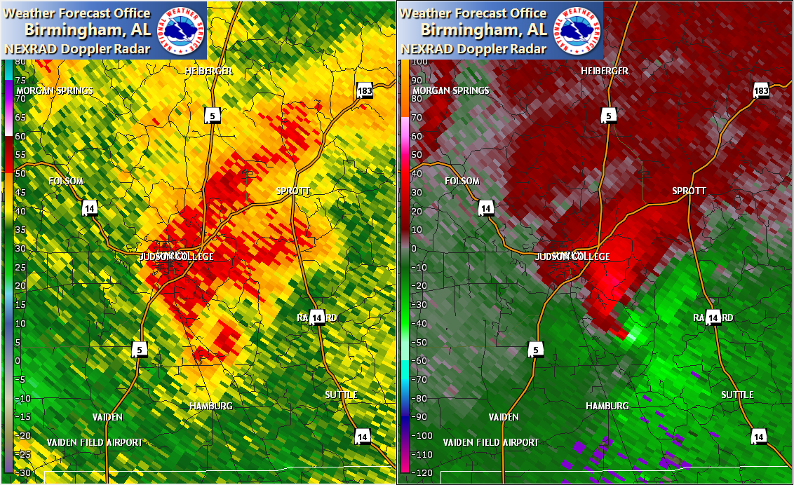
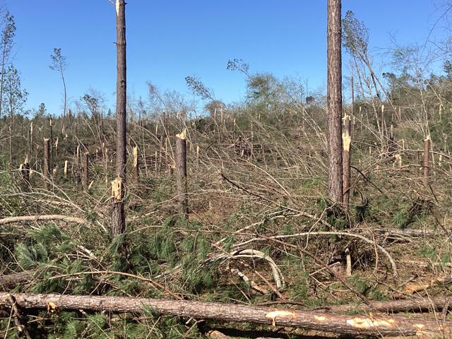
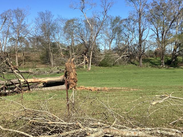
NWS Meteorologists surveyed damage southeast of Marion in Perry County and determined it was the result of an EF-2 tornado.
The tornado began along Dr JJ Howard Road where a path of trees were snapped and uprooted either side of farmland. Additional trees were snapped and uprooted along Albert Turner Sr Memorial Highway where a residence escaped any significant damage despite significant surrounding timber damage. The most significant damage occurred along Fikes Ferry Road where a swath of pine trees were snapped, pushing the rating to EF-2. The tornado then continued northeastward, coming to an end before reaching Highway 14 just north of Radford.
The data is PRELIMINARY and may be subject to change.
|