|
Event Summary
|
|
EF-3
|
|
Estimated Maximum Wind:
|
145 mph
|
|
Injuries/Fatalities:
|
2 Injuries |
|
Damage Path Length:
|
29.46 miles
|
|
Maximum Path Width:
|
1200 yards
|
|
Approximate Start Point/Time:
|
5 SW Oakmulgee
32.7471/-87.1201
at 953 PM CDT
|
|
Approximate End Point/Time:
|
University of Montevallo
33.1086/-86.8612
at 1024 PM CDT
|
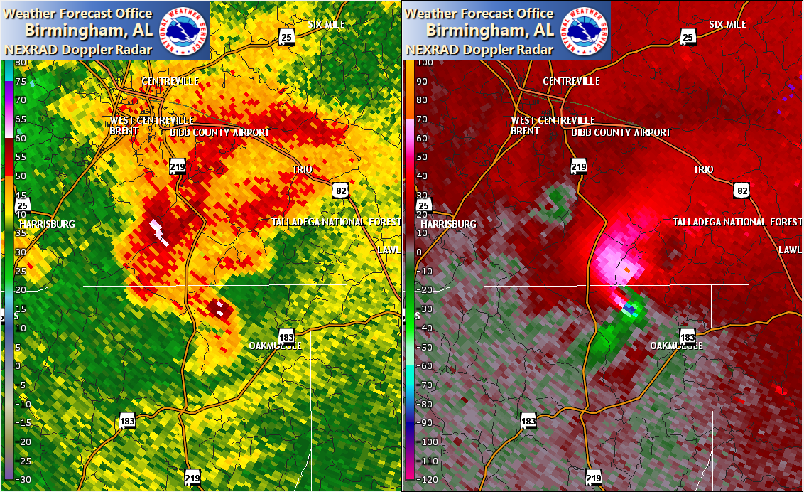
NWS Meteorologists surveyed damage stretching from northeast Perry County north-northeastward into extreme southwest Shelby County and determined it was the result of an EF-3 tornado.
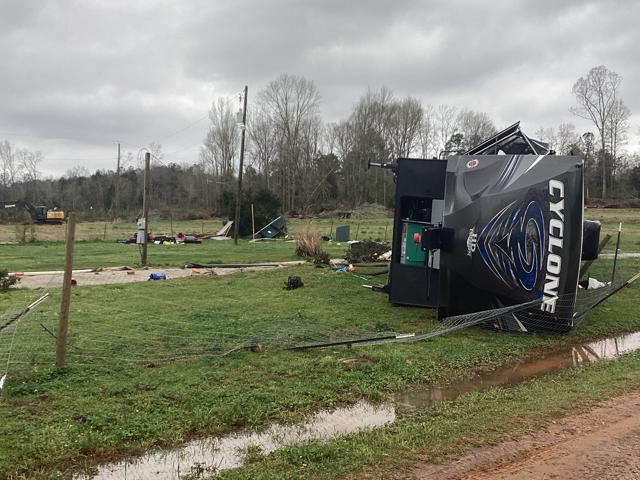
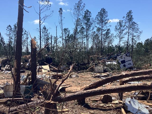
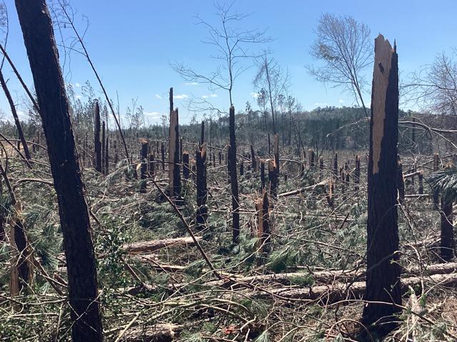
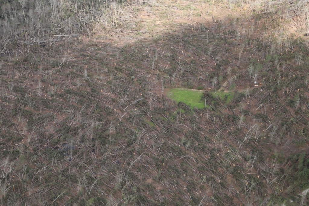
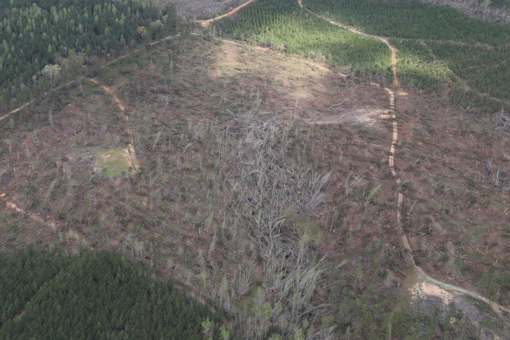
The tornado began near the intersection of SR 183 and SR 219 near Adler. Tree damage was observed, of which became quite significant along Barnette Road and Whitetail Road where a wide swath of large pine trees were snapped. Several camper units belonging to a hunting club were also rolled or destroyed with debris blown downwind. The tornado then continued northeastward, causing additional timber damage consisting of uprooted and snapped trees. A few residences had damage either caused directly by wind or fallen trees. A secondary area of significant and widespread tree damage was observed just south of Highway 82 near Trio. Trees were uprooted and snapped over a distance of one-half mile in width. The tornado then continued to the northeast, causing additional timber damage. A few homes were damaged in Wilton, in the area of Church Street due to fallen trees. The tornado dissipated over the University of Montevallo campus where a few trees were blown over, several windows were blown out and some roofing damage was seen on a few buildings.
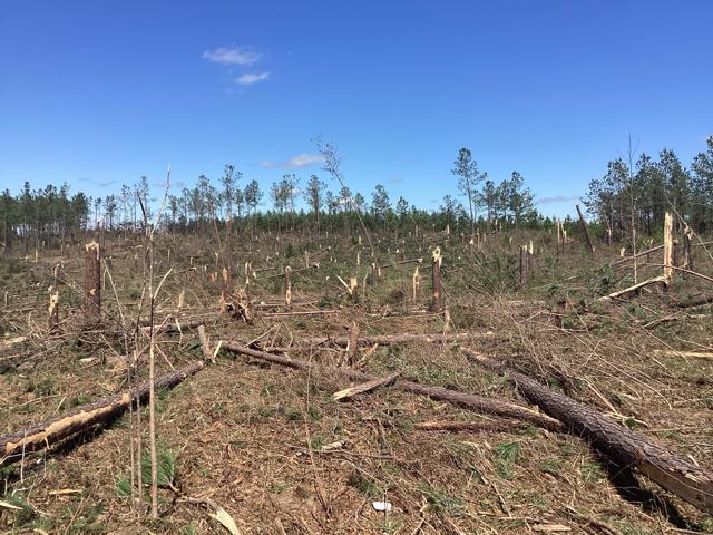
An aerial survey was conducted across portions of Shelby, Bibb, and Perry Counties on 4/12/22. Significant timber damage was observed and photographed, mainly in southeast Bibb and northeast Perry Counties. This area is in the Oakmulgee Ranger District of the Talladega National Forest. Though it`s hard to assess how many trees were blown down, it`s clear that tens of thousands of hardwood and softwood trees were snapped and uprooted along the tornado`s path during max intensity. Some embedded trunks were left at least partially debarked. Due to the widespread nature of the timber damage, including some 300-400 yard wide sections of complete blow-down, the rating of this tornado has been upgraded to EF3 with estimated peak winds of 145 mph. The max width was expanded to 1200 yards. NWS Birmingham would like to send special thanks to Shelby County Sheriff`s Office for their assistance on this aerial survey.
The data is PRELIMINARY and may be subject to change.
|