|
Event Summary
|
|
EF-2
|
|
Estimated Maximum Wind:
|
120 mph
|
|
Injuries/Fatalities:
|
None |
|
Damage Path Length:
|
13.94 miles
|
|
Maximum Path Width:
|
850 yards
|
|
Approximate Start Point/Time:
|
2 NNW Cooper
32.8086/-86.5578
at 9:01 pm CDT
|
|
Approximate End Point/Time:
|
1 ENE Lyle
32.8913/-86.3254
at 9:21pm CDT
|
National Weather Service meteorologists surveyed the damage in southeastern Chilton County northeastward into western Coosa County and determined it was the result of an EF-2 tornado.
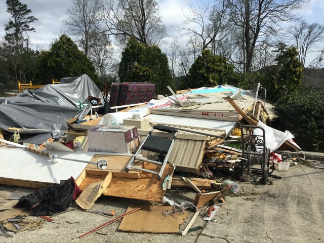
The tornado first touched down along CR 495, just east of Clanton, with minor tree damage. The tornado moved east northeast producing mainly minor tree damage and some structural damage as it crossed CR 97. The tornado then tracked across mainly inaccessible forest land before producing notable tree damage along CR 480 before tracking over several homes along Lake Mitchell, south of County Road 472. Most of the homes had minor roof damage or sustained more damage from fallen trees. One home off of County Road 481 had a garage completely collapse. There were also numerous hardwood trees snapped near the pumphouse on County Road 474. Near this point, the tornado reached its maximum intensity of EF-2 at 120 mph. The tornado then crossed Lake Mitchell into Coosa County.
Substantial tree damage, with many hardwood and softwood trees snapped, was noted along Little Airplane Road, CR 121, and Bluff Road. Several houses along Little Airplane Road had roof and structural damage with one right along the lakefront sustaining more substantial damage. A home along Bluff Road appeared to lose much of its roof, top floor, and walls. At this point, the tornado reached its maximum intensity of EF-2 at 115 mph. The tornado continued to move northeast along the far southern extent of Lake Mitchell producing tree damage and some structural damage along the lakeshore.
The tornado weakened notably as it moved east of Lake Mitchell with more minor tree damage noted along CR 29. The tornado snapped some limbs along CR 188 before lifting just east of Herb Valley Drive.
|