|
Location/Summary
|
Damage Rating/Estimated Maximum Wind Speeds
|
Injuries/Fatalities
|
Damage Path Length/Width
|
Starting Point/Time
|
Ending Point/Time
|
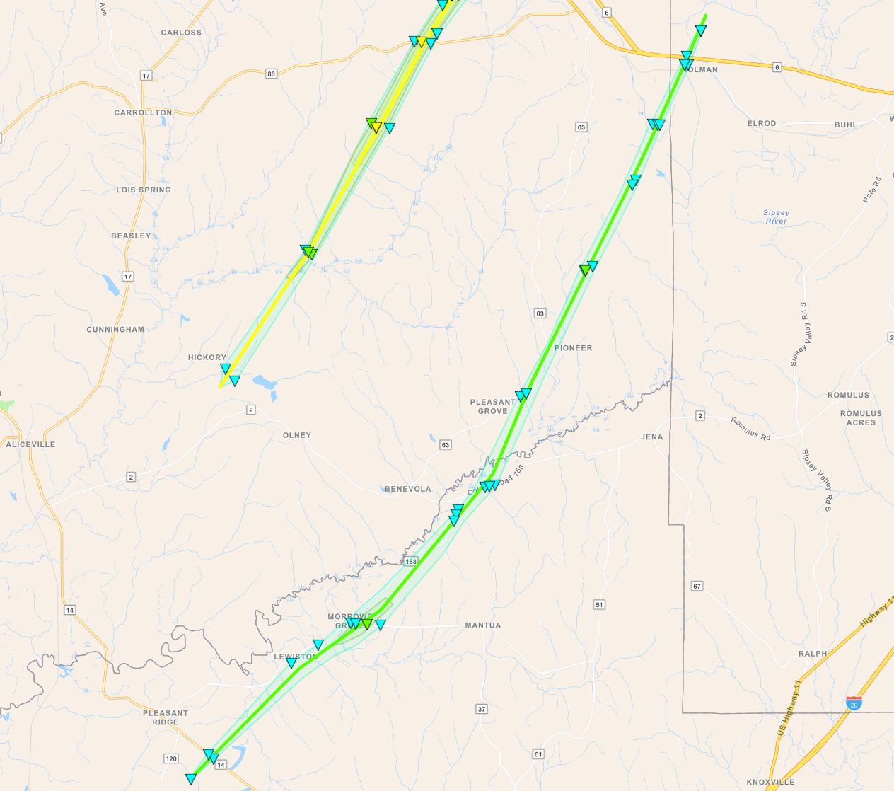
Lewiston-Holman Tornado
(Greene/Pickens/Tuscaloosa Counties) |
EF-1
90 mph |
None |
26.46 miles
1200 yards |
2 SSE Pleasant Ridge 32.9887/-88.0700
3:08 pm CDT |
3 NW Elrod 33.3007/-87.8210
3:43 pm CDT |
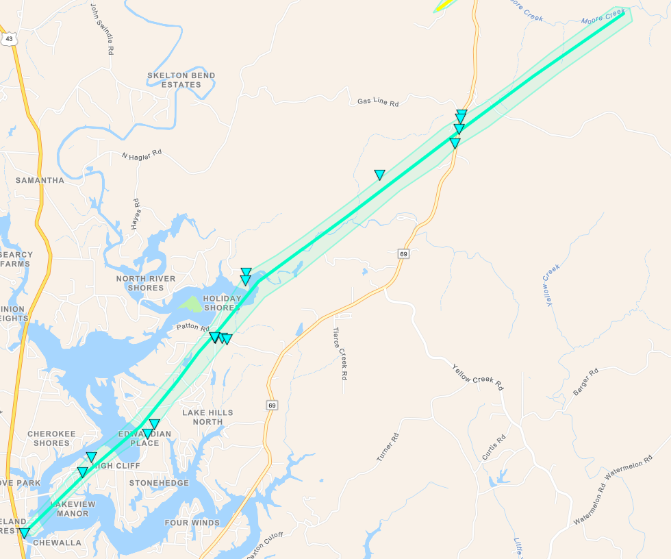
Lake Tuscaloosa Tornado
(Tuscaloosa County) |
EF-1
95 mph |
None |
11.54 miles
600 yards |
1 SSW Lake Tuscaloosa Tierce Patton Bridge 33.3475/-87.6089
4:00 pm CDT |
3 SE Windham Springs 33.4562/-87.4586
4:14 pm CDT |
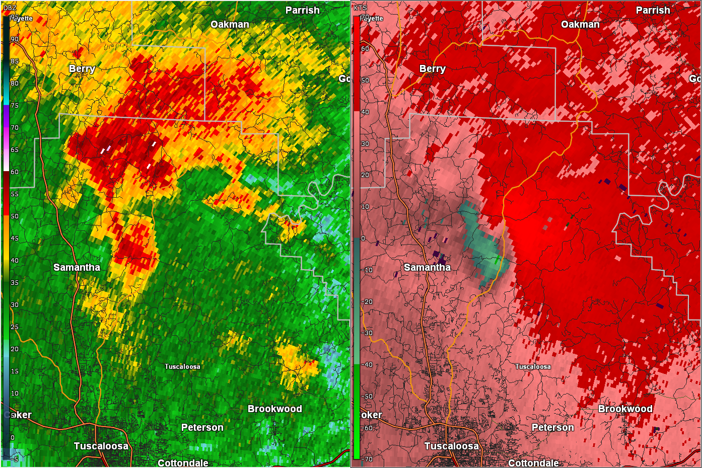
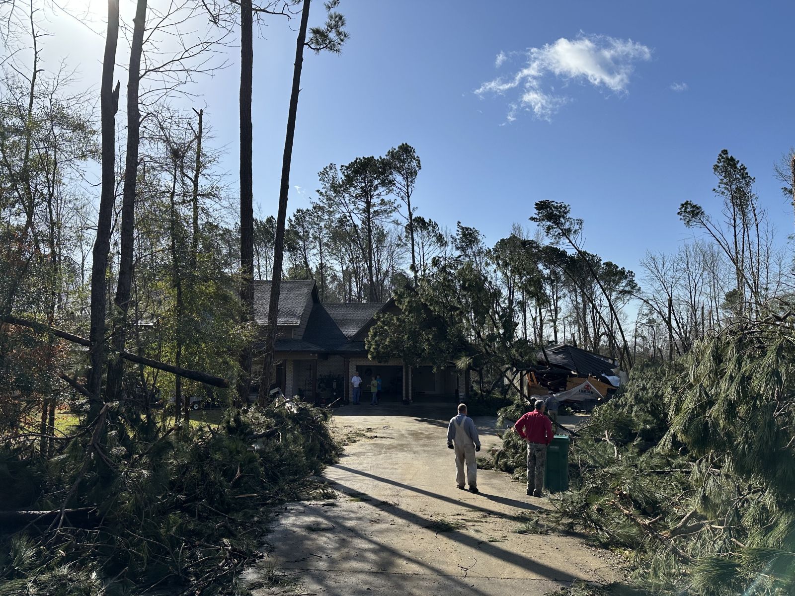
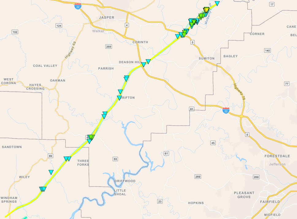
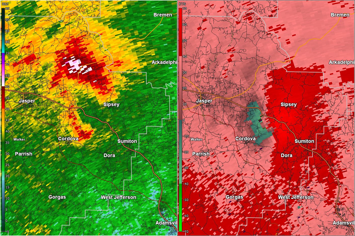
Windham Springs - Sipsey Tornado
(Tuscaloosa/Walker Counties) |
EF-2
120 mph |
None |
39.48 miles
1000 yards |
2 S Windham Springs 33.4571/-87.5051
4:12 pm CDT |
3 NNW Empire 33.8554/-87.0311
4:55 pm CDT |
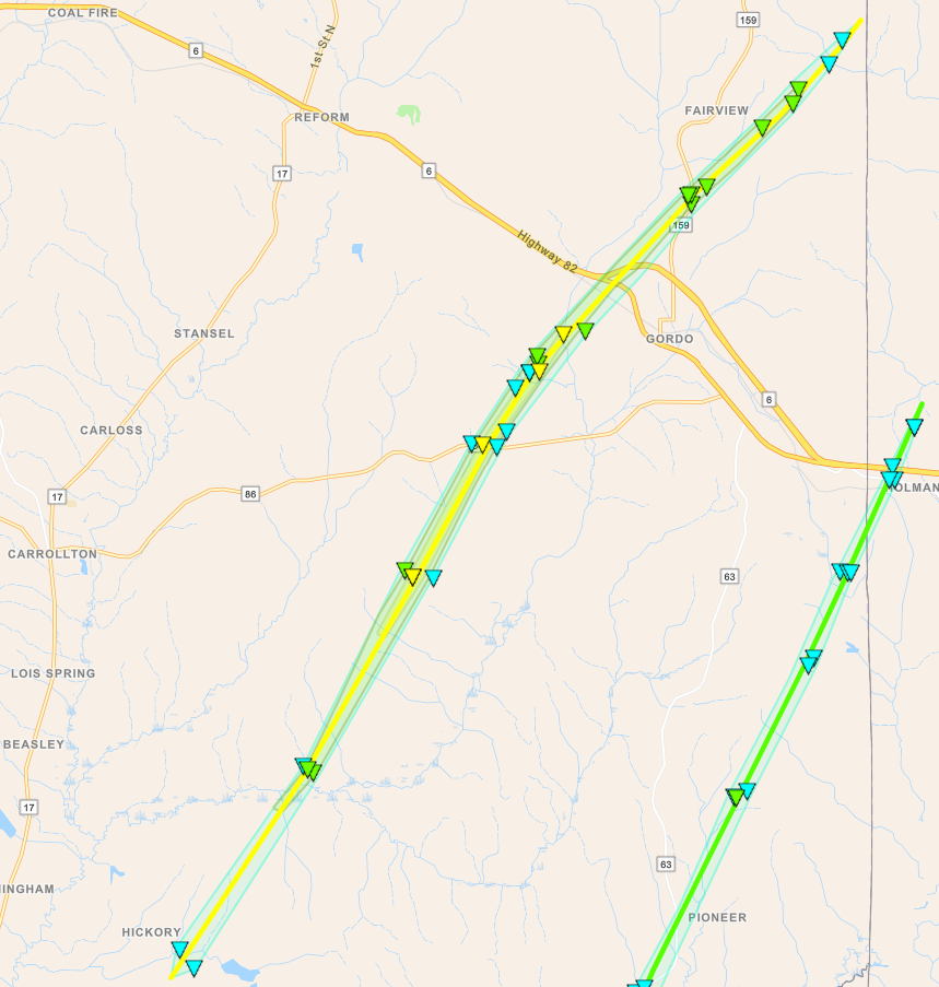
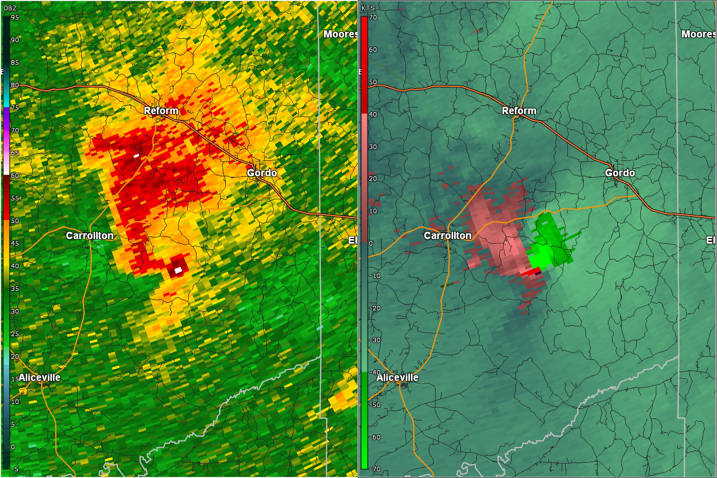
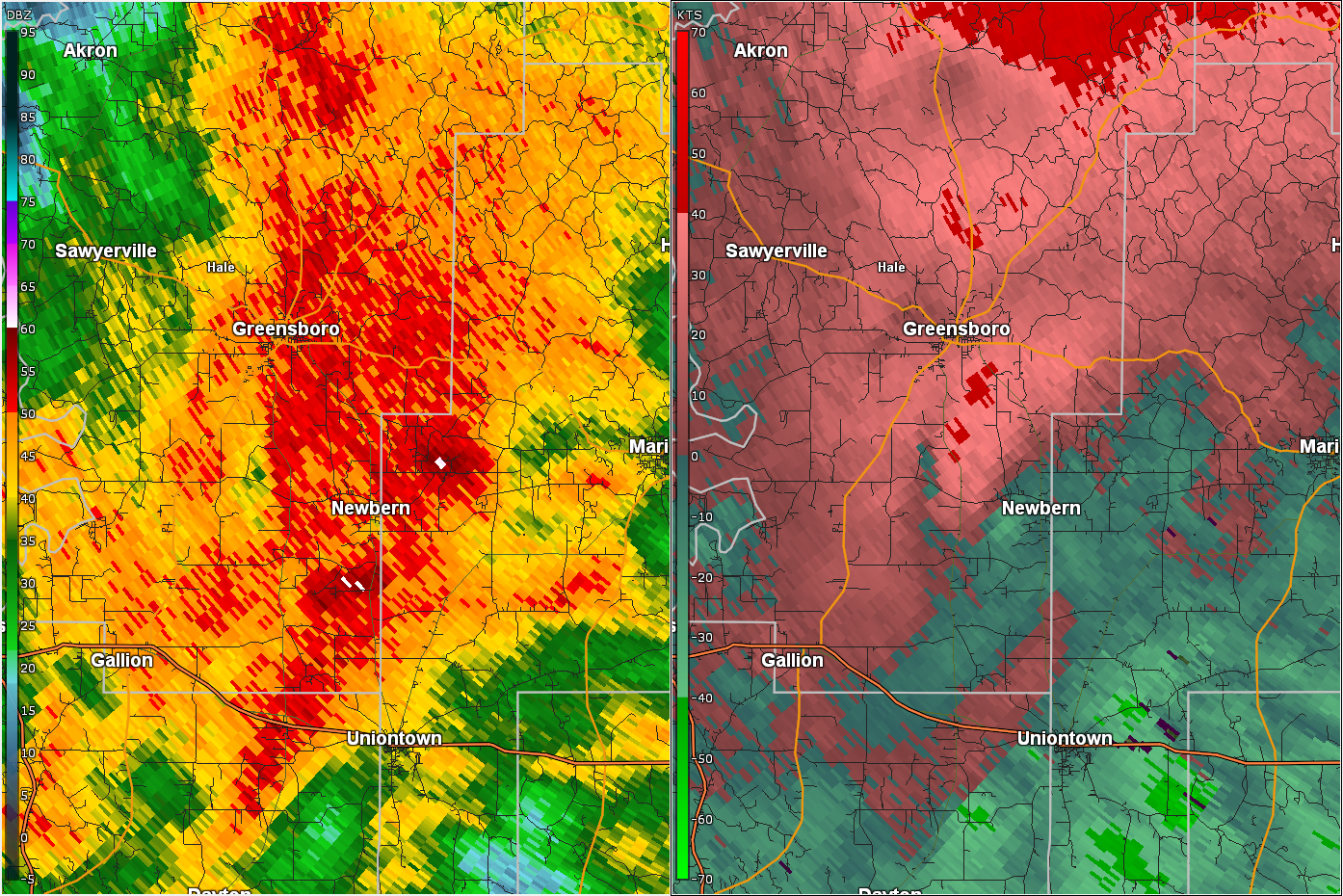
Gordo Tornado
(Pickens County) |
EF-2
115 mph |
None |
21.56 miles
950 yards |
1 W Johnston Lake 33.1499/-88.0569
4:32 pm CDT |
3 SE Lubbub 33.4008/-87.8387
4:58 pm CDT |
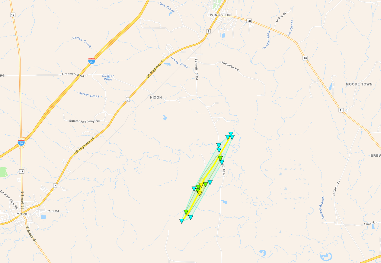
Alamuchee Creek Tornado
(Sumter County) |
EF-2
120 mph |
None |
3.32 miles
650 yards |
4 E Old Mallard Airport 32.4847/-88.2078
5:20 pm CDT |
4 NW Lilita 32.5264/-88.1798
5:26 pm CDT |
Allenville Road Tornado
(Hale/Perry Counties) |
EF-0
80 mph |
None |
21.61 miles
700 yards |
3 E Gallion
32.4976/-87.6612
6:38 pm CDT |
2 S Morgan Springs
32.7189/-87.4183
7:05 pm CDT |
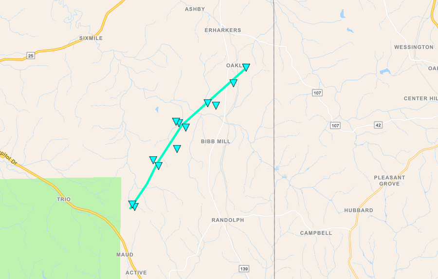
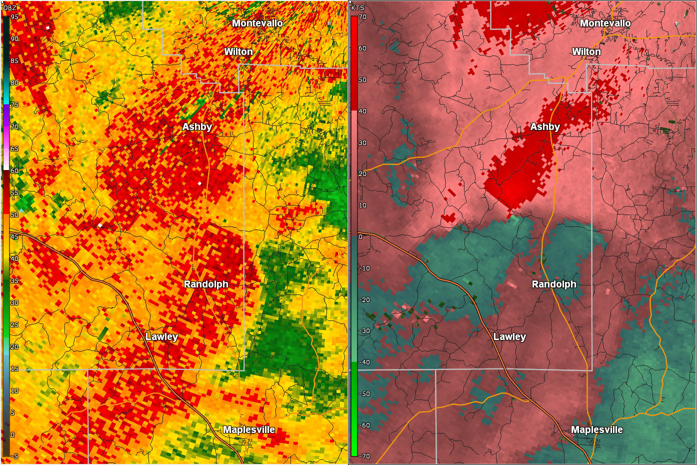
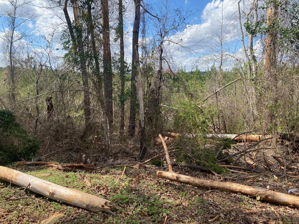
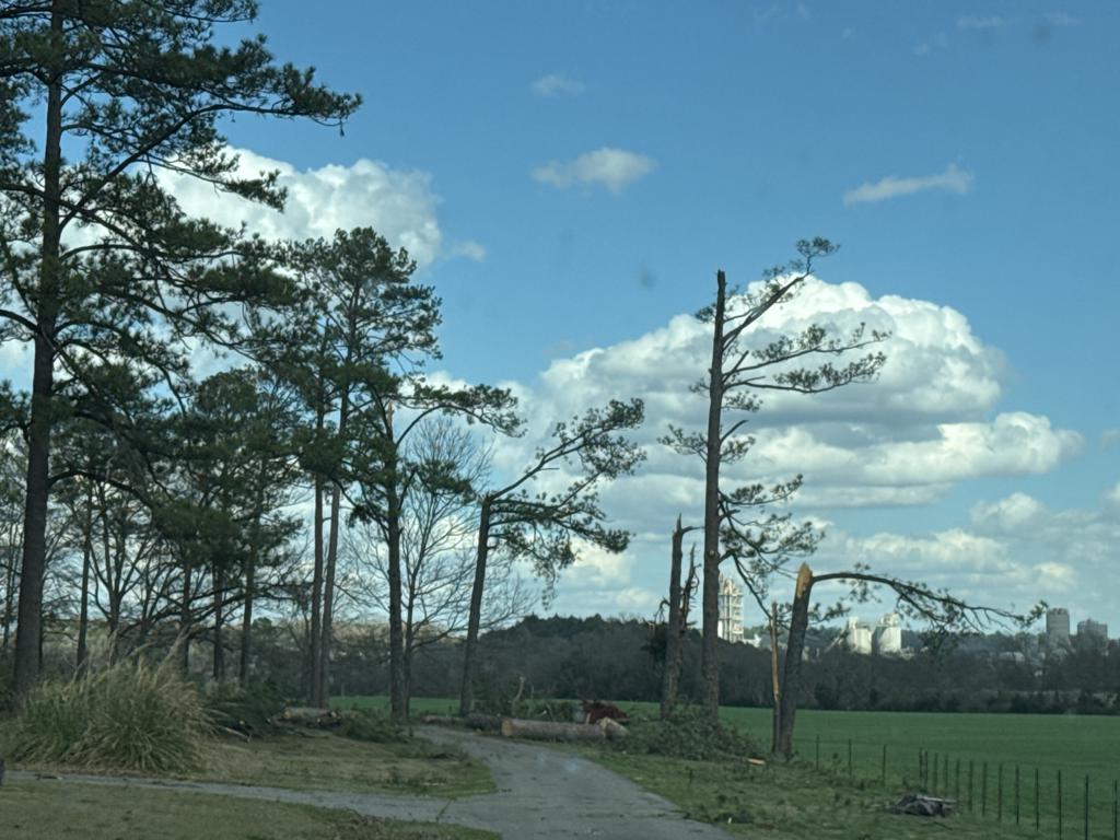
Deer Creek Road Tornado
(Bibb County) |
EF-0
80 mph |
None |
7.63 miles
75 yards |
2 NNE Talladega NF
32.9063/-86.9776
7:39 pm CDT |
2 SE Ashby
32.9906/-86.8946
7:54 pm CDT |
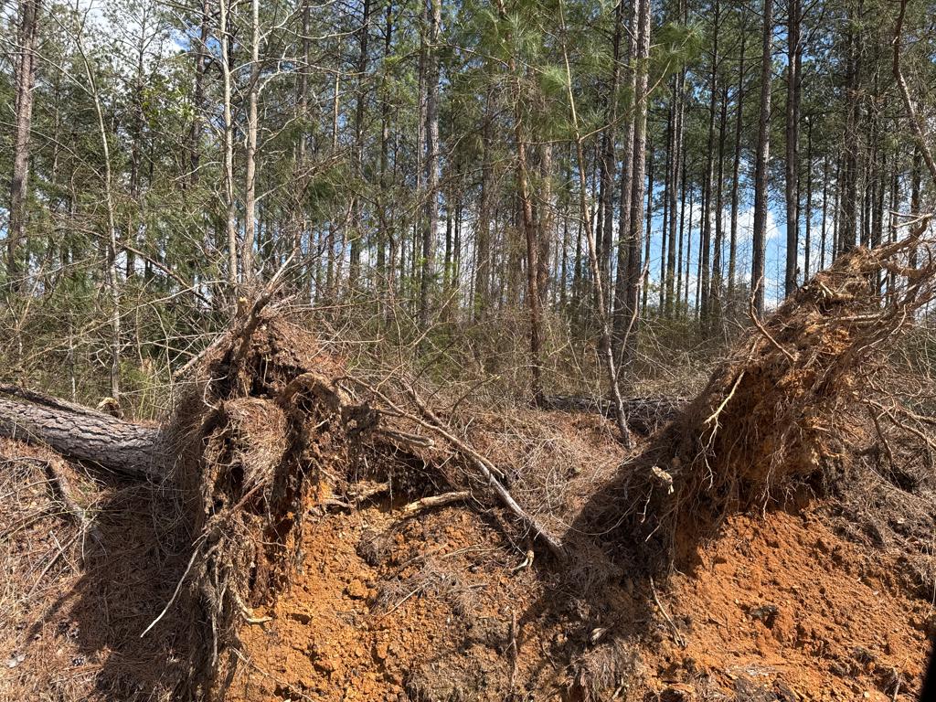
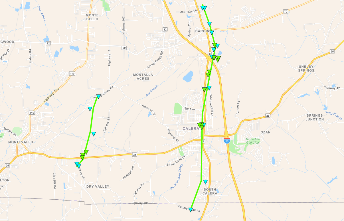
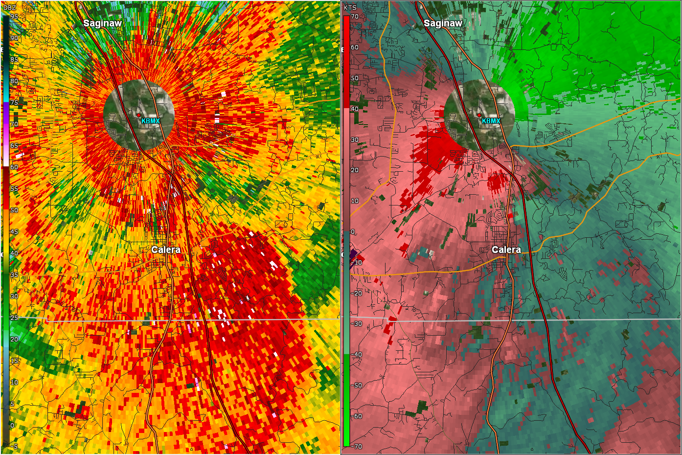
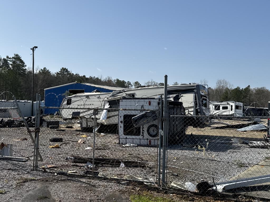
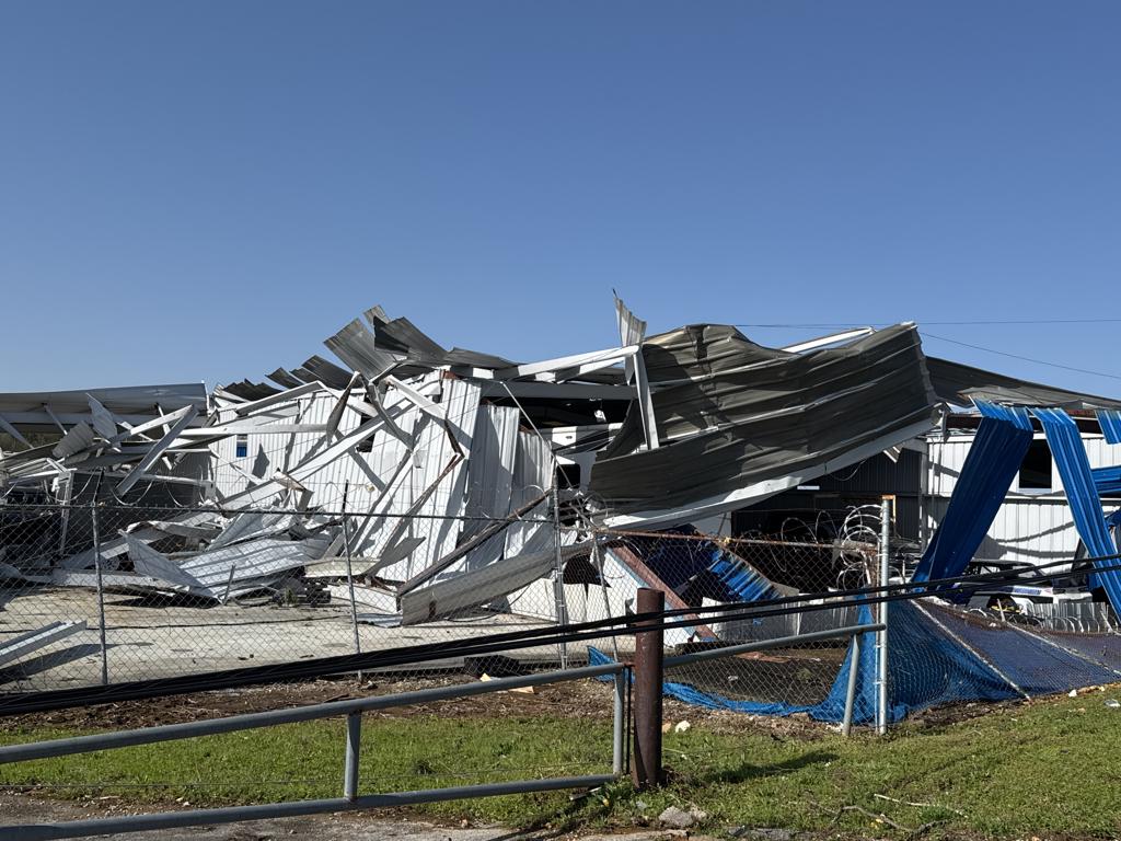
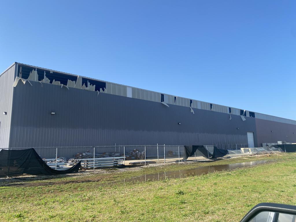
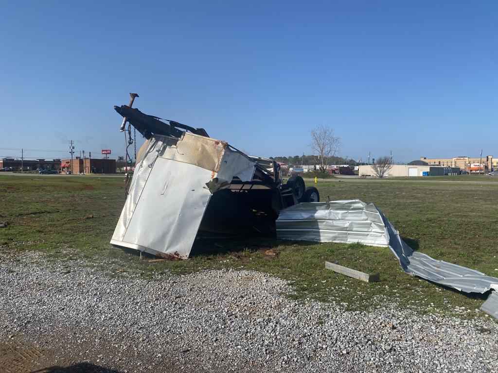
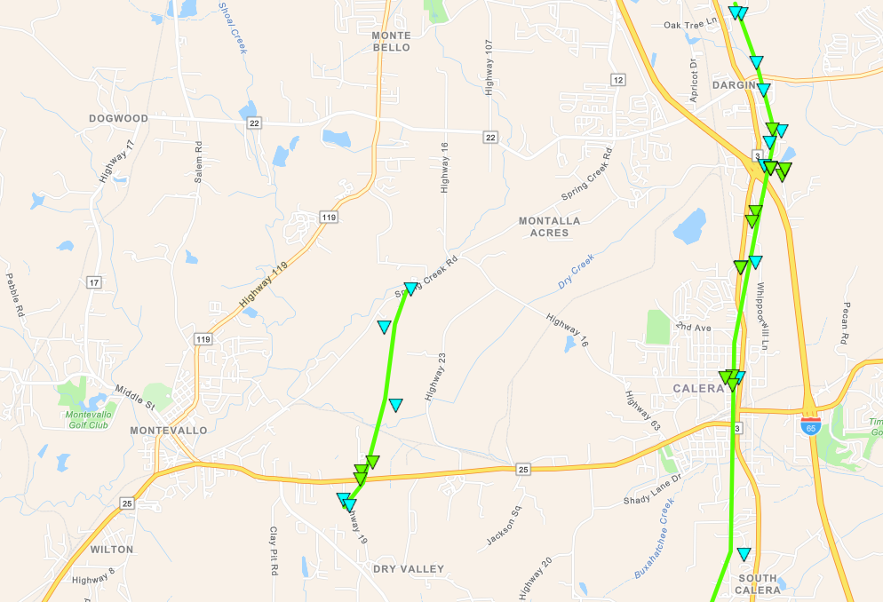
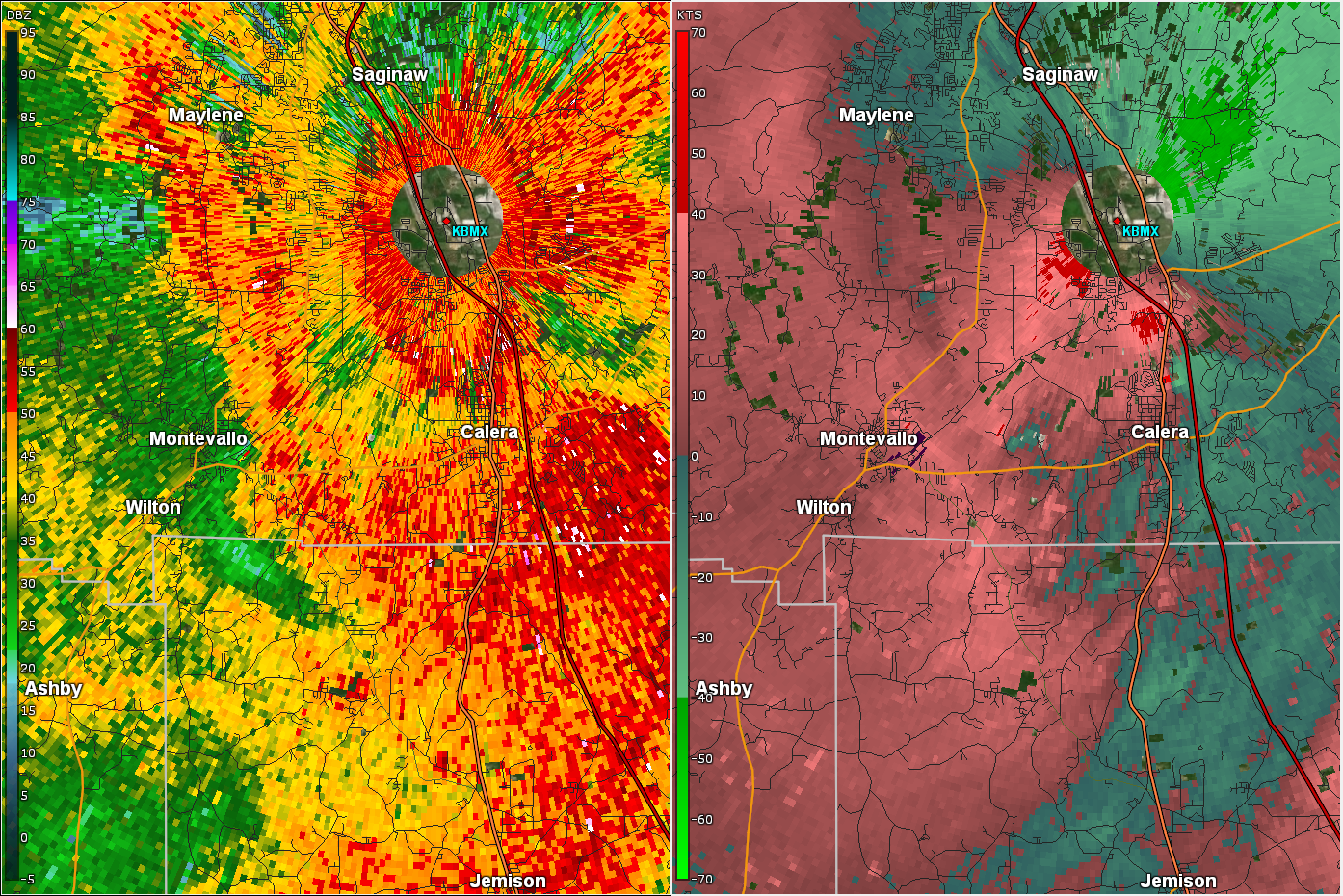
Calera Tornado
(Chilton/Shelby Counties) |
EF-1
90 mph |
None |
7.47 miles
250 yards |
1 N Minooka Park
33.0660/-86.7608
7:57 pm CDT |
2 E Shelby County Airport
33.1713/-86.7508
8:09 pm CDT |
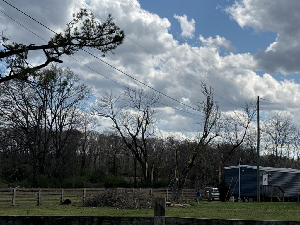
Lawler Drive Tornado
(Shelby County) |
EF-1
90 mph |
None |
2.55 miles
150 yards |
2 ESE Montevallo
33.0875/-86.8291
8:00 pm CDT |
1 SE American Village
33.1225/-86.8170
8:06 pm CDT |
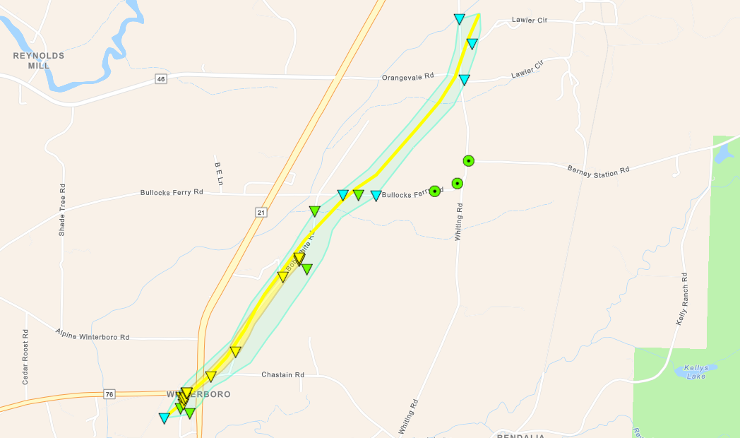
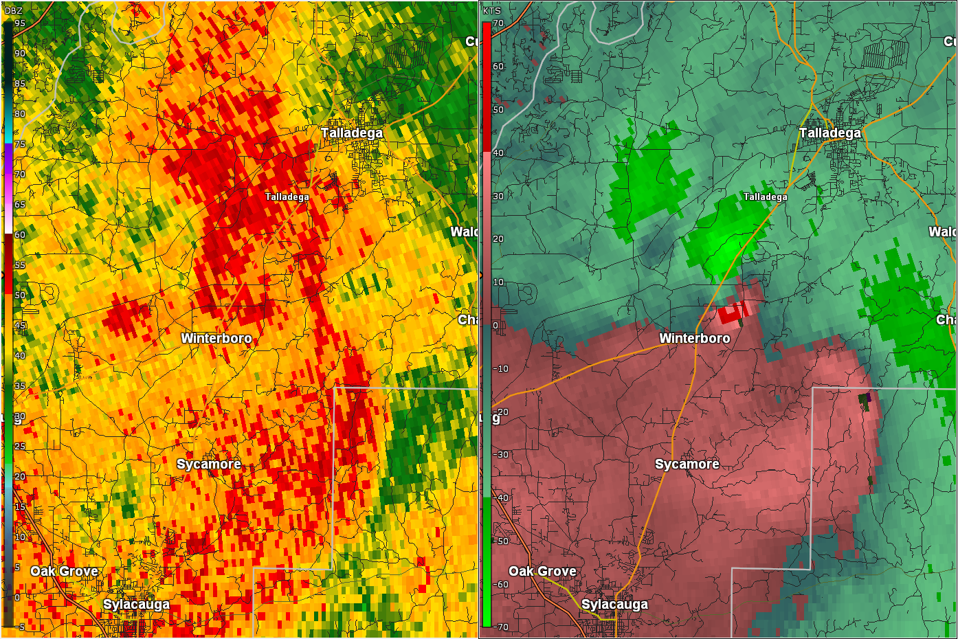
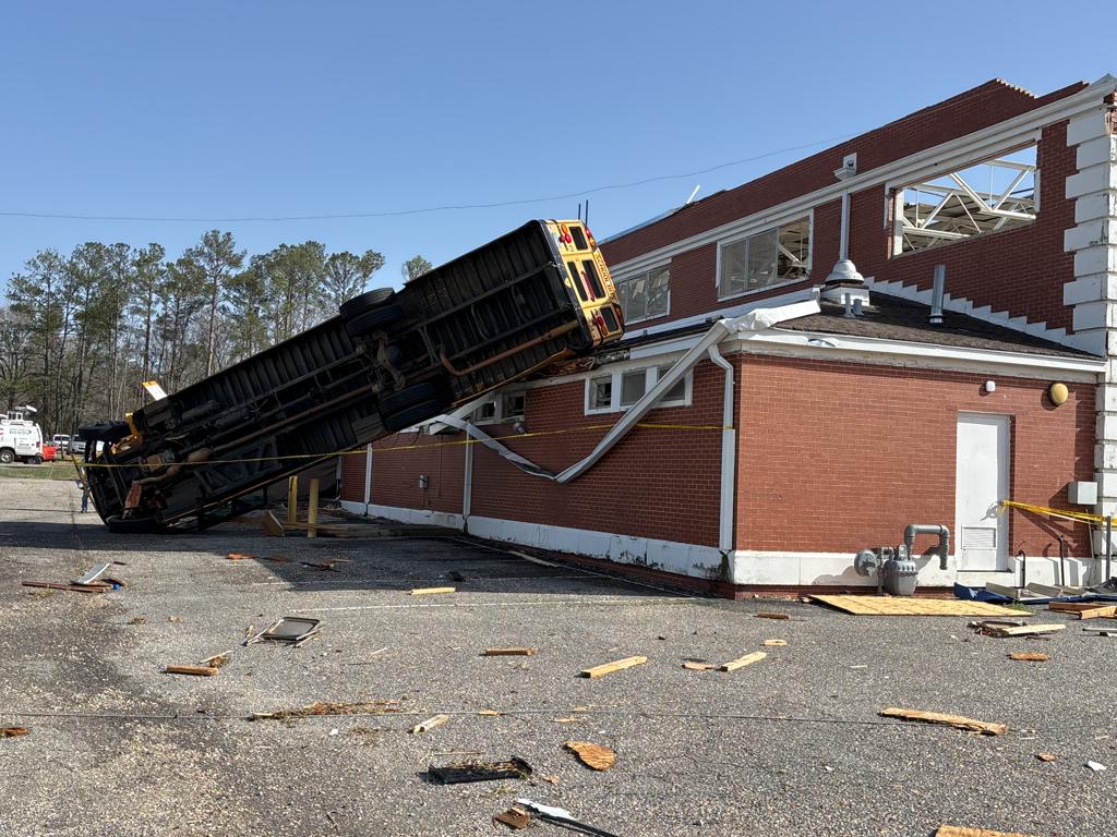
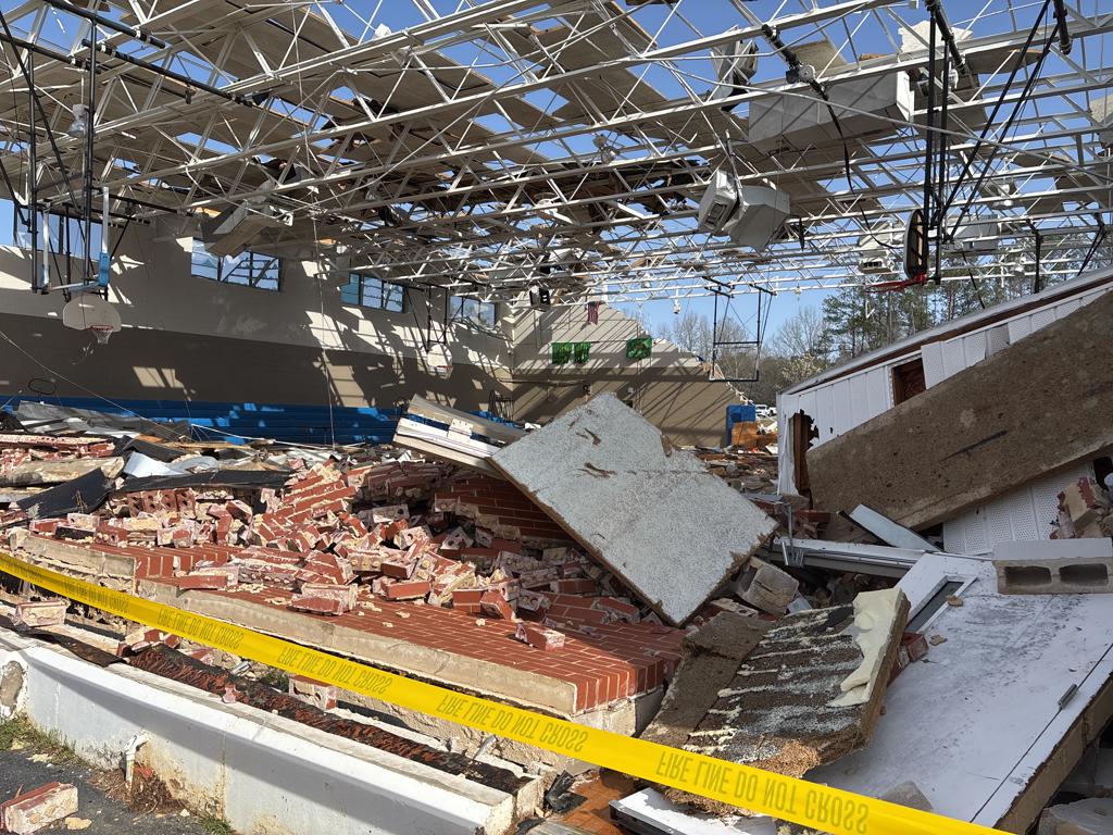
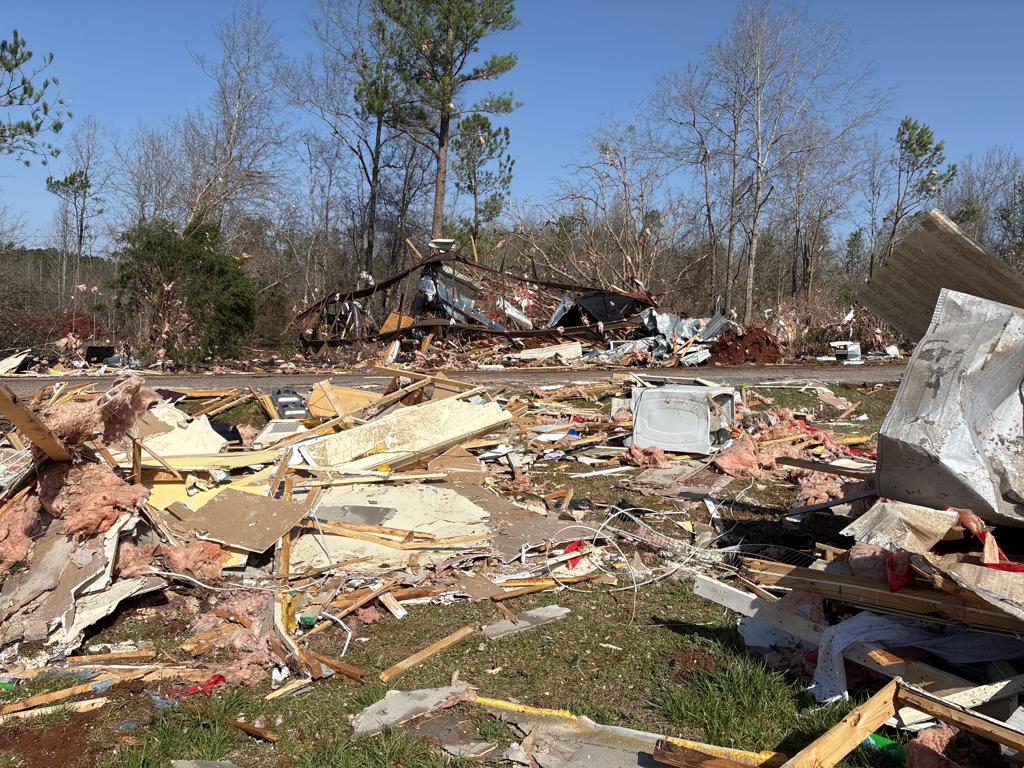
Winterboro Tornado
(Talladega County) |
EF-2
120 mph
|
1 Fatality
1 Injury |
3.63 miles
500 yards |
Winterboro
33.3194/-86.2005
8:42 pm CDT
|
3 NNE Winterboro
33.3603/-876.1623
8:49 pm CDT
|
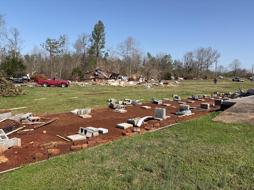
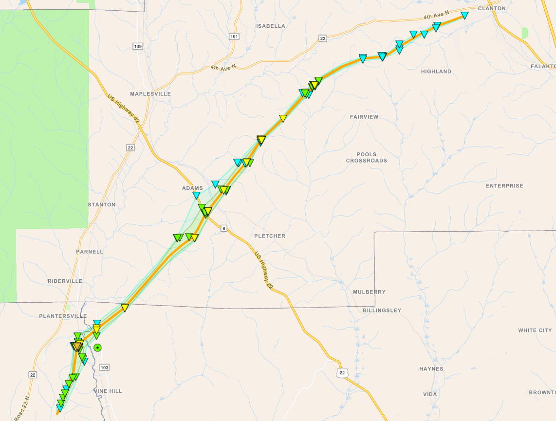
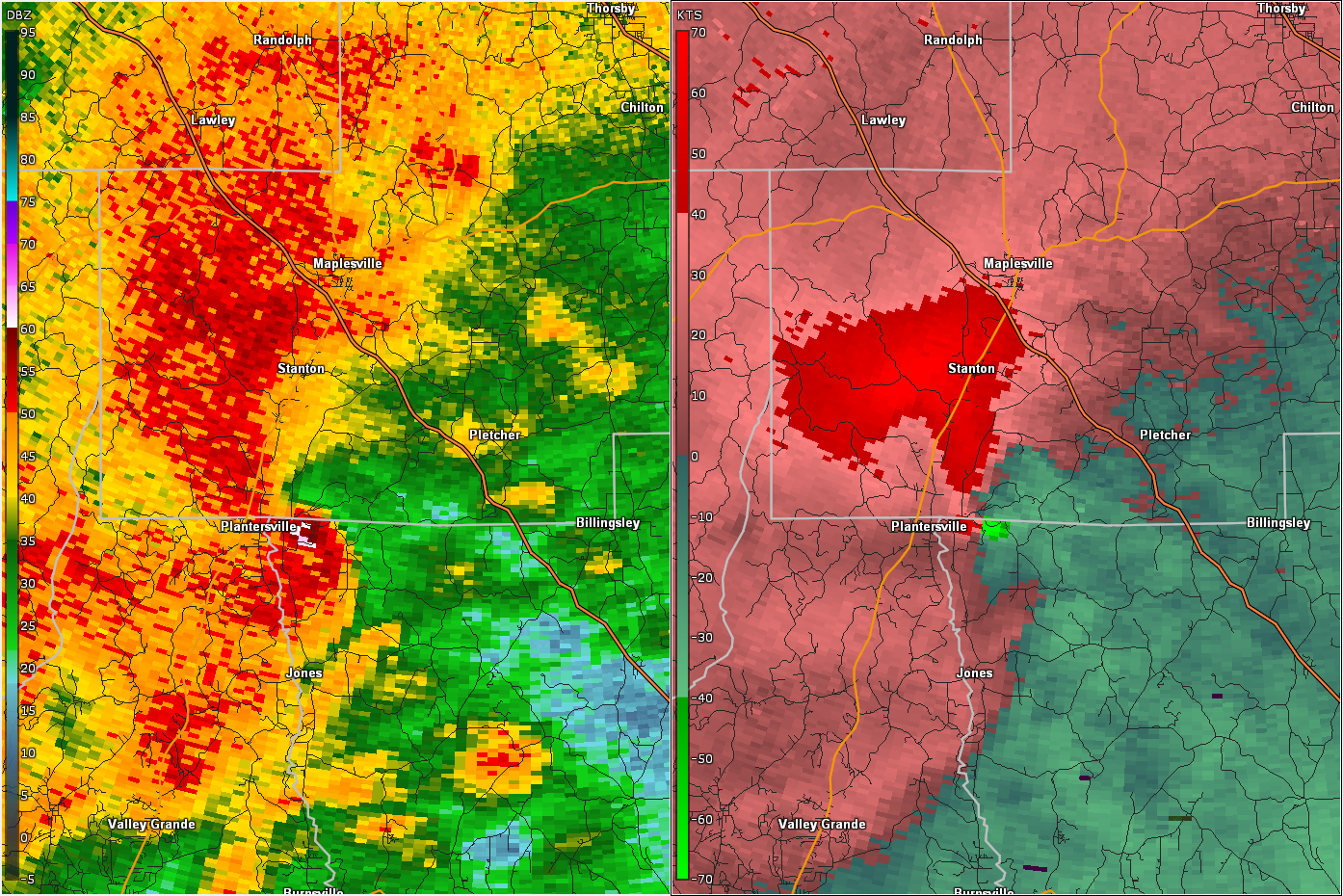
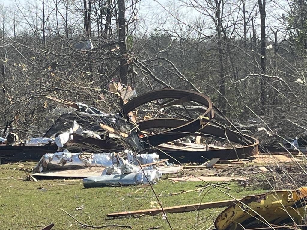
Plantersville Tornado
(Dallas/Autauga/Chilton Counties) |
EF-3
140 mph
|
2 Fatalities
2 Injuries |
24.33 miles
1000 yards |
1 NNW Valley Creek Junction
32.5971/-86.9377
8:50 pm CDT
|
1 WSW Clanton
32.8339/-86.6501
9:20 pm CDT
|
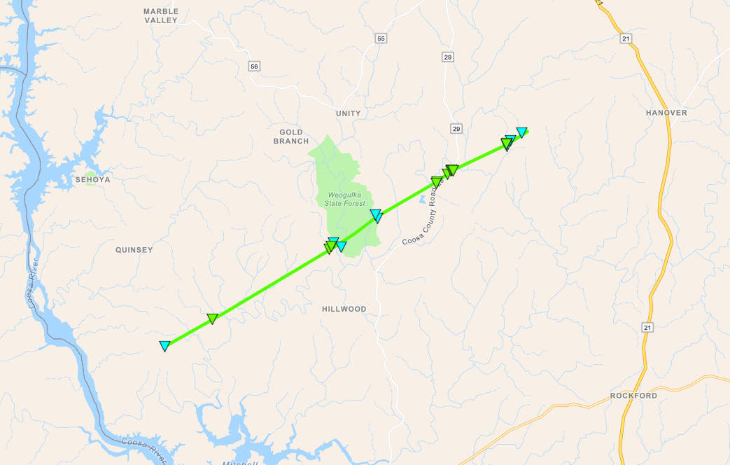
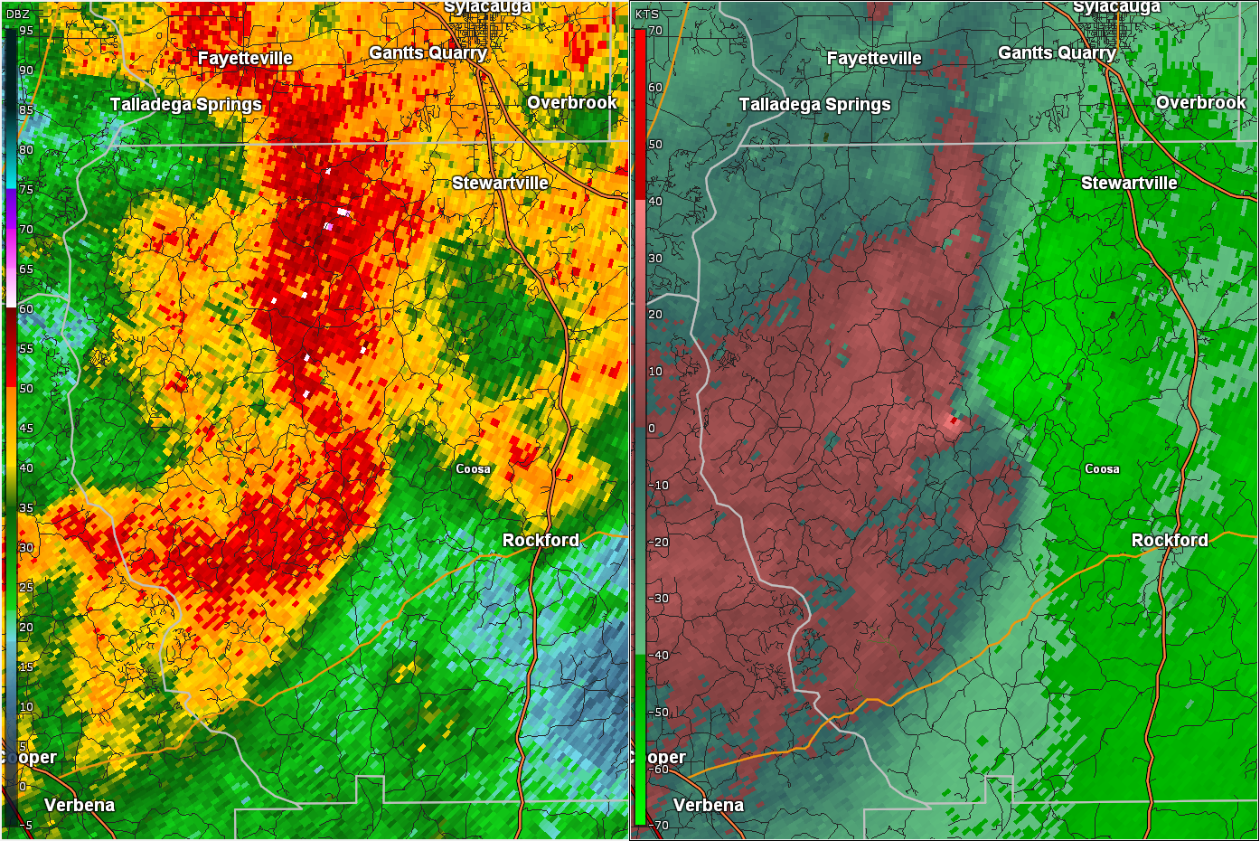
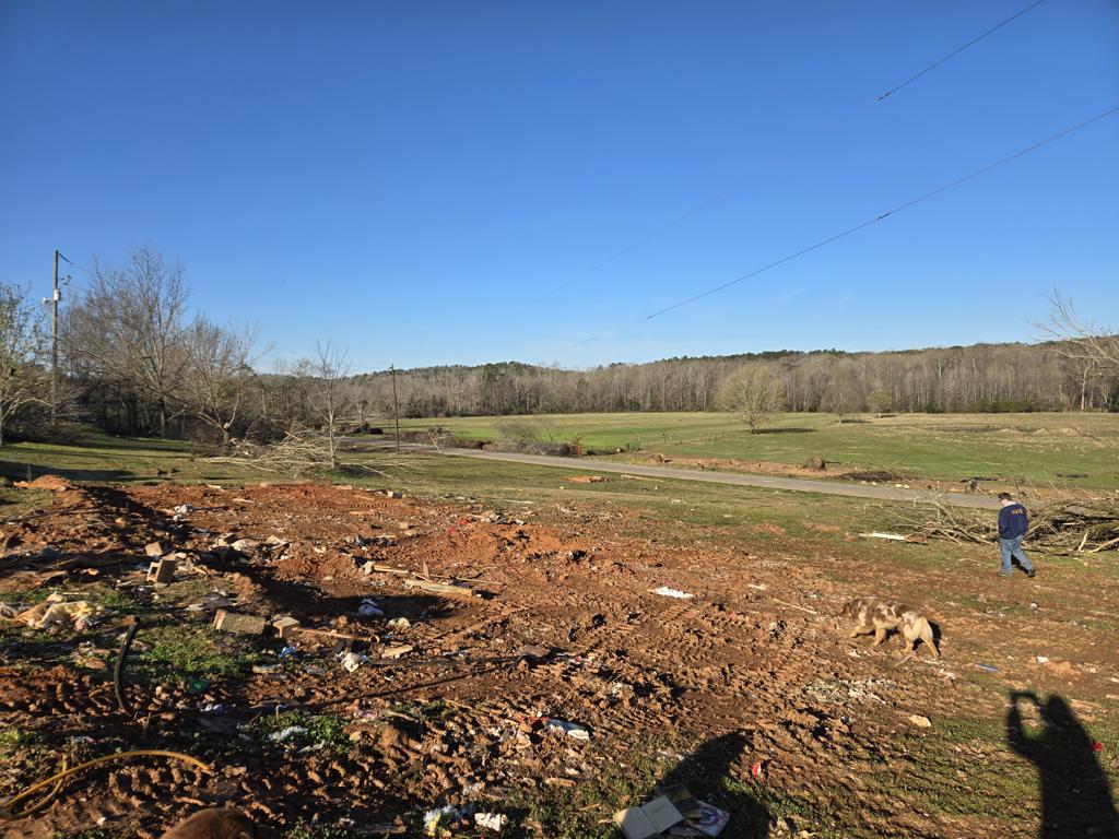
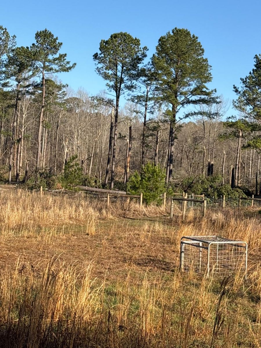
County Road 29 Tornado
(Coosa County) |
EF-1
110 mph |
None |
12.02 miles
200 yards |
2 NW Dollar 32.9090/-86.4495
9:33 pm CDT |
3 ESE Weogufka 32.9973/-86.2715
9:50 pm CDT |
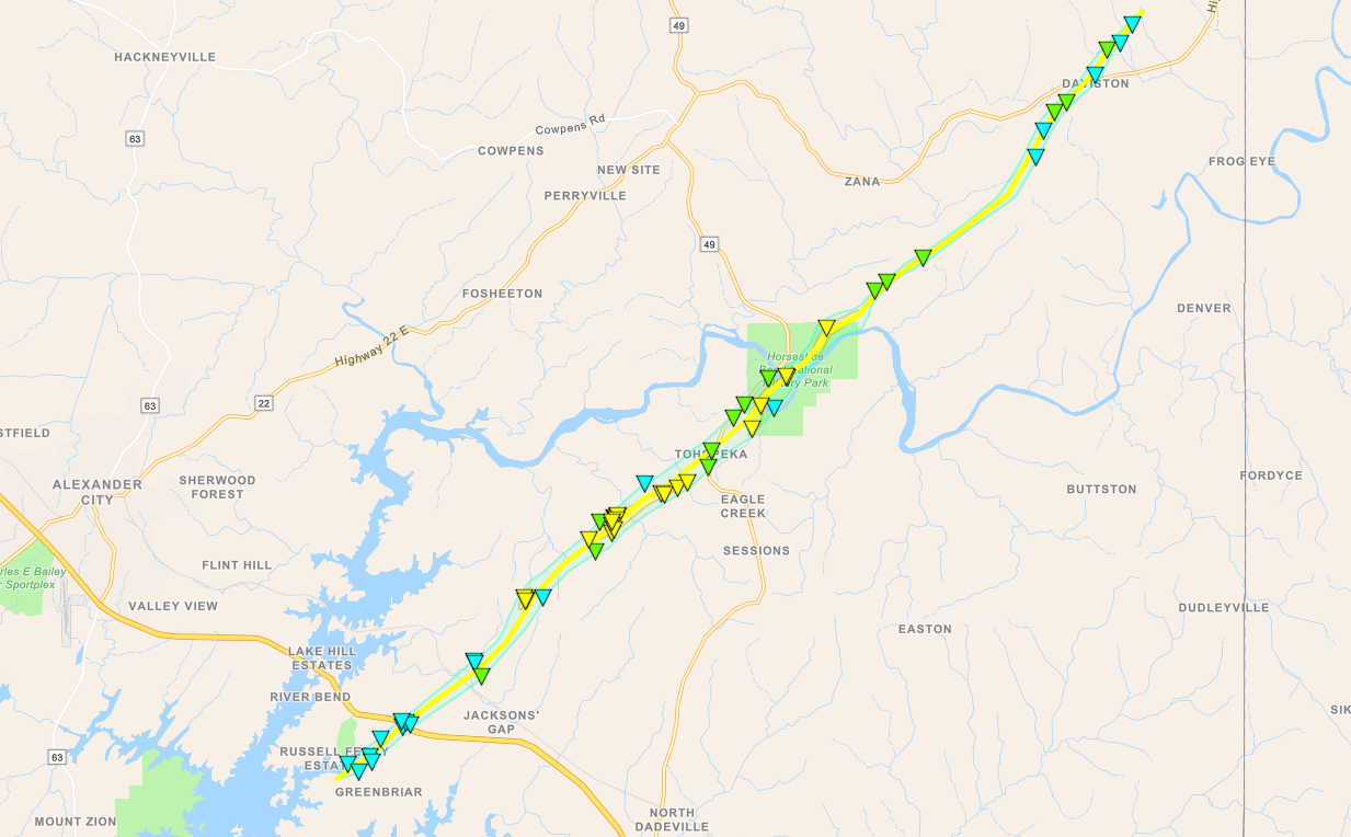
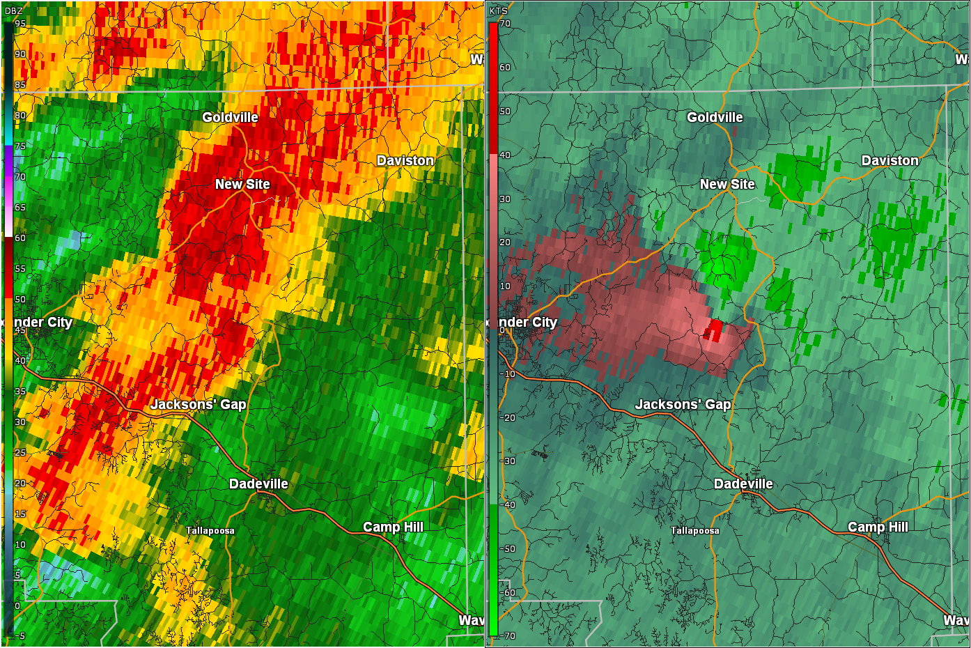
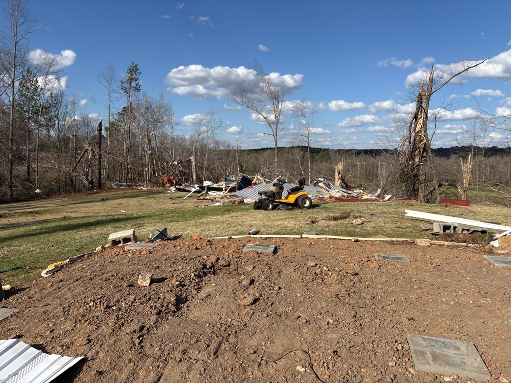
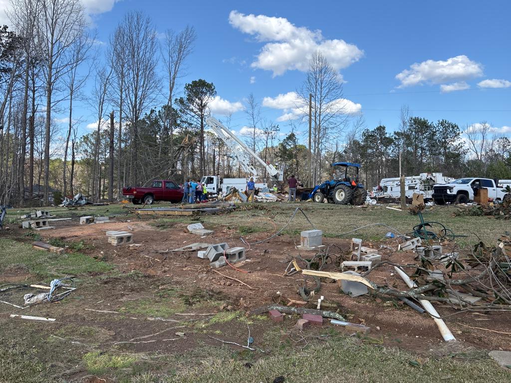
Horseshoe Bend Tornado
(Tallapoosa County) |
EF-3
140 mph
|
None |
20.45 miles
800 yards |
3 NNW Dare Park
32.8695/-85.8778
10:48 pm CDT
|
1 NNE Daviston
33.0711/-85.6254
11:12 pm CDT
|
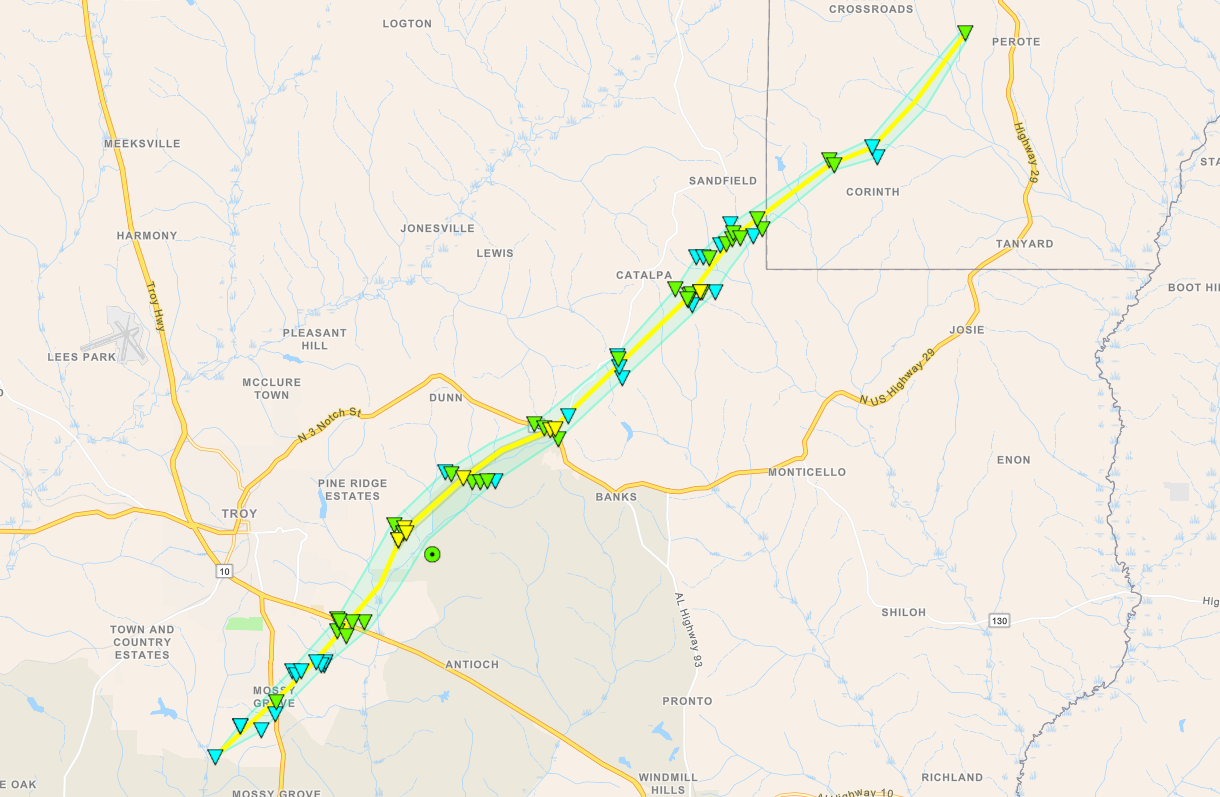
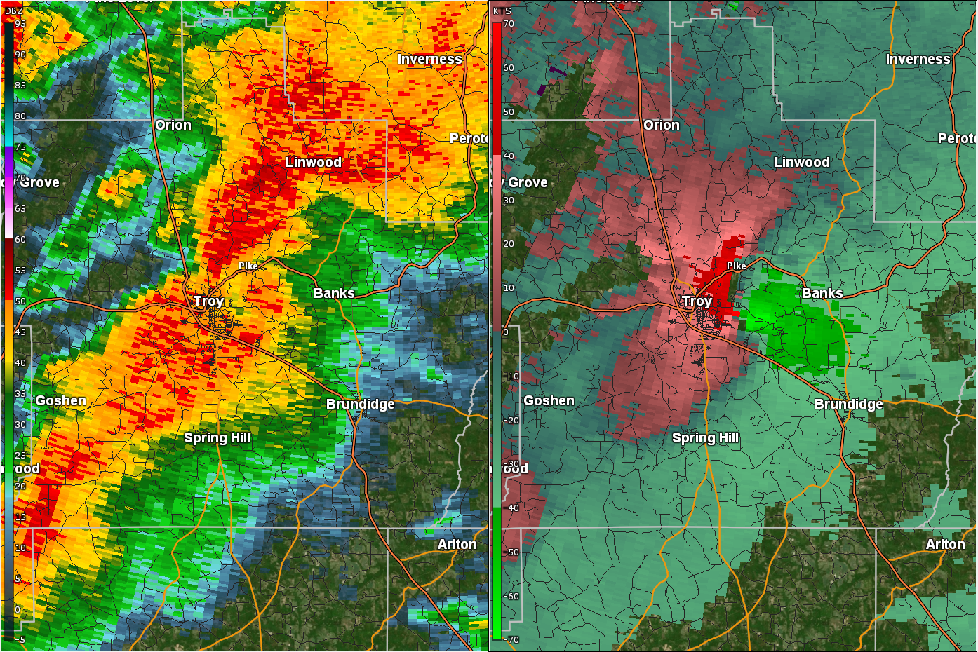
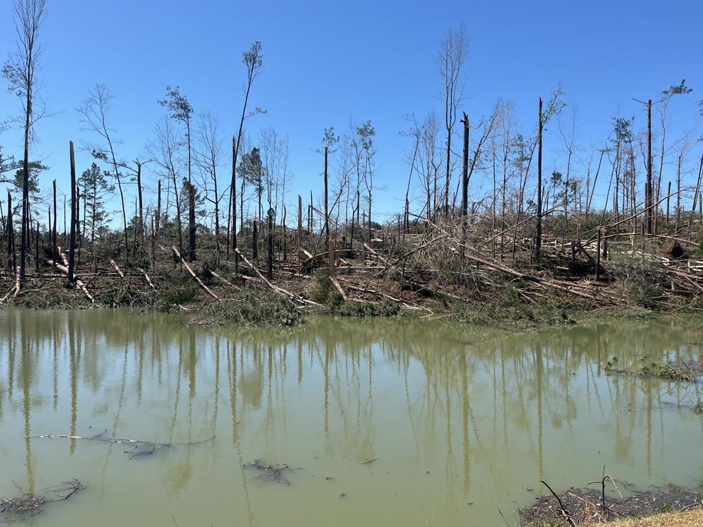
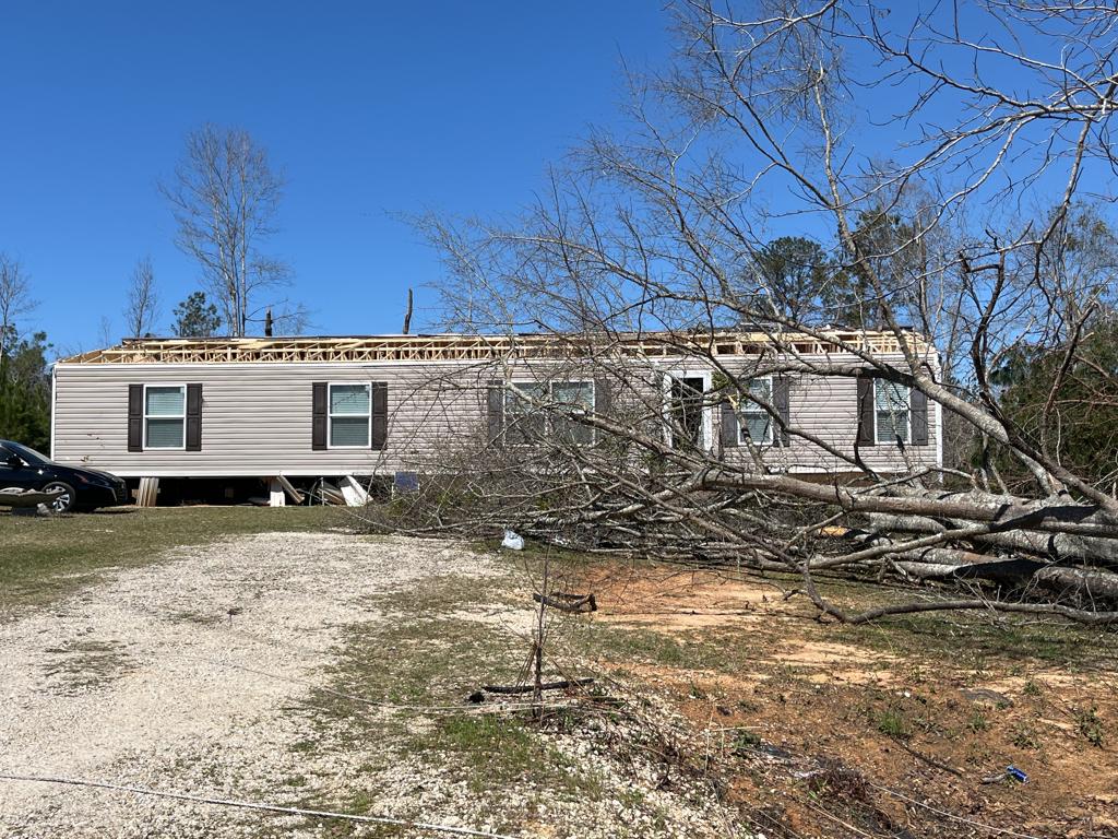
Pike County Tornado
(Pike/Bullock Counties) |
EF-2
130 mph
|
3 Injuries |
21.31 miles
1400 yards |
2 SW Mossy Grove
31.7383/-85.9805
11:02 pm CDT
|
1 WSW Perote
31.9491/-85.7230
11:28 pm CDT
|
Snapper Creek Tornado
(Chambers County) |
EF-0
80 mph
|
None |
3.80 miles
100 yards |
4 SSW Chambers County Lake
32.7831/-85.3810
11:59 pm CDT
|
1 S Kellys Crossroads
32.8214/-85.3355
12:03 am CDT
|