NWS Birmingham, Alabama
Weather Forecast Office
Cherokee County Tornado - March 15th, 2008
|
Rating:
(Click for EF Scale) |
EF-2
|
|
Estimated Maximum Wind:
|
115 mph
|
|
Injuries/Fatalities:
|
None
|
|
Damage Path Length:
|
3.6 miles
|
|
Maximum Path Width:
|
50 yards
|
|
Approximate Start Point:
|
33.9835/-85.6295 at 950 AM
|
|
Approximate End Point:
|
33.9920/-85.5674 at 954 AM
|
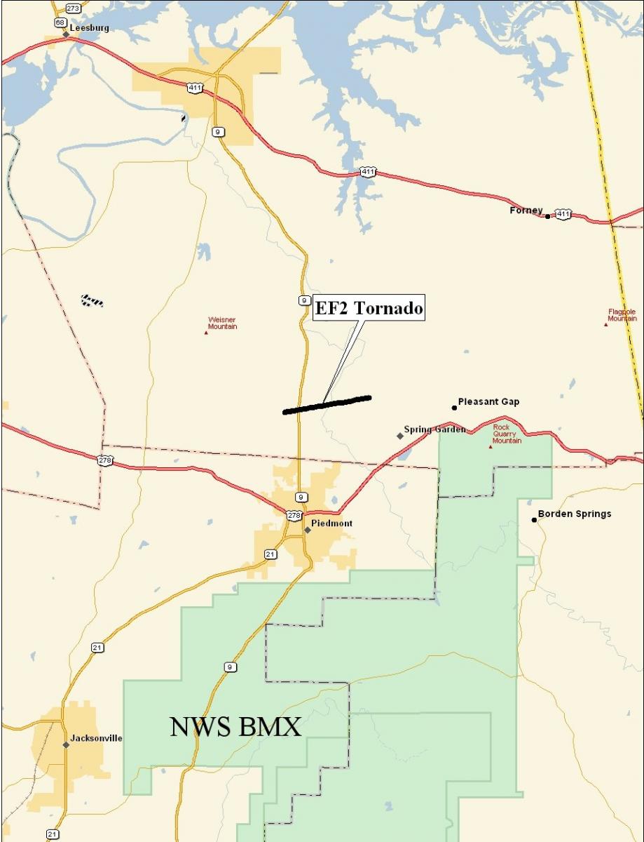
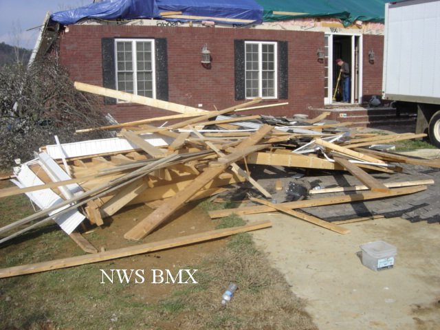
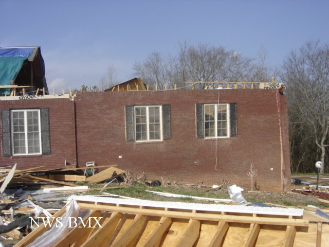
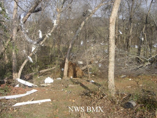
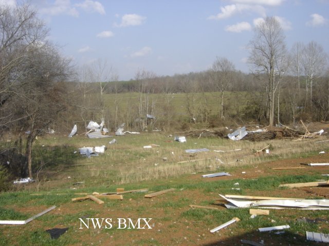
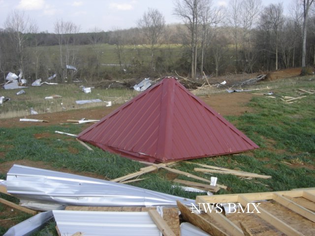
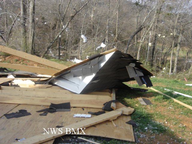
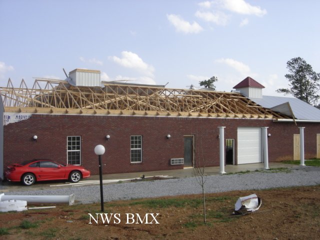
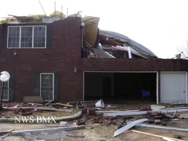
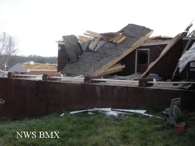
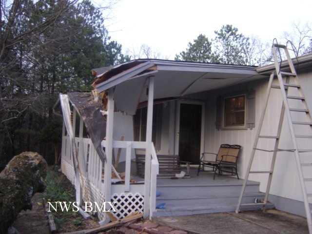
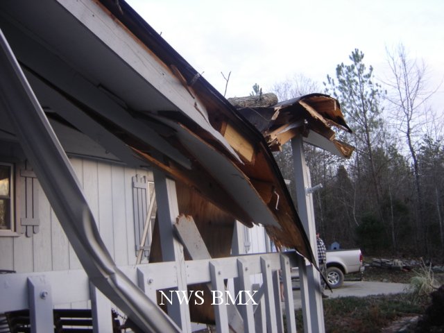
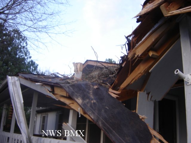
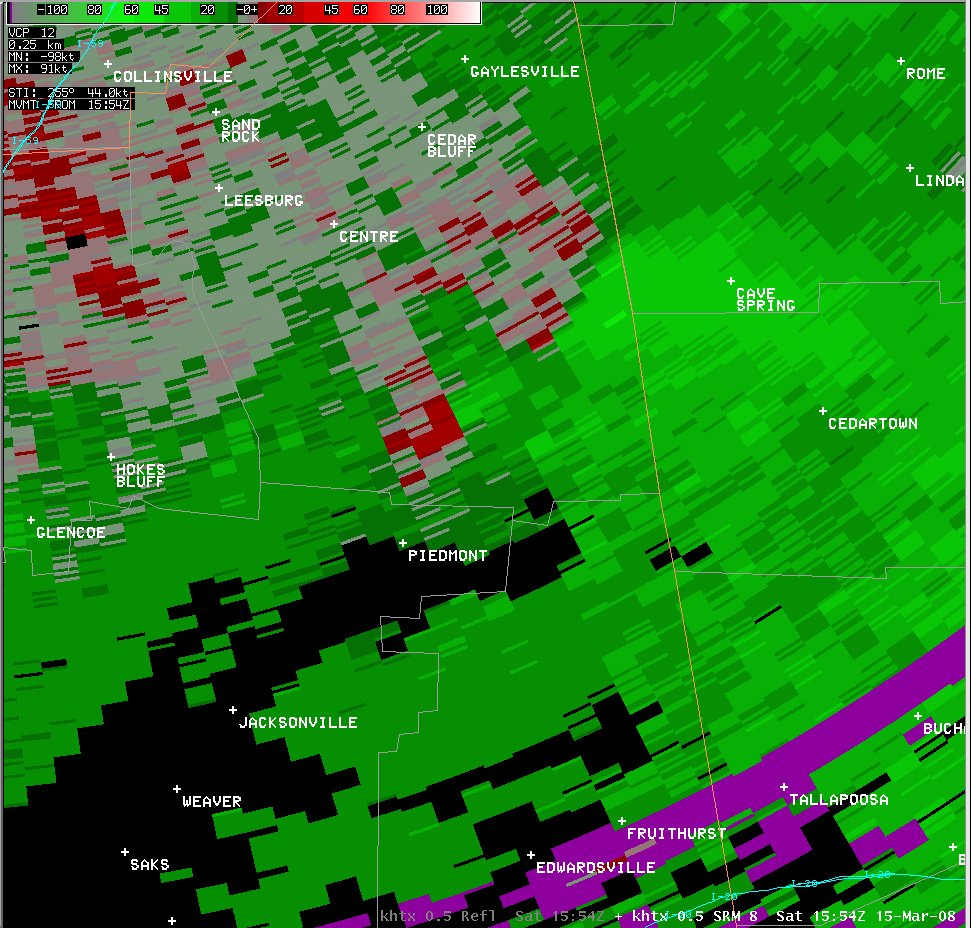
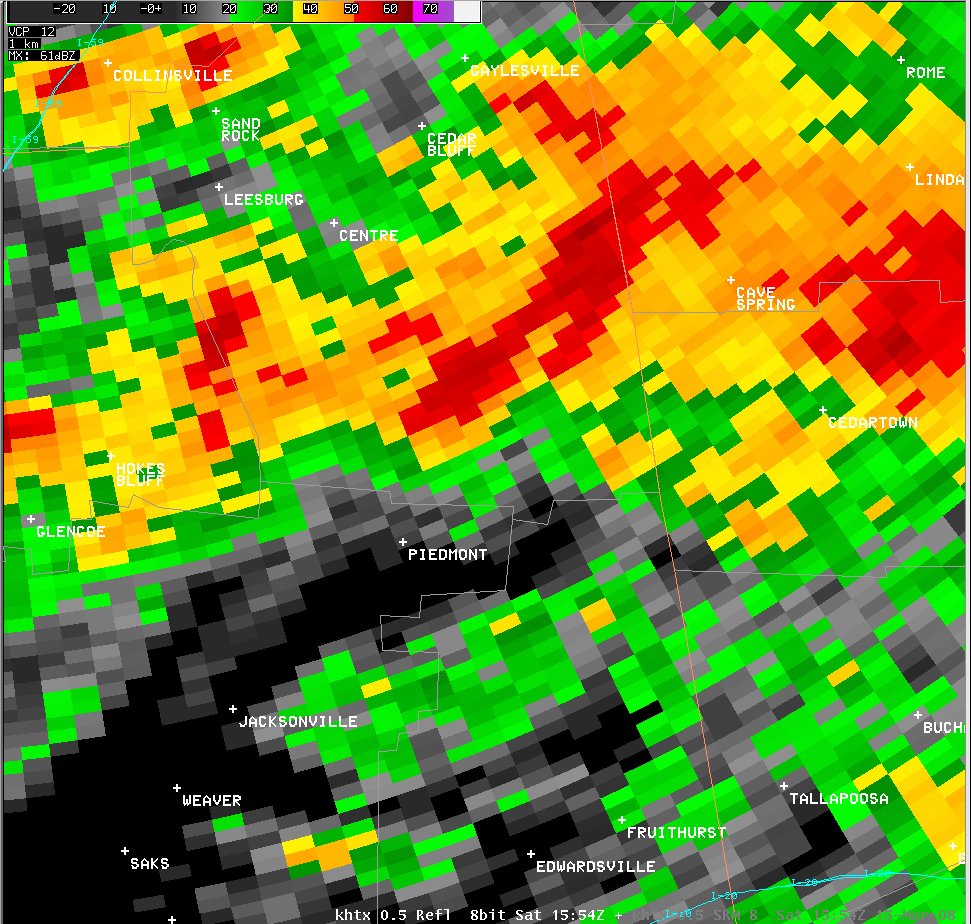
A National Weather Service Damage Assessment Team has surveyed the storm damage in southern Cherokee County north of Piedmont. It has been determined the damage was the result of a tornado.
The tornado briefly touched down at County Road 10, approximately 2 miles northwest of Spring Garden. Metal roof paneling was torn off a barn and one-half of a roof was torn off a brick home. Several pines trees were snapped off. The tornado was rated an EF-2 on the Enhanced Fujita Scale. The tornado was on the ground for approximately 3.6 miles, and the damage path was 50 yards wide at its widest point. The damage was consistent with winds near 115 mph.
|
|
||||||||||||||||||||||||||
Current Hazards
National Outlooks
Tropical
Local Storm Reports
Public Information Statement
Graphical Hazardous Weather Outlook
Current Conditions
Regional Weather Roundup
Rivers and Lakes
Drought Monitor
Forecasts
Aviation Weather
Graphical Forecasts
Forecast Discussion
Air Quality
Fire Weather
Climate and Past Weather
Past Events
Storm Data
Tornado Database
Daily Rainfall Plots
Tropical Cyclone Reports
Warnings and Other Products
Tornado Warnings
Severe Thunderstorm Warnings
Flash Flood Warnings
Winter Weather Warnings
Special Weather Statements
Non-Precipitation Warnings
Flood/River Flood Warnings
Productos en Español
Conciencia y Preparación
Previsión de 7 Días
Weather Safety
NOAA Weather Radio
Severe Weather Preparedness
Severe Safety Rules
Tornado Safety Rules
Severe Safety w/ ASL
Awareness Weeks
Severe Weather
Hurricane Preparedness
Summer Safety Campaign
Winter Weather
US Dept of Commerce
National Oceanic and Atmospheric Administration
National Weather Service
NWS Birmingham, Alabama
465 Weathervane Road
Calera, AL 35040
205-664-3010
Comments? Questions? Please Contact Us.