|
Event Summary
|
|
EF-1
|
|
Estimated Maximum Wind:
|
90 mph
|
|
Injuries/Fatalities:
|
None |
|
Damage Path Length:
|
9.55 miles
|
|
Maximum Path Width:
|
300 yards
|
|
Approximate Start Point/Time:
|
3 ESE Ellards
32.7966/-87.1707
at 637 pm
|
|
Approximate End Point/Time:
|
3 NE Oakmulgee
32.8318/-87.0138
at 657 pm
|
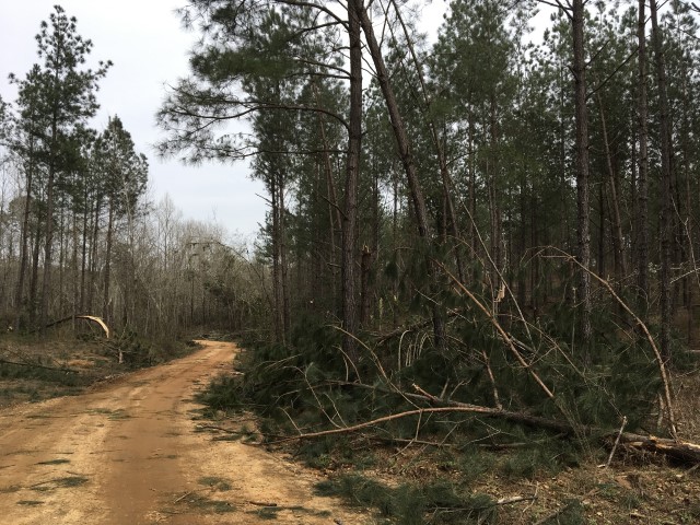
NWS Meteorologists surveyed damage in extreme northeast Perry County and determined it was the result of a tornado.
The same supercell that produced the tornado near Heiberger dropped another tornado in northeast Perry County and northwest Chilton County. The tornado touched down west of AL Highway 219 near the intersection of Fire Tower Road and Sherman Huey Road. This location is about 10 miles south southwest of Centreville. Several trees were snapped off and many trees had broken branches. The tornado tracked northeast and crossed AL Highway 219 at Pinetucky Road, Star Circle, Apple Lane, and Sunday Drive. This is where the most concentrated damage occurred. Numerous trees were snapped off and were uprooted and some power poles were downed. Several outbuildings were damaged here mainly due to fallen trees. The tornado continued east northeast and crossed Foster Road, Whitetail Road, Buck Road, and Mill Creek Road and then crossed into Chilton County. Hundreds of trees were either snapped off, were uprooted, or lost plenty of branches. The tornado lifted near Holingsback Road in far western Chilton County.
|