NWS Birmingham, Alabama
Weather Forecast Office
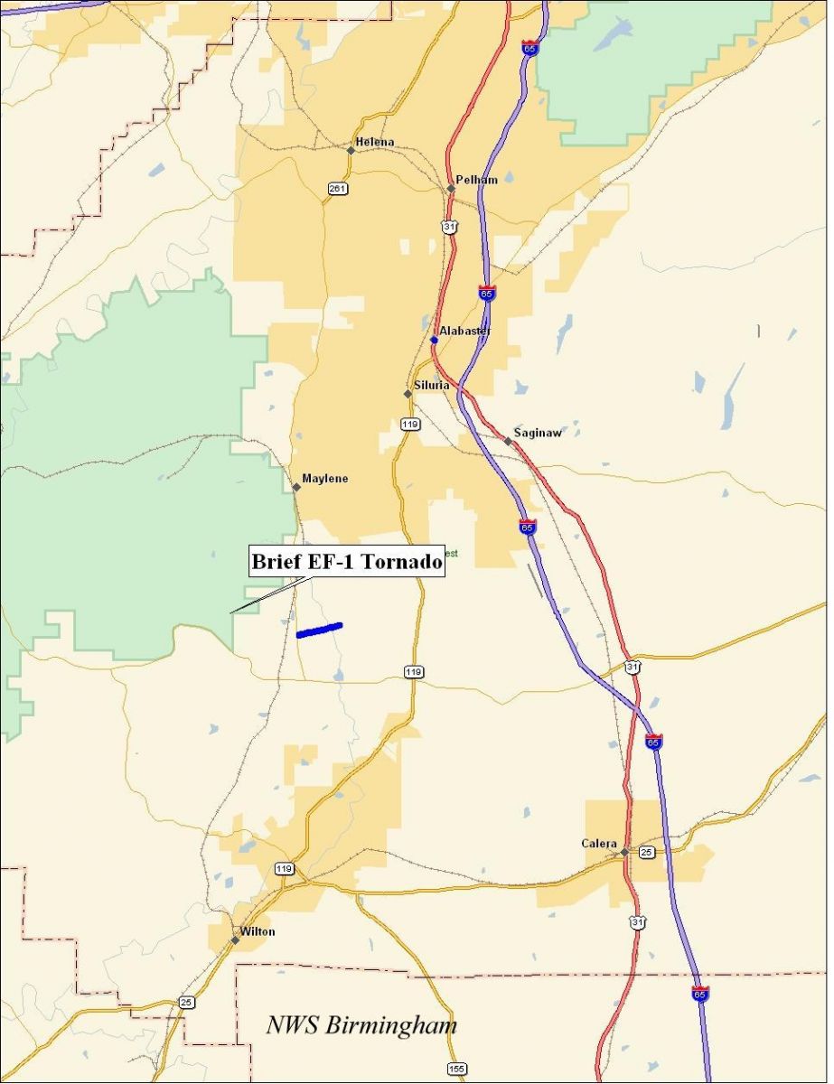
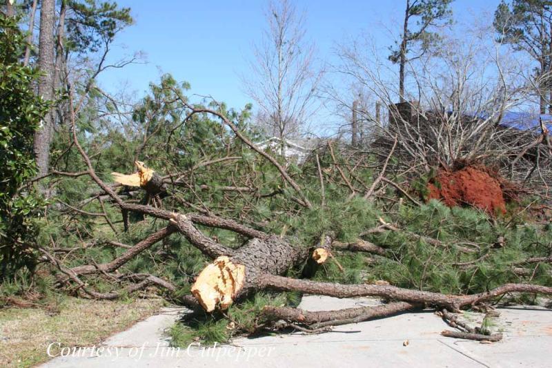
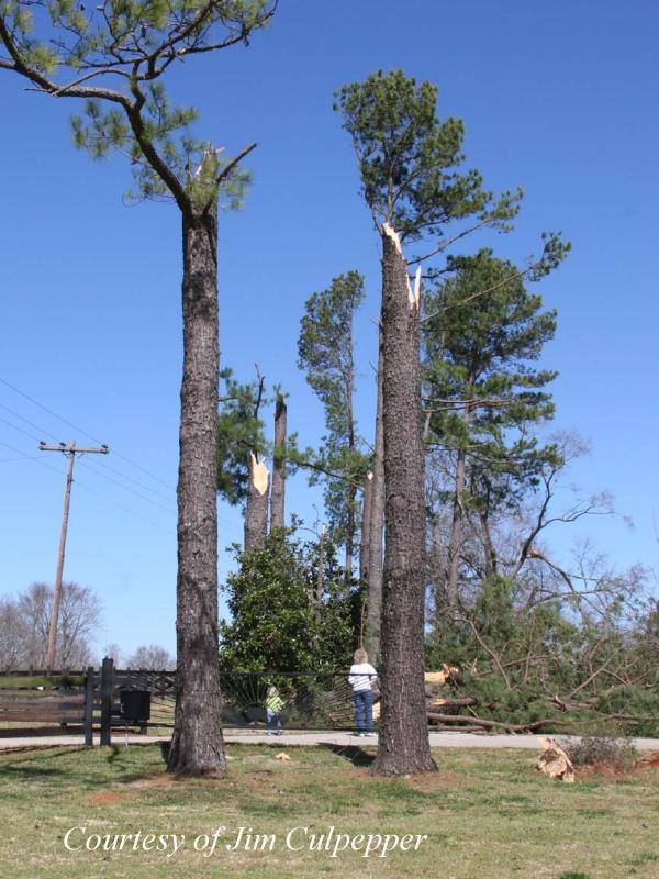
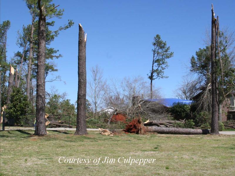
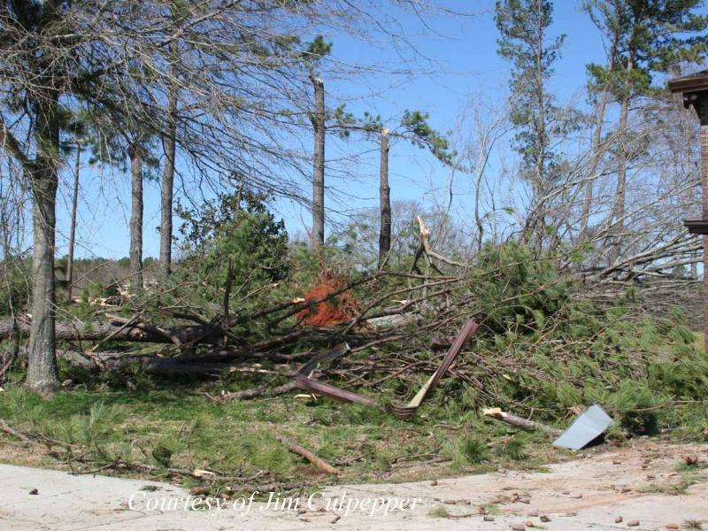
Shelby County Tornado - March 1, 2007
EF-1
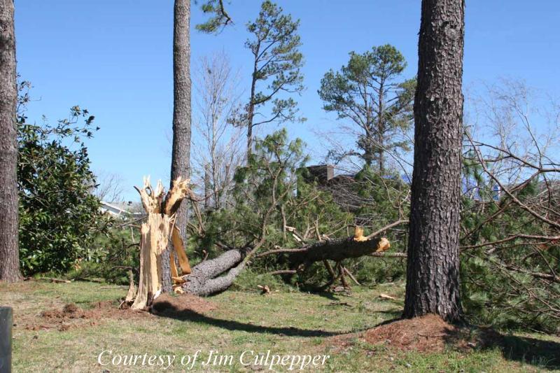
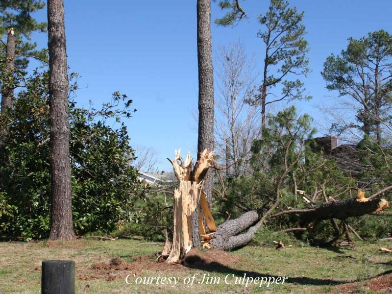
National Weather Service meteorologists surveyed storm damage in western Shelby County. It has been determined that the damage was the result of a tornado. The tornado has been rated an EF-1 on the Enhanced Fujita Scale with estimated maximum winds of 105 mph.
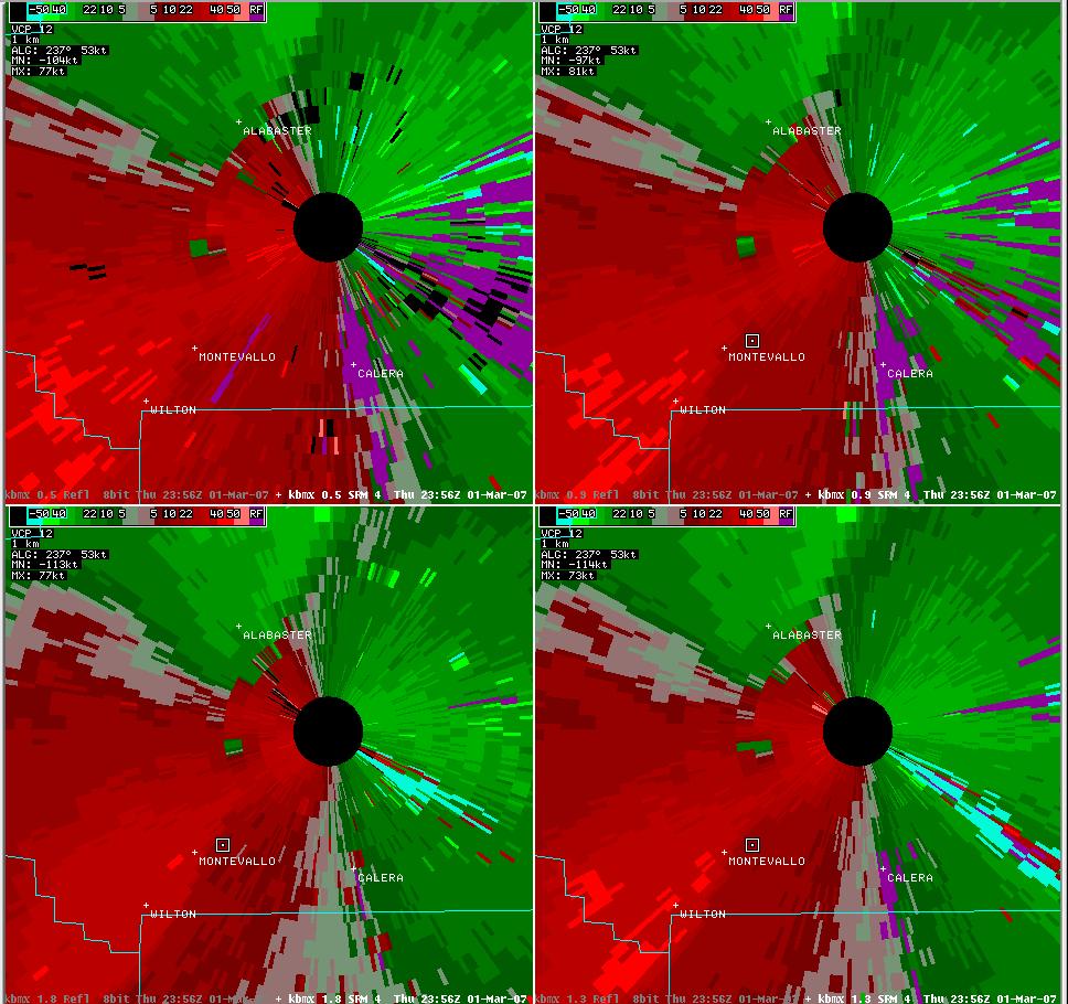
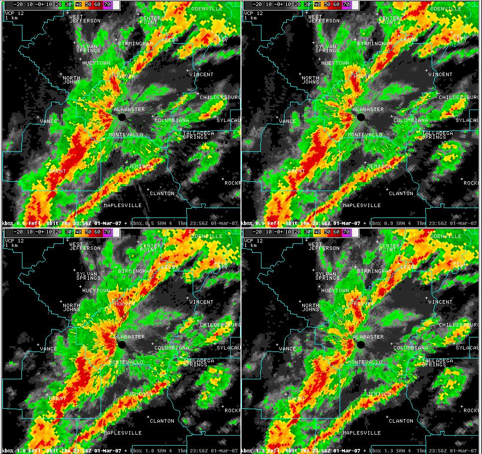
A tornado touched down along County Road 17, about 6 miles southwest of Alabaster. The tornado traveled northeastward for approximately 3/4 of a mile and was 100 yards wide at its widest point. At least 15 large pine trees were snapped off along the short path. One home suffered major roof damage and a barn sustained roof damage. The tornado was on the ground from 556 PM CST to 557 PM CST. A Tornado Warning was in effect for Shelby County from 538 PM CST valid until 630 PM CST. All of central Alabama was outlooked for a High Risk of Severe Thunderstorms including the chance of violent tornadoes. A Tornado Watch was valid from 730 AM CST until 8 PM CST.
Click on the images below for larger picture.
|
|
||||||||||||||||||||||
Current Hazards
National Outlooks
Tropical
Local Storm Reports
Public Information Statement
Graphical Hazardous Weather Outlook
Current Conditions
Regional Weather Roundup
Rivers and Lakes
Drought Monitor
Forecasts
Aviation Weather
Graphical Forecasts
Forecast Discussion
Air Quality
Fire Weather
Climate and Past Weather
Past Events
Storm Data
Tornado Database
Daily Rainfall Plots
Local Climate Data
Tropical Cyclone Reports
Warnings and Other Products
Tornado Warnings
Severe Thunderstorm Warnings
Flash Flood Warnings
Winter Weather Warnings
Special Weather Statements
Non-Precipitation Warnings
Flood/River Flood Warnings
Productos en Español
Conciencia y Preparación
Previsión de 7 DÃas
Weather Safety
NOAA Weather Radio
Severe Weather Preparedness
Severe Safety Rules
Tornado Safety Rules
Severe Safety w/ ASL
Awareness Weeks
Severe Weather
Hurricane Preparedness
Summer Safety Campaign
Winter Weather
US Dept of Commerce
National Oceanic and Atmospheric Administration
National Weather Service
NWS Birmingham, Alabama
465 Weathervane Road
Calera, AL 35040
205-664-3010
Comments? Questions? Please Contact Us.