NWS Birmingham, Alabama
Weather Forecast Office
Russell-Lee-Muscogee County Tornado - March 1, 2007
EF-2
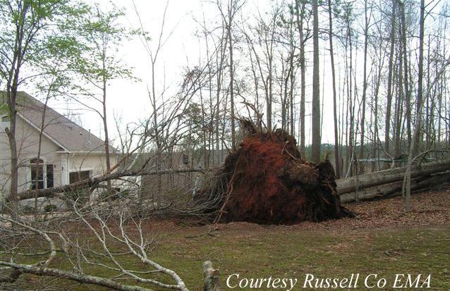
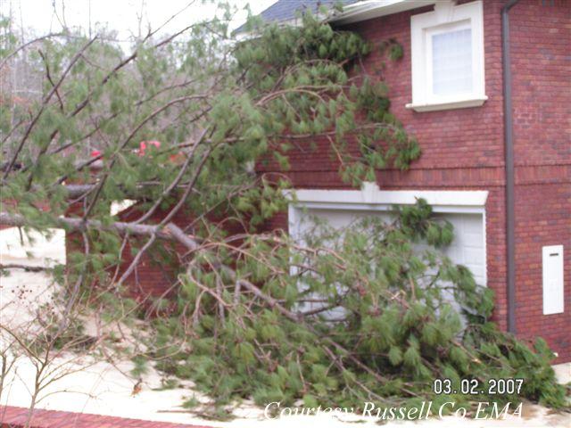
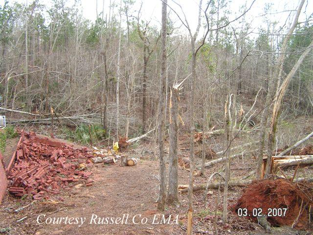
Emergency Management Officials surveyed storm damage in the Phenix City area. It has been determined that the damage was the result of a tornado. The tornado has been rated an EF-2 on the Enhanced Fujita Scale. This rating was based on the highest damage along the entire path through Georgia. The damage in Russell County is consistent with EF0 damage and the damage in Lee County is consistent with EF1 damage.
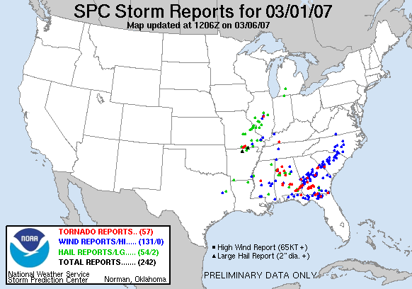
The tornado touched down near the Russell-Lee County line in Phenix City. Damage near the touchdown point was very light with only minor tree damage being reported. As the tornado tracked northeastward, it became stronger as it approached Lake Oliver on the Chattahoochee River. The greatest damage was from Summerville Road into the River Oak and Rock Island areas. Numerous pine trees were snapped off and some hardwoods were uprooted. At least 20 residential properties reported tree damage. At least 25 homes suffered shingle, window or minor structural damage. Some of the fallen trees landed on homes and produced moderate damage. The tornado continued eastward where it produced damage in Columbus Georgia. The total tornado damage path was 10.3 miles long and was 300 yards wide at its widest point. The damage path in Alabama was only 2.4 miles. The tornado was on the ground in Alabama from 527 PM CST until 531 PM CST. All of central Alabama was outlooked for a High Risk of Severe Thunderstorms including the chance of violent tornadoes. A Tornado Watch was valid from 945 AM CST until 8 PM CST. See the Report from the National Weather Service Office in Atlanta.
Click on the images below for larger picture.
The National Weather Service would like to thank the Russell County Emergency Management Agency for providing support during the storm survey process.
Current Hazards
National Outlooks
Tropical
Local Storm Reports
Public Information Statement
Graphical Hazardous Weather Outlook
Current Conditions
Regional Weather Roundup
Rivers and Lakes
Drought Monitor
Forecasts
Fire Weather
Aviation Weather
Graphical Forecasts
Forecast Discussion
Air Quality
Climate and Past Weather
Past Events
Storm Data
Tornado Database
Daily Rainfall Plots
Tropical Cyclone Reports
Warnings and Other Products
Tornado Warnings
Severe Thunderstorm Warnings
Flash Flood Warnings
Winter Weather Warnings
Special Weather Statements
Non-Precipitation Warnings
Flood/River Flood Warnings
Productos en Español
Conciencia y Preparación
Previsión de 7 Días
Weather Safety
NOAA Weather Radio
Severe Weather Preparedness
Severe Safety Rules
Tornado Safety Rules
Severe Safety w/ ASL
Awareness Weeks
Severe Weather
Hurricane Preparedness
Summer Safety Campaign
Winter Weather
US Dept of Commerce
National Oceanic and Atmospheric Administration
National Weather Service
NWS Birmingham, Alabama
465 Weathervane Road
Calera, AL 35040
205-664-3010
Comments? Questions? Please Contact Us.


