|
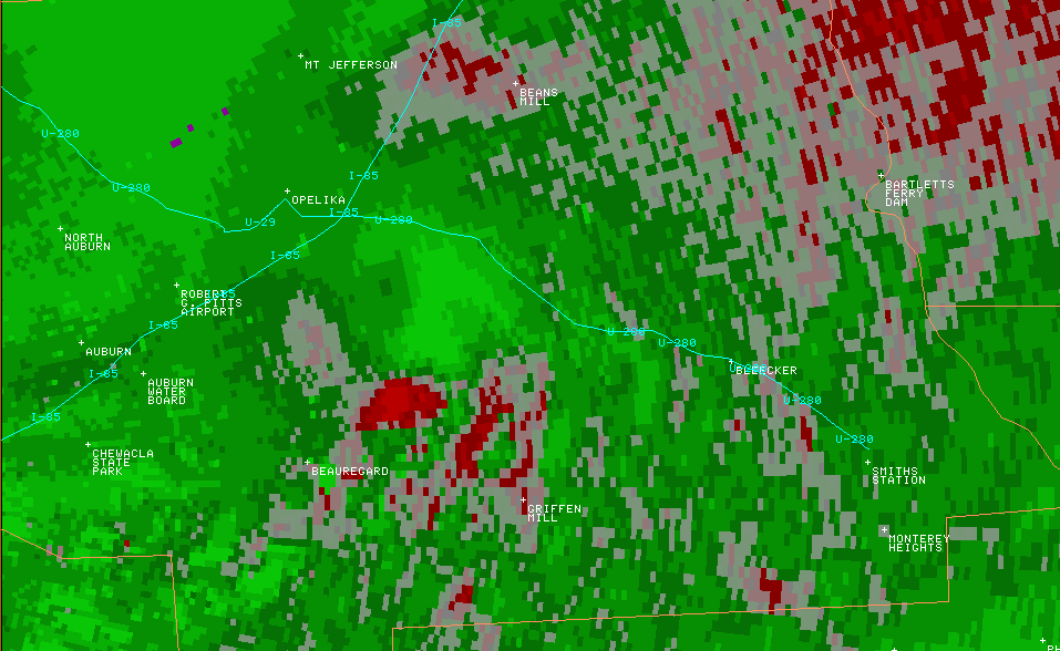
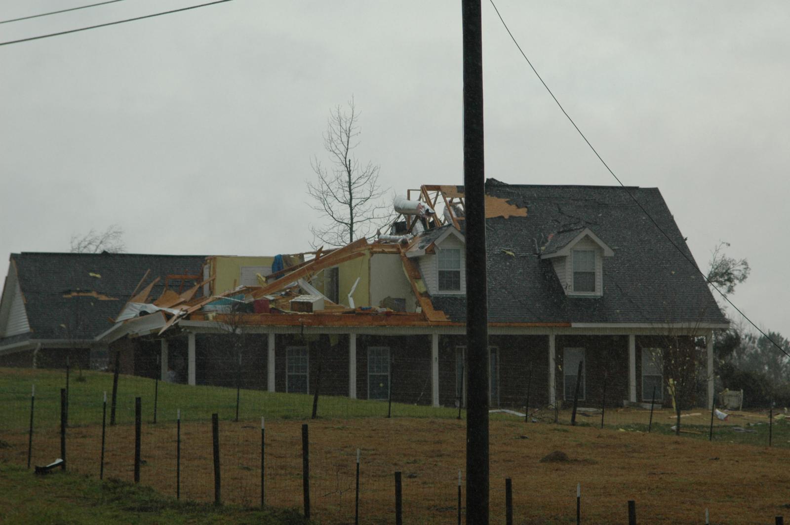
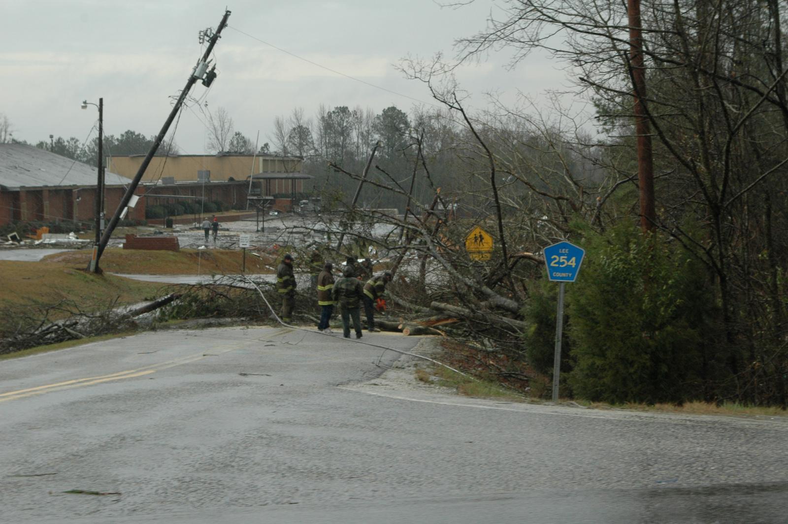
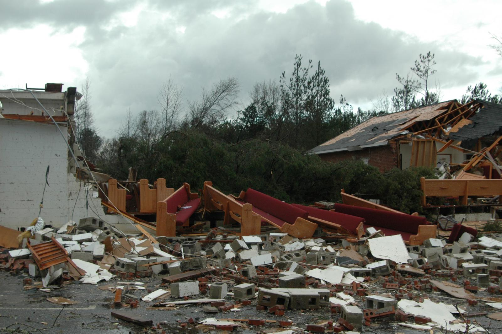
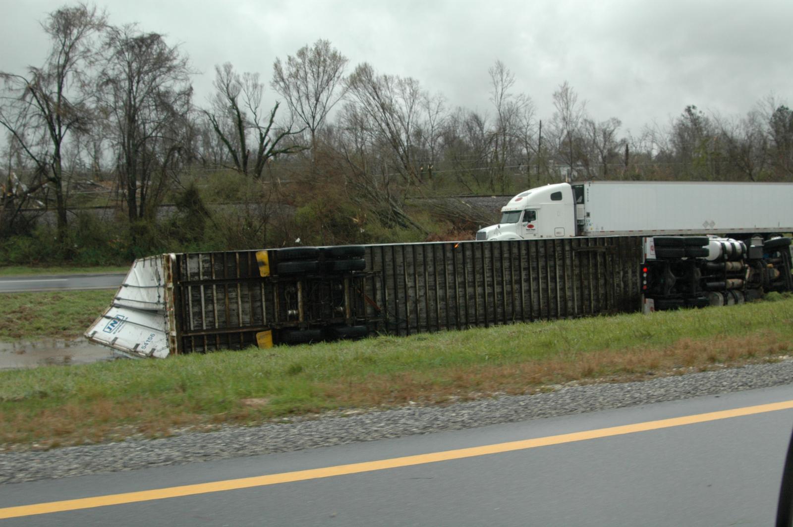
A National Weather Service Damage Assessment Team has surveyed the storm damage in Lee County. It has been determined the damage was the result of a tornado. The tornado has been rated an EF-2 on the Enhanced Fujita Scale. Damage estimates were consistent with winds between 125 and 130 mph.
The tornado touched down southwest of the community of Salem. Once on the ground, it moved east-northeast and crossed U.S. 280. The tornado lifted about six miles east of Salem, as it crossed County Road 379. Damage included hundreds of trees snapped off and uprooted, at least 40 homes were damaged or destroyed, 10 additional structures (schools, businesses and churches) were damaged or destoyed and one 18-wheeler was overturned.
Hail was also reported with this storm. The hail was at least nickel size.
|