Highland Lakes Tornado & Shelby County Wind Damage - February 26th, 2008
|
Rating:
(Click for EF Scale) |
EF-1
|
|
Estimated Maximum Wind:
|
90 mph
|
|
Injuries/Fatalities:
|
None
|
|
Damage Path Length:
|
0.6 miles
|
|
Maximum Path Width:
|
150 yards
|
|
Approximate Start Point:
|
33.4011/-86.6577 at 350 AM
|
|
Approximate End Point:
|
33.4035/-86.6497 at 351 AM
|
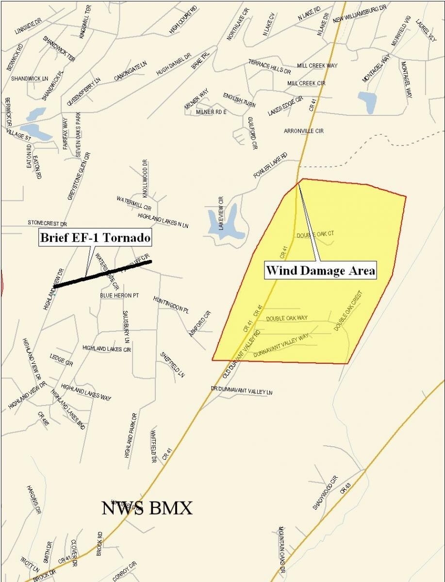
A National Weather Service Damage Assessment Team has surveyed the storm damage in northern and eastern Shelby County. It has been determined the damage was the result of a combination of tornado and straight line wind damage. The brief tornado has been rated an EF-1 on the Enhanced Fujita Scale. Damage estimates were consistent with winds around 90 mph for the tornado and around 105 mph for the straight line winds.
A fairly narrow path of damage that was approximately 150 yards wide at the widest point began just to the lee of Double Oak Mountain...and continued east-northeastward on a 080 degree heading for 0.6 miles. Twenty to 30 trees were either uprooted, or snapped along the path in a slightly convergent, crossing pattern. Several homes received damage from direct or indirect hits from falling trees. On one street directly in the path of the tornado, the mailboxes on both sides of the street were sucked open. At Pinecliff Circle and Highland Park Drive, at least 3 homes had roofing or siding stripped off the homes by the tornado. Wind speeds with this tornado were estimated between 80 and 95 mph. Twenty to 30 homes were also damaged along the path of this tornado. The tornado was on the ground at approximately 350 am and was on the ground for a minute or less.
In the eastern portion of Highland Lakes and along County Road 41, there was extensive tree damage with several hundred trees either snapped or fallen in a slightly divergent pattern centered around a heading of 040 degrees. This damage area was approximately 1.2 miles wide and approximately 0.6 miles long. Still, wind speeds in this area were estimated at 90 to 105 miles per hour which would be equivalent in strength of an EF-1 tornado or a low end category 2 hurricane.
On Highway 119 between Highway 280 and the Shelby County line, there were numerous sporadic instances of tree damage consistent with wind speeds of up to 90 mph. At approximately 400 am at the intersection of County Road 43 and Lilly Road, 20 to 30 trees were either uprooted or snapped. All trees were felled in a uniform direction with winds possibly funneled somewhat due to local terrain. Wind speeds in this area were also estimated at 90 to 105 miles per hour.
A Severe Thunderstorm Watch was in effect at the time of these events. A Severe Thunderstorm Warning was in effect from 347 am until 415 am. No injuries were reported.
 Tornado Damage Path |

