NWS Birmingham, Alabama
Weather Forecast Office
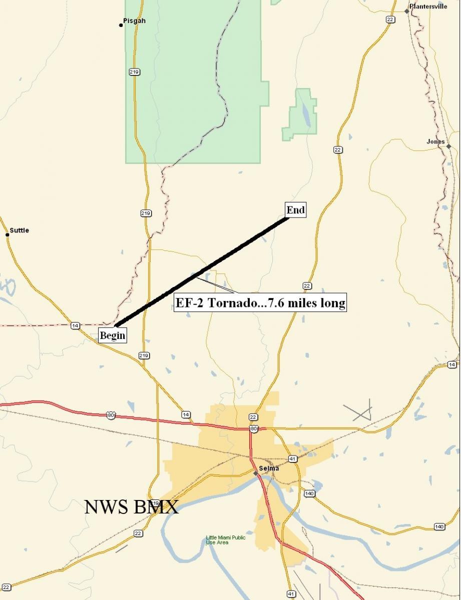
Summerfield Tornado - February 17, 2008
|
Rating:
(Click for EF Scale) |
EF-2
|
|
Maximum Wind:
|
120 mph
|
|
Injuries/Fatalities:
|
None
|
|
Path Length:
|
7.6 miles
|
|
Maximum Path Width:
|
400 yards
|
|
Start:
|
32.4873/-87.1105 at 1226 pm
|
|
End:
|
32.5458/-87.0004 at 1238 pm
|
A National Weather Service Damage Assessment Team has surveyed the damage in Dallas County and it has been determined that the damage was the result of a tornado. The tornado has been rated an EF-2 on the Enhanced Fujita Scale. Damage estimates were consistent with winds around 120 mph. The tornado damage path was 7.6 miles long and 400 yards wide at its widest point.
The tornado touched down near Warrior Drive, just southeast of the Perry County line. This location is approximately 4 miles southwest of Summerfield. The tornado tracked northeastward across State Highway 219 near the intersection of County Road 230, moved right through Summerfield, crossed County Road 37, and lifted just east of County Road 37 and County Road 844. At least 7 homes and 2 businesses were totally destroyed. Twelve to fifteen additional structures were damaged to varying degrees. Hundreds of trees were either snapped off or uprooted along the damage path. A Tornado Warning was in effect from 1208 pm until 100 pm. No injuries were reported.
Current Hazards
National Outlooks
Tropical
Local Storm Reports
Public Information Statement
Graphical Hazardous Weather Outlook
Current Conditions
Regional Weather Roundup
Rivers and Lakes
Drought Monitor
Forecasts
Fire Weather
Aviation Weather
Graphical Forecasts
Forecast Discussion
Air Quality
Climate and Past Weather
Past Events
Storm Data
Tornado Database
Daily Rainfall Plots
Tropical Cyclone Reports
Warnings and Other Products
Tornado Warnings
Severe Thunderstorm Warnings
Flash Flood Warnings
Winter Weather Warnings
Special Weather Statements
Non-Precipitation Warnings
Flood/River Flood Warnings
Productos en Español
Conciencia y Preparación
Previsión de 7 Días
Weather Safety
NOAA Weather Radio
Severe Weather Preparedness
Severe Safety Rules
Tornado Safety Rules
Severe Safety w/ ASL
Awareness Weeks
Severe Weather
Hurricane Preparedness
Summer Safety Campaign
Winter Weather
US Dept of Commerce
National Oceanic and Atmospheric Administration
National Weather Service
NWS Birmingham, Alabama
465 Weathervane Road
Calera, AL 35040
205-664-3010
Comments? Questions? Please Contact Us.

