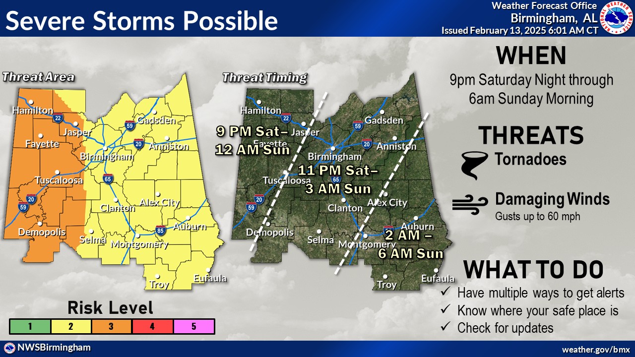
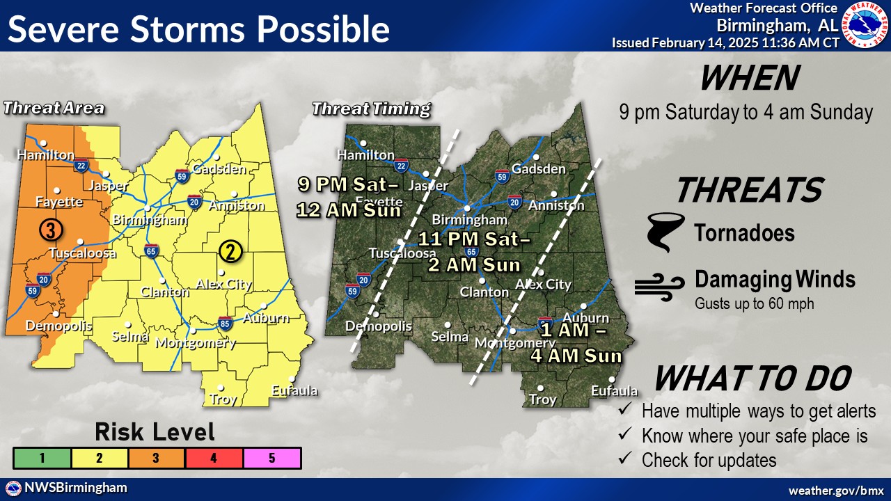
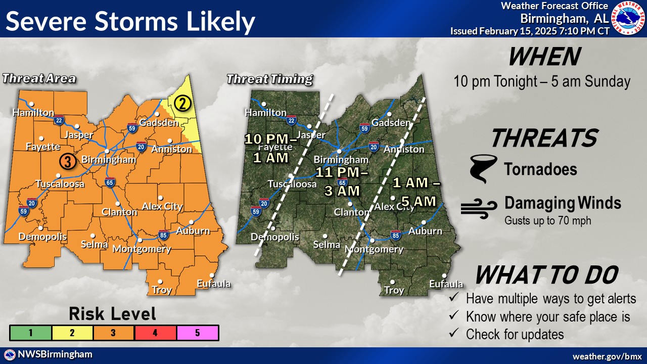
|
Event Summary
|
|
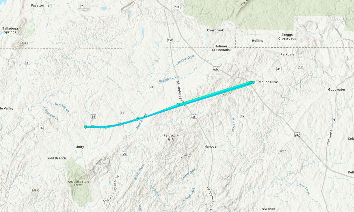
EF-1
|
|
Estimated Maximum Wind:
|
95 mph
|
|
Injuries/Fatalities:
|
2 Injuries |
|
Damage Path Length:
|
18.37 miles
|
|
Maximum Path Width:
|
200 yards
|
|
Approximate Start Point/Time:
|
4 S Cedarville
32.5582/-87.6852
at 12:52 am CST
|
|
Approximate End Point/Time:
|
4 SW Marion
32.5918/-87.3753
at 1:10 am CST
|
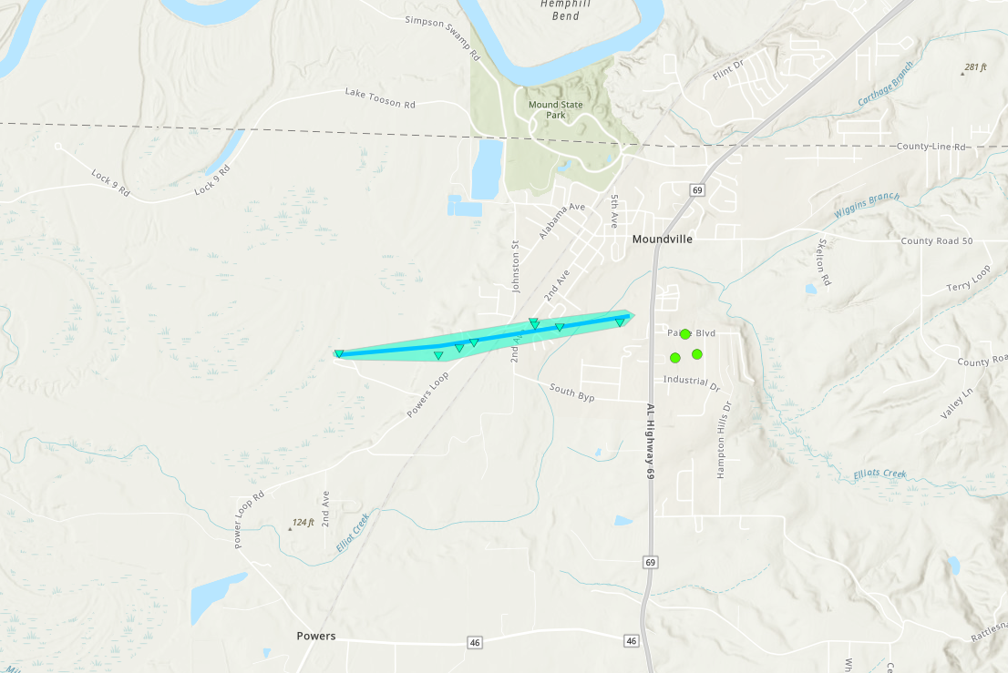
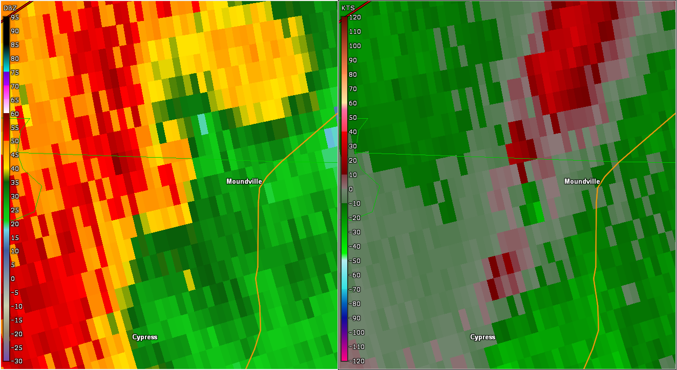
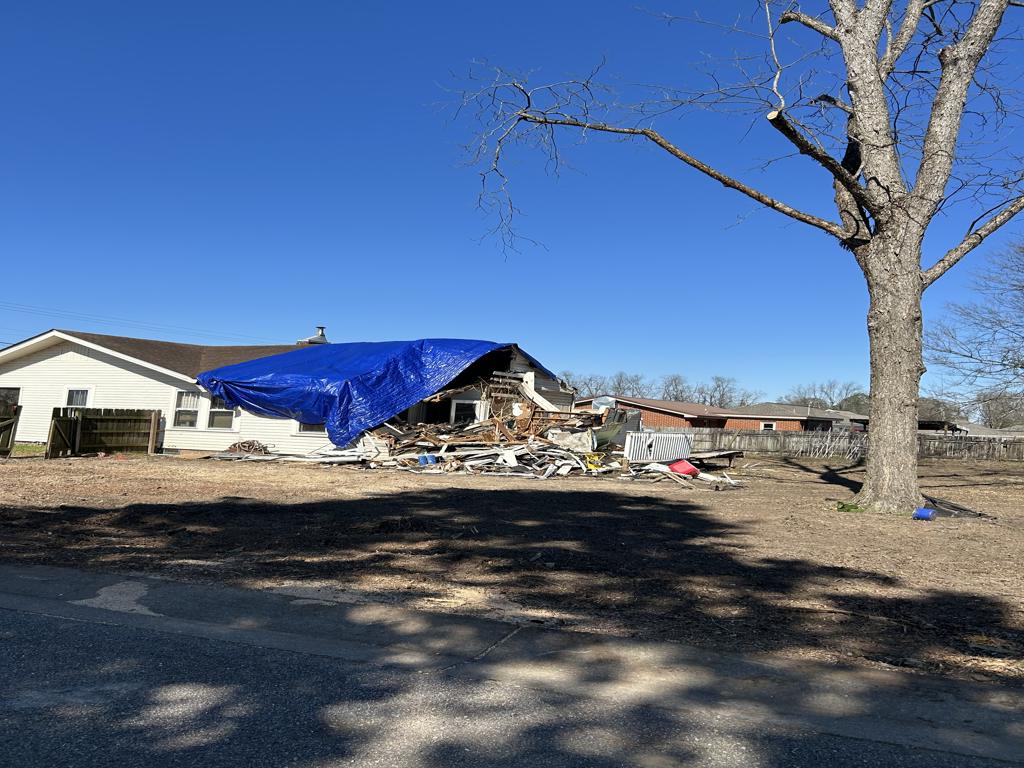
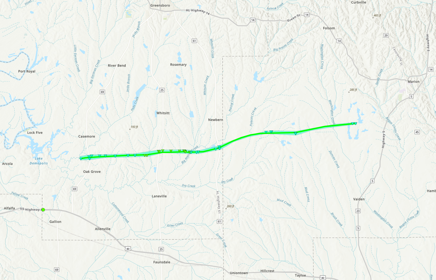
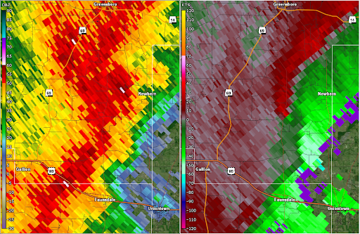
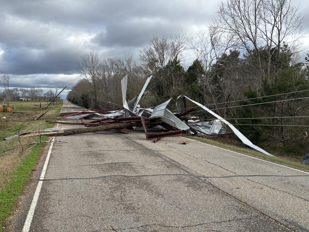
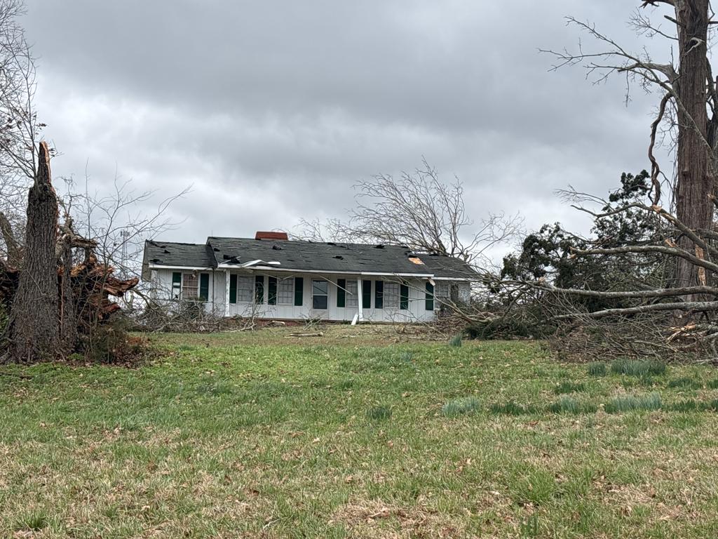
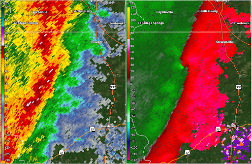
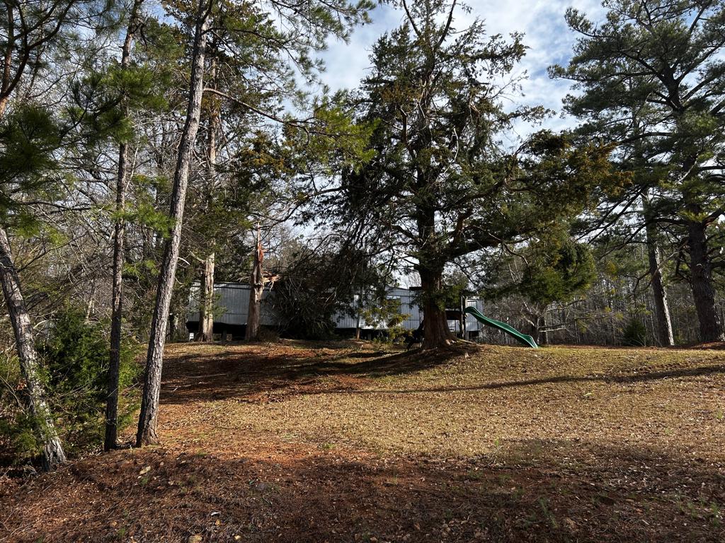
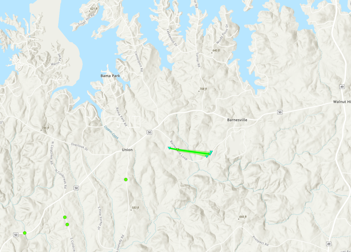
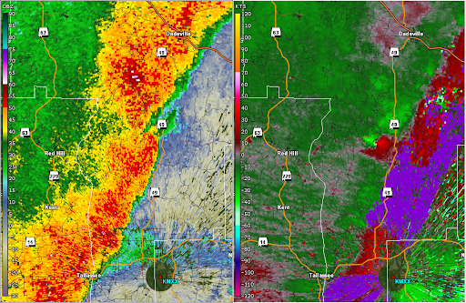
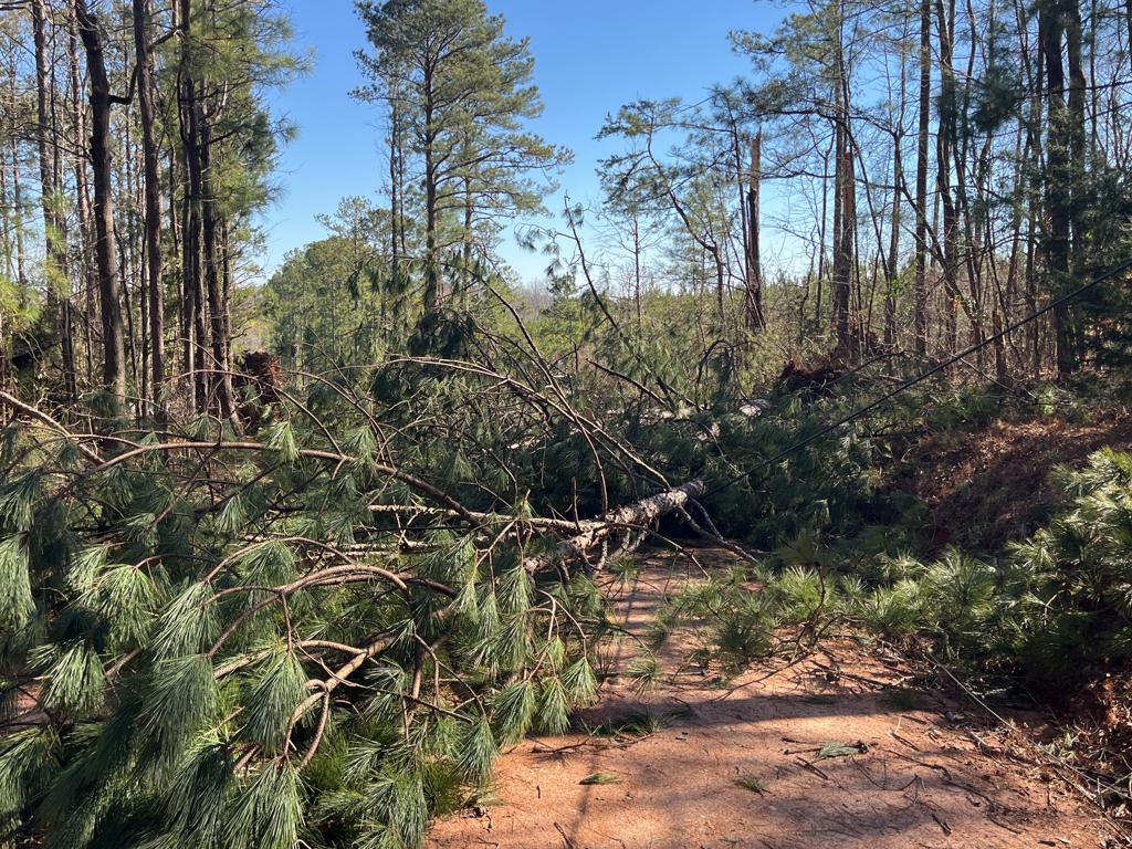
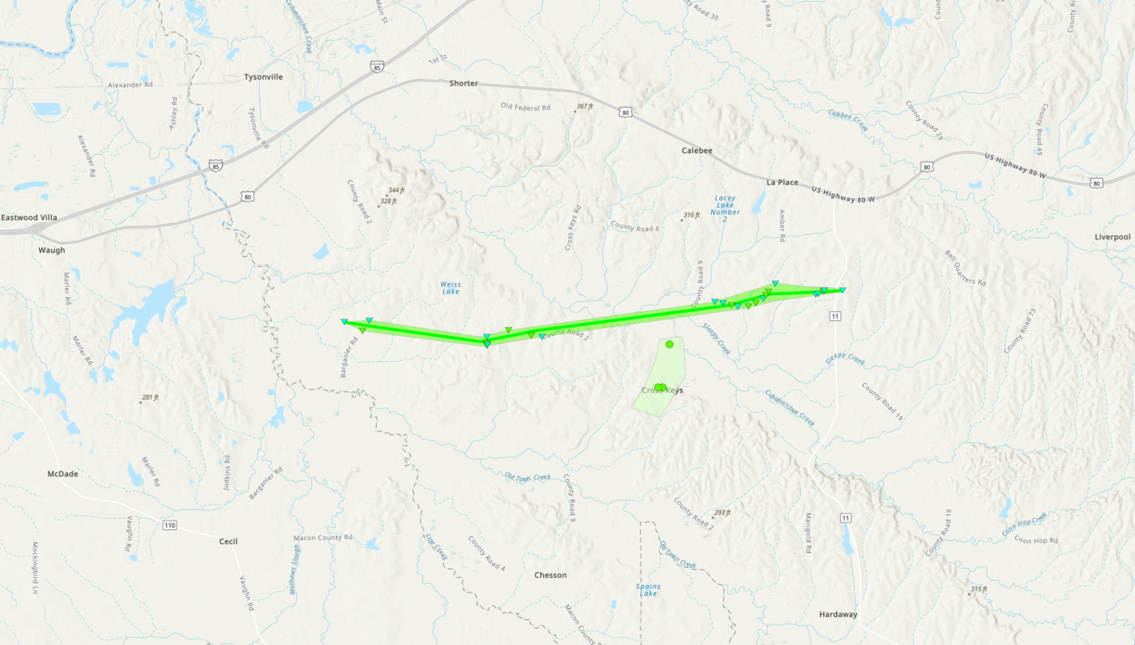
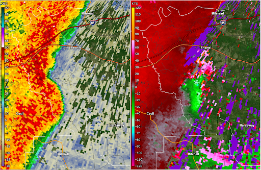
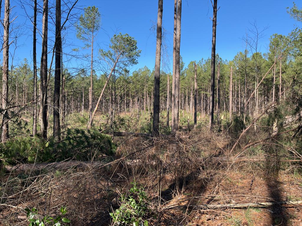
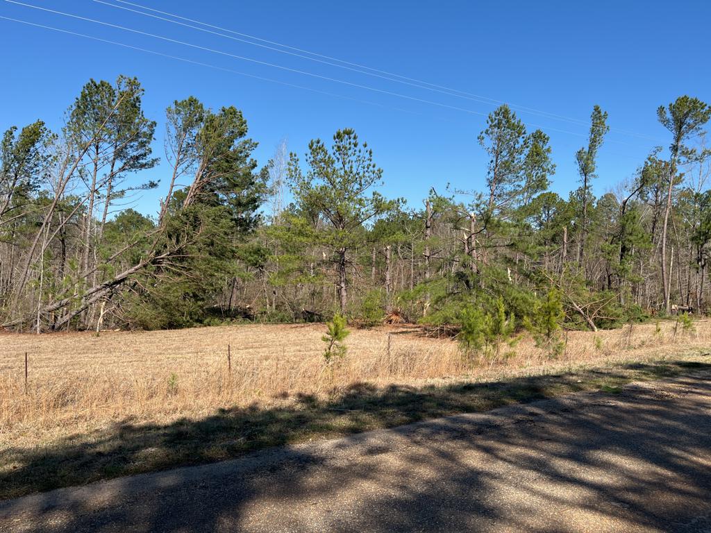
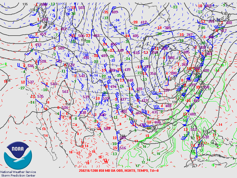
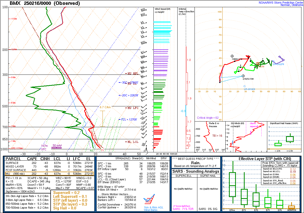
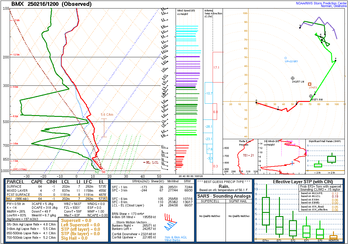
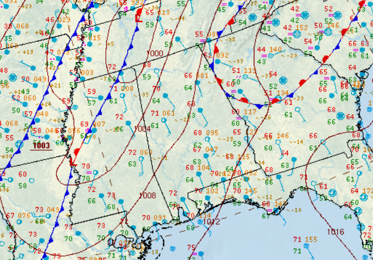
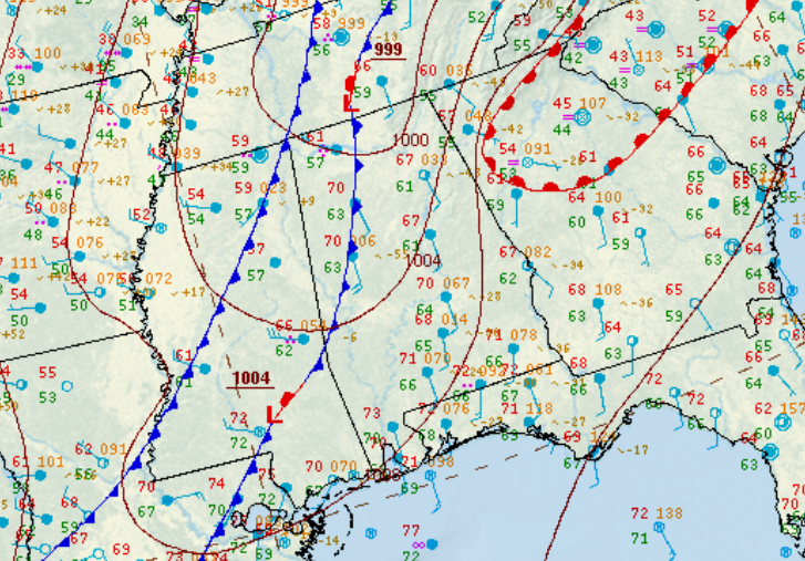
The start of the tornado was estimated to be just west of Alabama Highway 69, where tree damage was observed in an inaccessible area. The tornado continued eastward, moving parallel to County Road 10. Along the roadway, numerous trees were snapped or uprooted, along with at least 40 to 50 power poles snapped. A site built home sustained roof damage along with farm outbuildings that sustained significant damage. The tornado gained strength as it moved east of Alabama Highway 25, where EF-1 damage occurred. Multiple manufactured homes were severely damaged due to large trees falling on top of them, while another manufactured home was destroyed due to tornadic wind gusts estimated around 95mph. Residents who were inside the homes received the tornado warning on their mobile phones, and were able to quickly take as much shelter as they could. A mother and her two kids in one home took shelter in their bathtub, which ended up being the only room in the home that did not sustain major damage. 2 injuries occurred where the homes were damaged, and the maximum width was estimated to be 200 yards at this location. The tornado continued eastward and crossed Alabama Highway 61 into Perry County. Minor tree damage was noted along Jenkins Bryant Rd, and farm outbuildings sustained major damage along Perry County Rd 23. The tornado lifted along Lakeland Farm Rd, and no further damage was noted to the east.
|