NWS Birmingham, Alabama
Weather Forecast Office
|
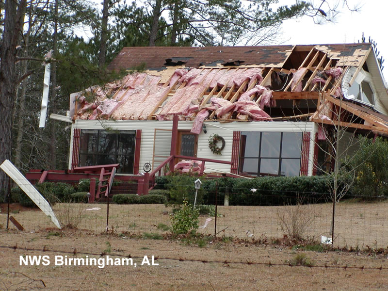
Marengo County Tornado...February 15, 2003 In what was believed to be the first tornado in Alabama in 2003, a small tornado touched down briefly in the northern half of Marengo County between Linden and Demopolis. No injuries or deaths were reported with the short-lived tornado. The tornado first touched down about 1.6 miles west-northwest of Providence on the west side of US 43 and about half a mile south of County Road 44. The tornado traveled northeasterly moving across County Road 44 and through the western sections of Chickasaw State Park. Where it first touched down, two mobile homes were damaged and a number of trees were either uprooted or snapped off.The tornado damaged one house significantly on the west side of US 43 just north of Chickasaw State Park and moved across US 43 downing several more trees. The tornado ended after crossing US 43 about 2.1 miles north of Providence on the east side of US 43. The tornado was rated an F1 primarily due to the damage done to the house just north of Chickasaw State Park. The tornado path length was 2.5 miles with a width of about 80 yards. The tornado began around 8:36 pm and ended at approximately 8:40 pm. The weak tornado was produced on the north side of what meteorologists refer to as a bow echo (in radar image below, bow echo is within white circle). Cycloninc rotation is often induced on the north side of the center of the bow. Bow echoes are known primarily for producing downbursts or straight line wind damage but also have the capability of producing weak tornadoes as apparently happened in this case. Tornado Watch Number 8 was issued at 5:40 pm and included Marengo County. A Severe Thunderstorm Warning was issued for Marengo County at 7:43 pm valid until 8:45 pm. |
|
Outbuilding/travel trailer west of US 43 near Chickasaw State Park |
Radar image during the tornado event |
|
|
Click on each thumb nail for a larger view.
|
||
Current Hazards
National Outlooks
Tropical
Local Storm Reports
Public Information Statement
Graphical Hazardous Weather Outlook
Current Conditions
Regional Weather Roundup
Rivers and Lakes
Drought Monitor
Forecasts
Aviation Weather
Graphical Forecasts
Forecast Discussion
Air Quality
Fire Weather
Climate and Past Weather
Past Events
Storm Data
Tornado Database
Daily Rainfall Plots
Tropical Cyclone Reports
Warnings and Other Products
Tornado Warnings
Severe Thunderstorm Warnings
Flash Flood Warnings
Winter Weather Warnings
Special Weather Statements
Non-Precipitation Warnings
Flood/River Flood Warnings
Productos en Español
Conciencia y Preparación
Previsión de 7 Días
Weather Safety
NOAA Weather Radio
Severe Weather Preparedness
Severe Safety Rules
Tornado Safety Rules
Severe Safety w/ ASL
Awareness Weeks
Severe Weather
Hurricane Preparedness
Summer Safety Campaign
Winter Weather
US Dept of Commerce
National Oceanic and Atmospheric Administration
National Weather Service
NWS Birmingham, Alabama
465 Weathervane Road
Calera, AL 35040
205-664-3010
Comments? Questions? Please Contact Us.


