The National Weather Service surveyed damage near Vida Junction in Autauga County and determined the damage was the result of a tornado. The tornado touched down just to the west of County Road 79 in rural Autauga County and moved eastward crossing County Road 19. Numerous trees were snapped and uprooted along the path. The damage path widened just to the west of County Road 19. A single family home sustained minor siding damage and several trees were snapped an uprooted around the home. Splattering of debris was noted on two sides of the home. The tornado continued across County Road 19 and quickly dissipated, as no further damage was found further east on U.S. Highway 82.
Radar Data & Damage Pictures
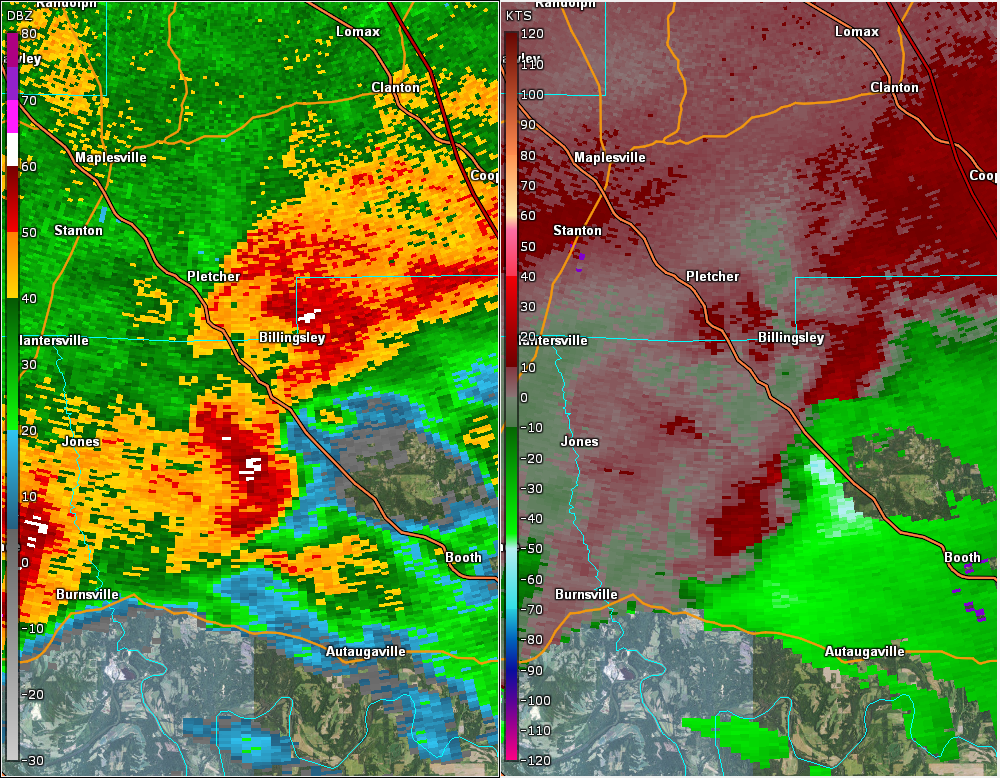
This is an image of the 0.5 degree reflectivity (left) and velocity (right) data from KBMX at 706 am CST just after the tornado touched down.