National Weather Service United States Department of Commerce

Tornadoes & Flooding of February 5-6, 2020

Event Summary for Central Alabama

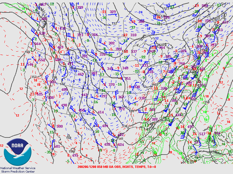
Rounds of rain and storms affected Central Alabama on February 5th and 6th as several impulses emanated from a deep upper trough centered over the central U.S. This event yielded tornadic storms, damaging winds, and flooding. Cold air arriving behind the system resulted in some snow showers early on February 7th.

The northward progression of a warm front allowed a seasonably warm and moist air mass to overspread the region on Wednesday, February 5th, featuring high temperatures in the 70s and dew points in the 60s. The initial round of convection on this day included areas of rain with embedded thunderstorms producing gusty winds as well as small hail --though there was one cell that produced quarter-sized hail. Repeated rounds of rainfall, some heavy, resulted in areas of minor flooding. This initial round of activity began to vacate Central Alabama late in the day, allowing a window for atmospheric recovery which would aid in the next round of convection.

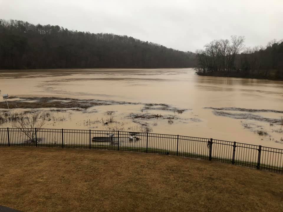
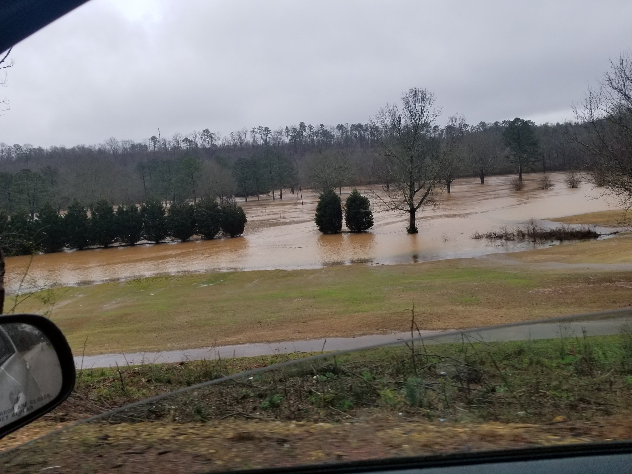
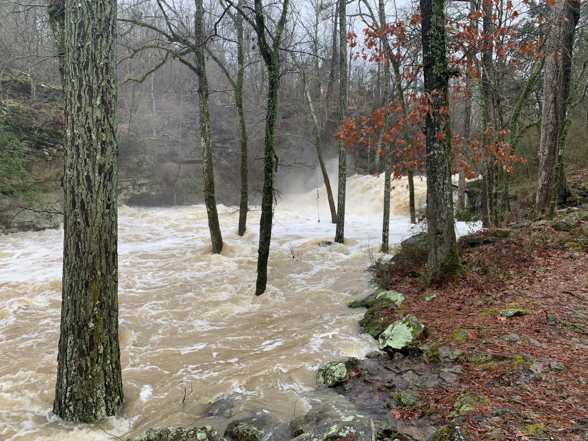
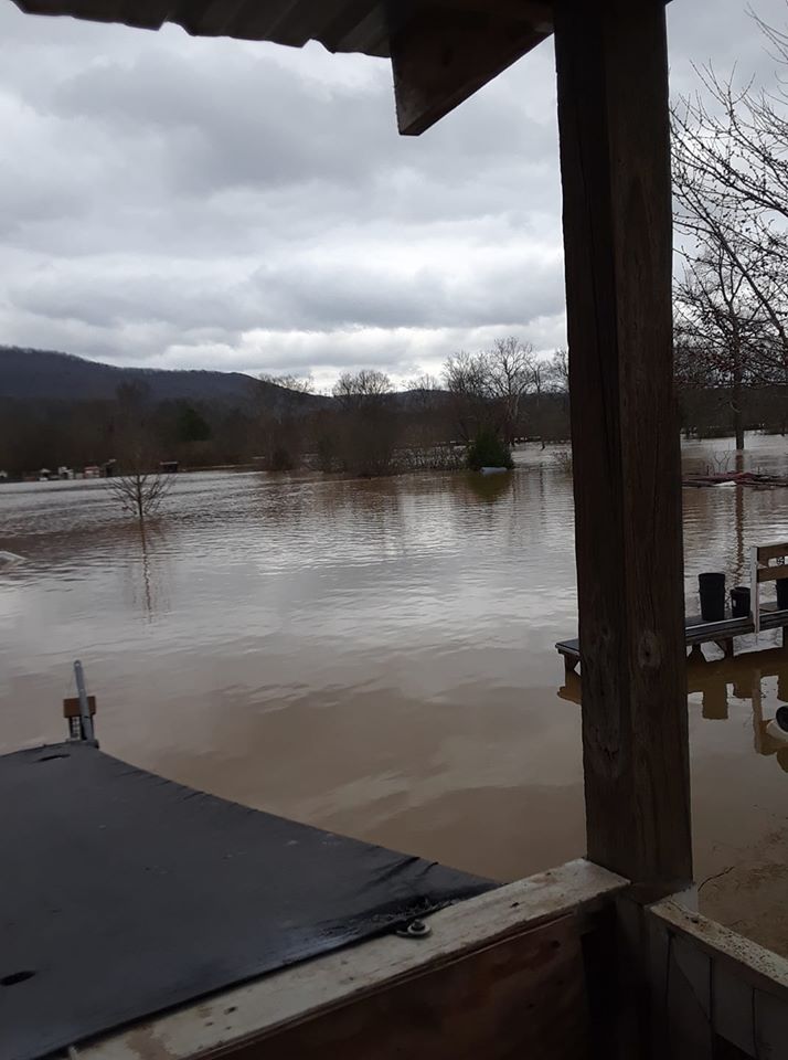
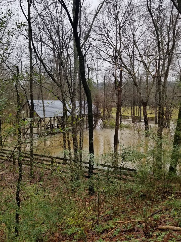
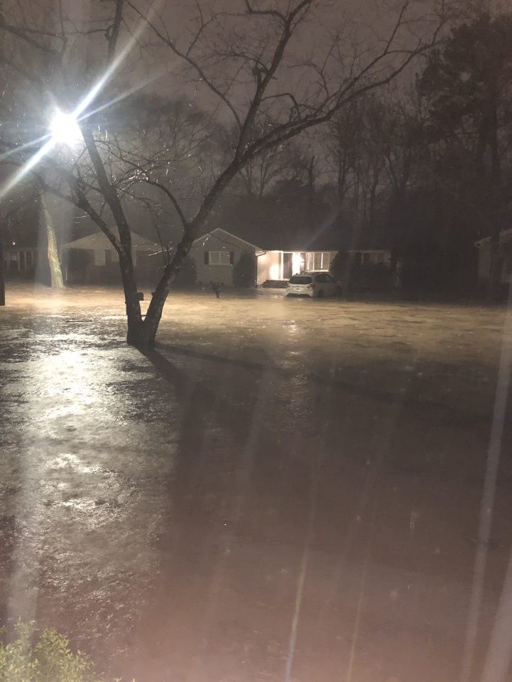
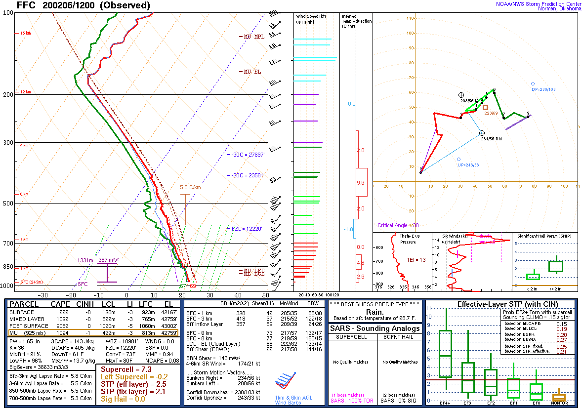
There was a relative lull in thunderstorm activity during a portion of Wednesday evening, before the next upper-level impulse arrived, alongside a cold front and nearby surface low. This round of activity began its formation to the west in Mississippi and then moved through Alabama Wednesday night through midday Thursday, February 6th. This round of convection produced widespread moderate to heavy rainfall, resulting in more substantial flooding. Some storms became tornadic due to the favorable wind shear and instability in place, while others produced damaging straight-line winds. Due to the overall wet and breezy conditions, trees fell in numerous locations from wind not associated with thunderstorms. Behind this storm system, cold air rushed into the region and yielded a period of snow showers early on Friday, February 7th within the plume of wrap-around moisture.

**The data below is considered PRELIMINARY.**


Interactive Tornado/Storm Report Map
View larger map
 
 
Location/Clickable Detailed Summary Link
Damage Rating/Estimated Maximum Wind Speeds
Injuries/Fatalities
Damage Path Length/Width
Starting Point/Time
Ending Point/Time
Ward Creek Tornado
(Shelby County)
EF-2
120 mph
None
9.91 miles
700 yards

5 NW Pea Ridge
33.2015/-86.9753
1:57 am CST

4 NNW Alabaster
33.2954/-86.8503
2:09 am CST
Spring Hill Tornado
(Marengo County)
EF-1
105-110 mph
1 Fatality
1 Injury
1.29 miles
400 yards

4 SE Demopolis
32.4617/-87.8012
2:13 am CST

4 SE Demopolis
32.4725/-87.7834
2:15 am CST
 

Pertinent Geographic Information Systems (GIS) Data from this Event


Flooding Photos


Trussville, AL
Kelly Wood


Trussville Golf Course
Trussville, AL
William Griffin


Lakeshore Parkway
Homewood, AL
Jonathan Skeen


Odenville, AL
Tracy Lopresti Brown


Ranburne, AL
Amanda Grace


Mardis Mill Creek
Blountsville, AL
Tyler Cantrell


Cahaba River
West Blocton, AL
Meghan Capshaw


Chattooga River
Gaylesville, AL
Tina Marie


Cold Branch Rd
Cleveland, AL
Rebecca Reeves


Hwy 13 (Trigger Creek)
Helena, AL
Michael Garrison


Indian Springs, AL
Kendahl Schnell


Dickey Springs Rd
Bessemer, AL
Rachel Harris Hawkins


Mountaindale Rd
Crestline, AL
Frank Mullens


University Blvd
Birmingham, AL
David White


Locust Fork River
Blount County, AL
Cynthia Stapp


Double Bridges
Rockford, AL
Melissa Buttram


Severe Weather Episode Data 

250 mb
250 mb Analysis
February 5 at 6 am

500 mb
500 mb Analysis
February 5 at 6 am

850 mb
850 mb Analysis
February 5 at 6 am

250 mb
250 mb Analysis
February 5 at 6 pm

500 mb
500 mb Analysis
February 5 at 6 pm

850 mb
850 mb Analysis
February 5 at 6 pm

250 mb
250 mb Analysis
February 6 at 6 am

500 mb
500 mb Analysis
February 6 at 6 am

850 mb
850 mb Analysis
February 6 at 6 am

250 mb
250 mb Analysis
February 6 at 6 pm

500 mb
500 mb Analysis
February 6 at 6 pm

850 mb
850 mb Analysis
February 6 at 6 pm

Surface
Surface Analysis
February 5 at 6 am

Surface
Surface Analysis
February 5 at 12 pm

Surface
Surface Analysis
February 5 at 6 pm

Surface
Surface Analysis
February 6 at 12 am

Surface
Surface Analysis
February 6 at 6 am

Surface
Surface Analysis
February 6 at 12 pm

Severe Threats
Local Severe Outlook
Issued February 3 at 420 am

Severe Threats
Local Severe Outlook
Issued February 4 at 420 am

Severe Threats
Local Severe Outlook
Issued February 5 at 11 am

KJAN Sounding
KJAN Sounding
February 5 at 6 am

KBMX Sounding
KBMX Sounding
February 5 at 6 pm

KFFC Sounding
KFFC Sounding
February 6 at 6 am

Storm Reports
Storm Reports
February 5

Storm Reports
Storm Reports
February 6

Storm Reports
3-Day Rainfall
February 4-6