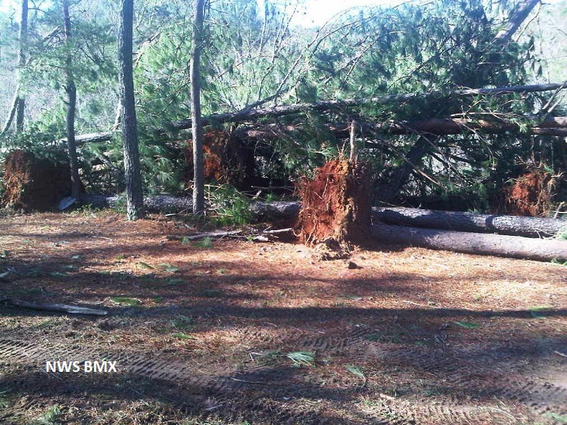
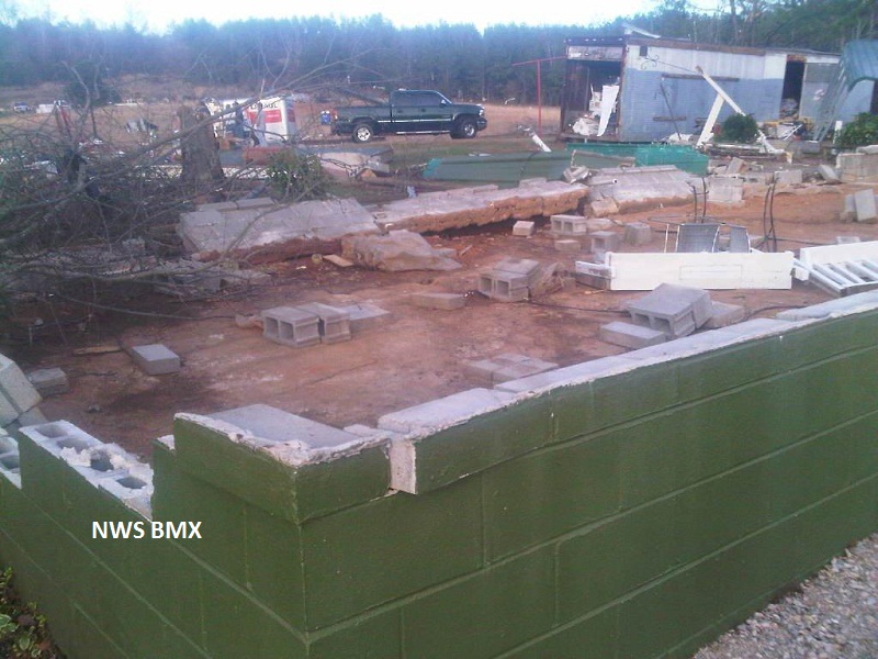
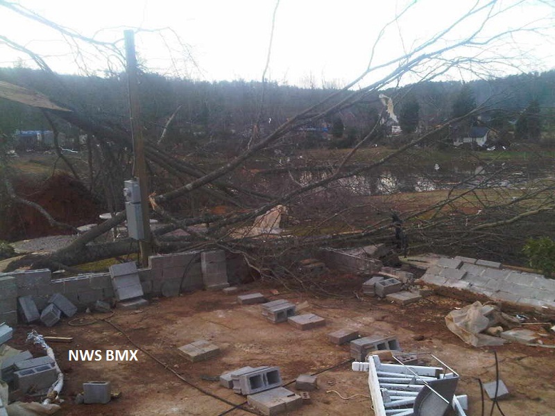
National Weather Service meteorologists have surveyed the damage just east of the Black Warrior River near the Tuscaloosa and Jefferson County line. The damage was the result of an EF-2 tornado. The tornado touched down 1 mile west of Groundhog Road. The tornado then moved northeast across Lock 17 Road, Camp Oliver Road, and Toadvine Road. The tornado lifted along Toadvine Road just southwest of Short Creek. Numerous trees were snapped and uprooted along the damage path. One fatality occurred along Toadvine Road where a mobile home was totally destroyed. Several other structures received varying degrees of damage along the path.
Radar Data
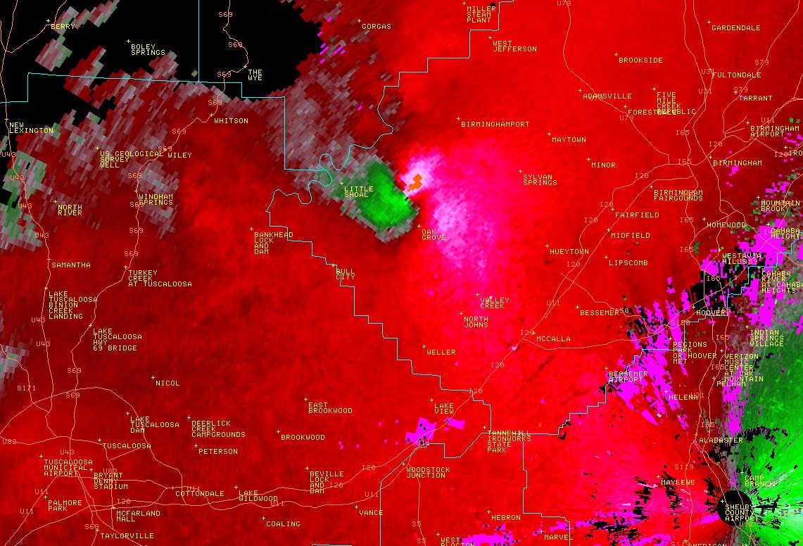
This is an image of the 0.5 degree reflectivity data from KBMX at 922 am as the tornado neared Oak Grove.
Click to enlarge.
This is an image of the 0.5 degree velocity (SRM) data from KBMX at 922 am as the tornado neared Oak Grove.
Click to enlarge