National Weather Service United States Department of Commerce

North Millbrook (Elmore) EF-1 Tornado
January 23rd, 2012

 
EF-1
Estimated Maximum Wind:
100 mph
Injuries/Fatalities:
None
Damage Path Length:
4.02 miles
Maximum Path Width:
200 yards
Approximate Start Point/Time:
32.5209/-86.4119 at 748 am
Approximate End Point/Time:
33.5309/-86.3437 at 755 am
 

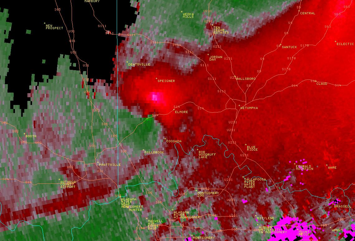
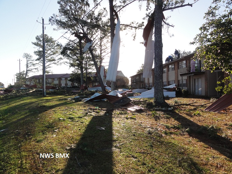
National Weather Service meteorologists have surveyed the damage between Millbrook, Deatsville, and Elmore. The damage was the result of an EF-1 tornado. The tornado touched down along County Road 39 near the Autauga County line. The tornado moved eastward and crossed Highway 7 near the Pines Golf Club. The tornado then moved along Highway 14 and lifted just before the Wetumpka Municipal Airport. Ten to fifteen homes suffered shingle and siding damage, and dozens of trees were blown down. One apartment had its metal roof blown off, and one auto center had its doors blown in.


Radar Data 

Radar Image
This is an image of the 0.5 degree reflectivity data from KMXX at 753 am as the tornado passed near the Pines Golf Club.
Click to enlarge.

Radar Image
This is an image of the 0.5 degree velocity (SRM) data from KMXX at 753 am as the tornado passed near the Pines Golf Club.
Click to enlarge


Storm Damage Images - Click to Enlarge

Storm Damage Image
Roof damage to apartment complex

Storm Damage Image
Roof damage

Storm Damage Image
Tree damage

Storm Damage Image
Fine debris