National Weather Service United States Department of Commerce

Koffman (Tuscaloosa) EF-2 Tornado
January 23rd, 2012

 
EF-2
Estimated Maximum Wind:
120 mph
Injuries/Fatalities:
None
Damage Path Length:
0.45 miles
Maximum Path Width:
400 yards
Approximate Start Point/Time:
33.3257/-87.6579 at 242 am
Approximate End Point/Time:
33.3305/-87.6526 at 243 am
 

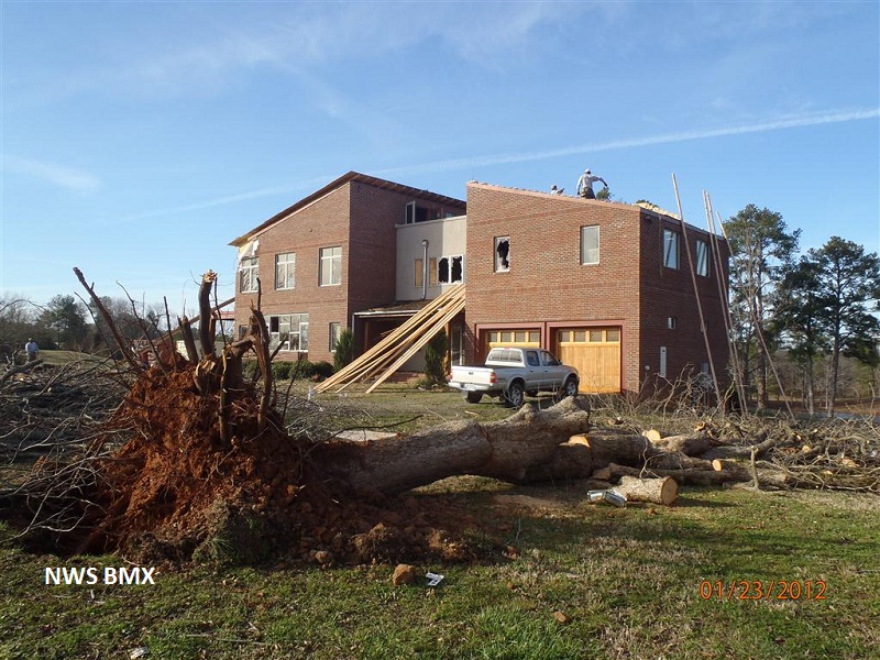
Update: Based on a discussion with structural engineers regarding the home damaged northeast of Koffman Spur, the peak wind and rating of this tornado was downgraded to a 120 mph EF-2.

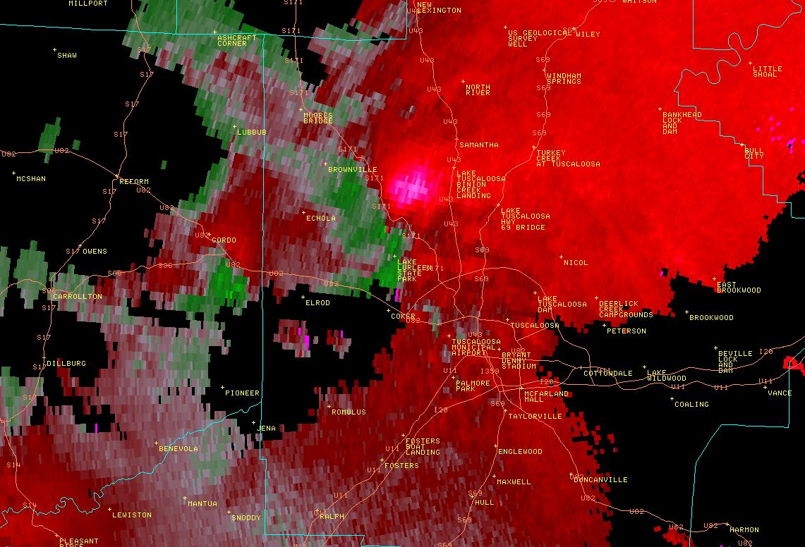
National Weather Service meteorologists surveyed damage just east of Al Hwy 171 in the Koffman area and determined that it was the result of an EF-2 tornado. The tornado touched down near the intersection of Al Hwy 171 and Koffman Ranch Rd where approximately two dozen pine trees were uprooted and oriented in multiple directions. The tornado then traveled northeast destroying one outbuilding along Koffman Spur. Just to the northeast of Koffman Spur, a barn was destroyed and the entire roof was torn off of a well-constructed single family residence. The tornado lifted before reaching Carroll Creek. The tornado damage path was approximately 0.46 miles long and was 400 yards wide at its widest point.


Radar Data 

Radar Image
This is an image of the 0.5 degree reflectivity data from KBMX at 240 am as the brief touchdown was about to occur near Highway 171 north of Tuscaloosa.
Click to enlarge.

Radar Image
This is an image of the 0.5 degree velocity (SRM) data from KBMX at 240 am as the brief touchdown was about to occur near Highway 171 north of Tuscaloosa.
Click to enlarge


Storm Damage Images - Click to Enlarge

Storm Damage Image
Trees Uprooted

Storm Damage Image
Major Roof Damage

Storm Damage Image
Radio AntennaTower Down

Storm Damage Image
Fine Debris

Storm Damage Image
Roof off Home