|
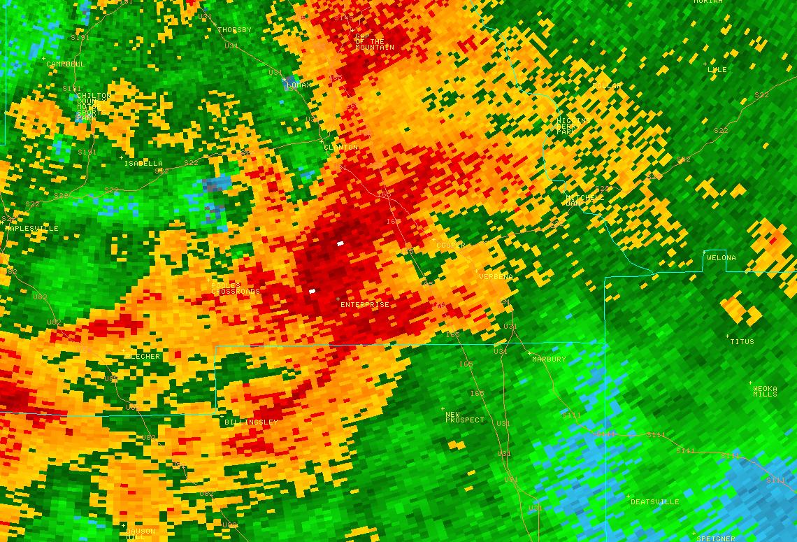
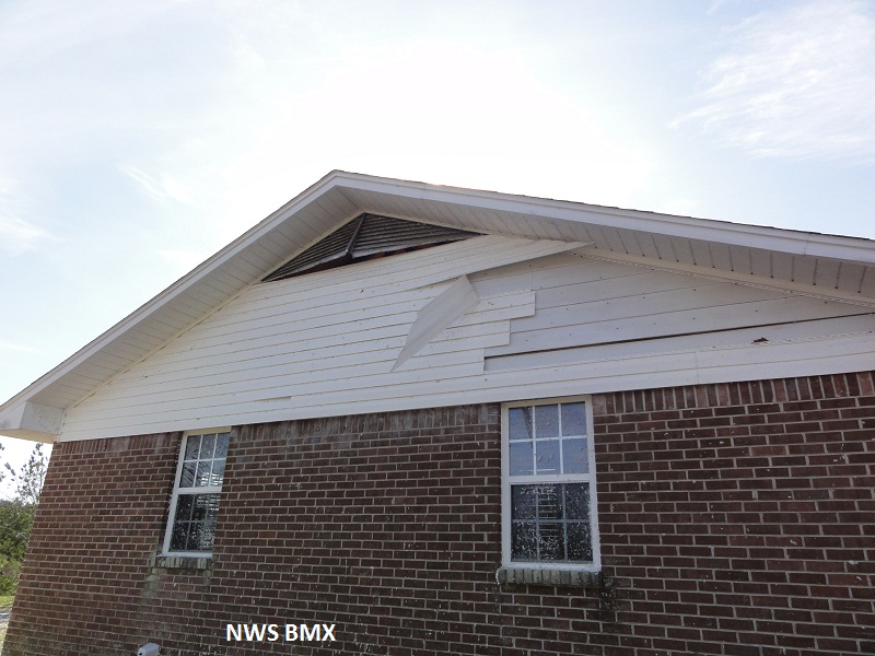
National Weather Service meteorologists have surveyed the damage in southern Chilton County and determined that it was the result of an EF-1 tornado. The tornado touched down near a mobile home park near the intersection of County Road 99 and Highway 24. Several mobile homes had minor roof and underpinning damage, and one mobile home was destroyed. The tornado continued towards the northeast crossing Highway 49 and severely damaging three homes. One home was completely shifted off its foundation while another was partially moved. Another home had 90 percent of its roof removed, but all walls remained standing. The storm was at its widest at this point at 500 yards. This was also the area with the highest wind velocity with estimated wind speeds of 105 to 110 mph. The tornado continued to the northeast from Highway 49 with several other homes receiving mainly roof and porch damage. There were a few outbuildings destroyed, and many trees were snapped and uprooted. The tornado then lifted near the intersection of County Roads 7 and 434.
|