| A Mostly Normal 2014…with Most of the Significant Flooding Limited to April.
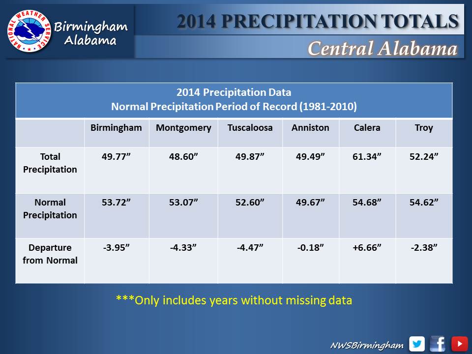
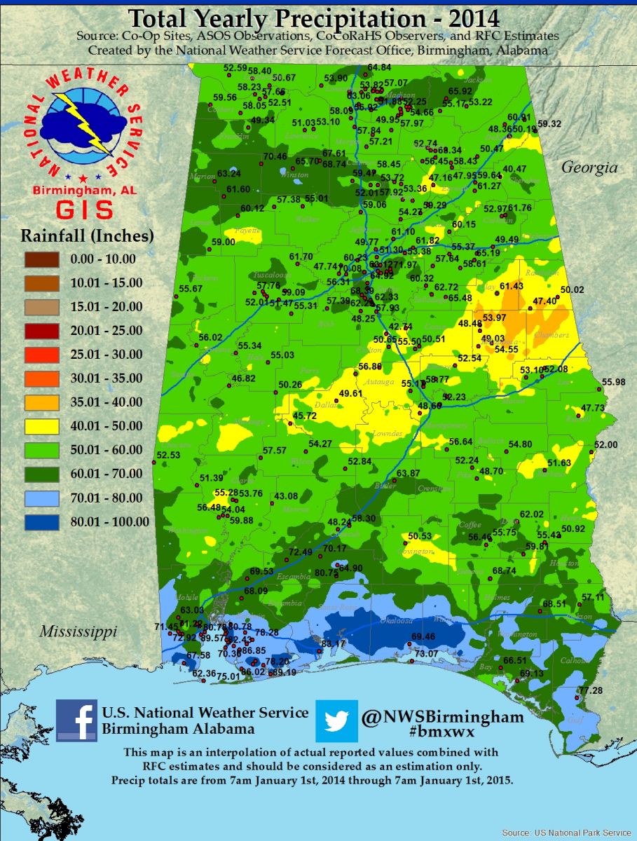
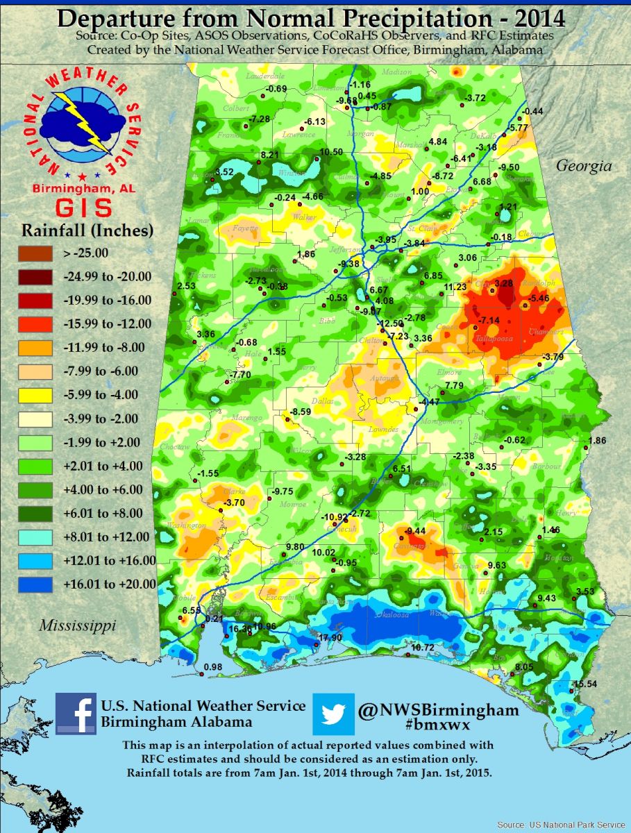
The hydrologic story for 2014 was one of generally near to below normal rainfall for much of Central Alabama, although localized areas received above normal amounts. This resulted in a relatively quiet year flood-wise, although April was an exception as above normal, widespread rainfall produced significant flooding that month. Yearly rainfall totals averaged between forty eight and sixty two inches across Central Alabama, with locally higher amounts reported.
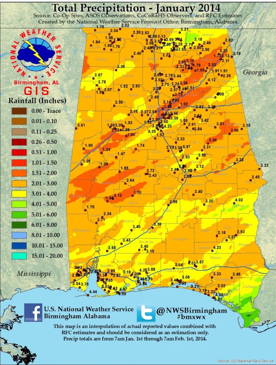
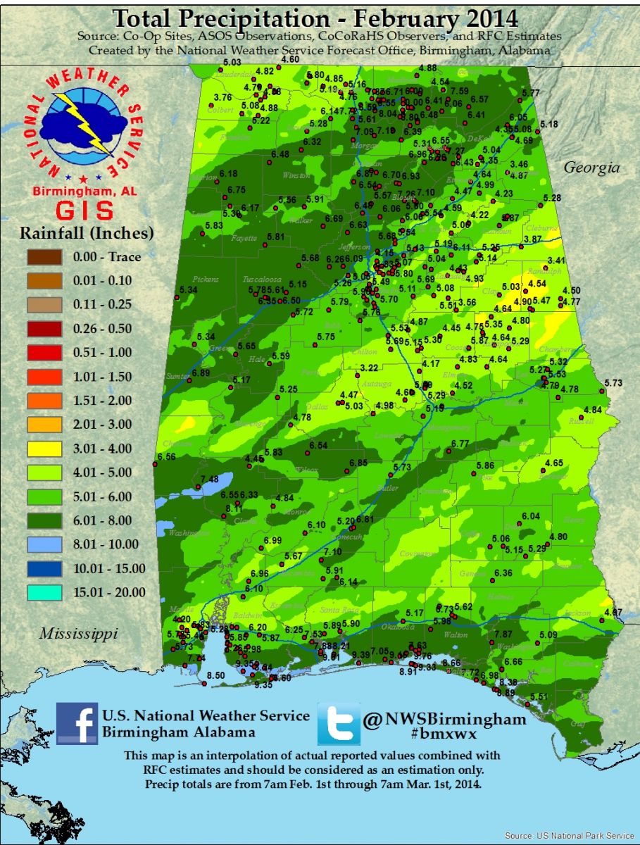
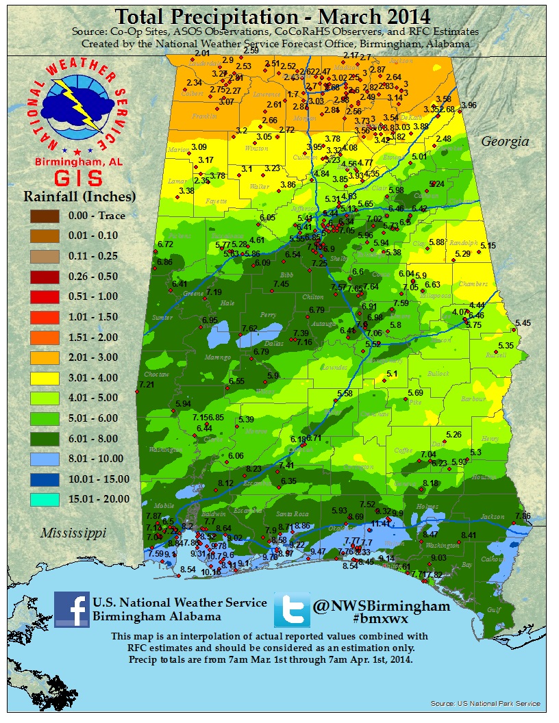
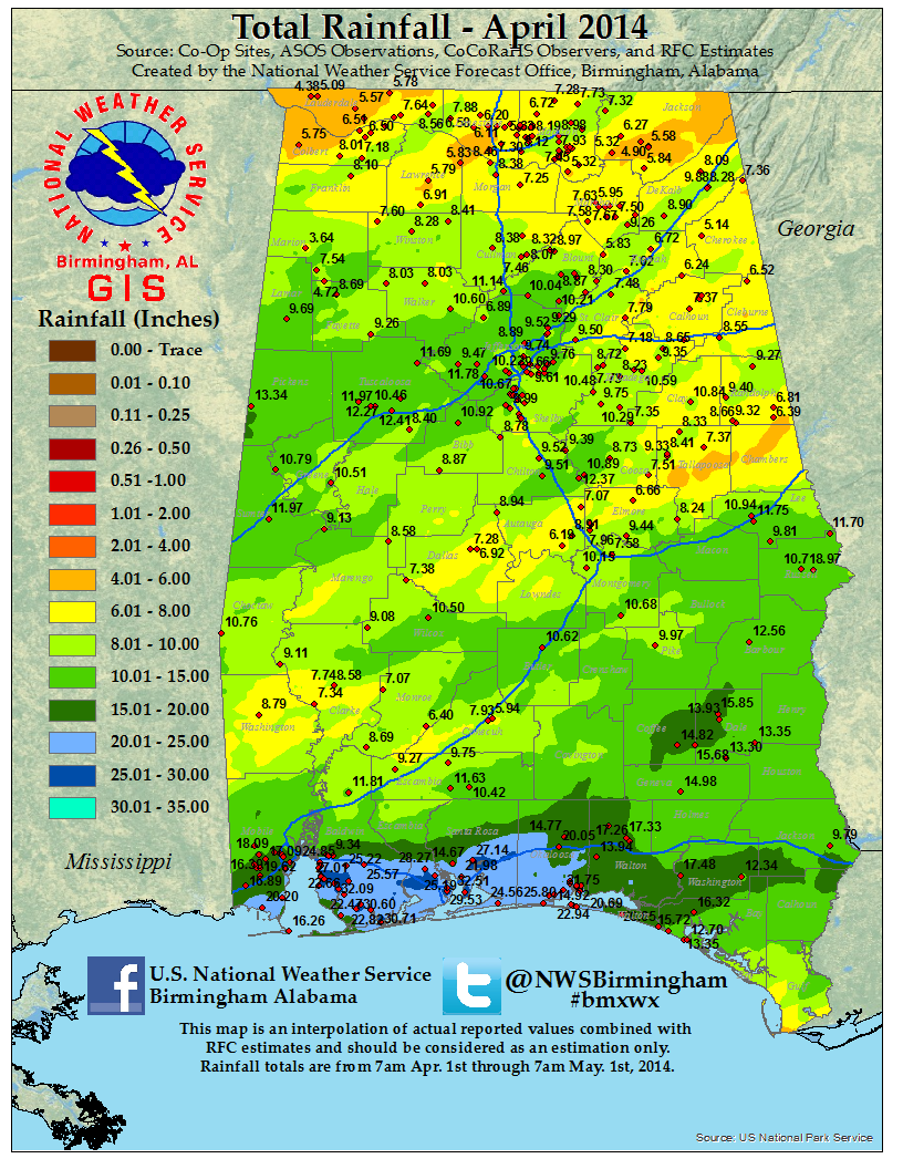
The year began relatively quietly as near normal rainfall occurred from January through March, with only a few episodes of moderate rises noted on area rivers. However, things changed quickly in April as well above normal rainfall fell across Central Alabama and produced flooding in many areas during the month.
The most significant flooding in April occurred following widespread heavy rainfall of four to eight inches that occurred from the 5th to the 8th. This heavy rainfall produced significant to widespread flash flooding across Central Alabama on the 6th and 7th. Widespread severe flash flooding occurred in portions of Jefferson and Shelby counties, with at least 79 homes suffering flood damage in portions of Pelham, Indian Springs Village, Wilsonville, Alabaster and along Highway 119 in Shelby County. Numerous evacuations and high water rescues were necessary, with 120 water rescues required in Homewood from the Lakeshore Garden Apartments. Seventy nine luxury cars were reportedly lost from a Vestavia Hills car dealership near Patton Creek. In Greensboro in Hale County, some homes were flooded as well as in Opelika in Lee County. Many rural roads in Lamar County became flooded and impassable.
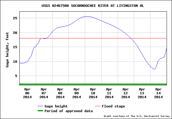
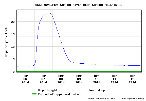
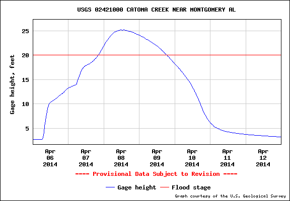
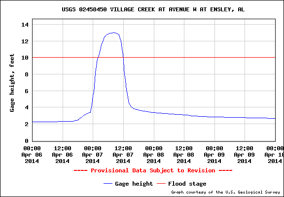
In addition to flash flooding, widespread river flooding occurred on most area rivers. Out of nineteen National Weather Service River Forecast Points, seventeen went into flood. Five of these forecast points experienced moderate flooding including the Sucarnoochee River at Livingston, the Cahaba River near Cahaba Heights, the Tombigbee River at the Demopolis Lock and Dam, Catoma Creek at the US 331 Highway Bridge near Montgomery and Village Creek at Avenue W in Ensley.
|
|
|
| Livingston - Sucarnoochee River |
Cahaba Heights - Cahaba River |
|
|
|
| US 31 Bridge - Catoma Creek |
Ensley - Village Creek |
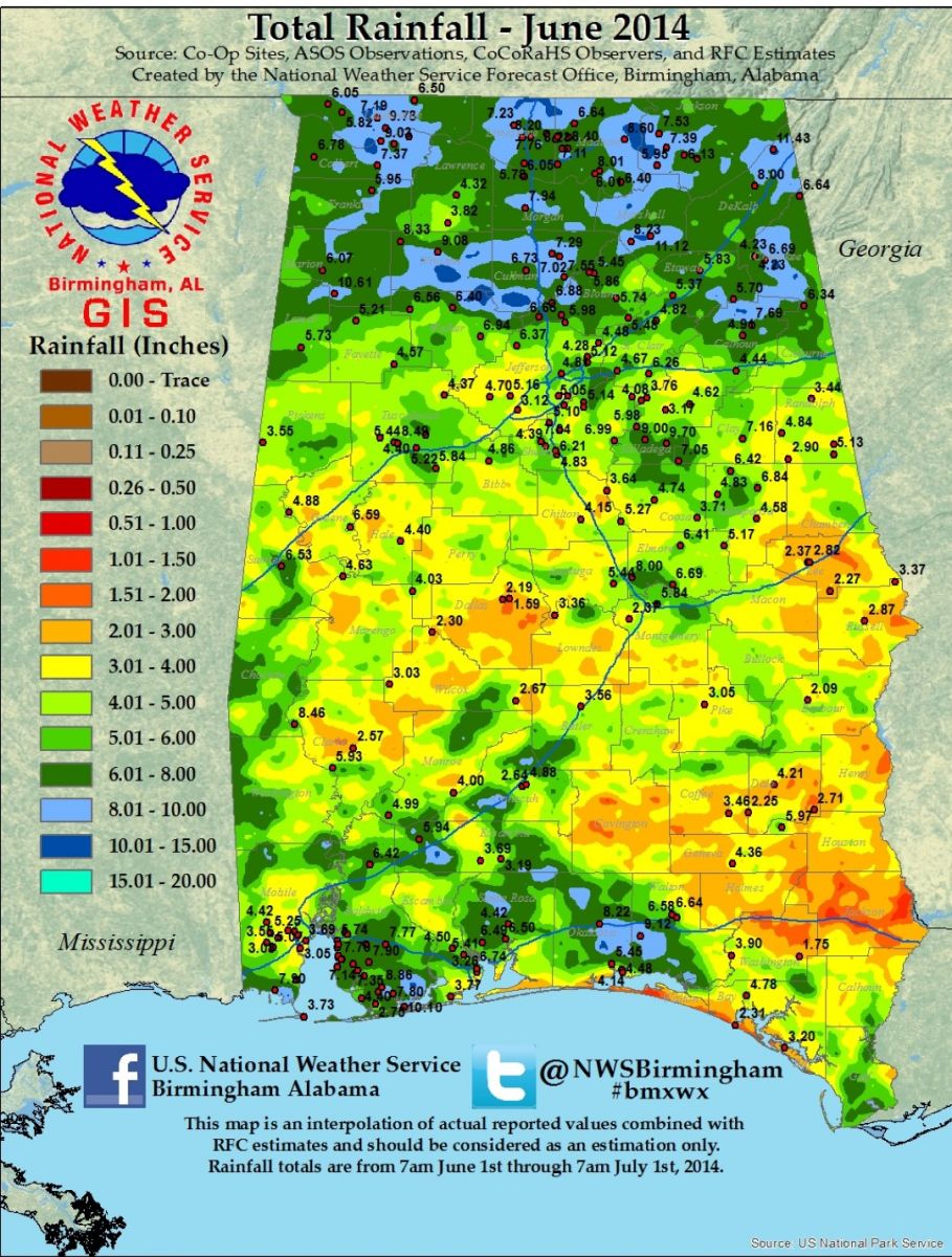
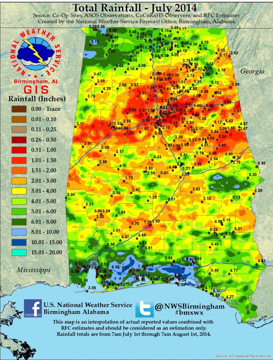
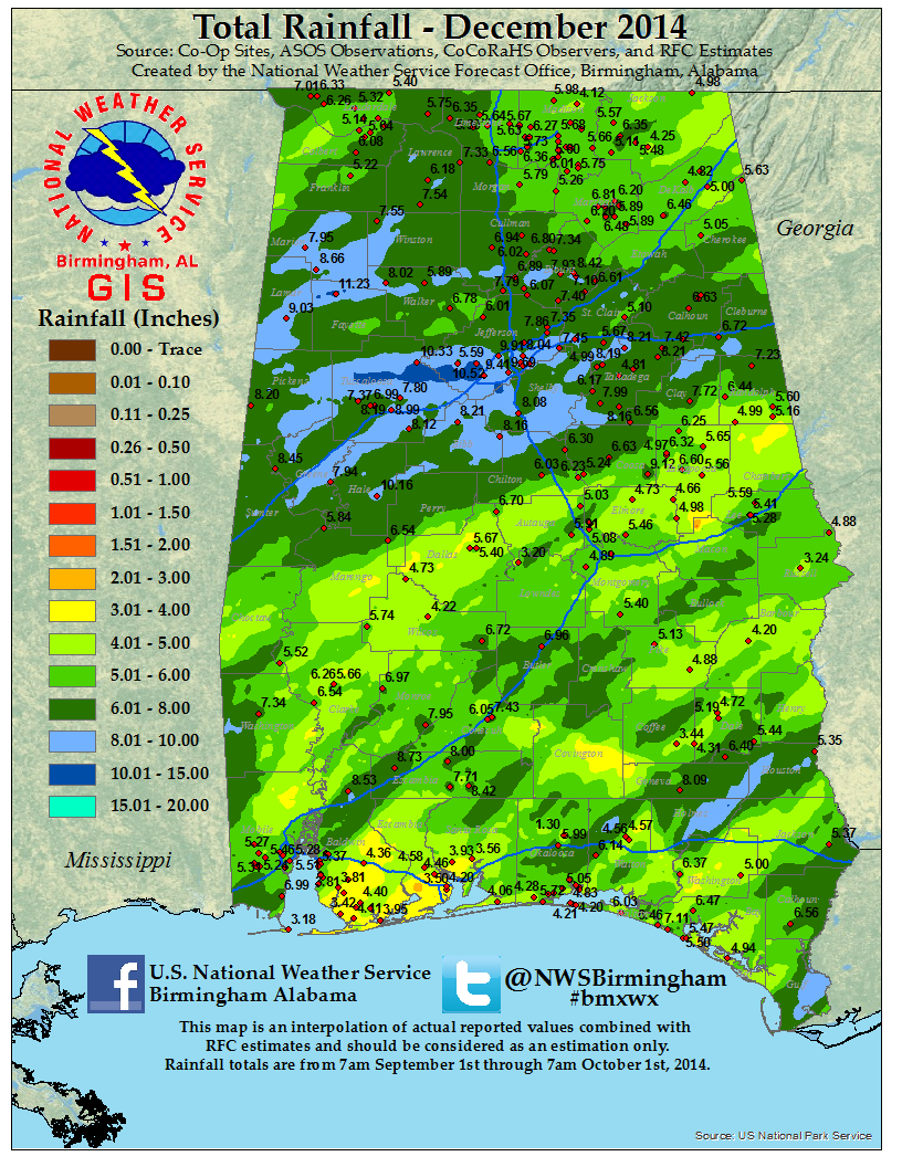
Fairly normal rainfall returned to Central Alabama in May, and continued through August as typical summertime thunderstorms produced localized heavy downpours with isolated, mainly nuisance type flooding observed. September saw generally below normal rainfall across the area, and this led to the development of moderate drought across portions of Central Alabama. Despite fairly normal rainfall throughout the remainder of the fall and into the early winter season, in December, moderate drought persisted in some central portions of Central Alabama. However, heavy rainfall around and just after Christmas brought significant improvement in the drought conditions as the year ended.
PDF version can be found...Here.
Data supplied by the NWS BMX. Additional Flood Information can be found at the following links:
|
|
|
| 2014 Precipitation Totals |
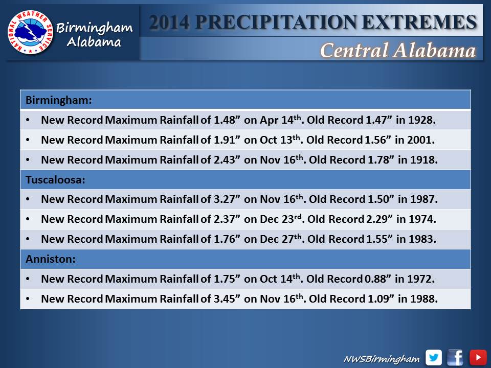
2014 Precipitation Extremes |
|
|
|
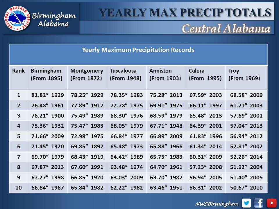
| Yearly Maximum Precipitation Totals |
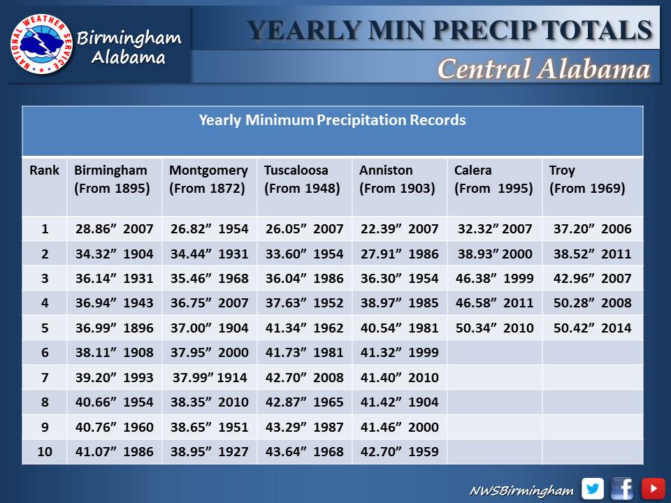
Yearly Minimum Precipitation Totals |
|
|
|
| 2014 Total Rainfall |
2014 Rainfall Departure |
|
|
|
|
| January Total Rainfall |
February Total Rainfall |
March Total Rainfall |
|
|

|
|
| April Total Rainfall |
May Total Rainfall |
June Total Rainfall |
|
|
|
|
| July Total Rainfall |
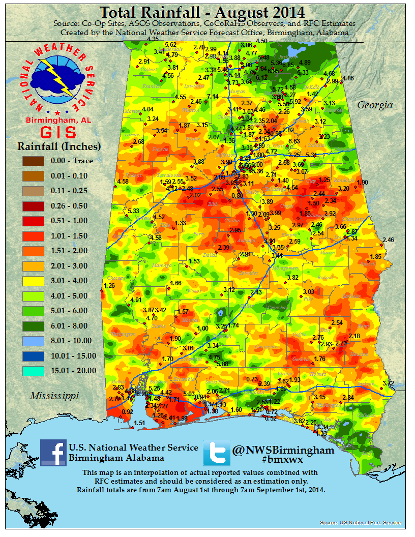
August Total Rainfall |
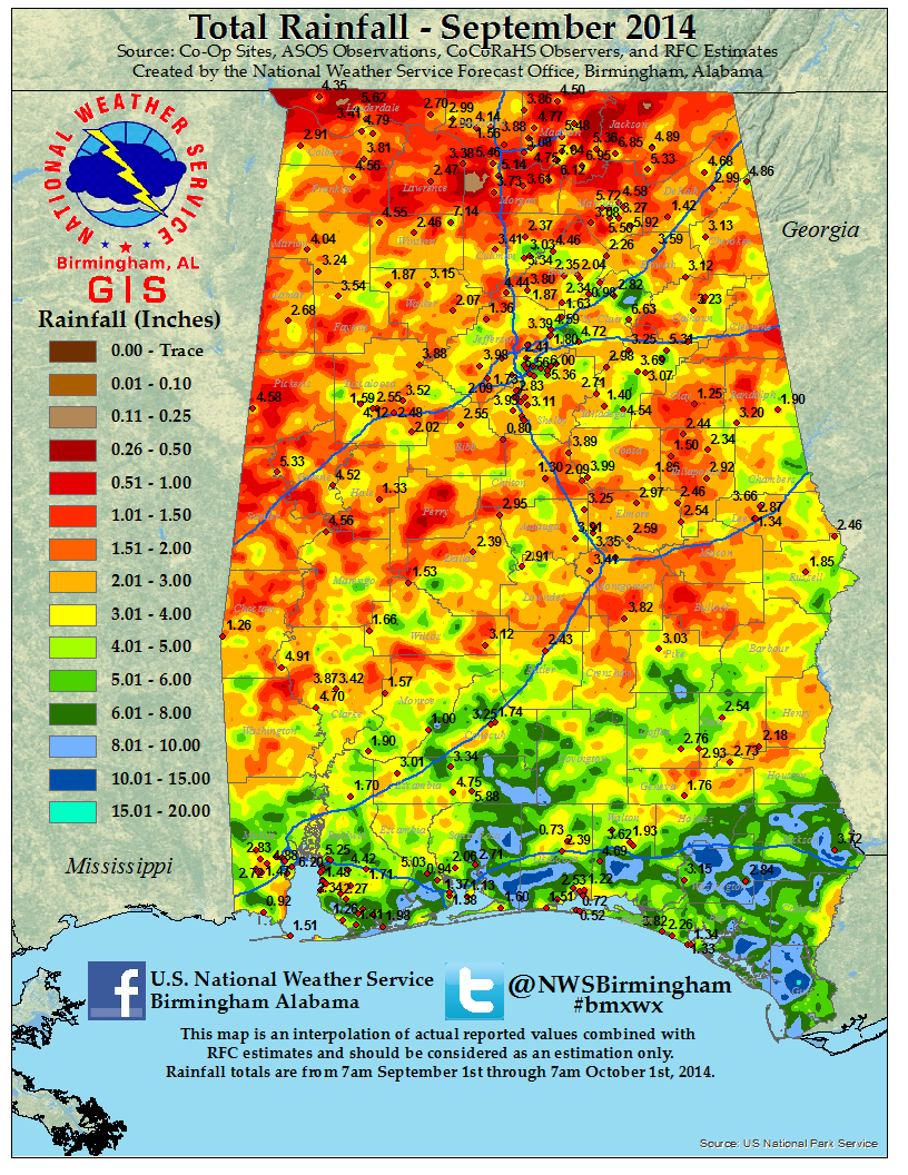
September Total Rainfall |
|
|
|
|
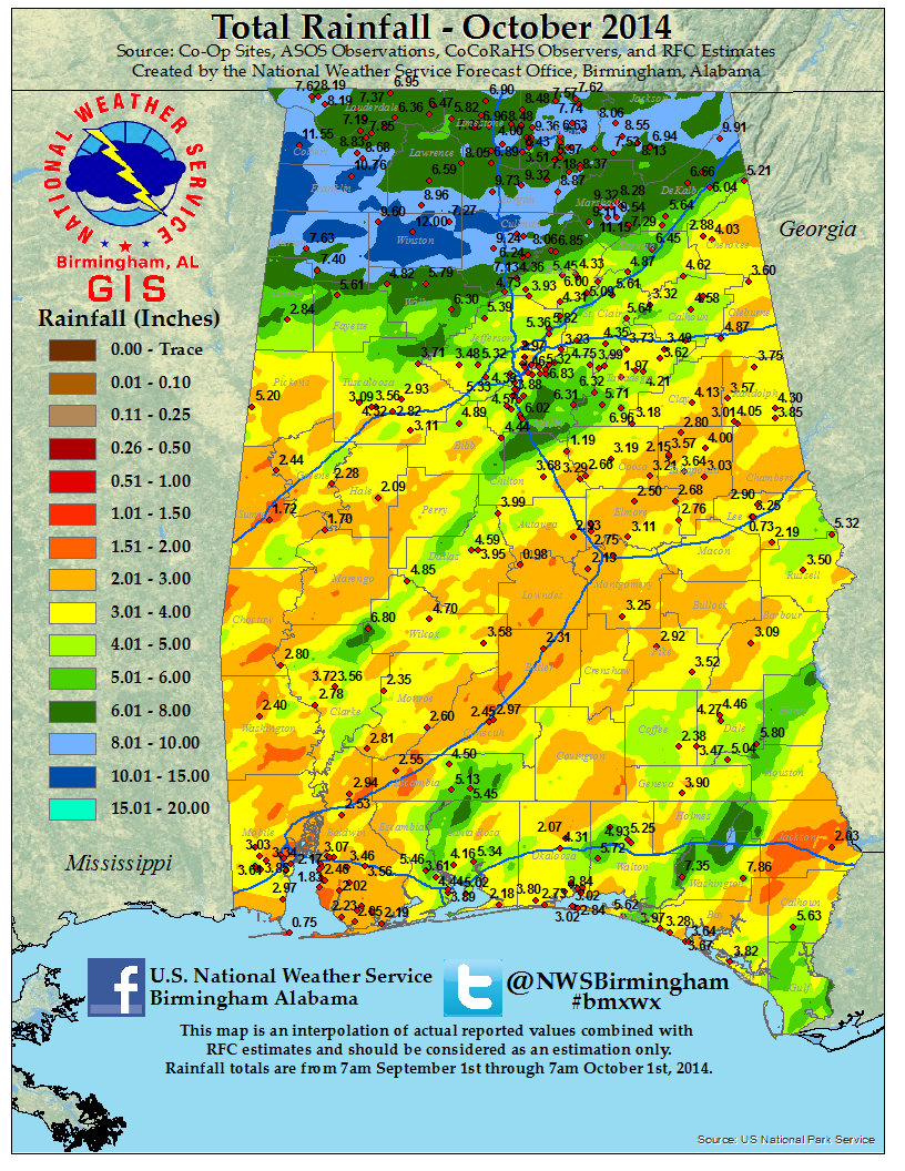
| October Total Rainfall |
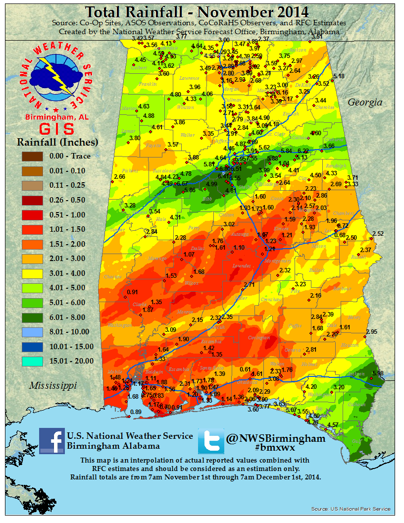
November Total Rainfall |
December Total Rainfall |
|