NWS All NOAA
NWS Birmingham, Alabama
Weather Forecast Office
2013 Central Alabama - The Year in Review
**Note: All of the following data should be considered preliminary. Not all of the data has been completely quality controlled. Incomplete Year-End Data will be updated upon completion after the New Year.**
Prolonged Drought Conditions End
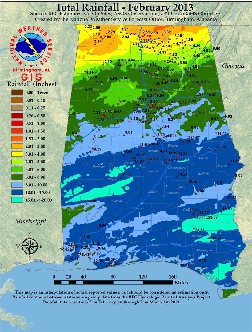
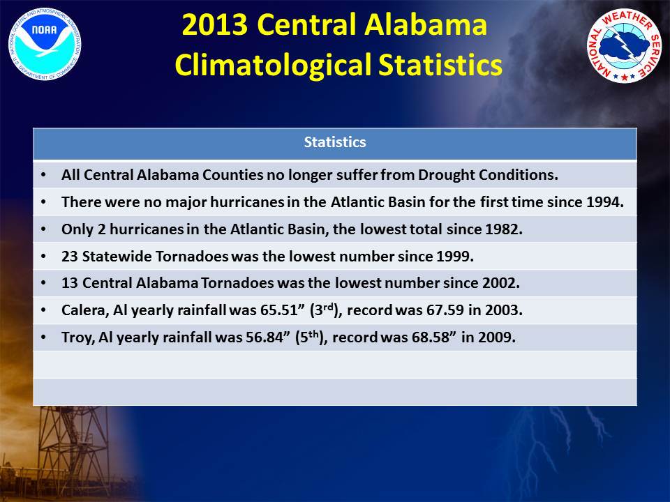
One of the most persistent hydrologic features from late 2010 through the beginning of 2013 was the damaging drought. At the beginning of 2013, areas east of a line from Selma to Heflin remained in drought. The most impacted areas were Macon, Lee, Chambers, Tallapoosa, Clay and Randolph Counties. These locations were in the Extreme to Exceptional Drought category (D3-D4). In actuality, the above normal rainfall in December 2012 and January 2013 brought much needed relief for many places and the drought area was decreased.
Widespread rainfall during the first half of February greatly improved drought conditions. Monthly rain amounts of 10 to 13 inches dropped all Central Alabama counties out of drought conditions, but a few areas remained Abnormally Dry. Several areas flirted with the Abnormally Dry conditions throughout the year, but most locations received well above normal precipitation in 2013. Therefore, we will end 2013 drought free.
PDF version can be found...Here.
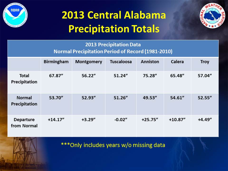
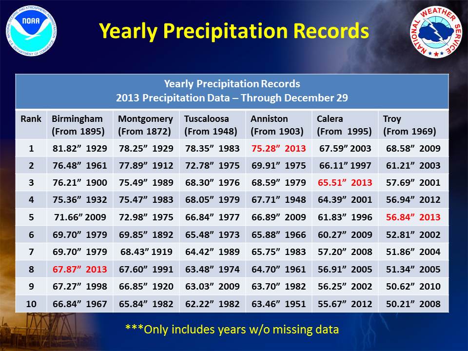
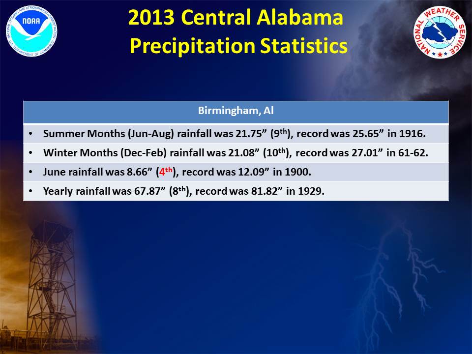
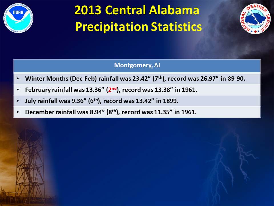
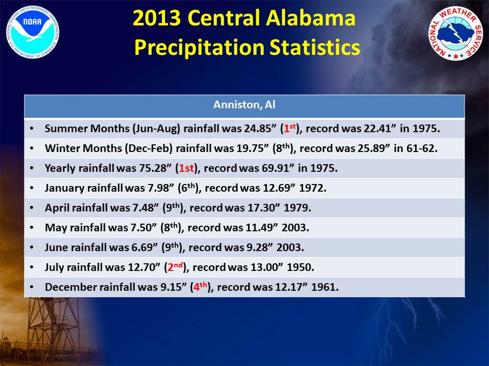
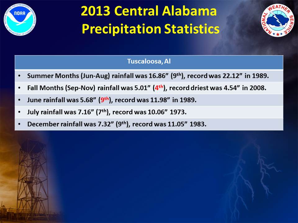
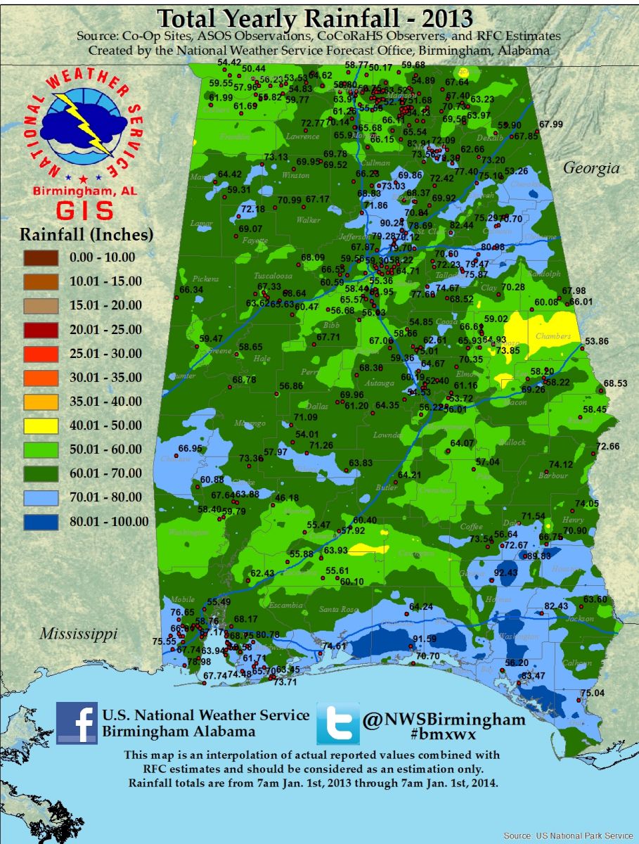
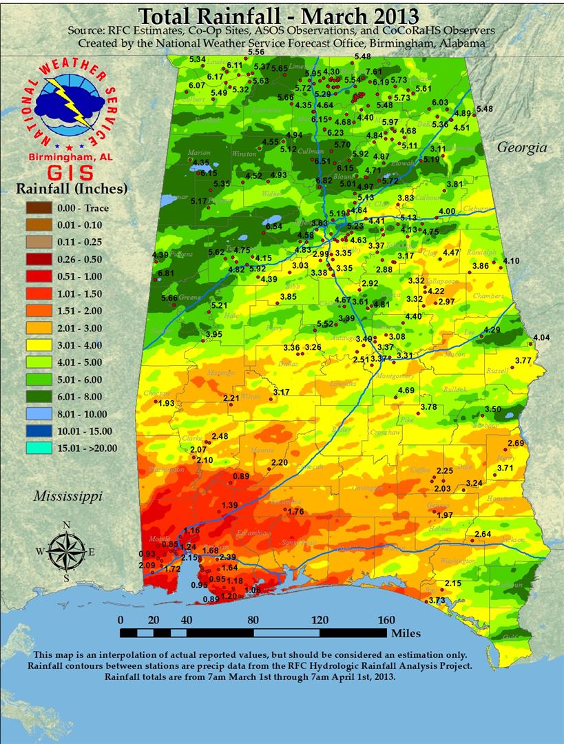
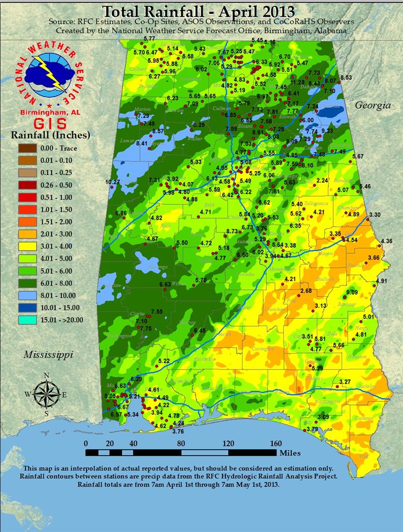
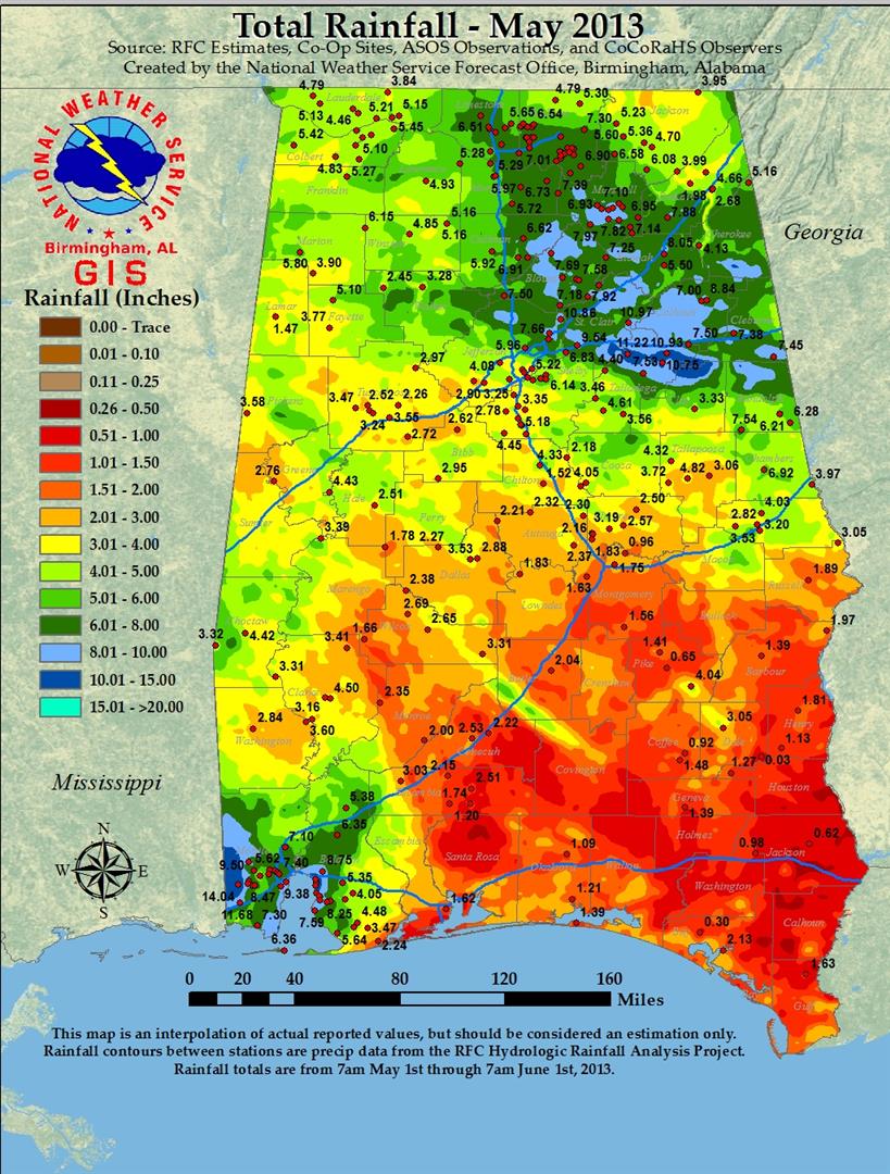
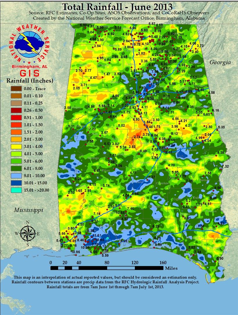
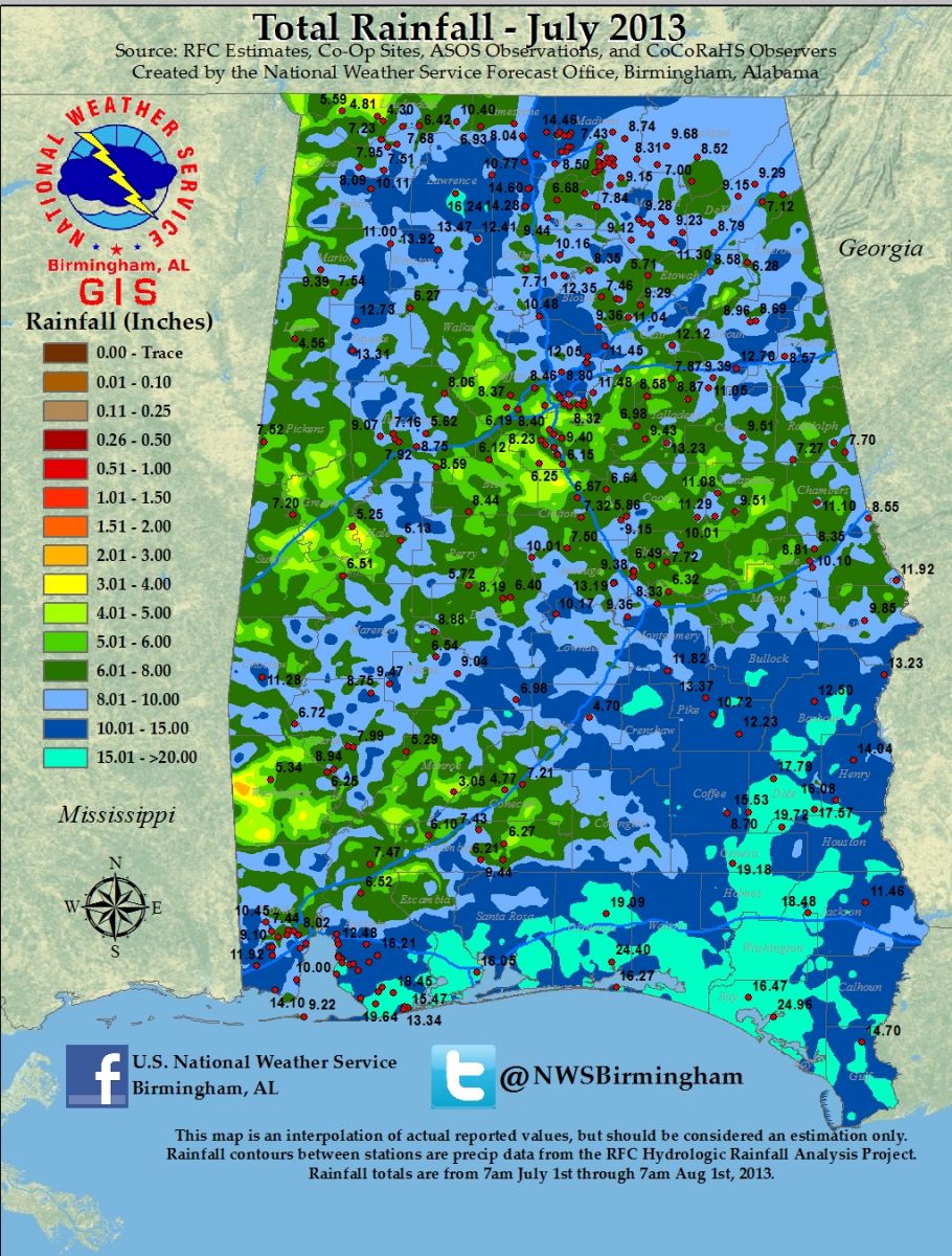
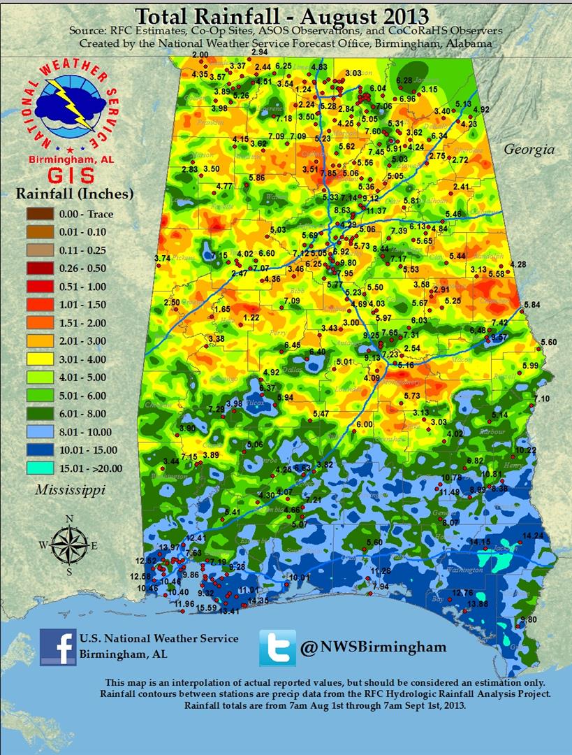
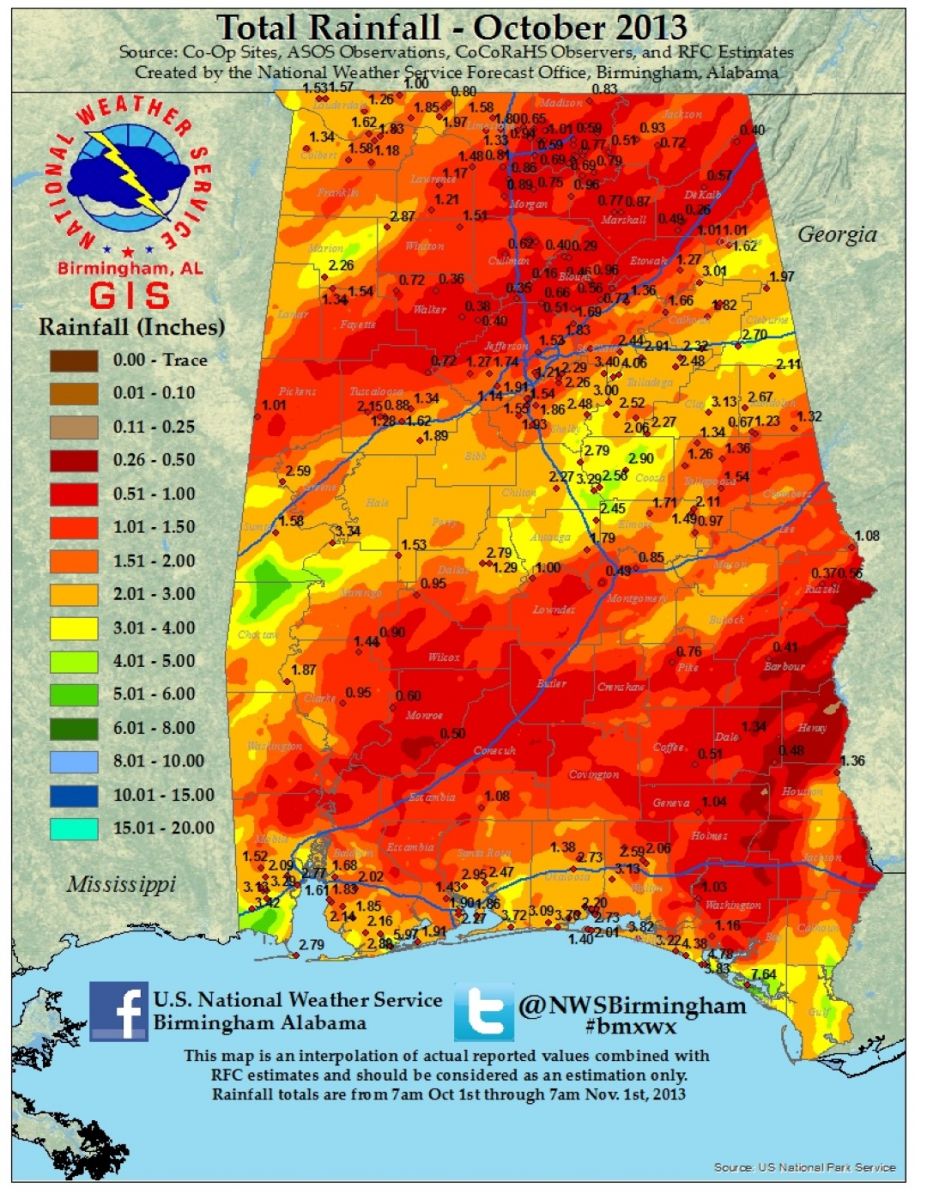
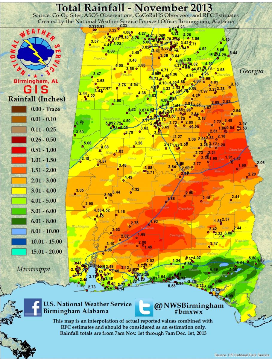
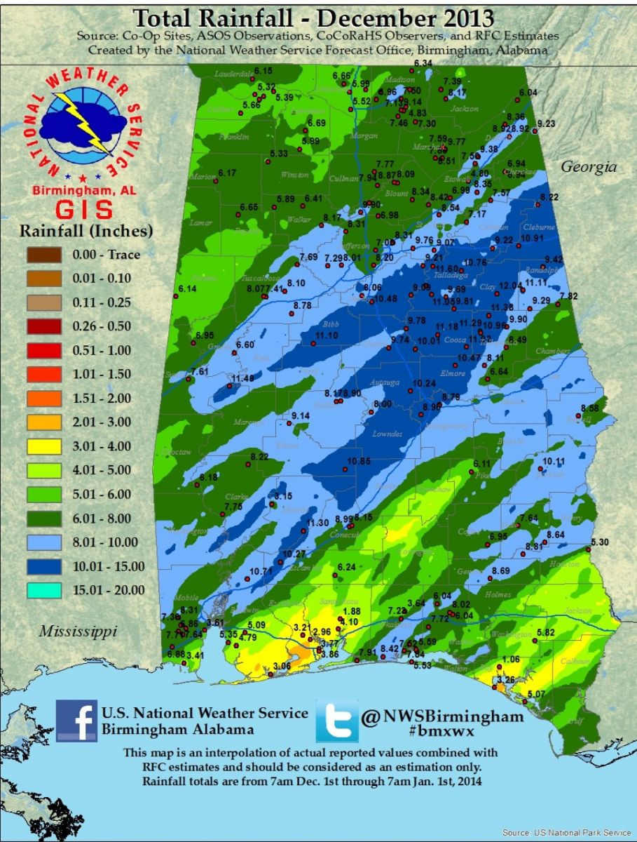
The weather story precipitation-wise was one of a wet year, with frequent and sometimes heavy rainfall events. However, despite the mostly above-average rainfall that occurred over Central Alabama in 2013, there were no major flood events on area main-stem rivers and mostly localized, sporadic episodes of flash flooding. Yearly totals averaged between 50-70 inches across Central Alabama, with local amounts in excess of 80 inches reported.
The year began with heavy rain of three to six inches across much of Central Alabama during the first half of January, which resulted in mostly minor flooding on portions of the Tombigbee and Black Warrior Rivers. More localized flash flooding, generally in the form of street flooding, also occurred at times throughout the month. This general pattern of periodic, locally heavy rainfall occurred throughout the remainder of the winter and spring season. Minor river flooding occurred in mid-February on portions of the Black Warrior, Tallapoosa and Sucarnoochee Rivers, as well as on Catoma Creek after rainfall of four to seven inches occurred over portions of these basins. Minor river flooding occurred again in March along portions of the Tombigbee and Black Warrior Rivers following heavy rainfall.
Periodic but localized flash flooding also remained a problem from February through April. Isolated, slow moving thunderstorms in the Oxford Area of Calhoun County produce flash flooding on April 17th along and near Highway 78, and also in the Centre area of Cherokee County. Many roads and some vehicles were flooded, with water also reported to have entered a home near Centre.
As Central Alabama moved into its summer season, summertime thunderstorms continued to produce episodes of localized, heavy rainfall and flash flooding. On June 5th, mostly minor flash flooding occurred in portions of Macon, Jefferson, Tuscaloosa and Cherokee counties, generally in the form of flooding of streets and roadways. Some water rescues occurred in the Birmingham area. June was followed by a wet July, with monthly rainfall totals in excess of 15 inches in some of the southeastern counties. One of the more significant flash flooding events occurred the morning of July 11th in Hale County, with water damage to several homes, and several roads flooded and impassable in Marengo County. Widespread flash flooding occurred in the Selma area during the late morning and early afternoon of August 14th, when four to six inches of rain fell. This produced widespread street flooding in and near Selma, with some localized flooding of businesses and homes in the area.
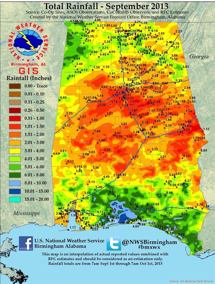
The wet weather pattern finally abated somewhat in September, with a drier and more normal pattern continuing through October and into November. However, late in the year a wetter pattern returned as Central Alabama headed into its early winter season. Periodic storm systems began to produce frequent rainfall once again in late November and December, but the major impact through this time was moderate rises on some area rivers and streams.
Data supplied by the NWS BMX. Additional Flood Information can be found at the following links:
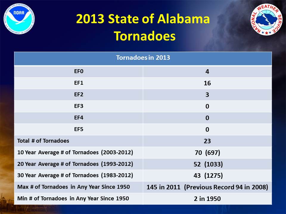
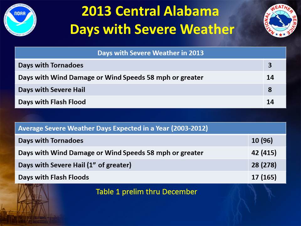
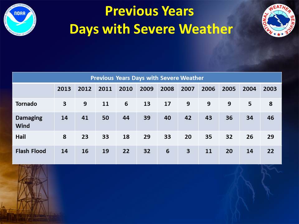
Preliminary severe weather numbers for Central Alabama in 2013:
Data supplied by the NWS BMX. Additional information on severe weather and storm surveys can be found at the following links:
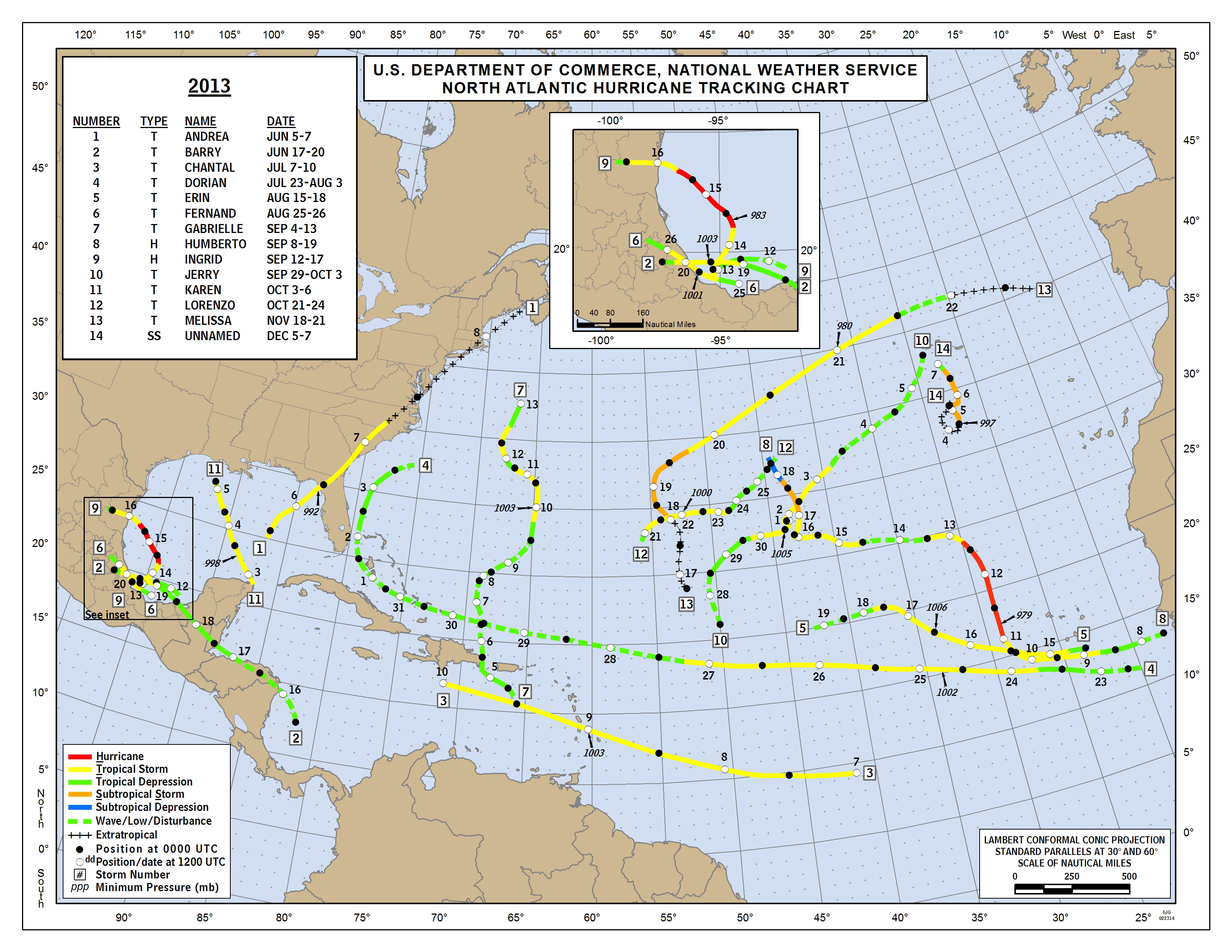
The 2013 Atlantic Hurricane Season produced 13 named storms, of which only 2 became hurricanes. There was also one Tropical Depression that formed but this system did not reach Tropical Storm strength. Based on the 30 year climatology, the Atlantic Basin has an average of 12 named storms, 6 hurricanes and 3 major hurricanes. Therefore, the number of named storms was very close to the normal expected. But the number of hurricanes and major hurricanes was well below normal. There were no major hurricanes in the Atlantic Basin for the first time since 1994. The number of hurricanes this year was the lowest overall number since 1982. None of these storms impacted Central Alabama.
National Hurricane Center 2013 Atlantic Hurricane Seasonal Summary
Data provided by the NWS BMX and NHC.