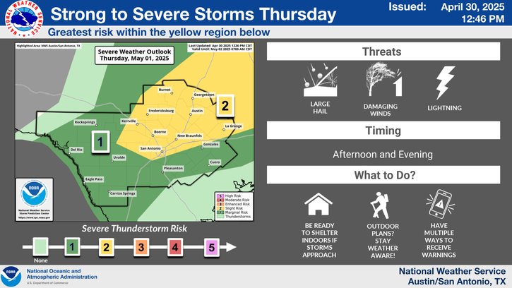
Isolated showers and thunderstorms continue over the area through late this afternoon, then chances mainly are seen west where strong to severe storms could move into our far western areas and move east late tonight. Further east, showers are more likely by early Saturday morning then rain chances peak tomorrow during the day as a cold front moves across the area.
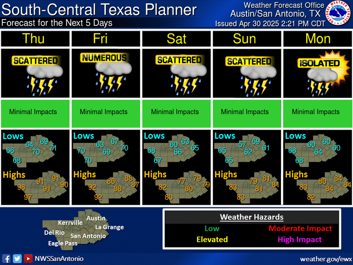
Warm conditions continue Saturday before a noticeable cooling trend arrives for Easter Sunday and early next week. Rain and storm chances return to the forecast, with peak probabilities expected Saturday. Some storms may be strong to severe and produce pockets of locally heavy rainfall.
Chances lean towards our streak of warmer than average months continuing into April. Chances are also tilted towards a wetter than normal April for South-Central Texas. This may provide some slight relief, but drought is forecast to persist for most of the area.


 Austin/San Antonio Radar
 Weather Map
 Satellite Imagery
 Del Rio Radar
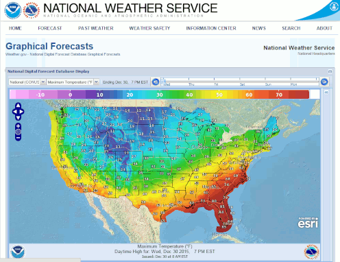 Digital Forecast Map
 Tropical Outlook
 Drought Status
 Air Quality
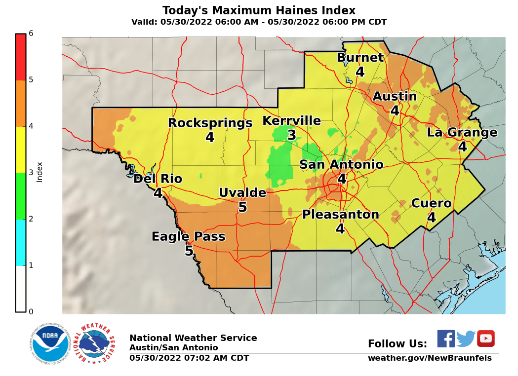 Fire Weather Forecasts
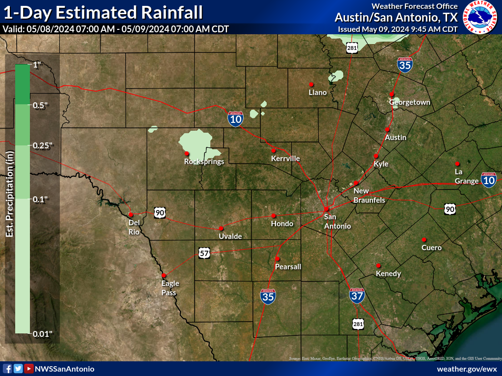 Observed Rainfall
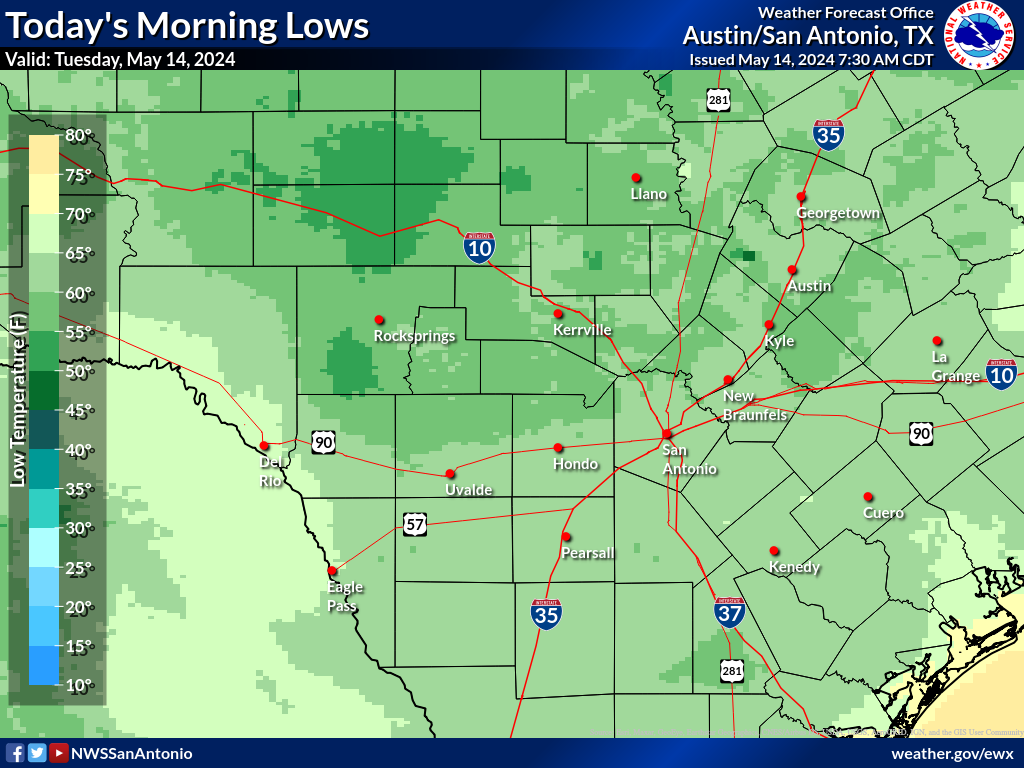 Observed Temperatures
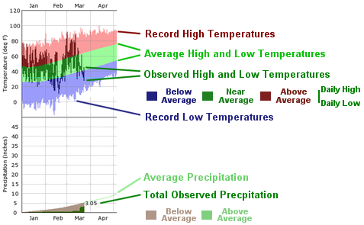 Daily Climate Graphs