The 2009 North American Christmas Blizzard developed over the Midwestern US with disastrous consequences for holiday travelers, closing Interstate 29 and sending snow so far south that even Dallas had its first white Christmas in over 80s years. With a duration of 5 days, snowfall accumulated to a depth of one to two feet.
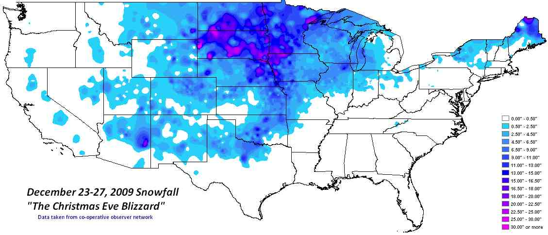
A broad upper level low pressure area over the Upper Midwest associated with an intense surface low pressure area brought widespread heavy snow along with blizzard conditions to central and northeast South Dakota. The storm was a slow mover and produced several rounds of snow over a three-day period. Total snowfall amounts were from 7 to as much as 25 inches. The heavy snow combined with winds of 25 to 40 mph with gusts to 50 mph brought widespread blowing and drifting snow with visibilities frequently less than a quarter of a mile.
This blizzard ranked in the top three for the entire state snowfall with a state average of 15.4 inches. Most of the state received 10 inches of snowfall or more with many locations with 20 inches or more. Pollock in north central South Dakota set an all-time high three-day snowfall total with 17 inches.
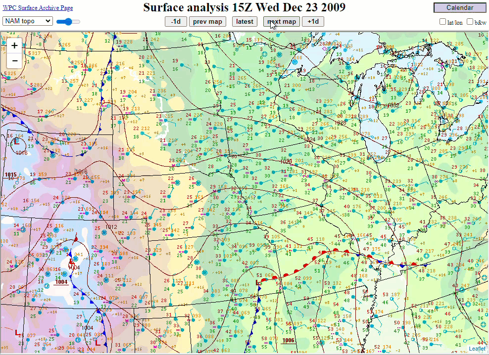
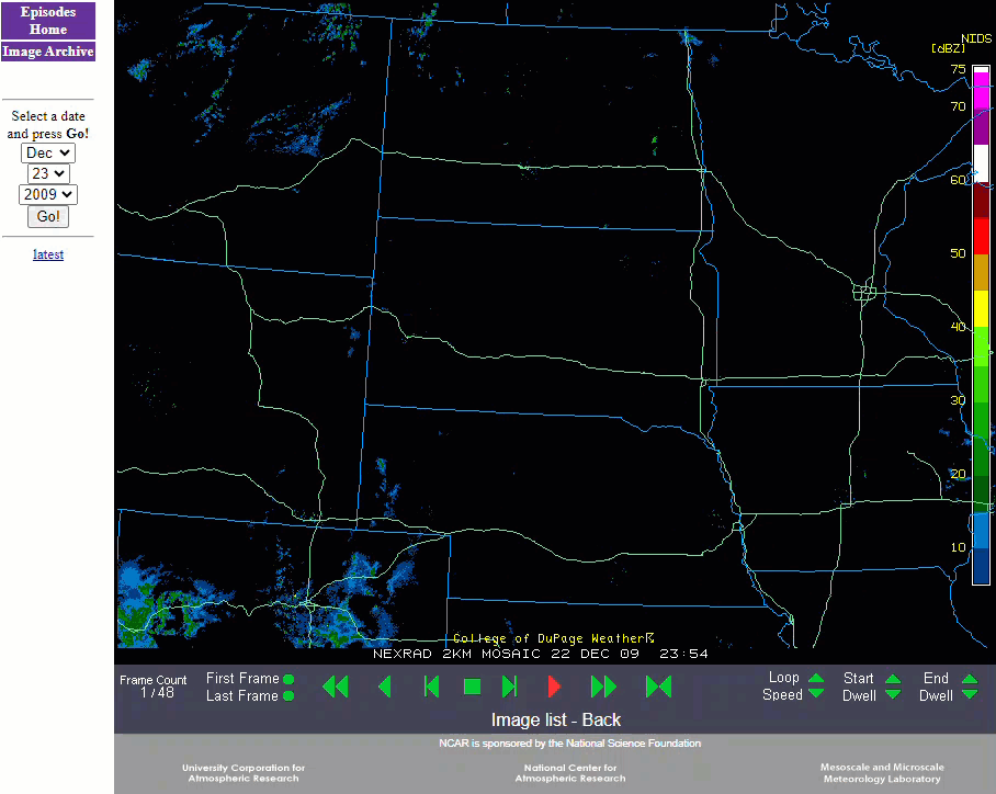
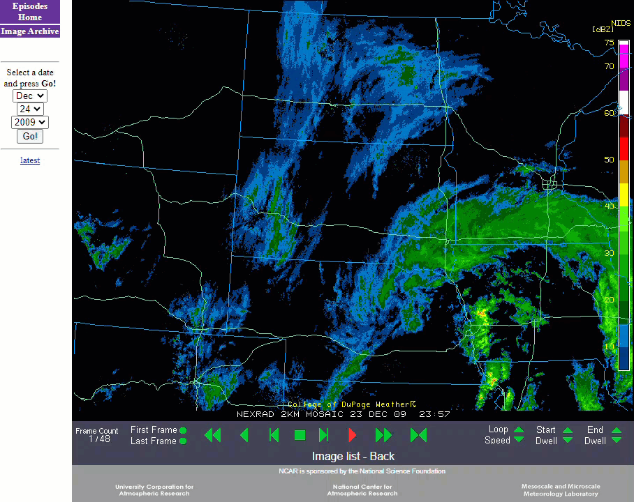
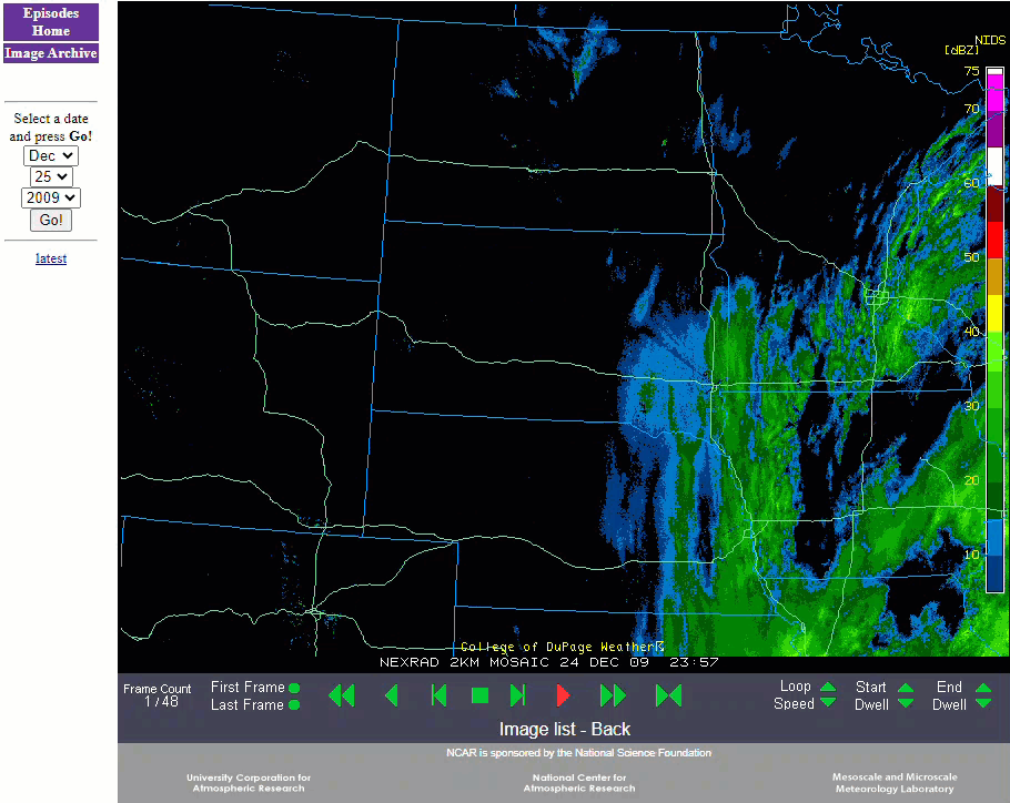
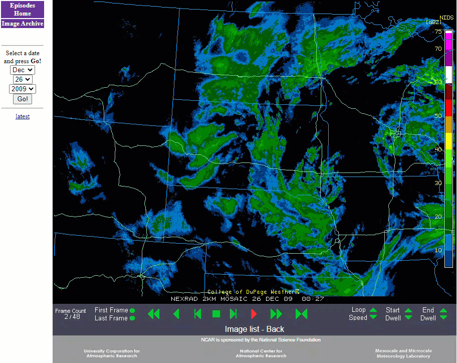
Prior to the onset of the storm, the Governor declared a state of emergency for South Dakota. Large portions of both Interstates 29 and 90 across South Dakota were closed late on Thursday, December 24th. Both Interstates were closed through Christmas Day and into Saturday, December 26th. There were some stranded holiday travelers due to the road closings along with a few rescues. Most roads were reopened by Sunday morning, December 27th. There were also several vehicle accidents with nothing serious. Several airports were also closed throughout the storm along with a few spotty power outages occurring in Lyman county in central South Dakota. The President declared a disaster area for public assistance for several counties in central and north central South Dakota. Costs were estimated in the several hundreds of thousands of dollars. Radar imagery over a 4-day period below.
Total snowfall amounts over the three-day period predominantly ranged from 1 to 2 feet. Snowfall amounts with a foot or more included; 12 inches at Mobridge, Eureka, Waubay, and Eagle Butte; 13 inches at Highmore and Miller; 14 inches at Castlewood, Summit, Watertown, Pierre, and Ree Heights; 15 inches at Groton, Gettysburg, Webster, Wilmot, Hayti, and McLaughlin; 16 inches at McIntosh, east of Hayes and east of Hosmer; 17 inches at Timber Lake, Britton, and Pollock; 18 inches near Victor; 20 inches near Keldron; 22 inches at Murdo; 23 inches at Sisseton and 25 inches at Kennebec.
 |
...FINAL STORM TOTAL SNOWFALL REPORTS...
BELOW IS A SUMMARY OF THE STORM TOTAL SNOWFALL REPORTS FROM THE
CHRISTMAS HOLIDAY BLIZZARD/SNOWSTORM. THE SNOWFALL TOTALS WERE
COMPILED FOR THE PERIOD DECEMBER 23 THROUGH DECEMBER 27. THE
SNOWFALL VALUES ARE A COMBINATION OF COOP REPORTS...SPOTTER
REPORTS...AND COCORAHS OBSERVATIONS.
-------------------------------------------------------------------
LOCATION SNOW FALL TIME/DATE
(INCHES) OF OBSERVATION LAT LON
MINNESOTA
...BIG STONE COUNTY...
10 N CORRELL 12.5 M 833 AM 12/27 45.38N 96.16W
...TRAVERSE COUNTY...
WHEATON 10.3 M 833 AM 12/27 45.81N 96.50W
BROWNS VALLEY 11.2 M 833 AM 12/27 45.59N 96.83W
LOCATION SNOW FALL TIME/DATE
(INCHES) OF OBSERVATION LAT LON
SOUTH DAKOTA
...BROWN COUNTY...
ABERDEEN 8.7 M 700 AM 12/28 45.47N 98.48W
CLAREMONT 13.7 M 700 AM 12/28 45.67N 98.01W
COLUMBIA 15.0 M 700 AM 12/28 45.61N 98.31W
...BUFFALO COUNTY...
GANN VALLEY 9.7 M 700 AM 12/28 44.03N 98.99W
...CAMPBELL COUNTY...
POLLOCK 17.0 M 833 AM 12/27 45.90N 100.29W
...CODINGTON COUNTY...
WATERTOWN 14.0 M 700 AM 12/28 44.91N 97.17W
...CORSON COUNTY...
MCINTOSH 16.0 M 700 AM 12/28 45.92N 101.35W
...DAY COUNTY...
WAUBAY 12.0 M 700 AM 12/28 45.33N 97.31W
WEBSTER 14.5 M 700 AM 12/28 45.34N 97.52W
...DEUEL COUNTY...
CLEAR LAKE 20.0 M 700 AM 12/28 44.77N 96.68W
...DEWEY COUNTY...
TIMBER LAKE 17.1 M 700 AM 12/28 45.43N 101.07W
...EDMUNDS COUNTY...
ROSCOE 11.4 M 700 AM 12/28 45.45N 99.33W
BOWDLE 15.0 M 700 AM 12/28 45.45N 99.66W
11 E HOSMER 16.0 M 700 AM 12/28 45.58N 99.25W
...FAULK COUNTY...
SENECA 13.2 M 833 AM 12/27 45.06N 99.51W
...GRANT COUNTY...
MILBANK 17.0 M 833 AM 12/27 45.22N 96.63W
...HAMLIN COUNTY...
1 W HAYTI 15.2 M 700 AM 12/28 44.66N 97.22W
...HAND COUNTY...
REE HEIGHTS 14.0 M 833 AM 12/27 44.52N 99.20W
...HUGHES COUNTY...
BLUNT 10.0 M 1008 AM 12/27 44.52N 99.99W
PIERRE 13.5 M 700 AM 12/28 44.37N 100.32W
...JONES COUNTY...
MURDO 20.2 M 1008 AM 12/27 43.89N 100.71W
...LYMAN COUNTY...
KENNEBEC 24.0 M 833 AM 12/27 43.90N 99.86W
...MARSHALL COUNTY...
ROY LAKE STATE PARK 15.0 M 700 AM 12/28 45.71N 97.43W
...MCPHERSON COUNTY...
LEOLA 11.4 M 700 AM 12/28 45.72N 98.94W
...ROBERTS COUNTY...
WILMOT 15.0 M 1035 AM 12/27 45.41N 96.86W
4 NNE VICTOR 17.9 M 1008 AM 12/27 45.92N 96.80W
SISSETON 23.4 M 700 AM 12/28 45.66N 97.05W
...SPINK COUNTY...
TURTON 16.0 M 833 AM 12/27 45.05N 98.10W
...STANLEY COUNTY...
7 E HAYES 15.5 M 833 AM 12/27 44.37N 100.88W
...SULLY COUNTY...
ONIDA 7.0 M 700 AM 12/28 44.70N 100.07W
...WALWORTH COUNTY...
MOBRIDGE 12.1 M 700 AM 12/28 45.54N 100.44W

