While many significant weather events affected central/northeast South Dakota and west central Minnesota in 2017, below is a listing of the top 10 events of the year in terms of scope, severity of impacts, and/or rarity. In chronological order:
Significant January Snow Depth
Early and heavy snows across central South Dakota led to a harsh winter (up until February). Once a snow pack developed by late November, cold air became entrenched and any snow melt was minimized. An active precipitation pattern continued piling up the snow as well, such that over 30" of snow depth was reported across parts of Corson County by early January. Any high wind event made blowing snow a major issue as well across this area.
Photo courtesy of Brent Gill, taken January 11th of cattle being herded through a plowed path near Timber Lake

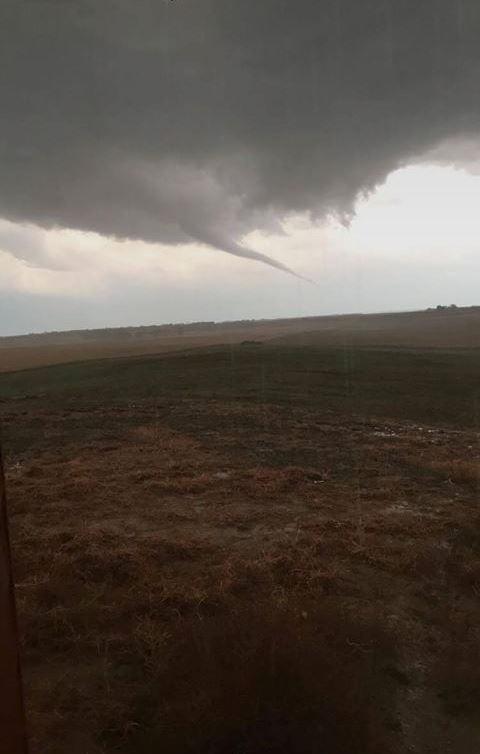
March 6th Minnesota Tornadoes, Earliest in State History
February featured record-breaking warmth and next to no new snowfall. In fact, the Northern Plains even experienced severe weather on the 21st when 1" hail fell just north of Hettinger, ND (the state's earliest 1" hailstone on record). Unseasonably mild air continued across the region into March, which allowed the incredibly early severe weather season to continue. While not in our Minnesota forecast area counties of Big Stone and Traverse, 3 tornadoes touched down across Minnesota on March 6th. This broke the record for earliest tornado in the state by 12 days (March 18, 1968). More information from the Minnesota DNR: http://www.dnr.state.mn.us/climate/journal/170306_earliest_mn_tornadoes.html
Photo by the NWS in Chanhassen, MN, taken near Elk Lake, MN

May Snow
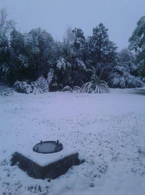
South Dakotans and Minnesotans know to expect snow into the spring... but May? In 2017, two systems produced accumulating snow in May which is very rare climatologically speaking. Watertown received 1.6" on May 1st, the 4th highest amount on any given May day on record there. What's more, Watertown has only ever observed accumulating snow in May on 10 days since 1893. The second system produced a narrow band of accumulating snow across eastern South Dakota on the evening of the 20th into the 21st. Around 2-3" of snow accumulated in and around Willow Lake
Photo courtesy of Jeannie Poline, taken in Willow Lake, SD on May 21st
June 13th Severe Weather
Thunderstorms rapidly developed in a humid and unstable airmass on the afternoon of June 13th. By the time they exited Big Stone and Traverse Counties by 9 pm, 10 tornadoes of EF-0 and EF-1 strength from west of Redfield, SD to the Graceville, MN area had been produced. Widespread straight-line winds, as intense as tornadoes in some cases, had also wreaked havoc across the area: a mobile mesonet measured a straight-line wind gust of 92 mph just south of Clark. Widespread damage to trees and many structures resulted, yielding many days of clean-up and rebuilding. More information can be found here: https://www.weather.gov/abr/2017_June13_WidespreadSevere
Photo courtesy of Bill Domms, taken near Clinton, MN

June 22nd Wind-Driven Hail
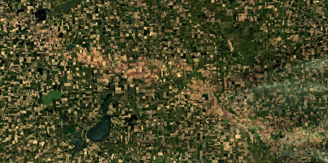
Severe weather broke out during the early morning of June 22nd across central and eastern South Dakota. One storm in particular stood out in terms of severity, and the aftermath could even be seen from space (see image below). Wind-driven hail battered and destroyed crops and anything else in its path just south of Watertown, including the towns of Castlewood and Astoria. Eighty to ninety mph winds downed power poles; debris blocked roadways; and hail up to golf balls knocked out windows to homes. More information can be found here: http://www.weather.gov/abr/20170622_WindDrivenHail
Image from the Sentinel 2A Satellite via Carl Jones, showing the hail scar across the landscape
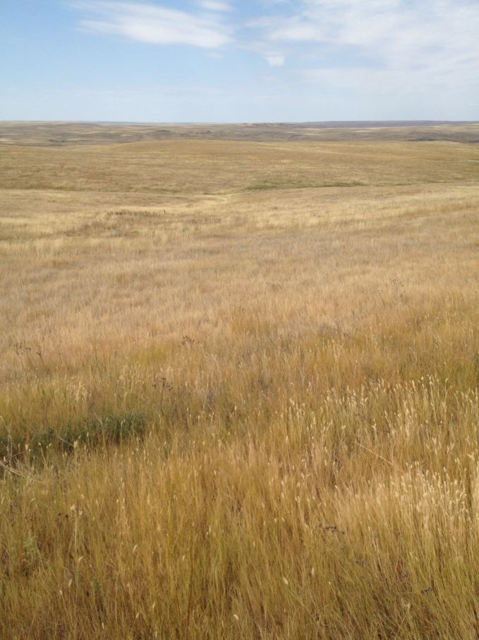
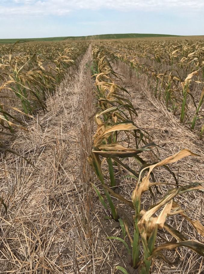
Extreme Drought
The extreme drought was the most impactful and costly weather/climate disaster across our forecast area in 2017. As designated by the US Drought Monitor, D2/Severe Drought began across north central South Dakota in the first week of June. By mid June much of South Dakota was in some level of drought, and D3/Extreme Drought conditions took hold across central South Dakota and lasted the rest of the summer and into the fall. Field crops were severely damaged, and the lack of feed for cattle forced ranchers to sell off livestock. By July 14th, Pollock, Eureka, Kennebec, Ipswich and others were experiencing a shortfall of 6 inches or more of precipitation since the 1st of the year. By September 30th, the cost of the drought across the Dakotas and Montana had reached $2.5 billion dollars. Blowing dust was common and gusty thunderstorms produced towering walls of dust. Fires were a constant concern through late into the fall, and left numerous scars across the land.
The drought led to many extremes in temperature as well. Temperatures soared above 100 degrees 6 times in July in Pierre and 7 times in Mobridge. July 17th was the warmest day since July 30, 2006 for Aberdeen and Sisseton when both sites went above 100 degrees. Record cold gripped the area as well, as the lack of moisture in the air meant it could cool more quickly at night. From June 24th through the 27th, temperatures dipped into the mid 30's across northern South Dakota. Already severely stressed crops from a lack of moisture were dealt another blow by an incredibly late frost that developed in low-lying spots from McLaughlin to Eureka.
Photo left from a NWS employee, taken on July 26th just south of the Cheyenne River on State Highway 63. Photo right courtesy of Joel Bierman, taken east of McLaughlin on June 27th.
July 11th 3" Hail
On the evening of July 11th, severe storms developed along a cold front across eastern South Dakota. By 7:30 pm, a supercell thunderstorm had developed to the north of Watertown, SD in an extremely volatile atmosphere. Large hailstones of up to 3" in diameter were released by the storm as it moved southeast into Watertown. There have only been 38 days in our forecast area with reports of 3" or larger diameter hailstones since 1950. More information can be found here: http://www.weather.gov/abr/20170711_WatertownHail.
Photo courtesy of Owen McElroy, taken in Watertown, SD

Very Wet August and September
Heavy rains totaling to over 3" above average for the month in some cases affected eastern South Dakota and western Minnesota in August. A particularly moist atmosphere on August 13th combined with slow-moving thunderstorms to produce more rainfall than the ground could absorb in parts of Codington and Grant Counties. Particularly hard-hit was Twin Brooks, when a campground became inundated by rising creek waters due to over 3" of rainfall that fell in a short period of time just west of town. This wet trend continued into September across eastern South Dakota and western Minnesota. Watertown recorded 4.92" of rain from the 19th through the 25th, their wettest 7 day period on record for September. In just one hour, between 10-11 pm on the 19th, 1.57" of rain fell in Watertown, resulting in street flooding.
Photo courtesy of Pam Nelson, taken at the Twin Brooks Threshing Show grounds on August 13th

September 19th Severe Weather
A vigorous late-season storm system raced across the area during the evening on September 19th. The right atmospheric conditions came together to produce large hail, damaging winds and tornadoes. The strongest of the three tornadoes struck a residence ~3 miles southwest of Tulare, SD, producing estimated 100 mph winds (EF-1 strength). While more common during the summer/spring months, tornadoes in September do happen in South Dakota and Minnesota. More information can be found here: https://www.weather.gov/abr/September19StormSummary
Photo courtesy of Nick Ihnen, taken southwest of Tulare, SD.
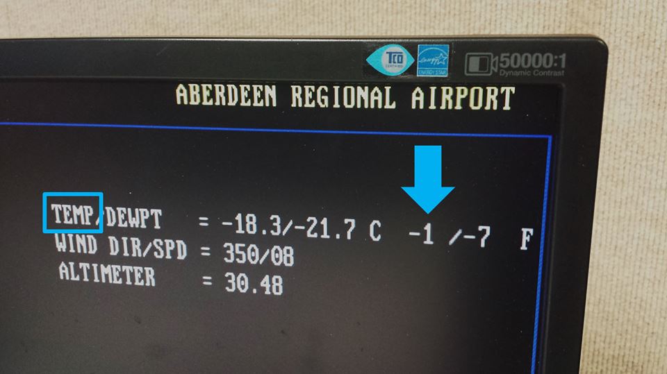
Arctic Cold Late December
While the winter of 2017-2018 has begun with a lack of snow, there was anything but a deficit of cold air during the last week of December. Aberdeen went 90 consecutive hours below zero degrees from 5:30 pm December 29th to 11:30 am January 2nd. This kind of streak was typical across the area. Air temperatures bottomed out to 30 or even 40 degrees below zero on the evening of the 31st, and daytime highs didn't get higher than 10 below for some. Pierre's low of 25 below on the 31st was the coldest temperature since January 10th, 1997. Wind chills dipped into the 40s and 50s below zero from the 29th through the 1st of January across the whole area. For Mobridge, Pierre, Aberdeen, Watertown and Sisseton (and likely many others), the final 7 days of 2017 averaged out to be the coldest final 7 days of a year ever recorded!
Photo from an NWS employee, taken at 5:30 pm on the 29th of the current temperature at the Aberdeen Airport