Local and Regional Events:
October 16, 1980:
A squall line packing damaging winds developed across portions of central South Dakota and raced into Minnesota during the afternoon and evening. The line of thunderstorms developed around 2 pm CDT and moved east and northeast at over 50 miles an hour. A large portion of southeast South Dakota was belted with winds of 50 to 70 miles an hour. Yankton reported winds of 60 to 70 mph while Sioux Falls was hit with a 62 mile an hour gust. Considerable damage was done in southeast South Dakota to trees, farm structures, and small buildings. Damage estimates were 100 to 200 thousand dollars. By late afternoon the thunderstorms were roaring through southwest Minnesota. Numerous outbuildings and many trees were downed or damaged. In Redwood County, two combines and a 24-foot travel trailer were tipped over and damaged.
U.S.A and Global Events for October 16th:
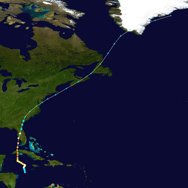
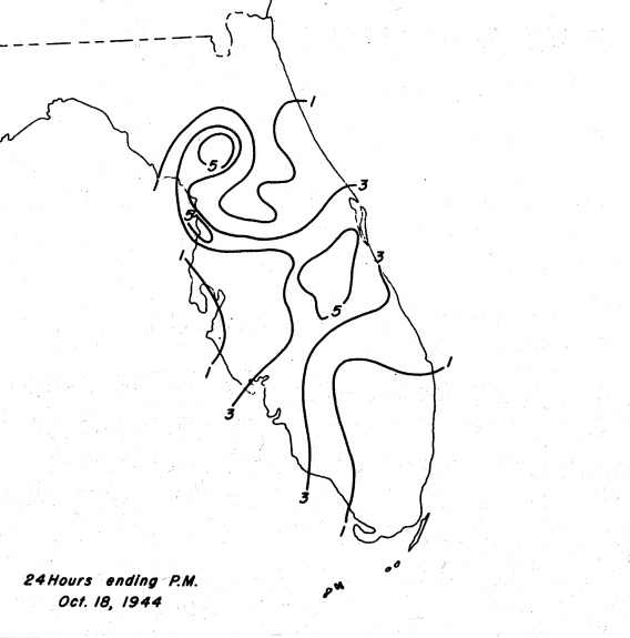
1944: The 1944 Cuba – Florida hurricane, also known as the Pinar del Rio Hurricane, struck western Cuba on this day as a Category 4. This storm killed an estimated 300 people in Cuba and nine in Florida. This hurricane is currently the 7th costliest U.S. Atlantic hurricane, with an estimated $46.9 billion (2015 USD) in damages.

The image above is courtesy of the National Hurricane Center.

The rainfall graphic above is courtesy of the Weather Prediction Center.
1988: An F2 tornado carved a 6 mile long, east-northeast path through a mostly rural area of north-central Indiana. The extremely slow-moving tornado touched down 1.5 miles north of Nappanee, just 300 yards north of a high school, and shortly after that moved through a subdivision where 11 homes sustained damage.
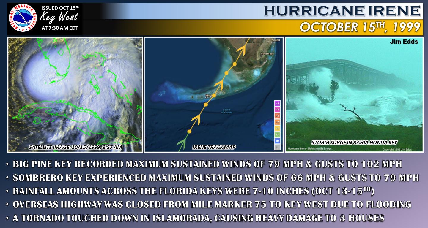
1999: Hurricane Irene moved across the Florida Keys producing heavy rainfall, strong winds, and high waves. A gust 102 mph was reported in Big Pine Key.

The image above is from a tweet by the NWS Office in Key West, Florida.
2007: A blinding sandstorm in the high desert north of Los Angeles wreaks havoc with local traffic causing a highway pileup involving dozens of vehicles. Two people die, and 16 are injured as a result of the storm, which reportedly raised dust to 1000 foot high.
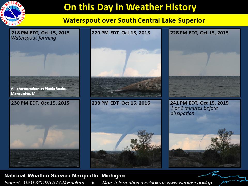
2015: A well-defined waterspout was visible from Marquette, Michigan. 
The image above is from a tweet by the NWS Office in Marquette, Michigan.
Click HERE for more This Day in Weather History from the Southeast Regional Climate Center.