
Critical fire weather conditions will continue across Southern California through this morning. Winds will begin to taper off this afternoon and into Saturday. A winter storm will continue to bring accumulating snow from eastern Oklahoma through the Mid-South and southern Appalachians, and ice accumulation across southern Arkansas through parts of the Southeast through Saturday morning. Read More >
Local and Regional Events:
October 10, 1928:
The temperature reached 90 degrees at Minneapolis, Minnesota, the latest such reading on record.
October 10, 1982:
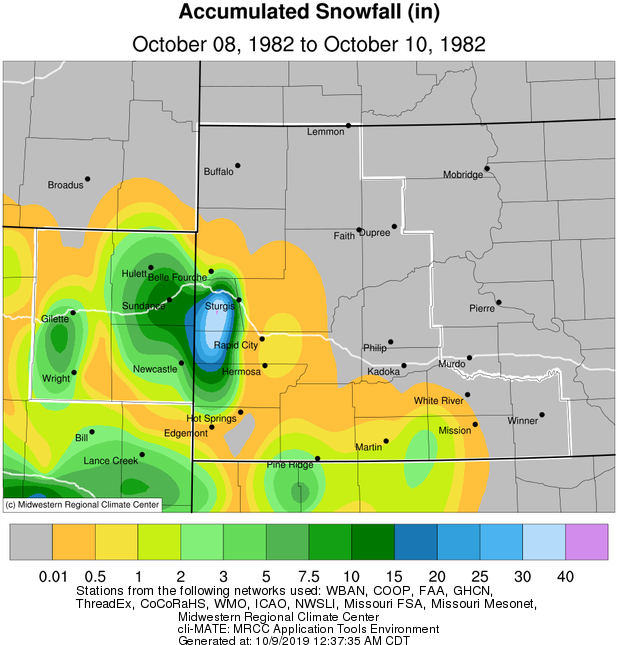
October 8th through October 10th, 1982, record amounts of snow piled up in the northern Black Hills. Not only was the storm an unprecedented breaker because it came so early in the season, but it was also a record snowfall producer for any time of year. Amounts of three to six feet were typical across the northern hills. On October 9th, 1982, thirty-two inches of snow buried Lead. The thirty-two inches that day is the most on record for 24 hours in South Dakota.
U.S.A and Global Events for October 10th:
1780: The Great Hurricane of 1780 made landfall on the island of Barbados on this day with estimated wind gusts of 200 mph. This hurricane went on to affect the islands of St. Vincent, where only 14 of 600 homes stood at Kings Town. St. Lucia, Martinique, Dominica, and Puerto Rico were all impacted by this hurricane. This storm is the deadliest Atlantic hurricane on record, with between 20,000 and 22,000 deaths. Click HERE for more information from the NWS Office in San Juan, Puerto Rico.
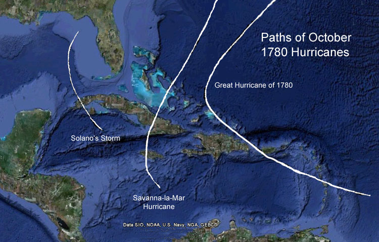
Above are estimated Hurricane tracks of 1780.
1846: A major hurricane, likely a Category 5, moved through the Caribbean Sea. This Great Havana Hurricane struck western Cuba on 10 October. It hit the Florida Keys on 11 October, destroying the old Key West Lighthouse and Fort Zachary Taylor.
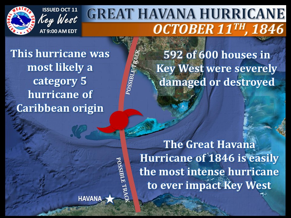
The image above is from a tweet by the NWS Office in Key West, Florida.
1949: A rapidly deepening area of low pressure produced gale to hurricane-force winds across much of Minnesota, Iowa, Wisconsin, Nebraska, Michigan, and the Dakotas. Sustained 1-minute winds reached 85 mph at Rochester, MN, and 79 mph at La Crosse, WI, during the early afternoon. Winds gusts were as high as 100 mph. This storm produced extensive damage to buildings and power lines. Also, many corn crops were flattened. Click HERE for more information from Minnesota’s Department of National Resources.
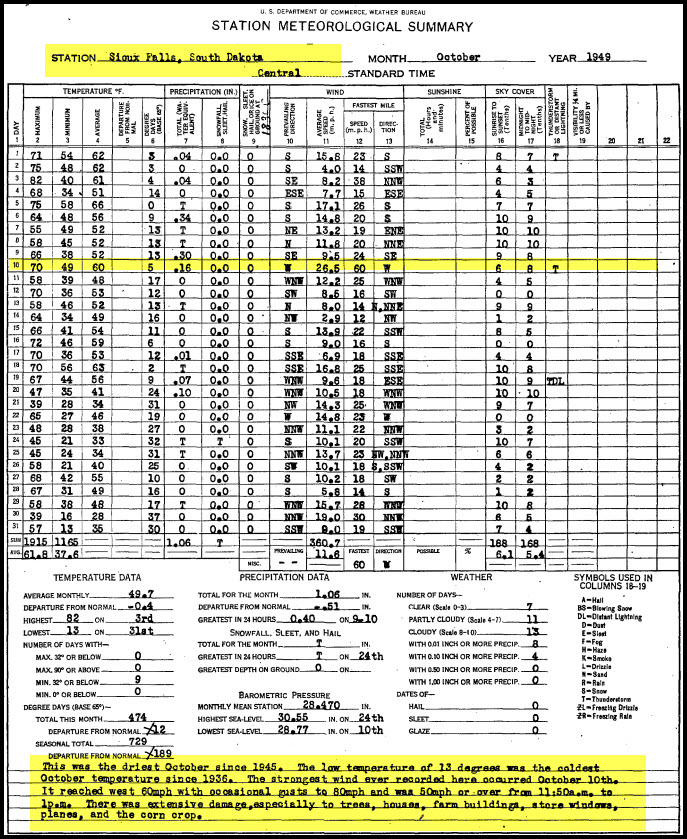
The monthly climate data for Sioux Falls, South Dakota is courtesy of NCEI.gov.
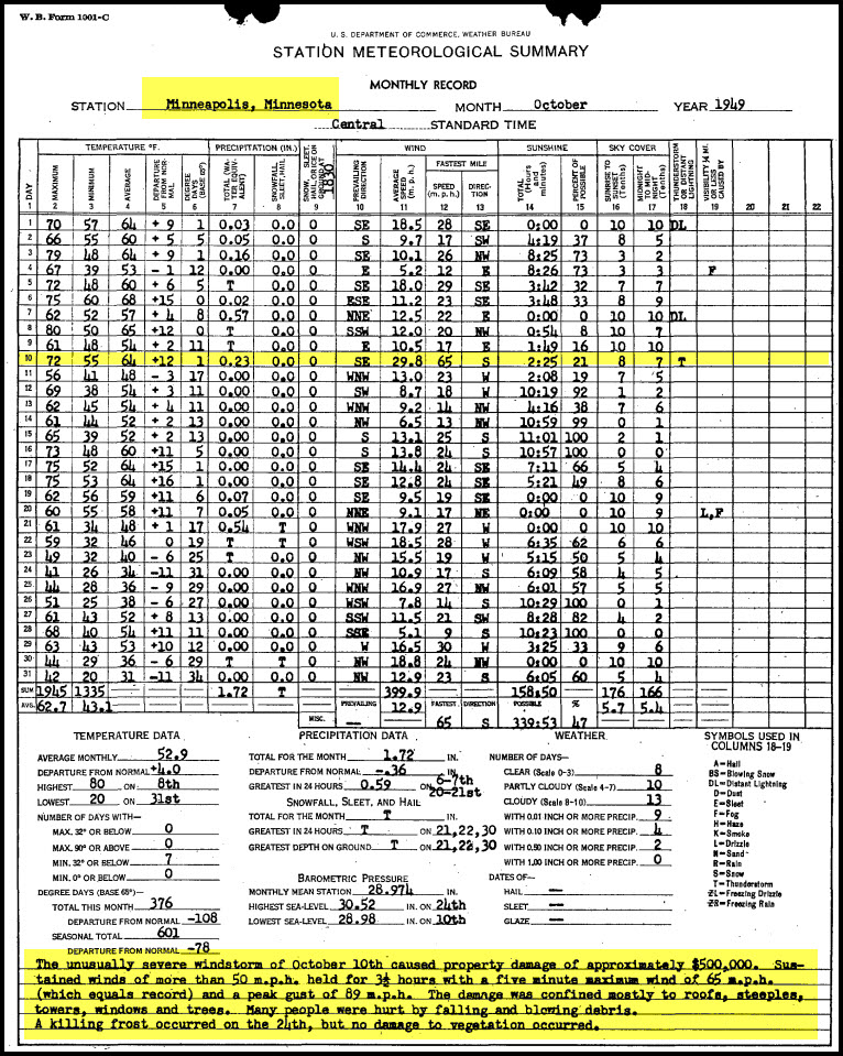
The monthly climate data for Minneapolis, Minnesota is courtesy of NCEI.gov.
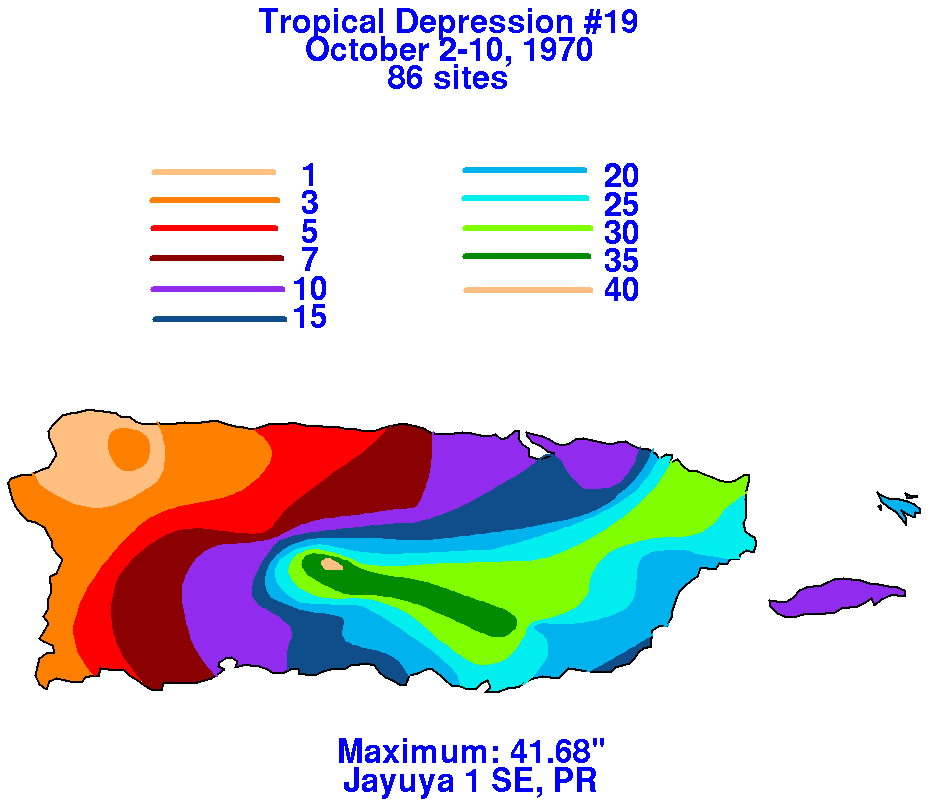
1970: A slow-moving tropical depression produced 41.68 inches of rain in Jayuya, Puerto Rico from October 2-10th, 1970. Click HERE for more information from the Weather Prediction Center.
2009: Nome, Alaska, experiences its first-ever October thunderstorm with five lightning strikes between 8 and 9 PM ADT.
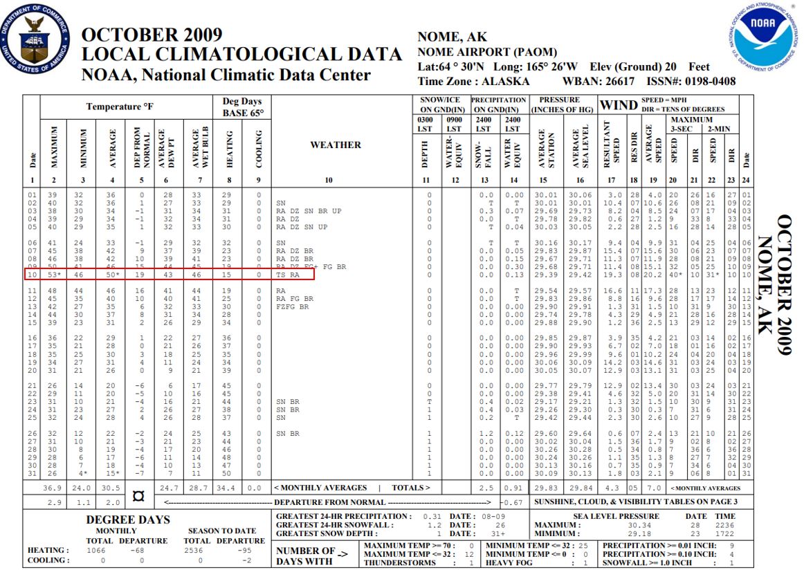
The Local Climatological Data above is courtesy of NCEI.gov.
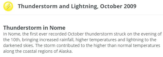
The image above is courtesy of the Alaska Center for Climate Assessment and Policy.
2009: A band of snow dropped a dusting to over 6 inches of snow in central to western Iowa, into central Nebraska. Click HERE for a tweet by the NWS Office in Des Moines, Iowa.
Click HERE for more This Day in Weather History from the Southeast Regional Climate Center.