Local and Regional Events:
September 14, 1993:
An early freeze and frost hit the state of South Dakota on the 14th and 15th. On the morning of the 14th, some low temperatures included 24 degrees at Rapid City, 19 degrees at Camp Crook and Porcupine, and 31 degrees at Pierre. The 24 degrees low at Rapid City broke the old record for the date by 10 degrees and was the earliest in the season it has ever been that cold. The air mass had moderated some by the time it hit eastern South Dakota early on the 15th. Some low temperatures on the 15th included 28 degrees at Brookings, 30 degrees at Watertown, and 32 at Sioux Falls.
​U.S.A and Global Events for September 14th:
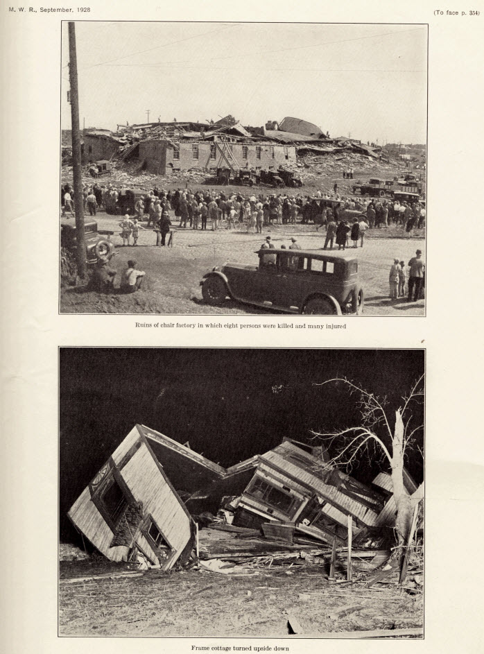
1928: A violent, estimated F4 tornado, with winds of 200 mph, tore across Rockford, Illinois. The tornado first touched down 8 miles south-southwest of Rockford and moved across the southeast part of the city. The tornado was on the ground for 25 miles with a width varying from 200 to 500 feet. A total of 14 people were killed, with around 100 injuries reported in Rockford alone. Two hundred buildings were damaged or destroyed. Click HERE for a vimeo.com video.

The image above is from the Monthly Weather Review published in September 1928.
1977: Severe thunderstorms produced several tornadoes in eastern Arkansas, killing one. Click HERE for a tweet by the NWS Office in Little Rock, Arkansas.
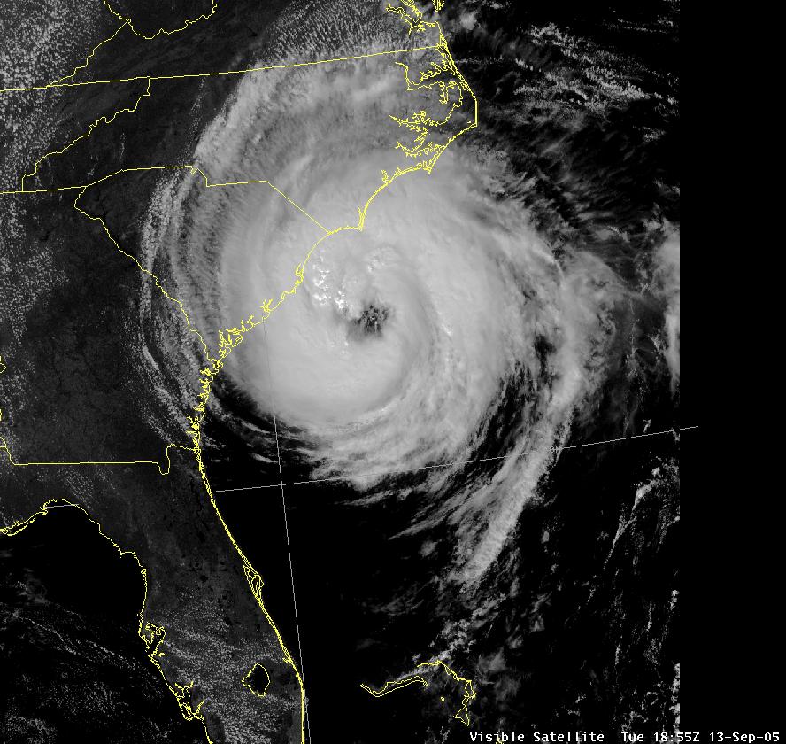
2005: Hurricane Ophelia caused some damage and beach erosion along the United States coastline from Florida to North Carolina. The closest approach occurred on September 14 and 15 with its western eyewall crossing land and the eye remaining just offshore in the Carolinas. Click HERE for more information from the NWS Office in Charleston, South Carolina.

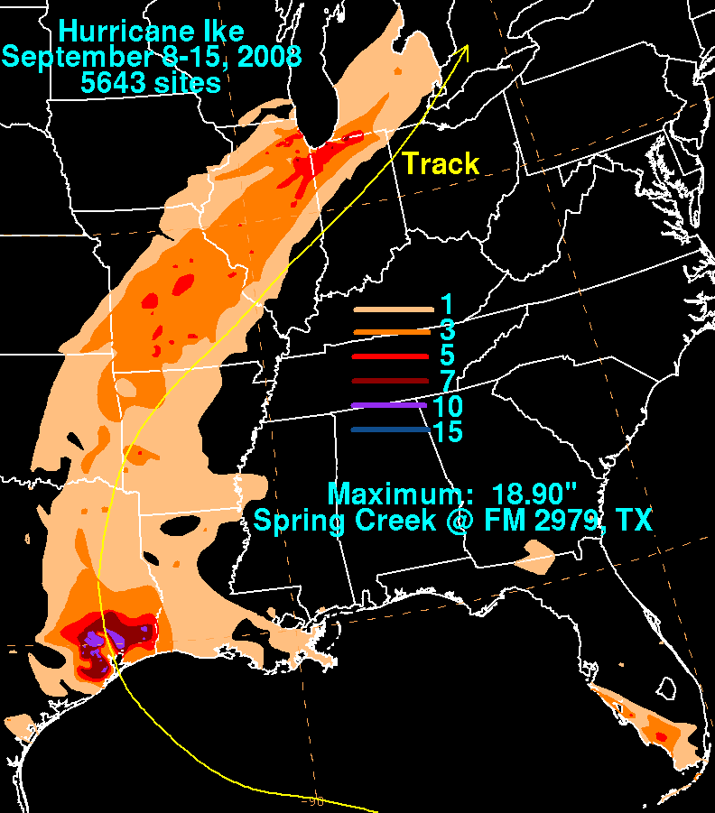
2008: Hurricane Ike became extratropical on this day. The St. Louis Metropolitan Area experienced hurricane conditions, with Ike's remnants inflicting severe damage to homes. Several areas in Illinois and Indiana, already flooded by the frontal boundary to the north, saw significant additional rainfall. Due to flooding in Chicago, a state of emergency was declared for Cook County due to flooding of the Des Plaines River. Hurricane-force wind gusts were reported to the east of the center across parts of Kentucky, Indiana, Ohio, and Pennsylvania with significant wind damage including structural damage to buildings and trees.

Storm total rainfall map of Hurricane Ike during September 2008. The image is courtesy of the Weather Prediction Center.
Click HERE for more This Day in Weather History from the Southeast Regional Climate Center.