Local and Regional Events:
September 5, 1983:
In the late afternoon and early evening, hail up to 2, and ½ inches in diameter pounded crops, trees, buildings, and windows resulting in extensive damage in Spink, Beadle, Turner, and Clay Counties. Trees were stripped of numerous branches broken off.
U.S.A and Global Events for September 5th:
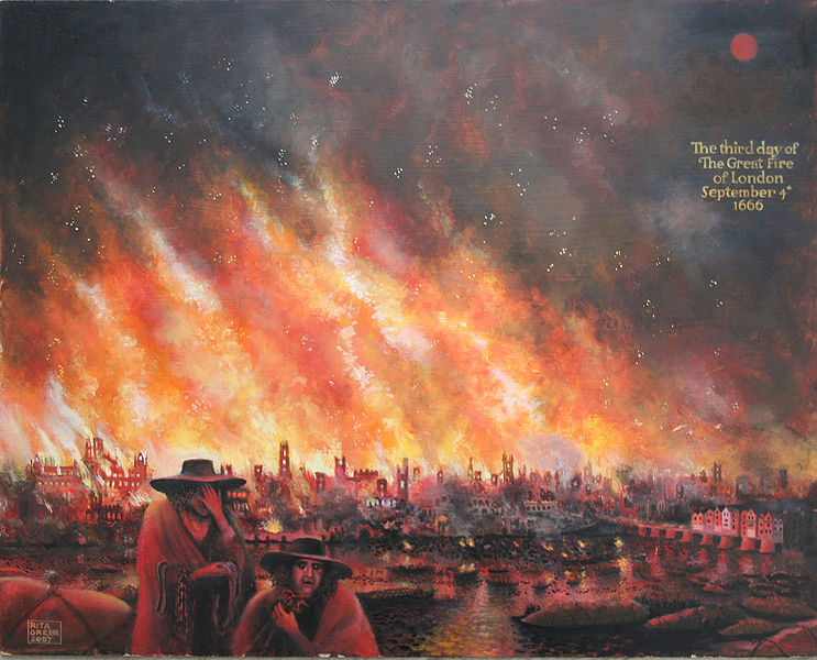
1666: The Great Fire of London started on September 2nd and continued through September 5th. The fire spread rapidly due to strong westerly winds. This fire consumed 13,200 homes, 87 parish churches, and St. Paul’s Cathedral. Click HERE for more information from the History Channel.

‘The Great Fire of London 1666’. The City is depicted on September 4th, the third day of the fire. The original is an oil painting on board by Rita Greer, history painter, 2008.
1929: Early season snowfall occurred in the mountains of Wyoming and the Black Hills of South Dakota on September 5th and 6th. The highest snowfall amount was 16 inches in Fox Park, Wyoming.
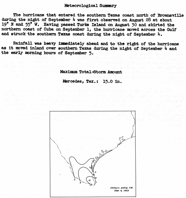
1933: A Category 3 hurricane made landfall on South Padre Island, Texas during the late evening hours on September 4th, or Labor Day. The storm caused 40 fatalities and nearly $17 million in damages. With the storm making landfall during a holiday weekend, fatalities could have been much higher. The following is from the report of the official in charge at Corpus Christi, Texas: "Probably never before in the history of Texas hurricanes have such widespread and early warnings been given as were received from Washington in advance of this one. The telegram of Saturday, September 2, warning all persons to avoid inaccessible places over the weekend probably saved thousands of lives."

The image above is courtesy of the National Hurricane Research Project, Report No. 3, Rainfall Associated with Hurricanes, published in 1956.
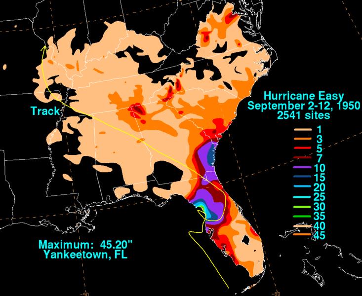
1950: Hurricane Easy was an erratic and unpredictable hurricane that lingered over the Tampa Bay area for days, dropping torrential rains and causing damage especially in Cedar Key, Florida where the storm eventually made landfall. This hurricane dumped 38.7 inches of rain in 24 hours in Yankeetown, a record for the U.S. at the time, and caused $3.3 million in damage. Total rainfall amounts in Yankeetown was 45.20 inches. Click HERE for more information from the Weather Prediction Center.

1978: Tropical Depression Norman became the most recent tropical system to make landfall in California near Long Beach as an extra-tropical storm.

The image above is from a tweet by the NWS Office in San Diego, California.
1996: Hurricane Fran made landfall near the tip of Cape Fear, North Carolina with maximum sustained winds near 115 mph on the evening of September 5th. Fran was responsible for 26 deaths and was at the time the most expensive natural disaster ever in North Carolina’s history. Click HERE for more information from the NWS Office in Wilmington, North Carolina.
2017: Hurricane Irma became a category 5 hurricane with maximum sustained winds of 180 mph. This made Irma one of strongest hurricane ever observed in the open Atlantic Ocean. Click HERE for more information from NWS Office in Tallahassee, Florida.

Hurricane Irma approaching the Leeward Islands at peak intensity on September 5, 2017.
Click HERE for more This Day in Weather History from the Southeast Regional Climate Center.