Local and Regional Events:
September 2, 1962:
From 315 to 445 pm, hail fell in and around the Mobridge area. The hail ranged from 1 1/2 to 4 inches in diameter. The ground was covered up to 3 inches deep with drifts of 2-3 feet. At this time, the storm was one of the worst in recent history for damage.

The image above is courtesy of Storm Data, September 1962.
September 2, 1983:
A tornado touched down in the late afternoon 3 miles west and 1 mile south of Polo in Hand County damaging buildings, machinery, and trees. The roof of a hog house was torn off, and the north side of the building was destroyed. A barn was pulled several inches off of its foundation, and numerous trees were destroyed. At a nearby farm, two outbuildings were damaged, with two cows injured along with two calves killed.
September 2, 1985:
Intense thunderstorms moved from south-central South Dakota to northeast South Dakota during the evening. Winds gusted to 60 to 70 mph over the area. Southwest of Presho, three small buildings were destroyed, and barns were damaged. Power lines and other property were damaged near Vayland, Miller, Wessington, Wolsey, Kimball, White Lake, Armour, and Castlewood. Large hail caused considerable damage to crops.
U.S.A and Global Events for September 2nd:
1775: The 1775 Newfoundland hurricane, also known as the Independence Hurricane, was a storm that hit the Colony of Newfoundland. It is believed to have killed at least 4,000 people, making it one of the deadliest Atlantic hurricanes of all time. The death toll in Virginia and North Carolina was 163 lives.
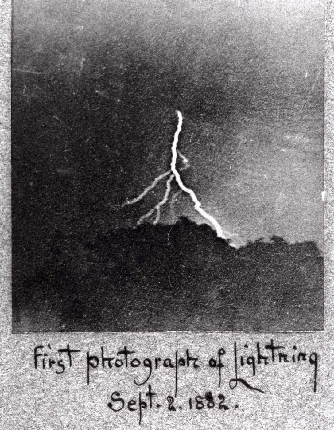
1882: Possibly the first photograph of a lightning strike was taken on this day by William Jennings in Philadelphia, Pennsylvania. Click HERE for more information from the website, Hyperallergic.
1887: The U.S. Army Signal Service station in Greenville, SC reported a minimum temperature of 50°F. This observation at Greenville still stands as the record low for the day. Additional stations across the state recorded low temps in the low 50's. Click HERE for an image of the U.S. Army Signal Service observation.
1935: The 1935 Labor Day Hurricane was the strongest and most intense hurricane to make landfall in the United States and the Atlantic Basin in recorded history. The death toll from this hurricane is between 400 to 600 individuals. Click HERE for more information from National Geographic.
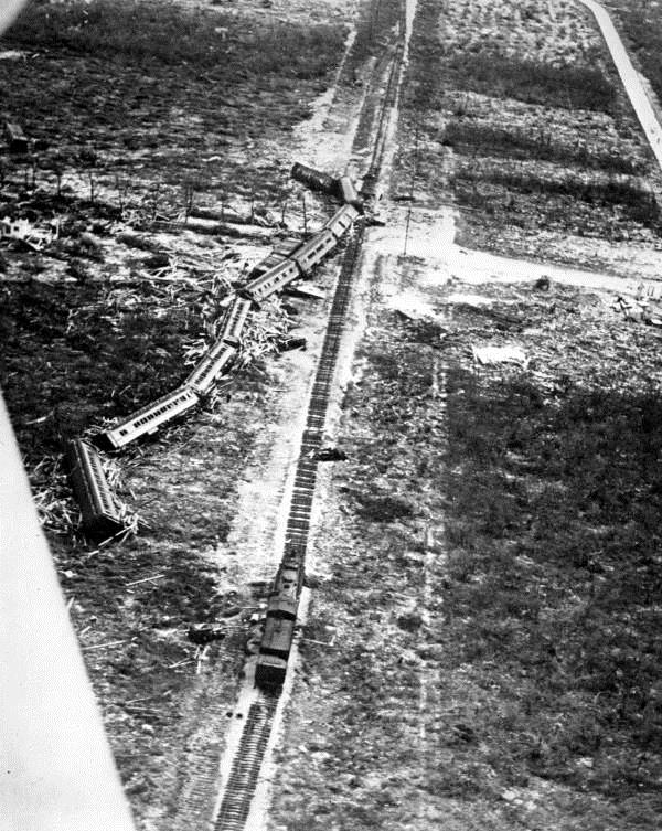
“The hurricane washed this eleven cars special train off the track soon after reaching the stricken area. The train was trying to rescue 683 World War I veterans in a rehabilitation camp, of which around 250 died as a result of the hurricane. The veterans, a remnant of the Bonus Army that marched on Washington, were employed for highway construction in the federal work relief project.” - State Archives of Florida, Florida Memory, https://floridamemory.com/items/show/149572
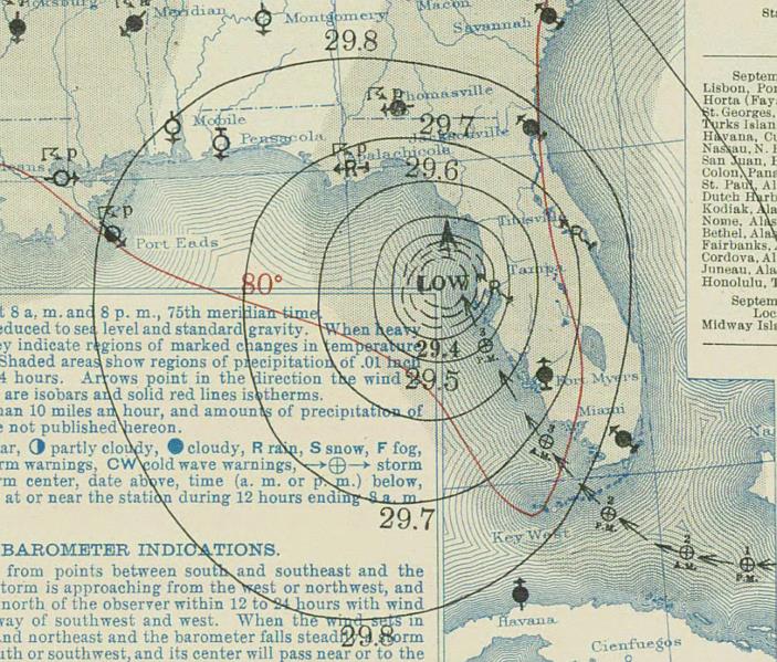
Surface weather analysis of the 1935 Labor Day hurricane on 4 September 1936.
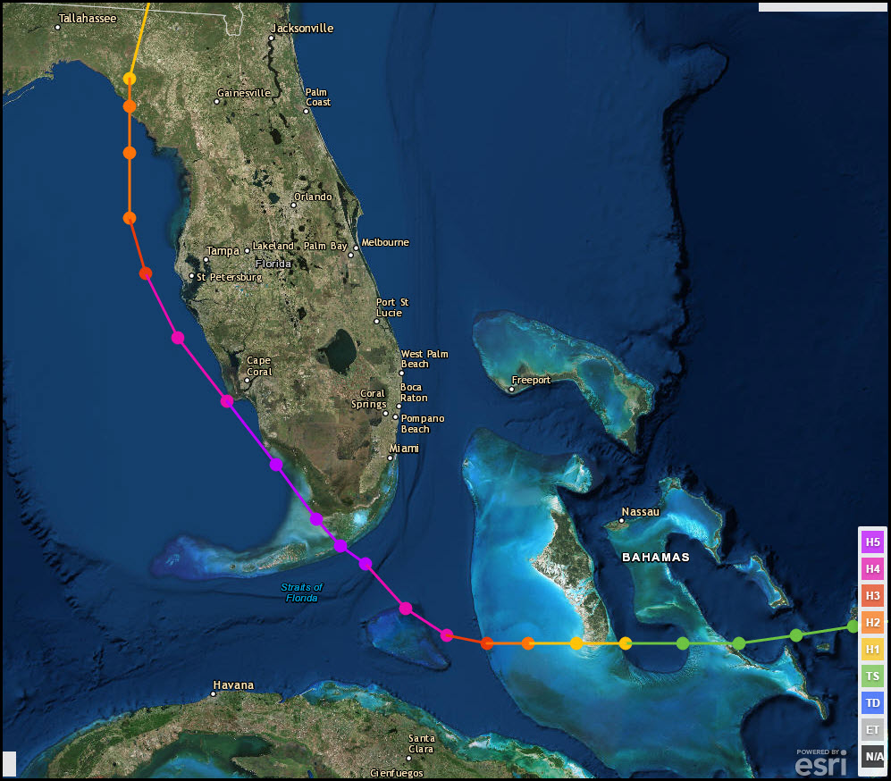
Track of the Labor Day Hurricane of 1935.
for more information from the NWS Office in MobileHERE made landfall near Biloxi, Mississippi causing major wind and storm surge damage. Click ElenaHurricane Category 3 1985: .
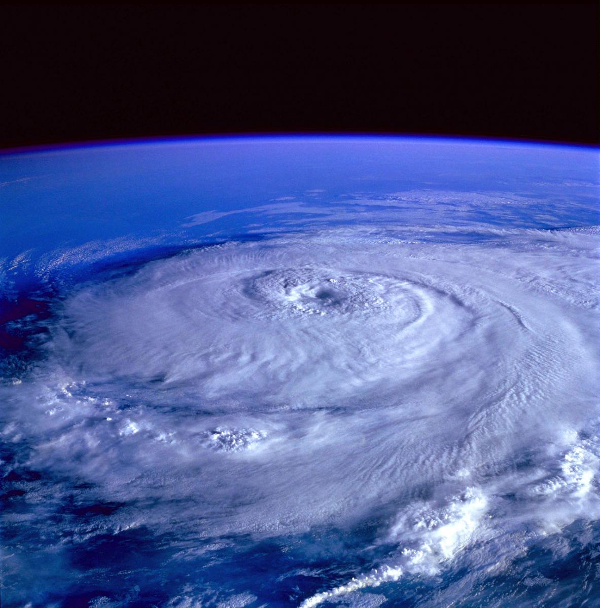
The NASA Space Shuttle Discovery captured Elena on September 1st, 1985.
2002: An F3 tornado destroyed much of the downtown area of Ladysmith, Wisconsin. Overall damage was estimated at $20 million, but there were no fatalities. Click HERE for photographs from rootsweb.ancestry.com
Click HERE for more This Day in Weather History from the Southeast Regional Climate Center.