
Gusty winds and low relative humidity will bring critical fire weather to the central/southern High Plains and portions of the Midwest. Two Pacific storms will continue to bring heavy mountain snow and gusty winds to the western U.S. through Thursday. A swath of wintry weather, including heavy snow and a wintry mix, is expected from the Northern Plains to New England. Read More >
Local and Regional Events:
October 12, 1997:
High winds upward of 60 mph were recorded throughout western South Dakota.
U.S.A and Global Events for October 12th:
1918: On October 10, 1918, two men working near a railroad siding northwest of Cloquet, Minnesota, saw a passenger train pass by the siding, and soon after, that discovered a fire burning through grass and piles of wood. The fire could not be contained, and by October 12, fires had spread through northern Minnesota. At least 450 lives were lost, and 52,000 people were injured or displaced, 38 communities were destroyed, 250,000 acres were burned. Click HERE for more information from the Library of Congress.

The image above is a residential area of Cloquet after the 1918 fire. The image is courtesy of the Minnesota Historical Society.
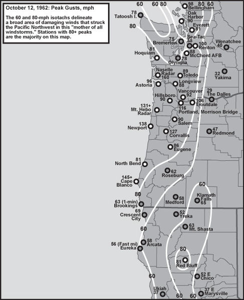
1962: The Columbus Day Storm of 1962 was a Pacific Northwest windstorm that struck the West Coast of Canada and the Pacific Northwest Coast of the United States. It is considered the benchmark of extratropical wind storms. The storm ranks among the most intense to strike the region since at least 1948, likely since the January 9, 1880 "Great Gale" and snowstorm. Click HERE for more information from the University of Washington. Click HERE for a video about this event.
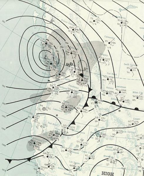
The image above is the surface weather analysis of the Columbus Day Storm on October 13th, 1962.
1979: The lowest barometric pressure ever recorded occurs in the center of Typhoon Tip on this day. A fly reconnaissance mission recorded the low pressure of 870 hPa or 25.69 inHg. Typhoon Tip was the most extensive tropical cyclone on record with a wind diameter of 1380 miles at its peak. Click HERE for more information from the Weather Doctor.
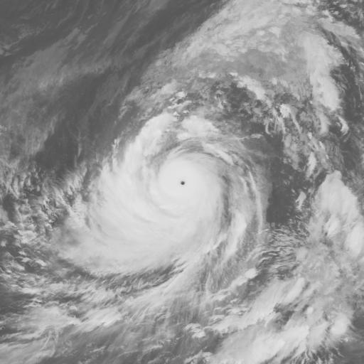
The satellite image above is Typhoon Tip at peak intensity on October 12th, 1979.
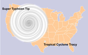
The image above is a comparison of the United States, Super Typhoon Tip, and the smallest storm, Tropical Cyclone Tracy.
Click HERE for more This Day in Weather History from the Southeast Regional Climate Center.