Weather History - February 10th
Local and Regional Events:
February 10, 1993:
Snow fell across South Dakota from the 10th to the 12th, with over 8 inches in south-central, west-central, and southwest. Some reports included 13 inches at Harrington, 12 inches at Midland, 10.5 inches at Winner, 10 inches near Stephan, Ardmore, and Wagner, 8.5 inches near Lead and Milesville, and 8 inches at Mitchell and Usta.
February 10, 1996:
Across central and northeast South Dakota and west-central Minnesota, an intense area of low pressure and an Arctic high-pressure area created strong winds from 35 to 50 mph with gusts to around 65 mph through the afternoon and into the late evening. These high winds combined with the falling snow and the snow on the ground create blizzard conditions and slick roads across northeast South Dakota and west-central Minnesota. Highway 12 from Webster to Summit was closed the evening of the 10th and Interstate-29 from Summit to Sisseton. Hundreds of travelers were stranded at Summit for several hours until conditions improved. Some wind gusts included 61 mph at Mobridge and 66 mph at Pierre and Aberdeen.
February 10, 2013:
A powerful area of low pressure brought widespread heavy snow of 6 to as much as 19 inches across South Dakota and into Minnesota. The combination of heavy snow and powerful winds of 30 to 50 mph caused extensive blowing and drifting snow. Roads, highways, and Interstates 29 and 90 were closed for a time, and schools started late or closed on Monday the 11th. Click HERE for more information about this blizzard.
U.S.A and Global Events for February 10th:
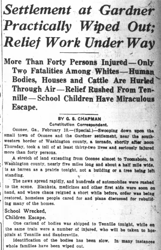
1921: Gardner, Georgia, was devastated by a massive, estimated F4 tornado that caused an entire small town section to disappear. The tornado killed an estimated 31 people and injured 100.

The Atlanta Constitution Atlanta, Georgia 11 Feb 1921, Fri • Page 1
1959: St. Louis, Missouri, was hit by a massive F4 tornado that killed 21 and injured 345. Over 2000 buildings were damaged or destroyed, including the St. Louis Arena. Click HERE for more information from The St. Louis Post-Dispatch.
1981: A morning tornado at Bay Minette, AL, struck the local middle school severely damaging the gymnasium. The tornado hurt 62 people were injured, 44 of whom were students. Click HERE for more information.

Newspaper photo of the tornado damage at Bar Minette Middle School.
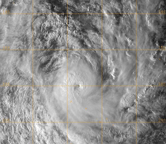
2010: Cyclone Pat slams The Cook Islands with 125 mph winds, which destroyed about 80 percent of the island of Aitutaki.

Above is a visible satellite image of Severe Tropical Cyclone Pat as the sunset on February 10th. The storm was near its peak intensity at this time and approaching the tiny island of Aitutaki. The image is courtesy of NASA.
2017: An atmospheric phenomena know as "moonbow" was seen in the Seattle area.
An atmospheric phenomena that doesn't happen often. Moonlight + passing shower = "moonbow". On @Skunkbayweather camera in past hour. #wawx pic.twitter.com/XPa8VKLwOY
— NWS Seattle (@NWSSeattle) February 10, 2017
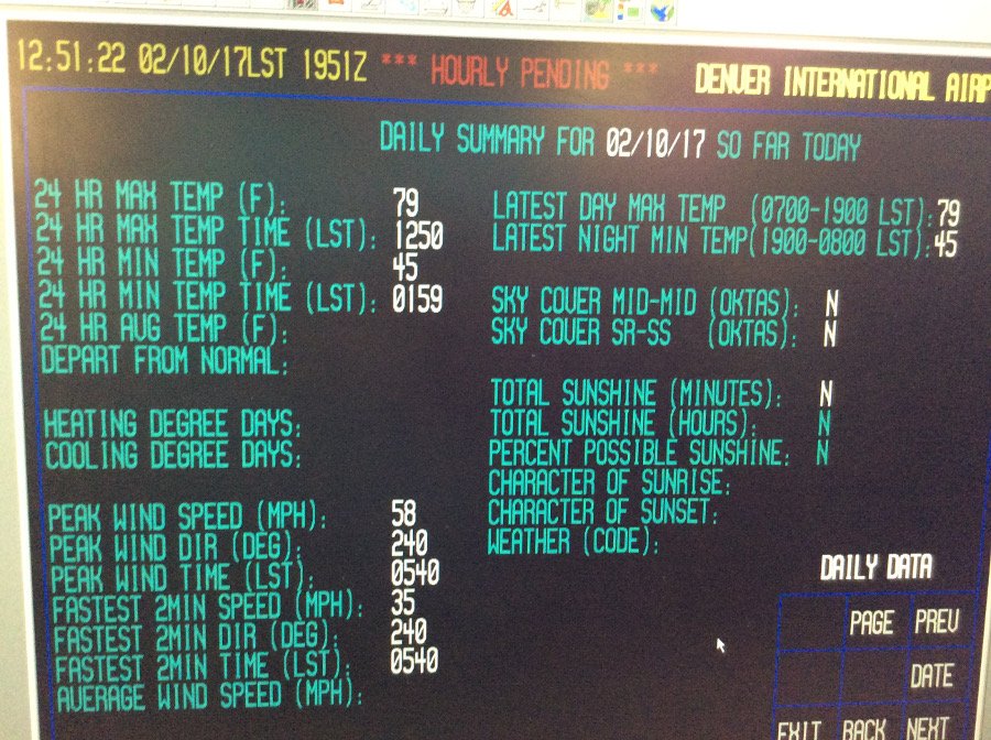
2017: Denver saw their all-time warmest temperature in February with a reading of 79 degrees. Click HERE for a tweet by the NWS Office in Boulder, Colorado.

Click HERE for more This Day in Weather History from the Southeast Regional Climate Center.