Weather History - February 9th
Local and Regional Events:
February 9, 1899:
Extreme cold blanketed most locations east of the Rocky Mountains during the first half of February. For South Dakota, the minimum temperature was the lowest experienced for many years, at least, and probably since its settlement. The week ending the 13th of February, the Weather Bureau stated: "With respect to temperature, this week is probably the most remarkable in the history of the Weather Bureau, over the greater part of the country east of the Rocky Mountains a large number of stations reporting the lowest temperatures recorded since their establishment. Over the whole region, extending from the eastern Rocky Mountain slope to the Atlantic coast and from the Gulf to the Great Lakes, the average daily deficiency exceeded 20 degrees. It ranged from 30 degrees to 35 degrees over an extensive area embracing the central valleys and portions of the Lake Region."
In South Dakota, the cold weather that culminated in the extremes began on January 26th and continued with little abatement over most of the state until February 12th. During the first twelve days of February, the Weather Bureau stations’ daily average temperatures ranged from zero to 27 degrees below zero.
Some low-temperature readings from February 8th through the 12th include:
-29 in Spearfish on the 11th
-30 in Yankton on the 11th
-34 in Milbank on the 9th
-34 in Rapid City on the 11th
-35 in Aberdeen on the 8th and 12th
-36 in Chamberlain on the 9th
-36 in Waubay on the 8th
-37 in Ipswich on the 8th
-38 in Watertown on the 11th
-39 in Mellette on the 11th
-39 in Mitchell on the 11th
-39 in Pierre on the 12th
-39 in Wessington Springs on the 9th
-40 in DeSmet on the 10th
-40 in Highmore on the 12th
-42 in Gann Valley on the 8th
-40 in Redfield on the 9th
-42 Sioux Falls on the 9th
February 9, 1994:
Widespread record cold occurred across central, north-central, and northeast South Dakota as well as west-central Minnesota. Record lows were set at Aberdeen, Mobridge, Pierre, Sisseton, Timber Lake, and Wheaton, with overnight lows in the 30s below to 40s below zero across the entire area. Aberdeen fell to 45 degrees below zero or one degree off the record low of 46 degrees below zero. Mobridge dropped to 38 degrees below zero, and Pierre fell to 35 degrees below zero. Watertown came just one degree short of their daytime record, with 35 degrees below zero.
U.S.A and Global Events for February 9th:
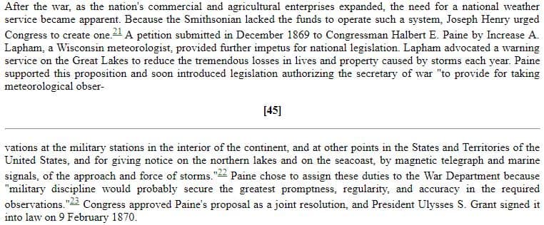
1870: President Ulysses S. Grant signed a law "to provide for taking meteorological observations at the military stations in the interior of the continent." A petition submitted by Increase A Lapham to Congressman Halbert E Paine in December 1869 began this process. Click HERE for more information.
1899: One of the most significant cold outbreaks to ever impact the United States occurred early to mid-February. From the 8th-11th, the statewide average temperature across Iowa was 14.6 degrees below zero, making it the coldest four-day stretch on record in the state. On the 8th, Sioux City experienced its coldest day on record, with a daily average temperature of 24 degrees below zero. Then on the 11th, they reached their second-coldest temperature on record with a low of minus 31. Overall the coldest readings were obtained on the morning of the 9th when reported low temperatures included -21 at Keokuk, -23 at Des Moines, -33 at New Hampton, -35 at Le Mars, -38 at Estherville, and -40 at Sibley. The cold across the middle of the country was so extreme and persistent that ice floes down the Mississippi River into the deep south, emerging into the Gulf of America near New Orleans on February 17th. This has happened only one other time: February 13, 1784. The temperature dropped to 63 degrees below zero at Norway House, Manitoba, Canada setting the province's low-temperature record.
1994: A devastating ice storm struck Mississippi, Louisiana, and extreme northwest Alabama. Freezing rain began falling over northern Mississippi during the early morning hours and continued until midday on the 10th. Ice accumulated 3 to 6 inches thick on exposed objects in the affected area. Due to the weight of the ice, power lines, trees, and tree limbs were down. Nearly one million people were without power after the storm, some for a month. Click HERE for more information from the NWS Office in Jackson, Mississippi.
Click HERE for more This Day in Weather History from the Southeast Regional Climate Center.

