Local and Regional Events:
December 30, 1985:
Winds gusted to 40 to 50 mph over northern South Dakota through the day and into the southern part of the state by late afternoon. The high winds lowered visibilities to near zero at times between Lemmon in Perkins County and Faith in Meade County. The strongest wind gusts were to 63 mph at Mitchell. At 9:33 pm CST, the strong winds blew a semi-tractor trailer off the highway one mile east of Aberdeen.
December 30, 2010:
A strong upper-level low-pressure trough and associated surface low-pressure area moved across the region bringing the first of two consecutive blizzards to central and northeast South Dakota. Snowfall amounts of 3 to 6 inches combined with bitter cold north winds of 25 to 40 mph caused widespread blizzard conditions across central and northeast South Dakota from the late morning until the evening hours. Near zero visibilities caused dangerous travel conditions resulting in the closing of Interstates 29 and 90 along with several highways across the region. Several hundred people were stranded in the aftermath of the storm. A group of fishermen had to be rescued in Day County when they became stranded on the ice. The snowfall began across the area anywhere from 7 to 11 am CST and ended between 10 pm and 1 am CST.
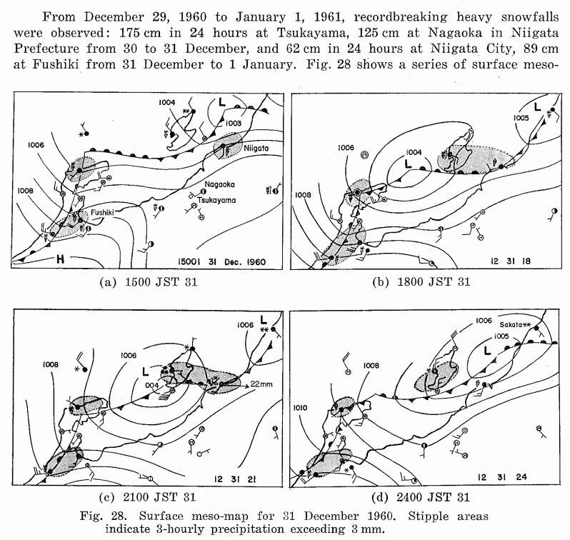
1960: A massive accumulation of snow, 68.2 inches to be exact, buries the Japanese city of Tsukayama in 24 hours. Tsukayama is located in the coastal mountains inland from the Sea of Japan along Honshu's west coast and subject to significant sea-effect snowfalls. Click HERE for more information from the Papers in Meteorology and Geophysics.

2003: The first time in five years, sections of Las Vegas receive an inch or two of snow on cars, roads, sidewalks, and trees, while snow flurries fell on downtown and the Strip.
2014: Steam Devils were seen over Lake Superior near Saginaw, Minnesota. Click HERE for more information from the Minnesota Public Radio.
2017: Funnels/steam devils were observed on Lake McConaughy, Nebraska in the morning. A boundary moved over the lake's 'warmer' water (compared to the surrounding air). The combination of converging winds and energy added by the lake helped spin these up.
Funnels/steam devils were observed on Lake Mac this morning! A boundary moved over the lake's 'warmer' water (compared to surrounding air). The combination of converging winds and energy added by the lake helped spin these up. Photo credit: Luanne Chavez #NEwx pic.twitter.com/WLJ6f0I4q1
— NWS North Platte (@NWSNorthPlatte) December 30, 2017