Weather History - December 2nd
Local and Regional Events:
December 2, 1978:
A low-pressure system moved northeast from Kansas, causing snow to fall over southern Minnesota south of a line from Alexandria to Duluth on the 2nd and 3rd, with the heaviest snow falling from west-central and southwest Minnesota to west-central Wisconsin. Snow depths of six inches or more fell in southwestern Minnesota, with 10 inches or more at Marshall, MN. Winds averaged near 20 mph, and temperatures ranged from 5 to 15 degrees above zero while the snow fell, but the snow did not cause extensive problems for the area. Wheaton had 2 inches, Artichoke Lake and Browns Valley had 3 inches.
December 2, 1984:
Snow fell in the central and northeast parts of South Dakota from the late afternoon of the 1st to the morning of the 2nd, with amounts ranging from 3 to 10 inches. The most substantial amounts were in the northeast part of the state, with Day County reporting 8 to 10 inches. Five inches of snow fell at Clear Lake; six inches fell at Waubay, Clark, Miller, and 12 miles southwest of Harrold with 7 inches at Redfield.
U.S.A and Global Events for December 2nd:
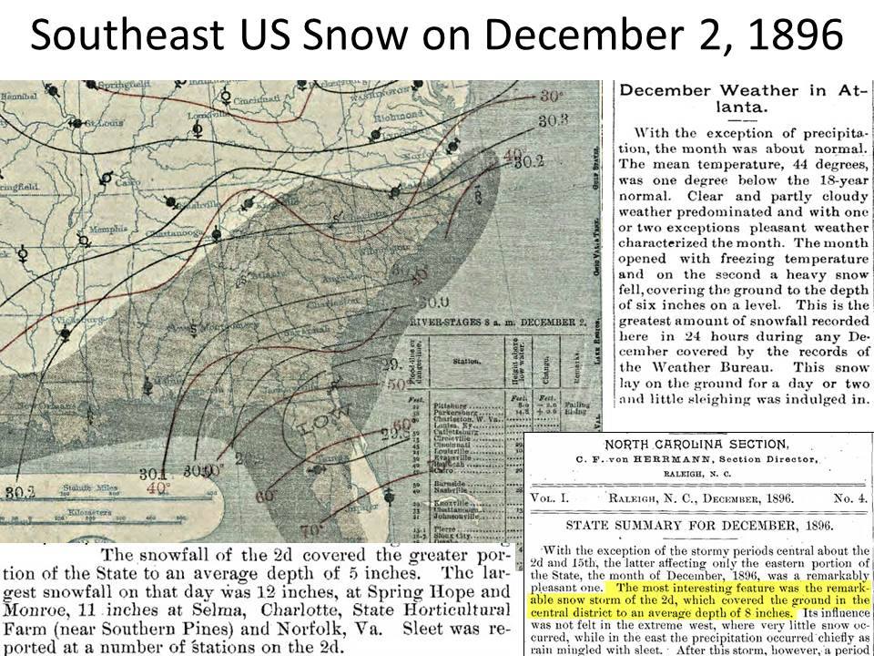
1896: Early season snow and ice storm struck the southeastern U.S. Eleven inches of snow fell at Charlotte, NC, and 6 inches at Atlanta, GA.

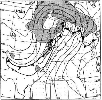
1950: A rare tornado event occurred when a storm system produces three tornadoes in Illinois and one in Arkansas. The three tornadoes in Illinois are relatively rare in December, with only three days with tornadoes from 1835 to 1950. The other years are 1876 and 1949.

The image above is the surface map at 2130 UTC on December 2, 1950. The first tornado down near Fosterburg, Illinois, about this time.
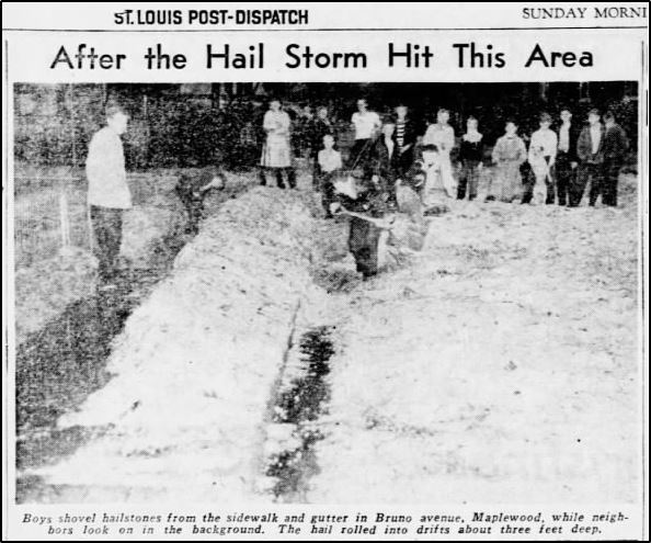
The same storm system brought significant hail to St. Louis. Click HERE for more information from WeatherWise.

1959: Between November 19 and December 2, an estimated 20 inches of rain fell near Frejus on the French Riviera. The rain caused the Malpasset Dam to collapse, which sent a 130-foot high wall of water into the towns of Malpasset and Bozon. The wall of water 10 feet tall reached Frejus, flooding the western half of the city. The dam breach killed 423 people and caused $68 million in damages.
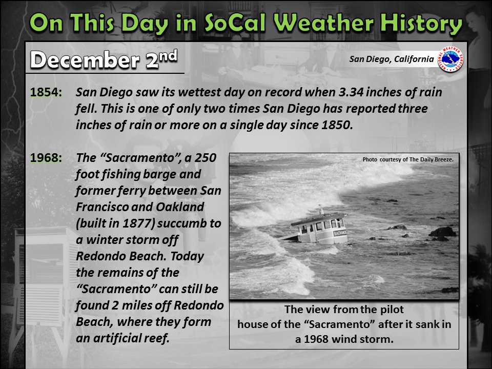
1968: The "Sacramento," a 250-foot fishing barge and former ferry between San Francisco and Oakland, succumb to a winter storm off Redondo Beach.

The graphic above is from a tweet by the NWS Office in San Diego, California.
Click HERE for more This Day in Weather History from the Southeast Regional Climate Center.