Weather History - August 27th
Local and Regional Events:
August 27, 1983:
High winds tore through Glenham and Wakpala, destroying several structures and damaging crops. The worst damage occurred in Glenham, in Walworth County, where two mobile homes were damaged, the roof of a school torn off, and trees limbs down. A tall TV antenna was blown over, and a boat was blown off a trailer. Highs winds also tore through the Bowdle area, downing power lines and tree limbs. Numerous roofs were also damaged.
August 27, 2013:
Numerous severe thunderstorms brought large hail along with wind gusts from 60 to 90 mph to parts of north central and northeast South Dakota. Numerous trees were downed along with many structures damaged. Eighty mph winds near Polo in Hand County snapped off two large cottonwood trees. Ninety mph winds snapped numerous trees off at their base along with destroying a garage and tipping several campers over onto their side at Cottonwood Lake near Redfield.
​U.S.A and Global Events for August 27th:
1854: A tornado struck downtown Louisville around noon on Sunday, August 27th, 1854. It first touched down near 25th Street, southwest of downtown and lifted at the intersection of 5th and Main Streets. Although the tornado was only on the ground for a little over two miles, the twister claimed at least 25 lives. Many of those who perished were killed in the Third Presbyterian Church, where 55 people were gathered for Sunday church services. Straight-line winds that accompanied the tornado did significant damage to the Ohio River, where at least one boat sunk. Click HERE for more information from the NWS Office in Louisville, Kentucky.
1881: A Category 2 Hurricane made landfall between St. Simons Island and Savannah, Georgia, on this day. Landfall coincided with high tide and proved very destructive. The hurricane killed 700 people, including 335 in Savannah, making it the sixth deadliest hurricane in the United States.
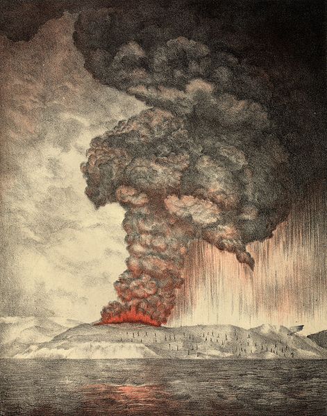
1883: Krakatoa Volcano exploded in the East Indies. The explosion was heard more than 2500 miles away, and every barograph around the world recorded the passage of the airwave, up to seven times. Giant waves, 125 feet high and traveling 300 mph, devastated everything in their path, hurling ashore coral blocks weighing up to 900 tons, and killing more than 36,000 persons. Volcanic ash was carried around the globe in thirteen days producing blue and green suns in the tropics, and vivid red sunsets in higher latitudes. The temperature of the earth was lowered one degree for the next two years, finally recovering to normal by 1888. Click HERE for more information from the Australian Government’s Bureau of Meteorology.

An 1888 lithograph of the 1883 eruption of Krakatoa. This view of Krakatoa during the Earlier Stage of the Eruption on Sunday the 27th, of May 1883.
1893: An estimated Category 3 hurricane made landfall near Savannah, Georgia on this day. This hurricane produced a high storm surge of 16 to 30 feet which cost the lives of 1,000 to 2,000 people. As of now, this storm is one of the top 5, deadliest hurricanes on record for the USA. Click HERE for more information from Preservation Society of Charleston.
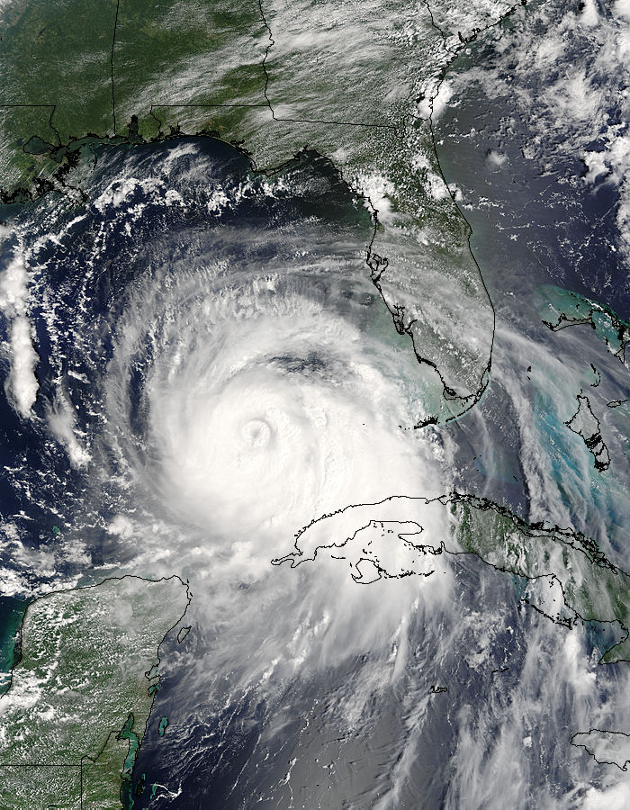
2005: Hurricane Katrina reached Category 3 intensity in the Gulf of America about 335 miles south-southeast of the mouth of the Mississippi River with maximum sustained winds of 115 mph.

The image above is courtesy of NASA’s Terra satellite. This image was captured on August 27th at 11:20 CDT.
Click HERE for more This Day in Weather History from the Southeast Regional Climate Center.