Weather History - August 26th
Local and Regional Events:
August 26, 1983:
Heavy rainfall up to four and a half inches fell in the town of Mahto, Corson County, flooding basements. Hail, up to three inches in diameter, caused significant damage to roofs and broke numerous windows.
August 26, 1998:
Massive rainfall of 3 to over 6 inches fell across far eastern Corson, most of Campbell and Walworth counties during the evening hours of the 26th. The heavy rain caused flooding on many roads along with some highways through the night and into the morning hours on the 27th. Near Selby, high winds, heavy rain, and some hail caused damage to sunflowers and moved a barn three feet off the foundation. In Selby, wind-driven rain pushed water through some ceilings and into basements. An old barn near Glenham was also blown down by the strong winds. Some rainfall amounts include 3.50 inches at Herried, 3.80 inches at Java, 4.20 inches at Selby, 4.50 inches 3N of Selby and just southeast of Mclaughlin, 5 inches at Glenham, 5.75 inches 8N of Mobridge, and 6.35 inches 1.5 miles southeast of Glenham.
U.S.A and Global Events for August 26th:
1864: A train running from Cincinnati to Chicago was derailed by a tornado in Dearborn County, Indiana, or 75 miles southeast of Indianapolis. Two passenger cars were lifted from the tracks and dropped in a ravine which injured 30 people.
1976: A weak tornado touched down briefly in the Hockley Hills near Kiana, AK, about 29 miles north of the Arctic Circle. This tornado is the most northerly report of a tornado on record. Kiana is 545 miles northwest of Anchorage, Alaska.
1992: Hurricane Andrew made a second landfall near Burns Point, LA as a Category 3 hurricane. Morgan City, LA recorded sustained winds of 92 mph with a peak gust of 108 mph. Hammond, LA was deluged with 11.92 inches of rain. As Andrew moved inland and weakened, it spawned 47 tornadoes from this date through the 28th from the South to the Mid-Atlantic States.
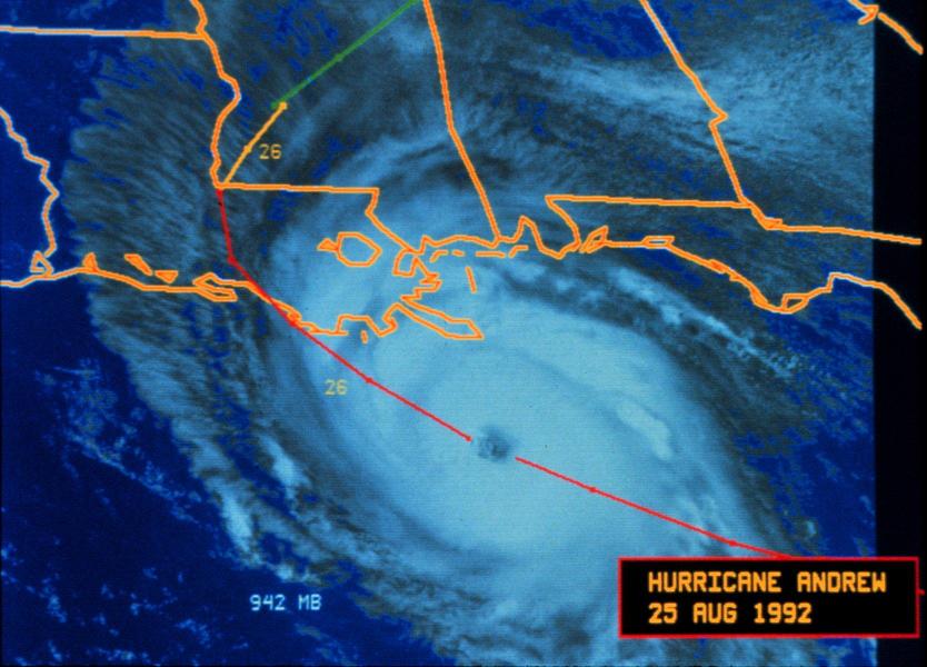
Hurricane Andrew was approaching the coast of Louisiana on August 25th, 1992.
Click HERE for more This Day in Weather History from the Southeast Regional Climate Center.

