Overview
The first half of February 2020 featured two widespread and impactful winter weather events: A heavy snow event on the 8th and 9th across central and east central South Dakota, and a blizzard on the 12th across northeastern and central South Dakota and west central Minnesota.Feb 8-9th Heavy Snow
Summary
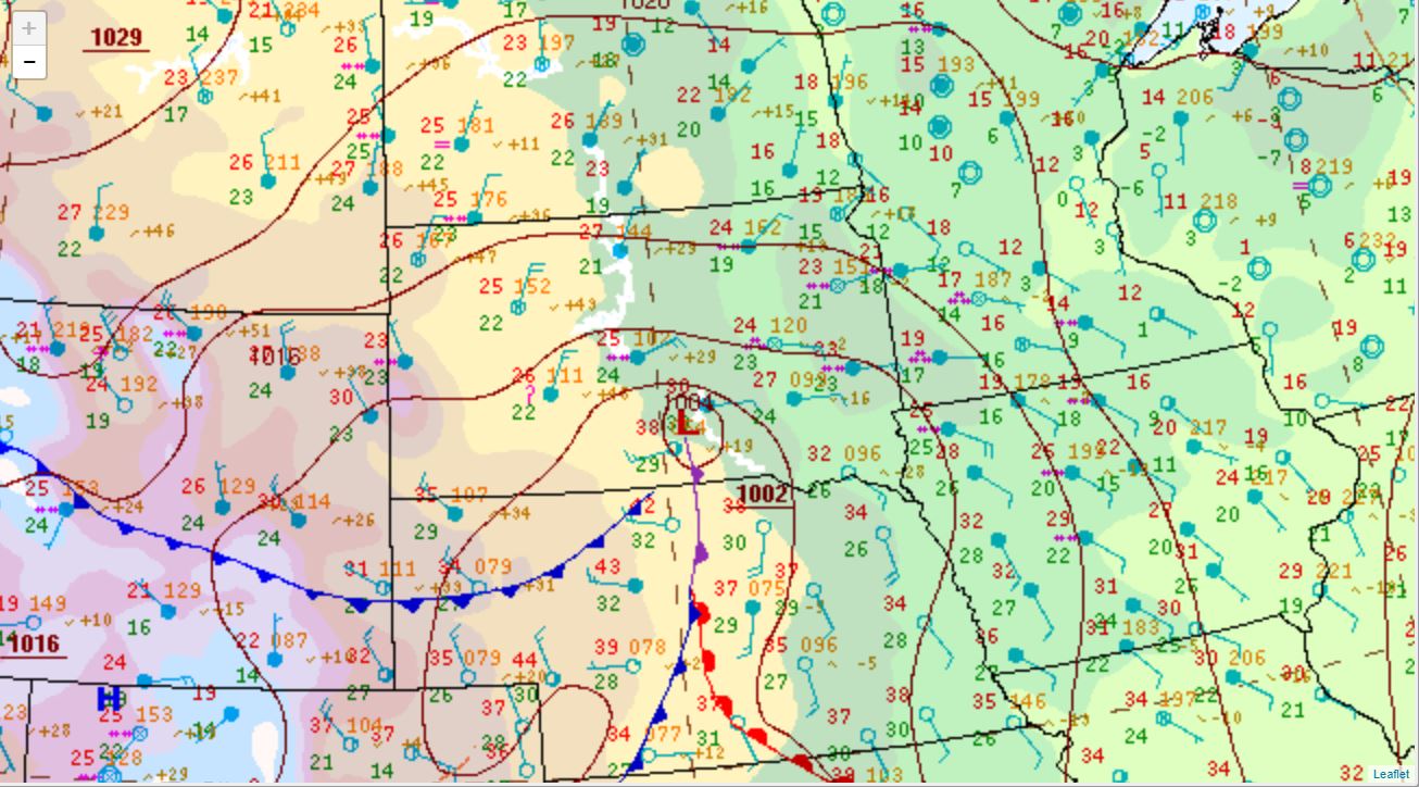
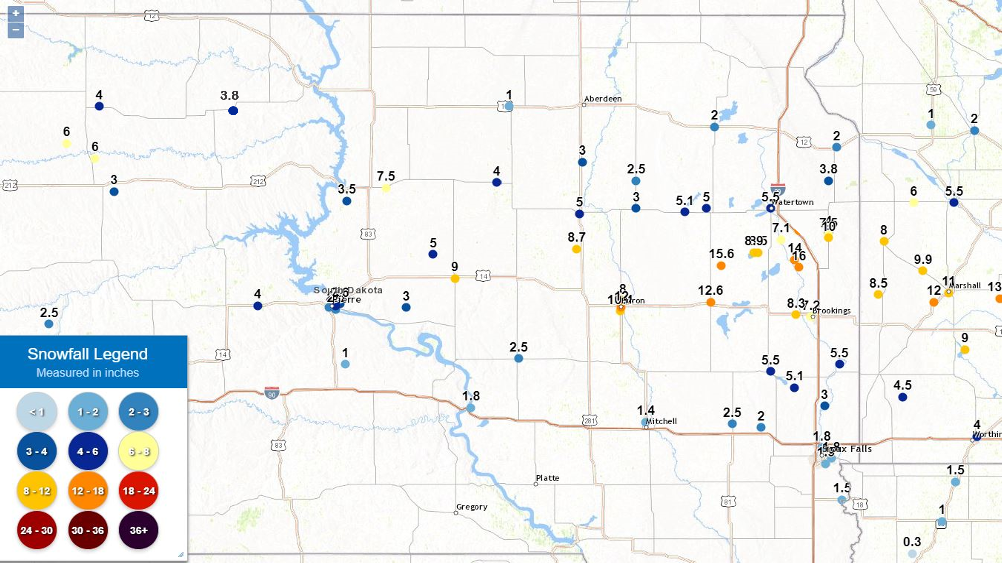
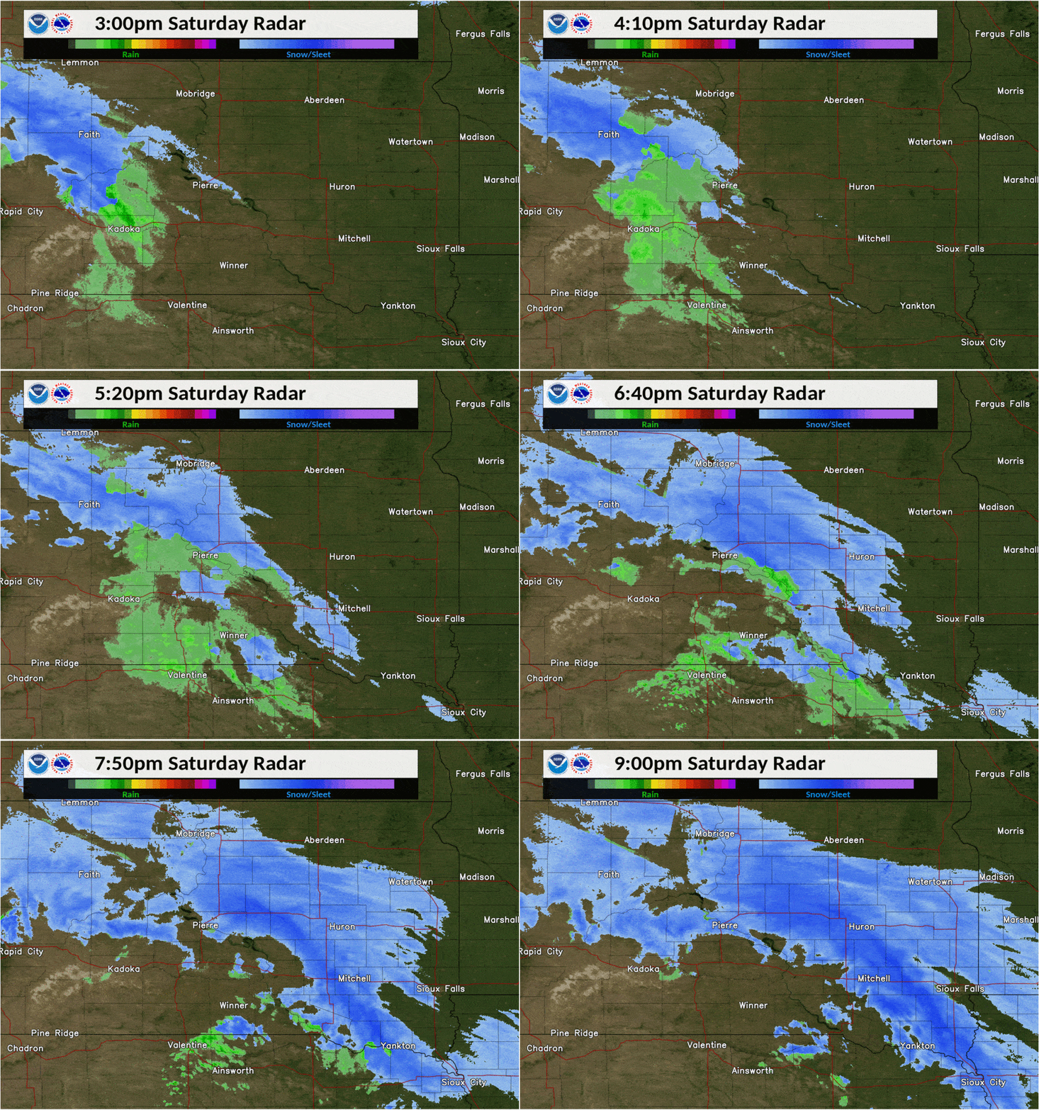
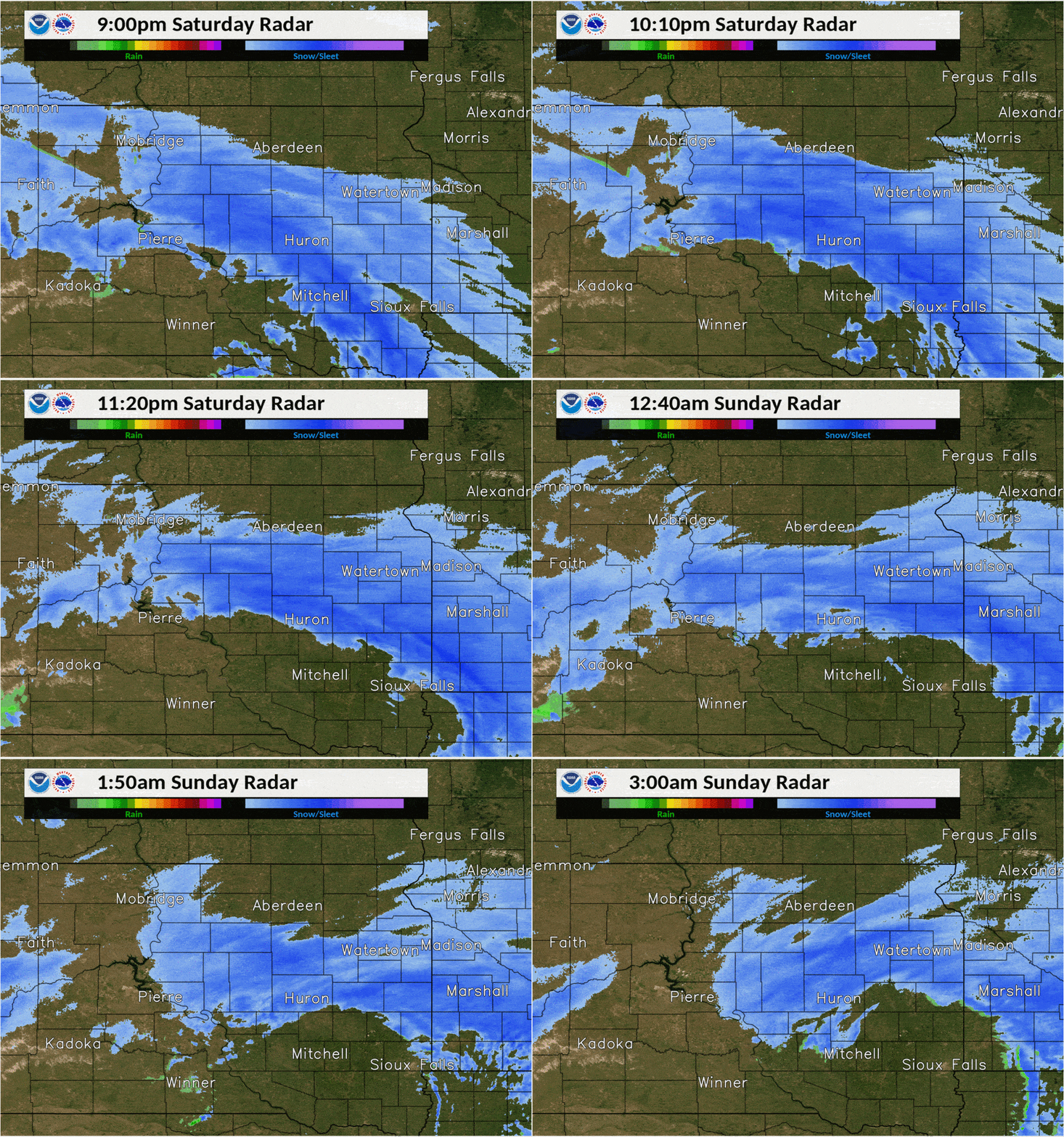
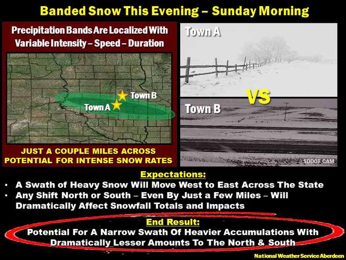
A potent low pressure system slid from the northern US Rockies to across southern South Dakota on February 8th and 9th, and produced a relatively narrow band of heavy snow across the area as it did so by the time it exited on the morning of the 9th. These types of events are known in the field as "banded snow", and are notorious for producing locally heavy (sometimes very heavy) snow surrounded by very little snow. In this case, 16" of snow reportedly fell in Estelline, but only 2" fell in Milbank just 45 miles further north. This system also produced thundersnow. The SDDOT marked many roads as "No Travel Advised" by Sunday morning across central and east central South Dakota.
 |
 |
 |
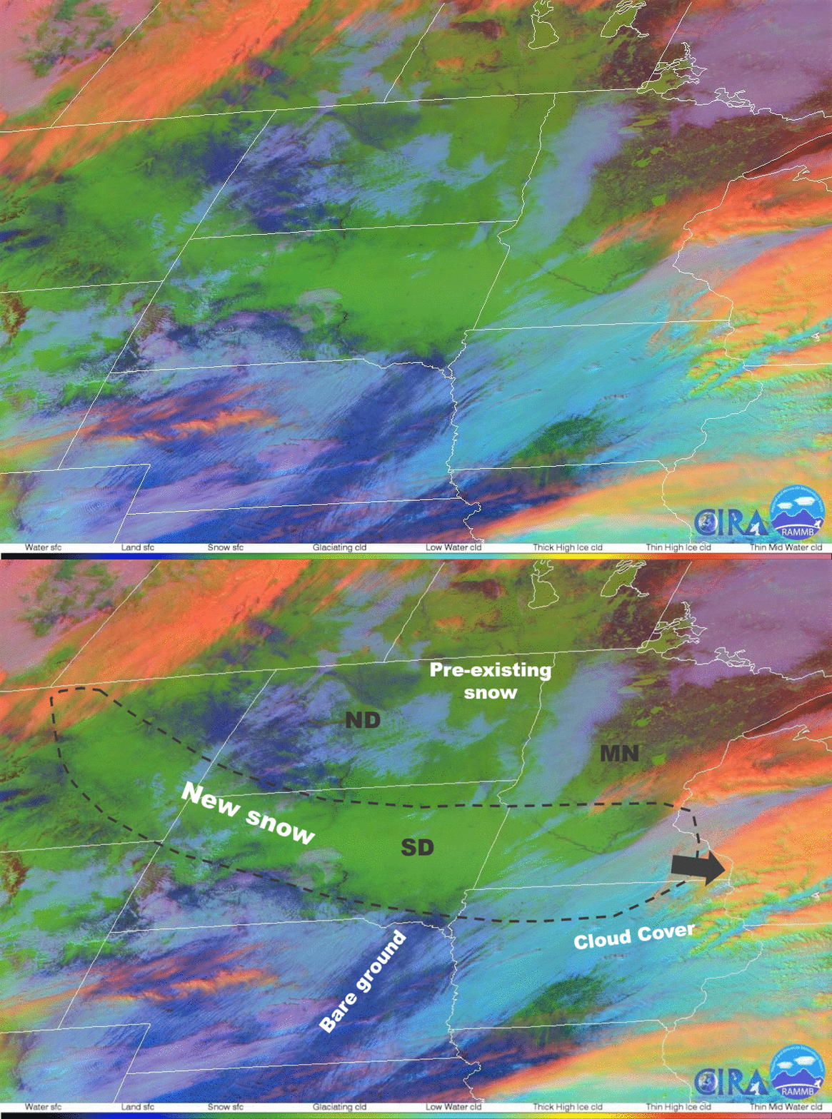 |
| Surface weather map at midnight on the 9th | Snowfall reports map | Snowfall map, estimated from NOHRSC | GOES-16 post-event satellite imagery |
 |
 |
.gif) |
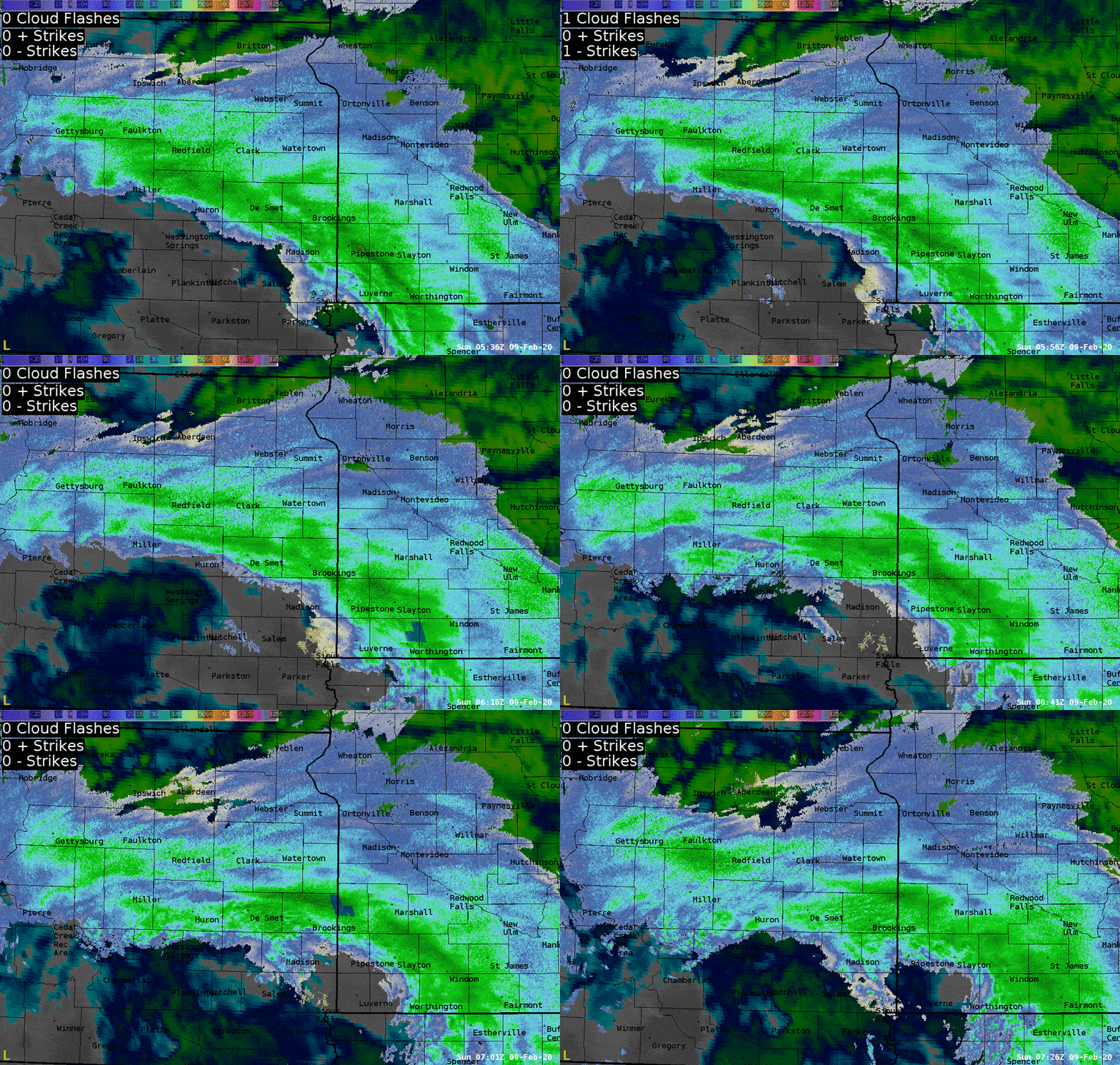 |
| Radar reflectivity from 3pm to 9pm on the 8th | Radar reflectivity from 9pm on the 8th to 3am on the 9th | Snowfall rates of 1-3" per hour as estimated by radar. A public report of 8" in 4 hours just north of Huron helps verify that this is reasonable | Thundersnow occurred as this system produced lightning in the Brookings area and across southern Minnesota |
 |
 |
 |
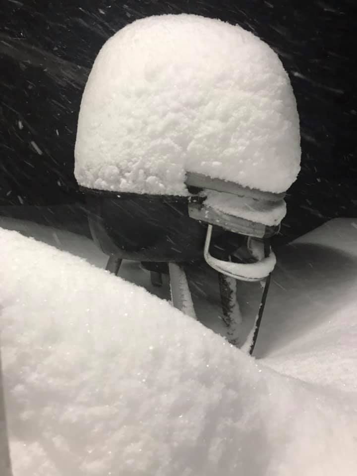 |
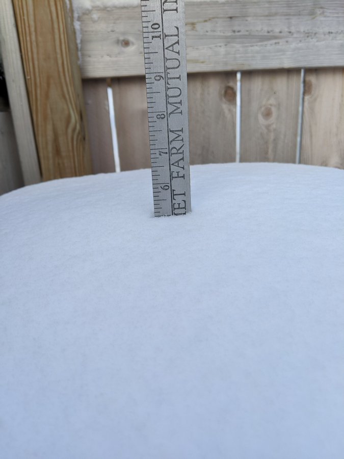
| 14 miles north of Estelline, courtesy of Henry Ladner Jr | About 5" of snow in Watertown, courtesy of Brent Nathaniel | Just before the bridge east of Lake Norden, courtesy of the Lake Poinsett Estates Campground | Heavy snow of about 14" at Lake Poinsett, courtesy of the Lake Poinsett Estates Campground |
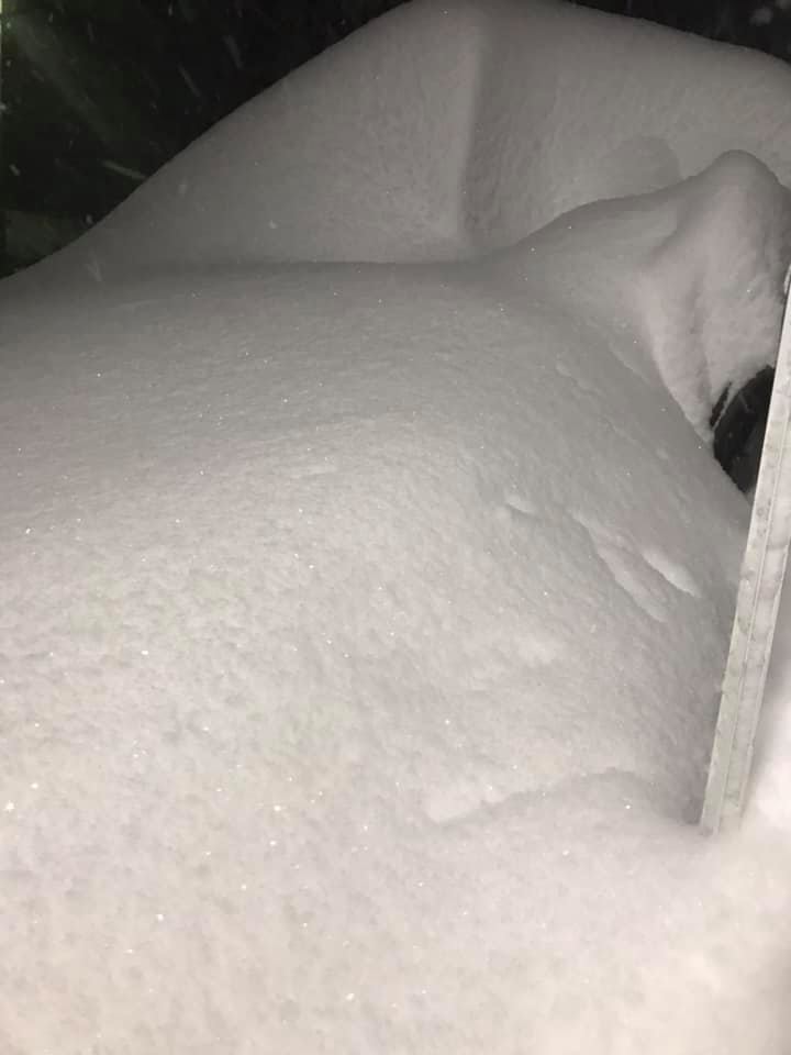 |
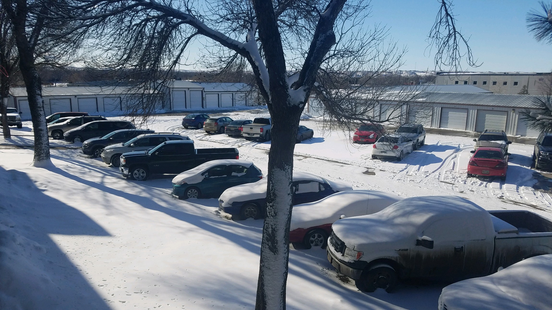 |
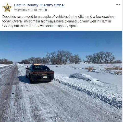 |
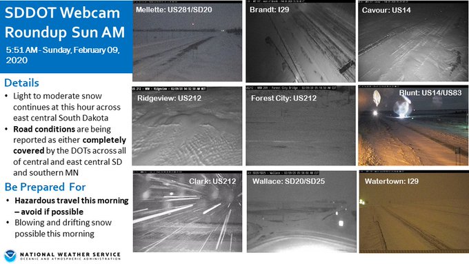 |
| Heavy snow of about 14" at Lake Poinsett, courtesy of the Lake Poinsett Estates Campground | About 4" of new snow in Pierre (bare ground previously), courtesy of Anthony Lueck | Couple vehicles in ditches across Hamlin County, courtesy of the Sheriff's Office | Area SDDOT webcams around 5:30 am on the 9th |
 |
 |
 |
|
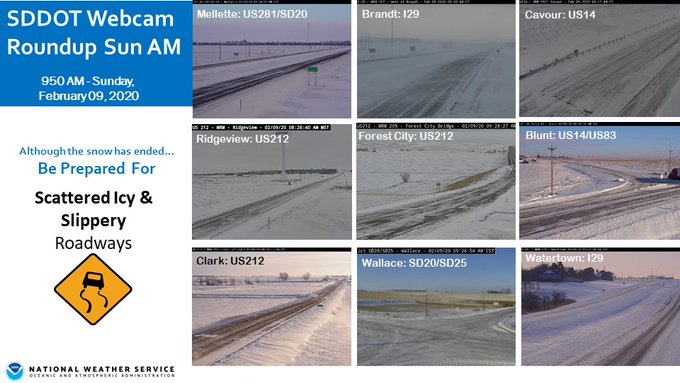
| Area SDDOT cams around 9:30 am on the 9th | Peak wind gusts during the heavy snow event | Banded snow explained |
Listing of snowfall reports
..TIME... ...EVENT... ...CITY LOCATION... ...LAT.LON... ..DATE... ....MAG.... ..COUNTY LOCATION..ST.. ...SOURCE....
..REMARKS..
0815 AM Heavy Snow Estelline 44.58N 96.90W 02/09/2020 E16.0 inch Hamlin SD Public
14 to 16 inches of snow.
0745 AM Heavy Snow Bryant 44.59N 97.47W 02/09/2020 M15.6 inch Hamlin SD Public
0700 AM Heavy Snow 3 NNW Estelline 44.62N 96.93W 02/09/2020 M14.0 inch Hamlin SD Public
0800 AM Heavy Snow 2 S Clear Lake 44.74N 96.68W 02/09/2020 M10.0 inch Deuel SD Public
8 to 10 inches of snow.
0830 AM Heavy Snow Highmore 44.52N 99.44W 02/09/2020 M9.0 inch Hyde SD Public
0700 AM Heavy Snow 1 WNW Hayti 44.66N 97.23W 02/09/2020 M8.9 inch Hamlin SD CO-OP Observer
0.47 inches liquid. 24 hour report.
0800 AM Heavy Snow 3 NW Spottswood 44.68N 98.54W 02/09/2020 M8.7 inch Spink SD Cocorahs
1120 AM Heavy Snow Hayti 44.66N 97.20W 02/09/2020 E8.5 inch Hamlin SD Public
0948 PM Heavy Snow Gary 44.79N 96.46W 02/09/2020 M8.0 inch Deuel SD Trained Spotter
Snow total from last night.
0728 PM Heavy Snow 4 WNW Onida 44.73N 100.14W 02/09/2020 M8.0 inch Sully SD CO-OP Observer
Snow total from last night.
1130 AM Heavy Snow Gettysburg 45.01N 99.95W 02/09/2020 M7.5 inch Potter SD Trained Spotter
0730 AM Heavy Snow 1 SSW Clear Lake 44.76N 96.68W 02/09/2020 M7.5 inch Deuel SD Public
0800 AM Heavy Snow Castlewood 44.73N 97.03W 02/09/2020 M7.1 inch Hamlin SD CO-OP Observer
0.63 inches liquid. 24 hour report.
0230 AM Heavy Snow Estelline 44.58N 96.90W 02/09/2020 E6.0 inch Hamlin SD Public
Report on social media saying easily 6 inches or more. Still snowing.
0900 AM Snow 3 ESE Watertown 44.90N 97.11W 02/09/2020 M5.5 inch Codington SD CO-OP Observer
CO-OP Observer station WRTS2 2.7 E Watertown.
0740 AM Heavy Snow 3 ESE Watertown 44.90N 97.11W 02/09/2020 E5.5 inch Codington SD Public
5 to 6 inches of snow.
0600 AM Snow Clark 44.88N 97.74W 02/09/2020 M5.1 inch Clark SD CO-OP Observer
CO-OP Observer station CAKS2 Clark.
0800 AM Heavy Snow 4 S Garden City 44.90N 97.58W 02/09/2020 M5.0 inch Clark SD Public
0700 AM Snow 9 N Holabird 44.65N 99.60W 02/09/2020 M5.0 inch Hyde SD Cocorahs
Cocorahs station SD-HY-8 Holabird 8.5 N.
0800 AM Snow Faulkton 45.04N 99.13W 02/09/2020 M4.0 inch Faulk SD CO-OP Observer
0745 AM Heavy Snow Pierre 44.37N 100.32W 02/09/2020 E4.0 inch Hughes SD Public
Between 4 and 5 inches.
0600 AM Heavy Snow 6 E Hayes 44.37N 100.90W 02/09/2020 M4.0 inch Stanley SD CO-OP Observer
0.54 inches liquid. 24 hour report.
0600 PM Snow Timber Lake 45.43N 101.07W 02/09/2020 M3.8 inch Dewey SD CO-OP Observer
Storm total.
0800 AM Snow La Bolt 45.05N 96.68W 02/09/2020 M3.8 inch Grant SD Cocorahs
Cocorahs station SD-GT-9 LaBolt.
0840 AM Heavy Snow 2 ENE Pierre 44.38N 100.29W 02/09/2020 M3.6 inch Hughes SD CO-OP Observer
0.32 inches liquid. 24 hour report.
1030 AM Snow 7 S Whitlocks Bay Rec A 44.94N 100.24W 02/09/2020 E3.5 inch Potter SD Public
0855 AM Heavy Snow Doland 44.90N 98.10W 02/09/2020 M3.0 inch Spink SD CO-OP Observer
0.20 liquid. 24 hour report.
0800 AM Snow 12 ESE Canning 44.36N 99.80W 02/09/2020 M3.0 inch Hughes SD CO-OP Observer
0700 AM Heavy Snow Mellette 45.15N 98.50W 02/09/2020 E3.0 inch Spink SD Public
2 to 3 inches of snow.
1003 AM Heavy Snow 1 S Pierre 44.35N 100.32W 02/09/2020 M2.5 inch Hughes SD Cocorahs
0.15 inches liquid.
0710 AM Snow 3 NNE Gann Valley 44.08N 98.97W 02/09/2020 M2.5 inch Buffalo SD CO-OP Observer
CO-OP Observer station GNVS2 Gann Valley 3 NNE.
0700 AM Snow 1 S Pierre 44.35N 100.32W 02/09/2020 M2.5 inch Hughes SD Cocorahs
Cocorahs station SD-HG-10 Pierre 1 S.
0700 AM Heavy Snow Turton 45.05N 98.10W 02/09/2020 M2.5 inch Spink SD Public
COOP Observation.
0900 AM Heavy Snow Fort Pierre 44.36N 100.37W 02/09/2020 M2.0 inch Stanley SD Cocorahs
0.12 inches liquid. 24 hour report.
0730 AM Heavy Snow 1 NE Milbank 45.23N 96.62W 02/09/2020 M2.0 inch Grant SD CO-OP Observer
0.10 inches liquid. 24 hour report.
0700 AM Heavy Snow Webster 45.34N 97.52W 02/09/2020 M2.0 inch Day SD Public
0700 AM Snow Fort Pierre 44.36N 100.37W 02/09/2020 M2.0 inch Stanley SD Cocorahs
Cocorahs station SD-ST-6 Fort Pierre 0.5 SE.
1001 AM Heavy Snow 9 NNE Vivian 44.05N 100.25W 02/09/2020 M1.0 inch Lyman SD Cocorahs
0.08 inches liquid.
0831 AM Heavy Snow Ipswich 45.45N 99.04W 02/09/2020 M1.0 inch Edmunds SD CO-OP Observer
Feb 12th Blizzard
Summary
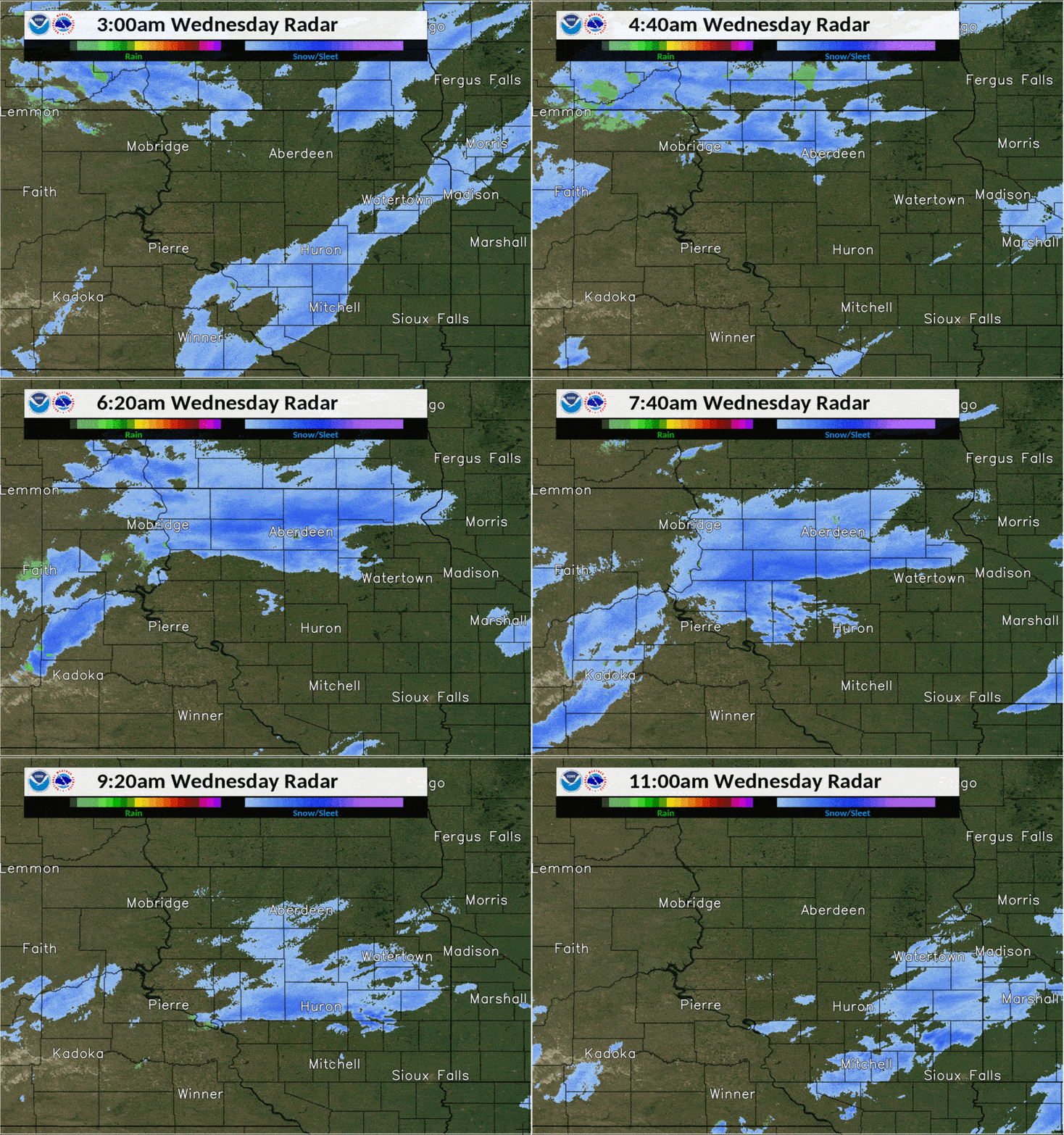
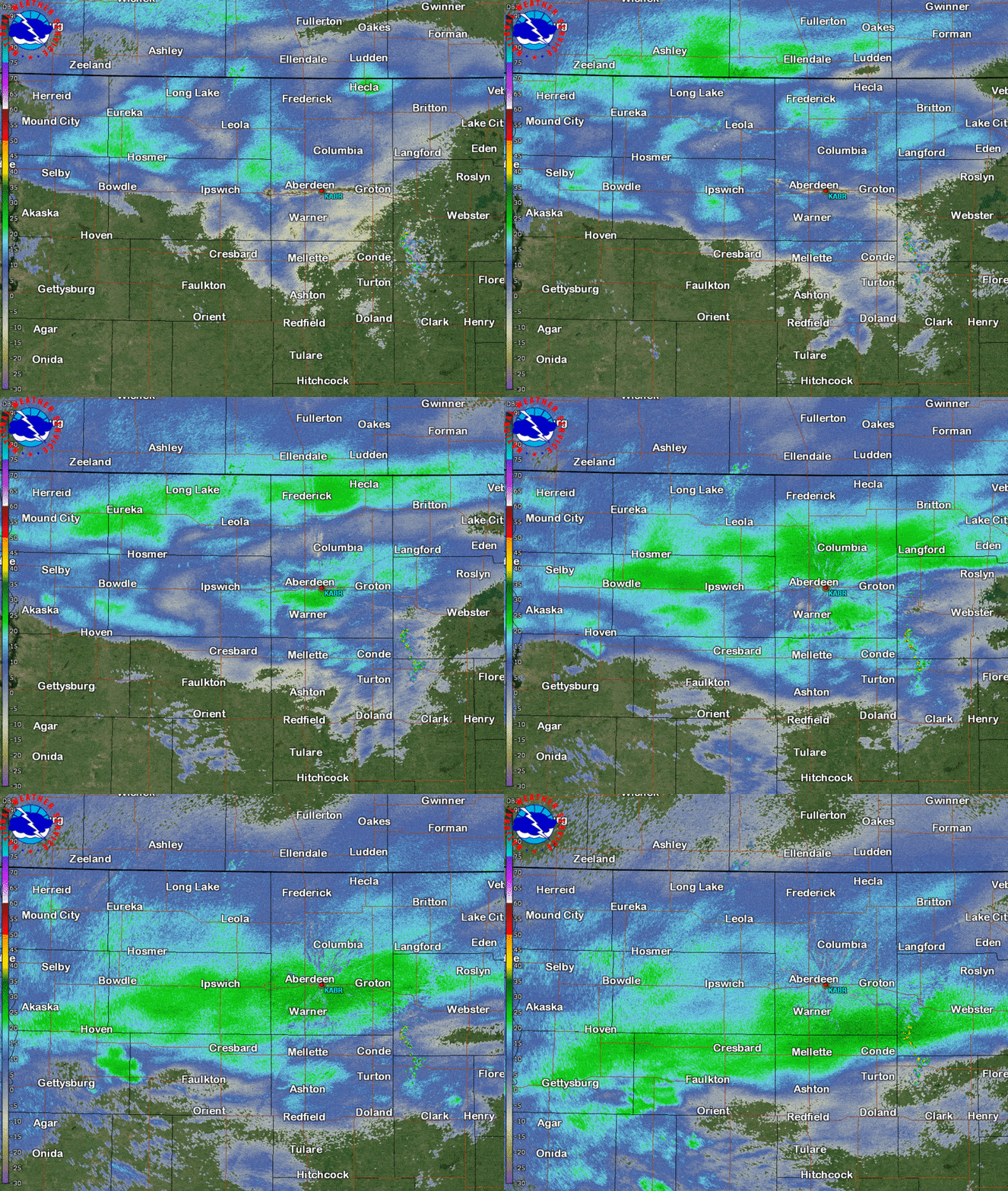
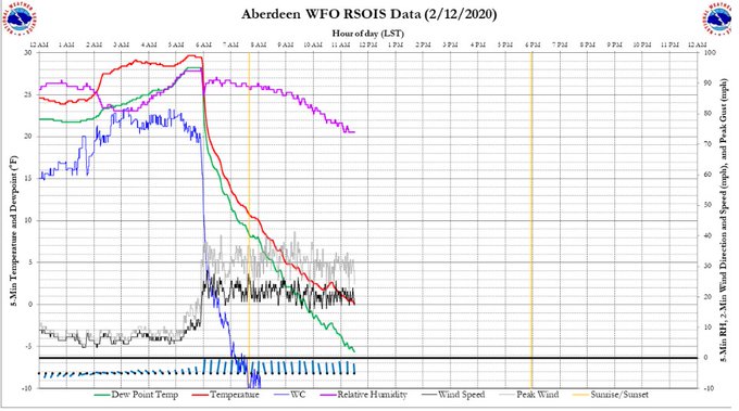
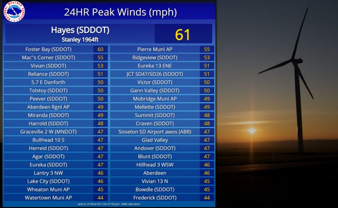
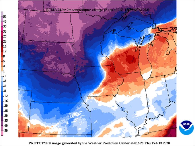
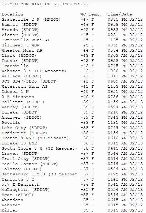
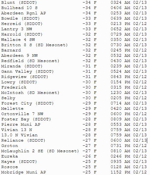
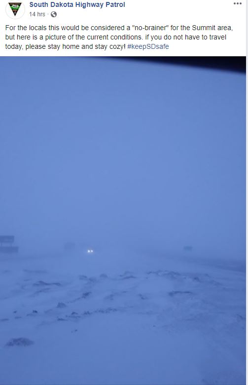
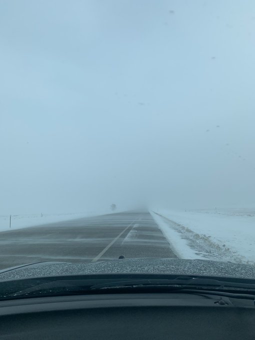
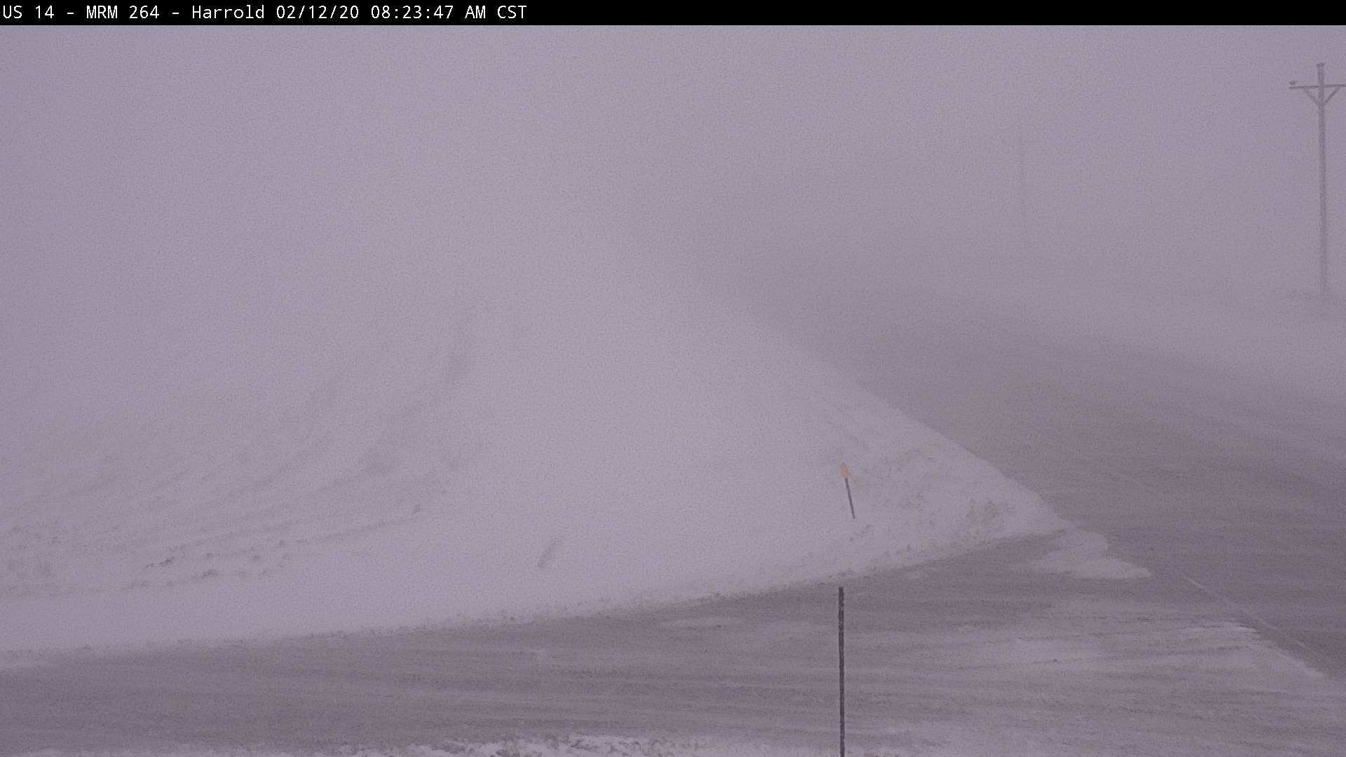
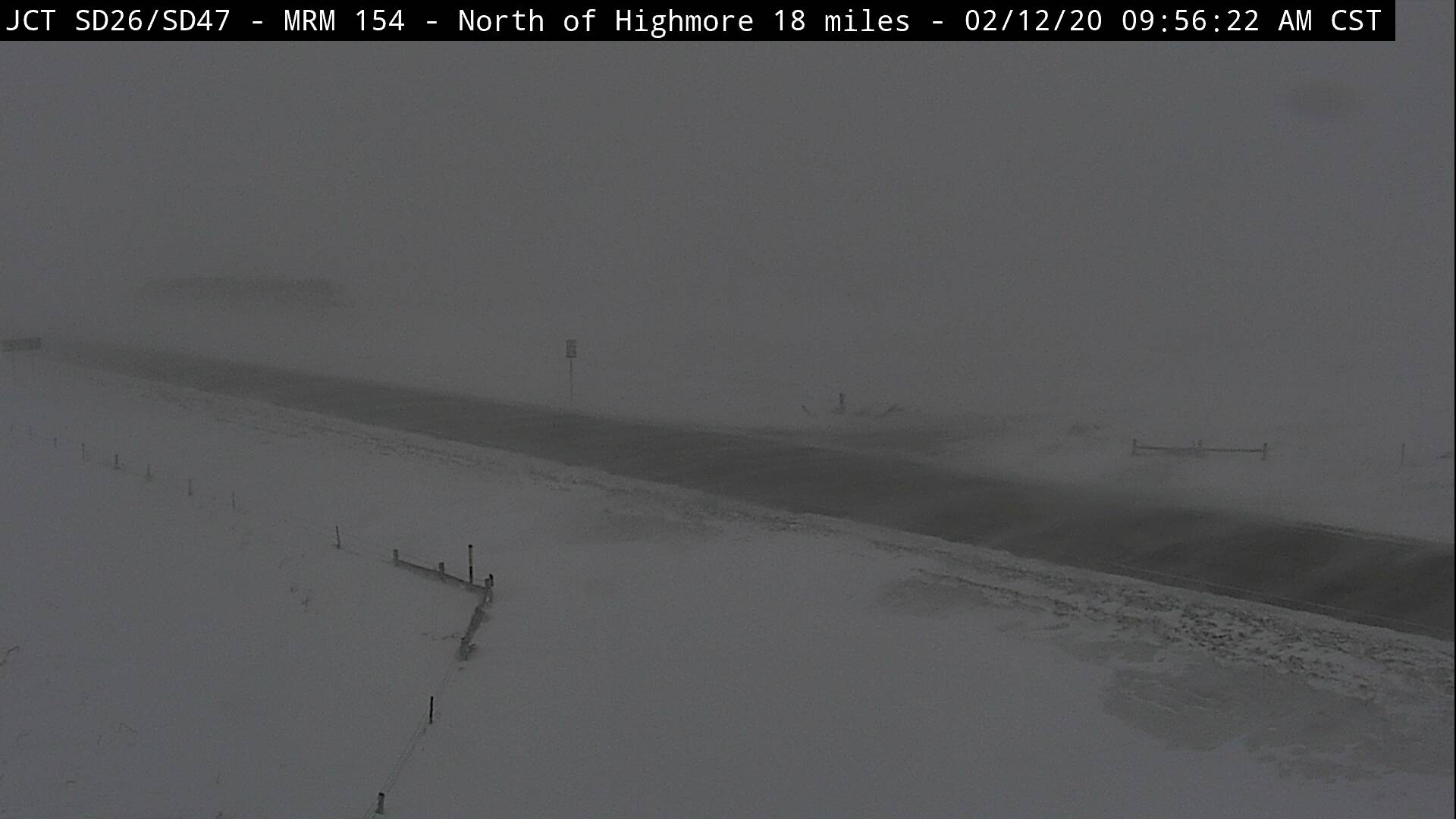
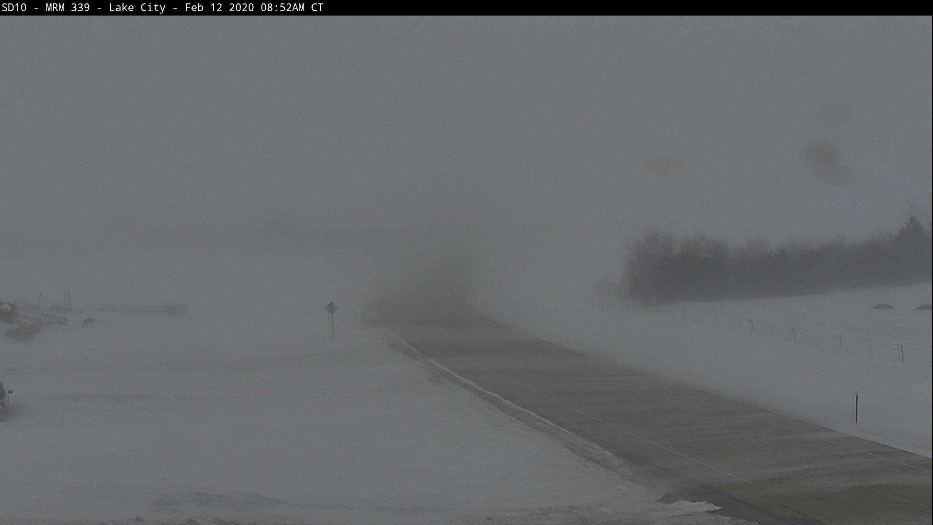
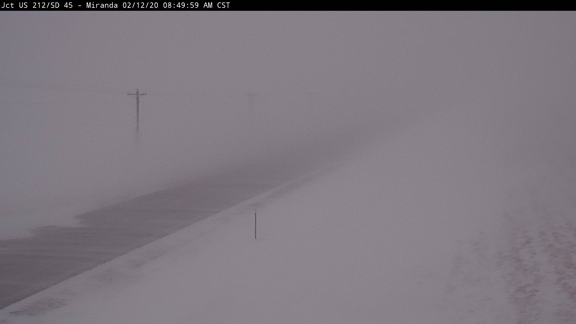
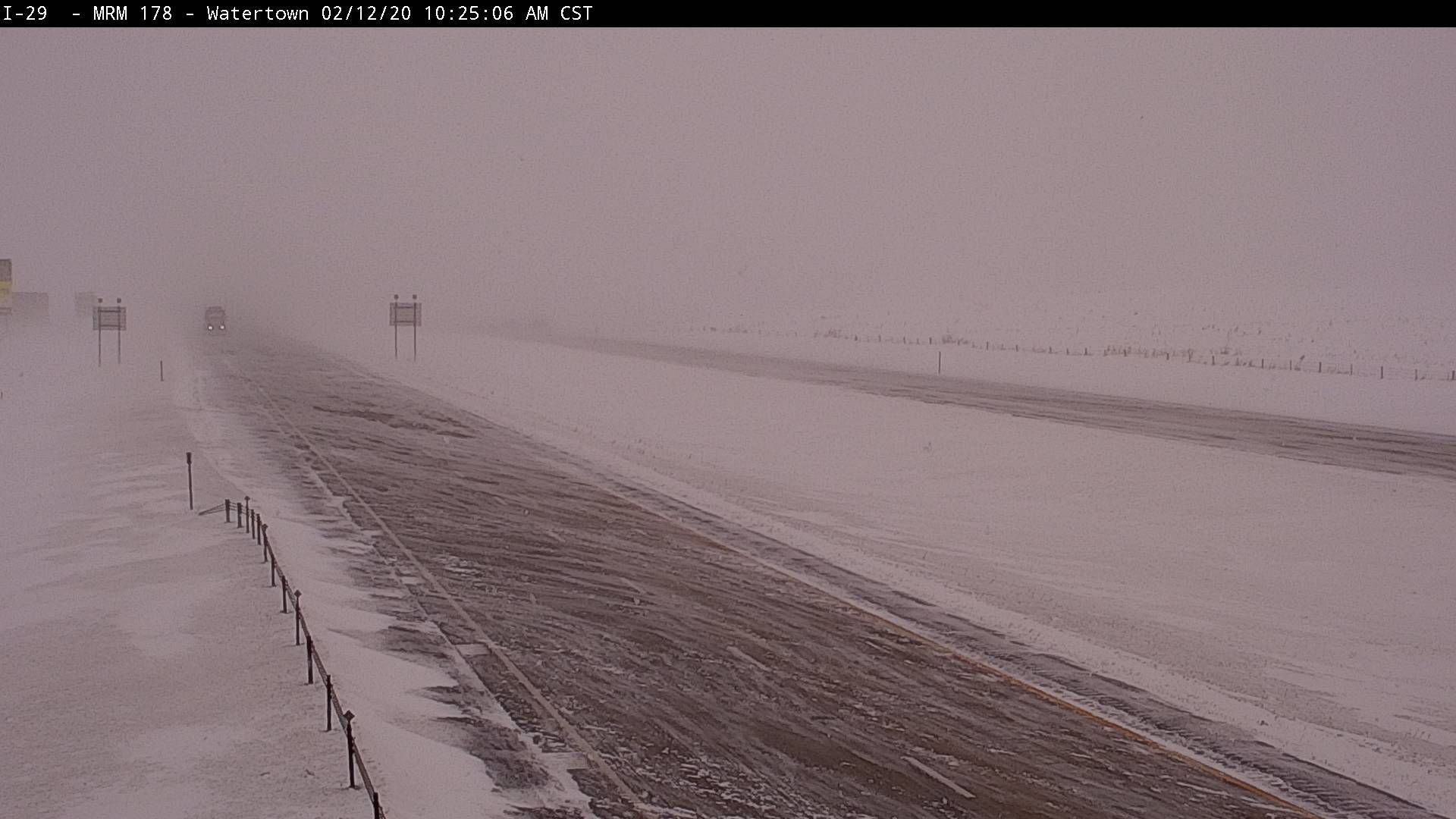
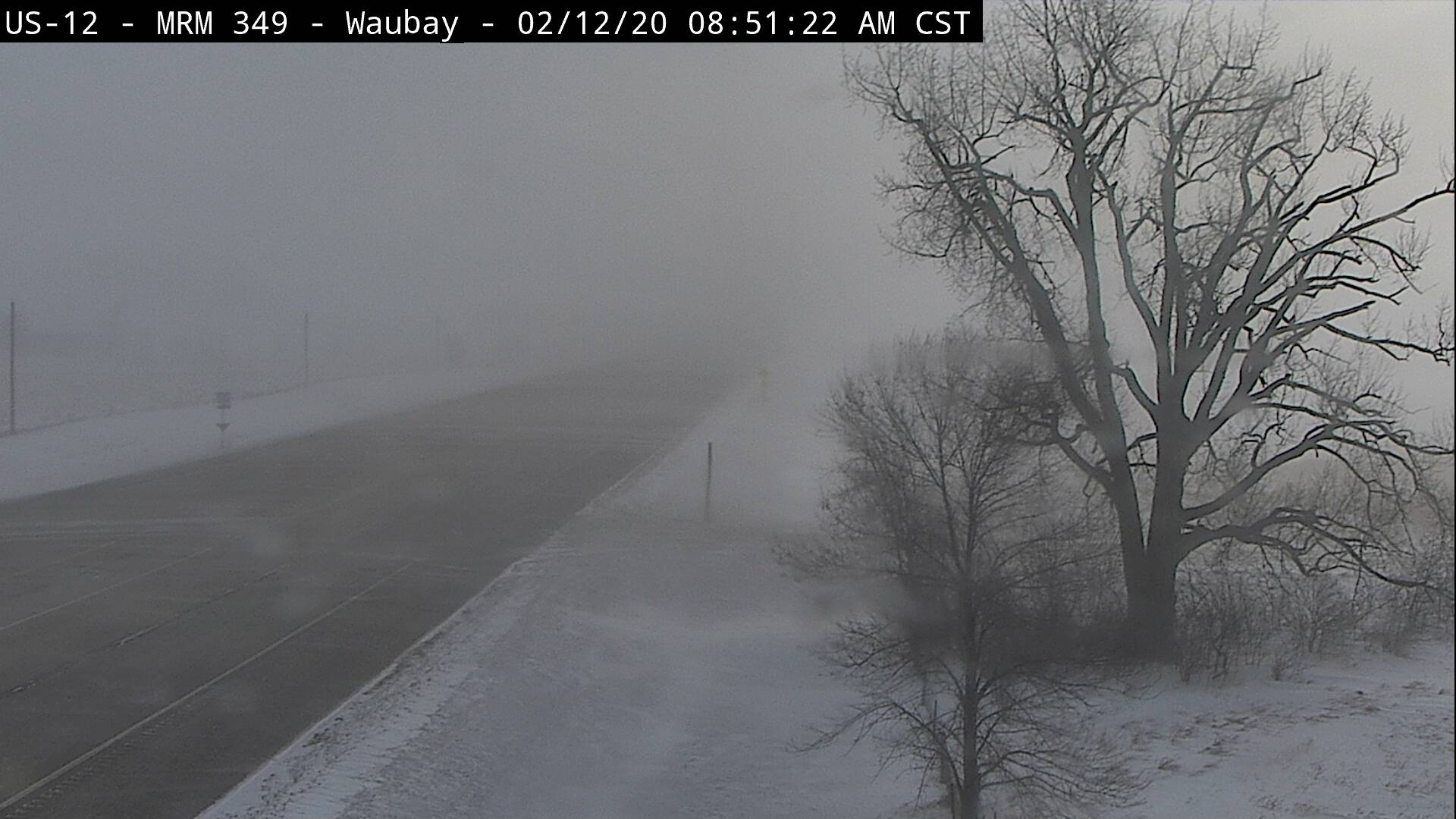
An arctic front raced southward across the Northern Plains during the morning and early afternoon across the area on Wednesday, Feb 12th. This front brought with it very cold air, a trace to ~1" of new snow, and strong wind gusts of 40 to 60 mph. The combination of either new or existing blowable snow (from the Feb 8-9th event) and strong winds led to widespread blizzard or near blizzard conditions during the morning commute. A blizzard by definition requires at least 3 hours of 35+ mph winds and at least 1/4 mile visibility, but even if this time criteria isn't met, conditions can still be extremely dangerous. The SDDOT marked many roads as "No Travel Advised" during the course of the event. By Thursday morning (13th), wind chill values ranged between -30 and -50 F for much of the area.
 |
 |
 |
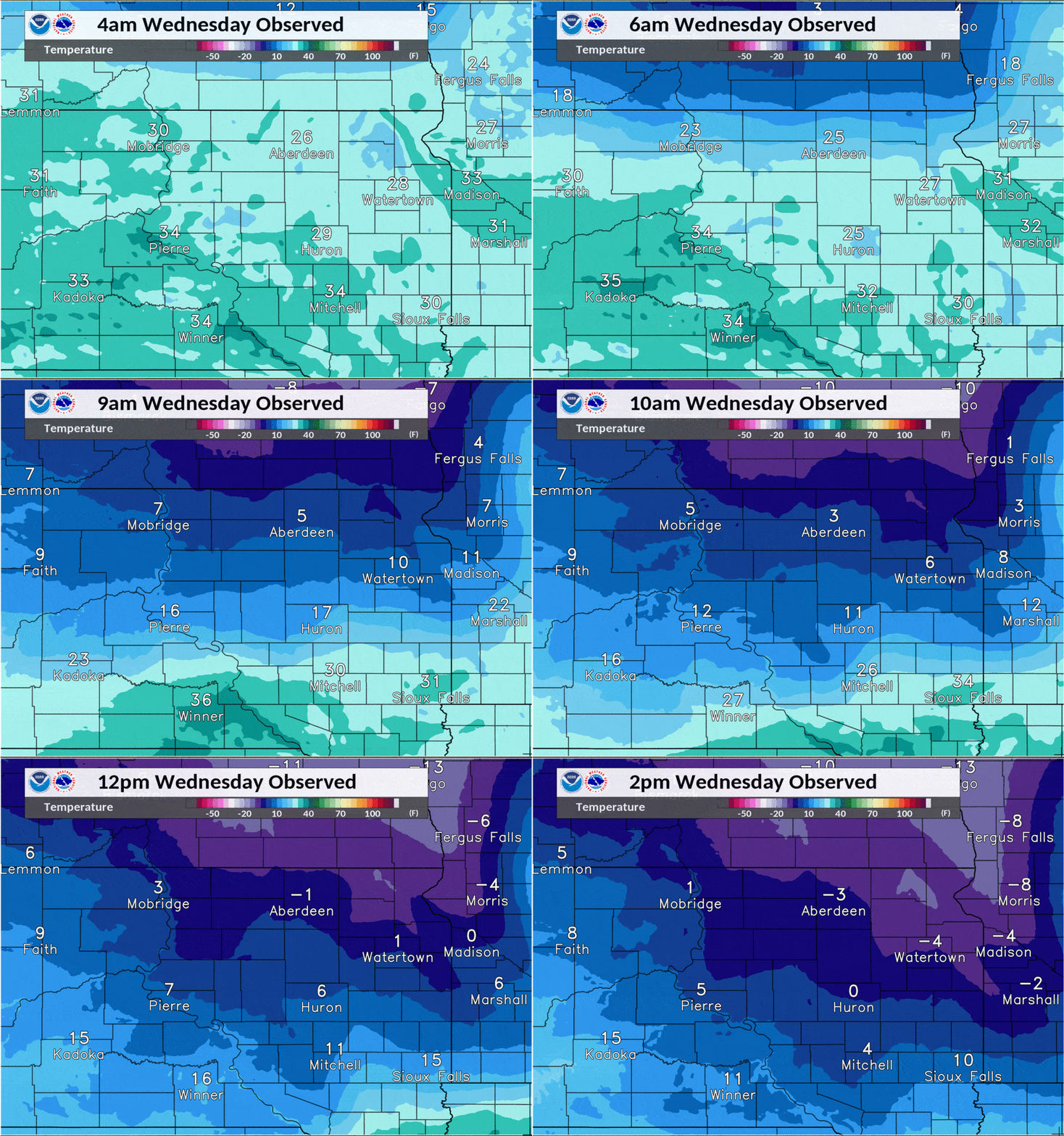 |
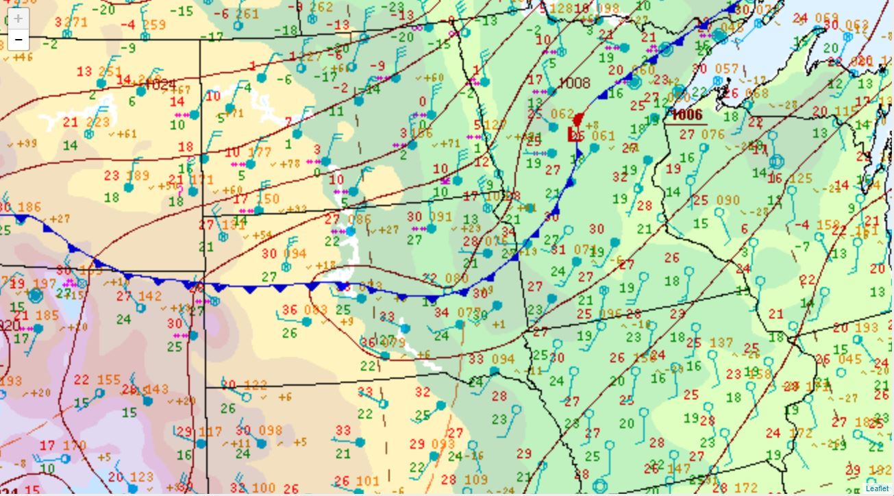
| Surface weather map at 6am on the 12th | Radar reflectivity from 3 to 11am on the 12th | Zoomed-in radar reflectivity from 4:37 to 7:12am, showing an initial fine line (strong wind gusts lofting snow) followed by a heavier band/snow squall | Hourly temperature from 4am to 2pm, showing the rapid advancement of cold air |
 |
 |
 |
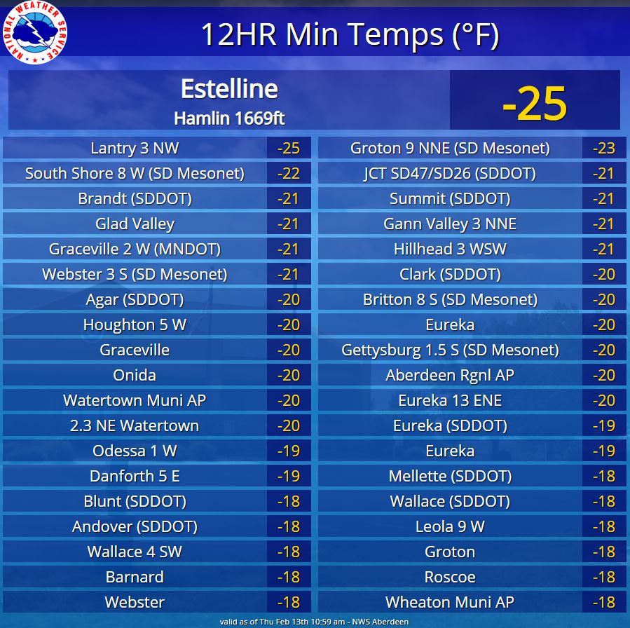 |
| Weather observations at the NWS office in Aberdeen. The red line is temperature - we dropped from 30 to 0 in 6 hours from 6am to noon | Peak wind gusts across the area on the 12th | 24 hour temperature chance across the region, from 8pm on the 11th to 8pm on the 12th, of 30 to 45 degrees | Coldest observed air temperatures over the past 24 hours as of 11am on the 13th |
 |
 |
 |
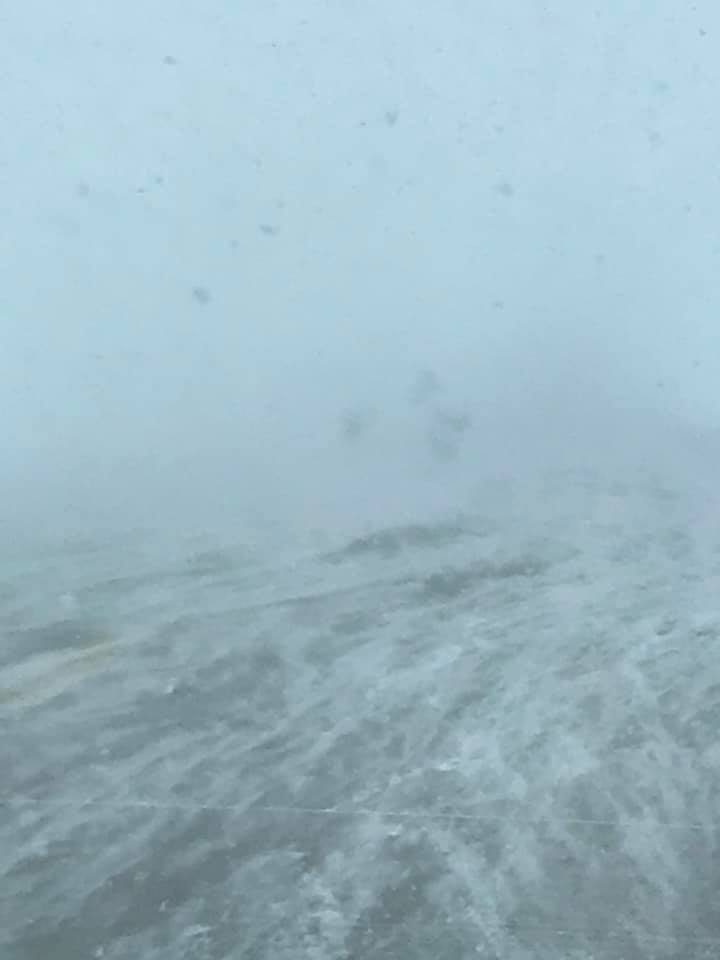 |
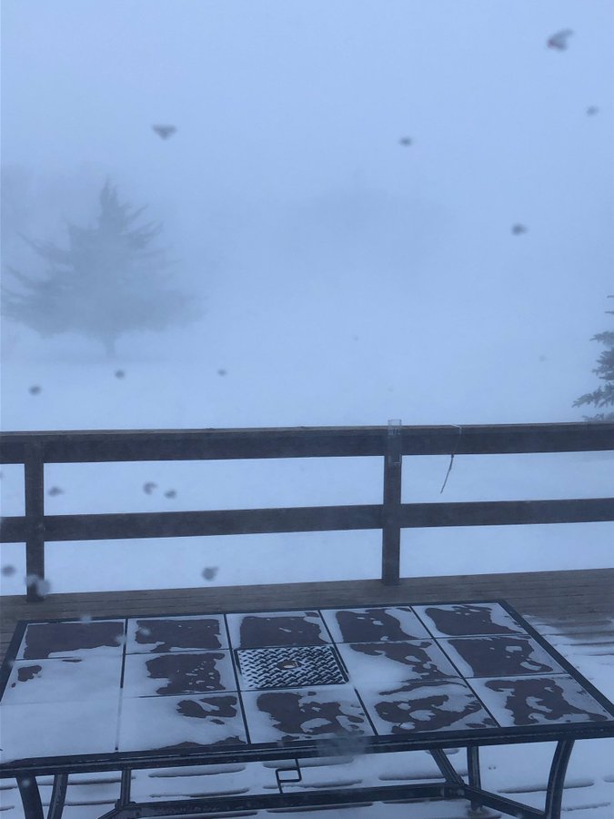
| Coldest observed wind chills over the past 24+ hours as of 11am on the 13th | Coldest observed wind chills over the past 24+ hours as of 11am on the 13th, continued | Significantly reduced visibility at Mellette at 8:50 am, courtesy of Marc @LanceCasual | Significantly reduced visibility on Hwy 81 in the Lake Poinsett area at 11:45 am, courtesy of the Lake Poinsett Estates Campground |
 |
 |
 |
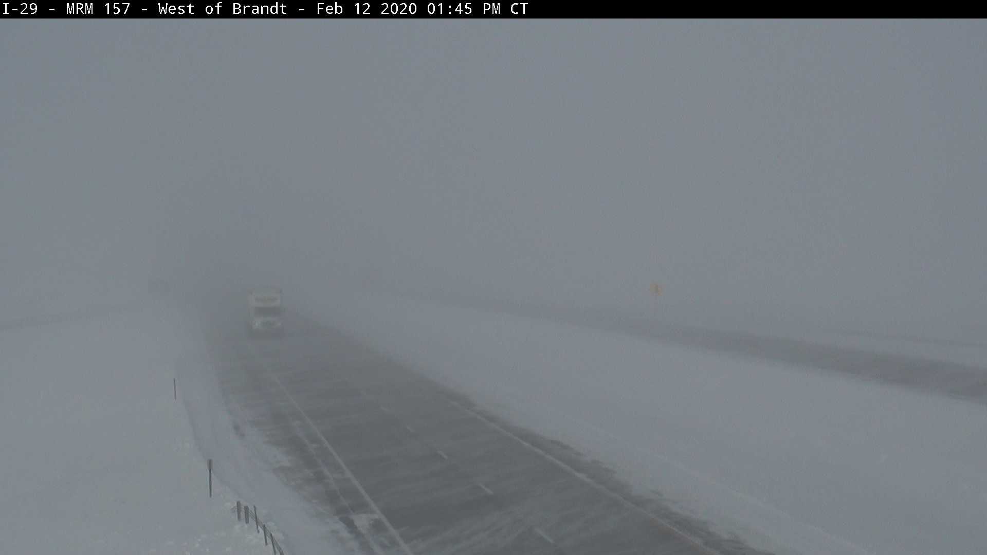 |
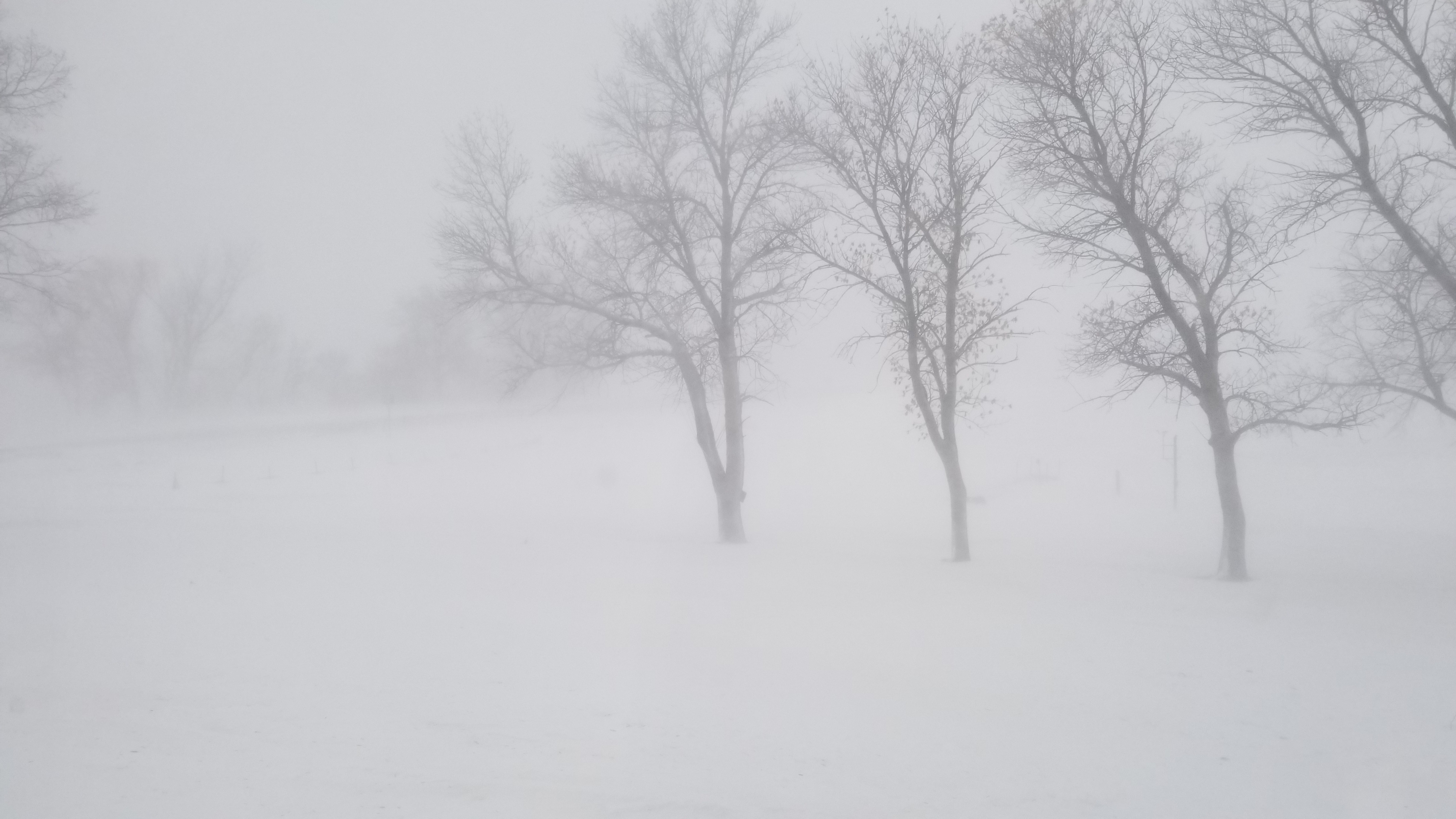
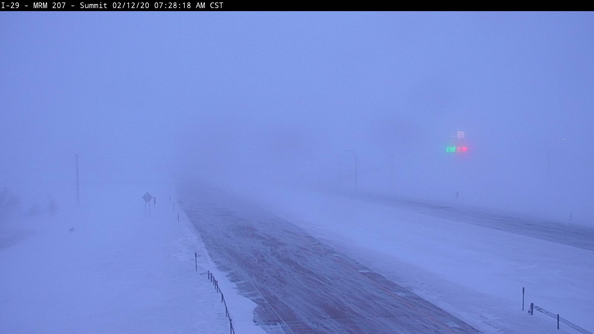
| <1/4 mile visibility at Mina Lake at 8:16 am, courtesy of a NWS employee | Significantly reduced visibility in the Summit area during the morning hours, courtesy of the SD Highway Patrol | Significantly reduced visibility on US281 & US212 near Redfield at 10:30am, courtesy of the SD Highway Patrol | SDDOT cam 9 miles west of Brandt on I-29 at 1:30pm |
 |
 |
 |
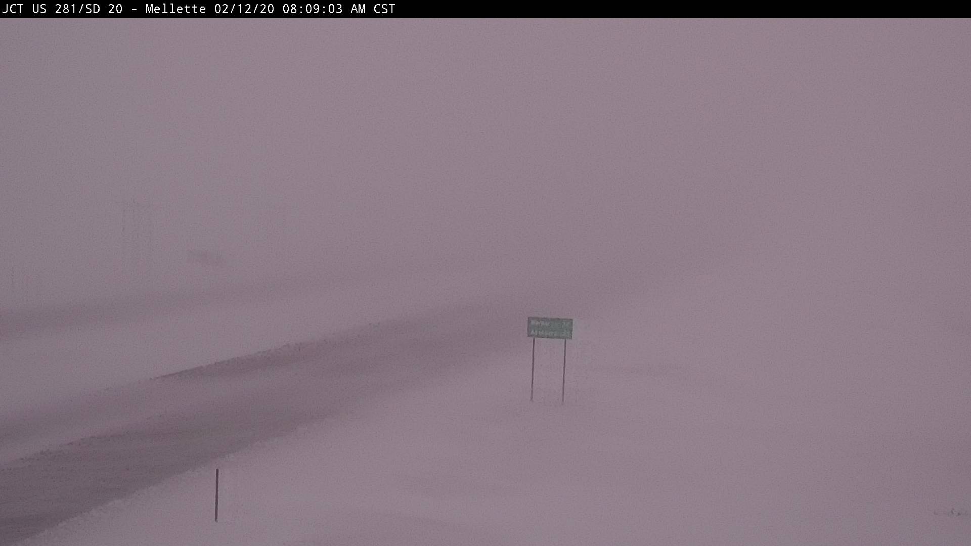 |
| SDDOT cam near Harrold on US14 at 8:30 am | SDDOT cam ~20 miles north of Highmore on SD47 at 10am | SDDOT cam near Lake City on SD10 at 9am | SDDOT cam near Mellette at US281&SD20 at 8:30 am |
 |
 |
 |
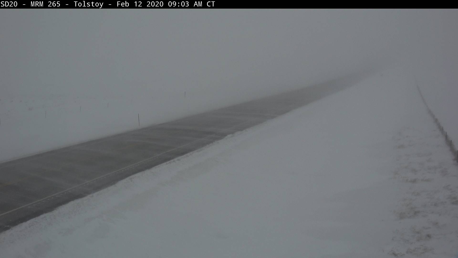 |
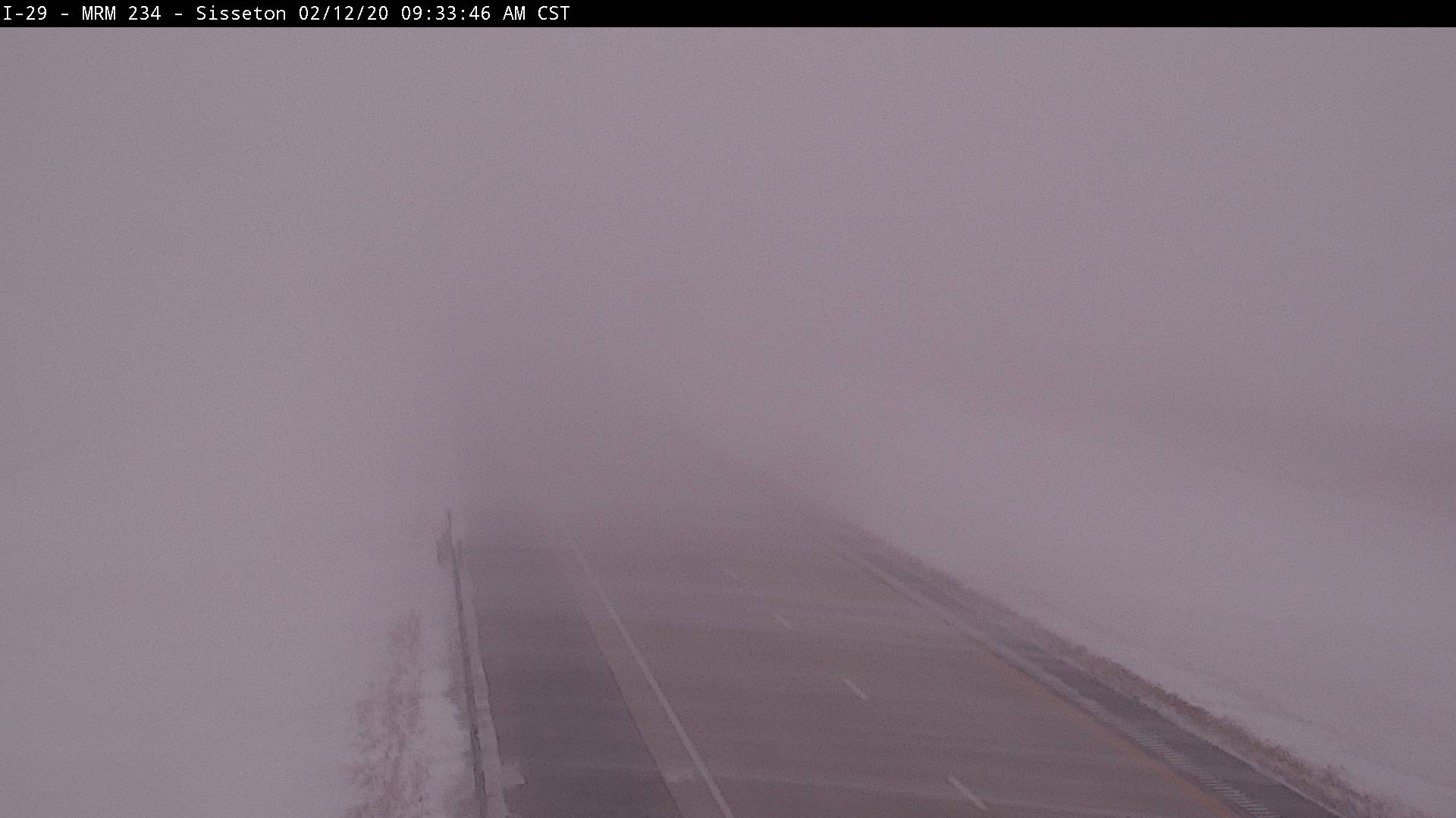
| SDDOT cam near Orient on US212&SD45 at 9am | SDDOT cam near Sisseton on I-29 at 9:30 am | SDDOT cam near Summit on I-29 at 7:30 am | SDDOT cam near Tolstoy on SD20 at 9am |
 |
 |
 |
|
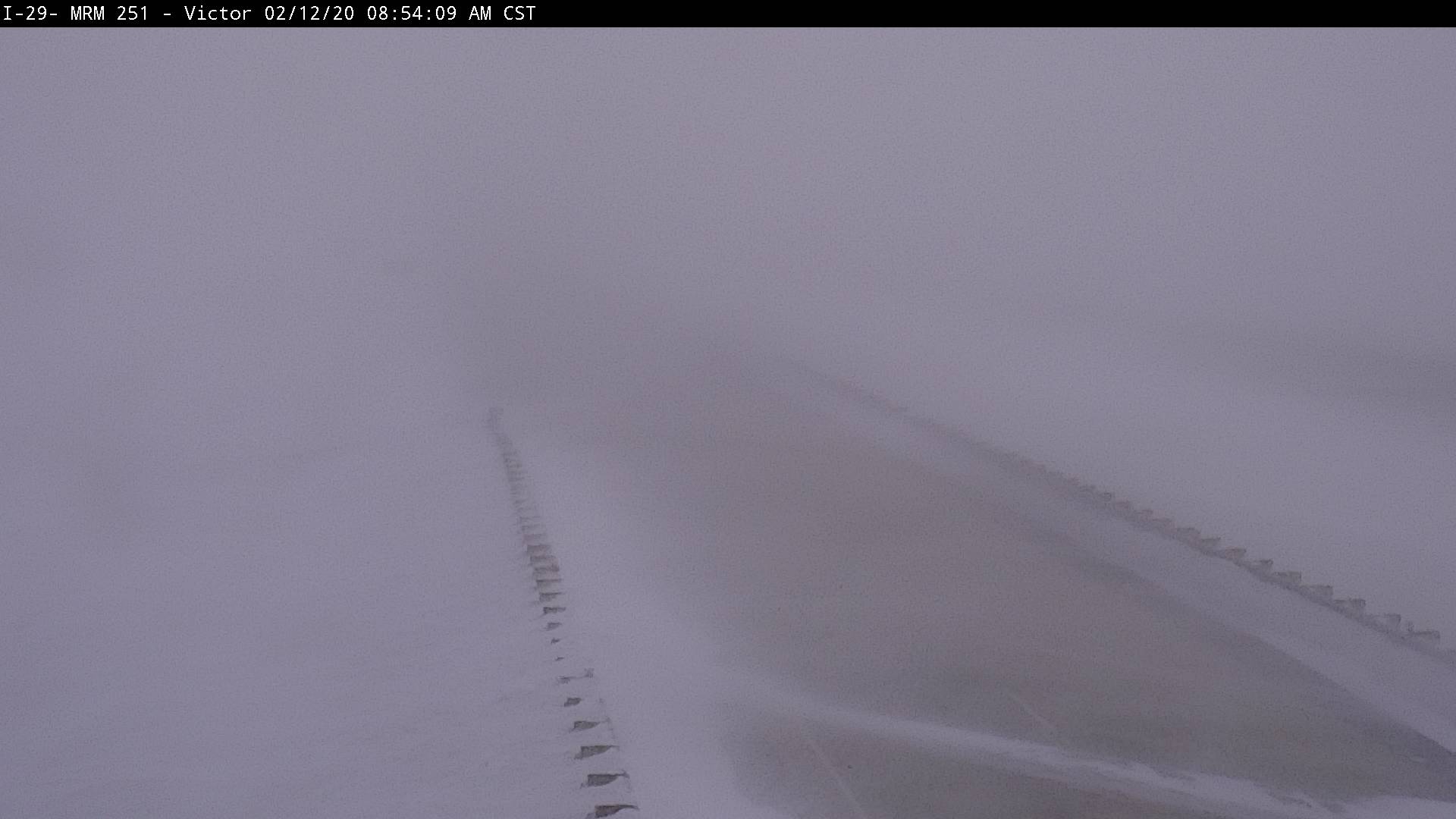
| SDDOT cam near Victor on I-29 at 9am | SDDOT cam near Watertown on I-29 at 10:30 am | SDDOT cam near Waubay on US12 at 9am |
 |
Media use of NWS Web News Stories is encouraged! Please acknowledge the NWS as the source of any news information accessed from this site. |
 |