Overview
|
The first severe weather event of the season across northeast/central South Dakota took place on the afternoon and evening of Sunday, May 22nd. It involved a few severe wind/hail reports as well as a brief landspout tornado. It was part of a much larger, broader outbreak of severe weather that stretched from Canada to Mexico, as seen at the right. The severe weather season began unusually quiet across the area. This event led to the first NWS Aberdeen Severe Thunderstorm or Tornado warning of 2016 across our County Warning Area, which tied a record for latest first warning to start a season (since 1986). |
.JPG) Caption |
Tornadoes:
|
Tornado - 8 mi northeast of Herreid, SD
Track Map 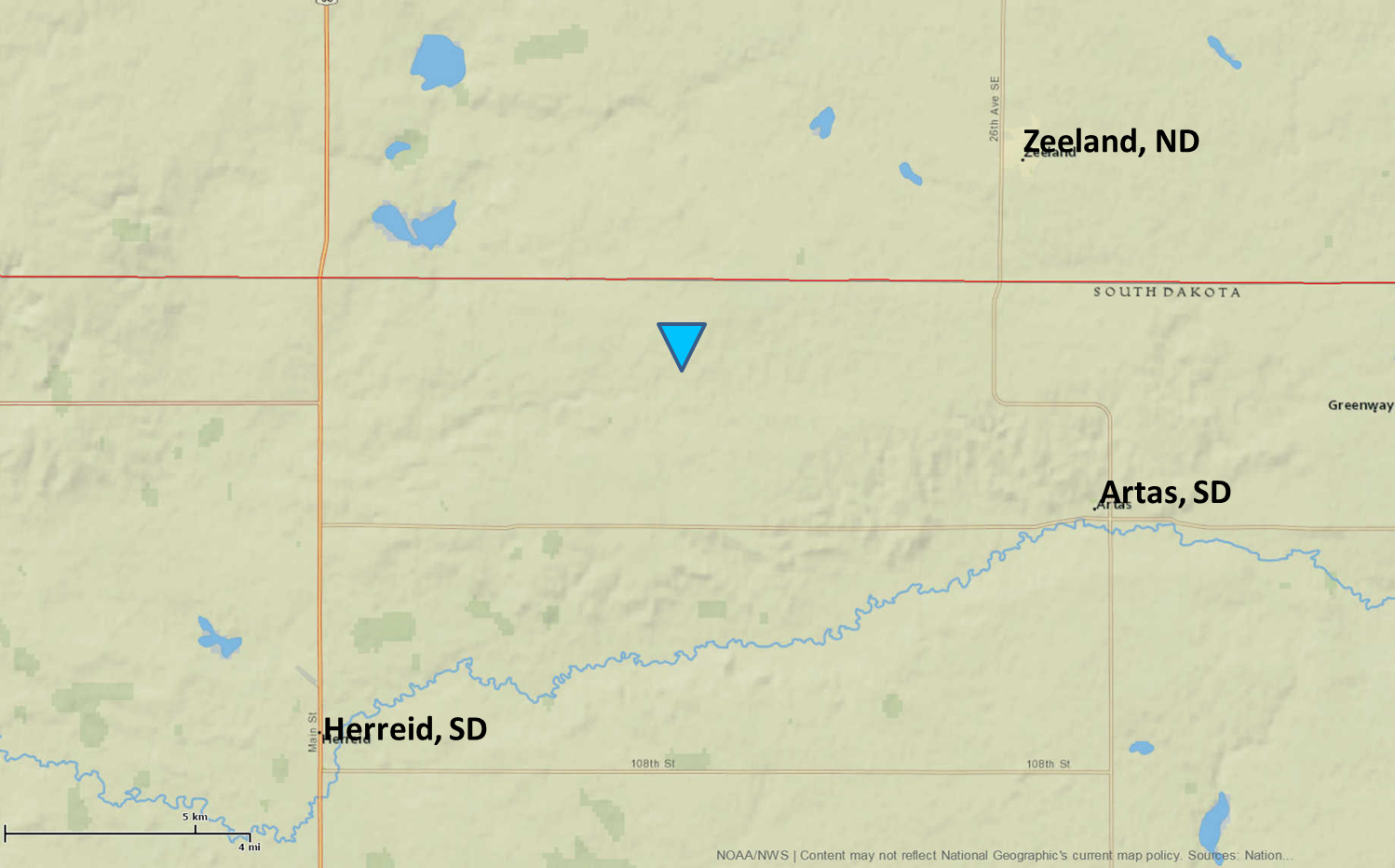 
Downloadable KMZ File |
||||||||||||||||
The Enhanced Fujita (EF) Scale classifies tornadoes into the following categories:
| EF0 Weak 65-85 mph |
EF1 Moderate 86-110 mph |
EF2 Significant 111-135 mph |
EF3 Severe 136-165 mph |
EF4 Extreme 166-200 mph |
EF5 Catastrophic 200+ mph |
 |
|||||
Wind & Hail:
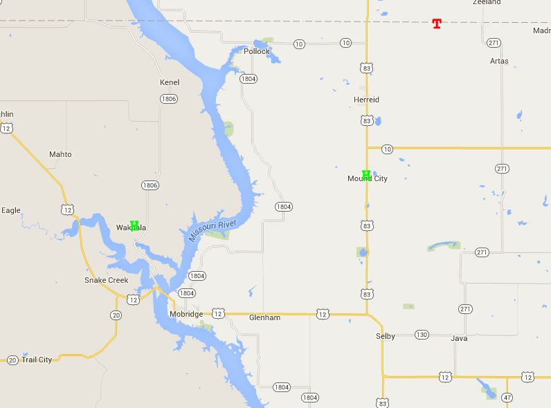
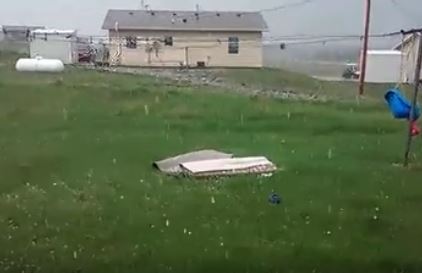
Storms that first developed during peak heating in the late afternoon possesed the largest threat for large hail. This took place across central South Dakota, and a couple reports of severe quarter sized hail (1 inch diameter) occurred in both Wakpala and Mound City. The image on the right is from Wakpala, courtesy of Laura Grijalva.
Hail
 |
 |
| Spc Storm Reports |
Wind
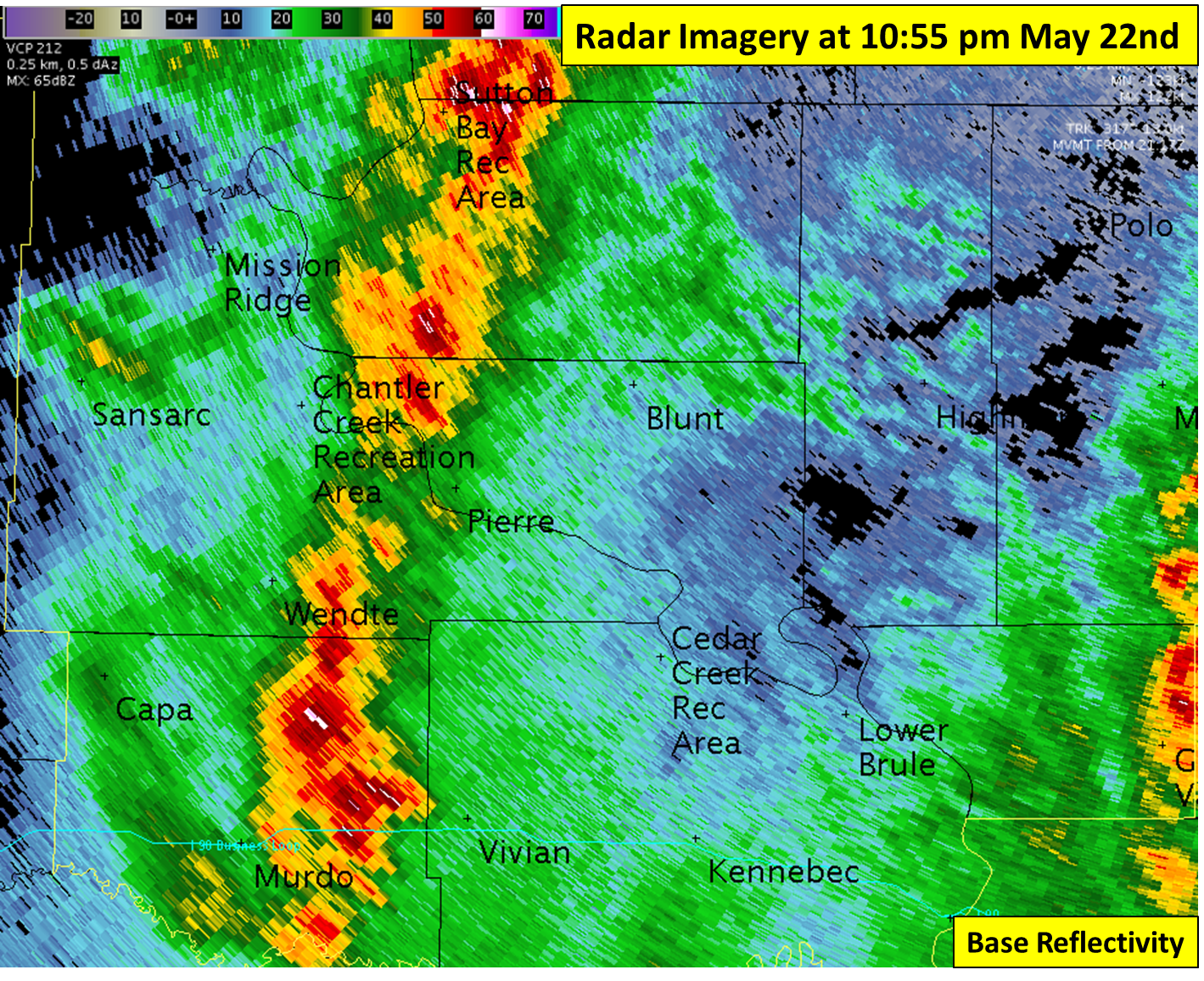
Once the initial storm cells across central South Dakota congealed and developed into a line later in the evening, the threat for hail decreased but the threat for strong winds increased. At 10:53 pm CDT, Pierre recorded a wind gust of 61 mph, and wind gusts in the mid 50 mph range continued as storms propogated east. For reference, severe thunderstorm criteria winds are 58 mph.
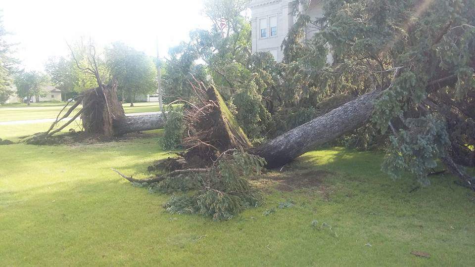
The most significant wind damage was reported in the city of Highmore late Sunday night. Structural damage was reported to the to the football field crows nest and bleachers. The strong winds also uprooted 40' pine trees at the courthouse and snapped branches off other trees. Finally, a liquid pump shed was blown down, damaging pipes and resulting in a 5000+ gallon chemical spill.
 |
 |
 |
 |
| Damage to football field | Damage to football field | Uprooted trees | Uprooted trees |
By the time storms reached the James River Valley area by around midnight, they had all but collapsed. However, a wind gust of 57 mph was recorded at the Aberdeen airport at 12:19 am early Monday morning. These winds were not produced by thunderstorms, but rather the low level jet - an area of strong southerly winds that typically develops above the surface during the night. In this case, these winds were brought down to the surface.
 |
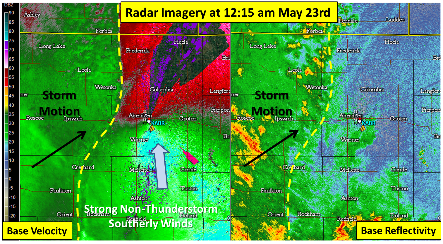 |
| Radar Imagery focused on Pierre | Radar Imagery focused on Aberdeen |
Photos & Video:
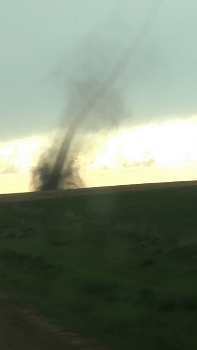
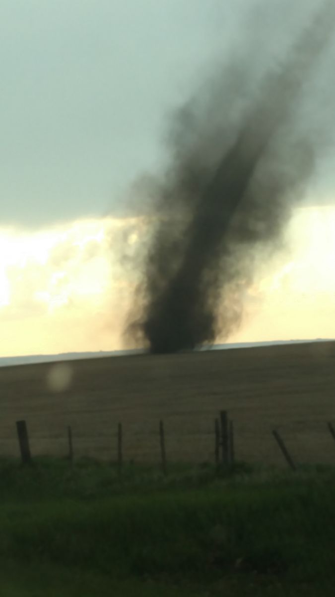
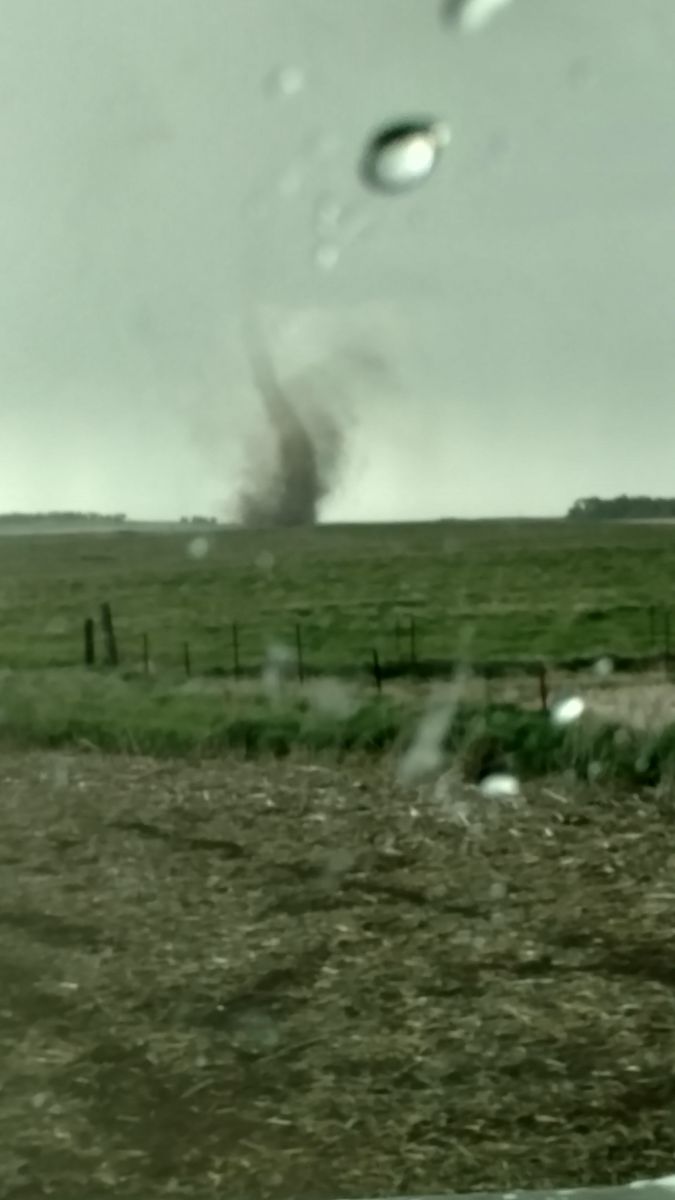
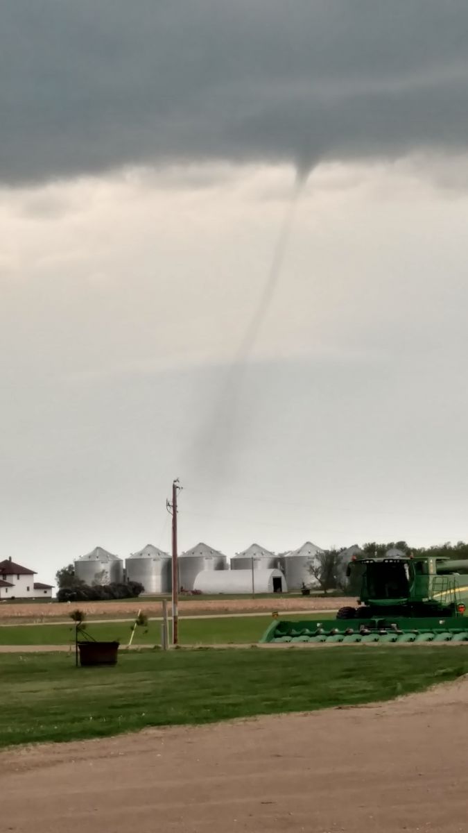
The Herreid Landspout - all photos and video courtesy of Josh Sayler
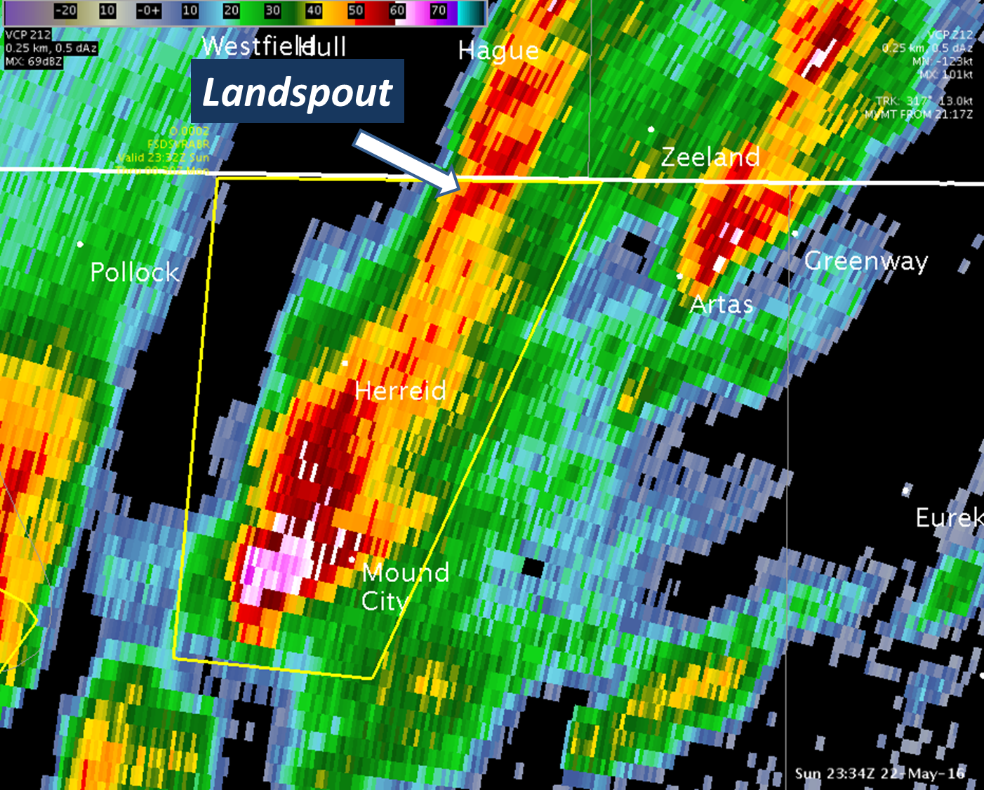
Landspouts are tornadoes, but different from the type that you'd normally think of. While typical tornadoes develop from rotating supercell thunderstorms and can last for an hour or more and produce EF-5 damage in extreme cases, landspouts develop when a thunderstorm updraft stretches and thus concentrates a relatively broad area of rotation. Think of a skater who begins to spin on ice with arms out, rotation is fairly slow, but as the skater pulls their arms in the speed of rotation increases. The same principle applies to landspouts (and waterspouts). Notice the radar image below - the storm responsible doesn't look very menacing, and no rotation was detected. This is why it's important to be in a safe place even during severe thunderstorm warnings. Landspouts are by nature are less of a threat than supercell tornadoes both in duration and intensity, but they are still very dangerous and fully capable of tearing a roof off of a home.
 |
 |
 |
 |
 |
 |
.gif) |
 |
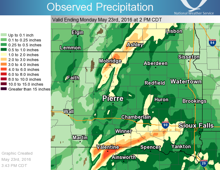
Rain Reports
After a dry spell, many locations received beneficial rains of at least a quarter inch.
 |
Media use of NWS Web News Stories is encouraged! Please acknowledge the NWS as the source of any news information accessed from this site. |
 |