Overview
| An environment favorable for intense thunderstorm development was in place across the area on Thursday, June 4th. While fairly isolated, thunderstorms that did become established produced a large degree of damage, most notably from Brown County east-southeastward through Deuel County and beyond. Measured wind gusts ranged from 50 to 95 mph, with even greater wind speeds likely at some locations. While damage was caused by straight-line winds (meaning no rotation), the wind speeds alone would fall into an EF1 tornado category. Downed power lines, uprooted trees, and even structural damage was reported in the wake of this storm as a result. | 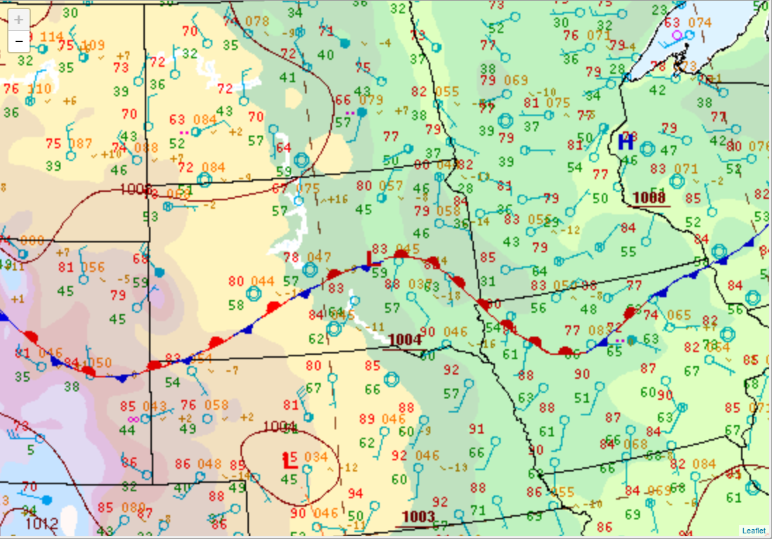 Surface weather map at 7pm on June 4th, 2020 |
Wind & Hail:
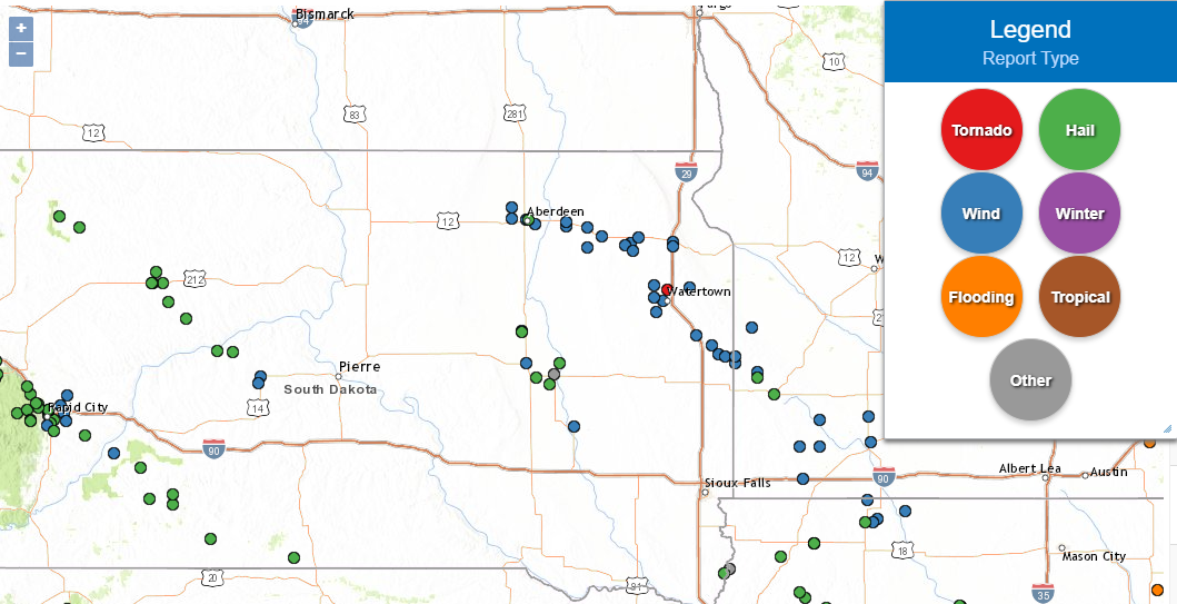
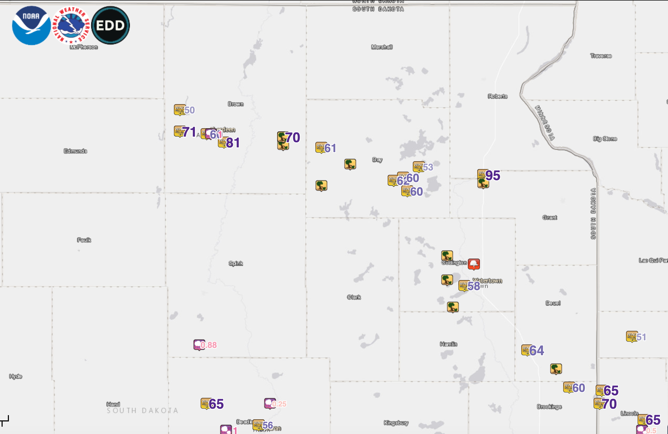
Storm Reports
 |
 |
||
| An overview of reports across the region here | A closer look at reports across Northeastern South Dakota |
Find a listing of the latest preliminary reports below:
PRELIMINARY LOCAL STORM REPORT...SUMMARY
NATIONAL WEATHER SERVICE ABERDEEN SD
1225 PM CDT FRI JUN 5 2020
..TIME... ...EVENT... ...CITY LOCATION... ...LAT.LON...
..DATE... ....MAG.... ..COUNTY LOCATION..ST.. ...SOURCE....
..REMARKS..
0655 PM TSTM WND GST 5 W HAYES 44.37N 101.13W
06/04/2020 M60 MPH STANLEY SD MESONET
0826 PM HAIL 3 NW SPOTTSWOOD 44.68N 98.54W
06/04/2020 M0.88 INCH SPINK SD CO-OP OBSERVER
WIND GUST REPORTED AT 53 MPH AT 817PM.
0817 PM TSTM WND GST 3 NNW SPOTTSWOOD 44.69N 98.54W
06/04/2020 M53 MPH SPINK SD COCORAHS
MEASURED G53MPH AT 817PM CDT, ALSO HAD HAIL
UP TO NICKEL-SIZE AND 0.71 INCHES OF
RAINFALL.
0840 PM TSTM WND GST 1 WNW SUMMIT 45.31N 97.05W
06/04/2020 M95 MPH ROBERTS SD MESONET
CORRECTS PREVIOUS NON-TSTM WND GST REPORT
FROM 1 WNW SUMMIT. MESONET STATION 55 SUMMIT
(SDDOT).
0900 PM TSTM WND GST 3 S TROY 44.99N 96.88W
06/04/2020 E60 MPH GRANT SD TRAINED SPOTTER
PEA-SIZED HAIL; 0.40IN OF RAIN; LOST POWER
FOR APPX 30 MIN LAST NIGHT.
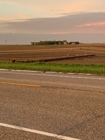
0831 PM TSTM WND DMG 2 SSW SUMMIT 45.28N 97.05W
06/04/2020 GRANT SD EMERGENCY MNGR
SEMI WITH BACK TRAILER BLOWN OVER ON
INTERSTATE.
0931 PM TSTM WND DMG 2 NW TORONTO 44.59N 96.67W
06/04/2020 DEUEL SD MESONET
51 MPH REPORTED IN TORONTO.
0921 PM TSTM WND GST 7 NE ESTELLINE 44.66N 96.82W
06/04/2020 M64 MPH DEUEL SD MESONET
0822 PM TSTM WND GST 3 SE WEBSTER 45.30N 97.47W
06/04/2020 E60 MPH DAY SD PUBLIC
50 TO 60 MPH WINDS REPORTED.
0819 PM TSTM WND GST 4 W WAUBAY 45.34N 97.39W
06/04/2020 M53 MPH DAY SD MESONET
MESONET STATION 182 WAUBAY (SDDOT).
0805 PM TSTM WND GST 3 S WEBSTER 45.29N 97.52W
06/04/2020 M62 MPH DAY SD MESONET
0800 PM TSTM WND GST 3 S WEBSTER 45.29N 97.52W
06/04/2020 M58 MPH DAY SD MESONET
MESONET STATION WEBS2 WEBSTER 3 S (SD
MESONET).
0800 PM TSTM WND GST 7 SSE WEBSTER 45.25N 97.45W
06/04/2020 E60 MPH DAY SD TRAINED SPOTTER
0743 PM TSTM WND DMG BRISTOL 45.35N 97.75W
06/04/2020 DAY SD EMERGENCY MNGR
SEVERAL TREES AND POWER LINES DOWN.
0739 PM TSTM WND GST ANDOVER 45.41N 97.90W
06/04/2020 M61 MPH DAY SD MESONET
MESONET STATION 45 ANDOVER (SDDOT).
0730 PM TSTM WND DMG 8 NNE CRANDALL 45.27N 97.90W
06/04/2020 DAY SD EMERGENCY MNGR
MACHINE SHOP DESTROYED. TIME ESTIMATED FROM
RADAR.
0844 PM TSTM WND GST 1 SE WATERTOWN 44.90N 97.15W
06/04/2020 M58 MPH CODINGTON SD ASOS
ASOS STATION KATY WATERTOWN MUNI AP.
0838 PM TSTM WND DMG 4 N THOMAS 44.82N 97.21W
06/04/2020 CODINGTON SD PUBLIC
TREES UPROOTED. FENCING TORN UP. ATTACHED
GARAGE PUSHED OFF FOUNDATION. MACHINE SHOP
ROOF BLOWN AWAY.
0834 PM FUNNEL CLOUD 1 WNW RAUVILLE 44.98N 97.10W
06/04/2020 CODINGTON SD TRAINED SPOTTER
0830 PM TSTM WND DMG 2 N SANDY SHORE STATE P 44.92N 97.24W
06/04/2020 CODINGTON SD PUBLIC
A LOT OF TREES DOWN, INCLUDING COTTONWOOD
AND EVERGREENS. TIME ESTIMATED BY RADAR.
0822 PM TSTM WND DMG 5 SE FLORENCE 45.01N 97.24W
06/04/2020 CODINGTON SD EMERGENCY MNGR
SEVERAL TREES DOWN ACROSS THE NORTHWESTERN
PORTIONS OF CODINGTON COUNTY.
0719 PM TSTM WND DMG GROTON 45.45N 98.10W
06/04/2020 BROWN SD EMERGENCY MNGR
APARTMENT BUILDING DAMAGED. TREES DOWN.
0719 PM TSTM WND GST GROTON 45.45N 98.10W
06/04/2020 E70 MPH BROWN SD LAW ENFORCEMENT
60 TO 70 MPH WINDS REPORTED.
0719 PM TSTM WND DMG 2 S GROTON 45.42N 98.10W
06/04/2020 BROWN SD LAW ENFORCEMENT
SEVERAL POWER POLES LEANING OR BROKEN, AND
TREES DOWN.
0703 PM TSTM WND GST 4 ESE ABERDEEN 45.43N 98.41W
06/04/2020 M81 MPH BROWN SD ASOS
0659 PM TSTM WND GST 1 SW ABERDEEN 45.46N 98.50W
06/04/2020 E60 MPH BROWN SD NWS EMPLOYEE
PEA SIZED HAIL ALSO REPORTED.
0659 PM HAIL ABERDEEN 45.46N 98.48W
06/04/2020 E1.00 INCH BROWN SD PUBLIC
0645 PM TSTM WND GST 5 SSW RICHMOND LAKE REC 45.47N 98.64W
06/04/2020 M71 MPH BROWN SD MESONET
CORRECTS PREVIOUS NON-TSTM WND GST REPORT
FROM 5 SSW RICHMOND LAKE REC AREA. MESONET
STATION EW5307 ABERDEEN.
0644 PM TSTM WND GST 2 W RICHMOND LAKE REC A 45.55N 98.64W
06/04/2020 M50 MPH BROWN SD NWS EMPLOYEE
0 MILE VISIBILITY IN HEAVY RAIN.
0703 PM TSTM WND DMG 6 NNW BUNKER 44.32N 101.15W
06/04/2020 STANLEY SD PUBLIC
WINTER WHEAT FIELD CROP DAMAGE. PEA-SIZE
HAIL ALSO OCCURRED.
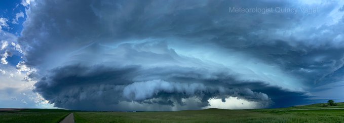
Photos
Thanks to everyone who submitted photos and reports through the course of and after this event.
 |
 |
 |
 |
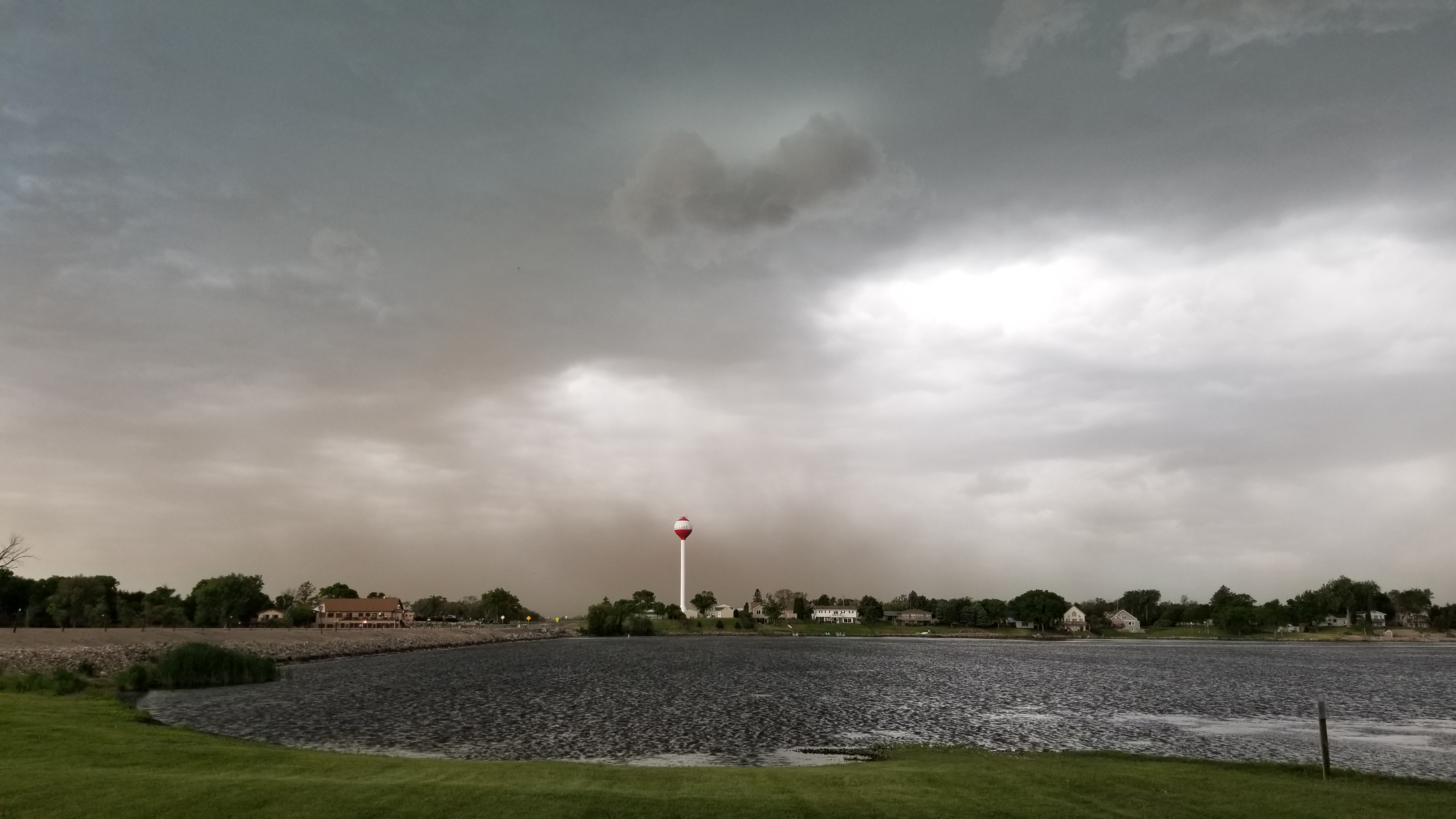
| Hayes, SD at 5:58 pm. Photo courtesy of Quincy Vagell | Storm with dust approaching Richmond Lake, from NWS employee | Storm with dust approaching Mina Lake at 6:30pm, from NWS employee | 6" tree limb down in Aberdeen, from NWS employee |
 |
 |
 |
 |
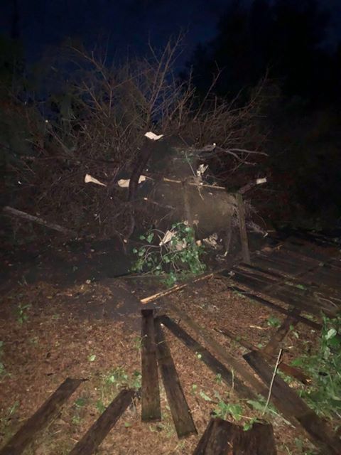
| Pile of sub-severe hail in Aberdeen, from NWS employee | Power lines down 2 miles south of Groton, courtesy of SD Highway Patrol | Power lines down 2 miles south of Groton, courtesy of SD Highway Patrol | Tree damage 2 miles south of Groton, courtesy of SD Highway Patrol |
 |
 |
 |
 |
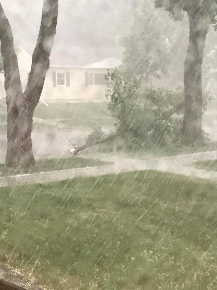
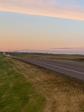
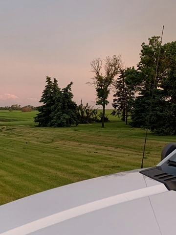
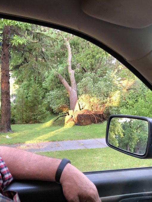
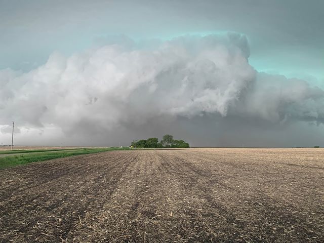
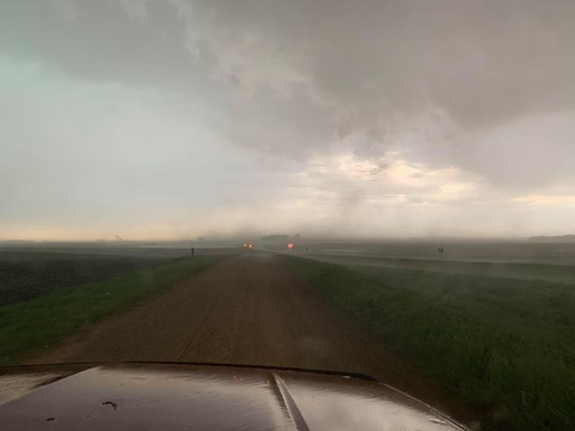
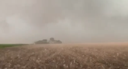
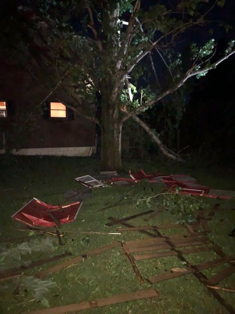
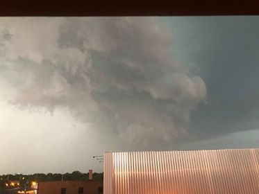
| Storm approaching Bristol, courtesy of Devon Huwe | Uprooted tree in Bristol, courtesy of @skh_28 | Storm approaching Valley Township south of Bristol, courtesy of Jordan Schmieg | Storm approaching Valley Township south of Bristol, courtesy of Jordan Schmieg |
 |
 |
 |
 |
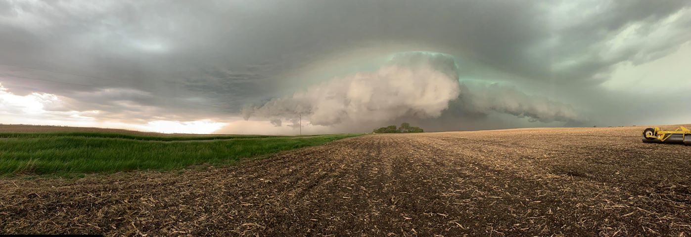
| Storm over Valley Township south of Bristol, courtesy of Jordan Schmieg | Storm over Valley Township south of Bristol, courtesy of Jordan Schmieg | Semi overturned on I-29 4 miles south of Summit, courtesy of SD Highway Patrol | Semi overturned on I-29 4 miles south of Summit, courtesy of SD Highway Patrol |
 |
 |
 |
 |
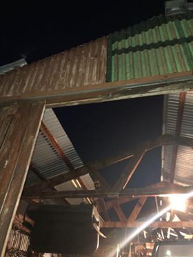
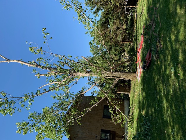
| Storm damage 4 miles north of Thomas, courtesy of Breanna Beebe | Storm damage 4 miles north of Thomas, courtesy of Breanna Beebe | Storm damage 4 miles north of Thomas, courtesy of Breanna Beebe | Storm damage 4 miles north of Thomas, courtesy of Breanna Beebe |
 |
 |
 |
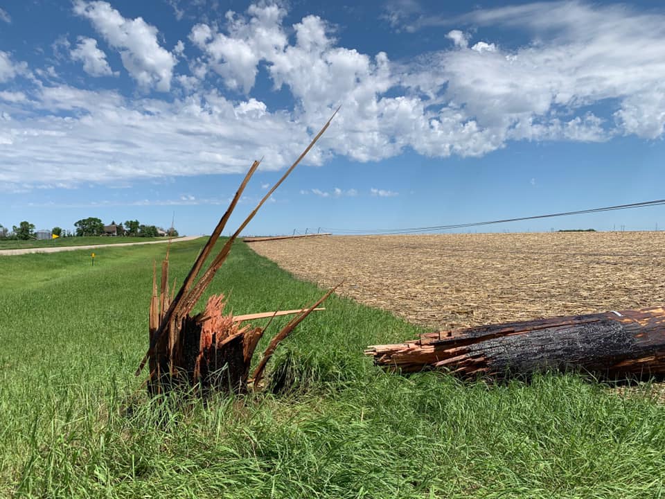 |
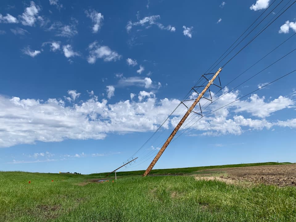
| Storm damage 4 miles north of Thomas, courtesy of Breanna Beebe | Storm damage 4 miles north of Thomas, courtesy of Breanna Beebe | Downed power lines near Groton, courtesy of the East River Electric Power Cooperative | Downed power lines near Groton, courtesy of the East River Electric Power Cooperative |
 |
|||
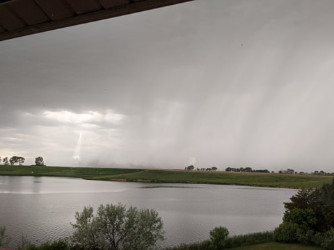
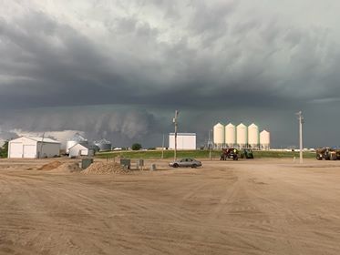
| Storm bearing down on Watertown. Image courtesy of Eric McPeek |
Radar & Satellite
 |
 |
 |
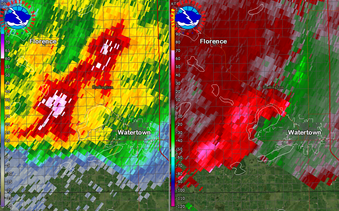 |
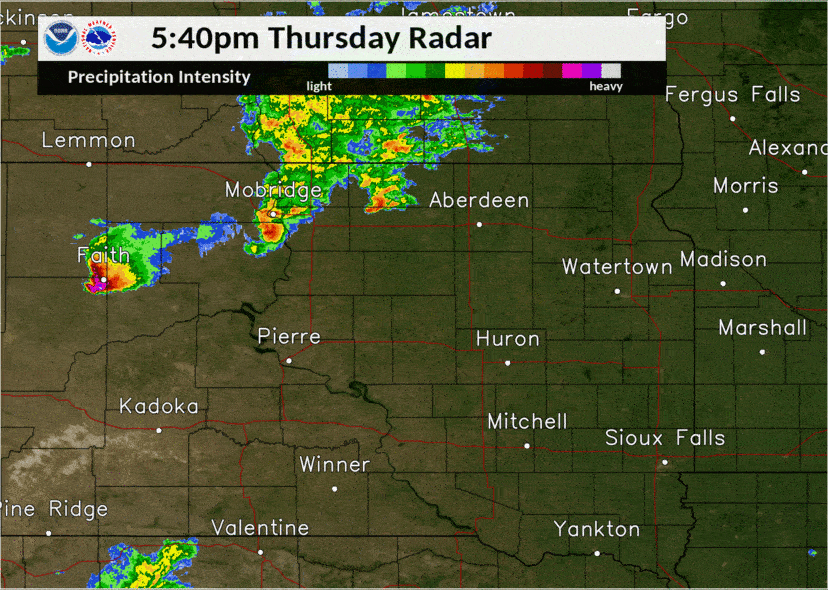
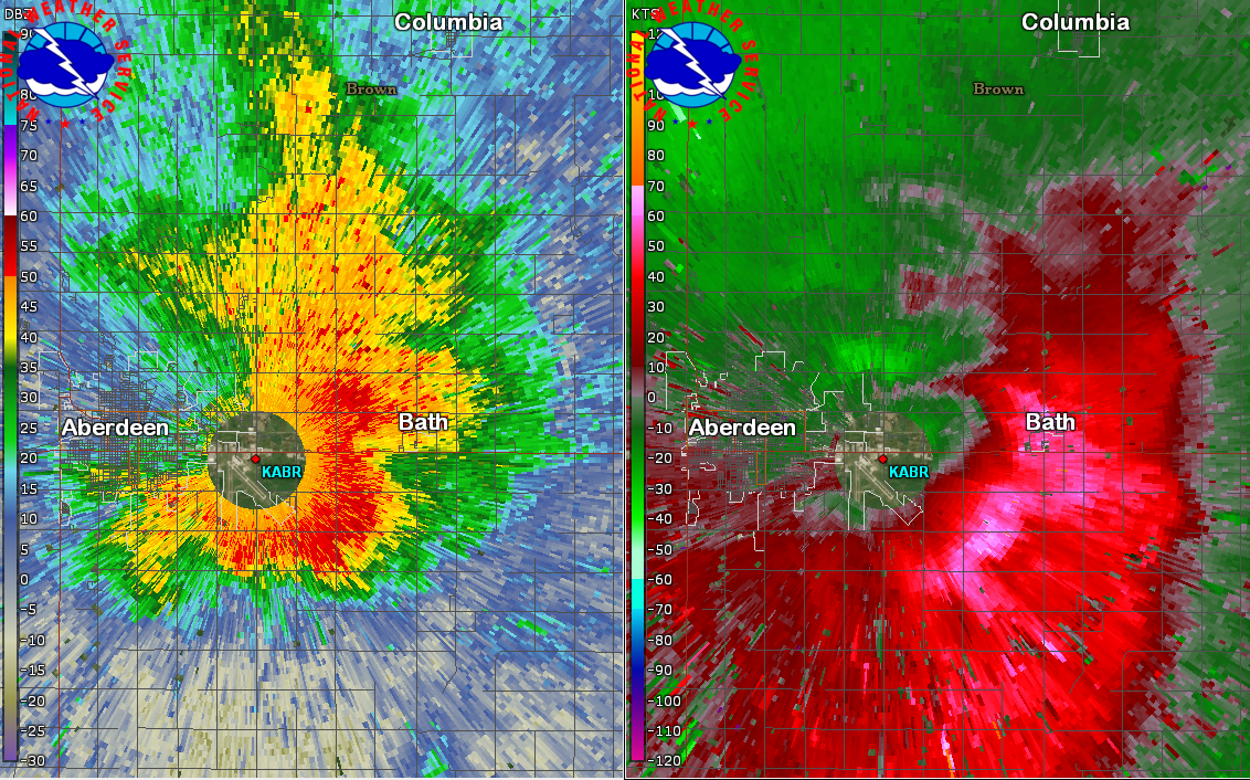
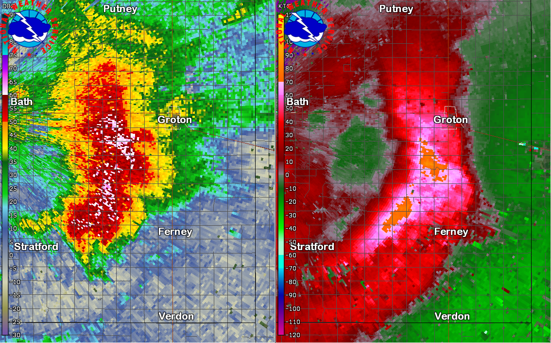
| Overview radar reflectivity from 5:30 to 10:00 pm. | Radar reflectivity (left) and velocity (right) at 7:07 pm shortly after storms produced a wind gust of 81 mph at the Aberdeen Airport. | Radar reflectivity (left) and velocity (right) at 7:19 pm as the storm was knocking down power lines near Groton. | Radar reflectivity (left) and velocity (right) at 8:32 pm around the time of numerous reports of tree damage and even structural damage around Watertown. |
 |
 |
||
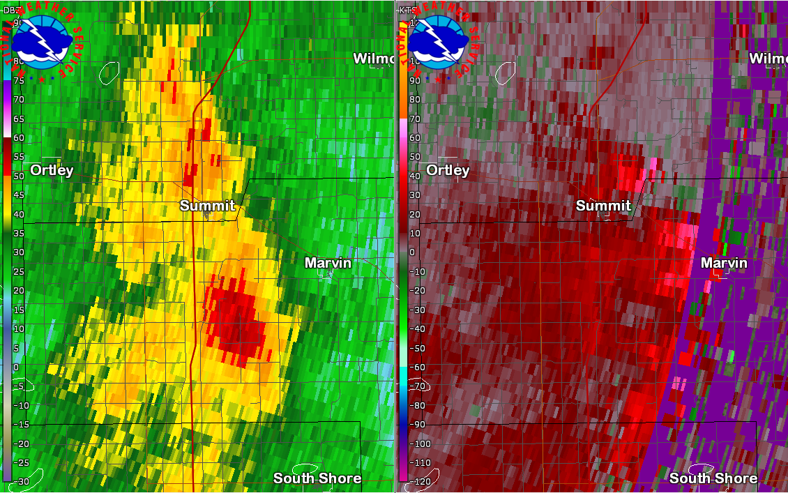
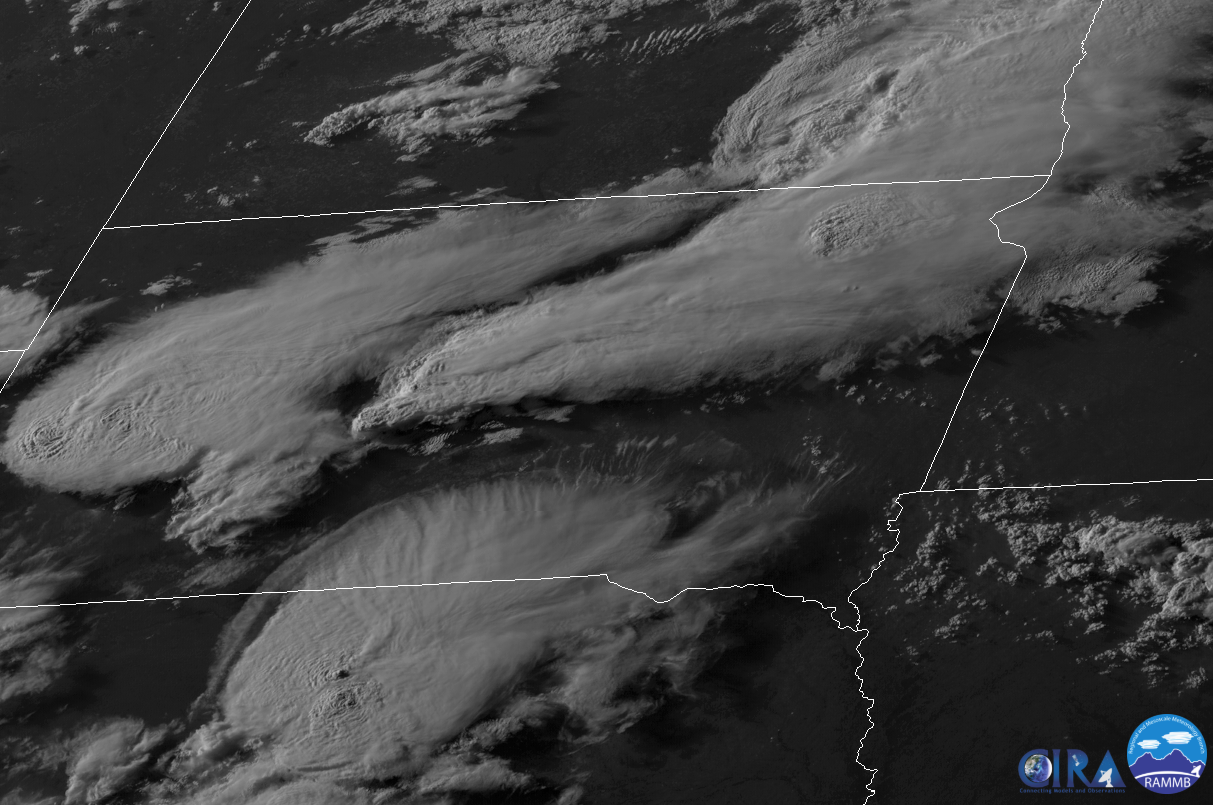
| Radar reflectivity (left) and velocity (right) at 8:40 pm as the storm blew over a semi on the interstate and produced a 95 mph wind gust at Summit. | GOES-16 visible satellite image taken at 7:30 pm on June 4th, from the SLIDER by RAMMB/CIRA at CSU |
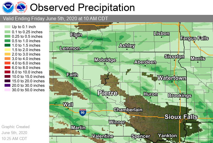
Rain Reports
Radar estimated combined with observed rainfall totals below.
 |
Media use of NWS Web News Stories is encouraged! Please acknowledge the NWS as the source of any news information accessed from this site. |
|

