Overview
|
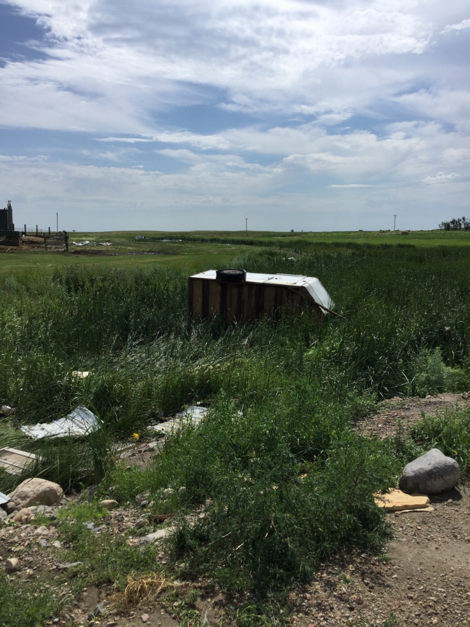
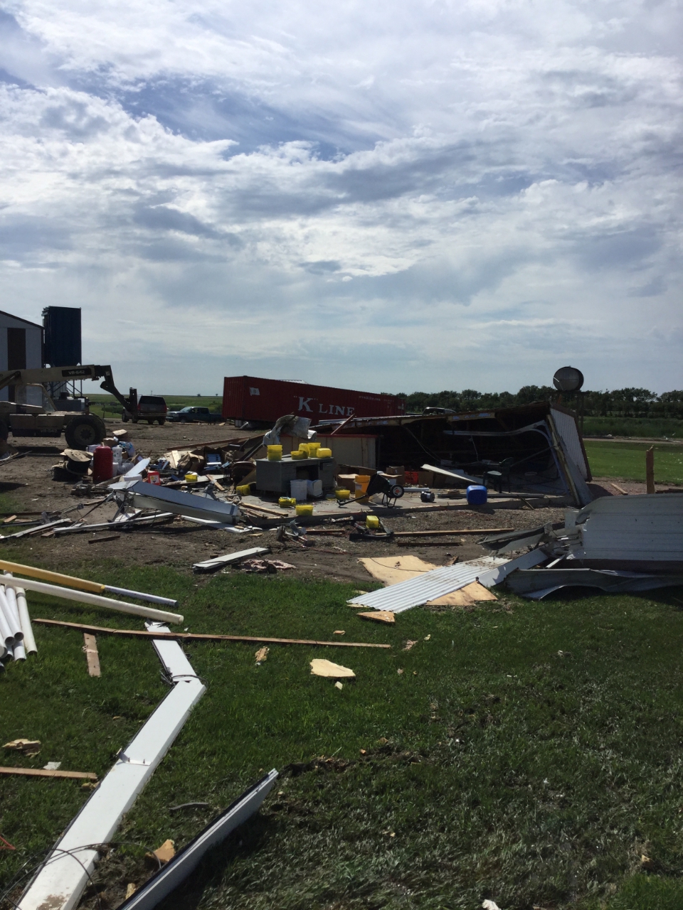
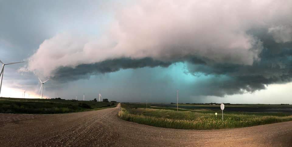
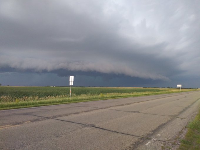
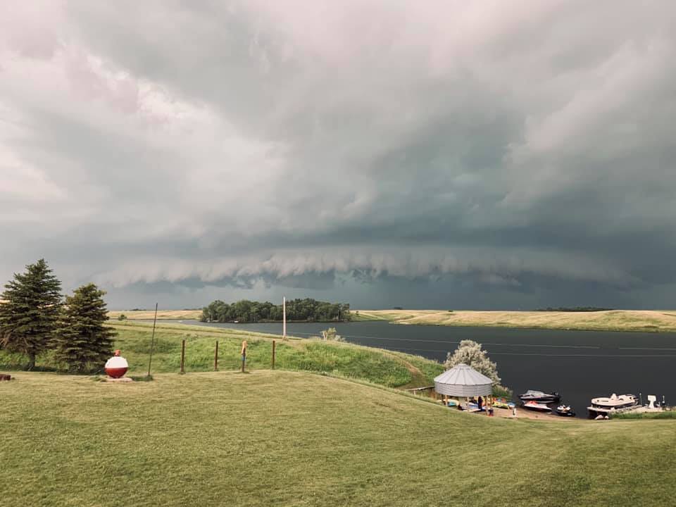
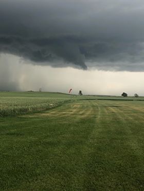
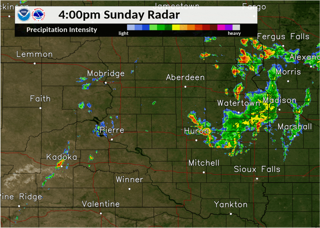
Mother Nature provided her own firework show this 4th of July for some, and unfortunately, severe weather as well. A few storms across southern North Dakota merged and intensified as they drifted southward from the early evening to past nightfall across/near the James River Valley. Significant damage resulted from straight-line wind gusts of 80+ mph, as well as an EF-2 tornado near Wetonka. Heavy rain, especially in Hand County, also led to flooding issues. Additional rounds of strong to severe thunderstorms developed the following day, on July 5th, mainly across and west of the James River Valley. Wind gusts of 70+ mph were associated with a complex of storms across Jones, Lyman and Buffalo Counties during the early evening. Numerous storms then developed from northern Brown to Walworth Counties, beginning around 7pm. Several funnel clouds were spotted with this activity, particularly around the Long Lake and Bowdle/Hoven areas. Strong winds and some hail, as well as localized flooding, also accompanied this activity at times before it all diminished in intensity by around 10pm. |
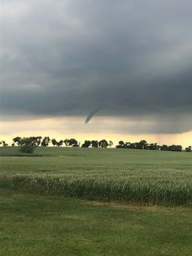
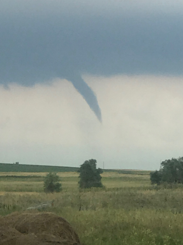
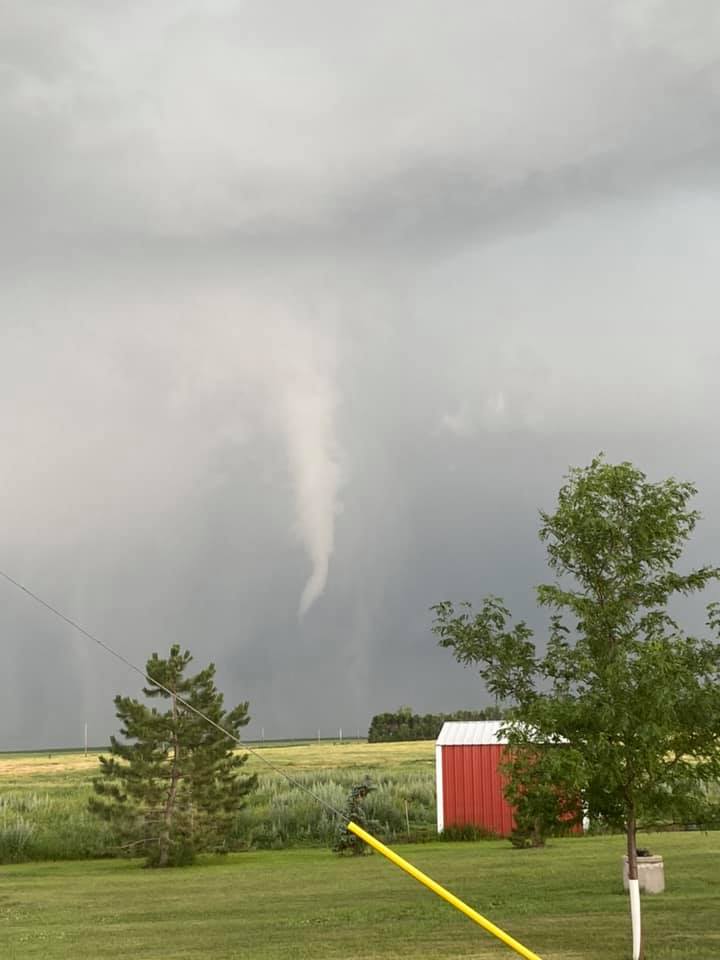 Funnel cloud observed on July 5th, courtesy of Missy Munns Thomas |
 |
 |
 |
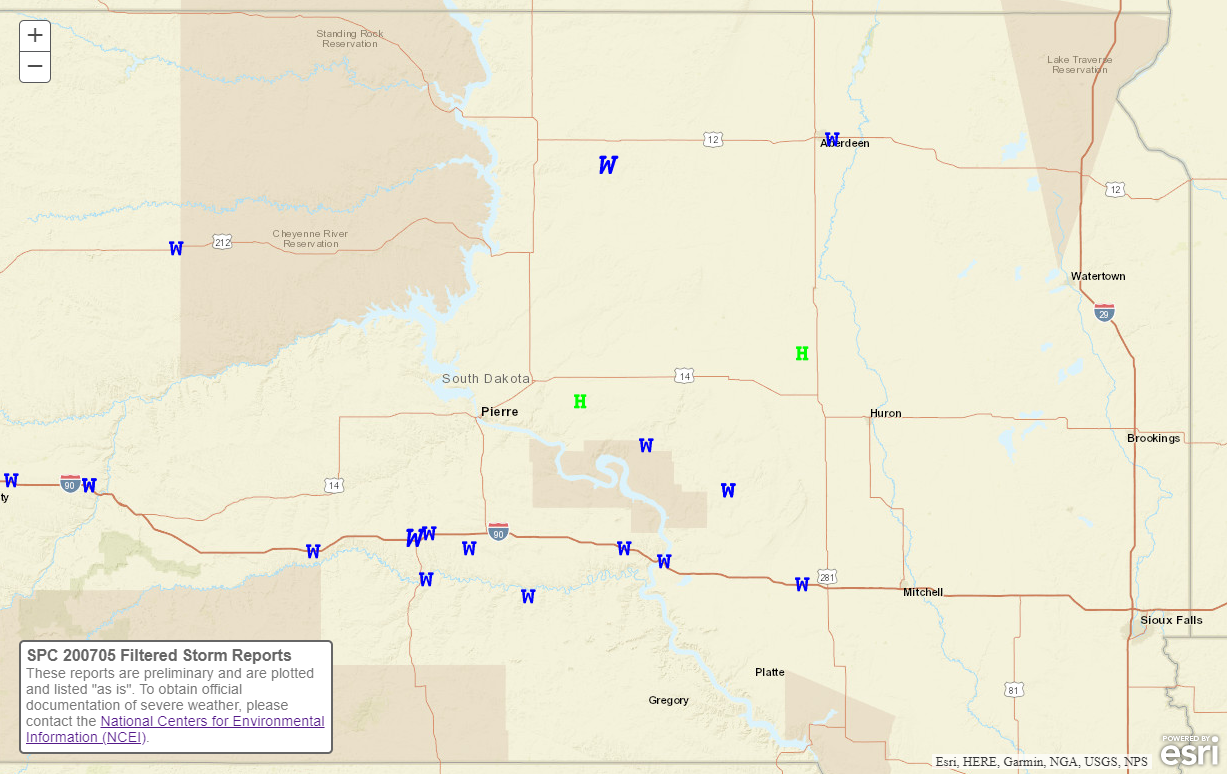 |
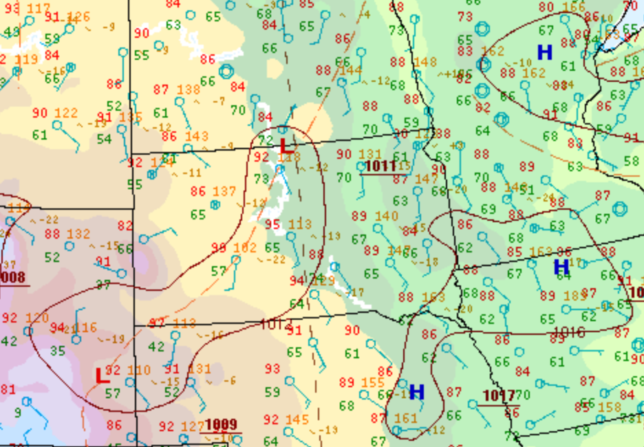
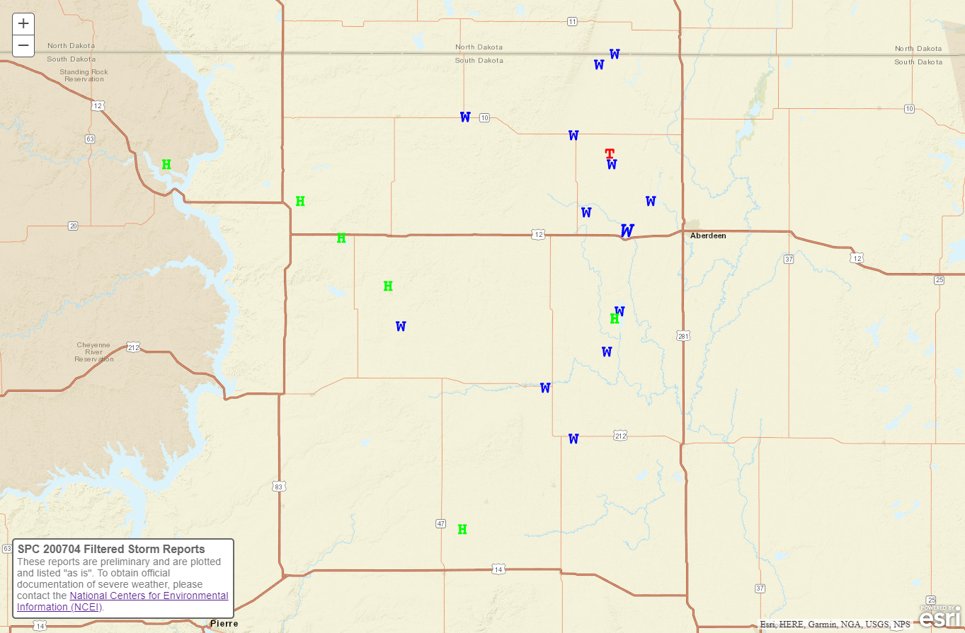
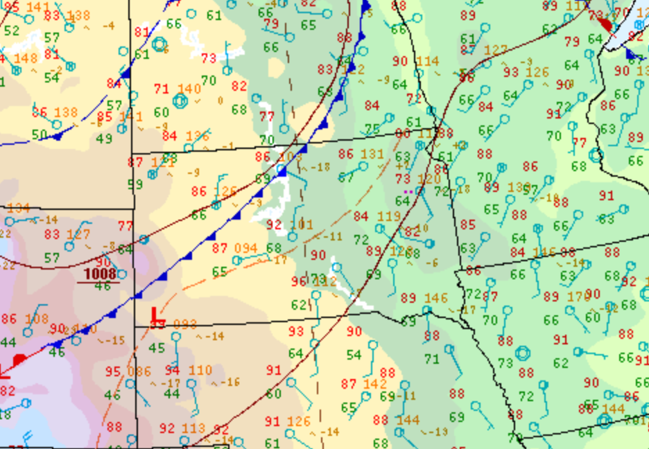
| July 4th surface weather map at 4pm | July 4th storm reports across the area | July 5th surface weather map at 4pm | July 5th storm reports across the area |
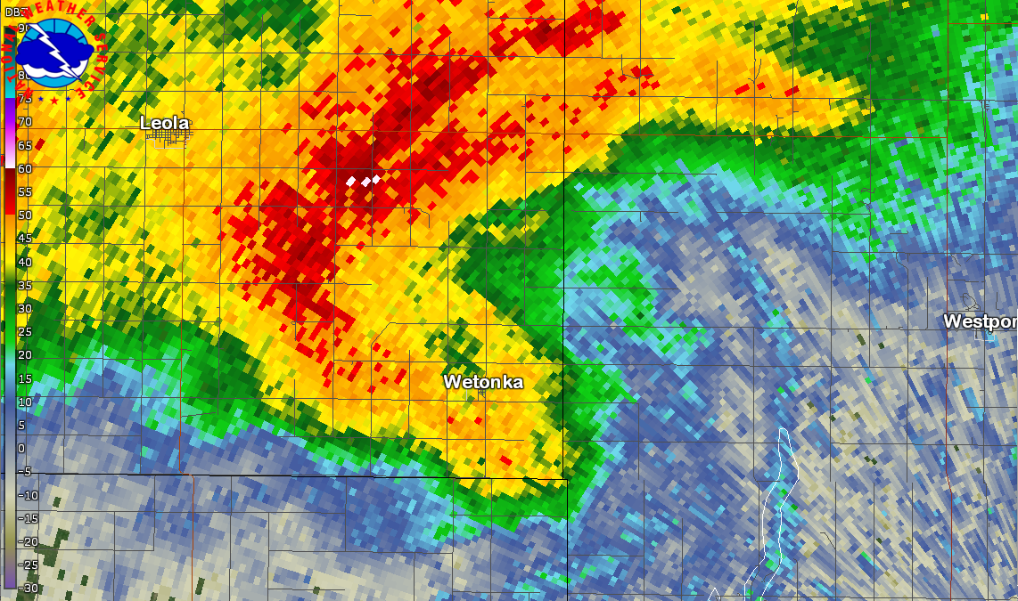
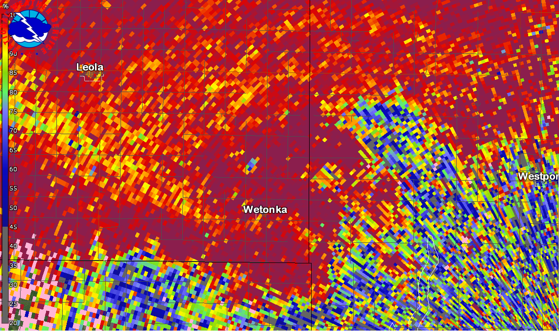
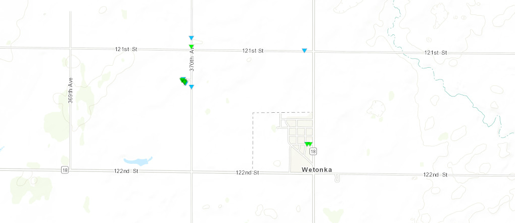
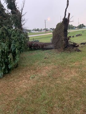
July 4th Tornado:
|
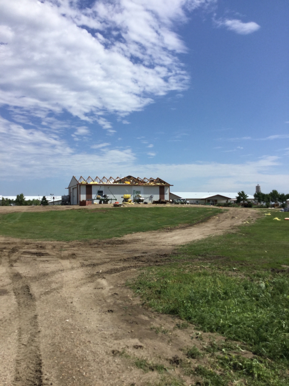
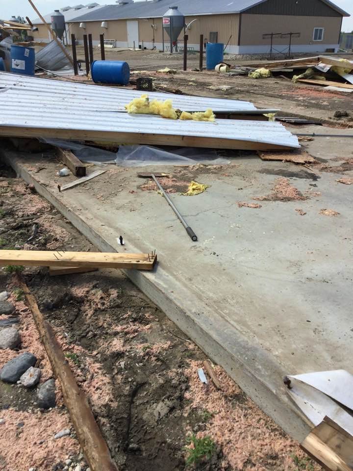
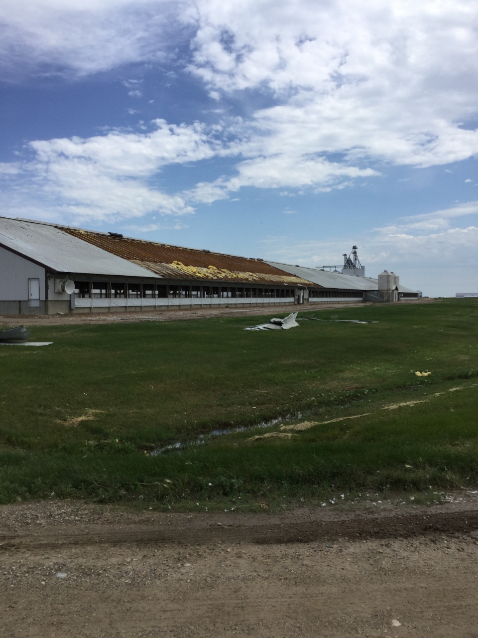
Tornado - 3 NNW Wetonka
Track Map 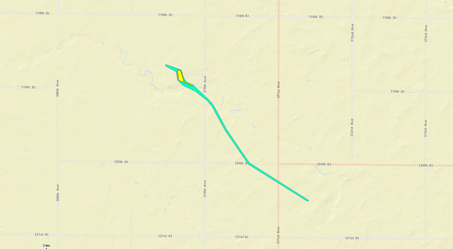 
|
||||||||||||||||||||||||||||||||||||||||||||||||||||||||||||||||||||||
The Enhanced Fujita (EF) Scale classifies tornadoes into the following categories:
| EF0 Weak 65-85 mph |
EF1 Moderate 86-110 mph |
EF2 Significant 111-135 mph |
EF3 Severe 136-165 mph |
EF4 Extreme 166-200 mph |
EF5 Catastrophic 200+ mph |
 |
|||||
July 4th Overview:
Images
 |
 |
 |
 |
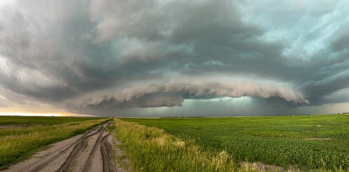
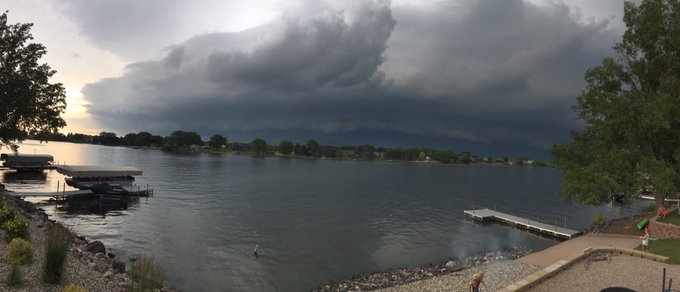
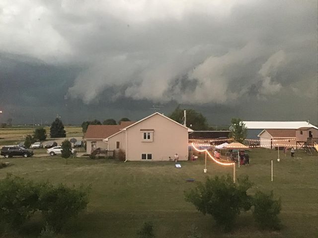
| Severe storm south of Forbes, ND at 6:15 pm, courtesy of Quincy Vagell | Severe storm north of Aberdeen near the ND/SD border, courtesy of Steven Fleegel | Photo taken at 382nd/Brown County Road 13 near Richmond Lake, courtesy of Zachary Nelson | View from Elm Lake at 6:17 pm, courtesy of Michelle Wiesner |
 |
 |
 |
 |
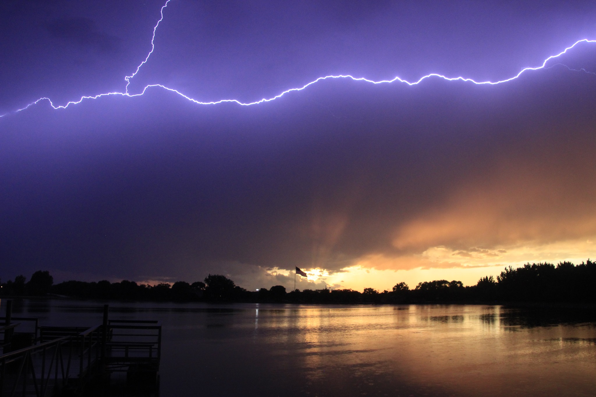
| Photo taken near Ipswich at 8:35 pm, courtesy of Alesha Thayer | Storm bearing down on Mina Lake, courtesy of Brad Peterson | Storm engulfing Mina Lake at 8:15 pm. An 85 mph wind gusts was recorded here 15 minutes after the above photo. Time lapse here. | Storm approaching the Aberdeen area, courtesy of Becky Desens |
 |
 |
 |
 |
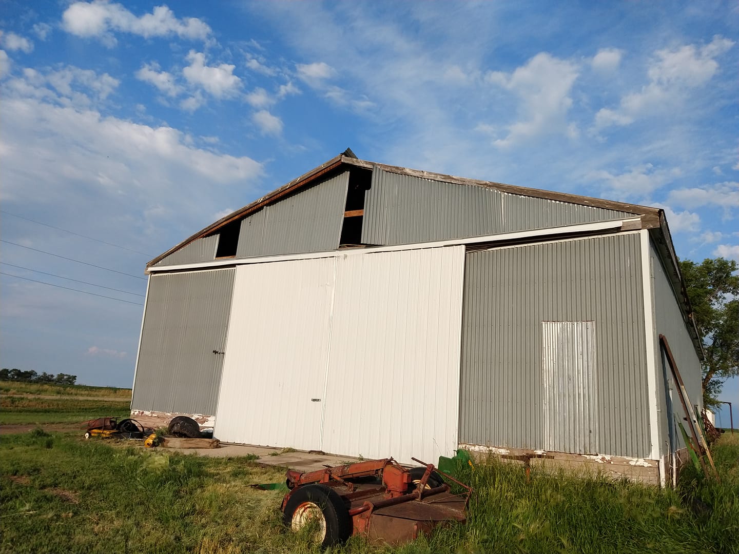
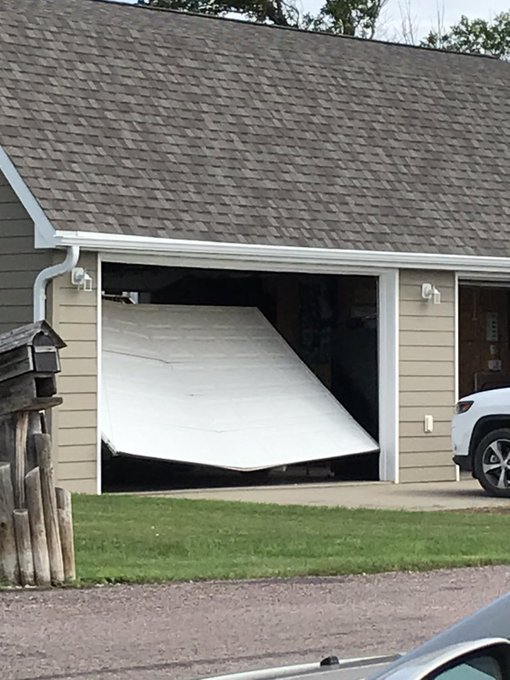
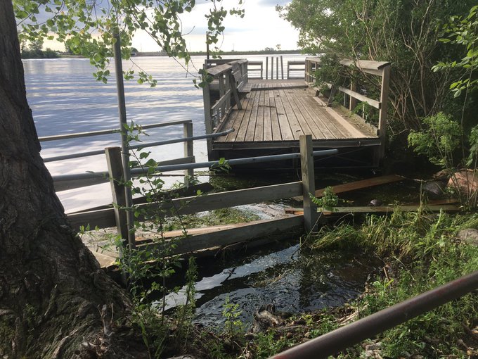
| Lightning over Wylie Park at 9:15 pm, courtesy of Mike Scott | Wind damage in Ipswich at 8:35 pm, courtesy of Alesha Thayer | Wind damage 4 miles north of Craven Corner, courtesy of Gerald Ray Noble | Wind damage 4 miles north of Craven Corner, courtesy of Gerald Ray Noble |
.jpg) |
 |
 |
 |
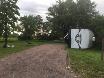
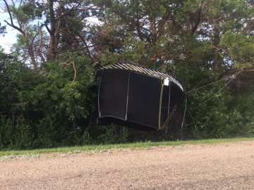
| Wind damage at Mina Lake, courtesy of Brad Peterson | Wind damage at Mina Lake, courtesy of Brad Peterson | Wind damage at Mina Lake, courtesy of Brad Peterson | Wind damage at Mina Lake, courtesy of Joe @xqzmepleeze |
 |
 |
||
| Wind damage at Mina Lake, courtesy of Joe @xqzmepleeze | Wind damage at Mina Lake, courtesy of Joe @xqzmepleeze |
Radar Loop
 |
|||
| Radar reflectivity animation over the course of the event, from 4:50 pm CDT to 1:50 am CDT. |
Preliminary Storm Reports
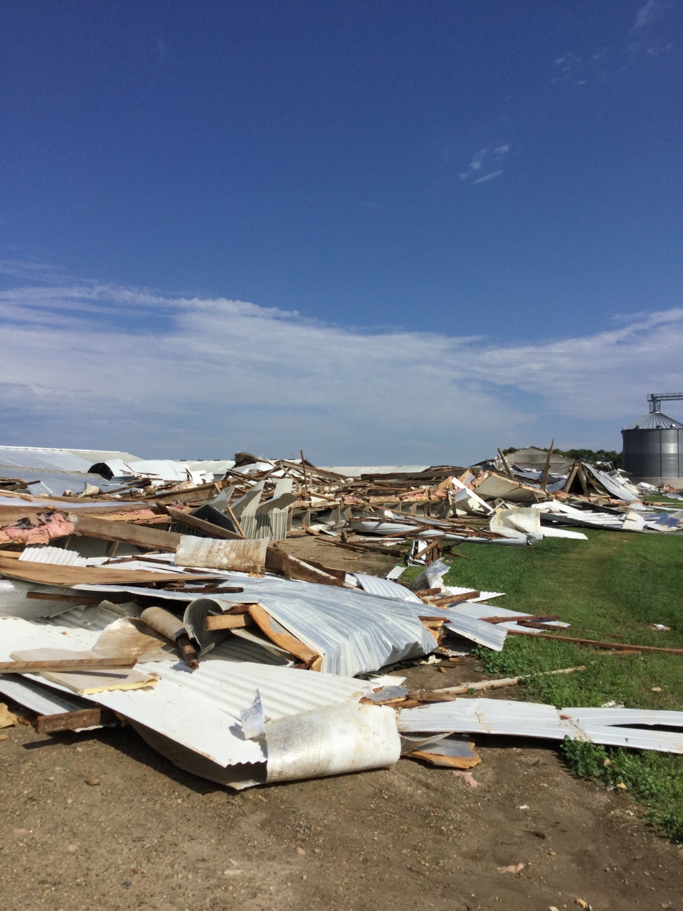
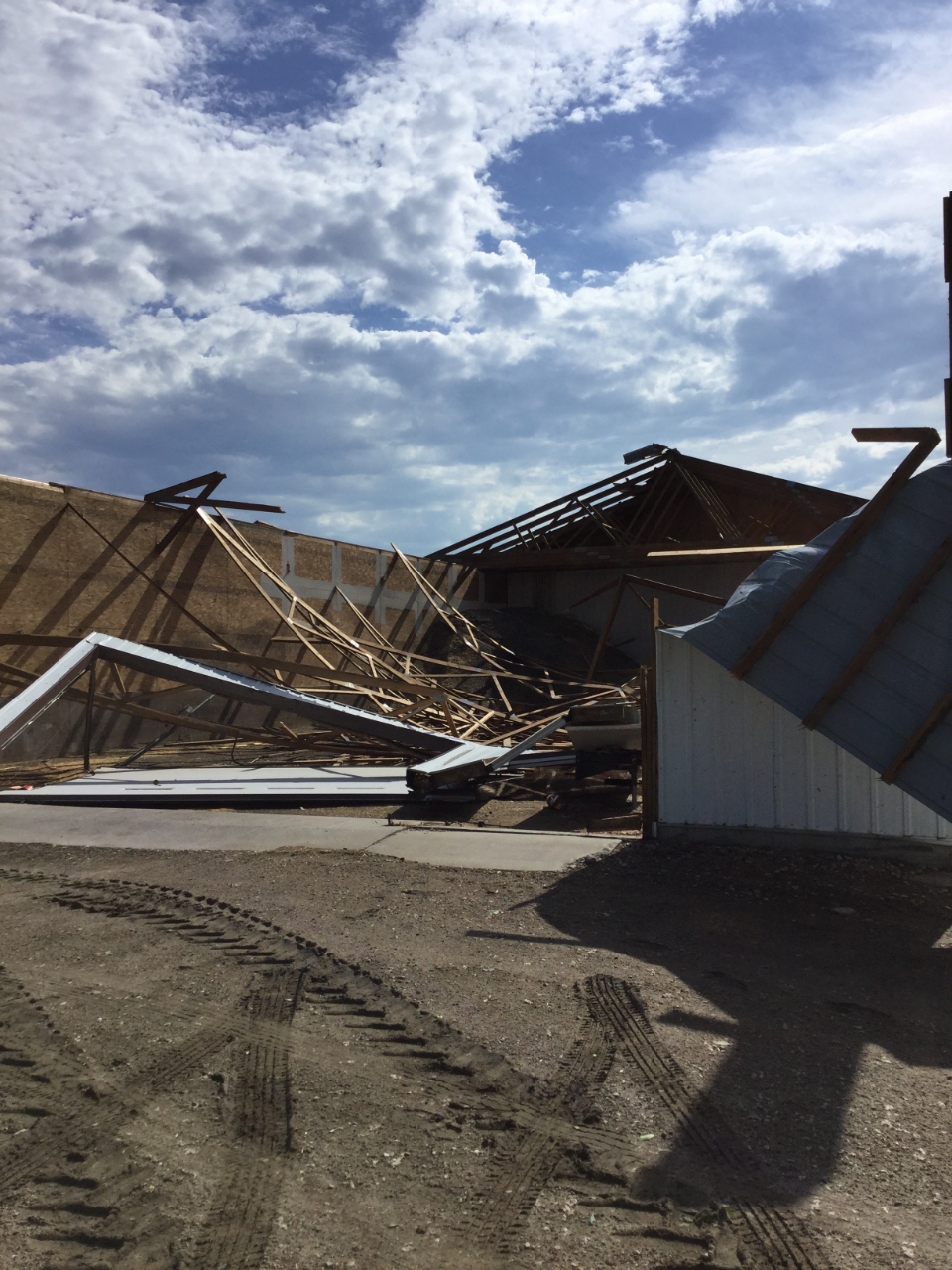
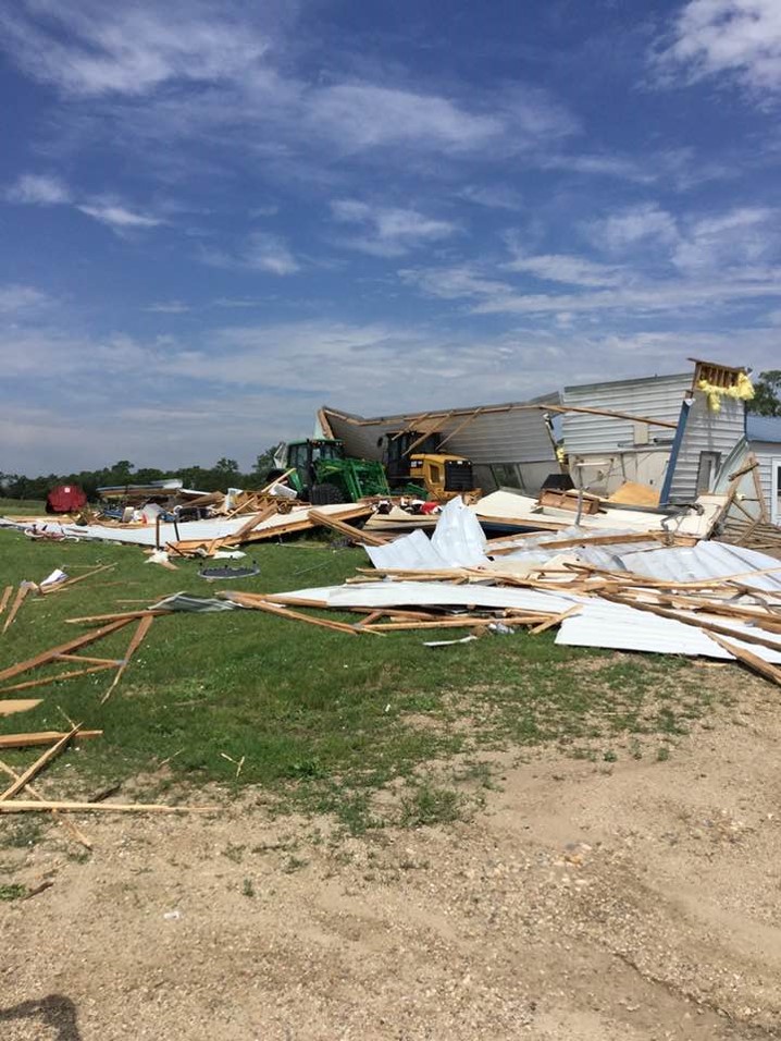
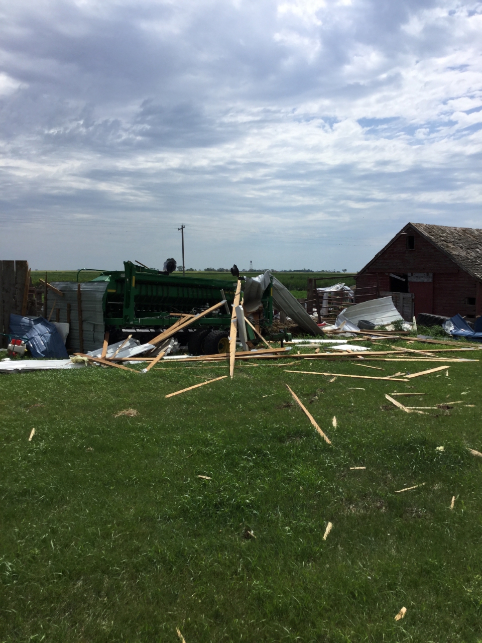
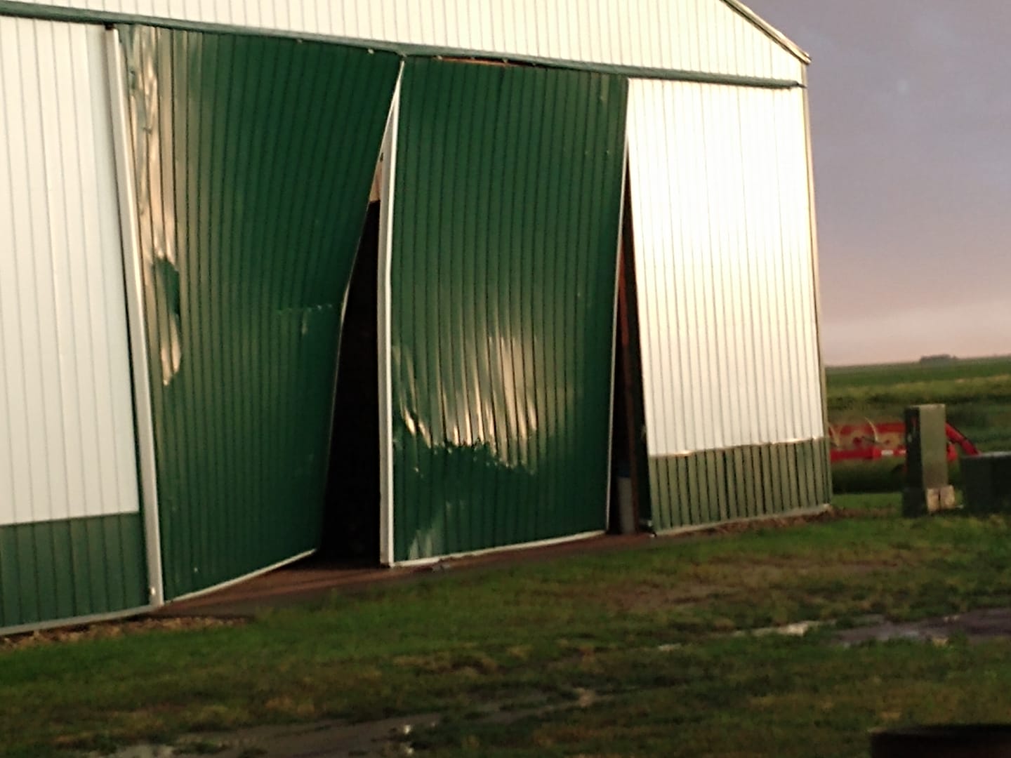
..TIME...   ...EVENT...      ...CITY LOCATION...     ...LAT.LON...
..DATE...   ....MAG....      ..COUNTY LOCATION..ST.. ...SOURCE....
            ..REMARKS..

0947 PM     Hail             7 NNW Tolstoy           45.31N 99.66W
07/04/2020  M1.75 inch       Edmunds            SD   Trained Spotter

0933 PM     Tstm Wnd Gst     17 W Polo               44.78N 99.45W
07/04/2020  M56 MPH          Hyde               SD   Mesonet
            Mesonet station 215 JCT SD47/SD26 (SDDOT).

0930 PM     Tstm Wnd Dmg     6 SSE Miranda           44.89N 98.94W
07/04/2020                   Hand               SD   Public
            Wind was strong enough to knock down limbs
            and trees in the area. Time estimated.

0930 PM     Hail             7 SW Bowdle             45.39N 99.78W
07/04/2020  E1.00 inch       Walworth           SD   Public
            Time estimated. Strong winds and heavy rain
            as well.

0920 PM     Hail             5 SSE Java              45.44N 99.84W
07/04/2020  M1.00 inch       Walworth           SD   Public

0917 PM     Tstm Wnd Gst     4 SW Chelsea            45.13N 98.81W
07/04/2020  M70 MPH          Faulk              SD   Mesonet

0910 PM     Hail             4 NNW Chelsea           45.22N 98.78W
07/04/2020  E1.75 inch       Faulk              SD   Public
            TIME ESTIMATED VIA RADAR. ONLY A FEW
            GOLFBALLS. Corrects earlier LSR.

0908 PM     Tstm Wnd Dmg     5 N Chelsea             45.24N 98.76W
07/04/2020                   Faulk              SD   Public
            Corrects previous non-tstm wnd dmg report
            from 5 N Chelsea. Chemical bulk containers
            scattered around the farm yard.

0832 PM     Tstm Wnd Dmg     Mina                    45.44N 98.76W
07/04/2020                   Edmunds            SD   Emergency Mngr
            Camper tipped over and evergreen tree
            snapped. Time estimated by radar.

0832 PM     Hail             3 NNE Selby             45.54N 100.00W
07/04/2020  E1.00 inch       Walworth           SD   Public
            pea up to quarter size. Time estimated. Via
            social media.

0830 PM     Tstm Wnd Dmg     4 NNE Cravens Corner    45.51N 98.89W
07/04/2020                   Edmunds            SD   Public
            Damage to barn doors, a few limbs down.
            Relayed through social media.

0831 PM     Tstm Wnd Gst     2 NE Mina               45.46N 98.73W
07/04/2020  M85 MPH          Edmunds            SD   NWS Employee
            Damage was also reported at Mina Lake.

0813 PM     Non-Tstm Wnd Gst 1 ESE Bowdle            45.44N 99.64W
07/04/2020  M49 MPH          Edmunds            SD   Mesonet
            Mesonet station 216 Bowdle (SDDOT).

0745 PM     Tstm Wnd Gst     2 W Richmond Lake Rec A 45.54N 98.64W
07/04/2020  M58 MPH          Brown              SD   Mesonet
            Mesonet station EW9368 Aberdeen 9 NW.

0730 PM     Tstm Wnd Dmg     1 NW Wetonka            45.64N 98.79W
07/04/2020                   McPherson          SD   Trained Spotter
            Electric poles down, tree damage, partial
            roof off shop, bales in different pastures.

0730 PM     Tstm Wnd Dmg     1 W Wetonka             45.63N 98.80W
07/04/2020                   McPherson          SD   Public
            Significant damage to machine shed.

0730 PM     Tstm Wnd Dmg     3 NNW Wetonka           45.67N 98.79W
07/04/2020                   McPherson          SD   Public
            Relayed report via neighbor: 3 turkey barns
            destroyed.

0658 PM     Tstm Wnd Gst     10 SW Long Lake         45.77N 99.36W
07/04/2020  M63 MPH          McPherson          SD   Mesonet
            Mesonet station 184 Eureka (SDDOT).

0658 PM     Tstm Wnd Dmg     10 SW Long Lake         45.77N 99.36W
07/04/2020                   McPherson          SD   Mesonet
            Mesonet station 184 Eureka (SDDOT).

0618 PM     Tstm Wnd Gst     2 E SPRING CREEK COLONY 45.91N 98.84W
07/04/2020  E70 MPH          McPherson          SD   Public
            TIME ESTIMATED BY RADAR. STRONG WINDS LASTED
            FOR 45 MINUTES.
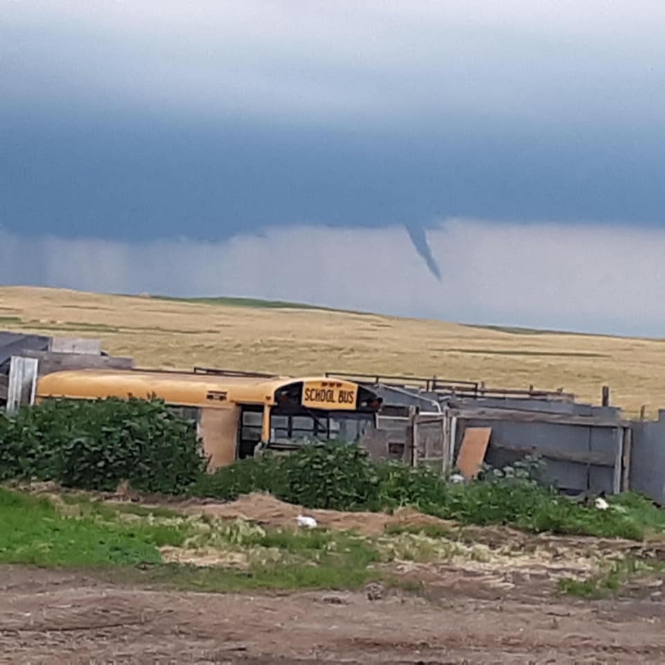
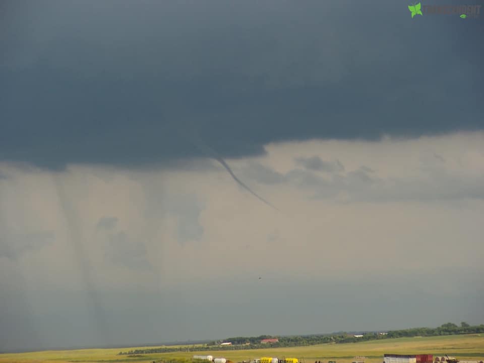
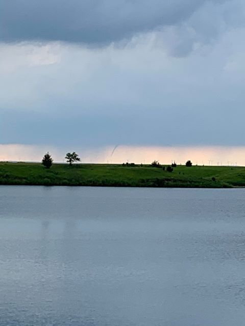
July 5th Overview:
Images
 |
 |
 |
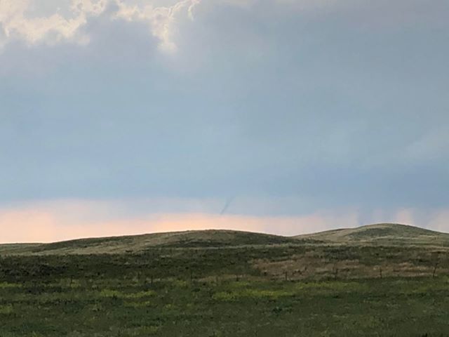 |
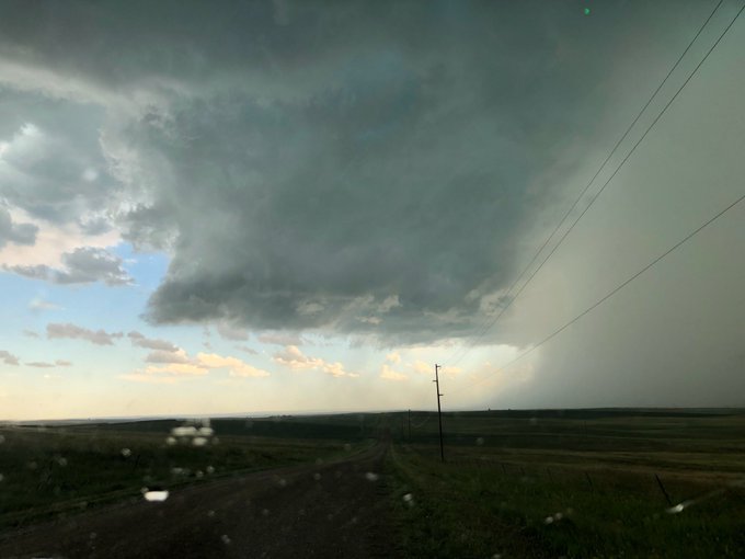
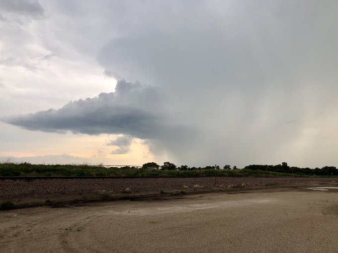
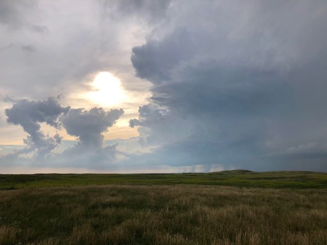
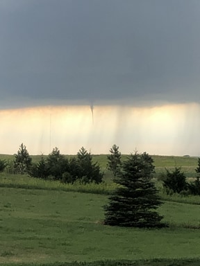
| Photo taken three miles east of Murdo, courtesy of Rich Sylva. A semi truck would be blown off I-90 around 5:20 pm, near this location and shortly after this photo was taken. | Photo of a supercell taken from Tulare at 6:58 pm, courtesy of Derek Thompson | Building storms 5 miles west of Leola, courtesy of Colin Hoffman | Funnel cloud 5 miles west of Leola, courtesy of Colin Hoffman |
 |
 |
 |
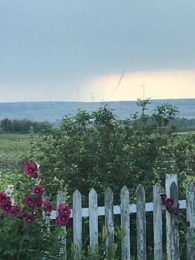 |
| Funnel cloud spotted by Darvin Fischer | Funnel Cloud spotted by Ethan Helfenstein | Funnel cloud seen from Elm Lake, looking west | Funnel cloud seen from Forbes, ND, courtesy of Holli Kronberg |
 |
 |
 |
 ​ ​ |
| Funnel cloud spotted near Long Lake, courtesy of Kay Retzer | Funnel cloud in the Long Lake area | Funnel cloud in the Long Lake area | Funnel cloud spotted near Ashley, ND |
 |
 |
​ | |
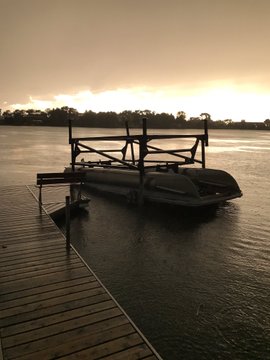
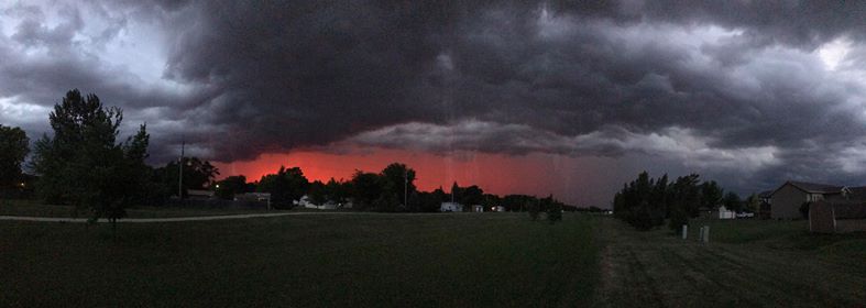
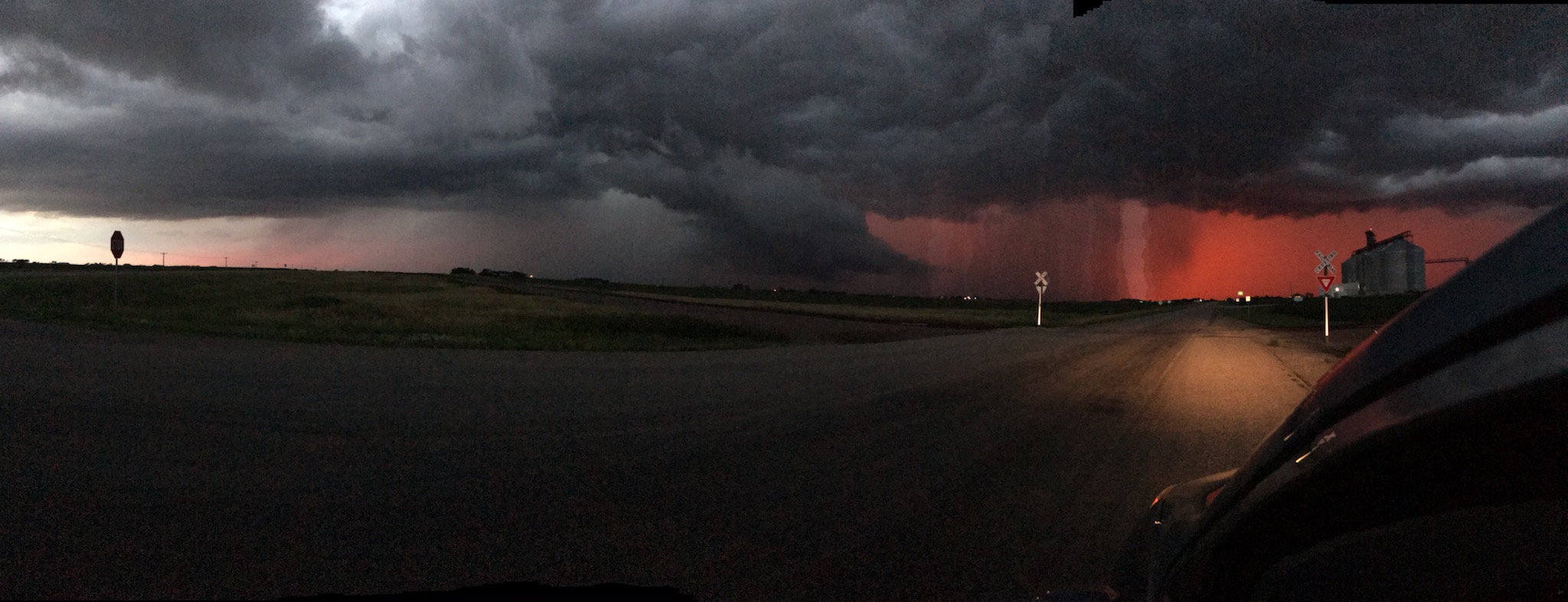
| Storm at sunset in the Aberdeen area | Storm at sunset in the Aberdeen area |
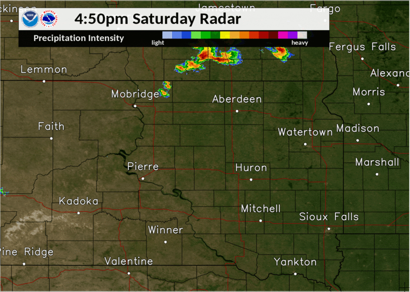
Radar Loop
 |
|||
| Radar reflectivity animation over the course of the event, from 4:00 pm CDT to 10:00 pm CDT. |
Preliminary Storm Reports
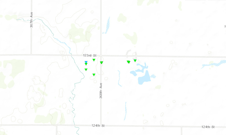
..TIME...   ...EVENT...      ...CITY LOCATION...     ...LAT.LON...
..DATE...   ....MAG....      ..COUNTY LOCATION..ST.. ...SOURCE....
            ..REMARKS..

0922 PM     Tstm Wnd Gst     3 ESE Aberdeen          45.45N 98.42W
07/05/2020  M59 MPH          Brown              SD   ASOS
            ASOS station KABR Aberdeen Rgnl AP.

0816 PM     Tstm Wnd Gst     7 S Bowdle              45.35N 99.65W
07/05/2020  E75 MPH          Edmunds            SD   Emergency Mngr

0806 PM     Hail             6 SSE Long Lake         45.78N 99.15W
07/05/2020  E0.88 inch       McPherson          SD   Public
            Just a few nickle sized, mostly smaller.

0804 PM     Tstm Wnd Gst     1 ESE Bowdle            45.44N 99.64W
07/05/2020  M58 MPH          Edmunds            SD   Mesonet
            Mesonet station 216 Bowdle (SDDOT).

0804 PM     Tstm Wnd Gst     3 N GANN VALLEY         44.08N 98.99W
07/05/2020  M73 MPH          Buffalo            SD   Mesonet
            MESONET STATION 201 GANN VALLEY (SDDOT).

0800 PM     Funnel Cloud     4 N Hoven               45.30N 99.78W
07/05/2020                   Walworth           SD   Fire Dept/Rescue

0800 PM     Funnel Cloud     2 S JAVA                45.47N 99.89W
07/05/2020                   Walworth           SD   Fire Dept/Rescue

0754 PM     Tstm Wnd Gst     3 N GANN VALLEY         44.08N 98.99W
07/05/2020  M67 MPH          Buffalo            SD   Mesonet
            MESONET STATION 201 GANN VALLEY (SDDOT).

0744 PM     Tstm Wnd Gst     3 N Gann Valley         44.08N 98.99W
07/05/2020  M61 MPH          Buffalo            SD   Mesonet
            Mesonet station 201 Gann Valley (SDDOT).

0718 PM     Funnel Cloud     1 W Long Lake           45.86N 99.22W
07/05/2020                   McPherson          SD   Public
            Brief touchdown possible.

0718 PM     Funnel Cloud     1 ESE Long Lake         45.85N 99.19W
07/05/2020                   McPherson          SD   Public

0715 PM     Funnel Cloud     2 WNW Long Lake         45.87N 99.23W
07/05/2020                   McPherson          SD   Public

0710 PM     Funnel Cloud     8 NE Long Lake          45.94N 99.10W
07/05/2020                   McPherson          SD   Public
            Brief touchdown possible, but not confirmed.
            Location estimated based off picture. Time
            is radar estimated (between 7pm and 735pm).

0704 PM     Tstm Wnd Gst     3 SE RELIANCE           43.85N 99.56W
07/05/2020  M60 MPH          Lyman              SD   Mesonet
            MESONET STATION 54 RELIANCE (SDDOT).

0704 PM     Tstm Wnd Gst     1 NE Stephan            44.26N 99.44W
07/05/2020  M59 MPH          Hyde               SD   Mesonet
            Mesonet station 183 Mac''s Corner (SDDOT).

0654 PM     Tstm Wnd Gst     3 SE RELIANCE           43.85N 99.56W
07/05/2020  M72 MPH          Lyman              SD   Mesonet
            MESONET STATION 54 RELIANCE (SDDOT).

0618 PM     Hail             2 SE Blunt              44.50N 99.95W
07/05/2020  M0.75 inch       Hughes             SD   Storm Chaser

0555 PM     Tstm Wnd Gst     8 SW Vivian             43.85N 100.41W
07/05/2020  E60 MPH          Jones              SD   Trained Spotter

0538 PM     Hail             7 SSW Harrold           44.43N 99.80W
07/05/2020  M1.25 inch       Hughes             SD   Storm Chaser

0522 PM     Hail             7 NNE Murdo             43.99N 100.67W
07/05/2020  E1.25 inch       Jones              SD   Public
            Estimated over 70 mph winds. Winds stayed
            strong for around 30 minutes. 3 foot
            diameter tree downed.

0520 PM     Tstm Wnd Dmg     4 ENE Murdo             43.91N 100.63W
07/05/2020                   Jones              SD   Emergency Mngr
            Semi truck blown over.

0520 PM     Tstm Wnd Dmg     2 NE Murdo              43.91N 100.69W
07/05/2020                   Jones              SD   Public
            Cornfield completely destroyed due to wind
            damage.

0519 PM     Tstm Wnd Gst     3 E Murdo               43.89N 100.65W
07/05/2020  M70 MPH          Jones              SD   Emergency Mngr
            pea sized hail also reported.

0515 PM     Tstm Wnd Gst     Murdo                   43.89N 100.71W
07/05/2020  M90 MPH          Jones              SD   Storm Chaser
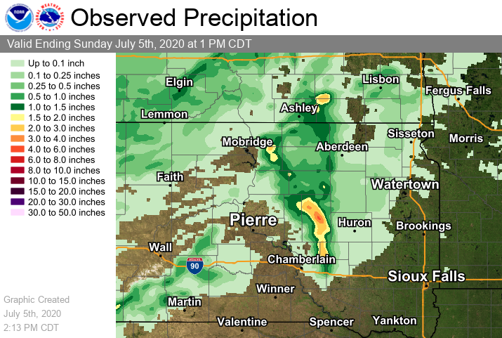
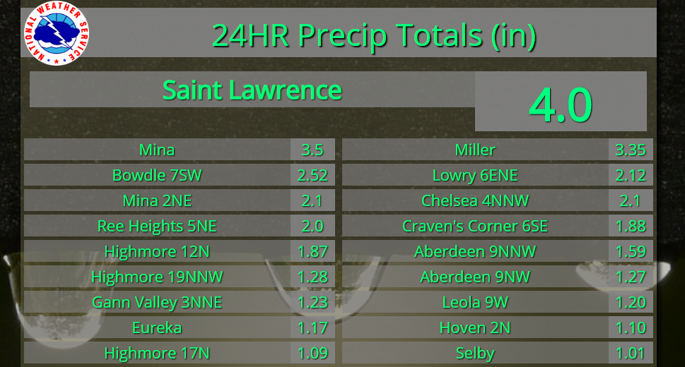
July 4th Precipitation Reports
24 hour totals ending during the morning of July 5th
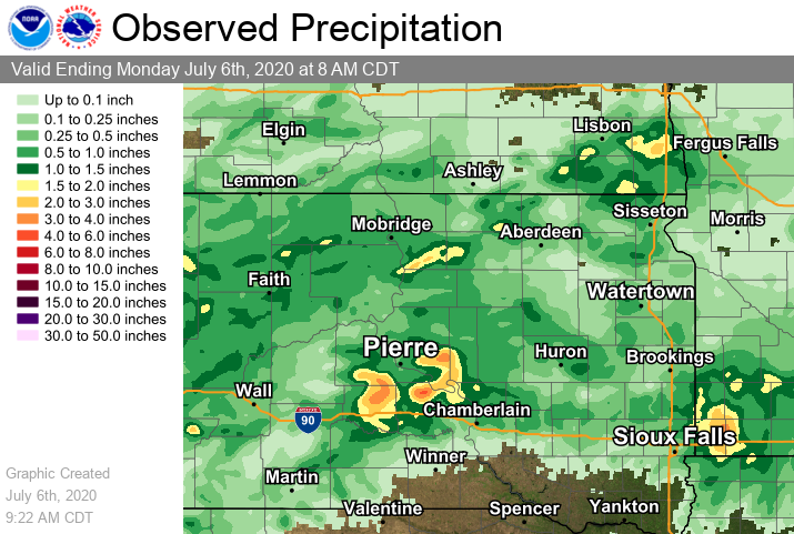
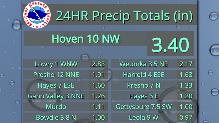
July 5th Precipitation Reports
24 hour totals ending during the morning of July 6th
 |
Media use of NWS Web News Stories is encouraged! Please acknowledge the NWS as the source of any news information accessed from this site. |
|