Overview
|
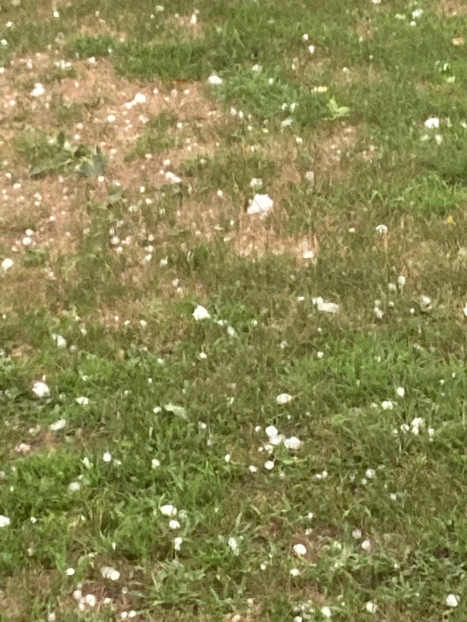
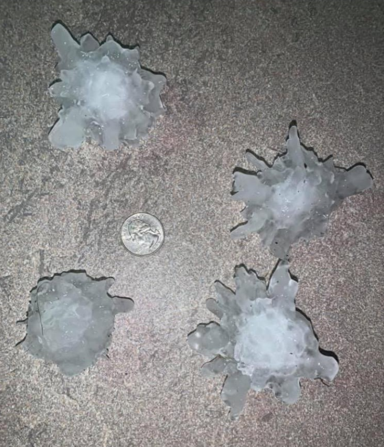
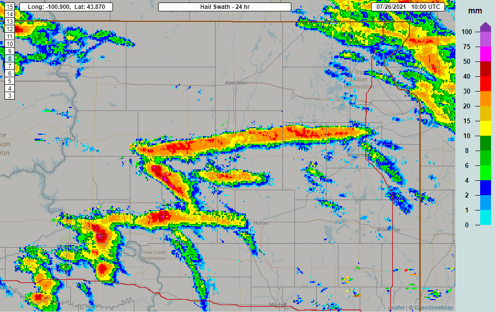
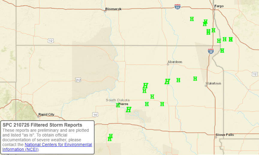
Thunderstorms developed near an area of low pressure across central South Dakota during the afternoon on Sunday, July 25th, and quickly intensified to severe limits in a favorable environment after becoming supercells (rotating thunderstorms). Despite temperatures in the 90s and even low 100s, these storms produced large to significantly large hail as they tracked to the east and southeast. By sunset, additional thunderstorms developed across west central Minnesota. One of the more prolific supercells produce hail continuously for ~125 miles from Faulk to Codington Counites over an over 3 hour window of time, of up to nearly 4" in diameter along the way. With 19 reports of severe-criteria hail (at least 1" in diameter) across our forecast area, we more than doubled in our total for the entire season in just one day. |
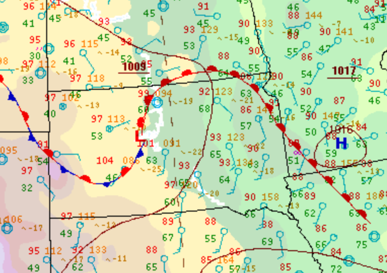 Surface observations at 4pm on July 25, 2021 from the Weather Prediction Center |
Photos & Video
 |
 |
 |
 |
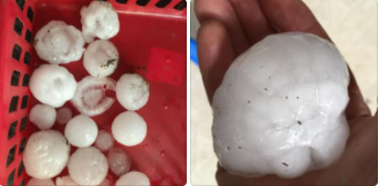
| Quarter to golf ball sized hail on the northeast side of Pierre. Photo courtesy of Mikayla Frick | Large hail from 12 miles south of Faulkton. Photo courtesy of Jason Koester | Large hail from 12 miles south of Faulkton. Photo courtesy of Jason Koester | Large hail from 2 miles north of Ashton. Photo courtesy of Garret Knebel |
 |
 |
 |
 |
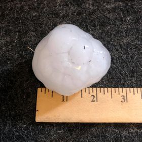
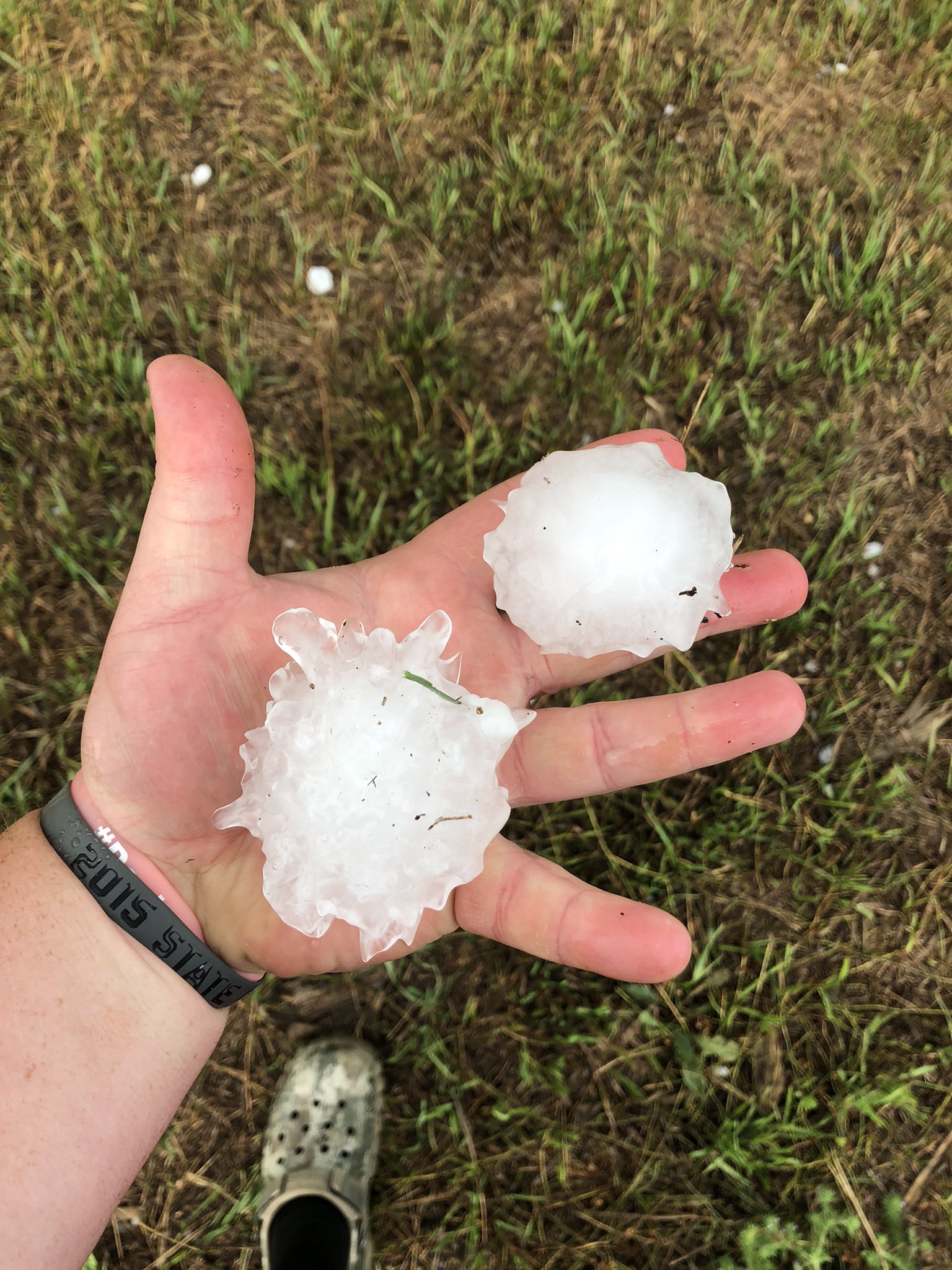
| Large hail at Wallace around 9pm. Photo courtesy of Billie and Monica Moshier, relayed on Twitter via Brent Nathaniel | Roughly 3.75" hail at Wallace around 9pm. Photo courtesy of Billie and Monica Moshier, relayed on Twitter via Brent Nathaniel | Large hail west of South Shore. Photo courtesy of Codington County Emergency Manager | Large hail west of South Shore. Photo courtesy of Codington County Emergency Manager |
 |
|||
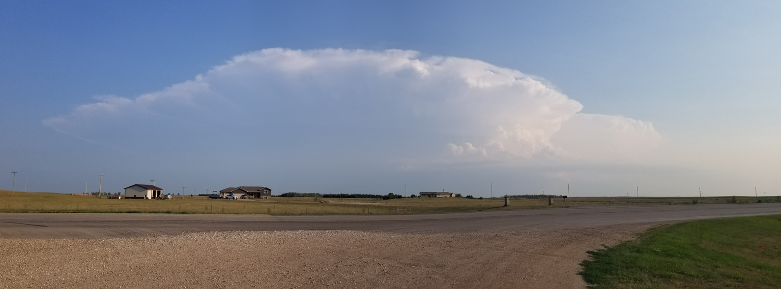
| Cumulonimbus of the large-hail producing storm over Faulk County around 7pm |
Radar, Satellite
| Radar reflectivity from 4pm to 10pm CDT July 25, 2021 |
| GOES-16 visible satellite imagery from 3pm to 910pm CDT July 25, 2021. From CIRA |
 |
 |
 |
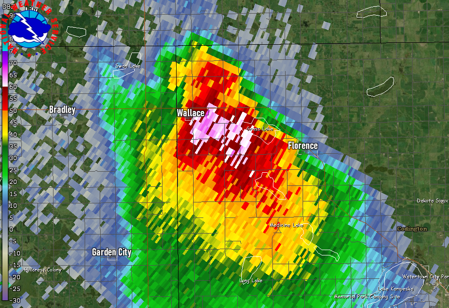 |
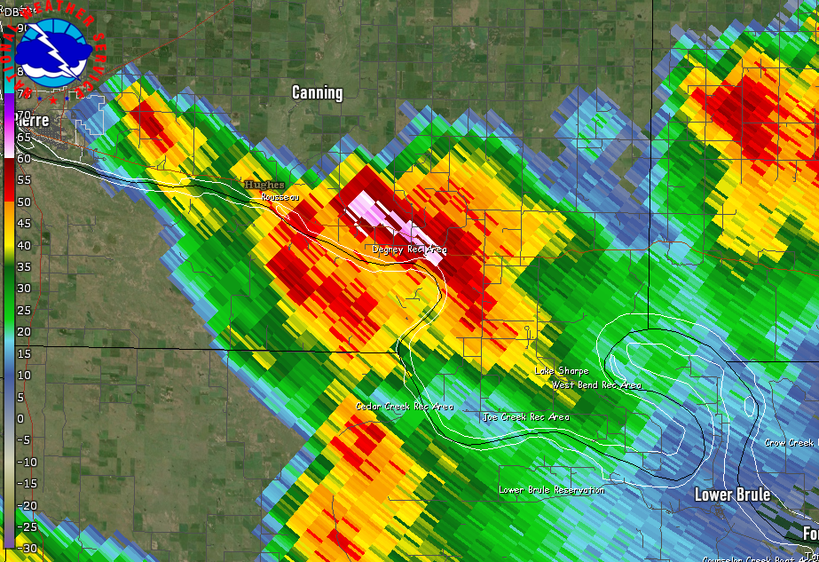
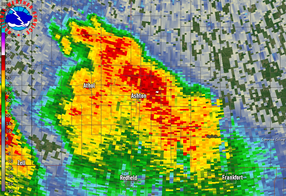
| 24 hour max estimated size of hail, showing the long-track nature of storms | Radar reflectivity at 617pm - southern Hughes County | Radar reflectivity at 740pm - northern Spink County | Radar reflectivity at 900pm - northwestern Codington County |
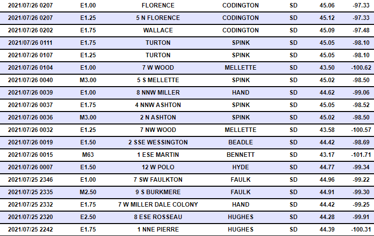
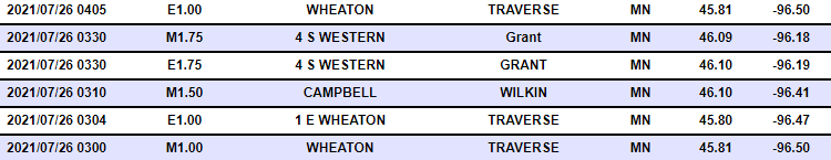
Storm Reports
Large hail reports from July 25, 2021 from the Storm Prediction Center. *Not shown below, 3.75" hail was also observed in Wallace.
 |
Media use of NWS Web News Stories is encouraged! Please acknowledge the NWS as the source of any news information accessed from this site. |
|

