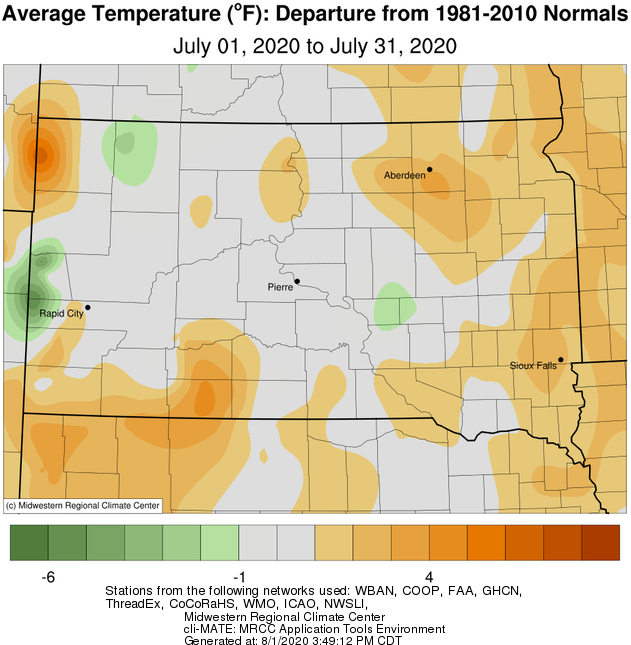
July 2020 finished near to up to 4 degrees above normal temperature-wise across the area. As is typical for the climatological hottest month of the year, a few heat spells with high temperatures in the 90s and dewpoints in the 70s gripped the area. Namely, July 17th and 23rd through 25th, when heat index values soared to 100-105+ degrees for many. Pierre broke the century mark air temperature-wise both on the 17th and again on the 25th as well. Rain shower-induced quick shots of hot air also resulted from heat bursts on the night of July 7th across portions of central and north central South Dakota (unfortunately also accompanied by wind gusts of 60 to 80 mph in some cases). Finally, daily record warm low temperatures were tied at Aberdeen on the 24th (76 degrees, also in 1963) and at Watertown on the 24th (75 degrees, also in 1940).
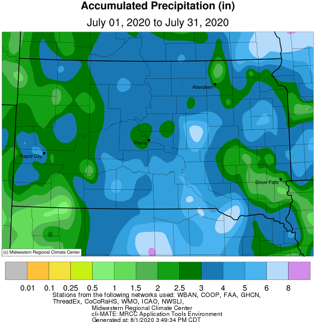
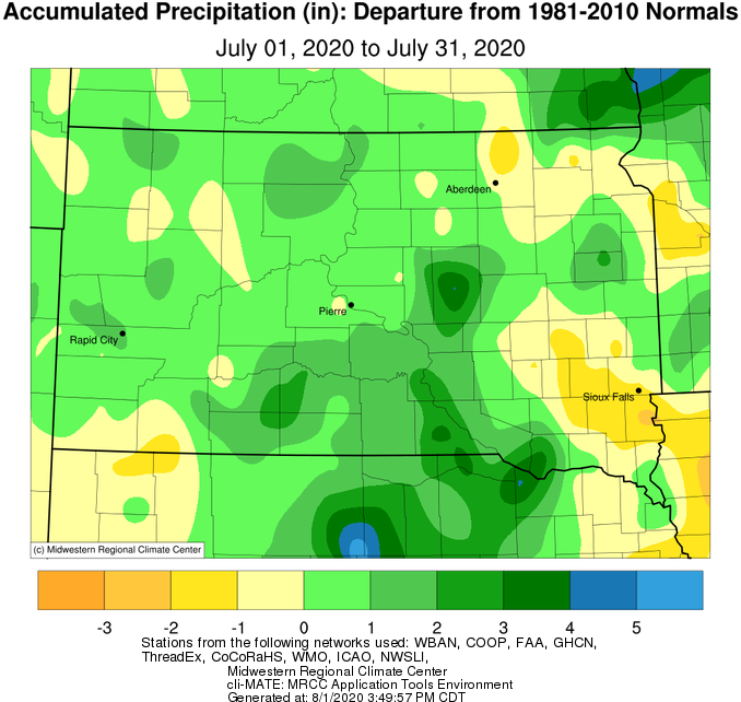
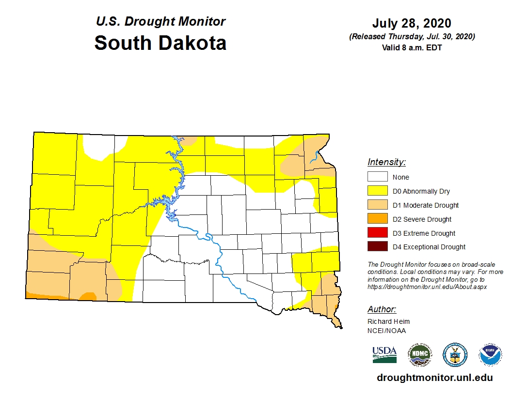
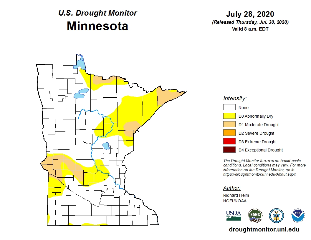
A fairly active pattern led to many precipitation opportunities, but exact location determined who finished above or below average as a whole for the month. For instance, as of July 28th, west central Minnesota and far northeastern and north central South Dakota were categorized as being in Moderate Drought (D1) by the US Drought Monitor. However, all the heat and humidity provided fuel for localized very heavy rain producers. In particular, a major flood event occurred in and around Elm Lake after 6” to as much as 11.92” (this measurement exceeds the existing state record for daily rainfall, but is still under investigation) of rain fell in under 4 hours on the evening of July 24th. More information here: https://www.weather.gov/abr/20200724_flooding. Daily record rainfall was observed at Mobridge on both the 24th (0.46” vs 0.41” in 1960) and 31st (1.02” vs 0.88” in 1975).
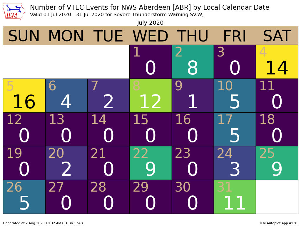
Several bouts of severe weather developed this month: 15 of the 31 days involved at least one Severe Thunderstorm Warning across our forecast area. Some of the more significant events include July 4th (EF-2 tornado near Wetonka and straight-line wind gusts of 80+ mph across parts of the James Valley: https://www.weather.gov/abr/July4-52020StormSummary), July 5th (straight-line winds up to 90 mph across I-90 and funnel clouds in the Long Lake and Bowdle/Hoven areas: https://www.weather.gov/abr/July4-52020StormSummary), July 6th (straight-line winds of 80+ mph across Jones/Lyman counties), July 17th (thunderstorm outflow wind gusts up to 80 mph across northeastern SD and west central MN), and on July 31st (thunderstorm outflow wind gusts up to 80 mph mainly across central SD). July 17th featured a Storm Prediction Center-issued Particularly Dangerous Situation (PDS) Severe Thunderstorm Watch which included Corson to Big Stone/Traverse Counties. PDS Severe Thunderstorm Watches are rare (issued on average only a few times a year across the country) and are designated for high-end wind threats with the potential for widespread and significant damage. The last time our forecast area was under such a watch was on June 19th, 2015 (Stanley/Jones to Buffalo Counties).
|
July 2020 |
||||
|
Temperature Data |
Aberdeen |
Sisseton |
Wheaton |
Watertown |
|
Warmest Temperature / Date |
95 / 17, 24th |
93 / 24th |
93 / 24, 25th |
91 / 17, 24th |
|
Coldest Temperature / Date |
53 / 15th |
55 / 22, 30th |
57 / 15, 23rd |
53 / 15th |
|
Average High / Departure from Normal |
87.7 / +4.2 |
85.0 / +2.1 |
83.5 / +1.0 |
83.5 / +0.9 |
|
Average Low / Departure from Normal |
62.8 / +3.8 |
59.5 / +2.2 |
64.1 / +3.4 |
62.1 / +2.5 |
|
Monthly Average / Departure from Normal |
75.2 / +3.9 |
73.4 / +2.2 |
73.8 / +2.2 |
72.8 / +1.7 |
|
Precipitation Data |
|
|
|
|
|
Monthly Precipitation / Departure from Normal |
1.73 / -1.29 |
1.81 / -1.77 |
3.97 / +0.77 |
4.55 / +1.53 |
|
Most Precipitation in 24 hours / Date |
0.61 / 25th |
0.55 / 8th |
1.14 / 8th |
0.93 / 18th |
|
Monthly Snowfall / Departure from Normal |
N/A |
N/A |
N/A |
N/A |
|
Most Snow in 24 hours / Date |
N/A |
N/A |
N/A |
N/A |
|
Temperature Data |
Pierre |
Kennebec |
Mobridge |
Timber Lake |
|
Warmest Temperature / Date |
103 / 17th |
98 / 17th |
96 / 31st |
98 / 17th |
|
Coldest Temperature / Date |
55 / 1st |
53 / 15th |
54 / 19th |
53 / 19th |
|
Average High / Departure from Normal |
89.8 / +1.0 |
89.1 / -0.6 |
88.4 / +2.6 |
87.3 / +1.3 |
|
Average Low / Departure from Normal |
62.5 / +0.6 |
62.5 / +0.5 |
62.4 / +2.9 |
59.3 / -0.4 |
|
Monthly Average / Departure from Normal |
76.1 / +0.7 |
75.9 / +0.0 |
75.4 / +2.8 |
73.7 / +0.9 |
|
Precipitation Data |
|
|
|
|
|
Monthly Precipitation / Departure from Normal |
3.29 / +0.68 |
4.00 / +1.51 |
3.75 / +1.05 |
4.05 / -1.43 |
|
Most Precipitation in 24 hours / Date |
0.97 / 29th |
0.94 / 25th |
1.02 / 31st |
0.99 / 7th |
|
Monthly Snowfall / Departure from Normal |
N/A |
N/A |
N/A |
N/A |
|
Most Snow in 24 hours / Date |
N/A |
N/A |
N/A |
N/A |
Temperature departure from normal for July 2020, from the Midwestern Regional Climate Center
Precipitation totals (left) and departures from normal (right) for July 2020, from the Midwestern Regional Climate Center. *Note, this map does not include the locally significantly heavy rains across northeastern McPherson and northwestern Brown Counties from the evening of July 24th.
Current US Drought Monitor as of July 28th
Number of Severe Thunderstorm Warnings issued by NWS Aberdeen by day this July, from the ISU Iowa Environmental Mesonet. There were also four Tornado Warnings issued on the 5th, and one on the 4th.

