Overview
Saturday, July 16th was an active day across central and northeastern South Dakota and west central Minnesota. Several rounds of storms impacted different areas throughout the course of the day, starting around noon and ending around midnight. When all was said and done, many had reported large hail, damaging straight line winds, and even a tornado/funnel clouds.Tornadoes:
|
Tornado - 7 S Clark
Track Map 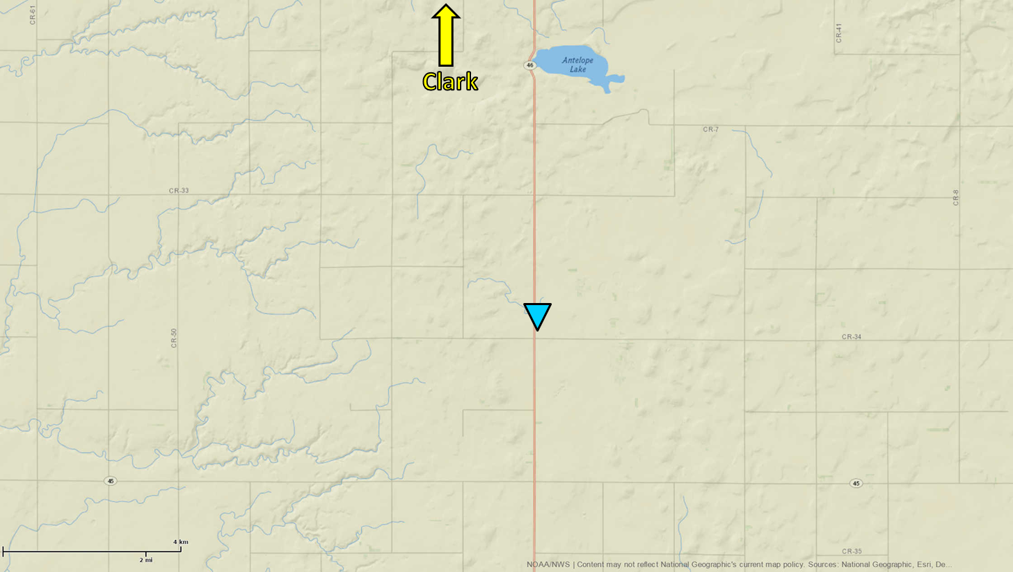 
Downloadable KMZ File |
||||||||||||||||
 |
 |
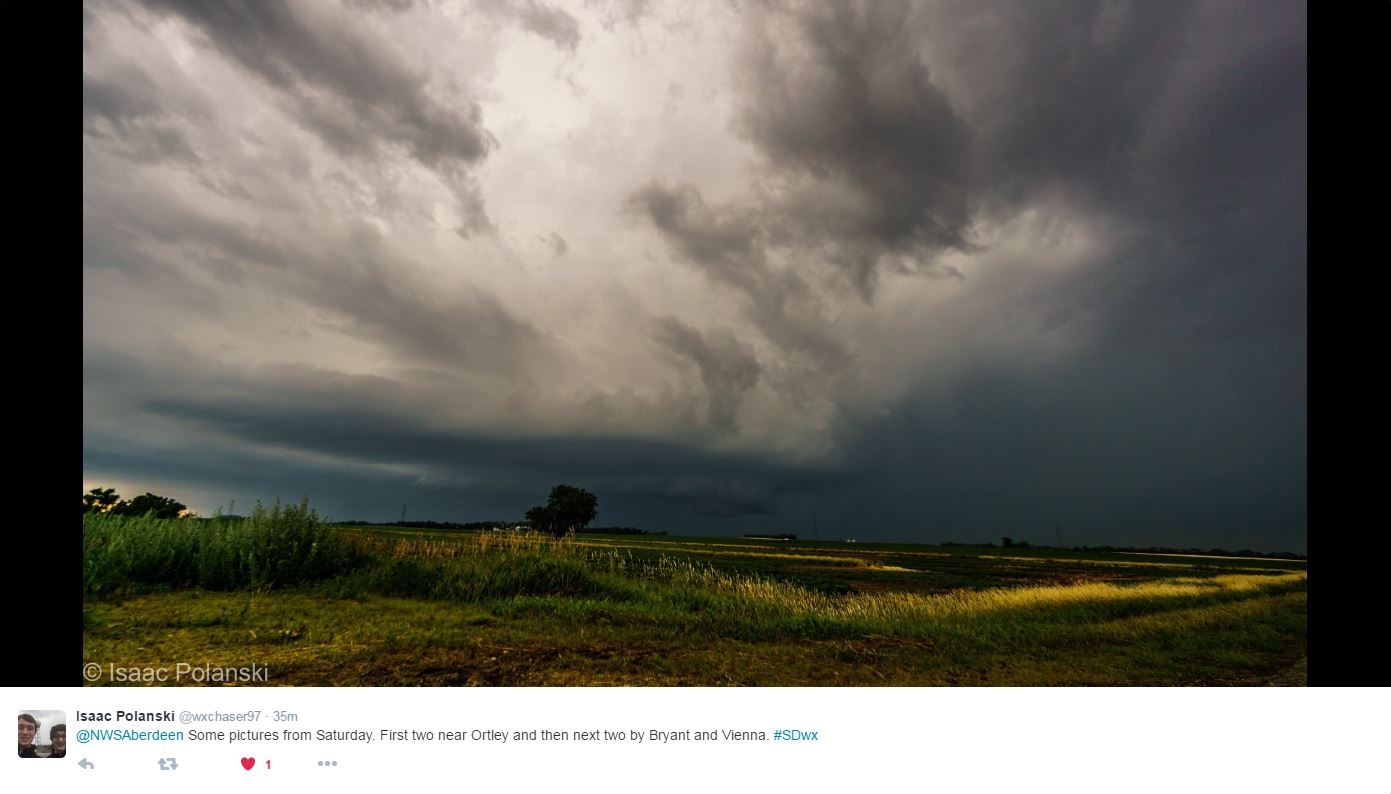 |
| Brief Tornado near Clark, SD - Photo by Bradley Winger | Wall cloud west of Clark - Photo by Bradley Winger | In the Bryant/Vienna area - Photo by Isaac Polanski |
The Enhanced Fujita (EF) Scale classifies tornadoes into the following categories:
| EF0 Weak 65-85 mph |
EF1 Moderate 86-110 mph |
EF2 Significant 111-135 mph |
EF3 Severe 136-165 mph |
EF4 Extreme 166-200 mph |
EF5 Catastrophic 200+ mph |
 |
|||||
Wind & Hail:
Wind
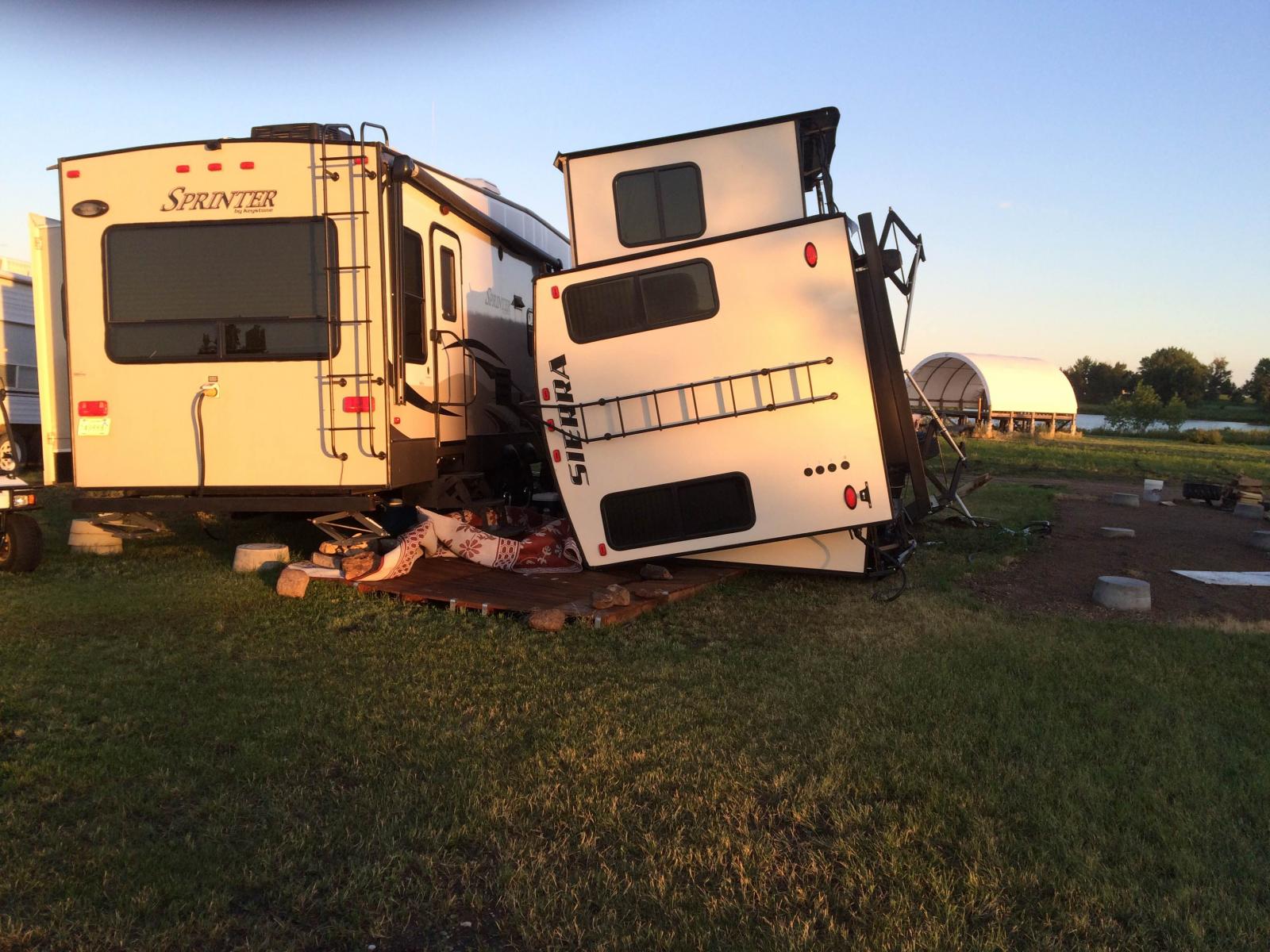
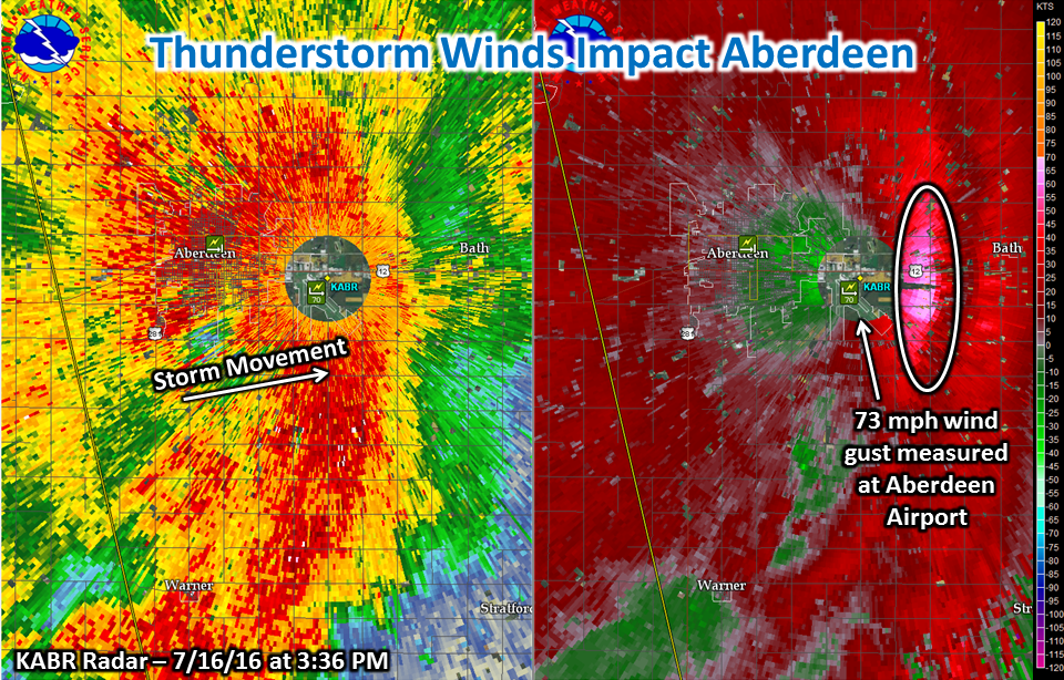
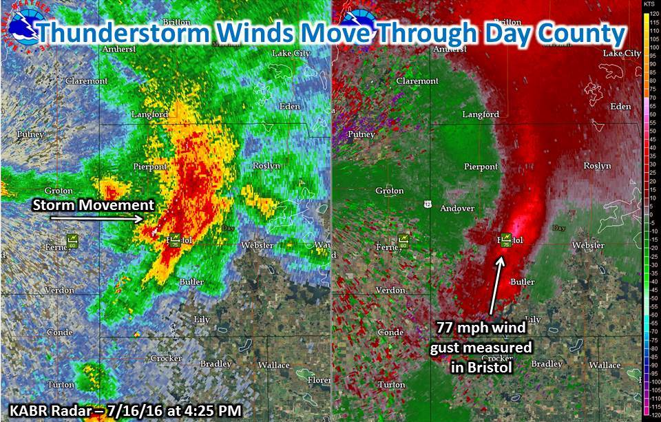
Dangerous high thunderstorm winds were the main story with Saturday's event as three distinct rounds developed throughout the day. The first raced east as a squall line from Edmunds through Grant County during the early afternoon. Wind gusts to 70 mph were reported consistently, including in Aberdeen where several instances of damage resulted. The next developed across Clark County during the evening hours as a supercell. Strong downdraft winds of 70+ mph struck the Lake Poinsett area, tipping several campers. Finally, around and after sunset, another intense line of storms developed across much of north central South Dakota. Many ~70 mph wind gusts, along with damage, were reported before it dissipated in Brown County after midnight.
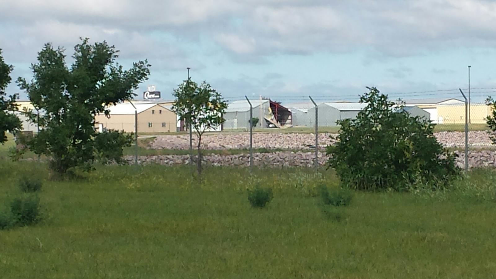
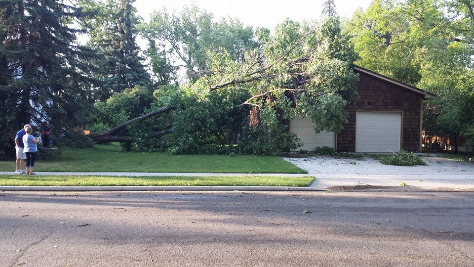
Aberdeen Area
 |
 |
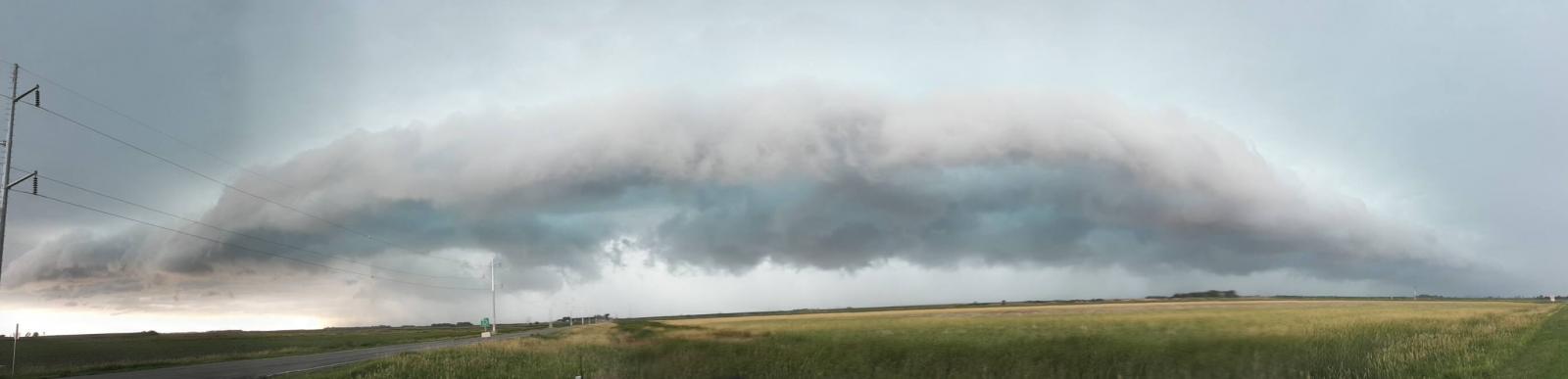 |
| Damage to a hanger at the Aberdeen Airport | Tree down on a garage in Aberdeen | Shelf cloud as seen a couple miles south of Aberdeen. Photo by Tina Urdahl. |
Brown/Day County
 |
 |
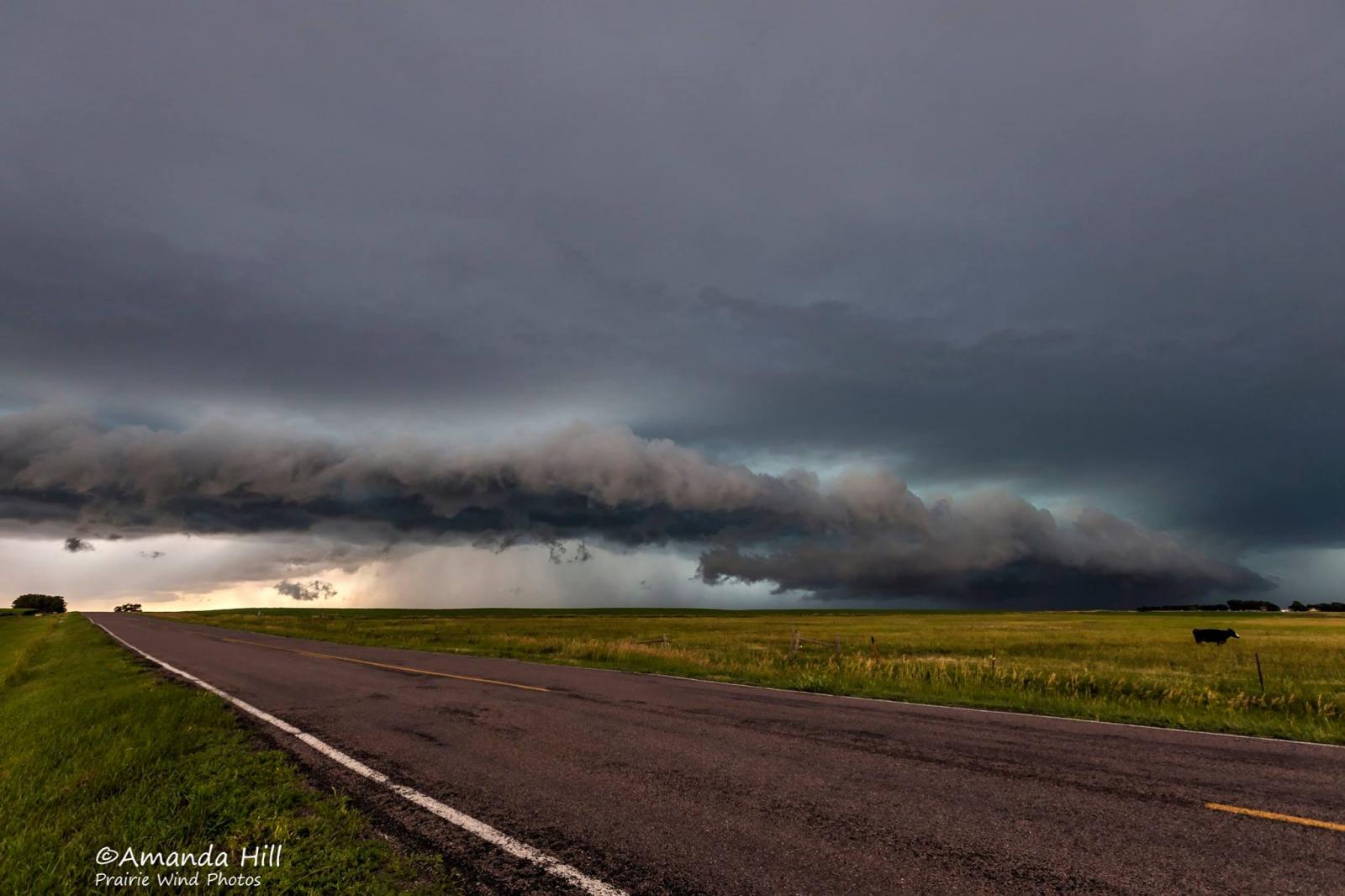 |
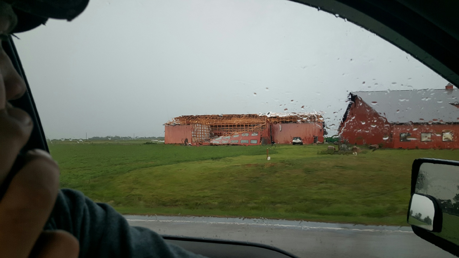
| 6 miles south of Groton - Video taken by Chad Johnson | Damage to a shed north of Bath | Shelf cloud located 6 miles west of Bristol - Photo by Amanda Hill |
Hamlin County
 |
 |
 |
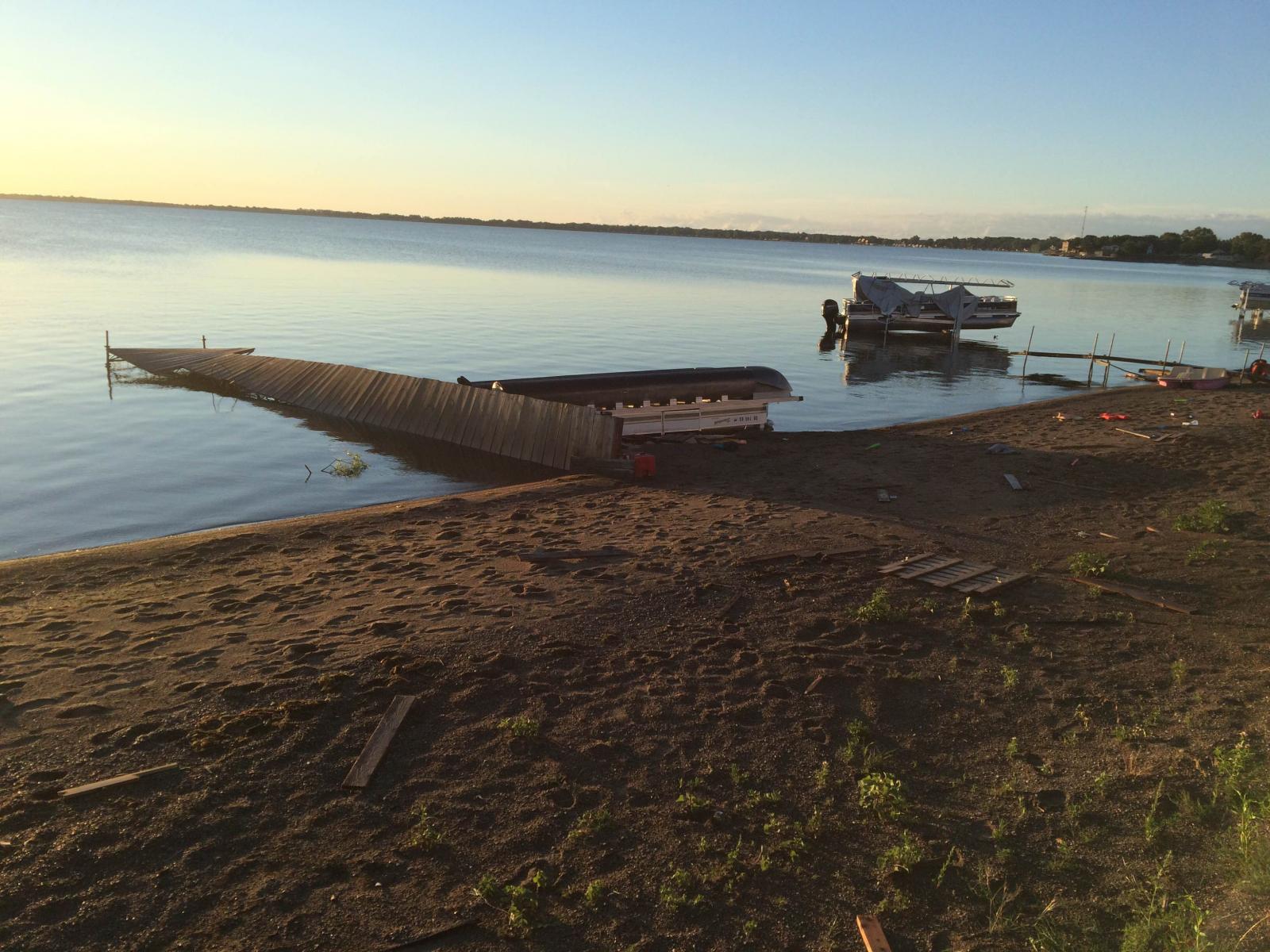 |
| Damage on Lake Poinsett - Photo by Dave Schaefer | Damage on Lake Poinsett - Photo by Dave Schaefer | Damage on Lake Poinsett - Photo by Dave Schaefer | Damage on Lake Poinsett - Photo by Dave Schaefer |
Hail
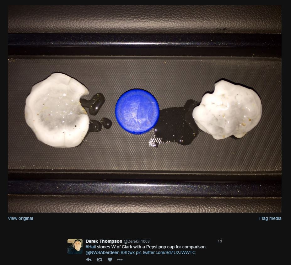
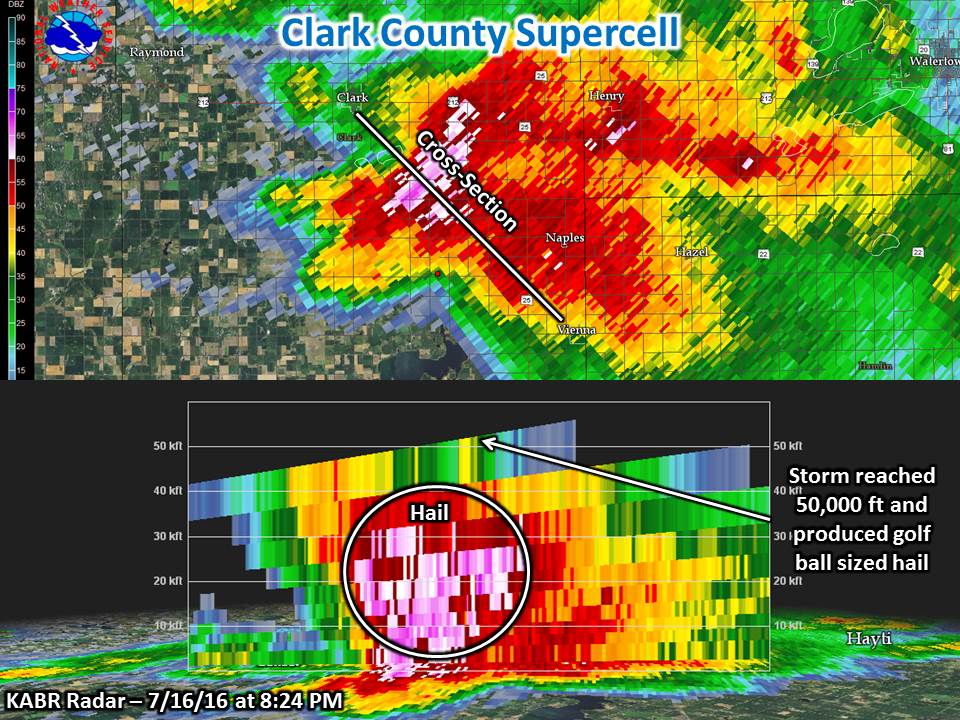
Large hail was also an issue, particularly with a supercell thunderstorm which impacted those roughly from Clark to Estelline. Reports of up to tennis ball sized (2.5") hail fell in that corridor. Additional storms with large hail impacted parts of Day through Traverse/Big Stone counties, as well as others across the area.
 |
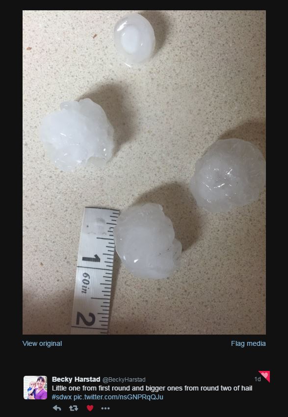 |
| Near Clark, SD: Derek Thompson | Wilmot, SD: Becky Harstad |
Radar:
Header
 |
 |
 |
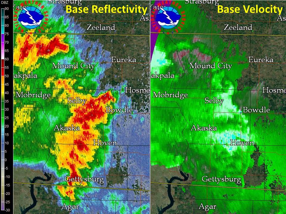 |
| Radar Image as the storm was exiting Aberdeen - 3:36 PM | Radar Image as the storm continued east through Day County - 4:25 PM | Radar image and cross-section of the supercell thunderstorm in Clark County at 8:24 PM | Radar Image of the squall line across north central South Dakota at 10:34 PM |
Storm Reports
.JPG)
Find the above map at http://www.spc.noaa.gov/climo/gmf.php?rpt=160716_rpts_filtered
PRELIMINARY LOCAL STORM REPORT
NATIONAL WEATHER SERVICE ABERDEEN SD
508 AM CDT SUN JUL 17 2016

..TIME...   ...EVENT...      ...CITY LOCATION...     ...LAT.LON...
..DATE...   ....MAG....      ..COUNTY LOCATION..ST.. ...SOURCE....
            ..REMARKS..

0147 PM     TSTM WND GST     2 E MOBRIDGE            45.54N 100.40W
07/16/2016  M60 MPH          WALWORTH           SD   ASOS

            .

0225 PM     HAIL             5 WSW LOYALTON          45.26N 99.36W
07/16/2016  E1.00 INCH       EDMUNDS            SD   PUBLIC

            NO DAMAGE APPARENT AT TIME OF CALL.

0230 PM     HAIL             2 NNW LOYALTON          45.31N 99.29W
07/16/2016  E0.75 INCH       EDMUNDS            SD   PUBLIC

            TIME ESTIMATED BY RADAR.

0330 PM     TSTM WND DMG     ABERDEEN                45.47N 98.48W
07/16/2016                   BROWN              SD   EMERGENCY MNGR

            SEVERAL TREES DOWNED ALONG WITH POWER LINES
            MAINLY IN SOUTHWEST ABERDEEN. A HANGER WALL
            AT THE AIRPORT ALSO DAMAGED. .

0335 PM     TSTM WND GST     3 ESE ABERDEEN          45.45N 98.42W
07/16/2016  M73 MPH          BROWN              SD   ASOS

            .

0340 PM     TSTM WND DMG     3 N BATH                45.52N 98.32W
07/16/2016                   BROWN              SD   EMERGENCY MNGR

            LARGE MACHINE SHED RECEIVED MAJOR DAMAGE TO
            A WALL AND THE ROOF. .

0400 PM     TSTM WND GST     2 NE FERNEY             45.35N 98.06W
07/16/2016  E60 MPH          BROWN              SD   PUBLIC

            SOME OF THE CORN CROP IS TWISTED, TORN AND
            BENT OVER.

0420 PM     HAIL             8 S KELDRON             45.81N 101.81W
07/16/2016  E1.00 INCH       CORSON             SD   PUBLIC

            NICKEL TO QUARTER SIZE HAIL WITH HEAVY RAIN.

0425 PM     TSTM WND GST     BRISTOL                 45.35N 97.76W
07/16/2016  M77 MPH          DAY                SD   TRAINED SPOTTER

            ROAD SIGN BENT SIDEWAYS AND ZERO VISIBILITY.

0500 PM     TSTM WND GST     1 NNW WAUBAY            45.34N 97.31W
07/16/2016  E65 MPH          DAY                SD   STORM CHASER

            .
0517 PM     TSTM WND GST     5 ENE ORTLEY            45.35N 97.11W
07/16/2016  E60 MPH          ROBERTS            SD   PUBLIC
0525 PM     TSTM WND GST     1 S SUMMIT              45.29N 97.04W
07/16/2016  M76 MPH          GRANT              SD   MESONET

            .

0720 PM     HAIL             2 N WILMOT              45.44N 96.86W
07/16/2016  M1.50 INCH       ROBERTS            SD   PUBLIC

            RELAYED VIA SOCIAL MEDIA. RADAR ESTIMATED
            TIME.

0740 PM     HAIL             2 SSW RAYMOND           44.88N 97.95W
07/16/2016  E1.00 INCH       CLARK              SD   LAW ENFORCEMENT

            .

0742 PM     FUNNEL CLOUD     2 S RAYMOND             44.88N 97.94W
07/16/2016                   CLARK              SD   LAW ENFORCEMENT

            .

0745 PM     HAIL             5 NW CLARK              44.93N 97.81W
07/16/2016  U1.00 INCH       CLARK              SD   PUBLIC

            .

0750 PM     HAIL             5 W CLARK               44.88N 97.84W
07/16/2016  E1.75 INCH       CLARK              SD   PUBLIC

            WALL CLOUD STILL VISIBLE.

0812 PM     FUNNEL CLOUD     3 S CLARK               44.84N 97.73W
07/16/2016                   CLARK              SD   LAW ENFORCEMENT

            .

0819 PM     HAIL             3 S CLARK               44.84N 97.73W
07/16/2016  E1.75 INCH       CLARK              SD   LAW ENFORCEMENT

            .

0820 PM     HAIL             5 S CLARK               44.80N 97.73W
07/16/2016  E2.50 INCH       CLARK              SD   STORM CHASER

            .

0823 PM     TORNADO          7 S CLARK               44.78N 97.73W
07/16/2016                   CLARK              SD   LAW ENFORCEMENT

            .

0845 PM     HAIL             3 ESE NAPLES            44.76N 97.46W
07/16/2016  E1.75 INCH       HAMLIN             SD   LAW ENFORCEMENT

            .

0908 PM     HAIL             FORT PIERRE             44.36N 100.38W
07/16/2016  E1.00 INCH       STANLEY            SD   PUBLIC

            .

0908 PM     TSTM WND GST     3 E FIRESTEEL           45.43N 101.22W
07/16/2016  E65 MPH          DEWEY              SD   PUBLIC

            .

0938 PM     HAIL             2 W LAKE NORDEN         44.58N 97.25W
07/16/2016  E1.00 INCH       HAMLIN             SD   EMERGENCY MNGR

            HAIL ACCOMPANIED BY 45-50 MPH WIND GUSTS.

0938 PM     TSTM WND GST     4 W TRAIL CITY          45.47N 100.81W
07/16/2016  M71 MPH          DEWEY              SD   MESONET

            .

0945 PM     TSTM WND GST     6 NE TRAIL CITY         45.54N 100.64W
07/16/2016  E60 MPH          CORSON             SD   LAW ENFORCEMENT

            .

0951 PM     HAIL             3 E LAKE NORDEN         44.59N 97.15W
07/16/2016  E1.00 INCH       HAMLIN             SD   STORM CHASER

            .

0951 PM     HAIL             3 ENE LAKE NORDEN       44.60N 97.15W
07/16/2016  E1.00 INCH       HAMLIN             SD   STORM CHASER

            .

0954 PM     TSTM WND GST     4 SE LAKE NORDEN        44.54N 97.16W
07/16/2016  E60 MPH          HAMLIN             SD   EMERGENCY MNGR

            .

0958 PM     TSTM WND GST     MOBRIDGE                45.54N 100.44W
07/16/2016  E70 MPH          WALWORTH           SD   LAW ENFORCEMENT

            .

1000 PM     HAIL             4 SSW STONE BRIDGE      44.55N 97.10W
07/16/2016  E1.00 INCH       HAMLIN             SD   PUBLIC

            .

1003 PM     TSTM WND GST     1 ENE MOBRIDGE          45.55N 100.41W
07/16/2016  M64 MPH          WALWORTH           SD   ASOS

            MOBRIDGE ASOS.

1005 PM     TSTM WND GST     1 SSE MAHTO             45.74N 100.66W
07/16/2016  M79 MPH          CORSON             SD   MESONET

            WINDS IN EXCESS OF 60MPH BEGAN AT APPROX
            955PM CDT AND CONTINUED THROUGH 1010PM CDT.
            PEAK WIND OF 79MPH AT 1005PM CDT.

1005 PM     TSTM WND GST     AKASKA                  45.33N 100.12W
07/16/2016  E60 MPH          WALWORTH           SD   LAW ENFORCEMENT

            .

1020 PM     TSTM WND GST     3 N GANN VALLEY         44.08N 98.99W
07/16/2016  M60 MPH          BUFFALO            SD   MESONET

            .

1028 PM     TSTM WND GST     POLLOCK                 45.90N 100.29W
07/16/2016  E70 MPH          CAMPBELL           SD   LAW ENFORCEMENT

            .
1036 PM     TSTM WND DMG     9 N ONAKA               45.33N 99.49W
07/16/2016                   EDMUNDS            SD   NWS EMPLOYEE

            FEW SHINGLES BLOWN OFF ROOF, LARGE TREE LIMB
            DOWN BLOCKING ROAD. RADAR ESTIMATED TIME.


1038 PM     TSTM WND GST     2 N HERREID             45.87N 100.07W
07/16/2016  M65 MPH          CAMPBELL           SD   MESONET

            .

1101 PM     TSTM WND GST     2 W ROSCOE              45.45N 99.37W
07/16/2016  M72 MPH          EDMUNDS            SD   EMERGENCY MNGR

            MEASURED WITH HAND-HELD DEVICE.

1110 PM     TSTM WND GST     10 SW LONG LAKE         45.77N 99.36W
07/16/2016  M73 MPH          MCPHERSON          SD   MESONET

            .

1120 PM     TSTM WND GST     CRAVENS CORNER          45.45N 98.93W
07/16/2016  M64 MPH          EDMUNDS            SD   MESONET

            .

1139 PM     TSTM WND GST     5 SSW RICHMOND LAKE REC 45.47N 98.64W
07/16/2016  M59 MPH          BROWN              SD   MESONET

            .

1149 PM     TSTM WND GST     1 WNW MELLETTE          45.16N 98.51W
07/16/2016  M56 MPH          SPINK              SD   MESONET

            .
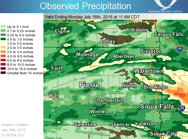
Rain Reports
 |
Media use of NWS Web News Stories is encouraged! Please acknowledge the NWS as the source of any news information accessed from this site. |
|

