
A significant heat wave continues for the Rockies, Northern Plains, and Great Lakes into the Mid-Atlantic, peaking in intensity through midweek and lingering across parts of the Northern Plains and Midwest until this weekend. Excessive rainfall my bring life-threatening and locally catastrophic flash and urban flooding across portions of southwestern Texas through early Friday. Read More >
Overview
|
The winter of 1996-97 was a harsh and prolonged, once in a generation type winter across central and northeastern South Dakota and west central Minnesota, with repeated instances of heavy snow, icing, extreme cold, strong winds, low visibilities, and very large snowdrifts and snow depths. Daily life was severely disrupted, and those who lived through it often have stories to tell. It began on October 26th, when a strong low pressure area came up from the southwest and produced up to 6 inches of heavy snow and wind gusts up to 50 mph in Corson County, which downed over 100 power poles and left several hundred people without power. Meanwhile severe weather with large hail, damaging winds, and tornadoes impacted northeast South Dakota and west central Minnesota. From November 1996 through April 1997, winter storm after winter storm affected central, north central and northeast South Dakota as well as west central Minnesota, which resulted in record snowfall and cold, blizzard conditions, massive snow drifts, and several bouts of icing from freezing rain. While there were many significant winter weather events through the course of the winter, as detailed further down the page, keep in mind there were also numerous additional instances of impactful lighter snow and blowing snow episodes along with persistent cold as well. By late March and early April, rapid snowmelt resulted in record flooding across many area rivers and record high water levels on area lakes. |
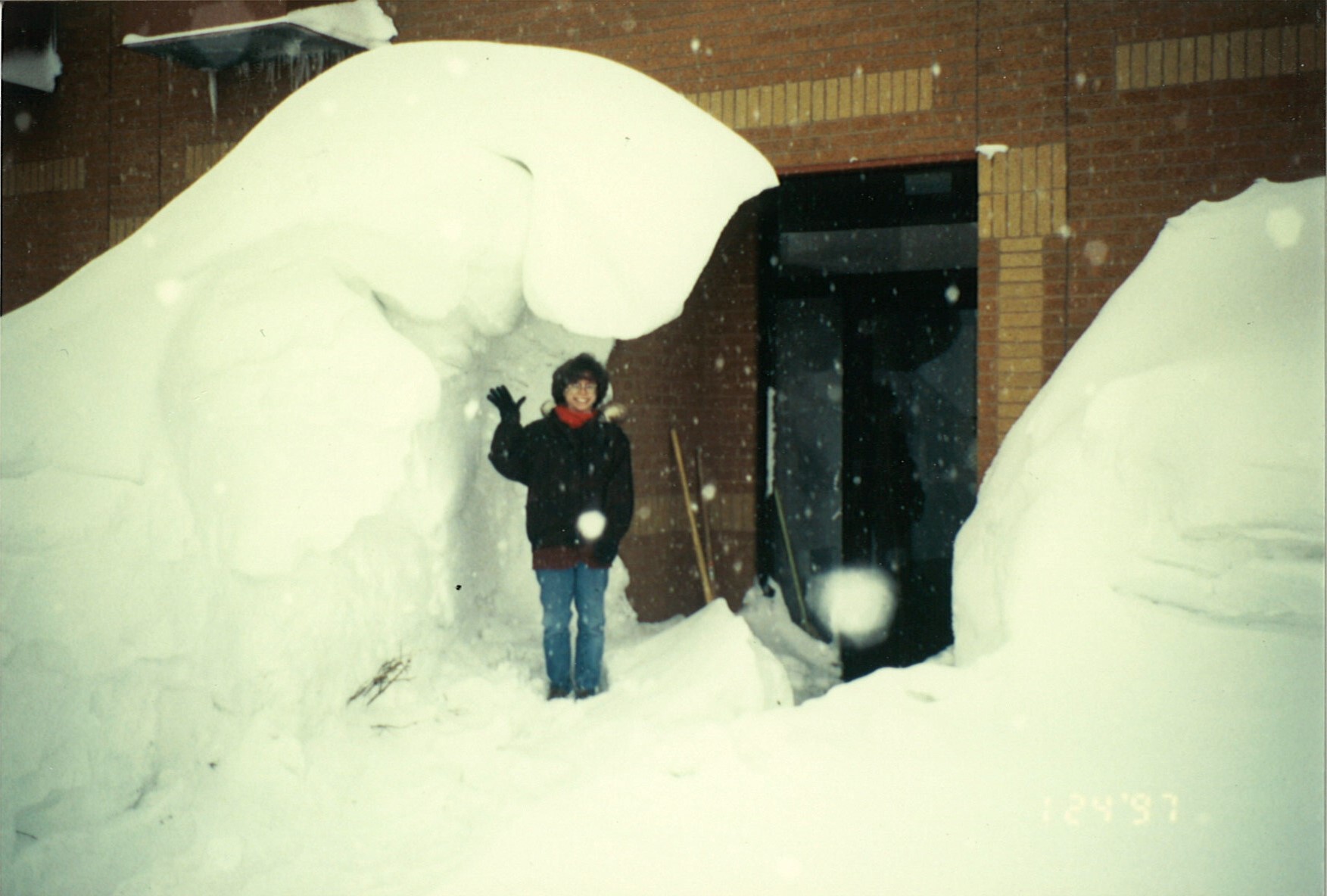 Large snow drift at the back exit of the NWS Aberdeen, SD weather forecast office on January 24th, 1997 |
Review & Historical Significance:
Add a written summary or simply an LSR map in this section. If writing an extensive report, you can break the report down into wind and hail below (otherwise delete).
Review
There were several significant weather events across our forecast area during the winter of 1996-97:
November 16th: Winter storm with heavy snow of 6 to 9 inches, November 16th-17th: Winter storm with widespread freezing rain, 4 to 10 inches of snow, near blizzard conditions, November 19th-20th: Winter storm with widespread freezing rain, 3 to 12 inches of snow, near blizzard conditions, November 22nd-23rd: Winter storm with heavy snow of 6 to 8 inches, November 29th-30th: Winter storm with widespread freezing rain and 2 to 4 inches of snow, December 14th: Winter storm with heavy snow of 6 to 20 inches and near blizzard conditions, December 16th-19th: Blizzard with gusts to 55 mph and extreme wind chills, December 23rd: Blizzard with 2 to 5 inches of snow, January 3rd-5th: Blizzard with gusts to 60 mph, widespread freezing rain, 6 to 26 inches of snow, and extreme wind chills, January 9th-10th: Blizzard with gusts to 60 mph, 2 to 7 inches of snow, extreme wind chills, January 22nd: Blizzard with extreme wind chills, February 3rd-4th: Winter storm with 4 to 7 inches of snow and blowing snow and low visibilities, Late February: Flooding began on the Bad River in central South Dakota, March 3rd-4th: Winter storm with 4 to 7 inches of snow and blowing snow with low visibilities, March 12th-14th: Winter storm with freezing rain and 3 to 8 inches of snow, Late March-April: Record flooding for all rivers and record high lake levels across the area, April 4th-6th: Ice storm/Blizzard, 1 to 3 inches of ice from freezing rain, 4 to 12 inches of snow with winds gusting to 70 mph, May: Flooding on several rivers continued throughout May.
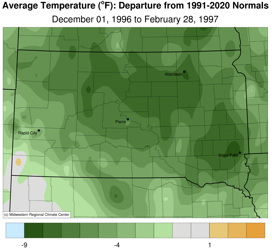
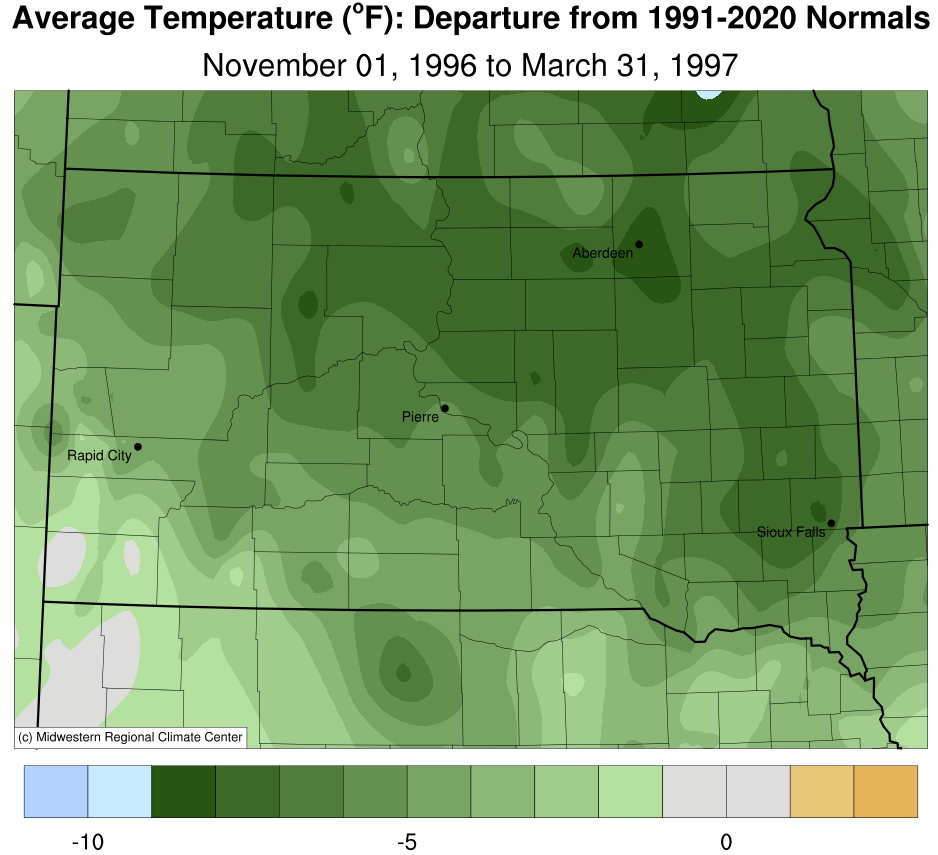
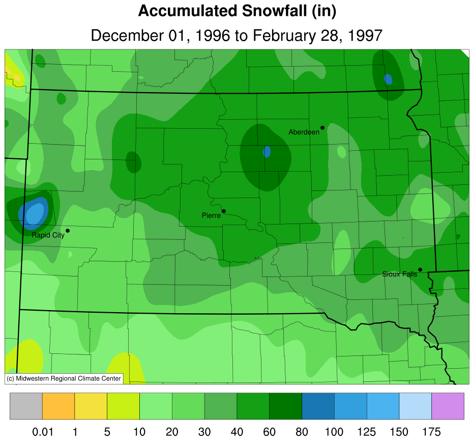
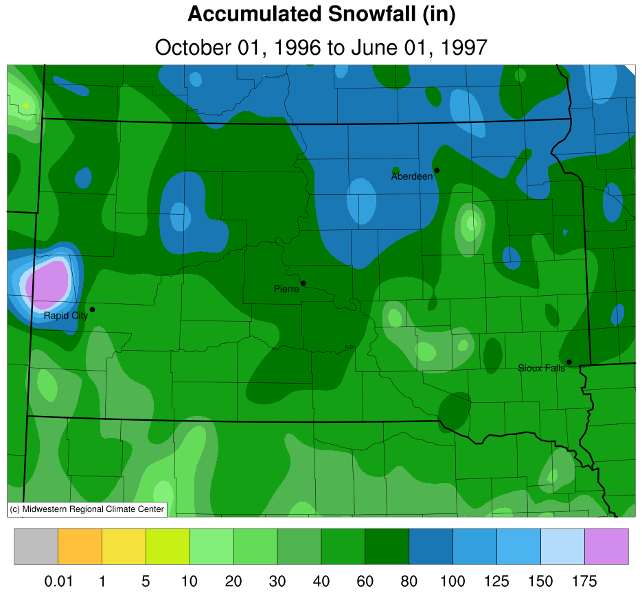
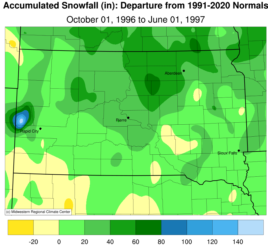
By springtime, Kennebec finished the 1996-97 winter season with 69.8" of snow, Pierre 73.7", Mobridge and Aberdeen 75.9", Sisseton 79.1", Timber Lake 80.0", and Wheaton 82.3" (no COOP Observer in Watertown this season). Below is how the winter season compares to normal in terms of overall temperature and snowfall, from the Midwestern Regional Climate Center.
 |
 |
 |
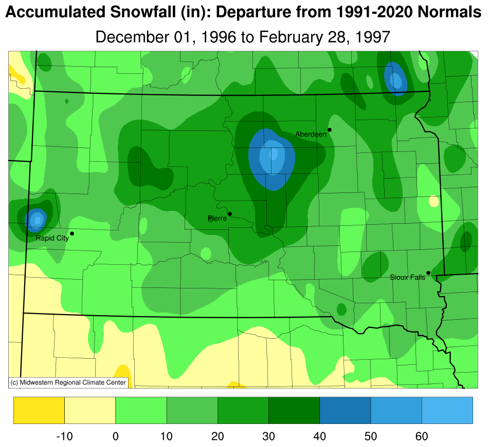 |
| December 1, 1996 - February 28, 1997 Temperature Departure from Normal | November 1, 1996 - March 31, 1997 Temperature Departure from Normal | December 1, 1996 - February 28, 1997 Accumulated Snowfall | December 1, 1996 - February 28, 1997 Snowfall Departure from Normal |
 |
 |
||
| October 1, 1996 - June 1, 1997 Accumulated Snowfall | October 1, 1996 - June 1, 1997 Snowfall Departure from Normal |
Historical Significance
Some of the effects from the devastating winter of 1996-97 include widespread power outages from thousands of power lines and poles downed, numerous county and township roads, highways, and interstates closed, thousands of stranded travelers, hundreds of accidents, ditched vehicles, and rescues, tens of days of school closings across the area, tens of thousands of livestock died, hundreds of outbuilding collapses from the weight of snow and ice, hundreds of businesses and airports closed throughout the winter along with events canceled or postponed, snow drifts high enough to nearly bury homes, and compact enough to drive on top of, and hundreds of homes, outbuildings, and roads flooded.
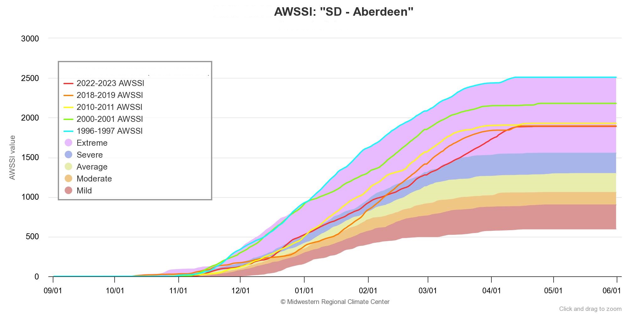
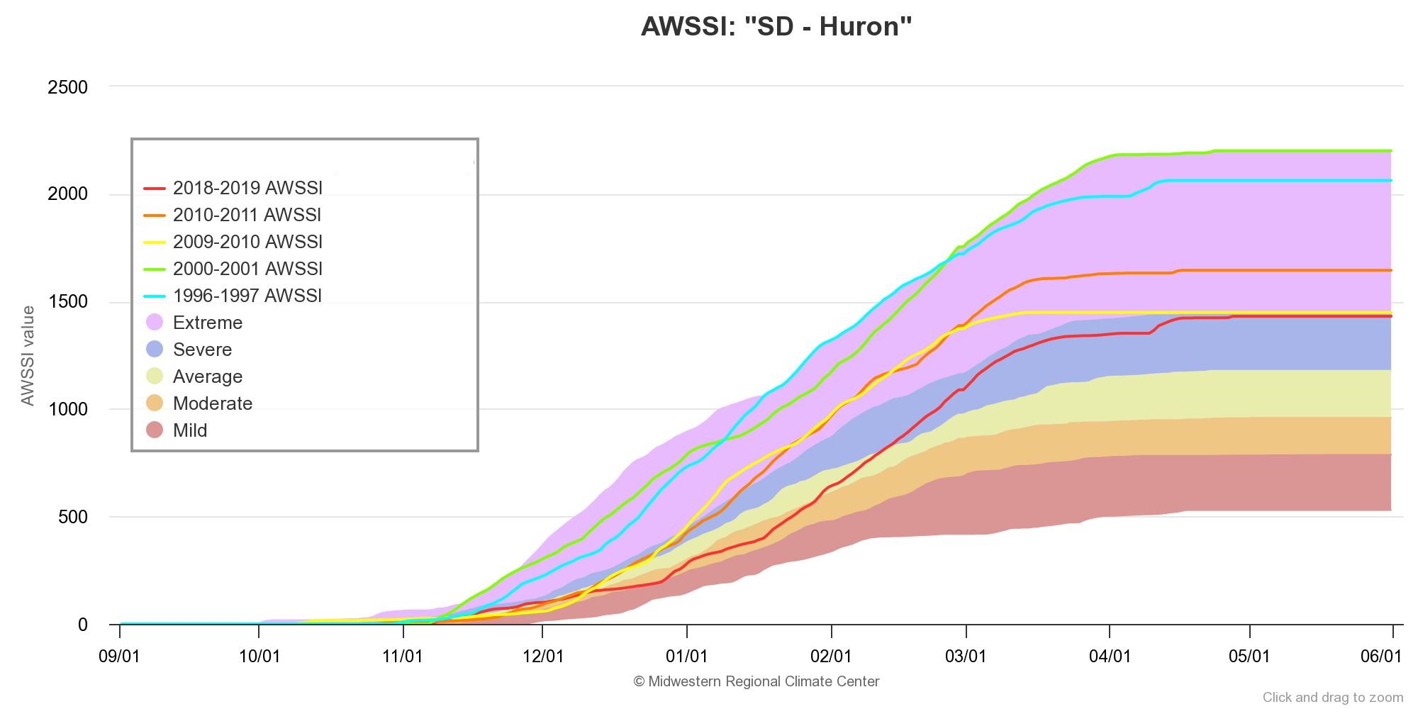
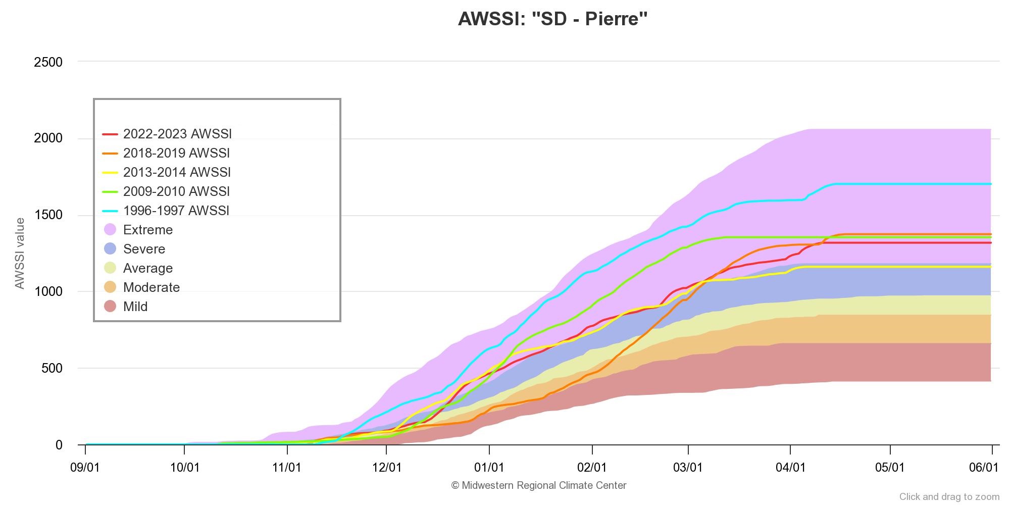
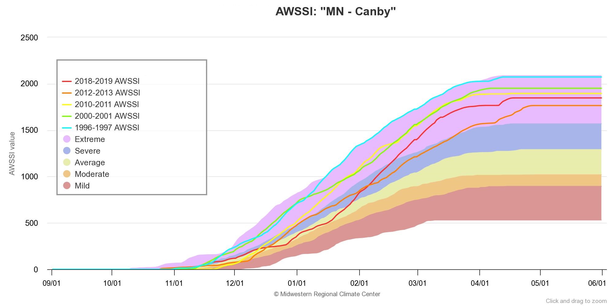
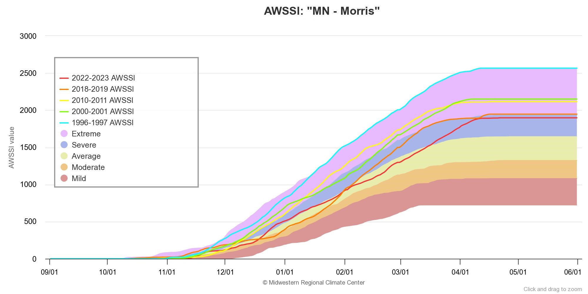
Below are graphs at various locations across the area (Watertown did not have a COOP Observer during the winter of 1996-97) of the Accumulated Winter Season Severity Index (AWSSI), which aims to answer the question "How severe was this winter" via objective quantification using max/min temperature, snowfall, and snow depth or precipitation (does NOT include less commonly available data such as wind, wind chill, blowing snow, mixed precipitation, or freezing rain). In a nutshell, the graphs depict a distribution of how mild (red background shade) to extreme (purple background shade) winters have been relative to each location's climatology, using data from 1950-2023. Plotted via lines is the winter of 1996-97, in cyan, and the worst 4 winters that have followed. Notice, some winters begin mild and become extreme through time, whereas others begin extreme and end that way, as was the case in 1996-97 for most.
 |
 |
 |
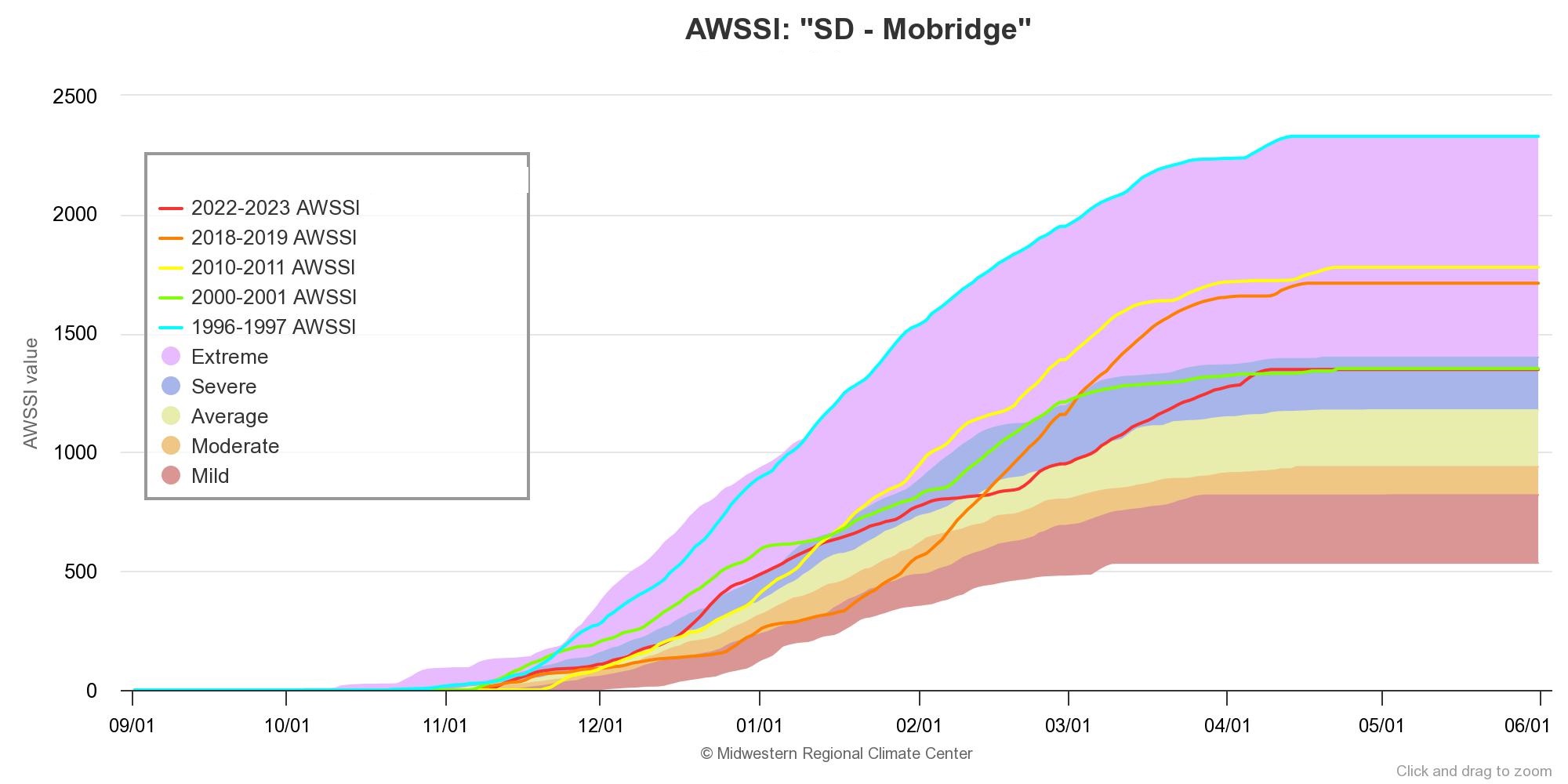 |
| Perspective via the AWSSI for Aberdeen, SD | Perspective via the AWSSI for Huron, SD | Perspective via the AWSSI for Pierre, SD | Perspective via the AWSSI for Mobridge, SD |
 |
 |
||
| Perspective via the AWSSI for Canby, MN | Perspective via the AWSSI for Morris, MN |
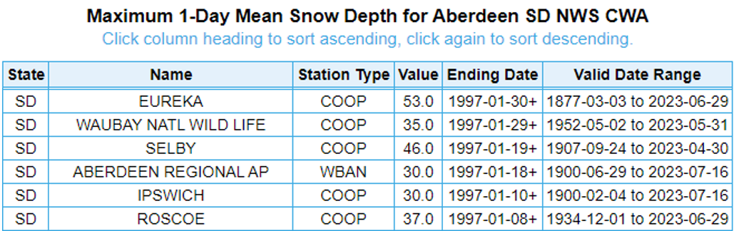
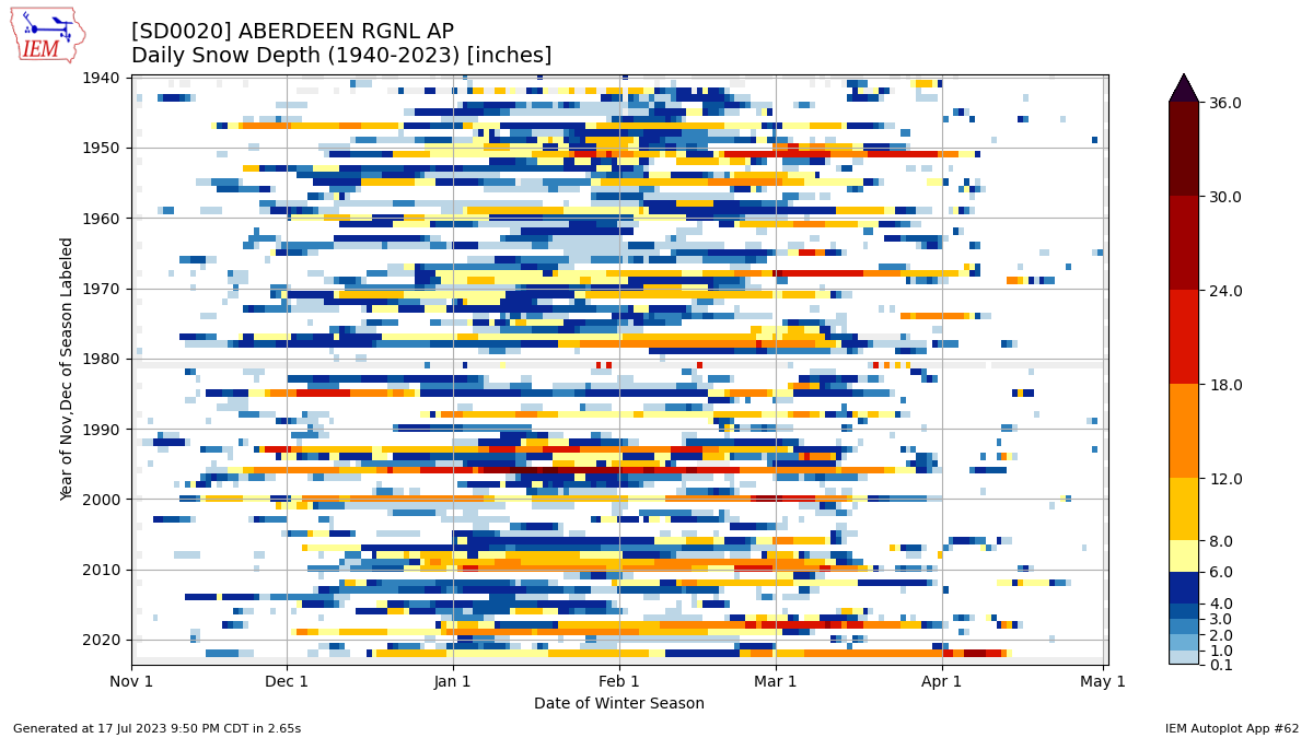
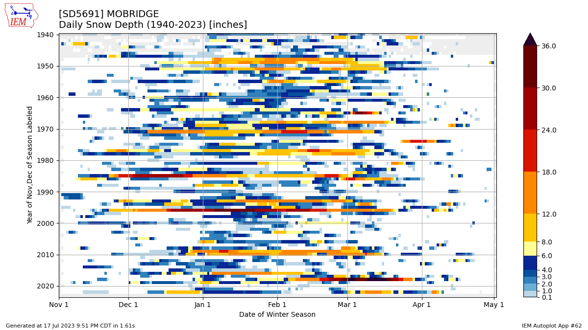
Below is information related to snow depth at various locations across the area, in part from the Iowa Environmental Mesonet.
 |
 |
 |
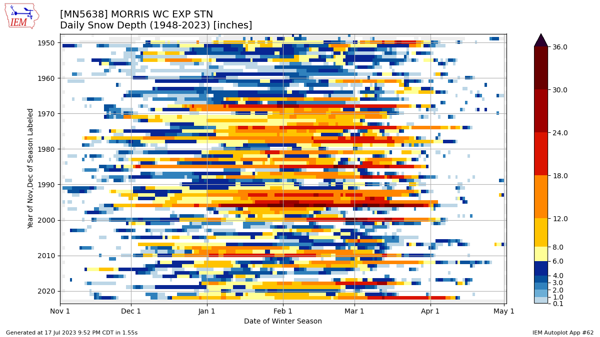 |
| A list of locations who's snow depth record remains unsurpassed as of summer 2023 | Snow depth records at Aberdeen, SD from 2023 to 1940 (bottom to top) and from November 1st to May 1st (left to right) | Snow depth records at Mobridge, SD from 2023 to 1940 (bottom to top) and from November 1st to May 1st (left to right) | Snow depth records at Morris, MN from 2023 to 1940 (bottom to top) and from November 1st to May 1st (left to right) |
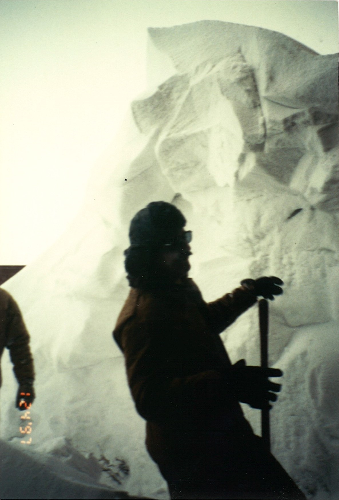
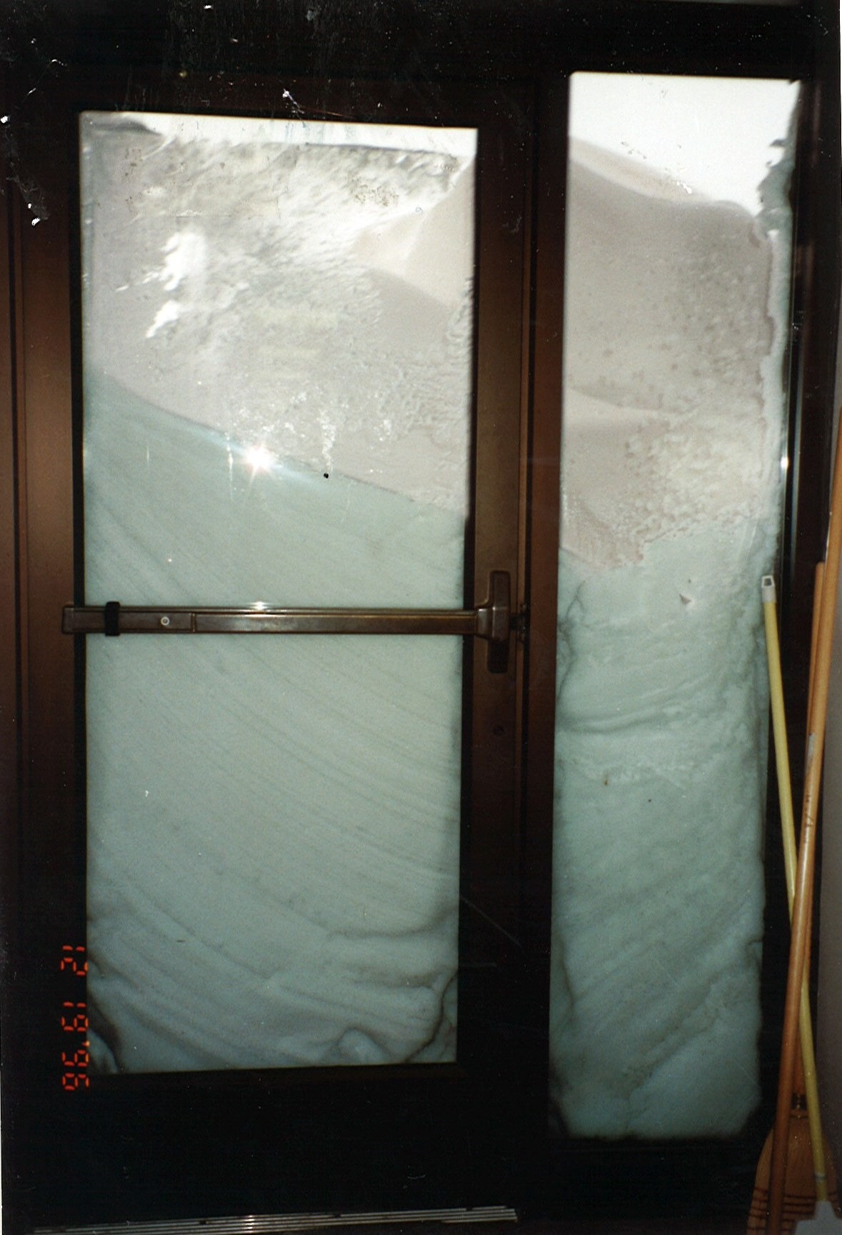
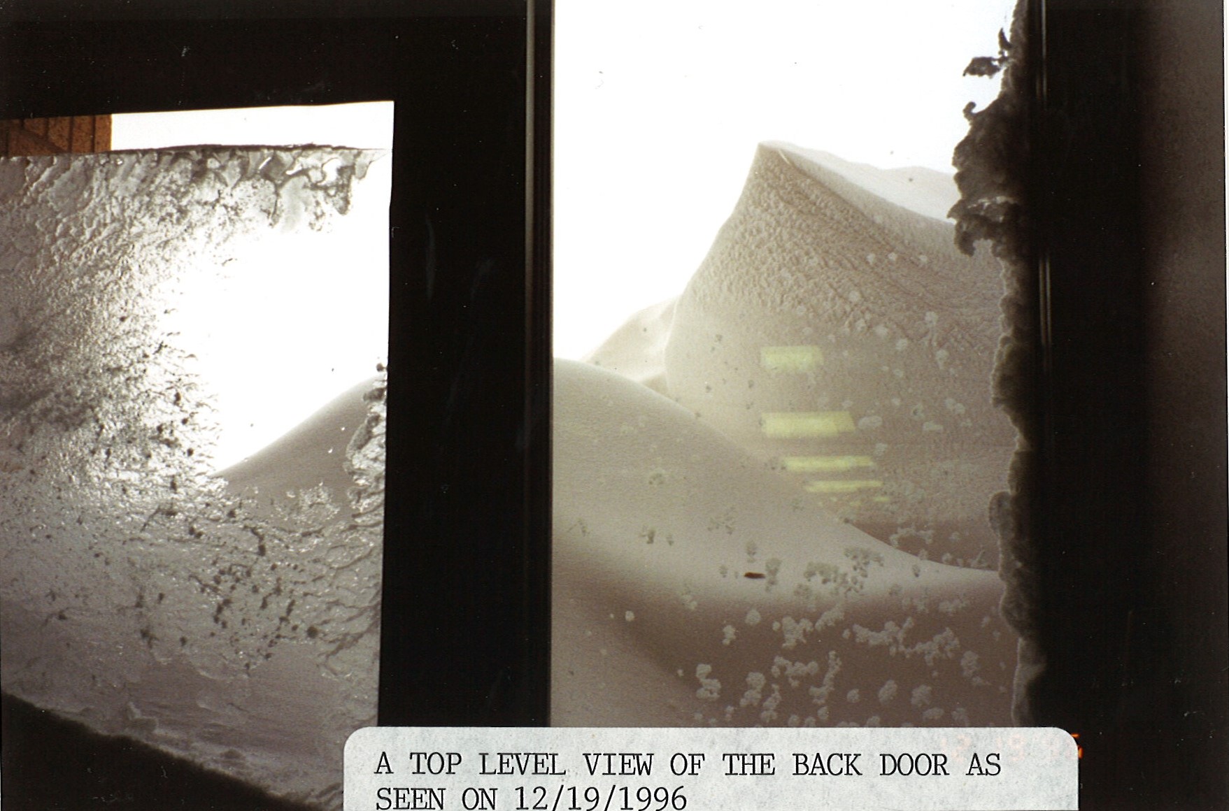
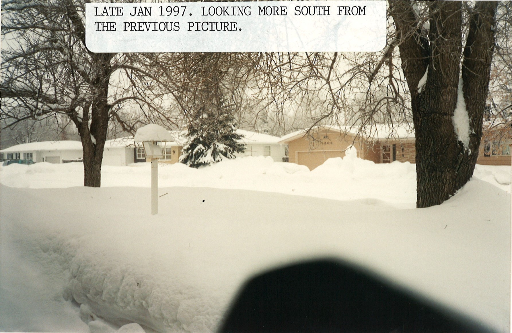
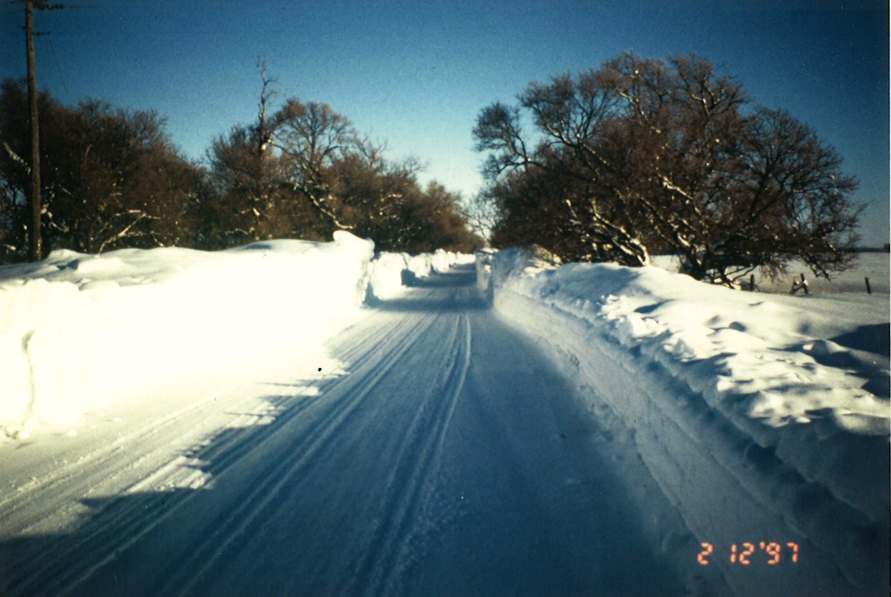
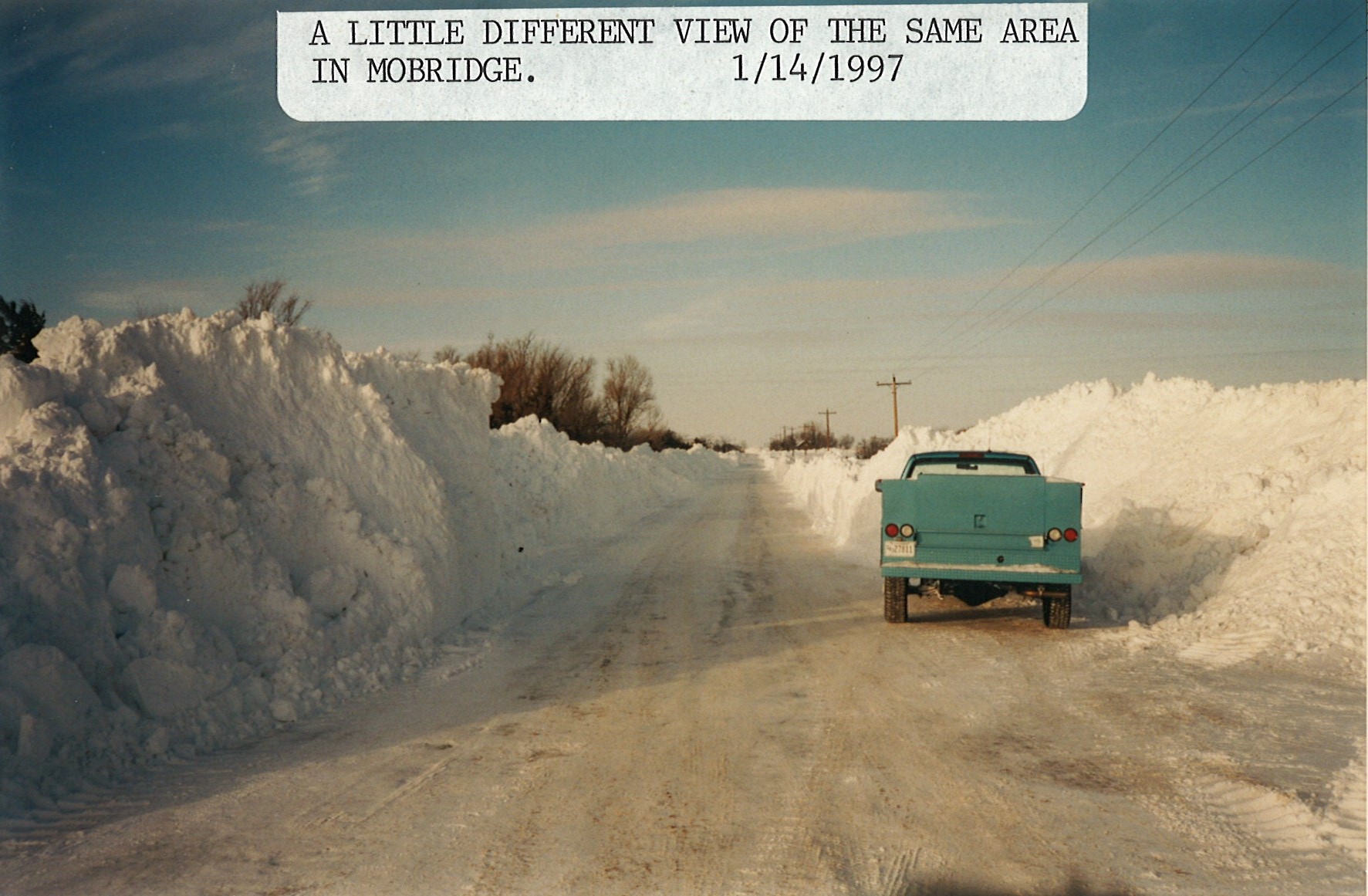
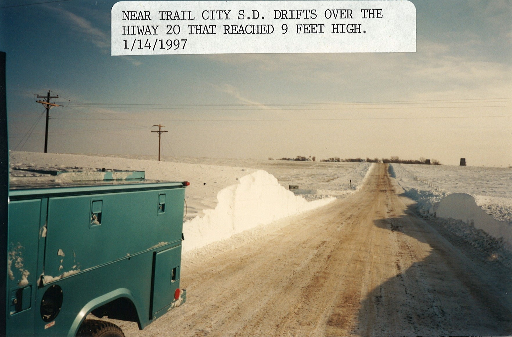
Winter Weather Photos
While photos can't do justice, here are several collected by the National Weather Service office in Aberdeen, SD during the winter of 1996-1997 and spring of 1997.
 |
 |
 |
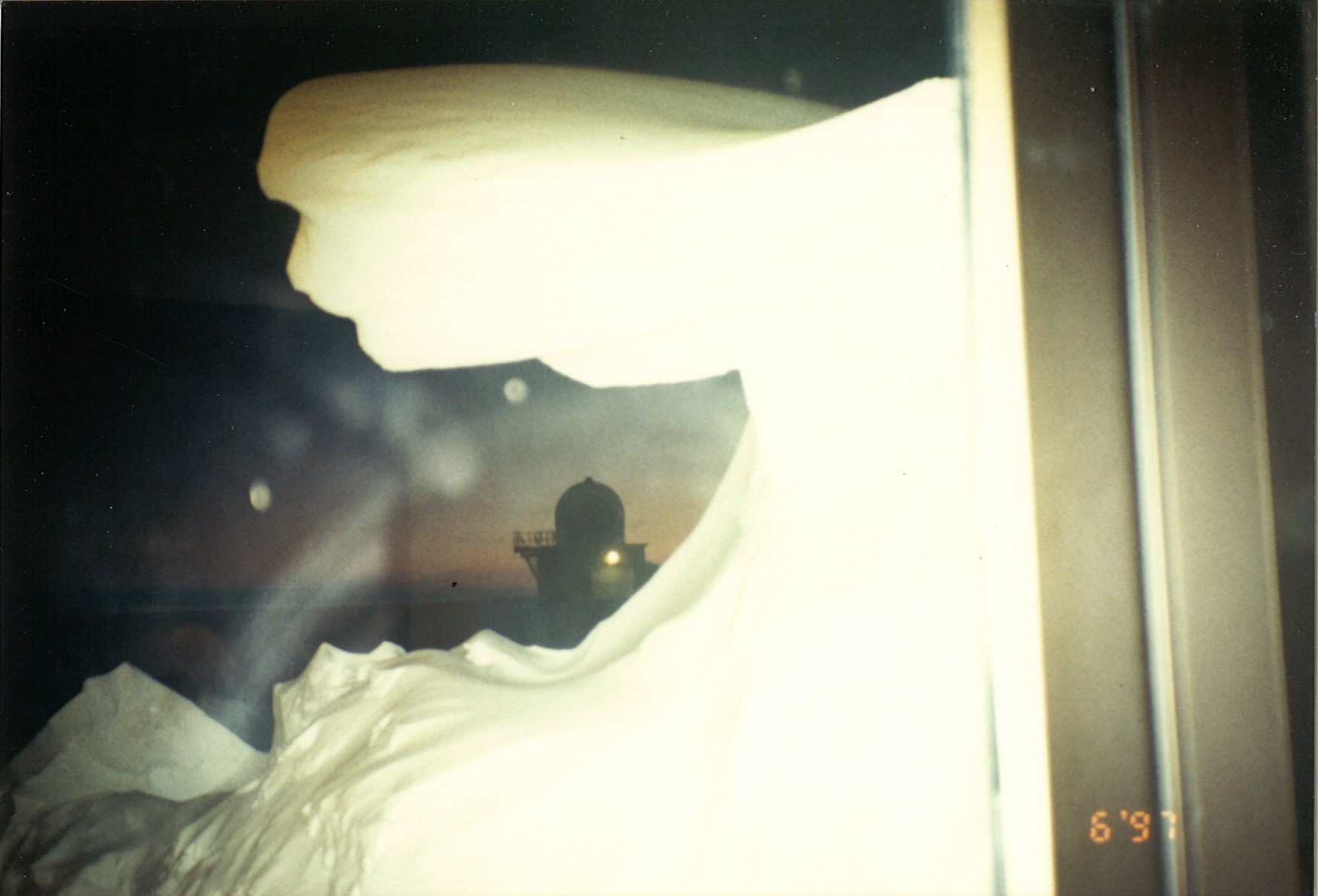 |
| Large drift at the NWS Aberdeen, SD weather forecast office | Large drift at the NWS Aberdeen, SD weather forecast office | Large drift at the NWS Aberdeen, SD weather forecast office | Large drift at the NWS Aberdeen, SD weather forecast office |
 |
 |
 |
 |
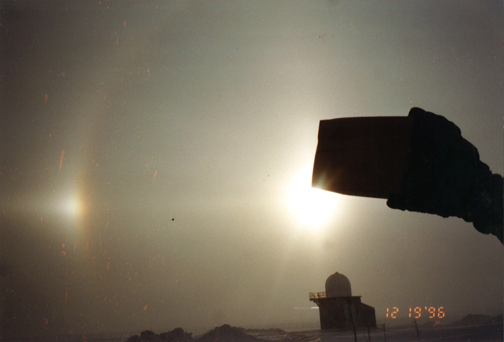
| Sun dogs captured at the NWS Aberdeen, SD weather forecast office |
 |
 |
 |
 |
 |
 |
 |
 |
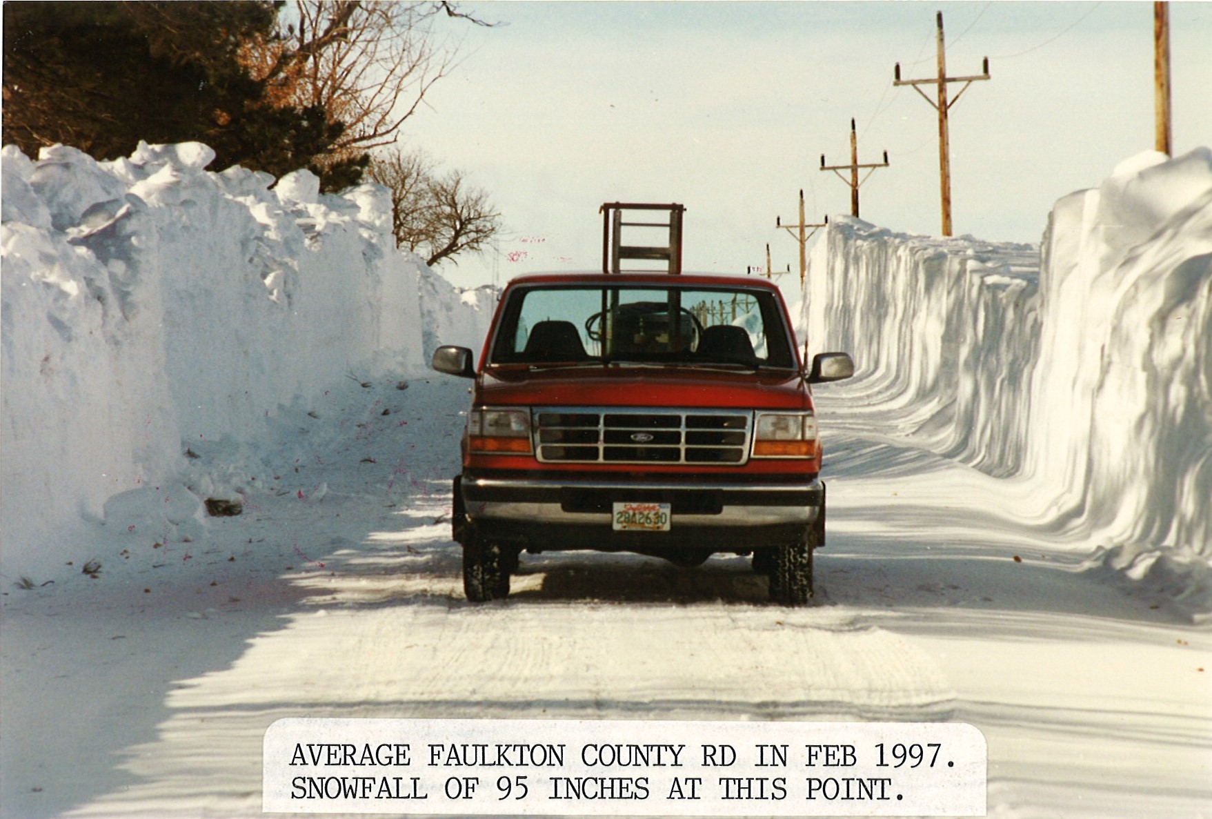
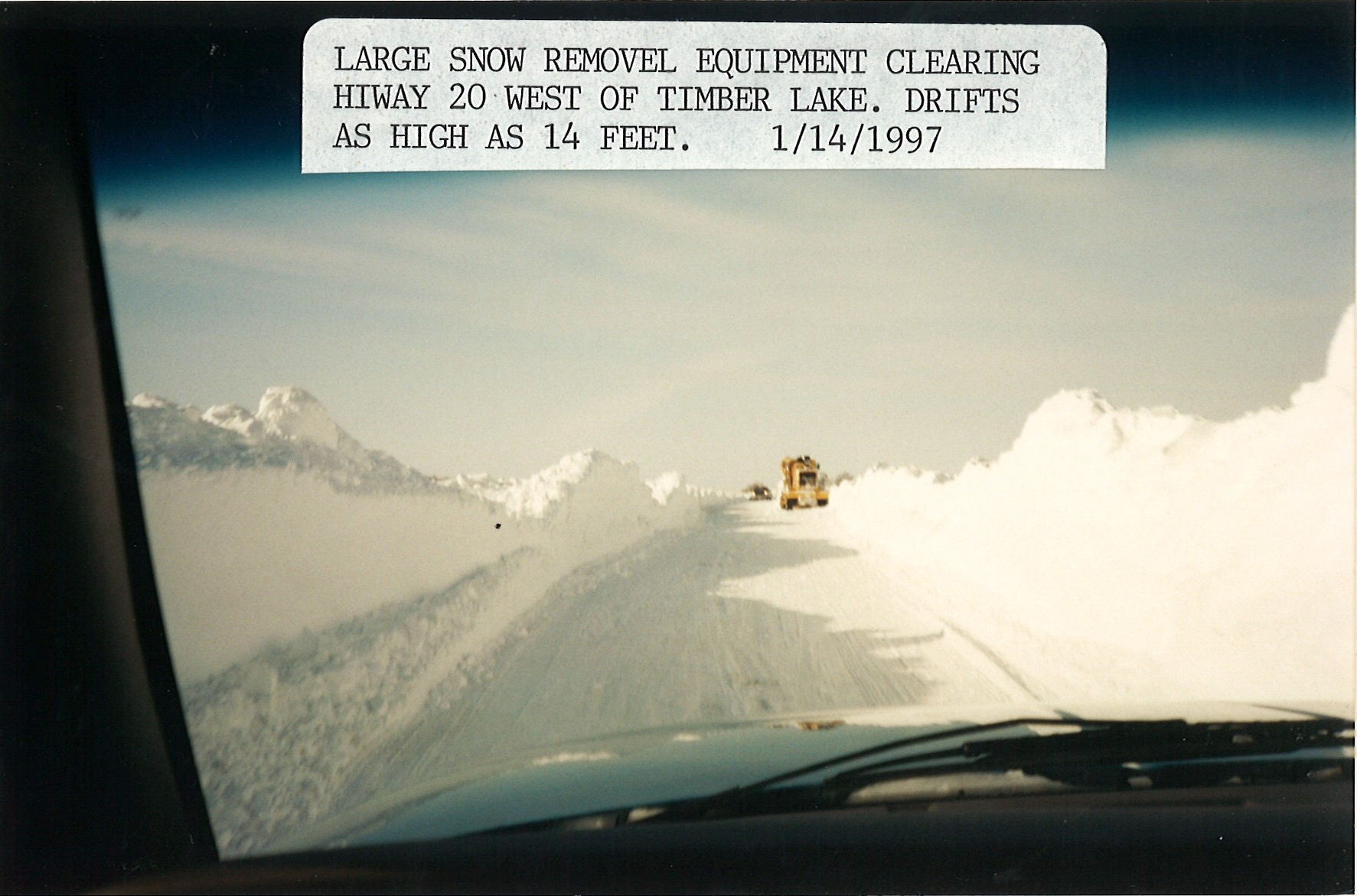
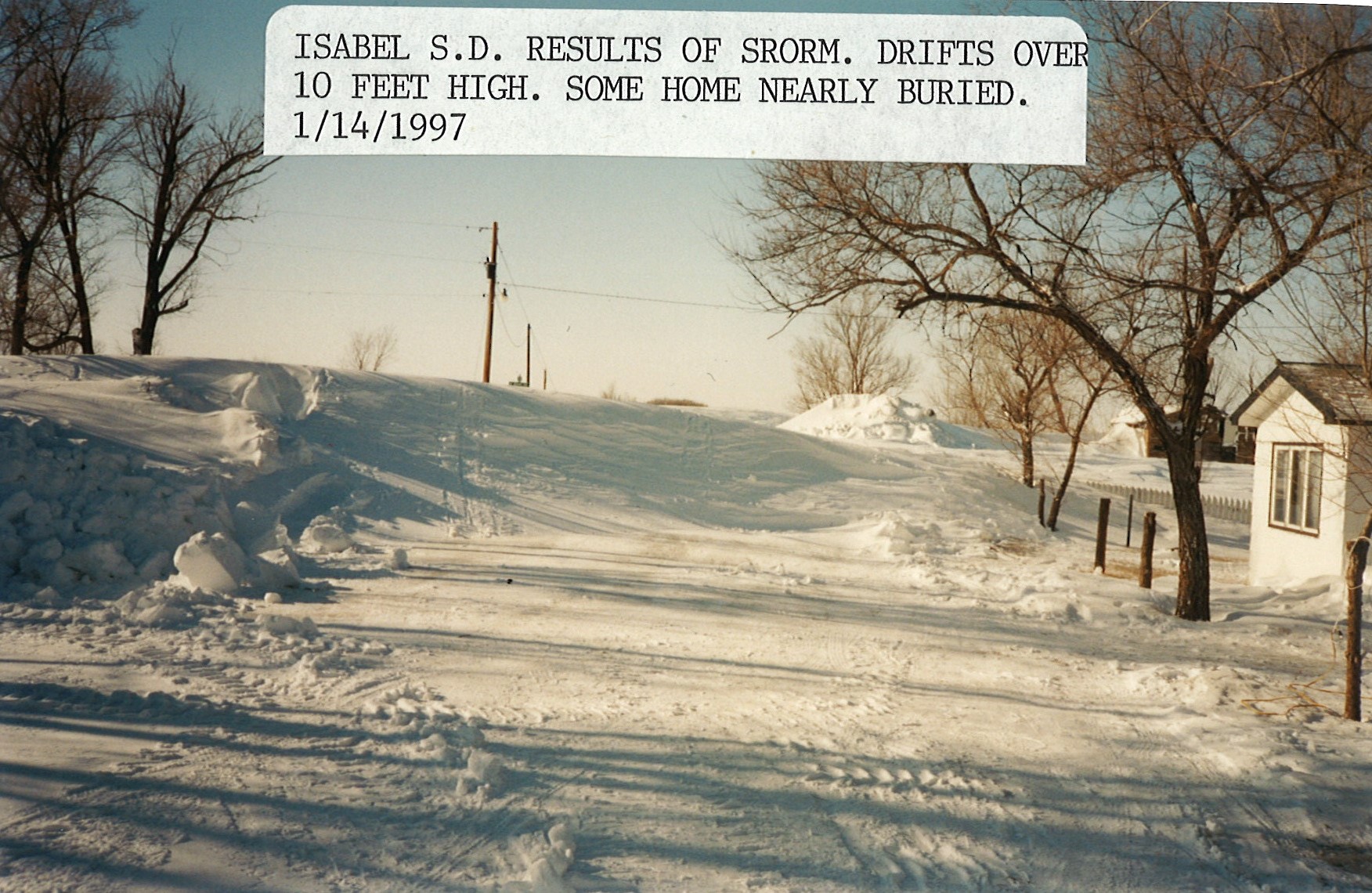
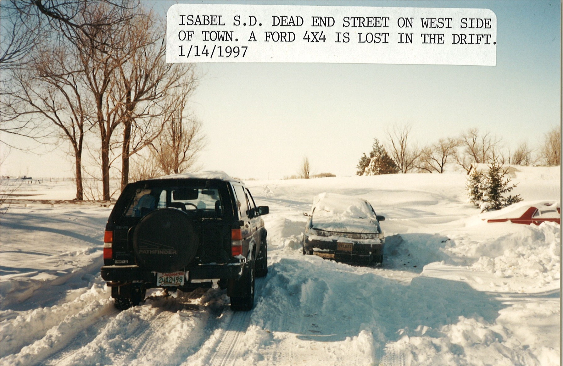
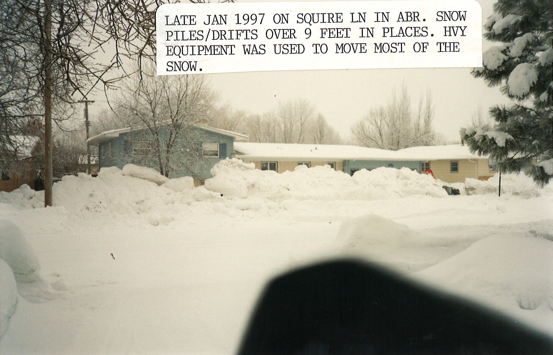
| Snow drifts up to 10 feet high |
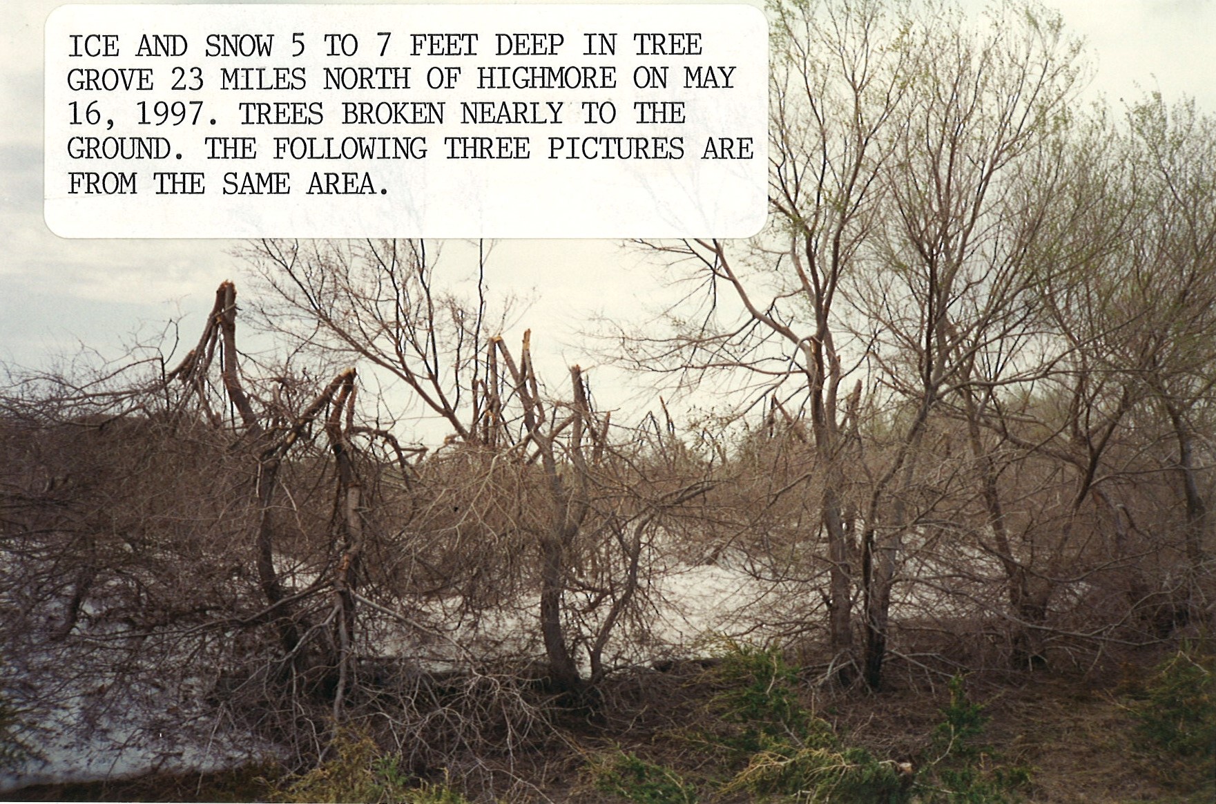
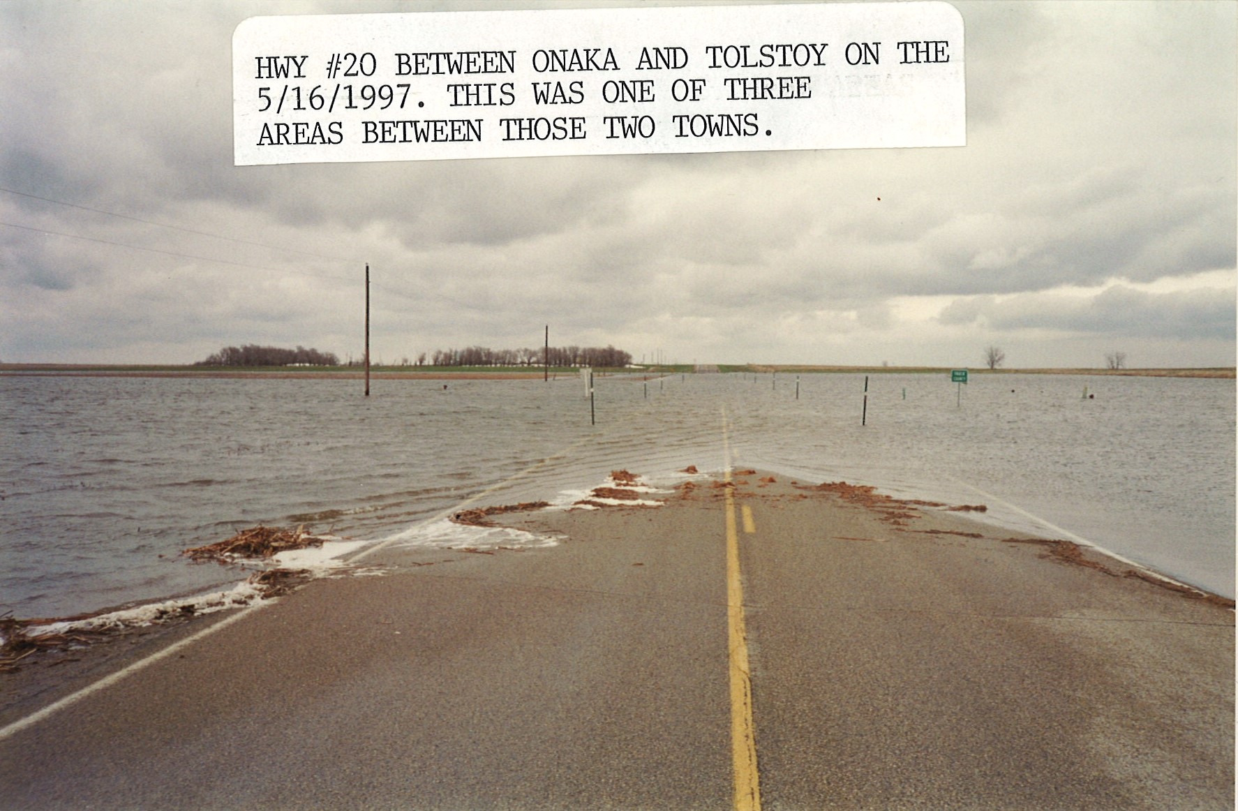
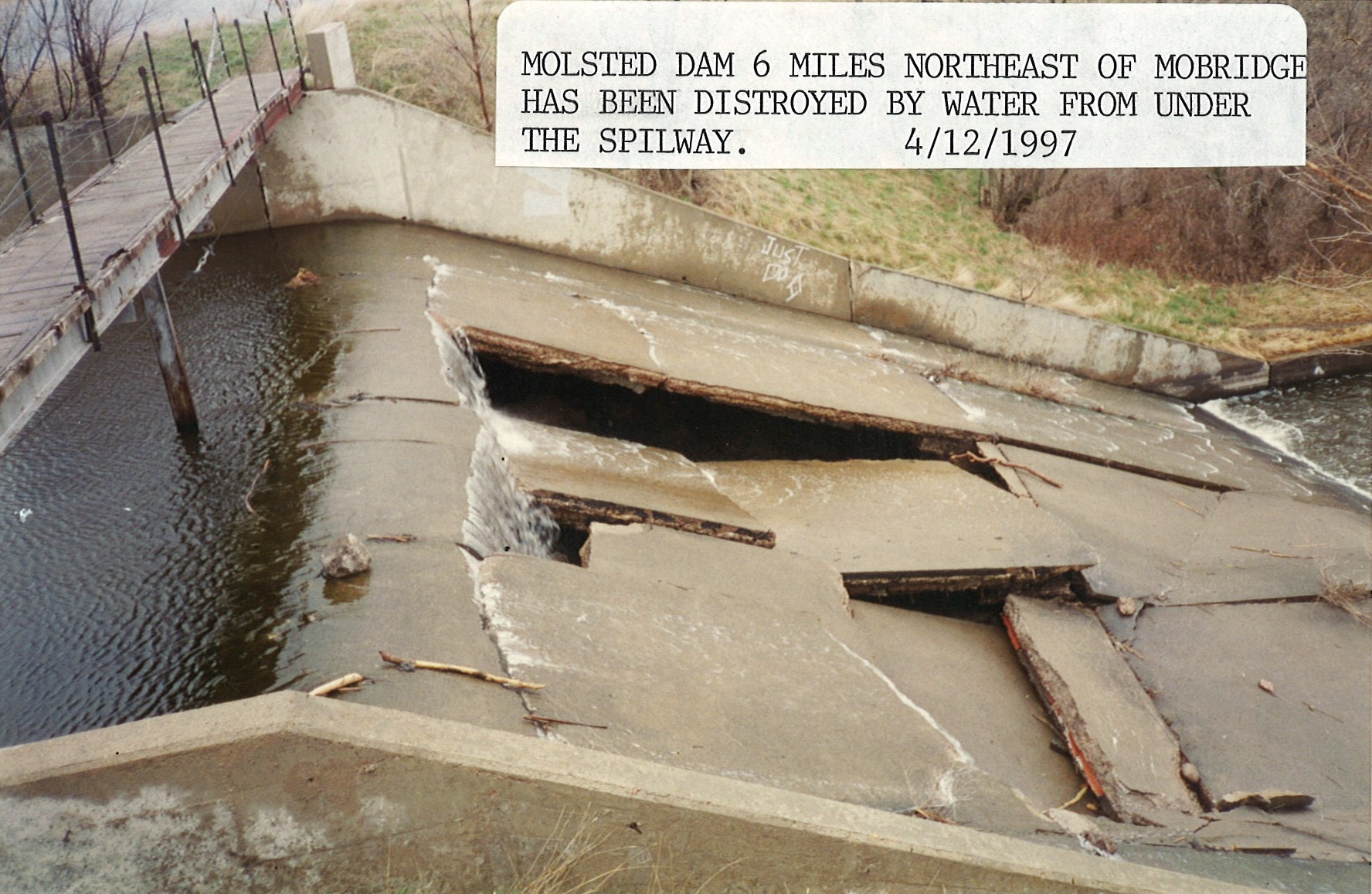
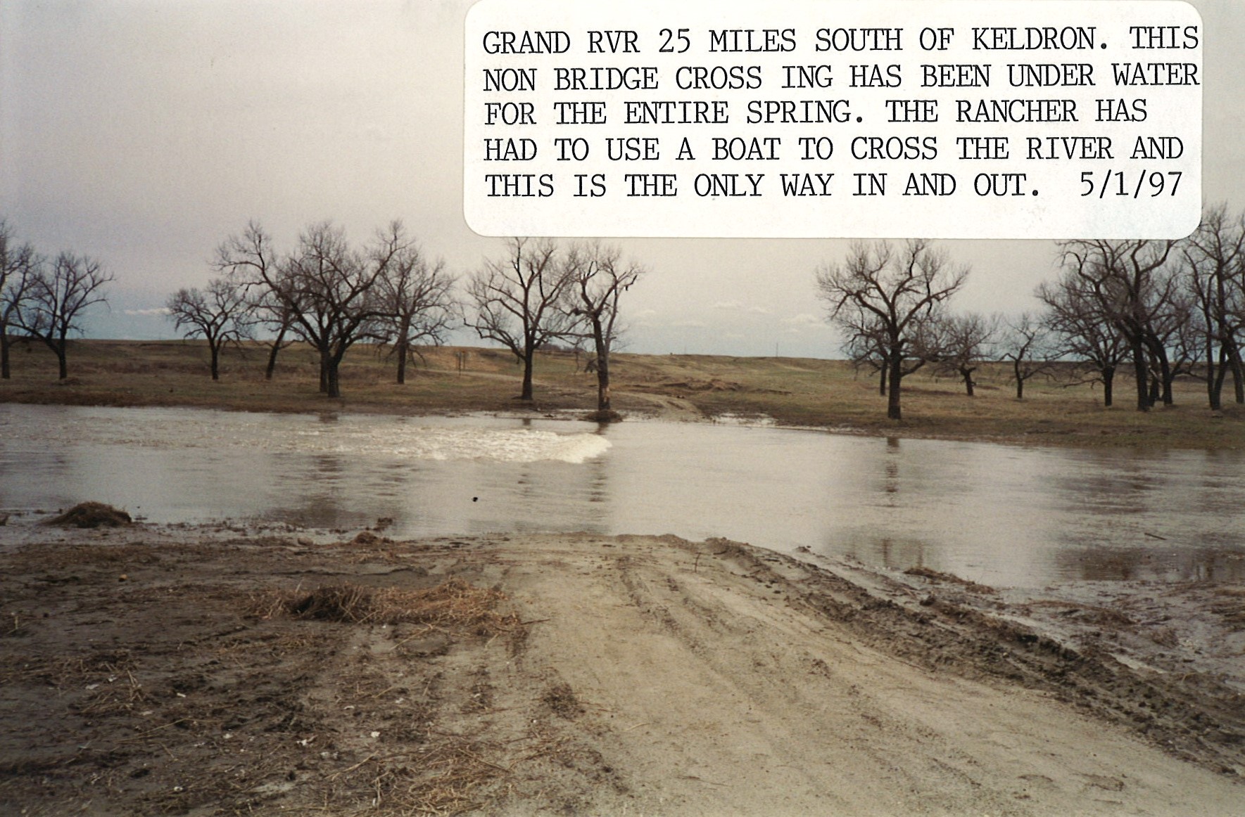
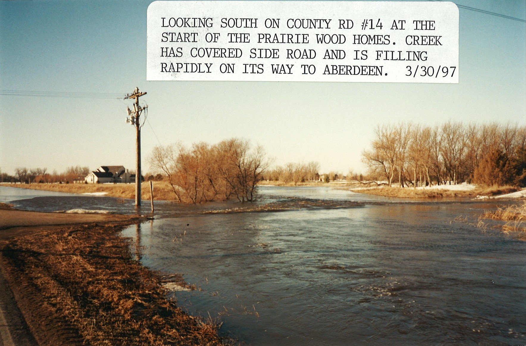
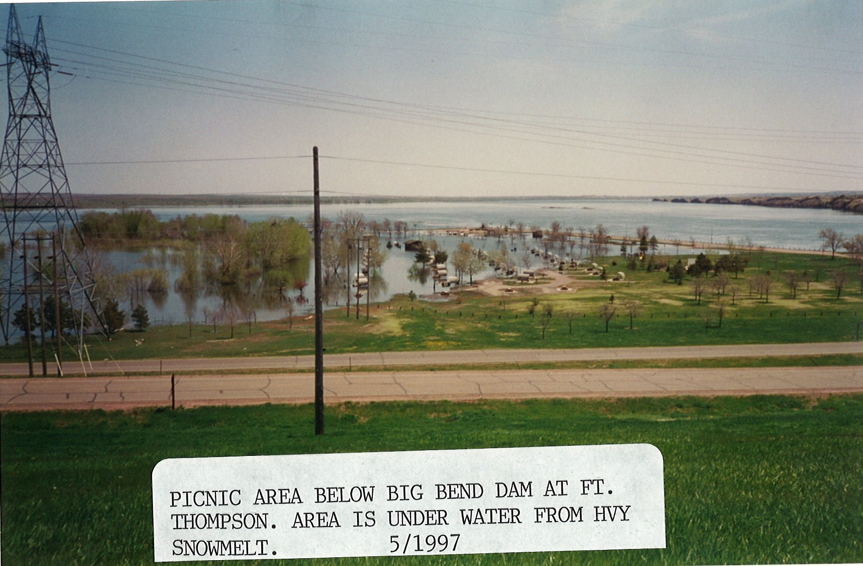
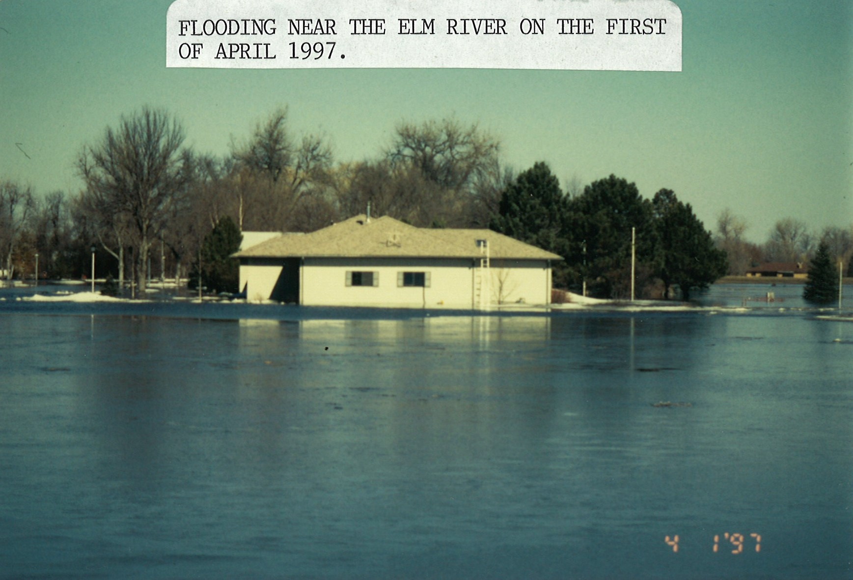
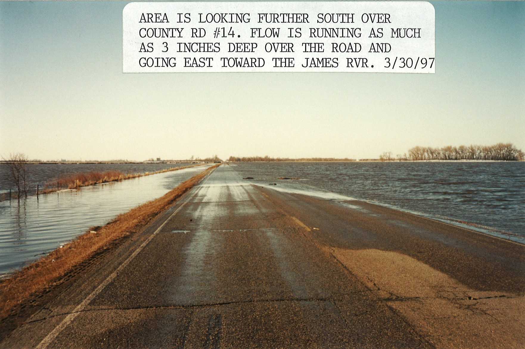
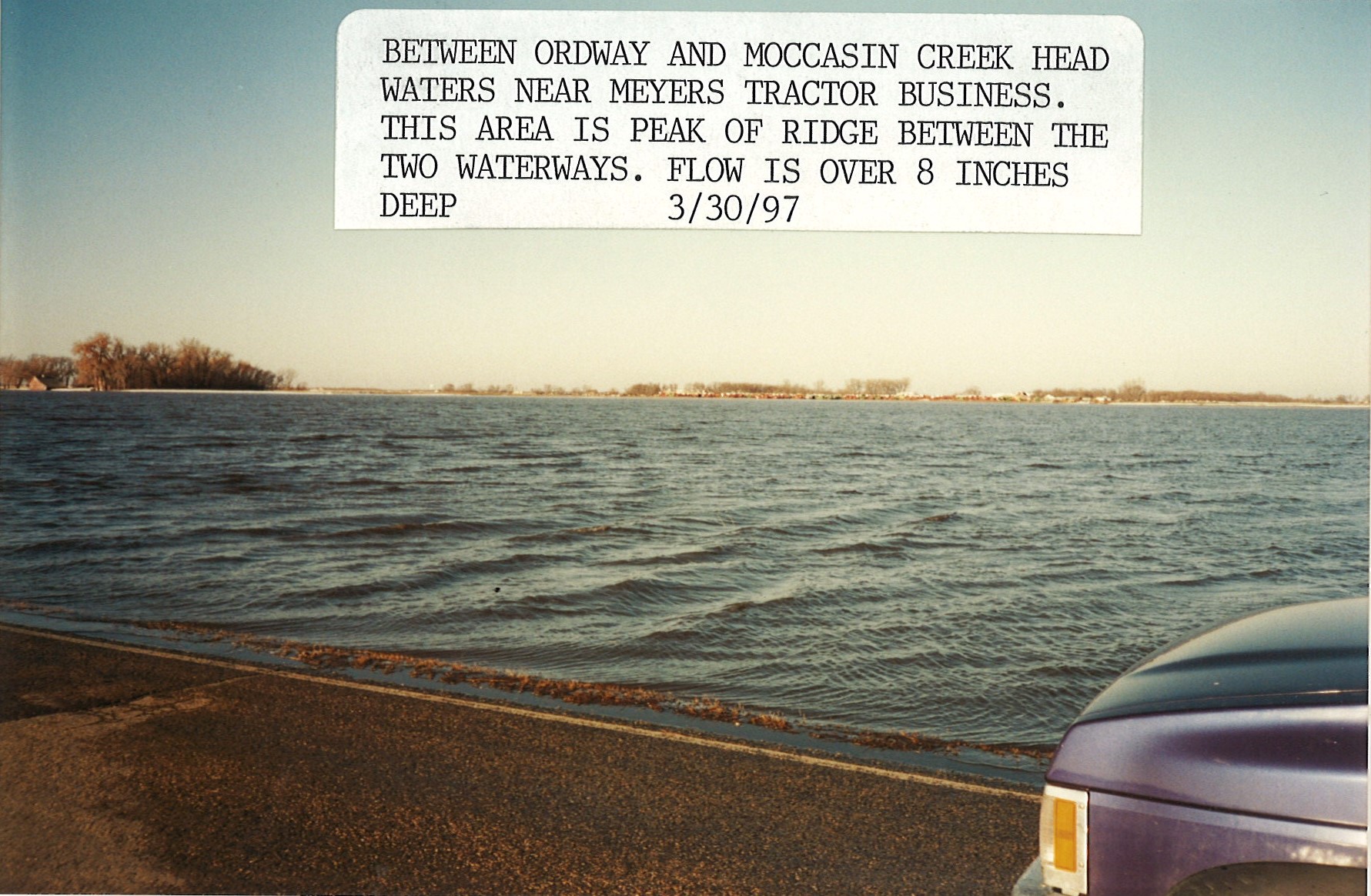
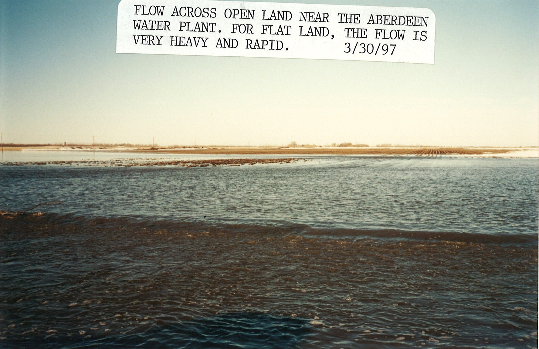
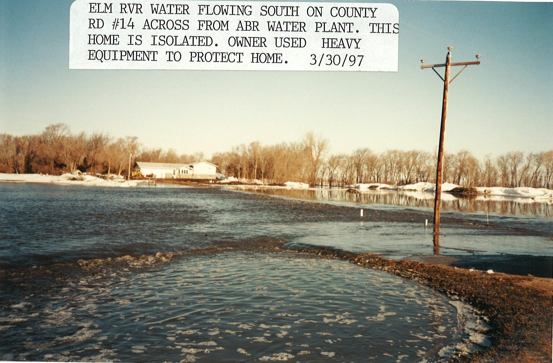
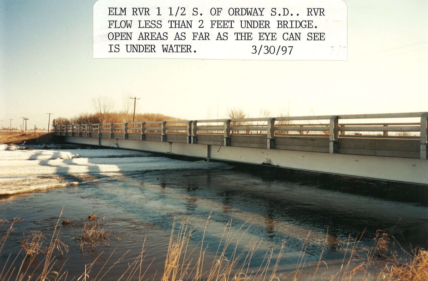
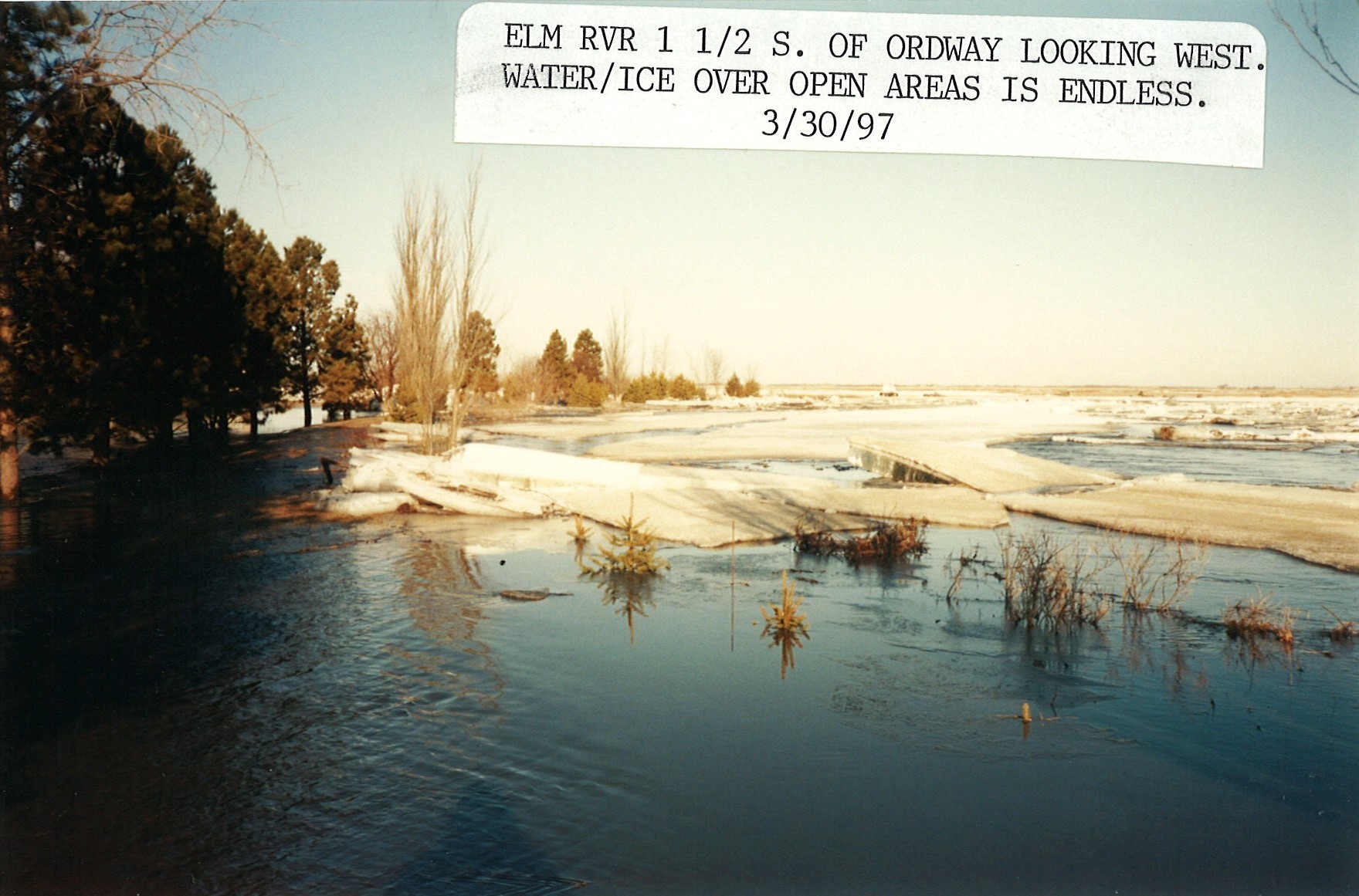
Spring Flooding Photos
 |
 |
 |
 |
 |
 |
 |
 |
 |
 |
 |
 |
 |
Media use of NWS Web News Stories is encouraged! Please acknowledge the NWS as the source of any news information accessed from this site. |
|

