Overview
|
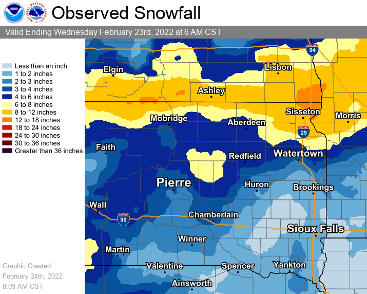
A long-duration storm system severely impacted the area with strong wind, heavy snow, blizzard or near-blizzard conditions, and dangerous cold from Sunday, February 20th through late on Tuesday, February 22nd. Wind chills of -25 to -45 F were widespread from the overnight of the 20th through the morning of the 23rd, and the brutal cold continued through the 25th. Conditions were at their worst across much of north central & northeastern South Dakota and west central Minnesota, as a "banded snowfall" event with upwards of a foot of snow was followed by additional accumulating snow and strong northerly winds to create periods of white-out conditions. Notably, with 2.8" of snowfall from this system, Pierre tripled it's *seasonal* total (1.4" prior to this event, 4.2" as of the 23rd). Impacts were wide-ranging, from school closures to numerous vehicle accidents. I-29 was closed from Watertown north to the North Dakota border (and beyond) from 6pm on the 21st through 10am on the 22nd, and many other roads were marked "No Travel Advised" by the Department of Transportation. |
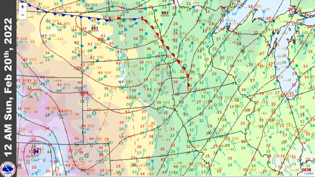 Loop of surface weather conditions across the region, from 12am Feb 20th through 9am Feb 23rd |
 |
 |
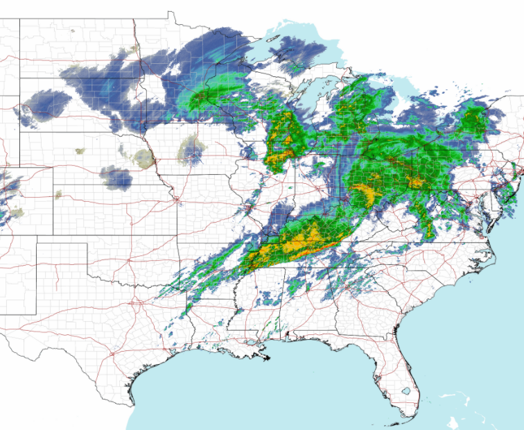 |
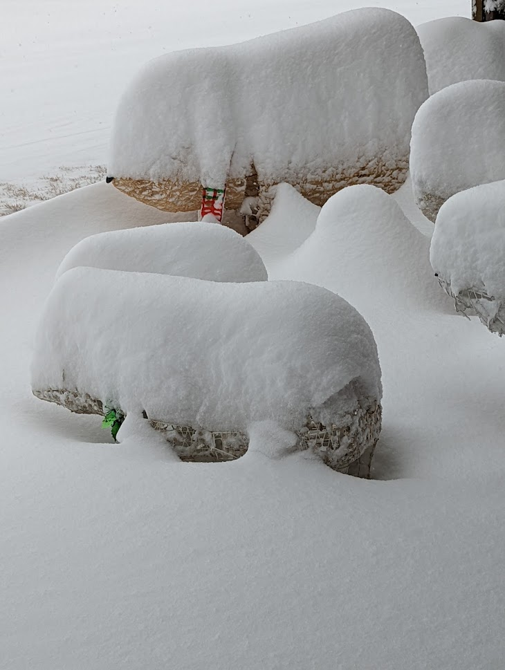
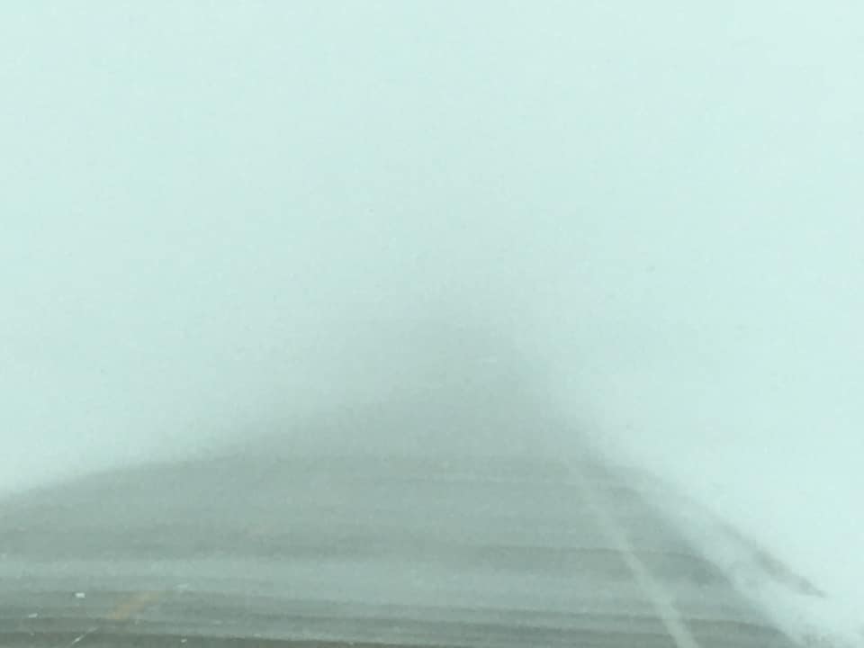
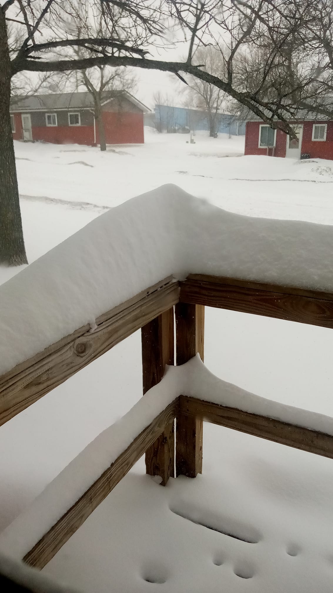
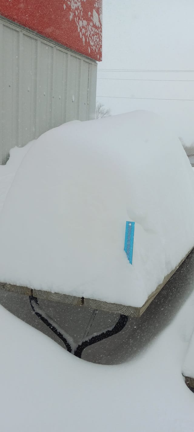
| Heavy snow accumulations in Pollock, as observed on the morning of Feb 22nd by Dale and Donna Meyer | Significantly low visibility near Groton on Hwy 37 during the early afternoon on Feb 21st, courtesy of Christy Leanne | National radar reflectivity at 11:30am CST Feb 22nd, showing the large scope of this system |
Heavy Snow
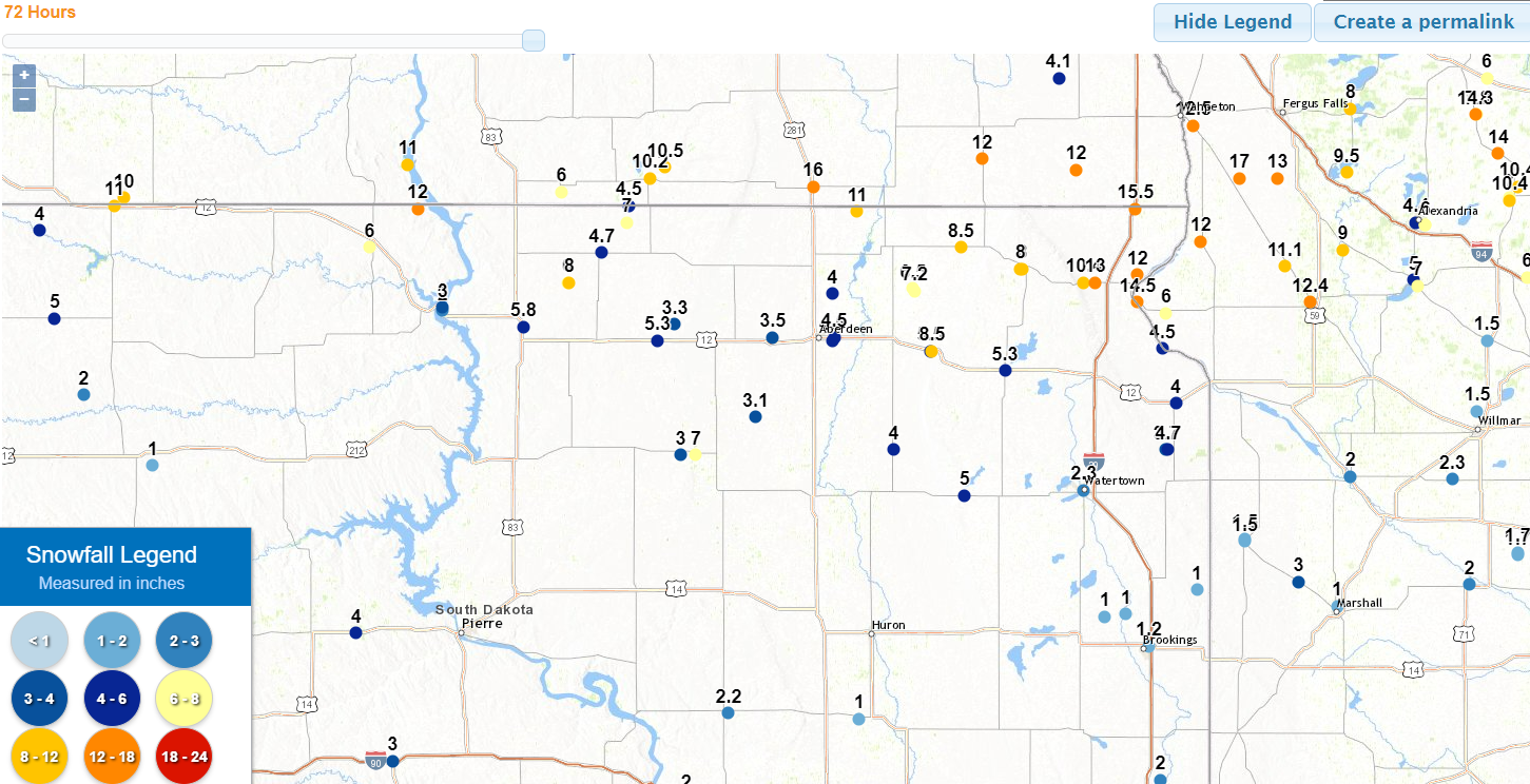
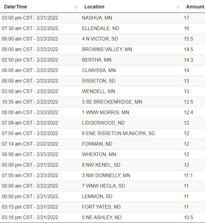
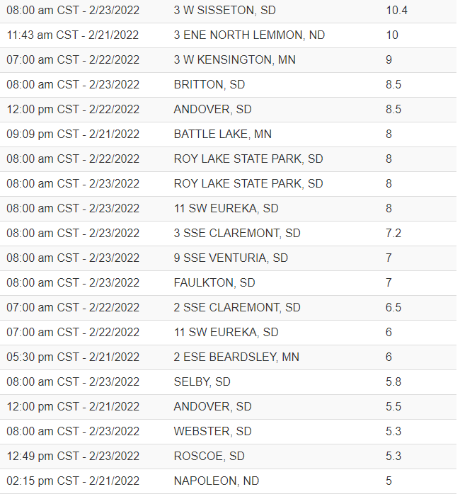
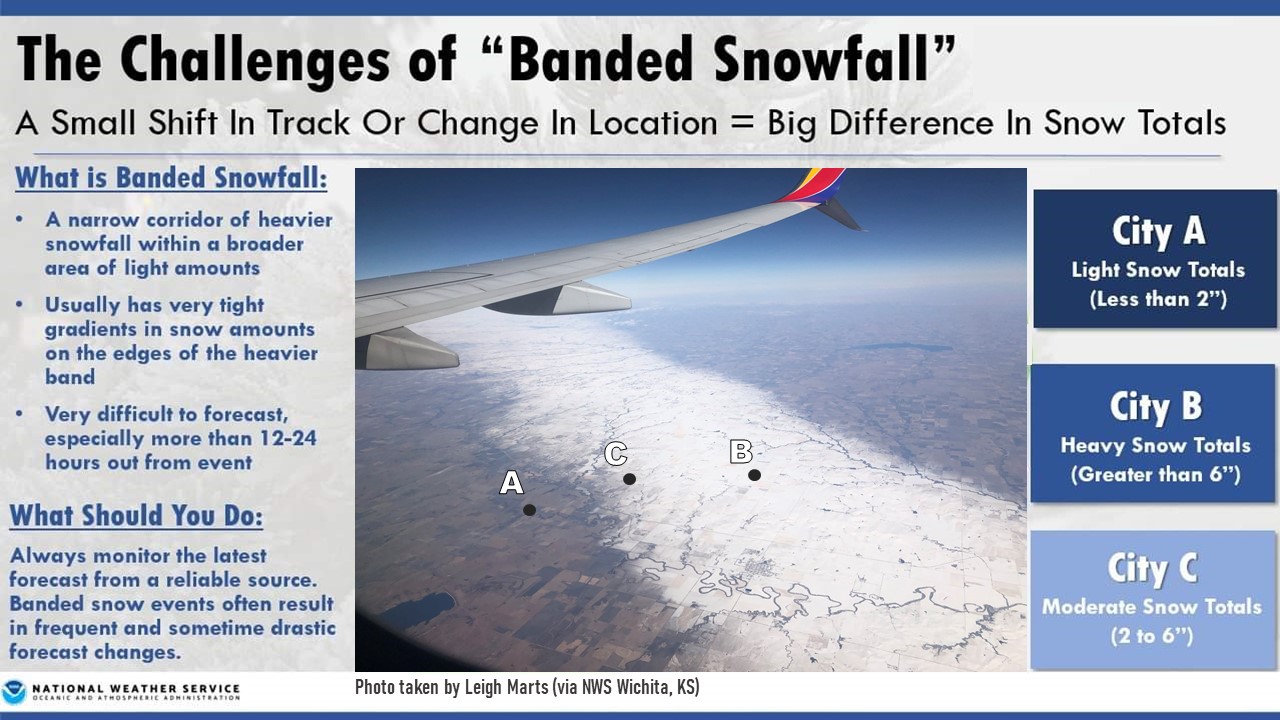
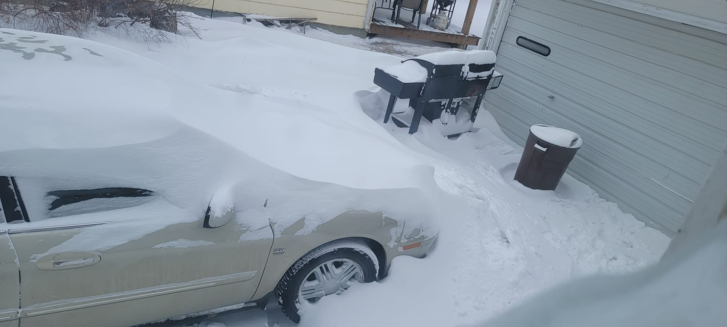
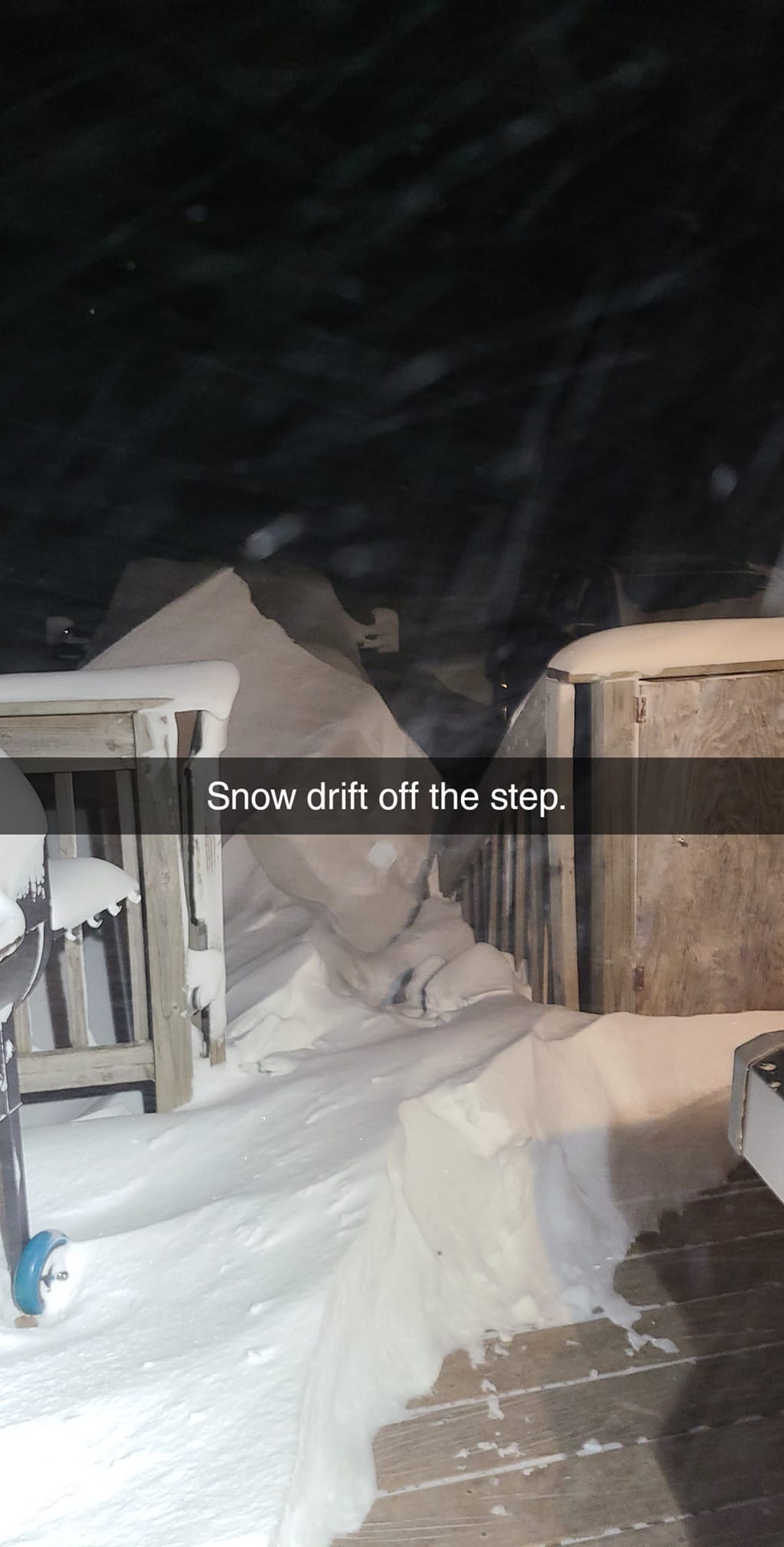
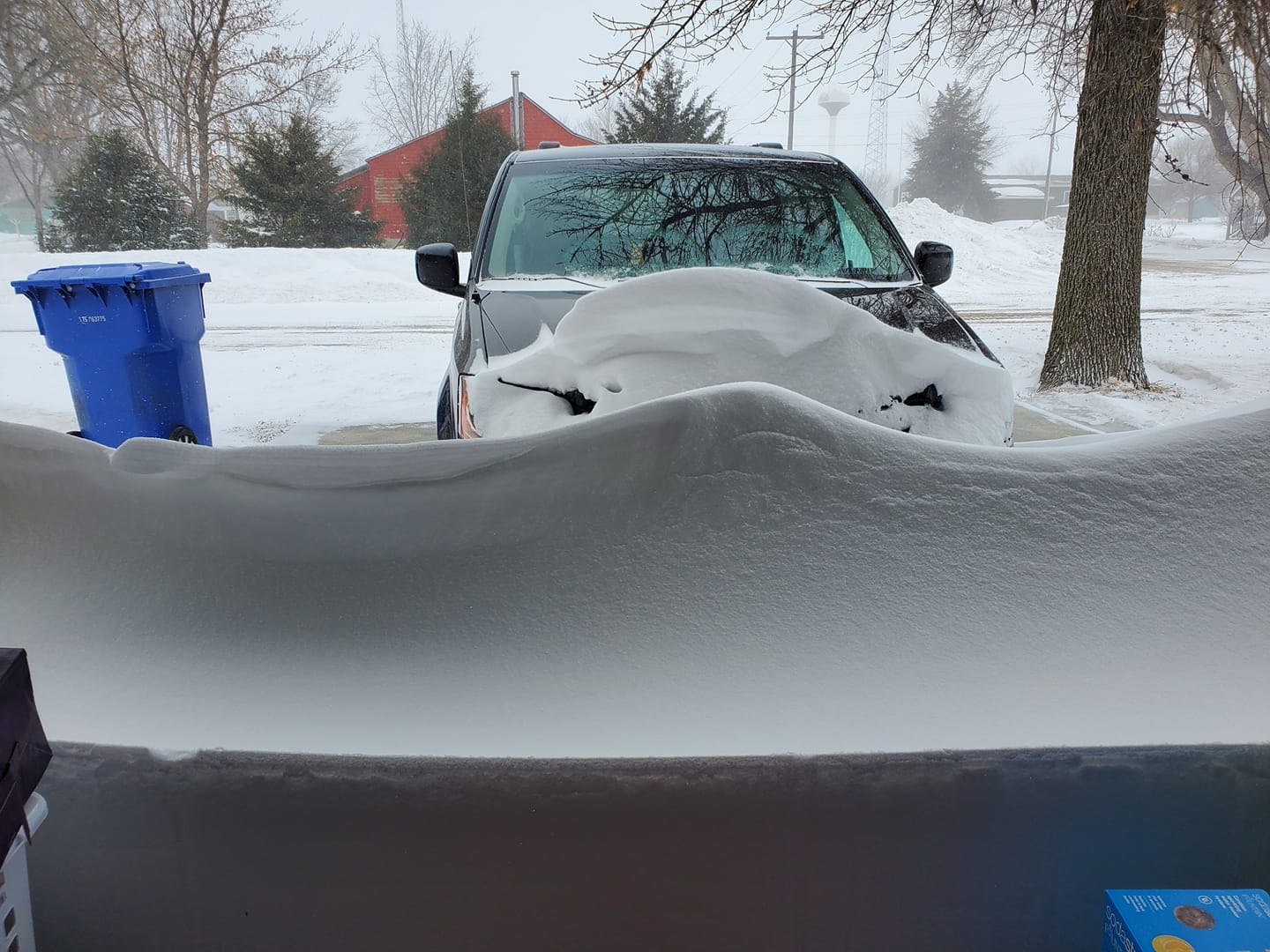
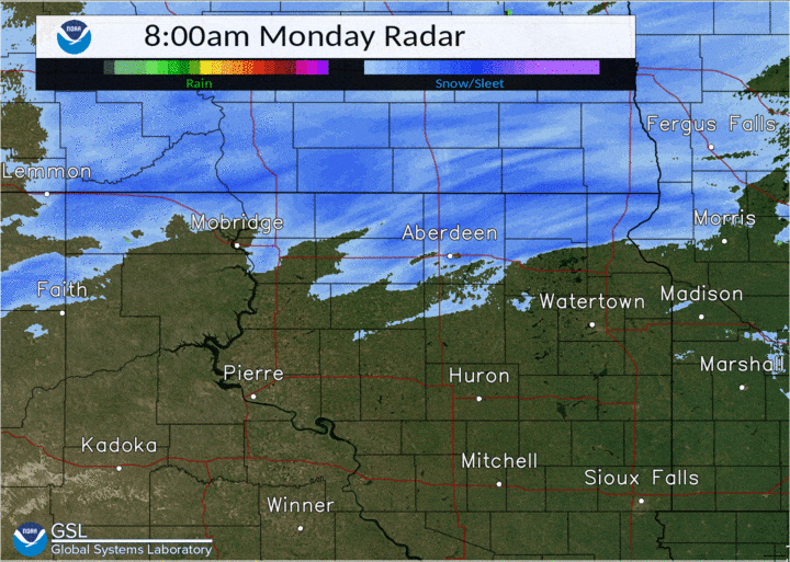
The majority of the snowfall with this system fell as "banded snowfall" - a relatively narrow band of heavy snowfall - from the 20th into the 21st. Additional light to moderate snowfall accumulated over an extended period from the 21st through the 22nd to bring snowfall totals to over a foot in some cases, and snow drifts were quite a bit deeper than that in many cases.
Observations
 |
 |
 |
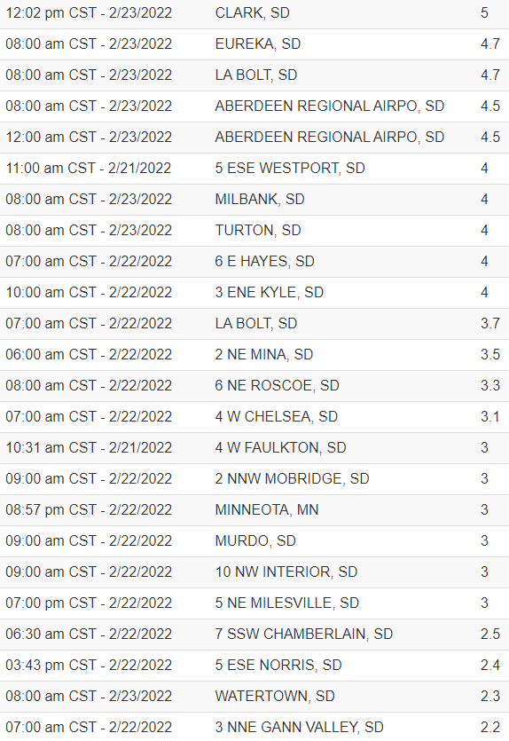 |
| Reported 72 hour snowfall totals | Reported 72 hour snowfall totals | Reported 72 hour snowfall totals | Reported 72 hour snowfall totals |
 |
 |
 |
|
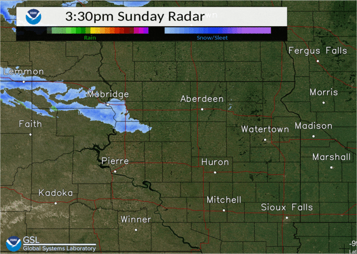
| Reports-based estimated snowfall totals | Radar reflectivity of the heavy banded snowfall from 3:30pm CST on the 20th through 8am CST on the 21st | Banded snowfall" is notoriously difficult to forecast, and this event was a classic case. For example, by ~7am on the 21st, Milbank had received just a trace of snow, whereas Browns Valley, just 27 miles further north, had picked up over 7"! |
Photos
 |
 |
 |
 |
| Veblen by the morning of Feb 21st, courtesy of Alba Castillo | Sisseton on the morning of Feb 21st, courtesy of Derek DeMarrias | Ashley, ND on the morning of Feb 22nd, courtesy of Bethany Schlenker | At the Old Agency C-Store on the morning of Feb 21st, courtesy of Jessie Lynn |
 |
 |
 |
 |
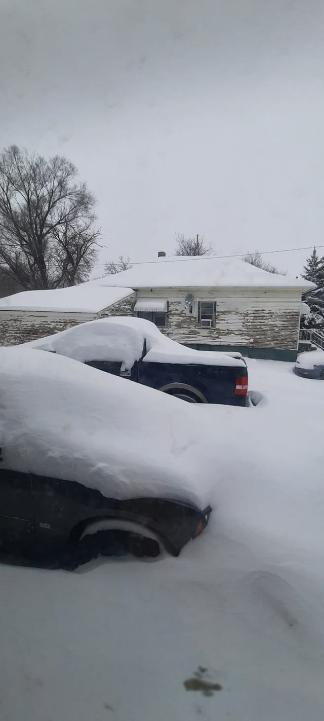
| Pollock on the morning of Feb 22nd, courtesy of Dale and Donna Meyer | Frederick area on the evening of Feb 21st, courtesy of Lisa Thayer | Hecla area at 3pm on Feb 22nd, courtesy of Linda Rae Kempf Lewis | Heavy snow and drifting at 6pm on Feb 21st, courtesy of Sheila Sullivan |
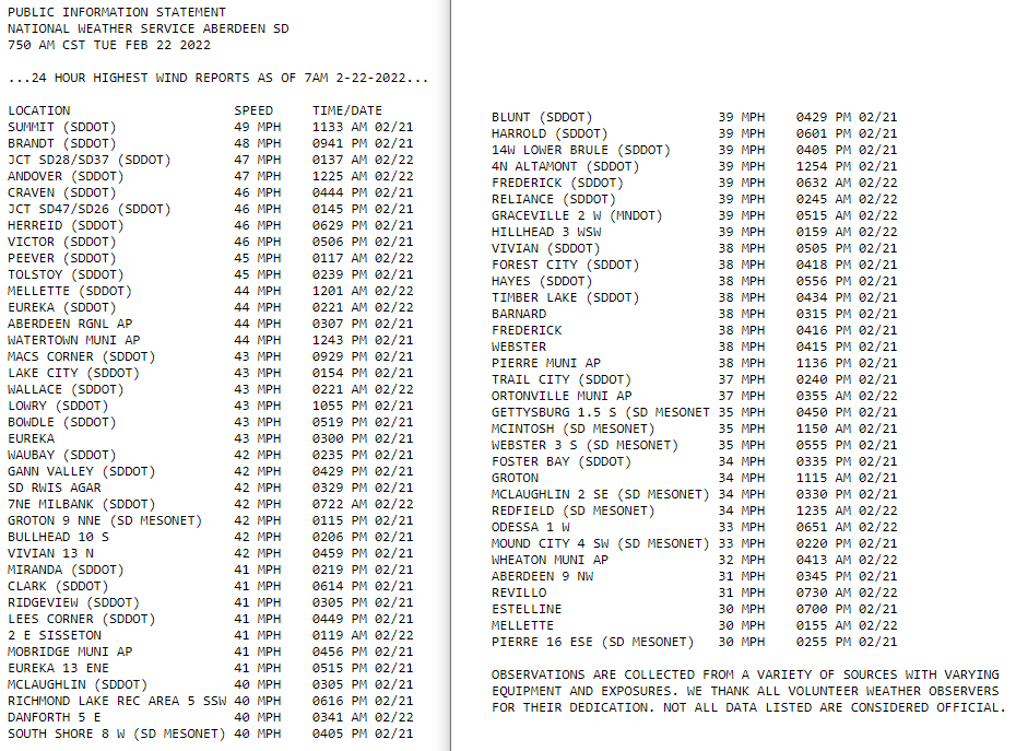
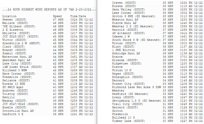
Wind, Blizzard
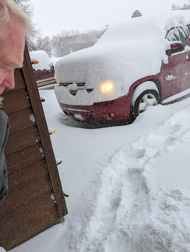
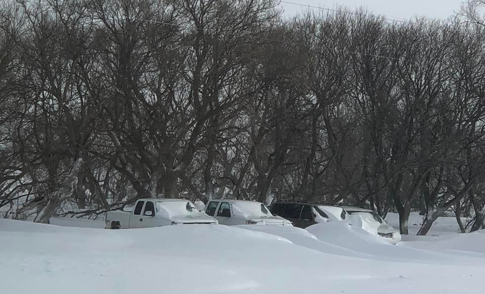
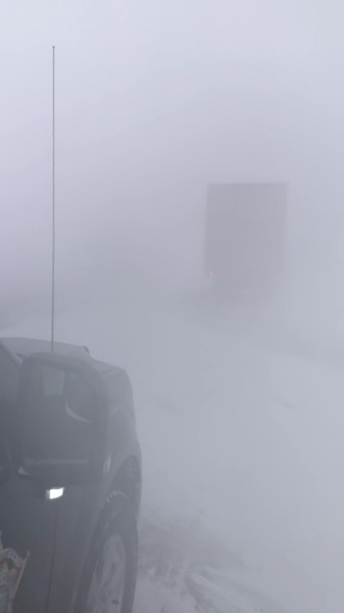
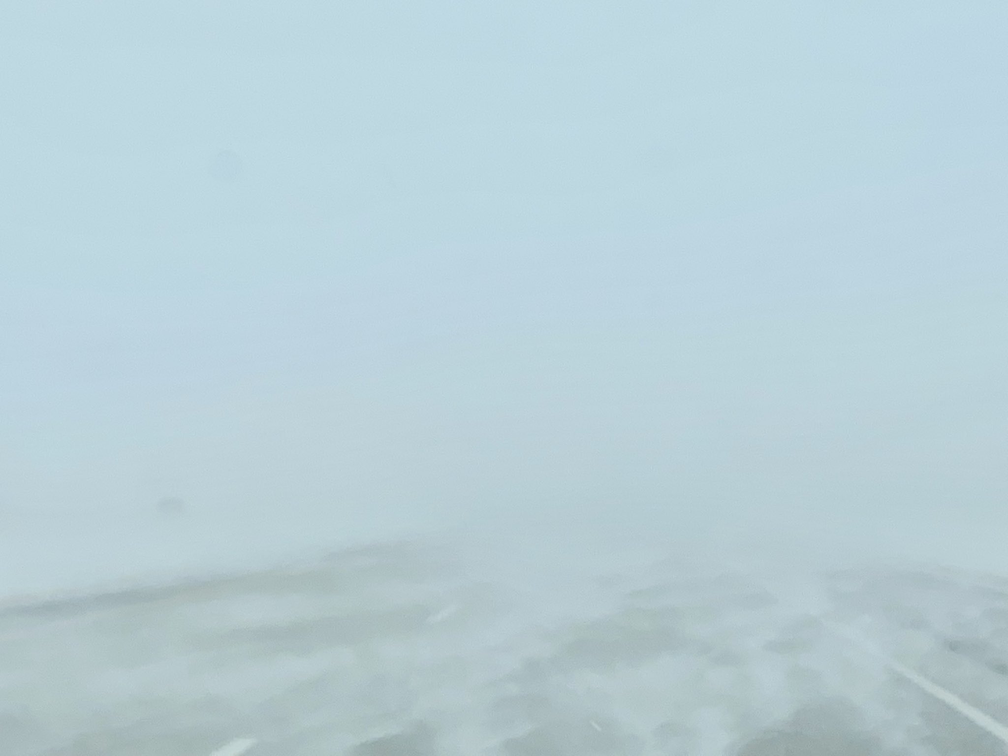
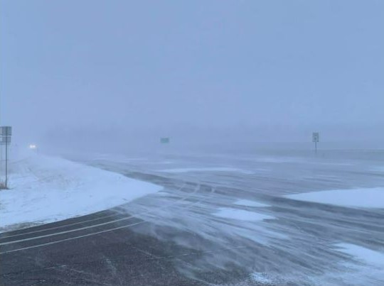
When breezy to windy northerly winds combined with falling snow during an extended period from much of/all of the 21st through much of the 22nd, visibilities dropped consistently to a few miles or less, and often to a quarter mile or less especially across portions of north central and northeastern South Dakota into west central Minnesota.
Observations
 |
 |
 |
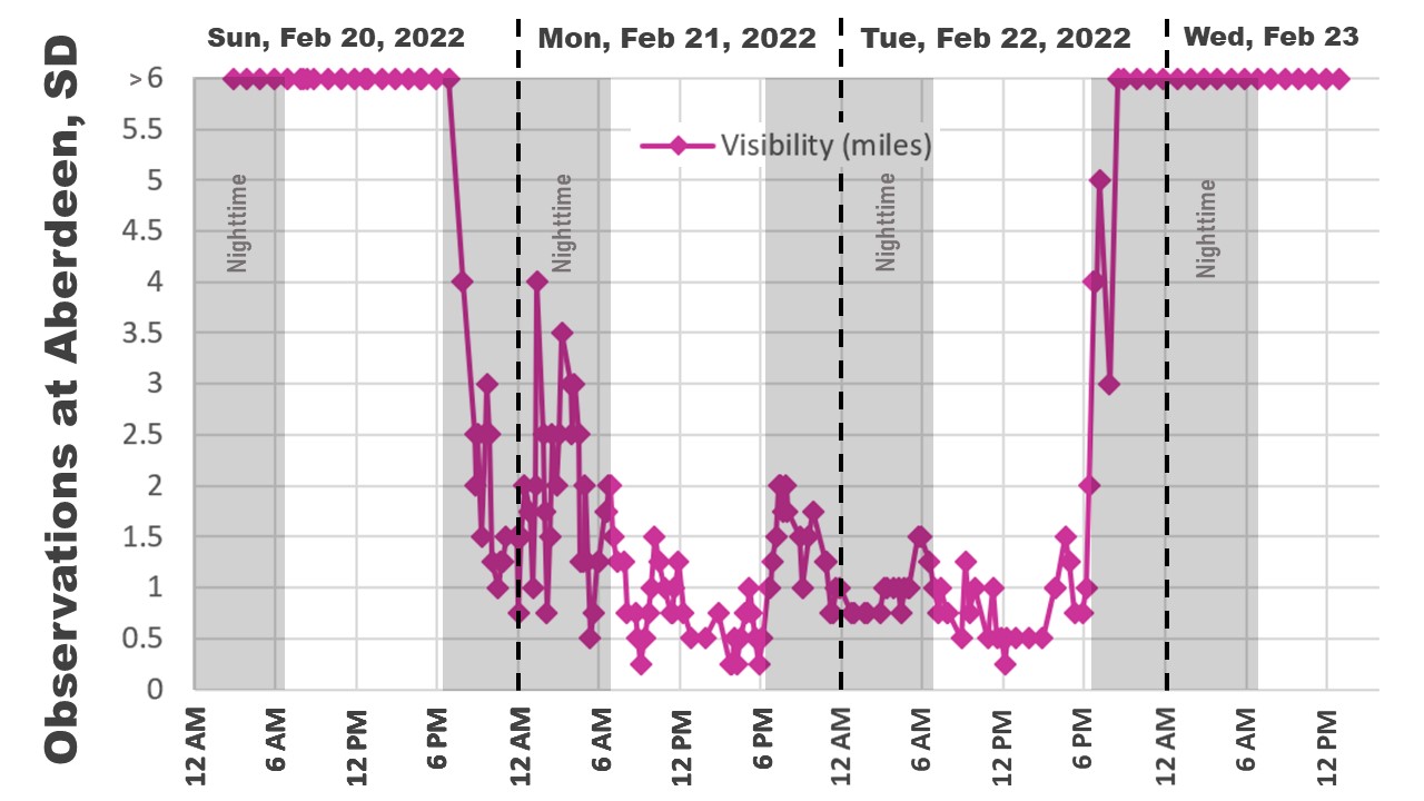 |
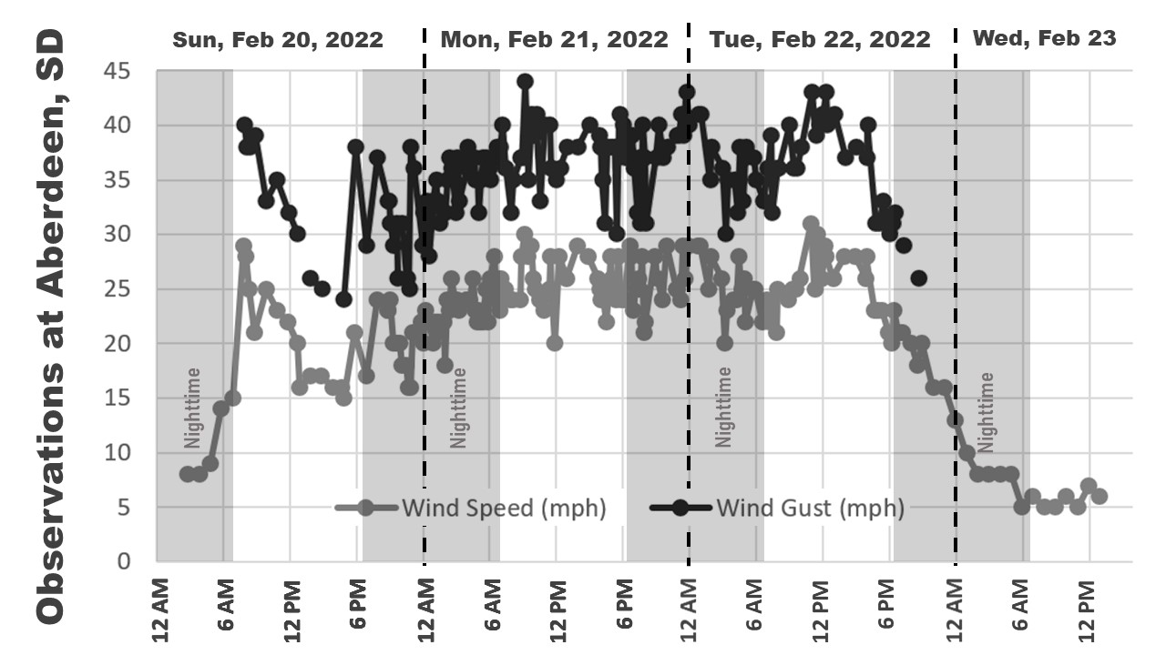
| An extended period of breezy to windy conditions occurred across the area from the 20th through the 22nd. These observations are from Aberdeen. | Maximum wind gusts from 7am Feb 21st through 7am Feb 22nd | Maximum wind gusts from 7am Feb 22nd to 7am Feb 23rd | Persistent winds combined with fairly persistent light to moderate snowfall to yield a prolonged period of reduced visibilities. These observations are from Aberdeen. |
 |
|||
| Radar reflectivity of the light to moderate snowfall following the heavier banded snow, from 8am CST on the 21st through 6pm CST on the 22nd. (The radar beam was overshooting snow that existed further away from the radar as well) |
Photos
 |
 |
 |
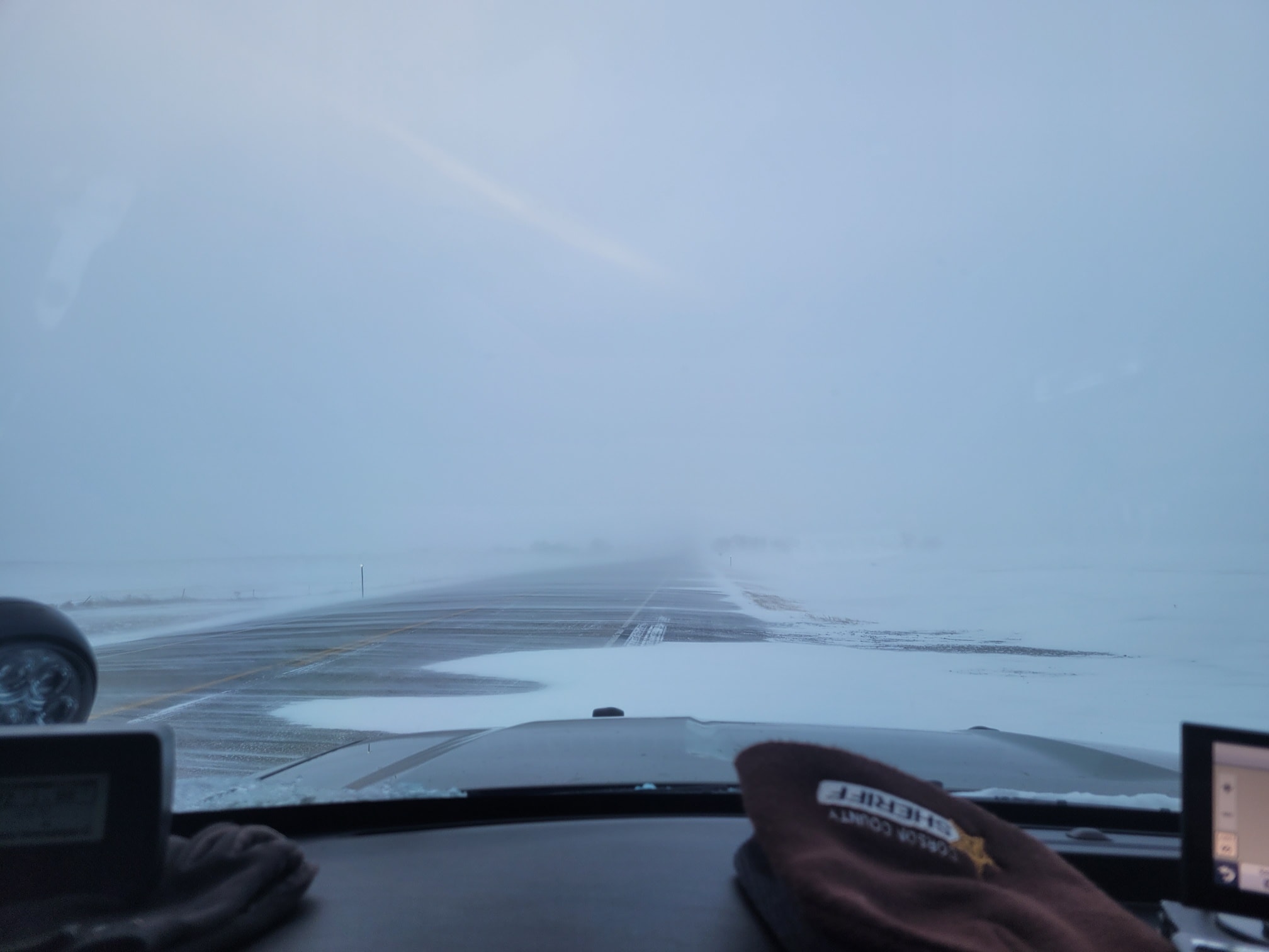 |
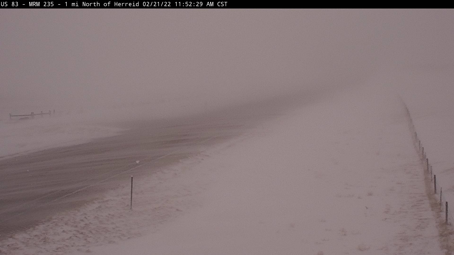
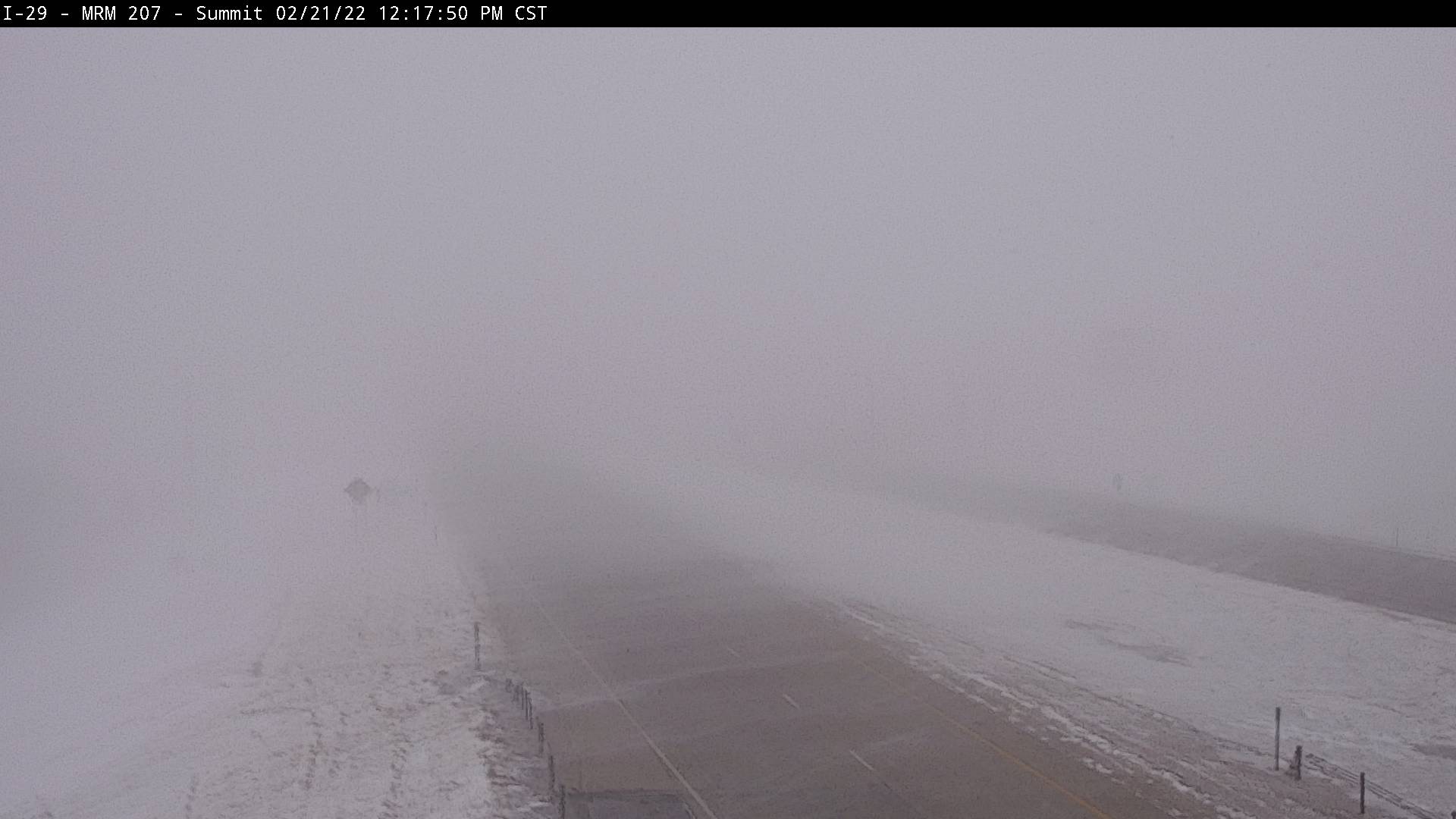
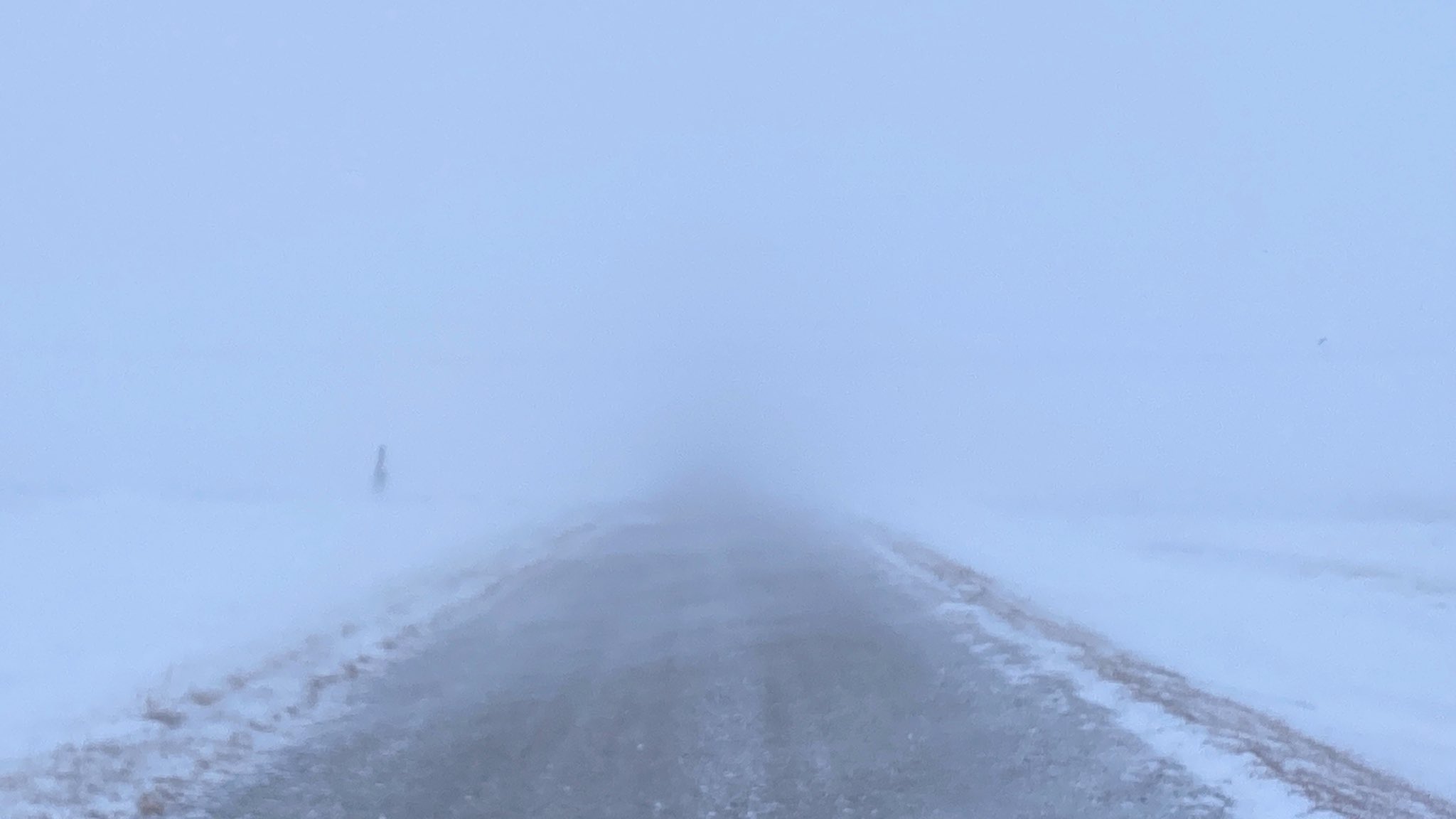
| Herreid area SDDOT camera at 11:50am on Feb 21st | Summit area SDDOT camera at 12:15pm on Feb 21st | 12 miles west of Summit at 515pm on Feb 21st, courtesy of Alex Resel | Conditions across parts of Corson County on Feb 21st, courtesy of the Corson County Sheriff's Office |
 |
 |
 |
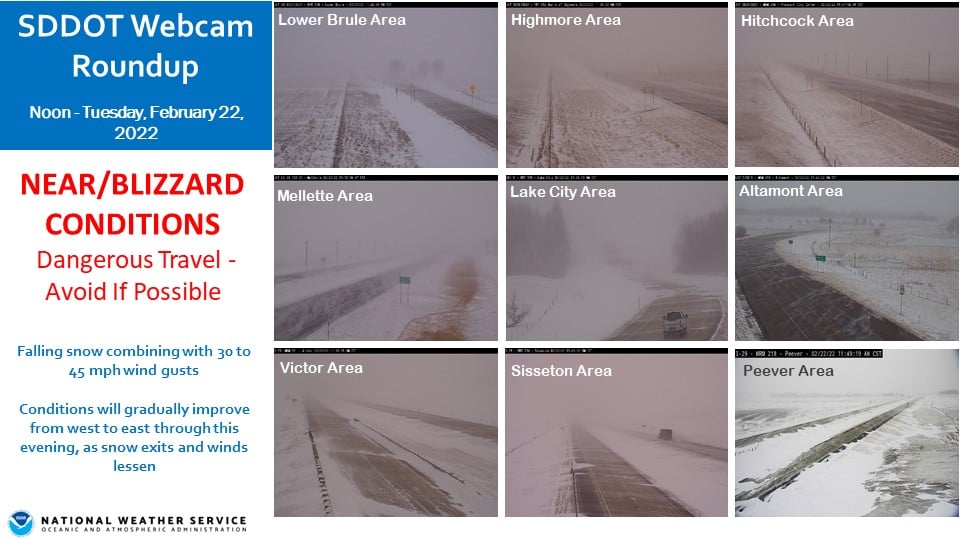 |
| Conditions across Big Stone County around 4pm on the 22nd, courtesy of the Big Stone County Sheriff's Office | South of Summit on I-29 at 3pm on the 22nd, courtesy of Alex Resel | Intersection of US Highway 81 and SD Highway 22 at 7:30am on the 22nd, courtesy of the Hamlin County Sheriff's Office | Several SDDOT webcams across the area around noon on the 22nd. |
Arctic Cold
One of the most severe Arctic cold outbreaks of the 2021-2022 winter season, in terms of severity and duration, began on the 20th and lifted on the 25th/26th. Dangerously cold wind chills were in place during an extended time as well, day and night, from late on the 20th through the morning of the 23rd. Additional bouts of at least -25 F wind chills across northern SD and west central MN continued on the overnights/mornings of the 24th and 25th.
Observations
.gif) |
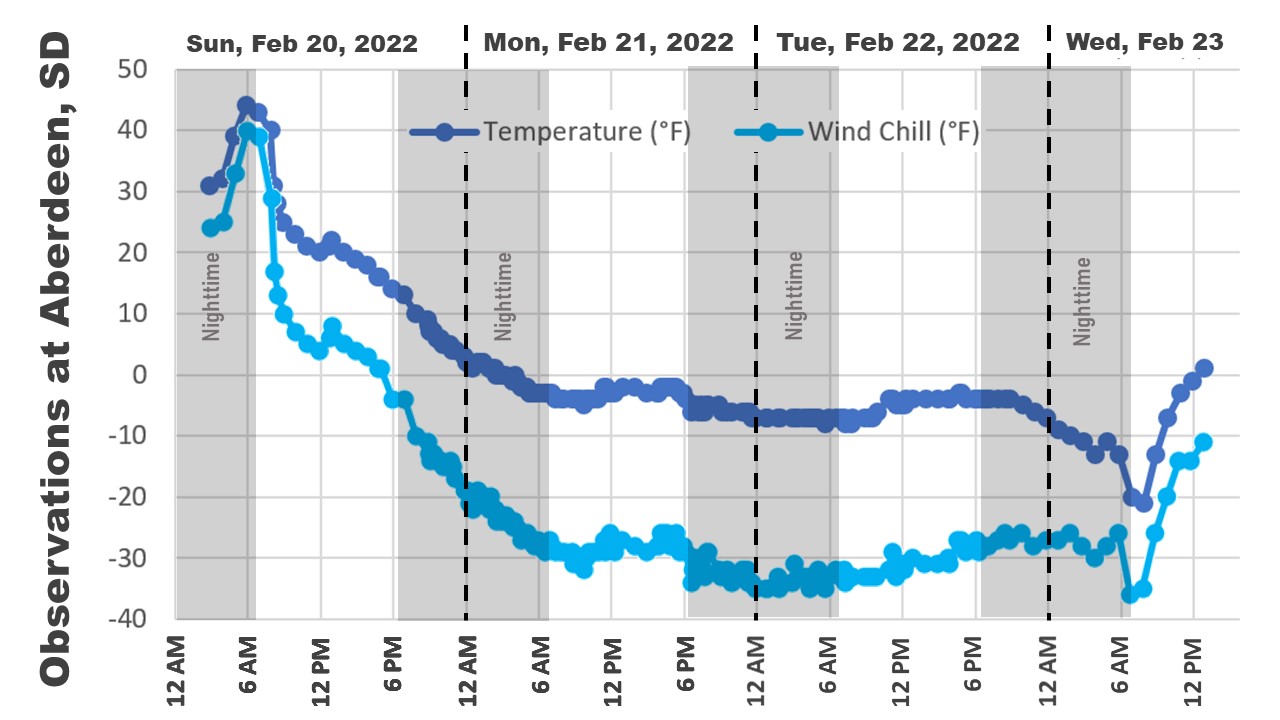 |
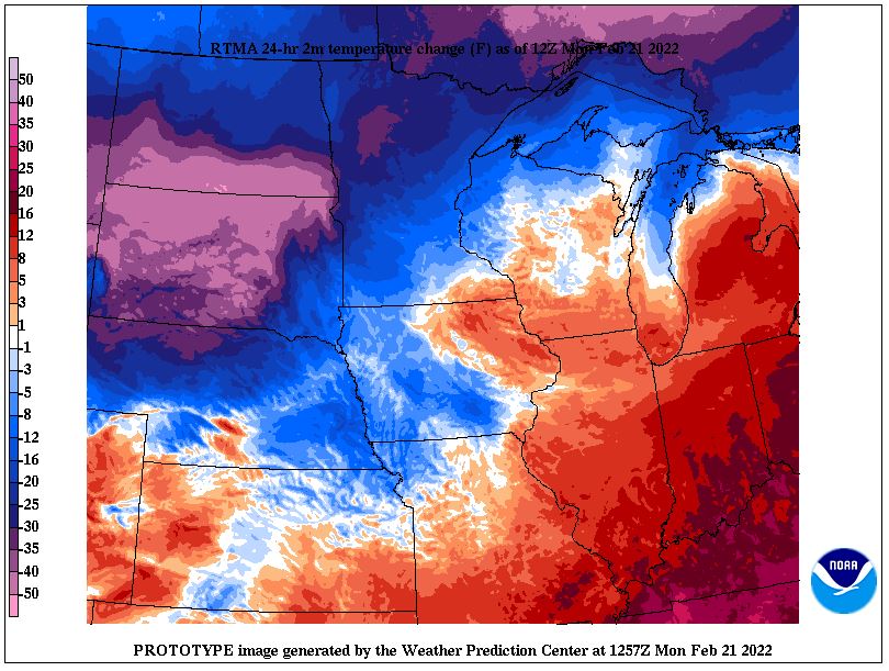 |
| This event began with an Arctic cold frontal passage on Sunday, Feb 20th, with a quick and significant drop in temperatures. These are hourly observations of temperature and wind. Temperatures would continue dropping to dangerously cold levels through the morning of the 23rd. | Temperature and wind chill observations at Aberdeen from the 20th - 23rd. On the 20th, Aberdeen dropped 15 degrees in one hour, from 40 F at 7:53am to 25 F at 8:53 am! | 24 hour temperature change ending at 6am on February 21st. The purple shading ranges from a 30 to 50 degree change. |
.PNG) |
 |
 |
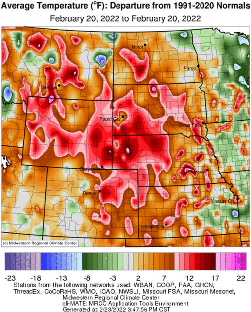 |
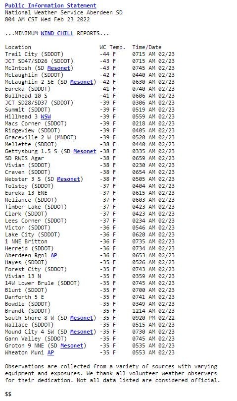
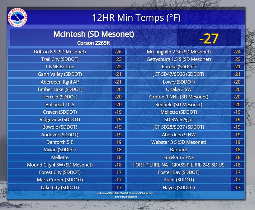
| 24 hour minimum wind chills as of 7am on the 22nd. | 24 hour minimum wind chills as of 8am on the 23rd. | 12 hour low temperatures (air temperatures) as of 8am on 23rd. | Average (highs and lows combined) daily temperature departures from normal across the region, from Feb 20th through Feb 23rd. Data from the Midwestern Regional Climate Center. |
 |
|||
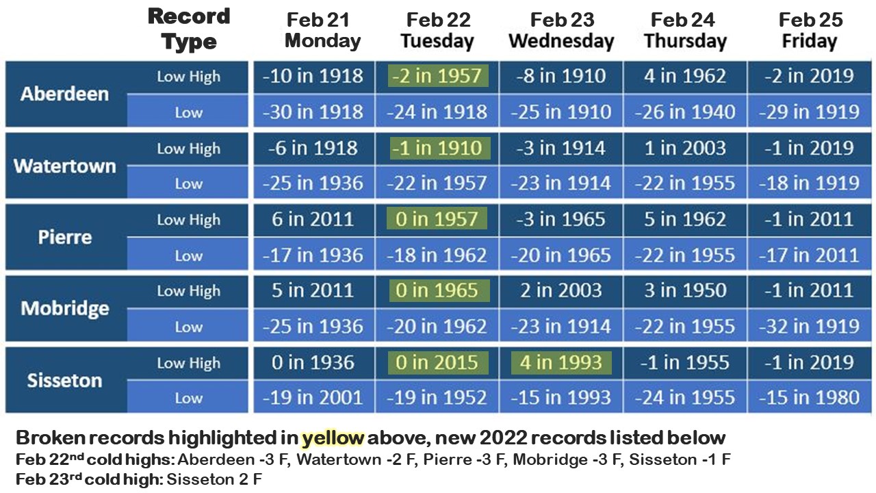
| A listing of record cold high and low temperatures, along with which records were broken by this Arctic blast. |
 |
Media use of NWS Web News Stories is encouraged! Please acknowledge the NWS as the source of any news information accessed from this site. |
|

