Overview
|
A powerful storm system impacted central and northeastern South Dakota and western Minnesota from the morning through evening of December 4th, 2017. For many, this was the first accumulating snow event of the season. Strong winds resulted in blizzard conditions across the area as well. Cold, single digit and lower air moved in behind this system as well. |
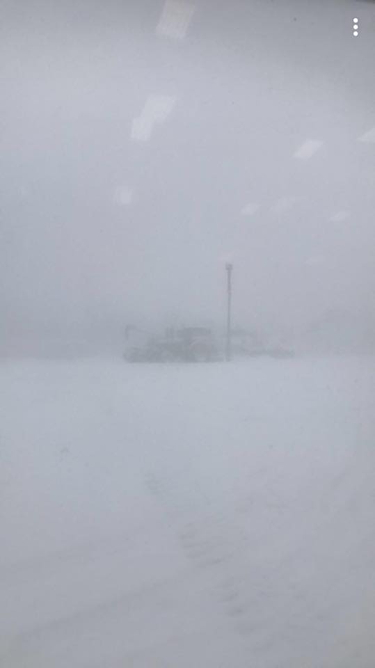
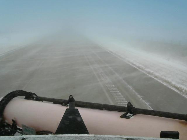 SDDOT snowplow webcam on I90-US85 at 1:48 pm Dec 4th |
Snow
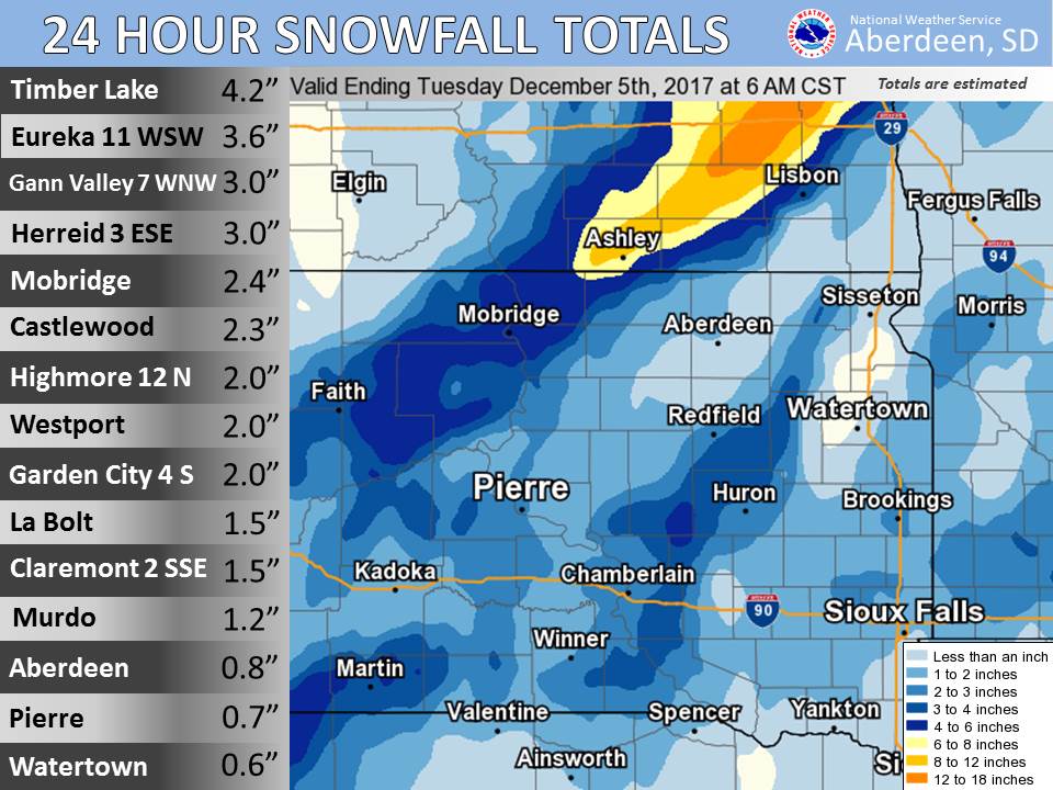
Snowfall reports from December 4th.
Photos:
 |
 |
 |
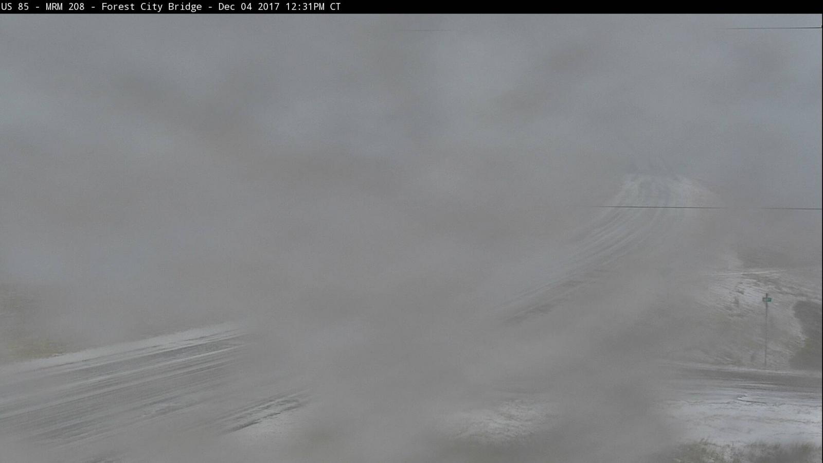 |
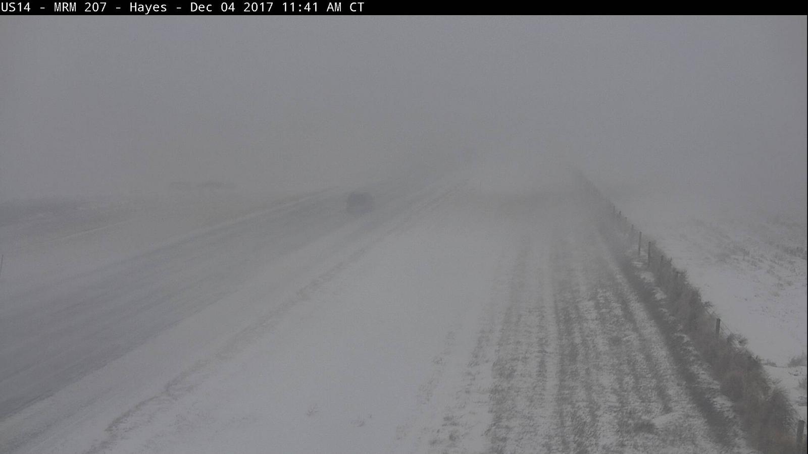
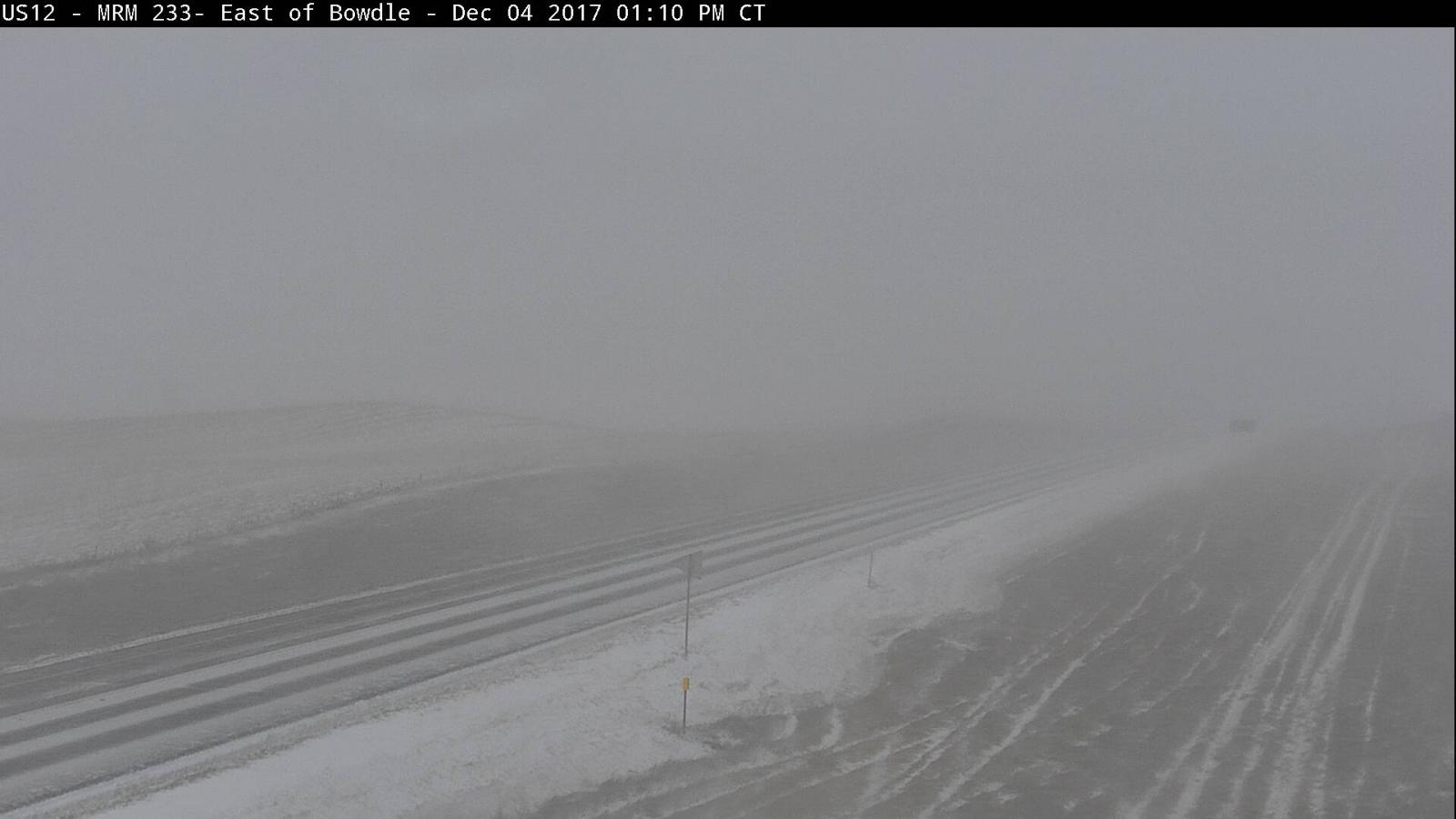
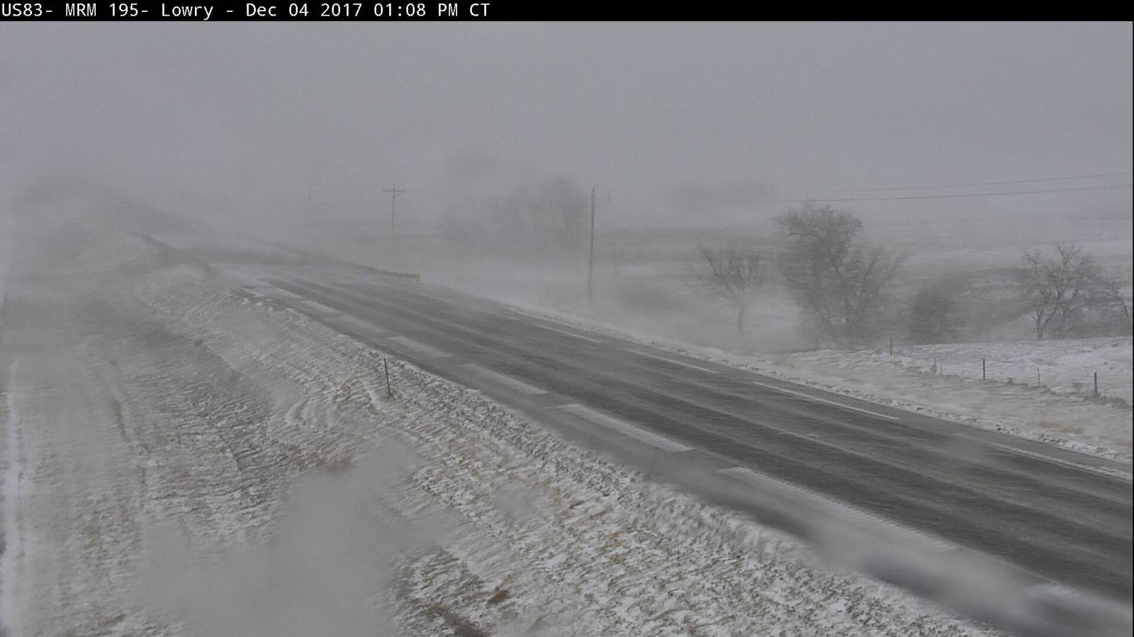
| SDDOT webcam from 12 miles E of Hayes at 11:41 am | SDDOT webcam from 1 mile ESE of Bowdle at 1:10 pm | SDDOT webcam from 4 miles WSW of Lowry at 1:08 pm | SDDOT webcam from Forest City at 12:31 pm |
.png) |
 |
|
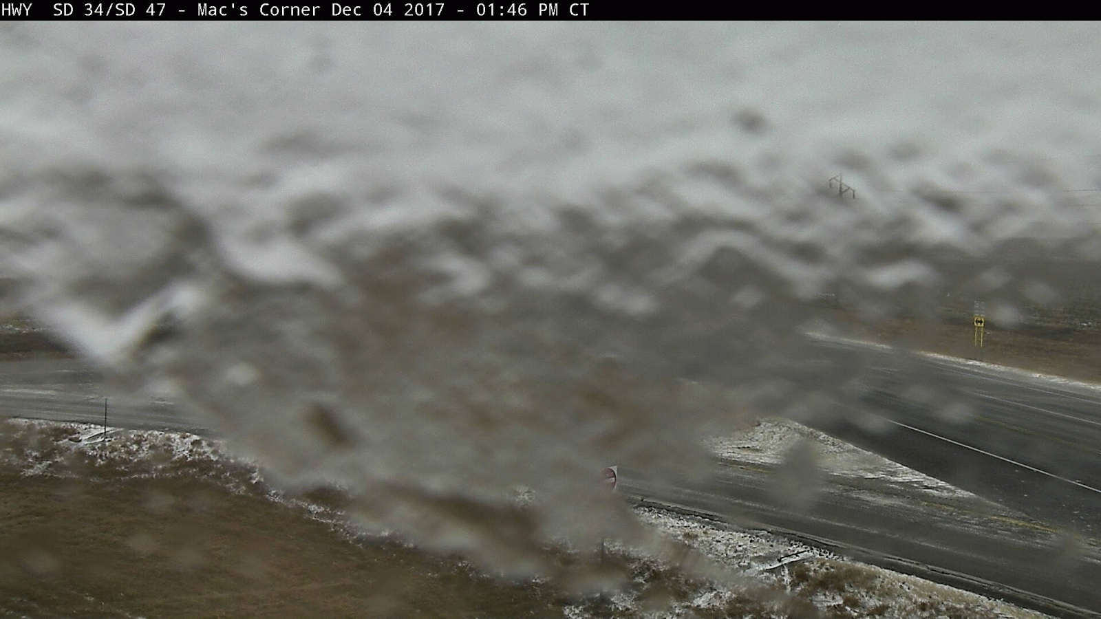 |
| SDDOT webcams from Trail City and Herreid, with visibility reference | Visibility approaching 150 feet, 5 miles W of Mound City at 11 am. Photo courtesy of Brent Odde | SDDOT snowplow webcam on I90-US85 at 1:48 pm | SDDOT webcam from Macs Corner. Pockets of freezing rain/drizzle preceded the snow in some cases |
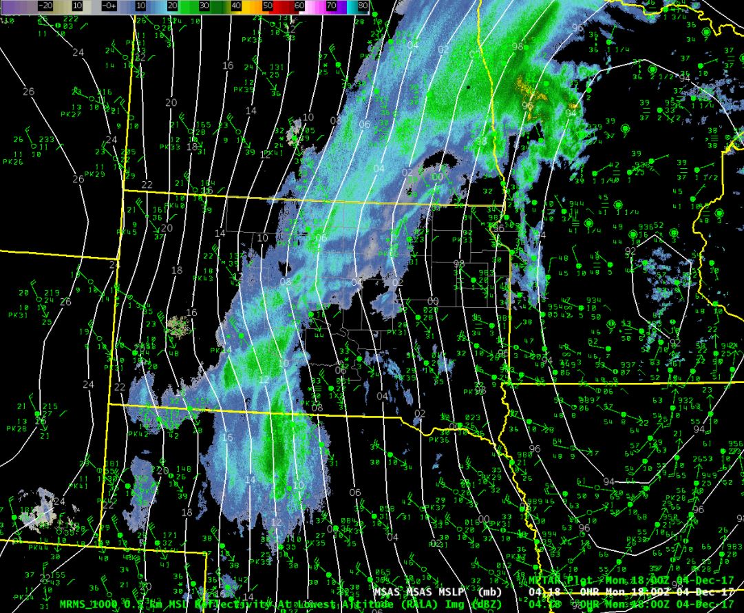
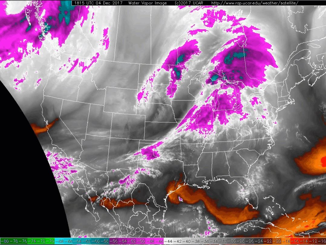
Radar & Satellite:
 |
 |
||
| Radar snapshot at 1 pm on Monday, Dec 4th | Water vapor satellite at 1:15 pm on Monday, Dec 4th |
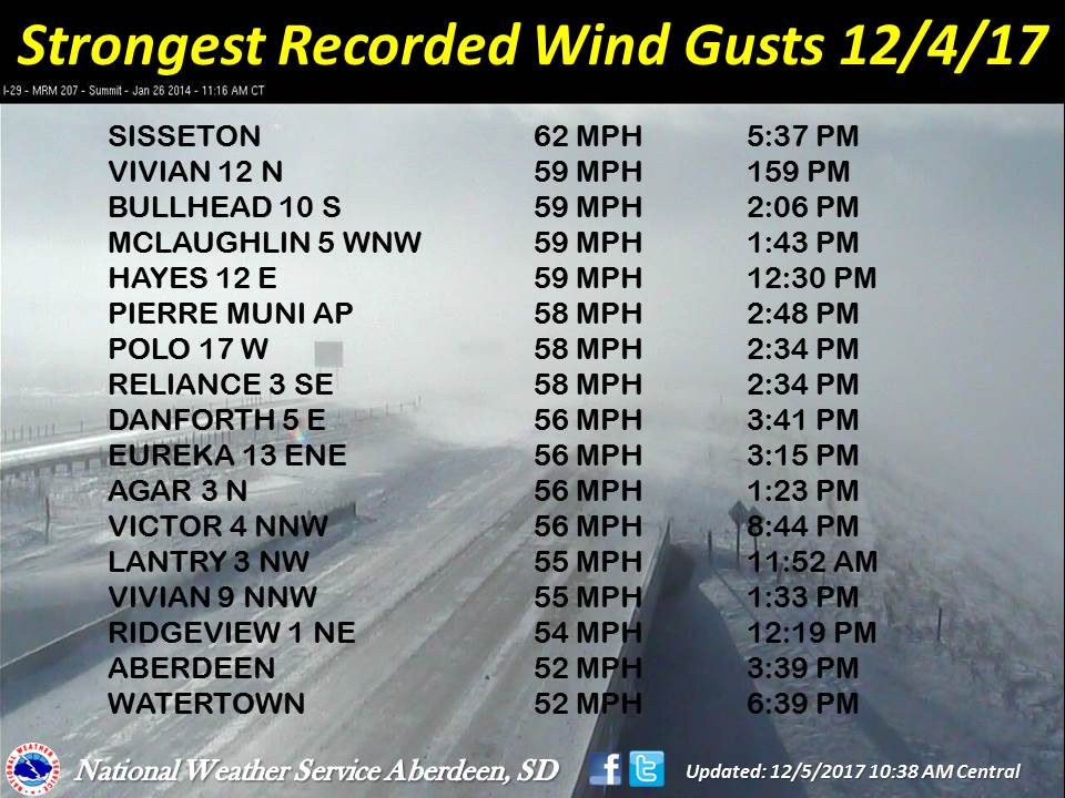
Storm Reports
Peak wind gusts from December 4th.
 |
Media use of NWS Web News Stories is encouraged! Please acknowledge the NWS as the source of any news information accessed from this site. |
|

