Overview
|
A fast moving winter storm brought snow, high winds and blizzard conditions to parts of central and northeast South Dakota as well as west central Minnesota on December 23rd. The system tracked from west to east across region, with snow and even light rain being documented during the overnight/early morning hours across central South Dakota, but quickly pushed to the east into parts of eastern South Dakota by mid to late Wednesday morning. In addition to periods of reduced visibility across central South Dakota, warm temperatures in advance of snowfall did lead to flash freezing on road surfaces and hazardous travel. For northeast South Dakota and west central Minnesota, the impacts persisted throughout the afternoon hours. Extremely strong northerly wind, with gusts of 50 to 70 mph were prevalent across the region during the afternoon, and combined with the falling snow, created widespread blizzard conditions and hazardous travel. Much of the region was placed under no travel advisories and there were many reports of traffic crashes and stranded motorists. Temperatures also dropped significantly behind the system. In fact, above normal and even record temperatures ranging from the 50s to low 70s on Tuesday, December 22nd, had dropped 40 to 50 degrees by the afternoon of Wednesday, December 23rd. |
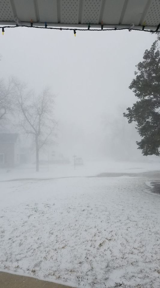
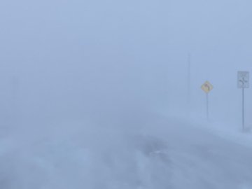 Whiteout conditions in Watertown, SD. Photo courtesy of Alex Resel. |
Photos & Video
 |
 |
 |
 |
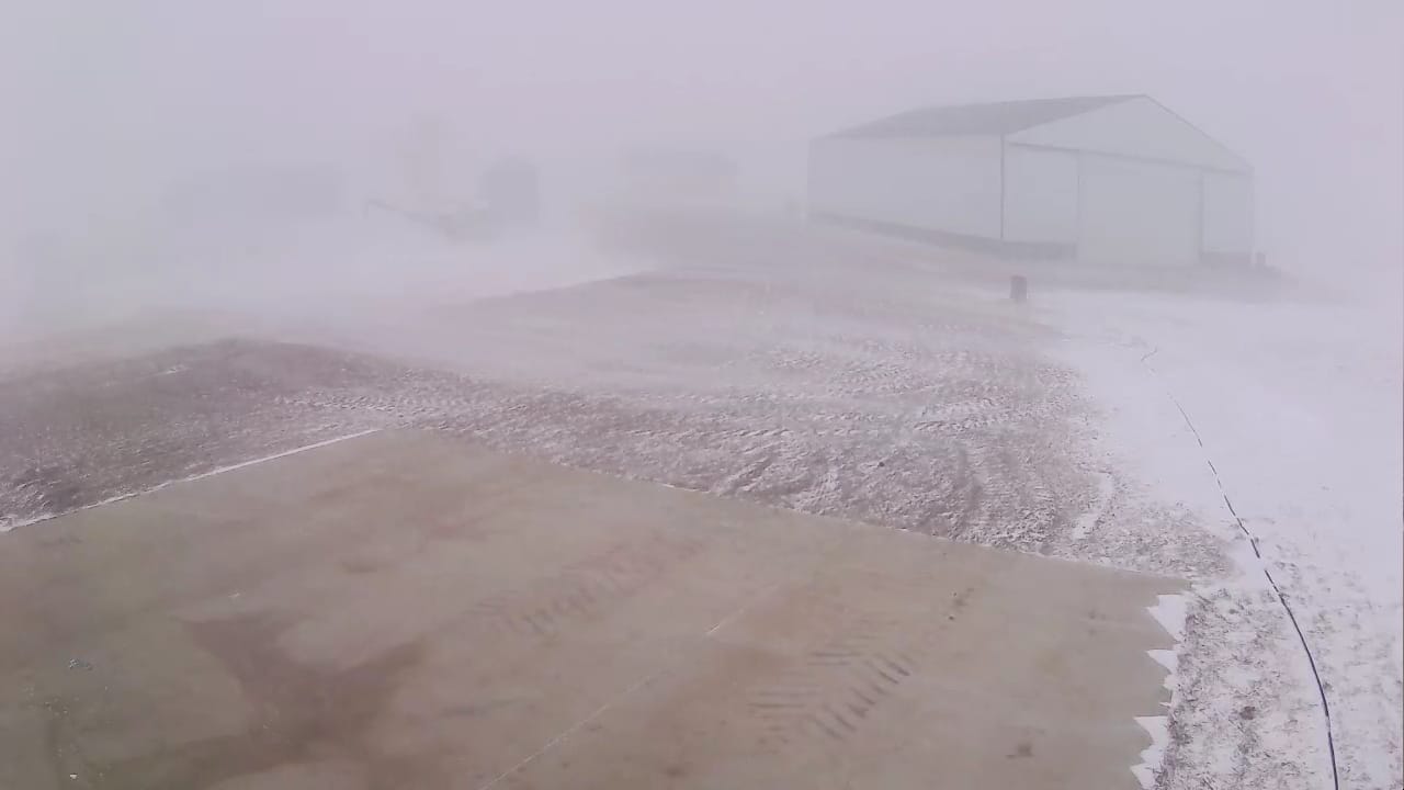
| Reduced visibility 4 miles north of Craven Corner in Edmunds County. Photo courtesy of Gerald Ray Nobel. |
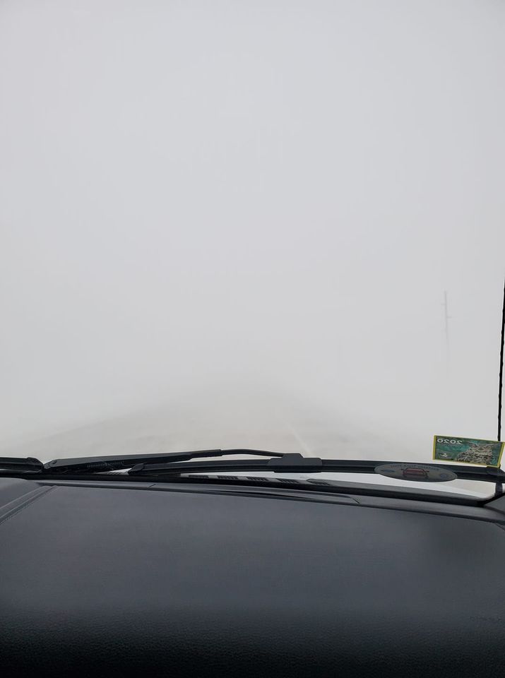
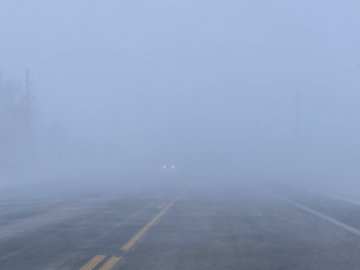
Reduced visibility along highway 12 between Roscoe and Ipswich Wednesday morning. Photo courtesy of Fran Ruckman. |
Slick roads and periods of reduced visibility caused a crash near Belvidere. Photo courtesy of the South Dakota Highway Patrol. |
Reduced visibility near Clark. Photo courtesy of Clark Police Department. |
 |
 |
 |
 |
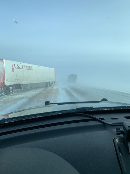
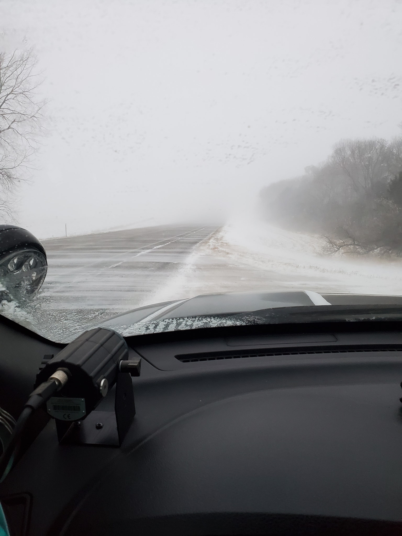
| Whiteout conditions at Summit, taken only 20 yards from semi ahead. Photo courtesy of South Dakota Highway Patrol. |
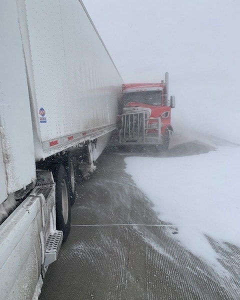
Jackknifed truck near Summit. Photo courtesy of South Dakota Highway Patrol. |
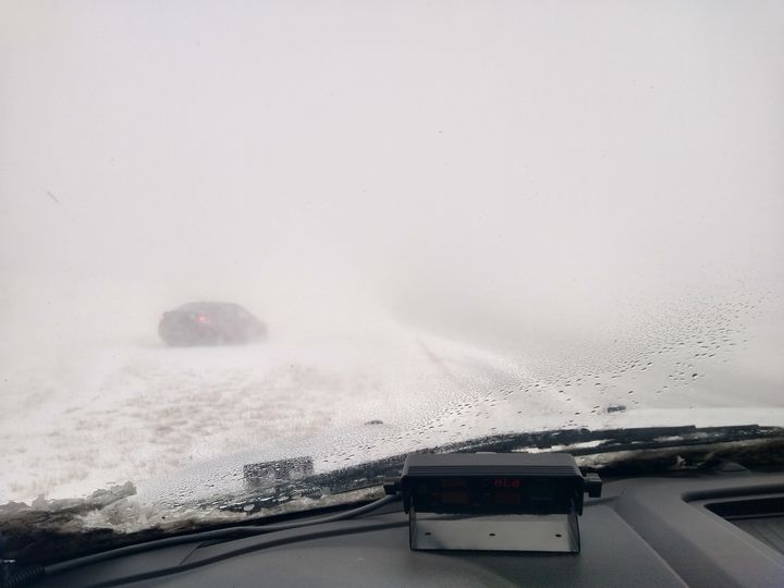
Car in ditch during blizzard conditions near Summit. Photo courtesy of South Dakota Highway Patrol. |
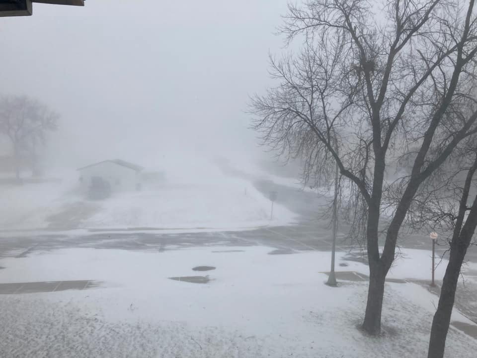
Whiteout conditions near Watertown. Photo courtesy of Alex Resel. |
 |
 |
 |
 |
| Blizzard conditions at Ortonville. Photo courtesy of John Paulson. |
Blizzard conditions near Clear Lake. Photo courtesy of Cody Drinkerd. |
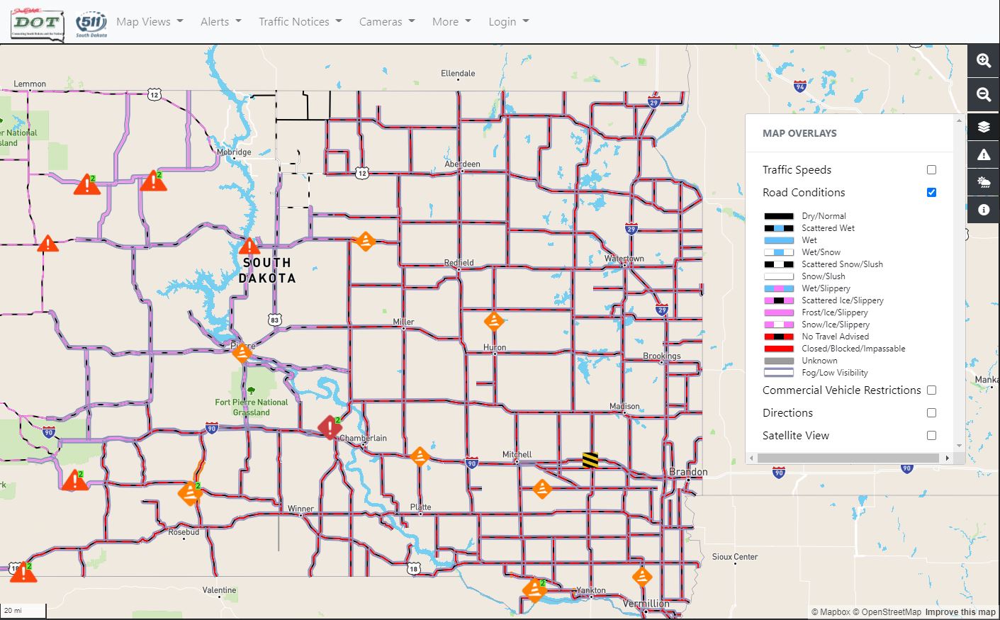
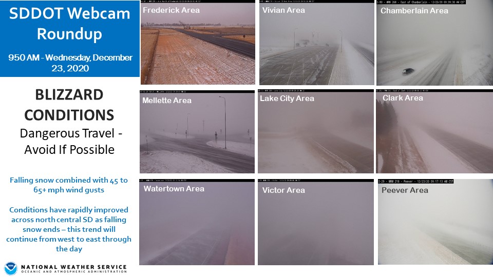
No travel advised across much of eastern South Dakota by 12:45 pm CST. Image from South Dakota Department of Transportation 511 Page. | Area webcams from the South Dakota Department of Transportation at 9:50 AM CST. |
Radar
| Radar Loop 9:50 pm CST Tuesday, December 22 through 3:50 am CST Wednesday December, 23 |
Radar Loop 3:50 am CST through 9:50 am CST Wednesday December, 23 |
Radar Loop 9:50 am CST through 3:50 pm CST Wednesday December, 23 |
Storm Reports
Click here for a text listing of wind, snow and blizzard reports: https://mesonet.agron.iastate.edu/lsr/#ABR/202012230600/202012241800/0100.
 |
 |
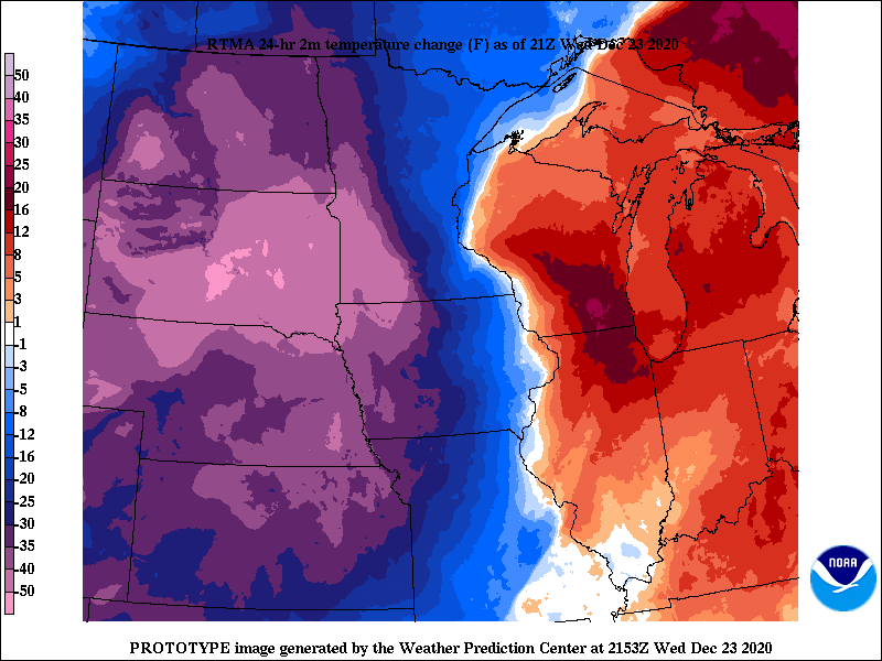 |
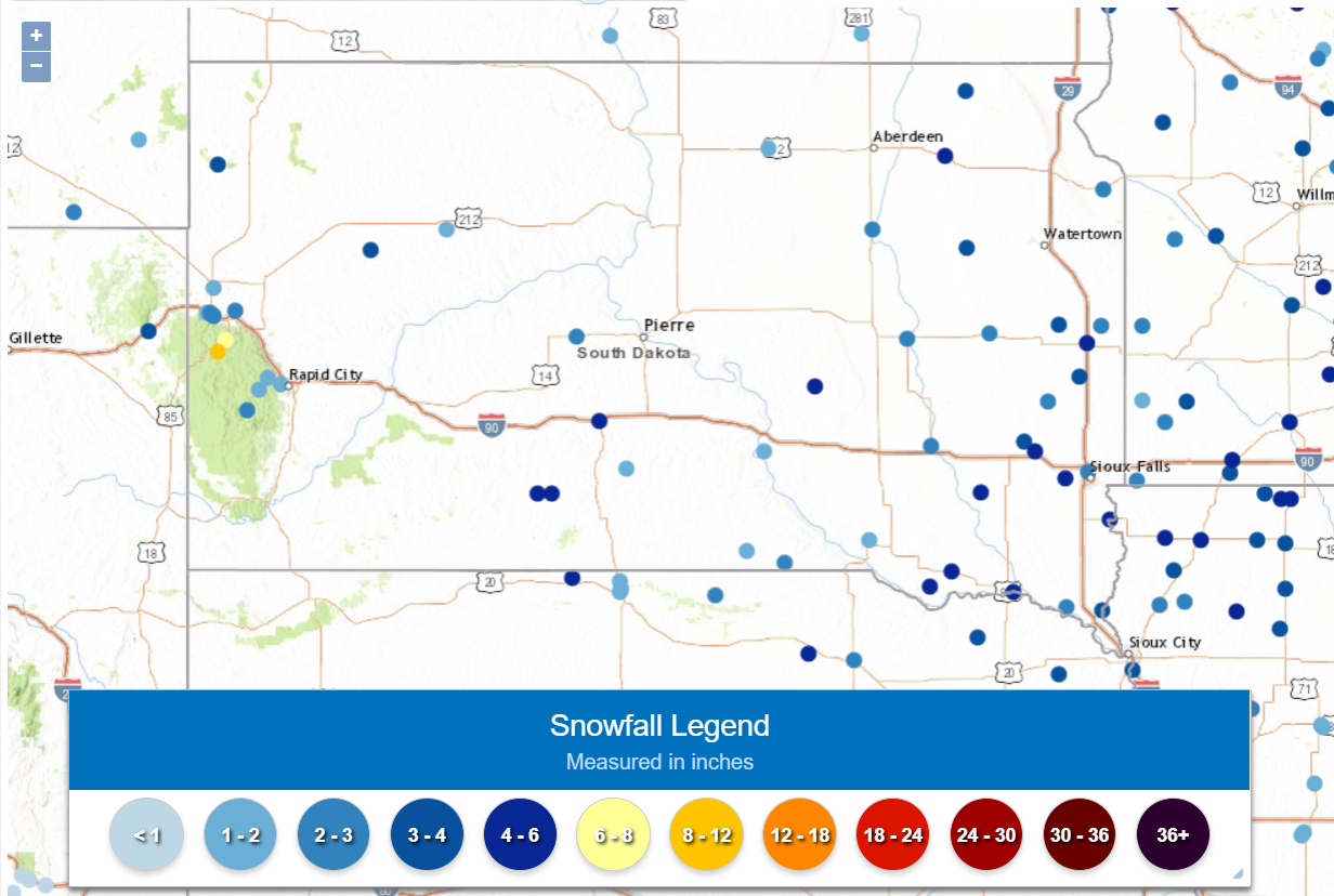
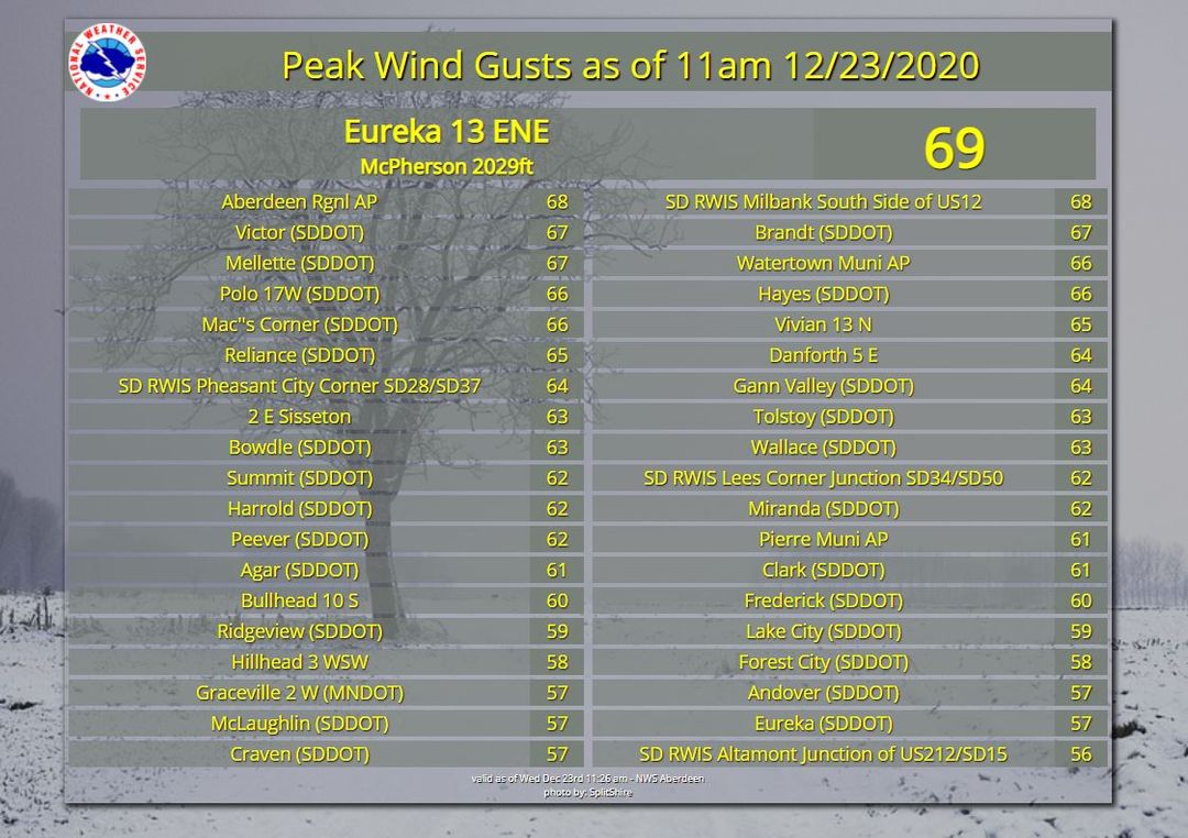
| Snowfall reports | Peak Wind Gust Reports | 24 hour temperature change between 3 pm CST on December 22nd and 3 pm CST on December 23rd. |
 |
Media use of NWS Web News Stories is encouraged! Please acknowledge the NWS as the source of any news information accessed from this site. |
|

