Overview
|
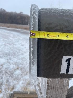
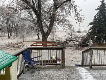
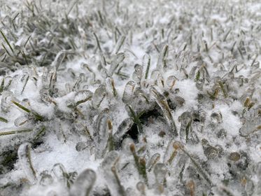
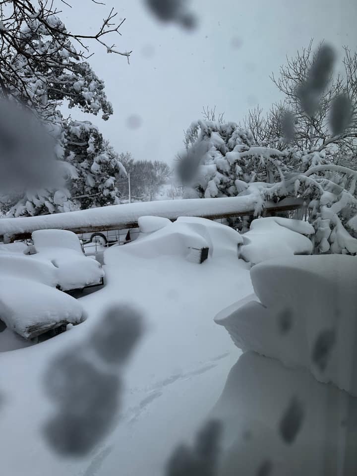
Freezing drizzle began across much of central and northeastern South Dakota during the day on Monday, Dec 12th. By the evening, a glaze of ice had formed on surfaces, up to a tenth of an inch thick. Freezing rain with significant ice accumulations followed into the day Tuesday, Dec 13th, especially across and near the Prairie Coteau where Ice Storm criteria was met (at least a quarter inch of ice). Meanwhile, wet, heavy snow fell further west. The responsible deep low pressure system would only slowly track east over the next several days, leading to round after round of additional snow across the region, sometimes with thunder, with the snow becoming progressively fluffier with time as colder air moved in on the backside. Once high winds developed with gusts of 40-60 mph, blizzard conditions developed and persisted for multiple days, finally wrapping up across northeastern SD through the day on Friday, Dec 16th. This was a highly impactful, major winter storm due to its severe, widespread and prolonged nature. To make matters worse, impacts were exacerbated as this system lasted through the entire work-week. Nearly the entire state was under an SDDOT "No Travel Advised" or had road closures by Thursday, as numerous roads became impassable. I90 closed from Chamberlain to Rapid City from 10am CST on Tue Dec 13th through mid-day Sat Dec 17th (from Kadoka to Chamberlain), and I29 closed from Watertown to the ND border from 7pm Wed Dec 14th through 9am Sat Dec 17th. Additionally, multiple consecutive days of school was cancelled, tree damage and power outages resulted (over a thousand at any given time for multiple days across the area), the KDLO transmitter tower near Garden City collapsed from the ice, and several dozens of semi drivers were stranded for several days and nights at the Coffee Cup Fuel Stop in Vivian. Numerous other vehicle accidents occurred as well. |
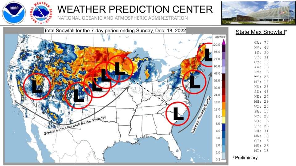 7 day total snowfall from Dec 11-18th, 2022 across the United States. |
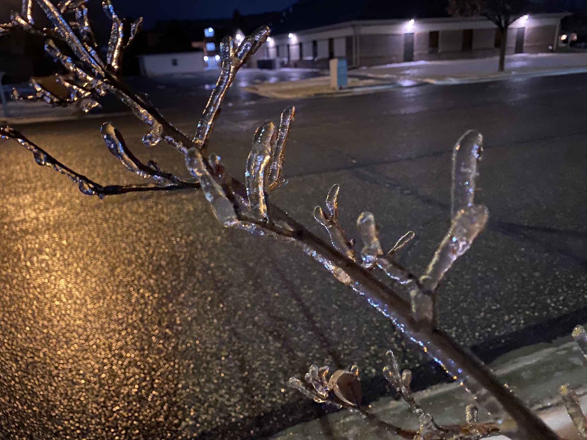
Ice Storm
Monday and Tuesday, December 12-13th
 |
 |
 |
 |
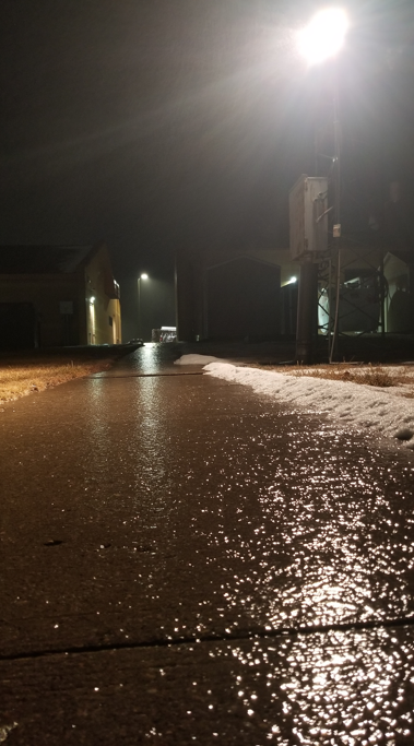
| Freezing drizzle impacts on Dec 12th at ~4:30pm on I-29 near the Wilmot exit. Photo courtesy of the SD Highway Patrol. | Freezing drizzle at the NWS office in Aberdeen on Dec 12th at 7:23pm | Semi crash near Bristol on US Highway 12 on Dec 12th at ~8pm. Photo courtesy of the SD Highway Patrol. | Ice accumulation on outdoor surfaces in Watertown as of 1:45am Dec 12th. Photo courtesy of Alex Resel. |
 |
 |
 |
 |
| Ice accumulation half a mile west of Webster at 11am Dec 13th. Photo courtesy of Stacey Williams Dunse. | Tree damage from ice in Willow Lake as of 12:30pm Dec 13th. Photo courtesy of Garrett Seefeld. | Watertown as of 5pm Dec 13th. Photo courtesy of Michelle Diane. | 6am Dec 13th ice in Watertown. Photo courtesy of Brent Nathaniel. |
 |
 |
 |
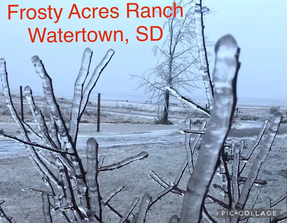 |
| Coating of ice from freezing rain as of 8am Dec 13th in Watertown. Photo courtesy of Devon Pitts. | Coating of ice off a tree branch in Wallace at ~9am Dec 13th. Photo courtesy of LaDawn Robinson. | Ice in Watertown as of 9am Dec 13th. Photo courtesy of Alex Resel. | Ice accumulation in Watertown as of 9am Dec 13th. Photo courtesy of Regina Staufer. |
 |
 |
 |
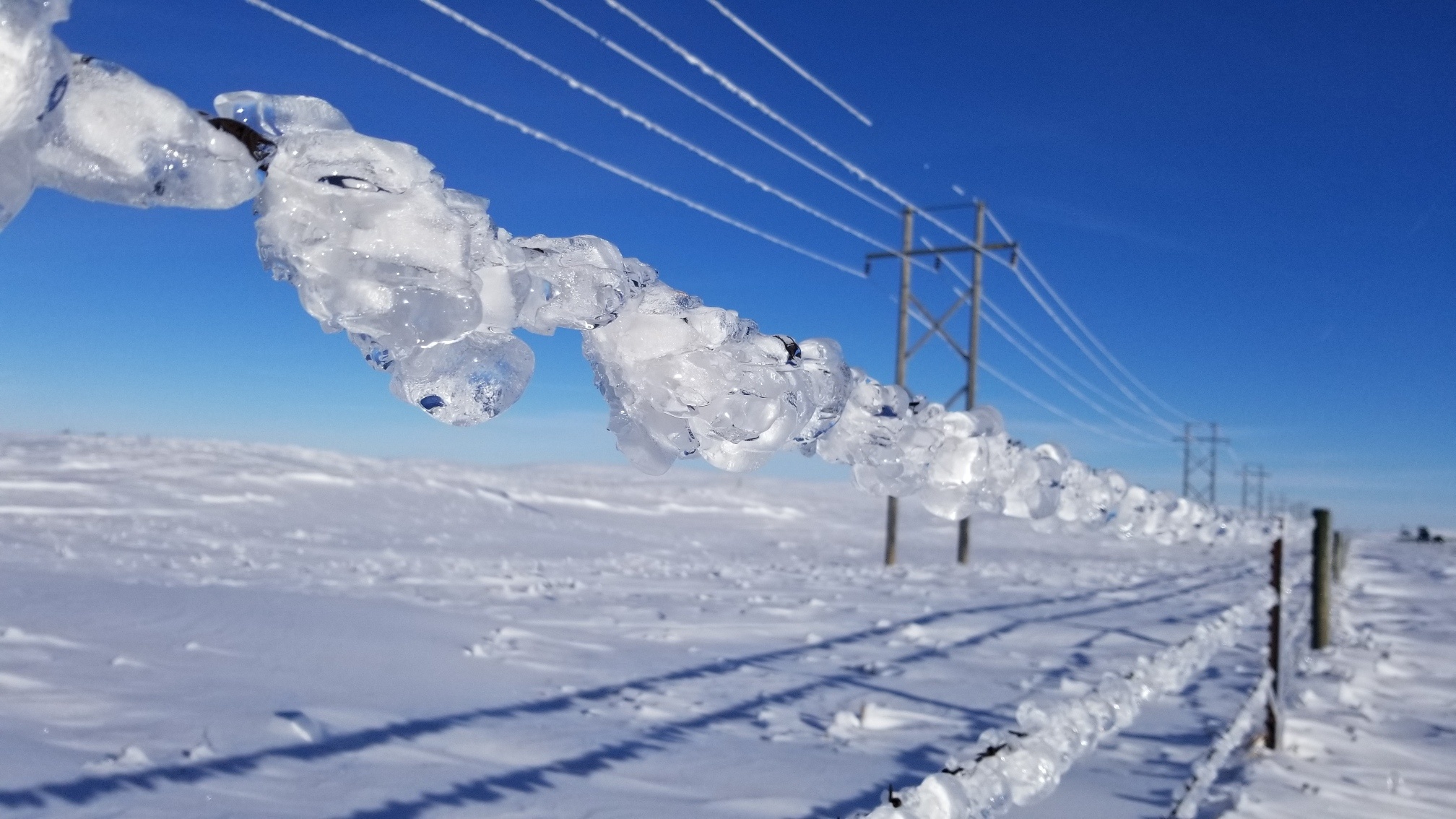 |
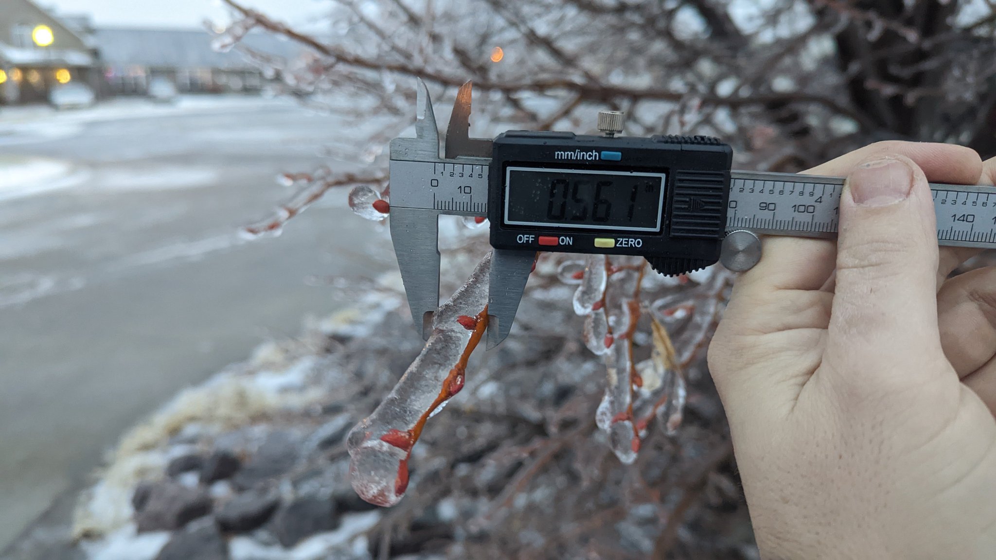
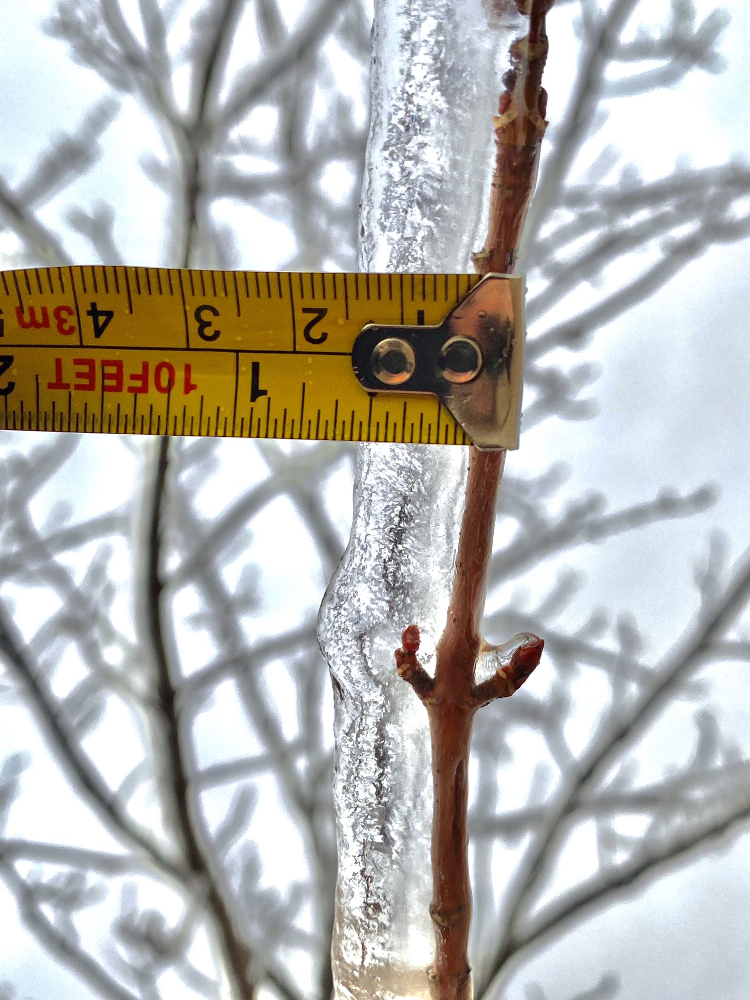
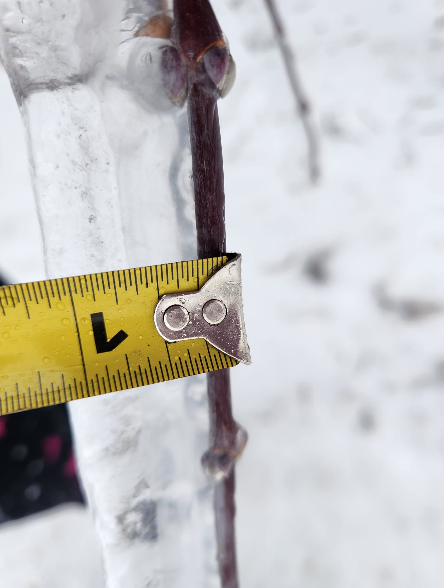
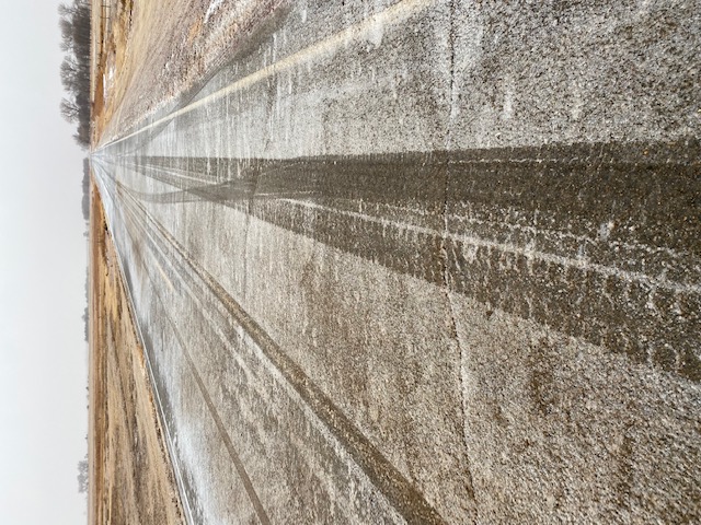
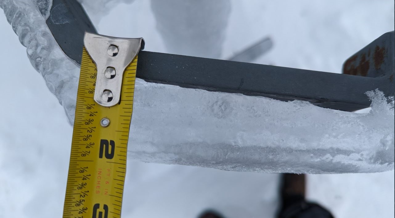
| Thick ice on vegetation 4 miles south of Strandburg as of 9am Dec 13th. Photo courtesy of Kristy Gruener-Rabine. | Poor road conditions Dec 13th at Raymond. Photo courtesy of the Clark County Emergency Manager. | Thick ice coating 5 miles southwest of Summit approximately a week after the storm. Photo courtesy of Devon Pitts. | Thick ice coating still in place near Marvin on Dec 26th. Photo from NWS employee. |
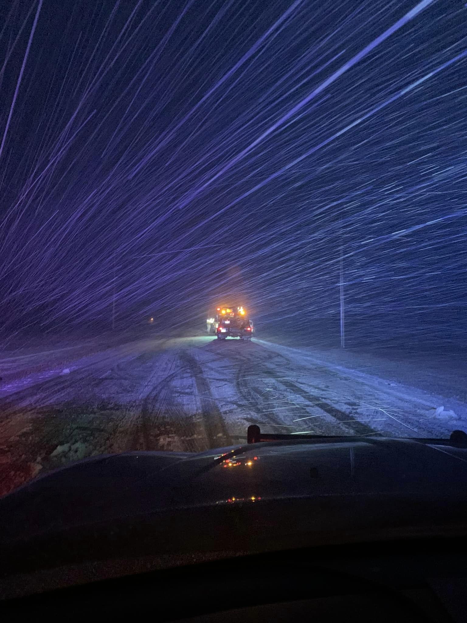
Heavy Snow, Blizzard
Tuesday and Wednesday, December 13-14th
 |
 |
 |
 |
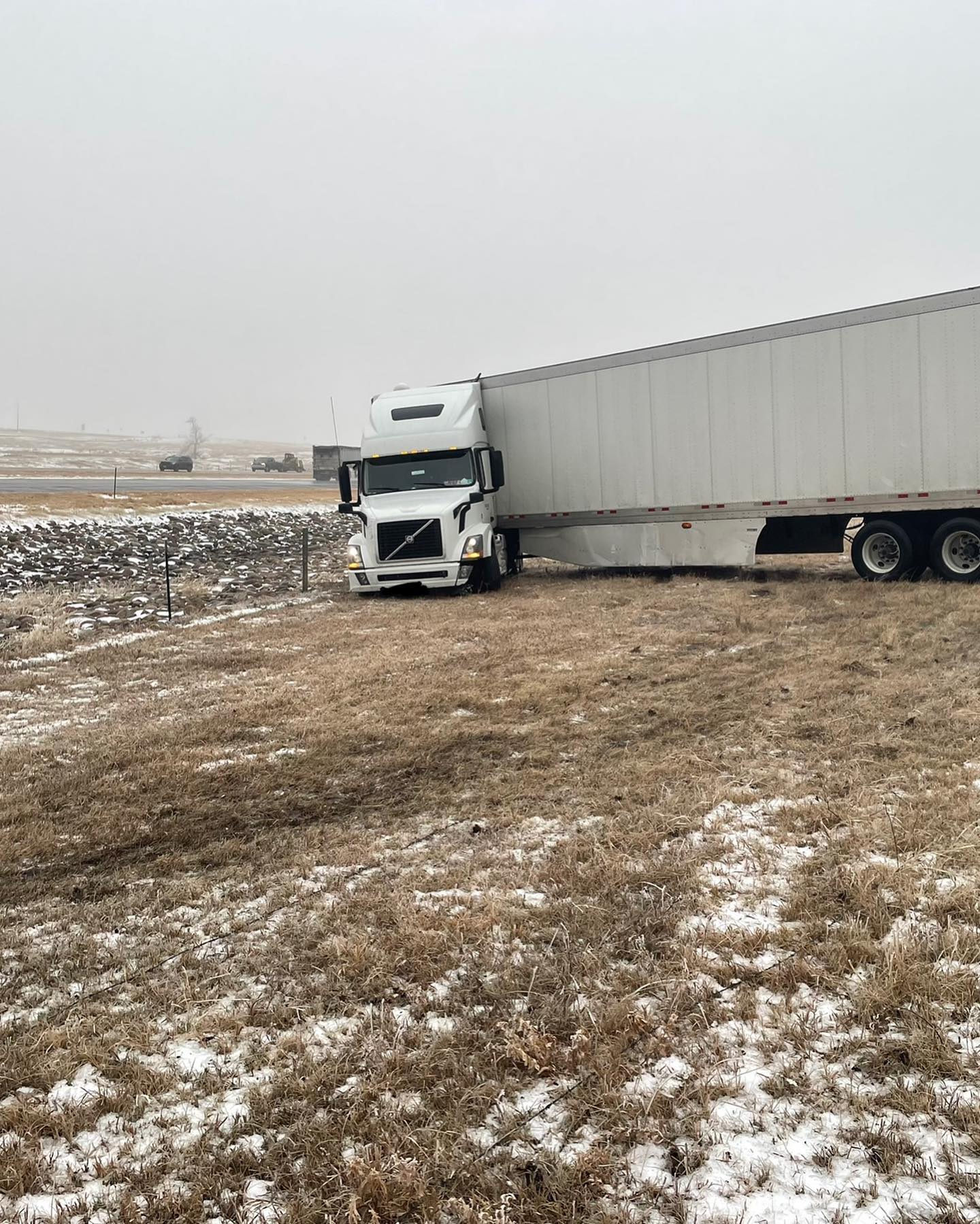
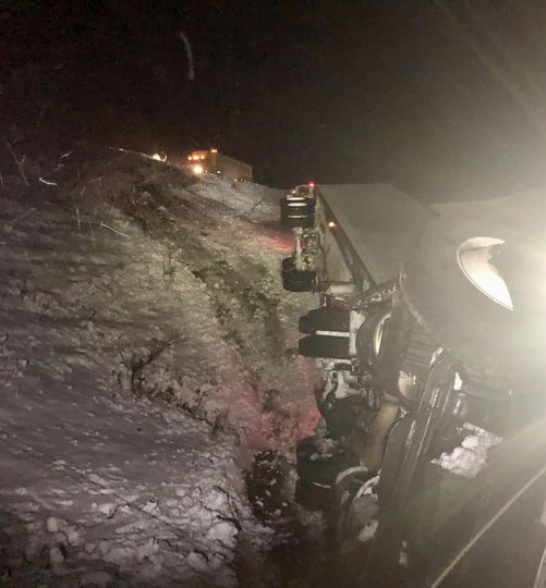
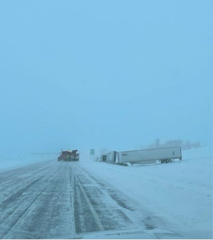
| Dec 13th at ~3pm on I-90 (mile marker 220). Photo courtesy of the Lyman County Sheriff. | Rare snow rollers spotted around 2pm on Dec 14th in Britton. Photo courtesy of Sara Holland. | Dec 13th ~740pm east of Pierre. Photo courtesy of the Hughes County Sheriff's Office. | Snowfall 2 miles north of Timber Lake as of Dec 14th. Photo courtesy of Grady Kraft. |
 |
 |
 |
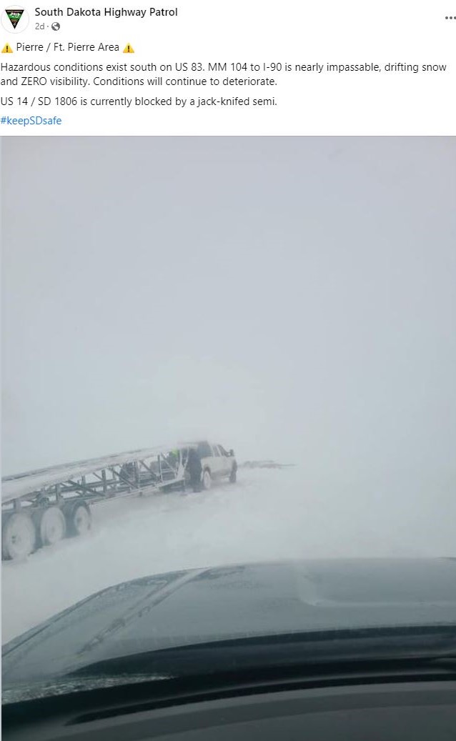
 |
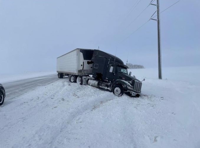
| Dec 14th at 5pm at US14 and SD 1806. Photo courtesy of the South Dakota Highway Patrol. | Dec 14th at ~9am on US Highway 12 near Bluedog Lake. Photo courtesy of the Day County Sheriff. | Downed power lines on Dec 14th at ~430am in the area of Lohre Road and 130th St. Photo courtesy of the Roberts County Sheriff's Office. | Accident due to poor road conditions on Dec 14th at ~730pm. Photo courtesy of the Hamlin County Sheriff. |
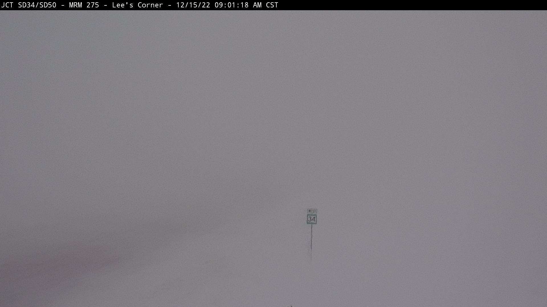
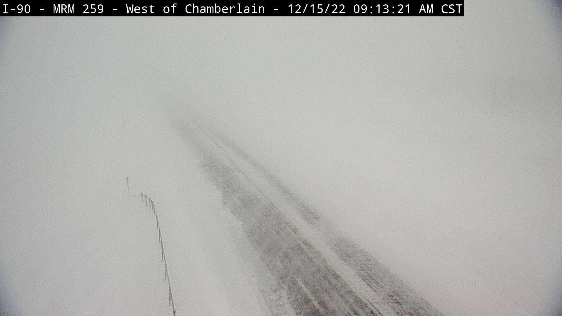
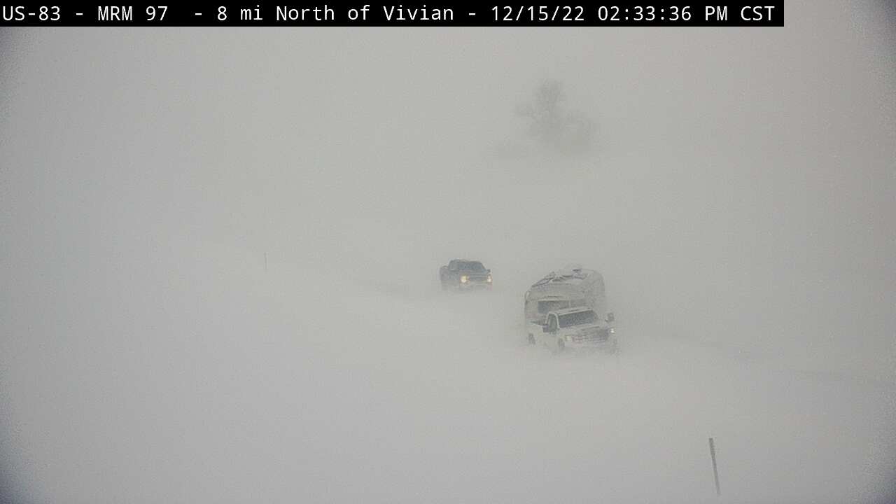
Thursday, December 15th
 |
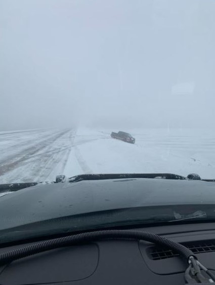
 |
 |
 |
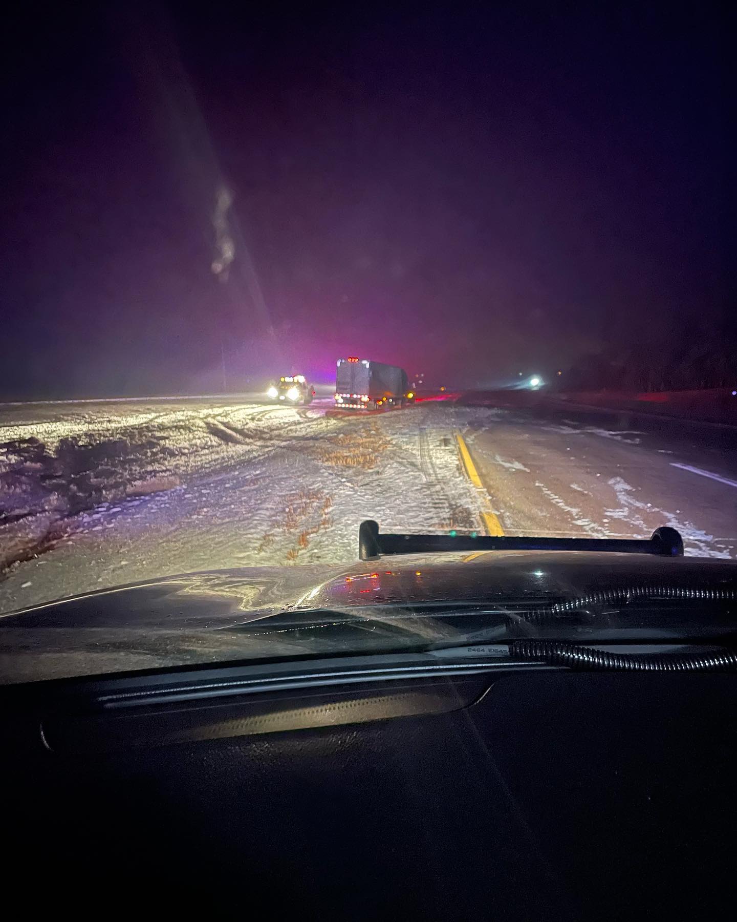
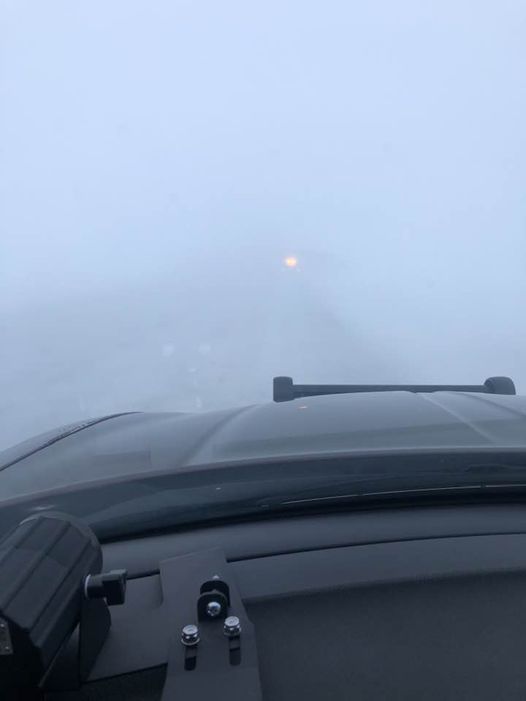
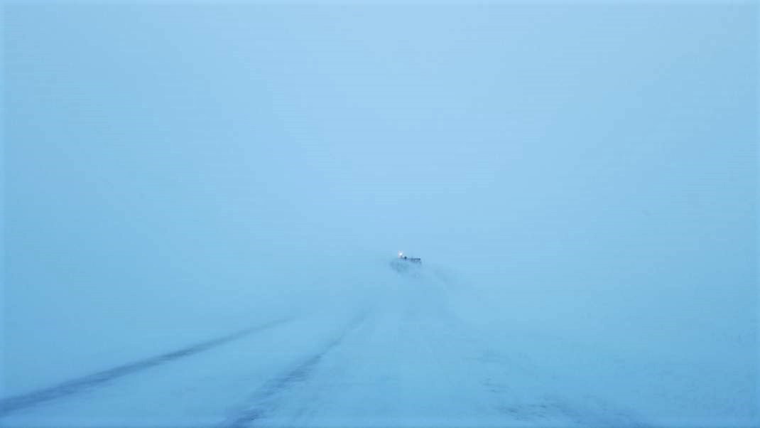
| 9am Dec 15th SDDOT webcam from 6 miles east of Fort Thompson at the junction of SD34 and SD50. | 9:13am Dec 15th SDDOT webcam from 2 miles NW of Oacoma on I-90. | 2:33pm Dec 15th SDDOT webcam from 8 miles north of Vivian on US83. Vehicles were stuck here for many hours. | Dec 15th at ~9am on I-29 near the Wilmot exit. Photo courtesy of the SD Highway Patrol. |
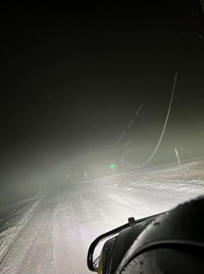
 |
 |
 |
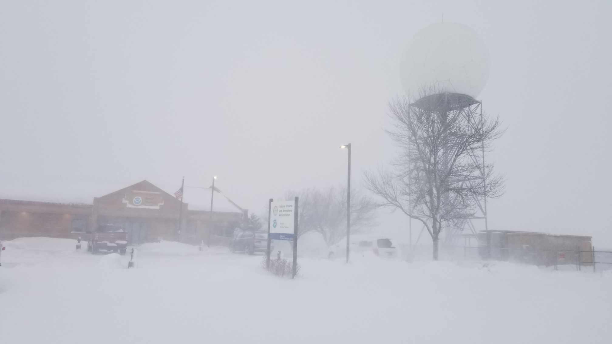 |
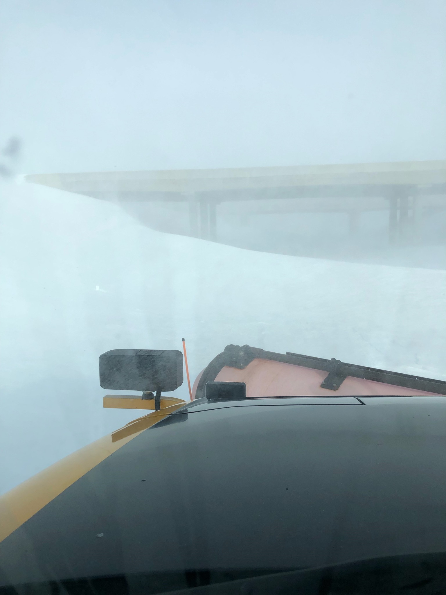
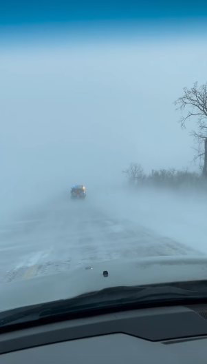
| Trooper's view of whiteout conditions on Dec 15th at ~1150am on SD25 west of Veblen. Photo courtesy of the SD Highway Patrol. | SDDOT plow camera from ~2:30pm on Dec 15th near Draper. | Virtually impassable Highway 1804 on Dec 15th at ~8am. Photo courtesy of the Hughes County Sheriff's Office. | Blizzard conditions at the Aberdeen airport at 4pm on Dec 15th. From NWS employee. |
 |
 |
 |
 |
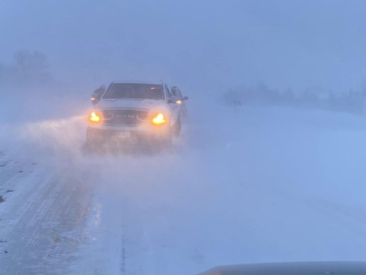
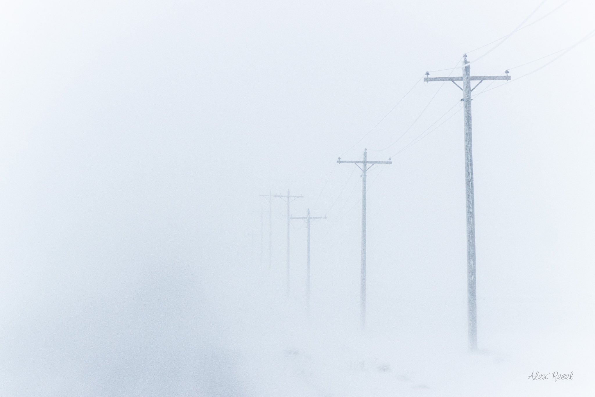
| Dec 15th blizzard conditions near Watertown. Photo courtesy of Alex Resel. | Car accident (without injuries) in Big Stone County. Photo courtesy of the Sheriff. | Severely drifted and impassable city roads and highways in Spink County on Dec 15th at ~1145pm. Photo courtesy of the Sheriff. | Dec 15th at ~930am on US Highway 12 west of Bowdle. Photo courtesy of the Walworth County Sheriff. |
Friday, December 16th and Beyond
 |
 |
 |
 |
| Dec 16th at ~11am, 20 miles east of Pierre. Photo courtesy of Lesley Roth Coyle. | Dec 16th at ~11am in Aberdeen. Photo courtesy of David Tukesbrey. | Dec 16th at ~11am on Highway 212 at the Orient Curve. Photo courtesy of the Faulk County Sheriff's Office. | Dec 16th at ~120pm. Ice covered highway 12 in Roberts, Day and Grant Counites. Photo courtesy of the SD Highway Patrol. |
 |
 |
 |
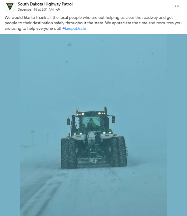
 |
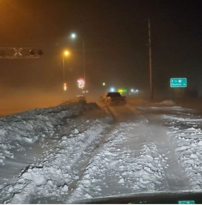
| Many locals volunteered with their own equipment and time to help clear roadways. Photo courtesy of the SD Highway Patrol. | Photo from Pierre, courtesy of the Hughes County Sheriff. | Photo from Pierre, courtesy of the Hughes County Sheriff. | Dec 16th late afternoon on County Road 12 west of Aberdeen. Photo from NWS employee. |
 |
 |
 |
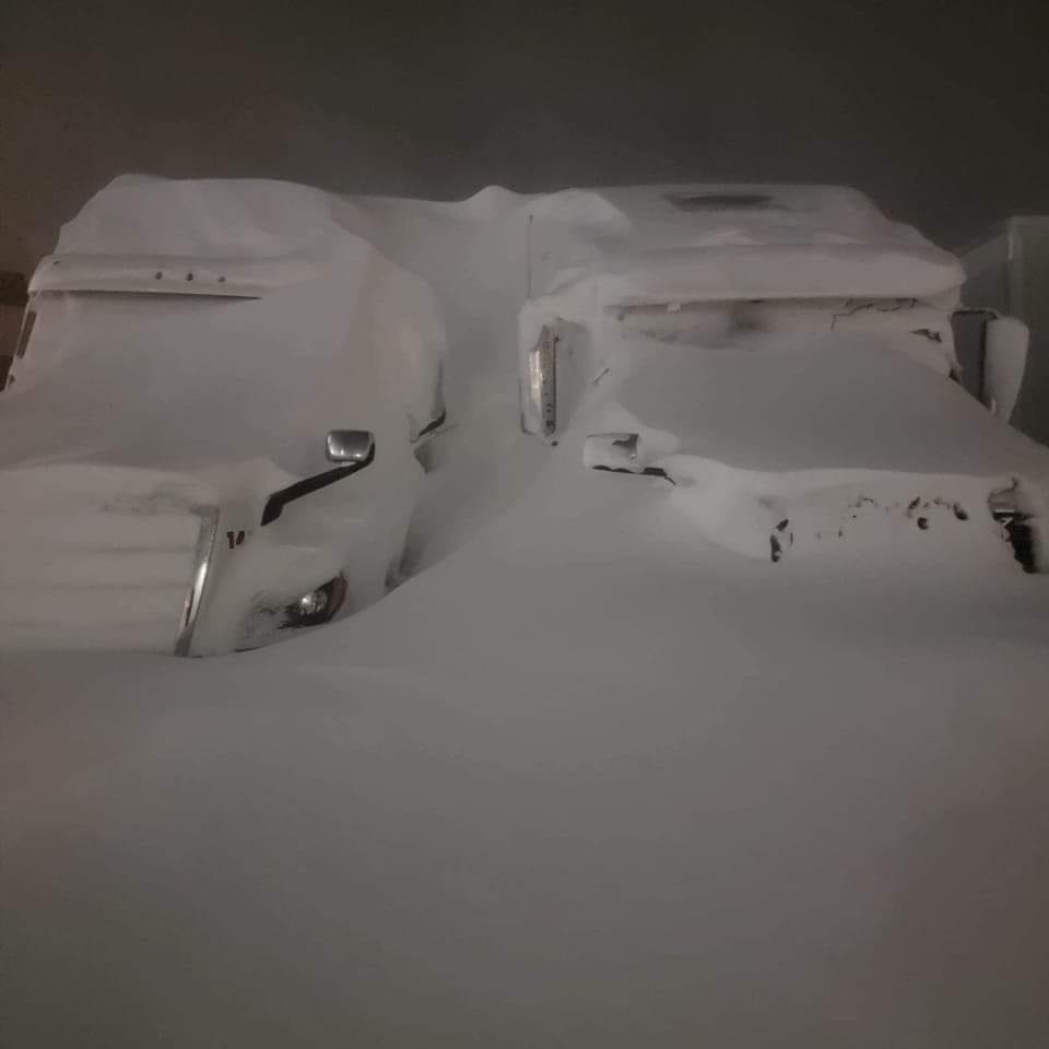
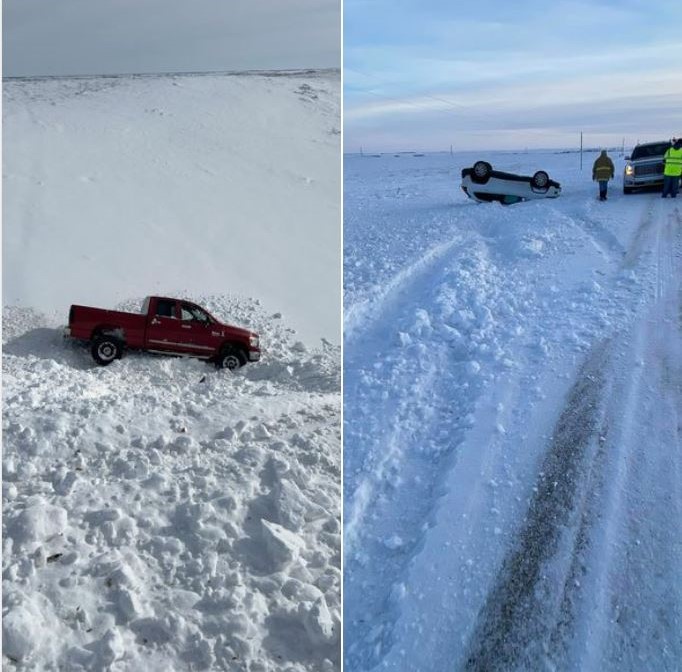 |
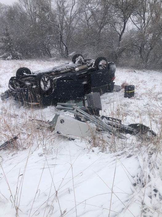
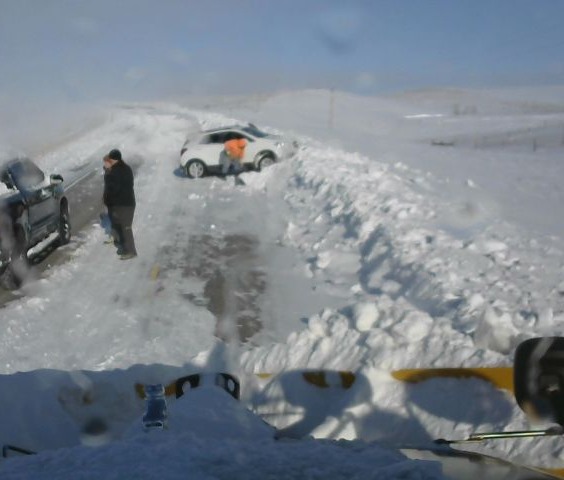
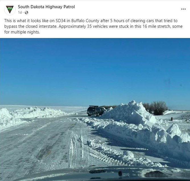
| Dec 17th near Presho. Photo from KCCR | A couple stranded vehicles out of dozens at the Coffee Cup Fuel Stop in Vivian. Photo courtesy of Kath Juhnke-Caslin. | Dec 17th on SD34 in Buffalo County. Photo courtesy of the SD Highway Patrol. | Dec 20th featured two rollover accidents due to still icy roads in Hand County (no injuries). Photos courtesy of the Sheriff. |
Radar, Satellite
| Local radar loop with estimated precipitation type over a nearly full 4 day period from 4pm Monday, Dec 12th through noon Friday, Dec 16th. | Regional radar loop with estimated precipitation type over a nearly full 4 day period from 4pm Monday, Dec 12th through noon Friday, Dec 16th. |
 |
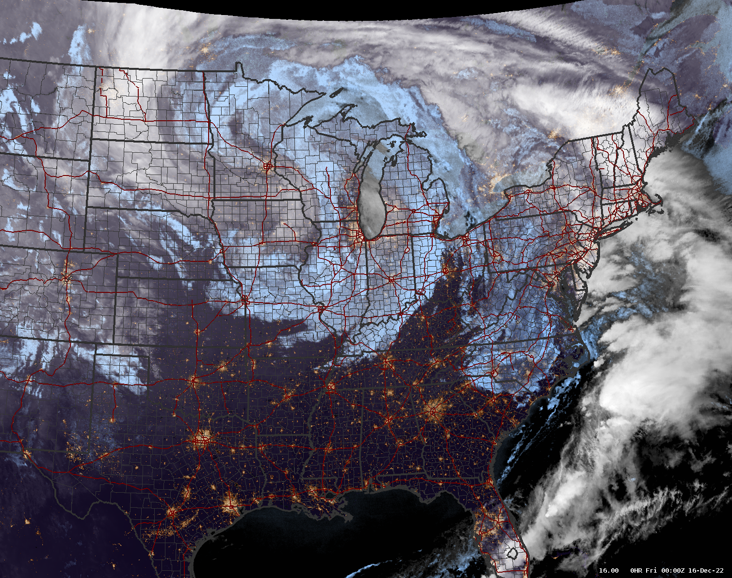 |
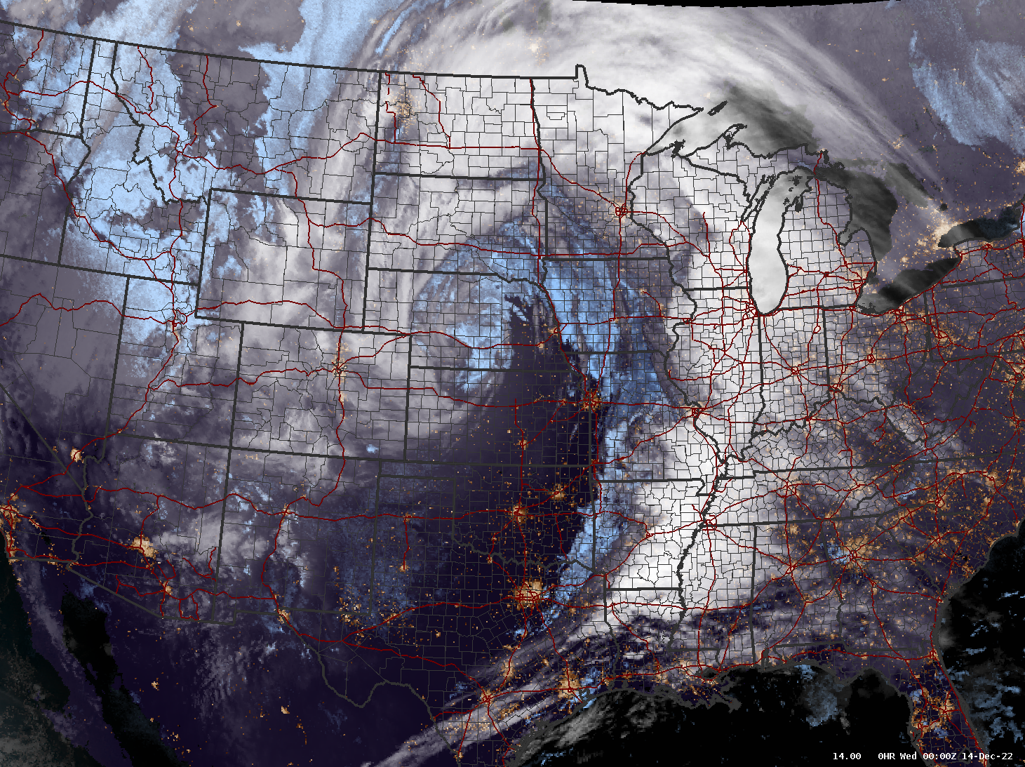
| Satellite imagery (GOES16 GeoColor) at 6pm Tuesday, Dec 13th, showing the massive scale and long duration of this storm. | Satellite imagery (GOES16 GeoColor) at 6pm Thursday, Dec 15th, showing the massive scale and long duration of this storm. |
Storm Reports, Other
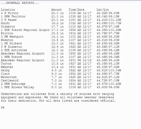
Additional information can be found in event summary pages from the Rapid City NWS Office, the Sioux Falls NWS Office, and the Grand Forks, ND NWS Office.
 |
 |
 |
 |
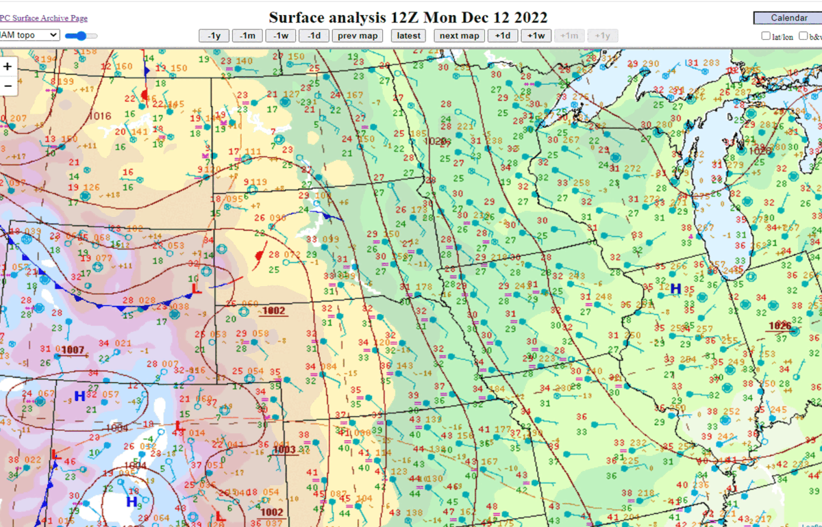
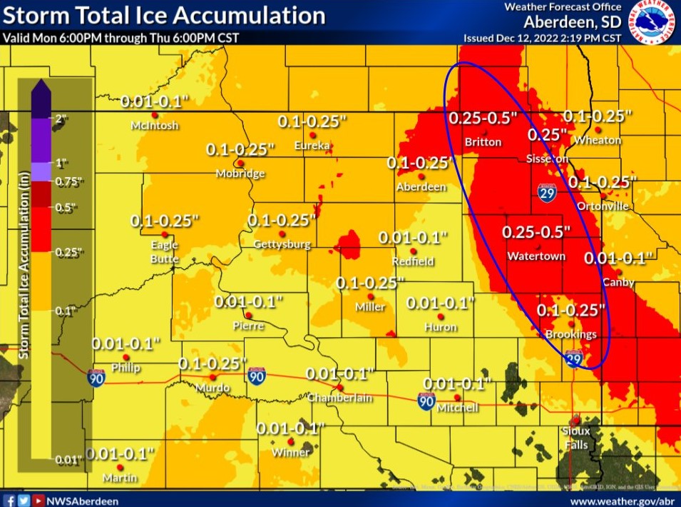
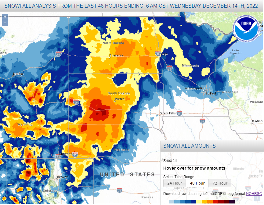
| Observed surface weather map every 12 hours from 6am Monday, Dec 12th through 6pm Fri, Dec 16th, showing the slow progression of this storm system. | NWS Aberdeen's ice accumulation forecast, showing the approximate region that was hit hardest by the Dec 12-13th ice storm. | Observed snowfall through 6am Dec 14th. Blue = 1-6", Yellow to Orange = 6-18", Red = 18-24" | Observed snowfall through 6am Dec 16th (light to moderate snow was still falling at times through the 16th). Blue = 1-6", Yellow to Orange = 6-18", Red = 18-24" |
 |
 |
 |
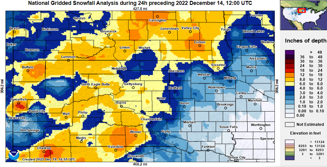 |
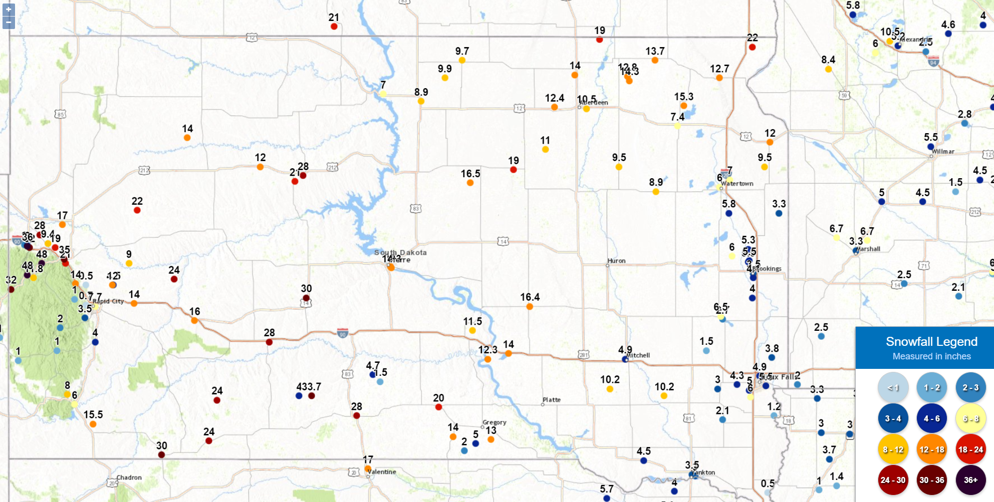
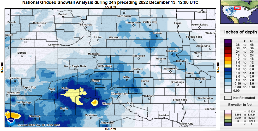
| Total snowfall measurements through 6am Dec 16th. | Total snowfall measurements through noon Dec 17th. | Approximate 24 hour snowfall amounts ending at 6am on Tuesday, Dec 13th (analysis from the NOHRSC) | Approximate 24 hour snowfall amounts ending at 6am on Wednesday, Dec 14th (analysis from the NOHRSC) |
 |
 |
 |
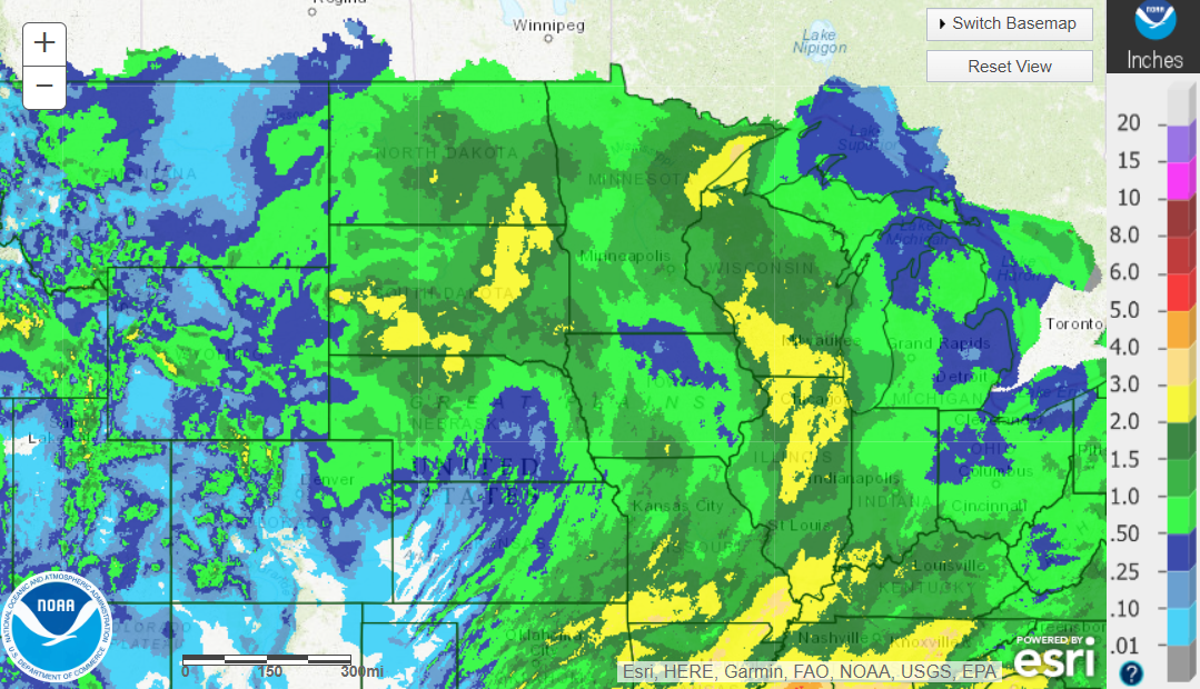 |
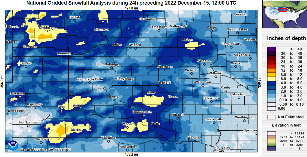
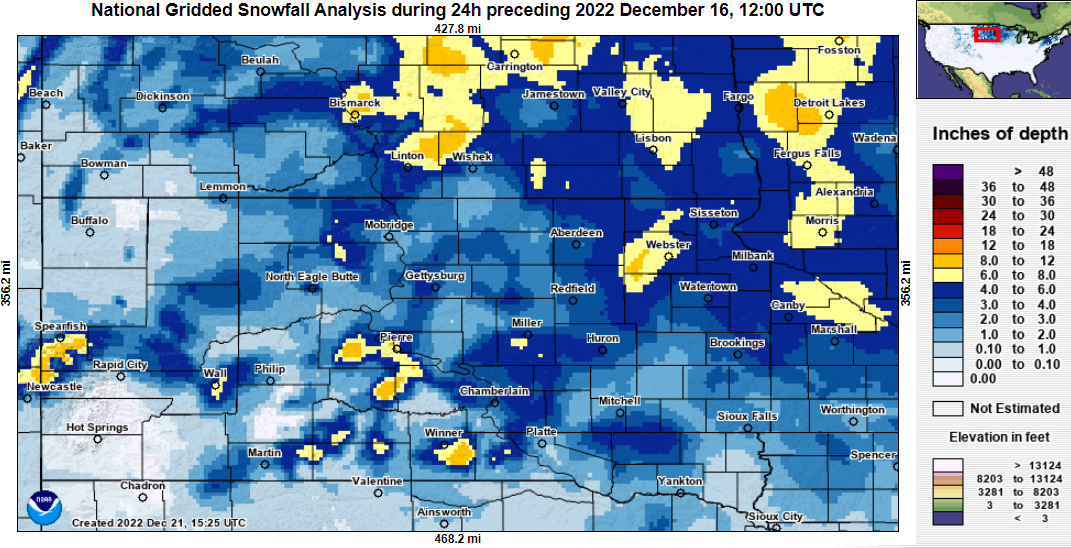
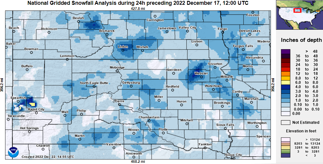
| Approximate 24 hour snowfall amounts ending at 6am on Thursday, Dec 15th (analysis from the NOHRSC) | Approximate 24 hour snowfall amounts ending at 6am on Friday, Dec 16th (analysis from the NOHRSC) | Approximate 24 hour snowfall amounts ending at 6am on Saturday, Dec 17th (analysis from the NOHRSC) | Observed total liquid-equivalent precipitation across the region through 6am Dec 16th. |
 |
 |
 |
 |
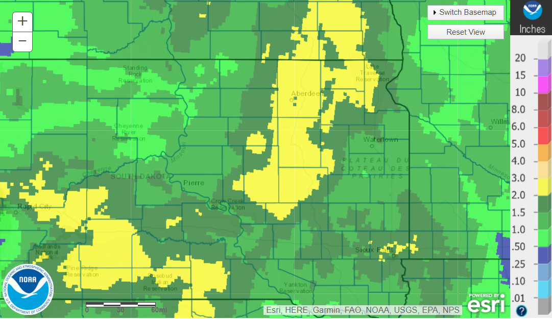
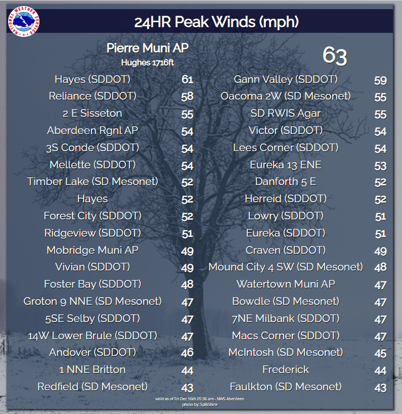
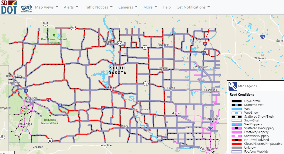
| Observed total liquid-equivalent precipitation across the local area through 6am Dec 16th. | Measured peak wind gusts as of 6am Dec 16th | SDDOT road report as of 8:30 am CST on Dec 15th. The majority of South Dakota had dangerous to impossible travel conditions for an extended period of time. | MNDOT road report as of 2:30pm CST on Dec 15th. |
 |
 |
 |
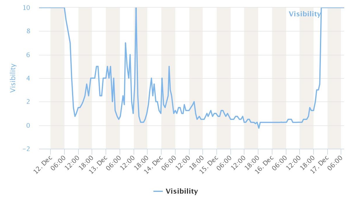 |
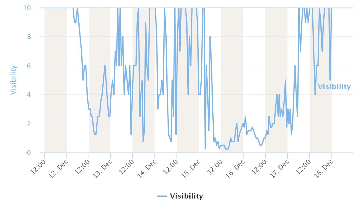
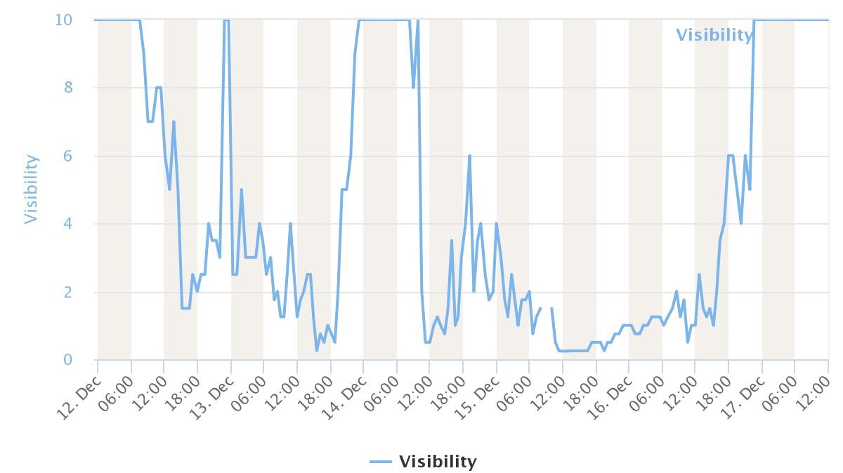
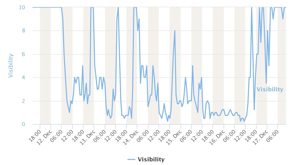
| Power outages at 4pm Dec 13th (not a complete accounting). Additional outages would be reported through the 16th and beyond across the area. | Observed visibility at the ASOS in Watertown from noon on Sunday, Dec 11th to noon on Mon, Dec 19th | Observed visibility at the ASOS in Aberdeen from noon on Monday, Dec 12th to noon on Saturday, Dec 17th | Observed visibility at the ASOS in Pierre, from 8pm on Sunday, Dec 11th to 6am on Saturday, Dec 17th |
 |
|||
| Observed visibility at the ASOS in Mobridge from 6pm on Sunday, Dec 11th to 6am on Saturday, Dec 17th |
 |
Media use of NWS Web News Stories is encouraged! Please acknowledge the NWS as the source of any news information accessed from this site. |
|

