Overview
|
On the heels of a major winter storm just a week before on Dec 12-16th, Arctic cold air settled in across the region beginning on Sunday the 18th with high temperatures for most of 5 degrees or colder each of the next consecutive 6 days through the 24th. Low temperatures dropped into the minus teens. An unusually potent blast of cold air for December followed in behind a reinforcing Arctic front Tuesday night, Dec 20th, into Wednesday, Dec 21st, along with a trace to as much as 2 to 3" of new snowfall on top of the pre-existing snow pack. Wind gusts of 35 to 55 mph behind this front impacted the region from the 21st through the 23rd, resulting in an extended period of life-threatening wind chills in the -35 to -60 degree F range and ground blizzard conditions. A ground blizzard is a blizzard, but does not involve any new falling snow. The extreme cold made the threat to stranded motorists even more dangerous, as numerous roads became impassable. Nearly the entire state was virtually shut down, for the second time this December, as roads were either deemed "No Travel Advised" or closed by the SDDOT. I29 closed from 6pm CST on Thu Dec 22nd from Sioux Falls to the ND state line until 9am on Fri Dec 23rd from Sioux Falls to Watertown and until noon from Watertown to the ND state line, and I90 closed from Rapid City to Chamberlain from 6pm MST on Wed Dec 21st until 2:30pm on Fri Dec 23rd from Rapid City to Murdo and until 4pm from Murdo to Mitchell. Additional impacts commonly included school closures. Governor Noem declared a Winter Storm Emergency on Dec 22nd, which activated the SD National Guard and allowed assistance from the state to county governments as needed. This storm system was wide-reaching, impacting much of the eastern two-thirds of the United States with dangerous cold and precipitation. Among the hardest-hit was Erie County in New York State, which includes Buffalo. As of Dec 29th, 39 people were reported to have perished in the storm there. |
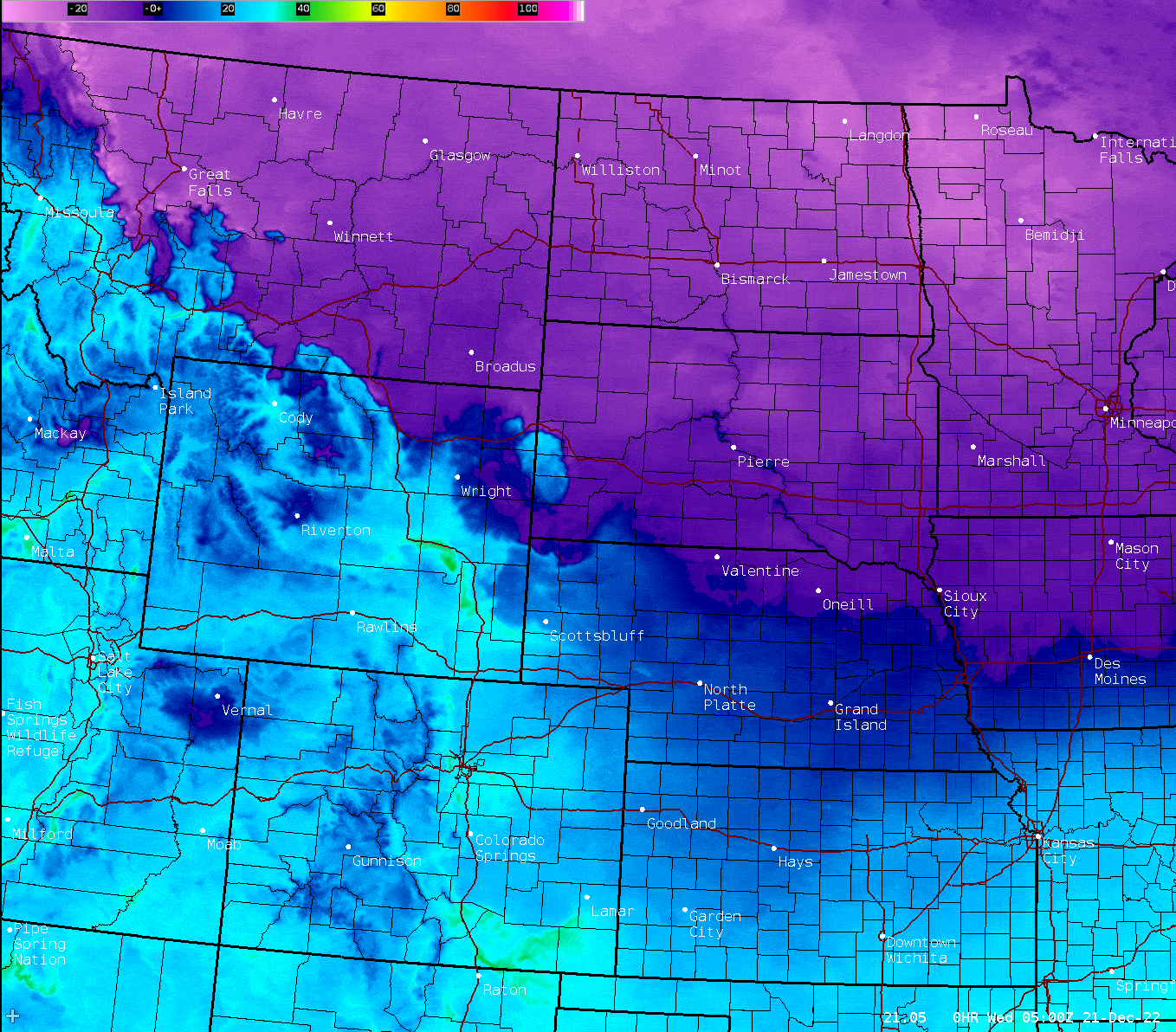 Hourly temperatures from 11pm Tue, Dec 20th through 11pm Wed, Dec 21st (purple represents sub-zero temperatures). |
Dec 18-24th Arctic Blast
 |
 |
 |
 |
| Greatest 1-hour temperature changes from Wed, Dec 21st through Fri, Dec 23rd across the US. | Greatest 24-hour temperature changes from Wed, Dec 21st through Fri, Dec 23rd across the US. | Observed high and low temperatures at select locations from Dec 17th through the 25th. | Perspective on the coldest day in terms of high temperatures. |
.PNG) |
.PNG) |
.PNG) |
.PNG) |
| Record longest streaks of sub-zero temperatures at Watertown. Period of record back to 1893. | Record longest streaks of sub-zero temperatures at Mobridge. Period of record back to 1911. | Record longest streaks of 0 degree or colder temperatures at Pierre. Period of record back to 1933. | Record longest streaks of 0 degree or colder temperatures at Sisseton. Period of record back to 1931. |
.PNG) |
 |
 |
 |
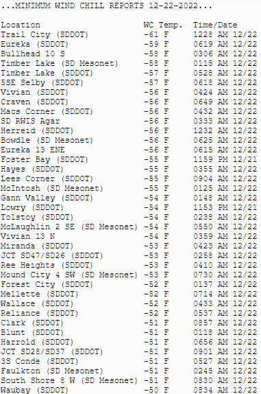
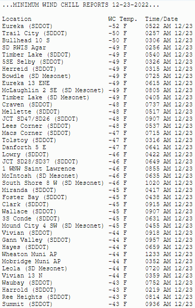
| Record longest streaks of 0 degree or colder temperatures at Aberdeen. Period of record back to 1893. | Forecast high temperatures for the 21st through the 25th (point values) and their departures from normal (color fill) to show the scope and severity of the cold air. | Minimum observed wind chills on Wed Dec 21st (part 1). Wind chills ranged from -25 F to -38 F across the area from the 19-20th as well. | Minimum observed wind chills on Wed Dec 21st (part 2). Wind chills ranged from -25 F to -38 F across the area from the 19-20th as well. |
 |
 |
 |
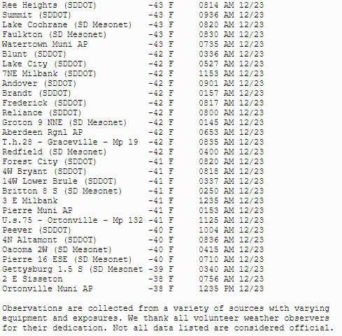 |
| Minimum observed wind chills on Thu Dec 22nd (part 1) | Minimum observed wind chills on Thu Dec 22nd (part 2) | Minimum observed wind chills on Fri Dec 23rd (part 1) | Minimum observed wind chills on Fri Dec 23rd (part 2) |
Dec 21-23rd Ground Blizzard
December 21st
 |
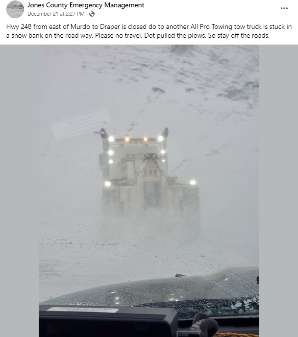 |
 |
 |
| Dec 21st on US Highway 83 south of Vivian. Photo courtesy of David Rudzik. | Dec 21st at ~2:30pm showing the rapidly deteriorated conditions. Photo courtesy of the Jones County Emergency Manager. | Blizzard conditions on Dec 21st at ~1pm. Photo courtesy of the Jones County Emergency Manager. | Emergency rescue operations on I90 Dec 21st at ~8:30pm, conducted by Jones County Emergency Management, the Sheriff's Office, the SDDOT and the SD Highway Patrol. |
 |
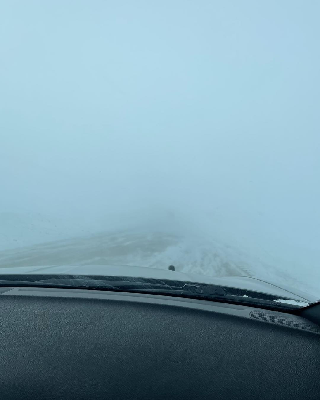
 |
 |
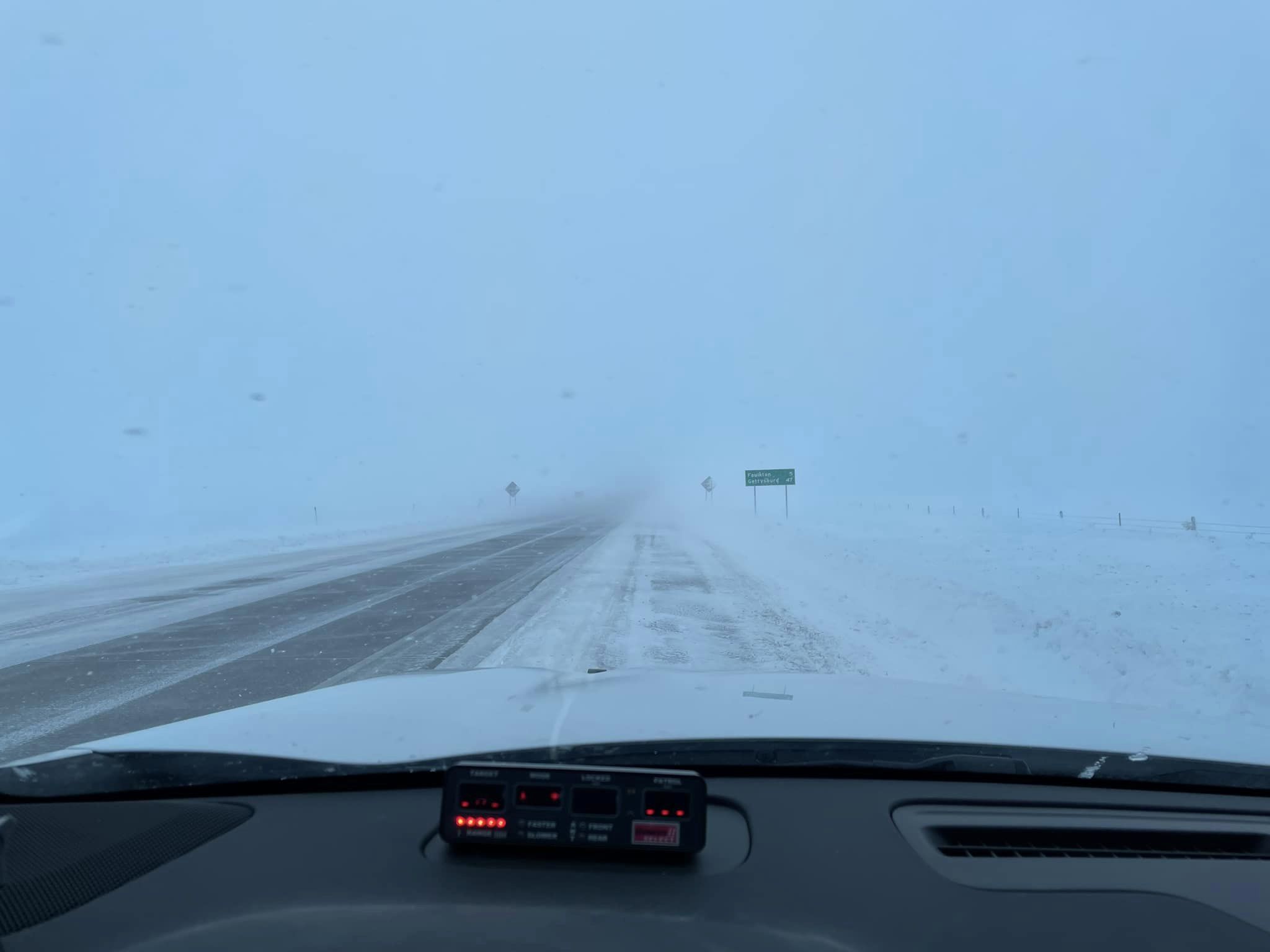
 |
| Dec 21st at ~4pm on US Highway 212, 5 miles outside of Faulkton. Photo courtesy of the Faulk County Sheriff's Office. | Accident on Dec 21st at ~2pm on US Highway 12 east of Bristol. Photo courtesy of the Day County Sheriff. | SDDOT webcam from 12 miles east of Hayes on US Highway 14 at 1:30pm MST on Dec 21st. | SDDOT webcam from 3 miles west of Murdo on I-90 at 2:45pm CST on Dec 21st. |
December 22nd
 |
 |
 |
 |
| View on Dec 22nd on Highways 14, 34 and 1804. Photo courtesy of the Hughes County Sheriff's Office. | Photo courtesy of the Lyman County Sheriff's Office at ~2:20 am on Dec 22nd of emergency rescue operations on I-90. Many other crews were involved in similar operations across the area including the Jones County EM, the SDDOT, and the SD Highway Patrol. | Blizzard conditions on Dec 22nd around noon near Watertown. Photo courtesy of Alex Resel. | Dec 22nd at ~3pm on US Highway 212 west of Redfield. Photo courtesy of the SD Highway Patrol. |
 |
 |
 |
 |
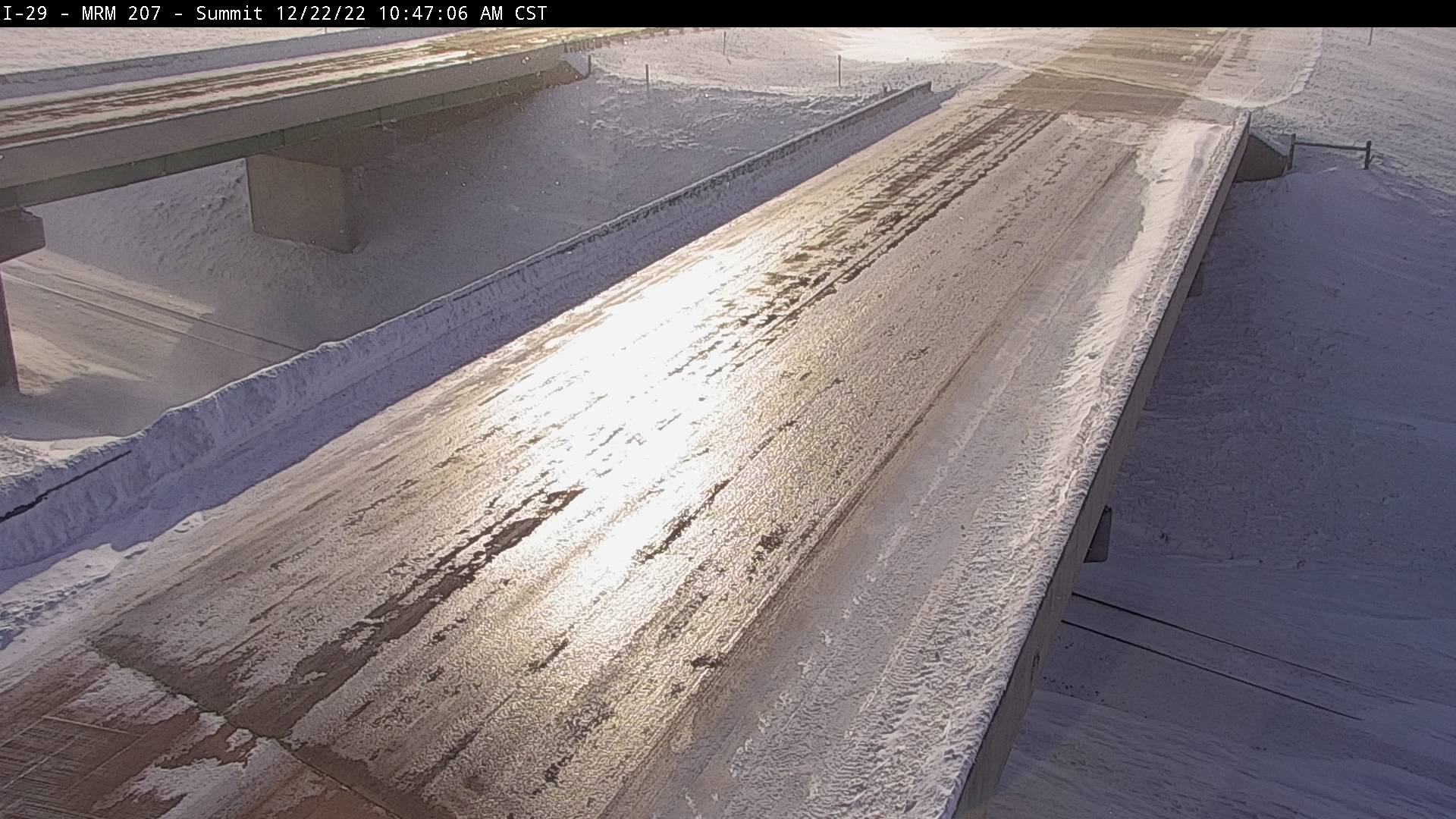
| Dec 22nd during the afternoon in Hamlin County. Photo courtesy of the Sheriff's office. | SDDOT webcam capturing how icy I-29 was on the morning of the 22nd near Summit. | North of Hoven on Highway 47 in Walworth County on Dec 22nd. Photo courtesy of the Sheriff. | Atmospheric optics on full display in the Watertown area around 11am on the 22nd. Photo courtesy of Alex Resel. |
 |
 |
 |
 |
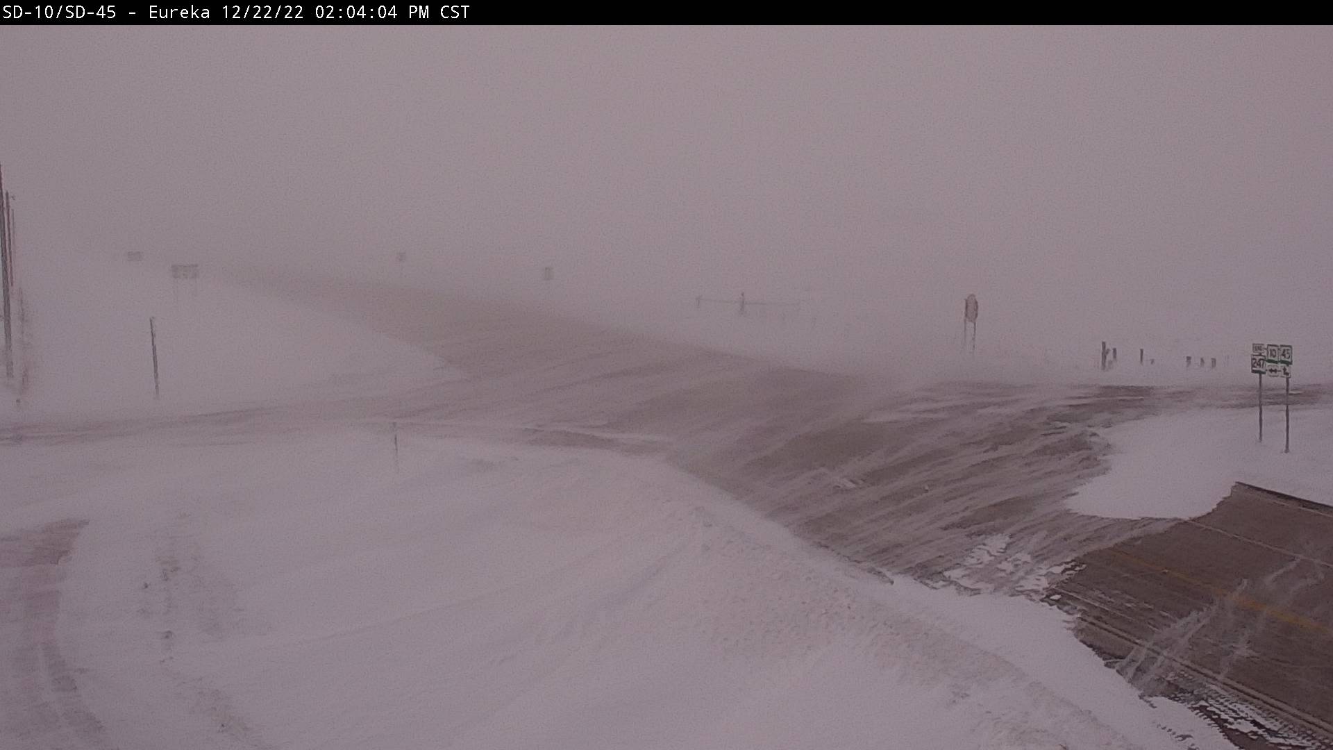
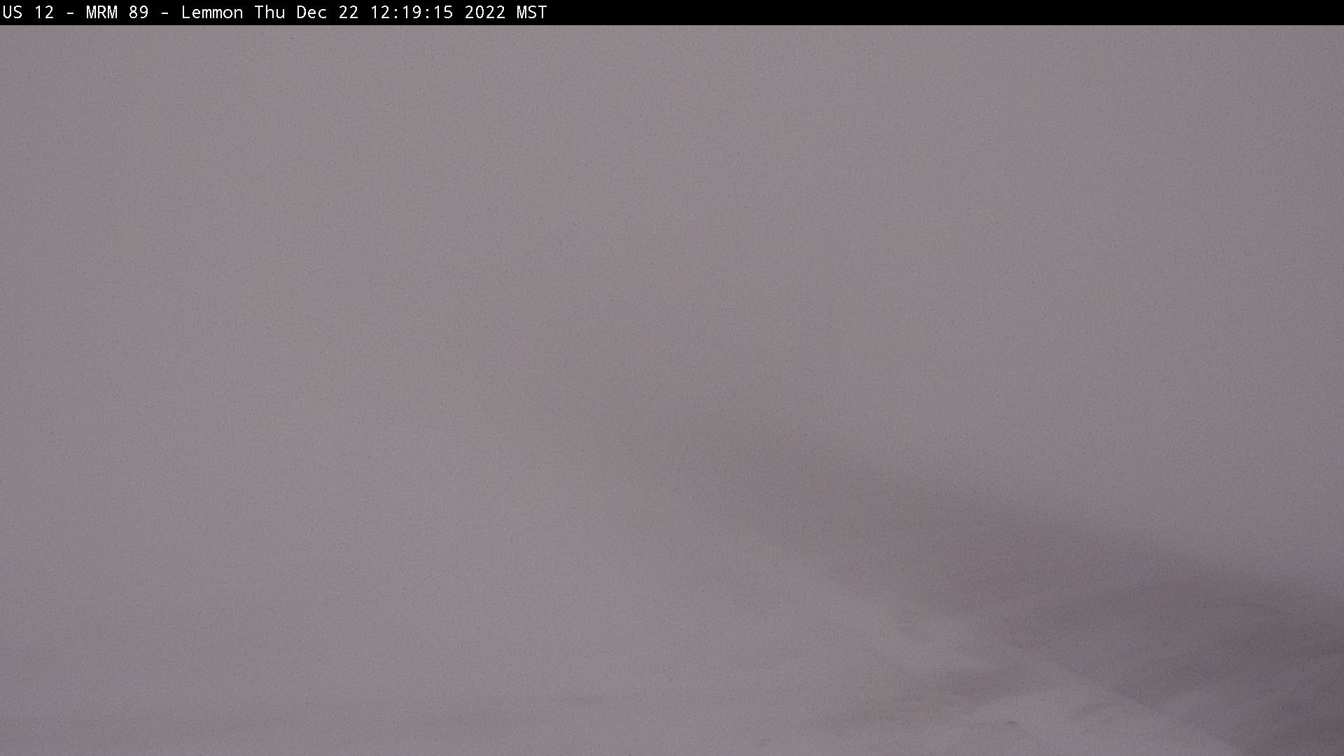
| SDDOT webcam 13 miles east of Eureka on SD10/SD45 at 2pm on Dec 22nd. | SDDOT webcam 3 miles west of Lemmon on US Highway 12 at 12:20pm MST on the 22nd. | SDDOT webcam near Mellette on US281/SD20 at 1:40pm on Dec 22nd. | SDDOT webcam 12 miles east of Hayes on US Highway 14 at 2:55pm MST on the 22nd. |
December 23rd
 |
 |
 |
 |
| Early morning on Dec 23rd on Highway 34 east of Pierre near the Hughes County line. Photo courtesy of the Hughes County Sheriff's Office. | Dec 23rd at ~2pm on US Highway 12 in Brown and Edmunds County. Photo Courtesy of the SD Highway Patrol. | Dec 23rd at ~2pm on I-29 near the Hamlin County line. Photo courtesy of the SD Highway Patrol. | Dec 23rd at ~7:40am on Highway 28 at the Stone Bridge in Hamlin County. Photo courtesy of the Sheriff's Office. |
 |
 |
 |
 |
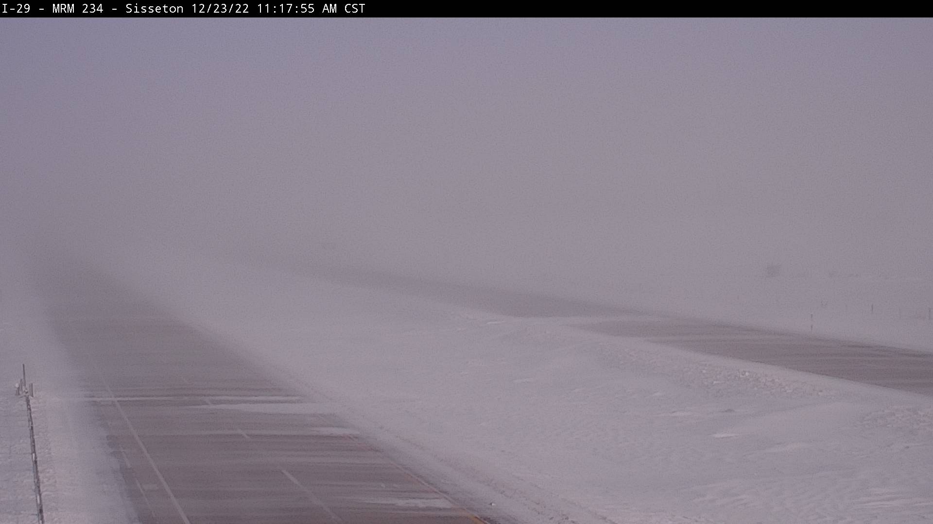
| SDDOT webcam 5 miles east of Ipswich on US12/SD45 at 11:53am on Dec 23rd. | SDDOT webcam 4 miles ENE of Sisseton on I-29 at 11:17am on Dec 23rd. | SDDOT webcam near Lake City on SD10 at 1:34pm on Dec 23rd. | SDDOT webcam near Summit on I-29 at 9:36am on Dec 23rd. |
 |
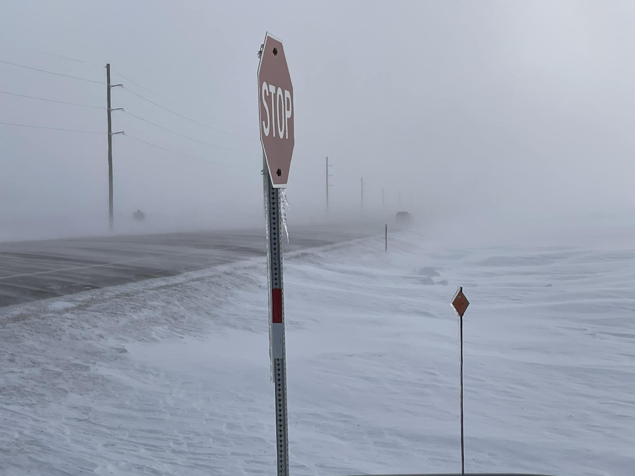
 |
 |
 |
| Highway 34 from Pierre to the County Line on Dec 23rd. Photo courtesy of the Hughes County Sheriff's Office. | A gravel road that was representative of many gravel roads, south of Milbank on Dec 23rd. Photo courtesy of the SD Highway Patrol. | Dec 23rd on US Highway 83 south of Vivian. Photo courtesy of David Rudzik. | Sundogs captured on the SD Mesonet at South Shore at 3:43pm on Dec 23rd. The wind chill at this time was -38 degrees F. |
|
|
|
| This time lapse video is composed of SDDOT webcam images from 12 miles east of Hayes on US Highway 14, showing a vehicle stranded from 3pm MST on Dec 21st through 7pm MST on Dec 23rd. This video helps illustrate the magnitude of this storm, as many similar incidents took place across South Dakota once roadways became impassable during the ground blizzard. | A loop of SDDOT webcam images from 8 miles north of Vivian on US83. The first image is at 12:22pm CST Dec 21st, the second is less than 3 hours later at 3:03pm. A vehicle is seen stuck at 6:34pm, and it is still there after the storm has stopped by 1:58pm Dec 23rd. |
Radar, Satellite
| Local radar loop from 1:30am to 10:30pm (CST) on Wednesday, December 21st |
 |
 |
 |
| Infrared satellite loop from 5pm CST Wednesday Dec 21st through 6am CST Thursday Dec 22nd, showing cloud cover associated with an Arctic Front (greens and yellows) and Arctic air behind it under mostly clear skies (blue shades). | Infrared satellite image at 9:46pm CST on Thursday, Dec 22nd showing the very cold air (light blue/grey border indicates about -10 F as sampled by the satellite) under clear skies across much of the region. | Infrared satellite loop from 4:20am - 6am CST Friday Dec 23rd, showing a deep low pressure system and associated cloud cover across the northeastern US (green, yellow, orange), and Arctic air across the northern US (light blue) |
Additional Information
More information can be found in event summary pages from the Sioux Falls NWS Office and the Grand Forks, ND NWS Office.
.gif) |
 |
 |
|
| Surface weather maps once every 12 hours starting at 6am on Wed, Dec 21st and ending at 6pm Fri, Dec 23rd showing the bombogenesis of the surface low, as well as the large expanse covered by the Arctic cold front. By 6am Saturday Dec 24th, the low was at ~964mb which is the equivalent pressure of a strong category 2/weak category 3 hurricane. | Observed snowfall accumulations from 6am Dec 20th through 6am Dec 22nd, showing a range of a trace to locally 2 to 3" of snow. | SDDOT road conditions as of 10pm on Dec 22nd showing the vast majority of South Dakota under "No Travel Advised" or having road closures. |
 |
 |
 |
 |
| Chart of observed visibility at the Aberdeen Airport through the event. | Chart of observed visibility at the Watertown Airport through the event. | Chart of observed visibility at the Pierre Airport through the event. | Chart of observed visibility at the Mobridge Airport through the event. |
 |
 |
 |
 |
| Peak wind gusts on the calendar day of Dec 21st | Peak wind gusts on the calendar day of Dec 22nd | Peak wind gusts on the calendar day of Dec 23rd | Infographic explaining what a ground blizzard is. Visibility can sometimes look OK in town during ground blizzards, but areas in the open country can simultaneously be white-out. |
 |
Media use of NWS Web News Stories is encouraged! Please acknowledge the NWS as the source of any news information accessed from this site. |
|


