Heavy to excessive rainfall may bring flooding to parts of Arizona, New Mexico, Florida, North Carolina, and Virginia today. Recently burned areas will be particularly vulnerable to flash flooding. Gusty winds and low humidity will bring elevated to critical fire weather conditions to parts of the Northwest U.S. and central Alaska today. Read More >
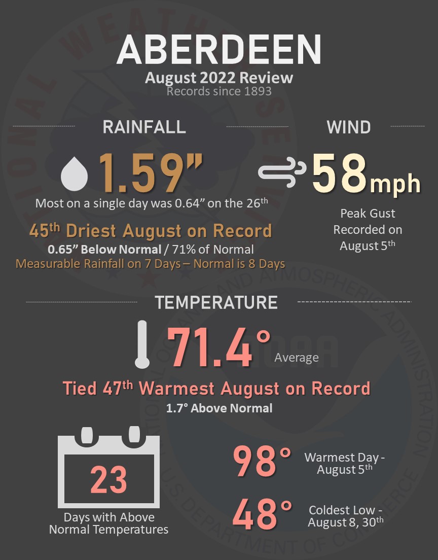
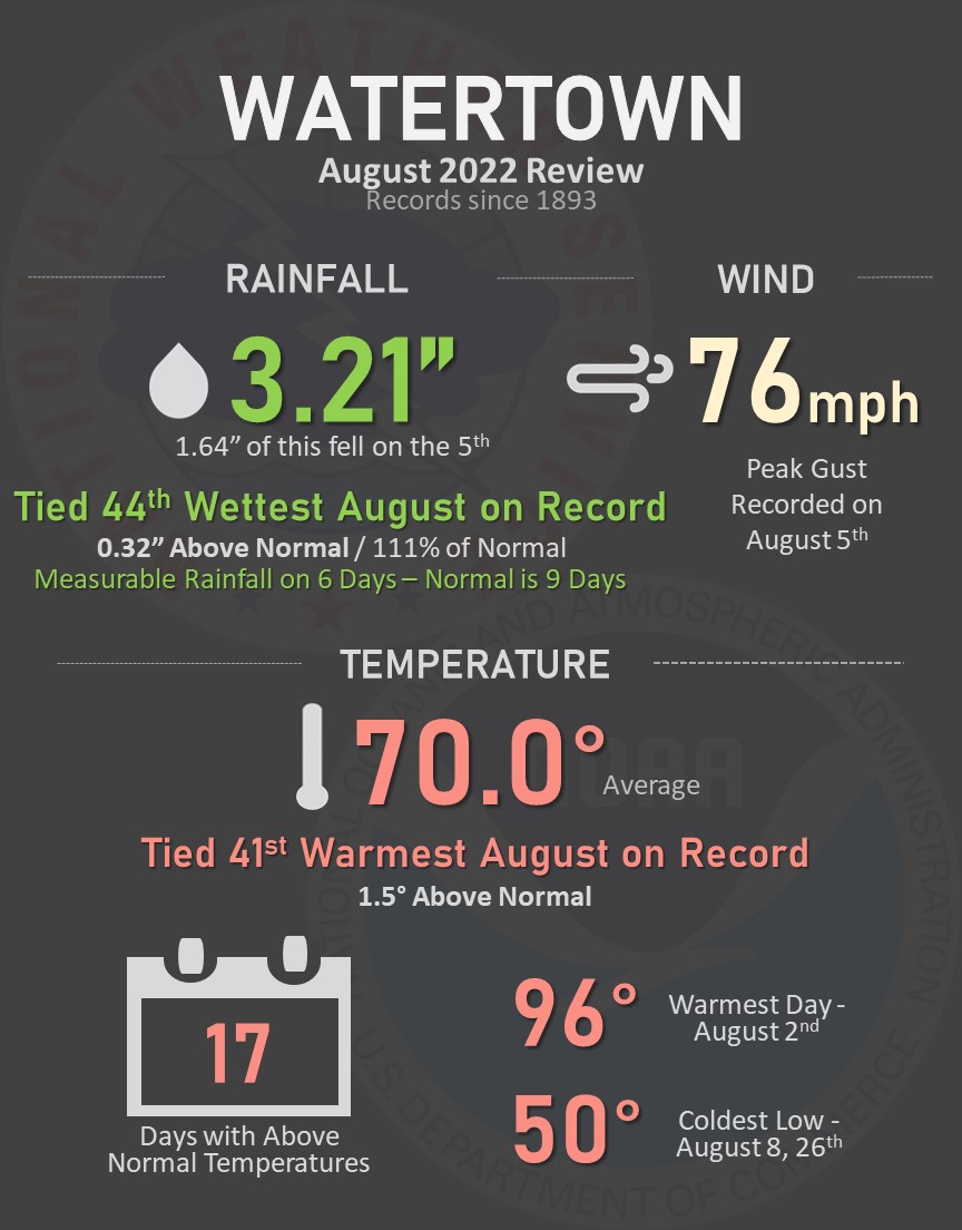
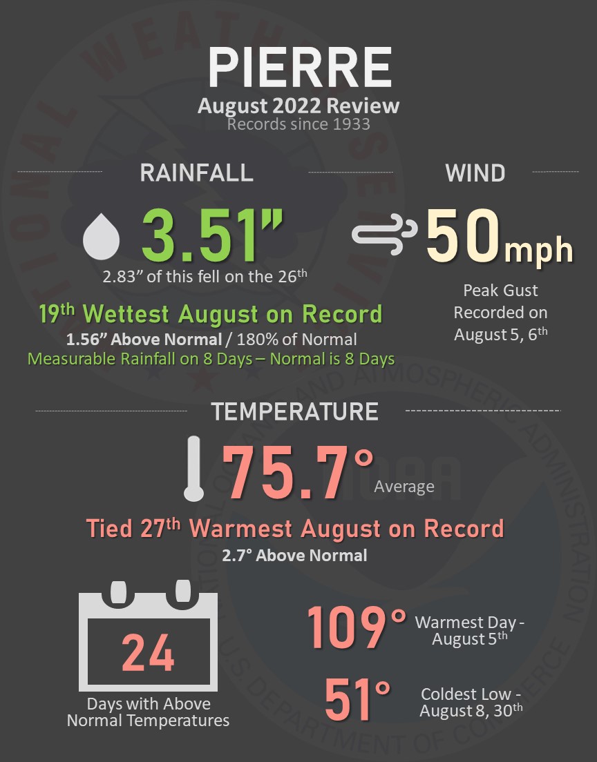
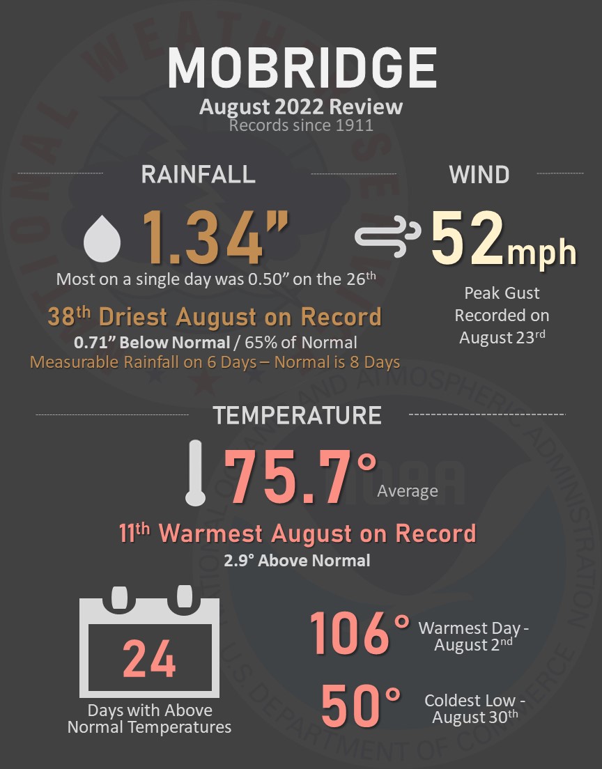
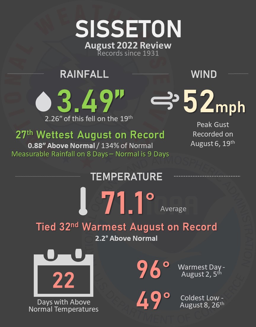
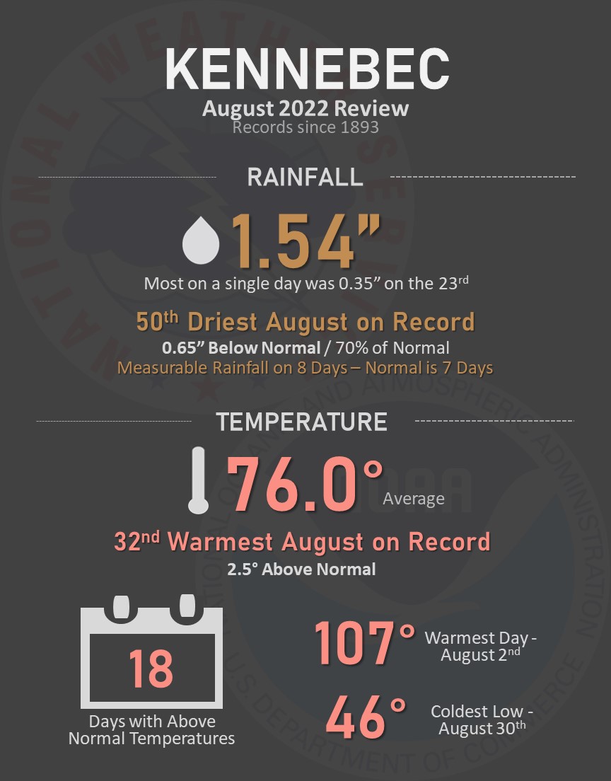
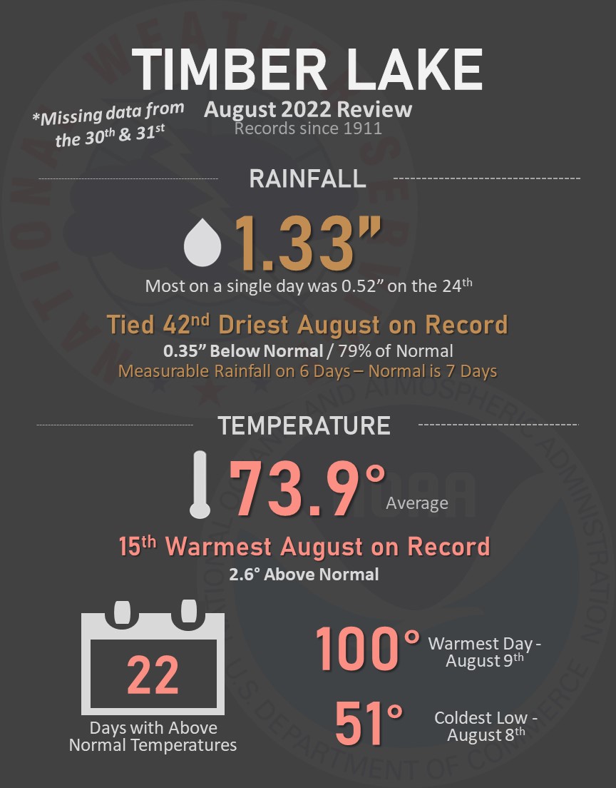
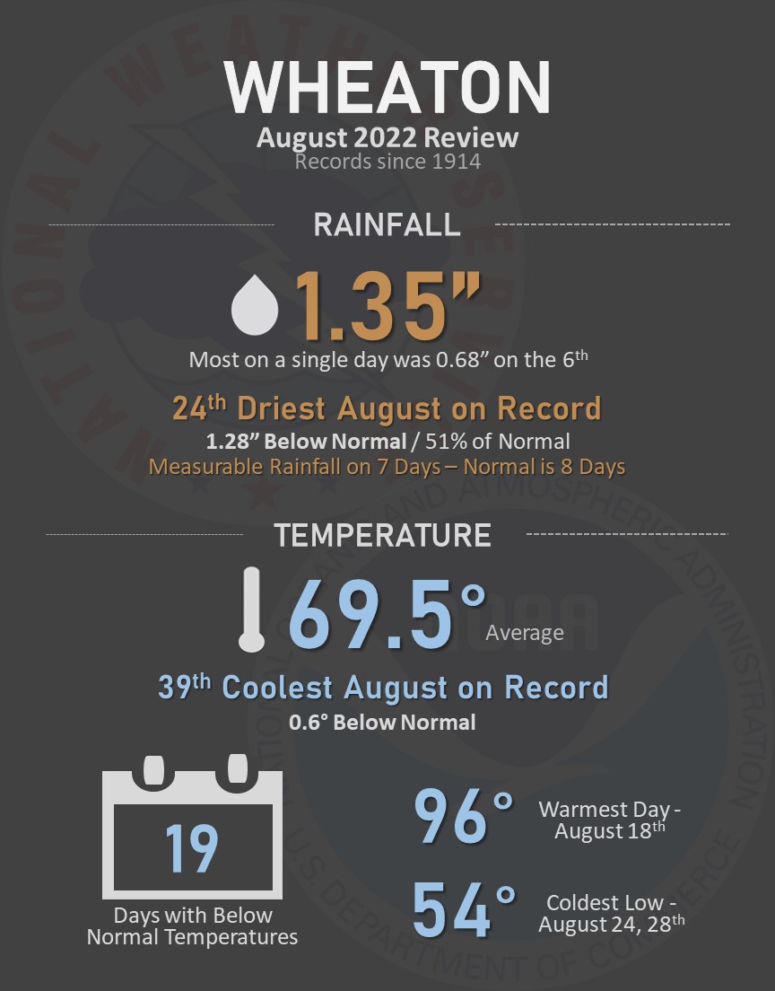
Here's a summary of August's weather at several towns across the area. Temperatures were near to above average, and precipitation varied quite a bit from place to place. Find information for additional locations here.
Meteorological summer (June - August) finished above average on the whole temperature-wise. Precipitation varied quite a bit, with a deficit of 4 to 6 inches across portions of northeastern South Dakota and west central Minnesota, but a surplus of 2 to 5 inches across portions of central South Dakota. The graphics below from the Midwestern Regional Climate Center illustrate this well, showing approximate temperature departures as well as precipitation totals and departures across our forecast area.
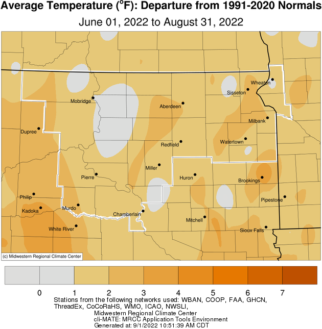
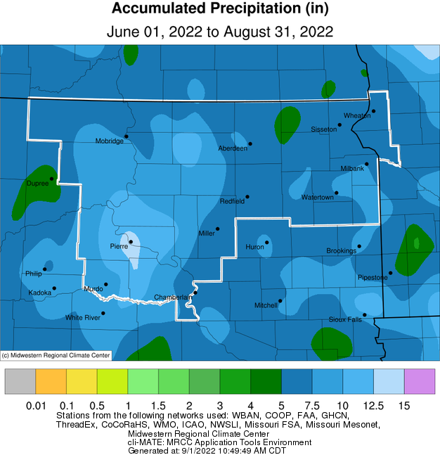
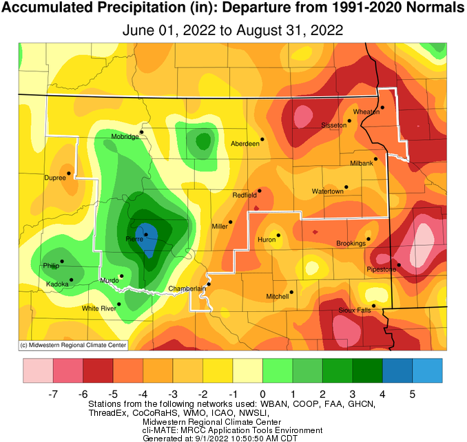
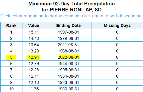
Noteworthy, with over a foot of rain, Pierre recorded their 5th wettest summer on record.
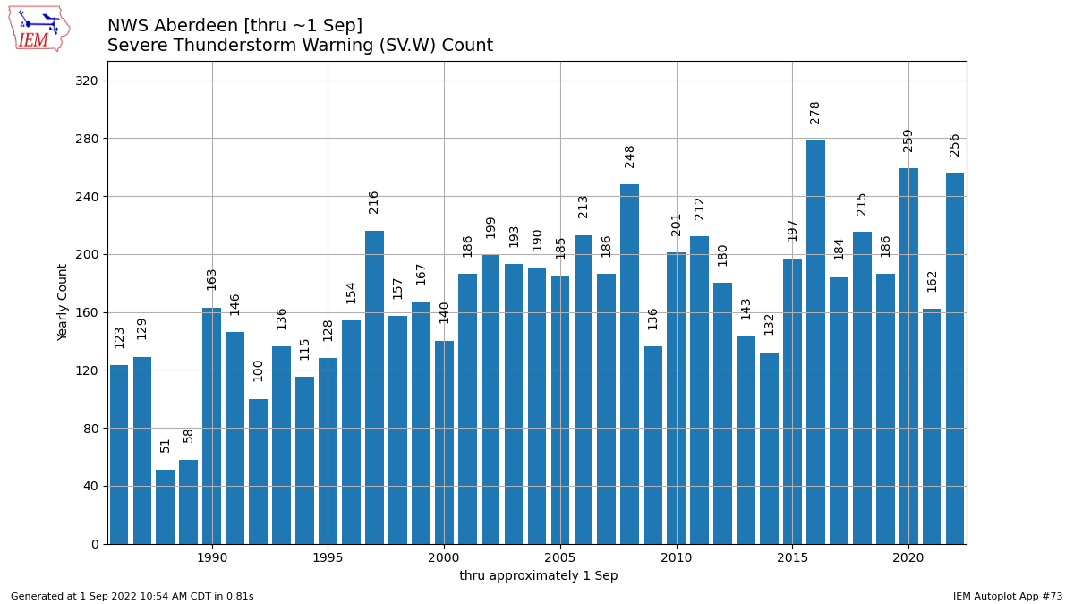
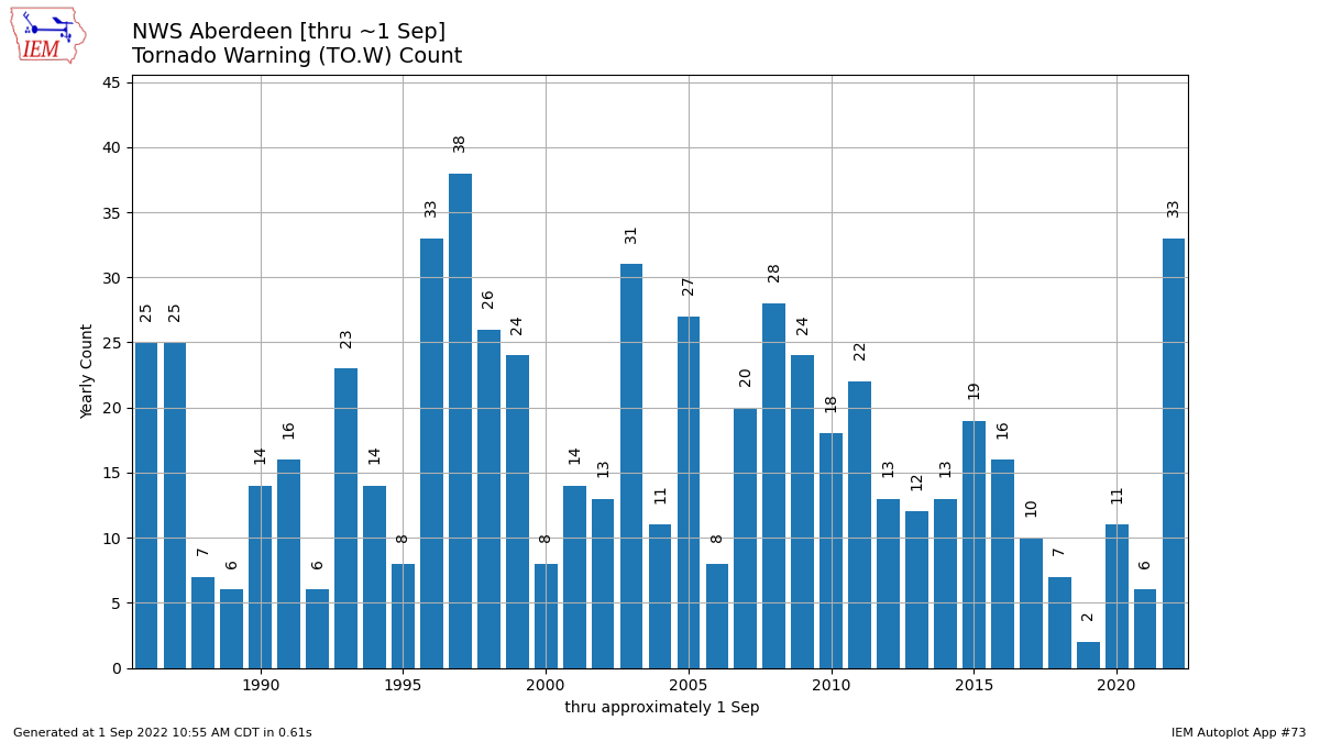
The severe weather season has been very active. NWS Aberdeen has issued 256 severe thunderstorm warnings so far this year, and 33 tornado warnings. Both of these rank among the highest year-to-date on record for our office since records began in 1986 (as seen in the graphs from the IEM below). We average an additional 10 severe thunderstorm warnings in September and 1 in October, and an additional tornado warning in September.